


Search for another town





Free U.S. delivery 7 to 10 days after you order
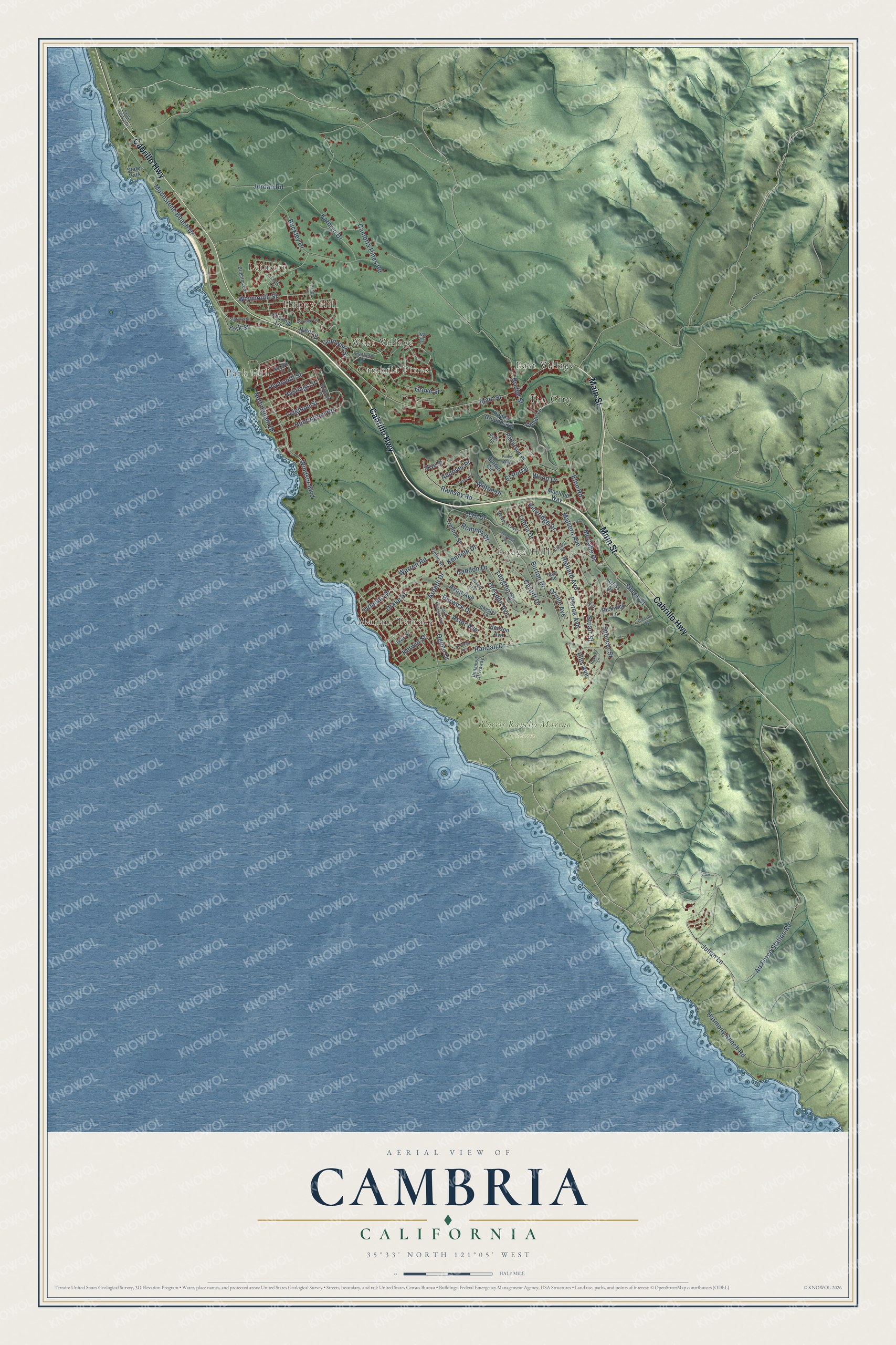
Cambria, California Map Art
Building by building, with labeled streets and shaded relief.
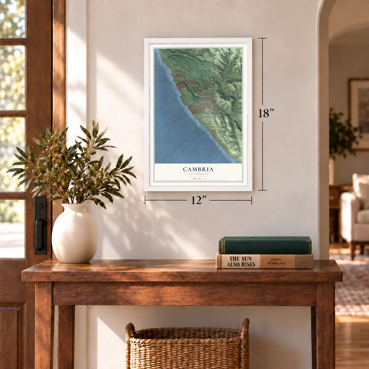
12" x 18" Archival Matte Print
A Map of Home. A Work of Art.
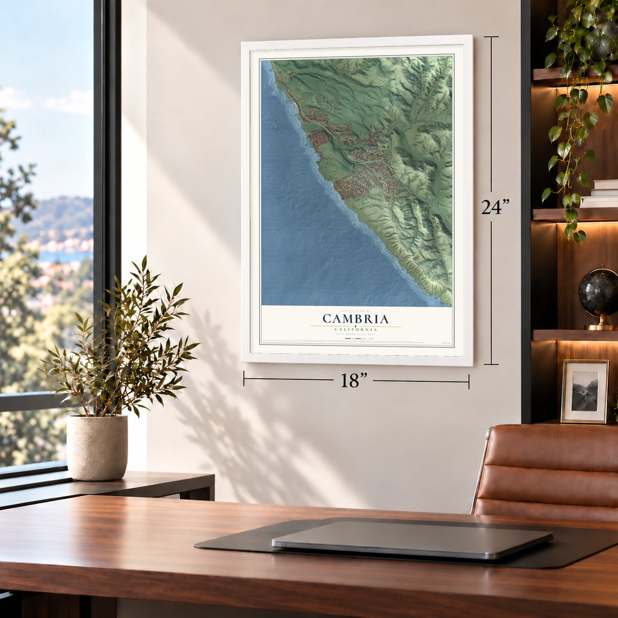
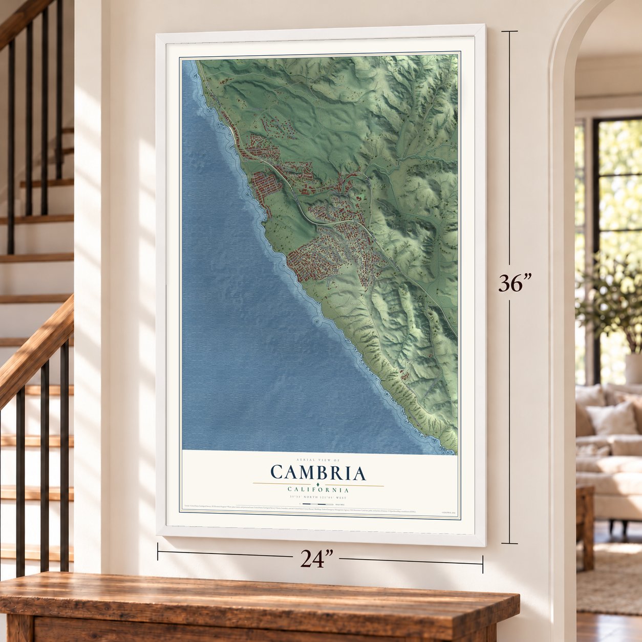
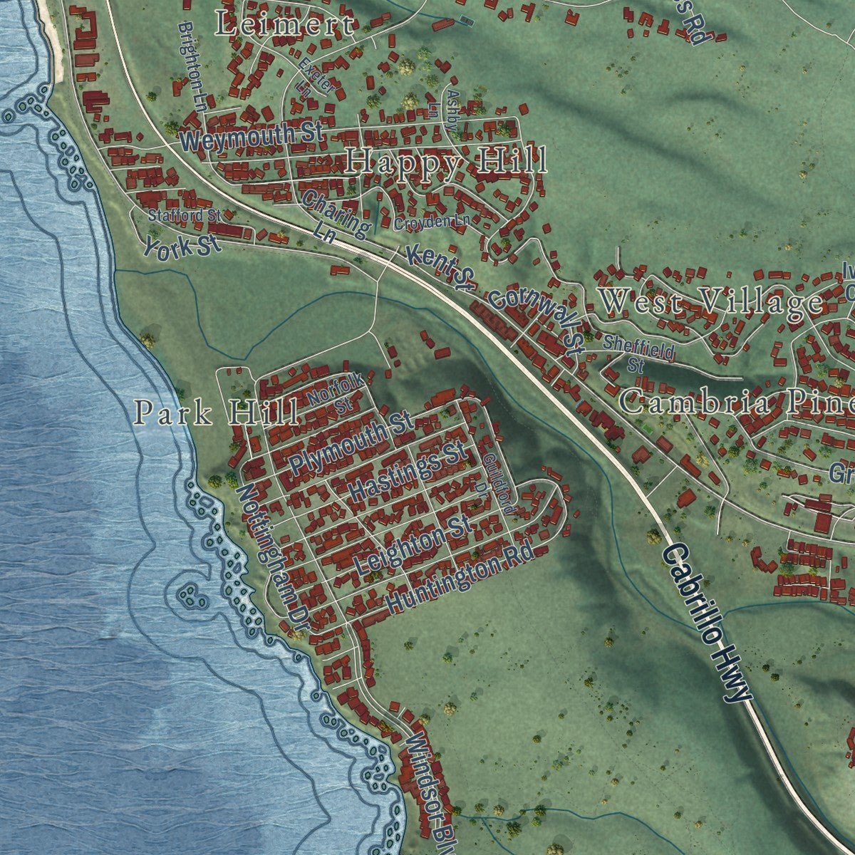
Explore Cambria, California from a whole new perspective. Created using aerial imagery and detailed geographic data, this map captures Cambria building by building, with labeled streets, familiar landmarks, and shaded topographical relief that highlights the natural contours of the landscape.
Combining modern data with the timeless character of a vintage atlas, this map is just as interesting up close as it is beautiful on the wall. Whether you grew up in Cambria, spent memorable years there, or call it home today, this unique map is a great way to celebrate a place that means something to you. Zoom in on the preview to look for your street, and then order a print to put your memories on the wall.
Three ways to hang it
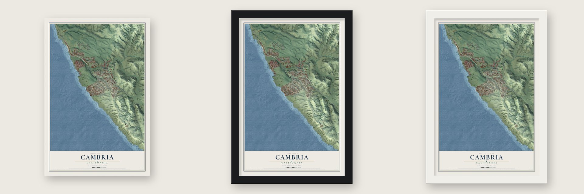
Unframed archival matte, a black wood frame or a white wood frame.
Up close
Geography Worth Displaying
This map was created using accurate cartographic data and authoritative geographic sources, including the U.S. Geological Survey and the Census Bureau. The map brings together terrain, waterways, roads, and building detail. The majority of the streets are labeled, houses are accurately depicted, and the topography is derived from government sources. Combining local data with carefully composed color and shading leads to this beautifully detailed Cambria artwork for your wall.
Rather than simply showing street outlines, we’ve included as many of the street names as we could reasonably fit on the map while keeping their names legible. Zoom in on the high resolution preview to see exactly what’s on the map. We truly set out to create a statement piece for anyone who loves Cambria. So whether it’s for you, or a gift for someone you love, we hope this map of Cambria brings back fond memories.
Read the story behind this map of Cambria, California from 2026.

Find your street
Names on the Cambria map
Every name below is printed on this map. Look for your street, your school, the park where you played, or the pond down the road.
Places and landmarks11
- Leimert
- Happy Hill
- West Village
- Park Hill
- Cambria Pines
- Norris Rancho Marino Reserve
- East Village
- Lodge Hill
- Marine Terrace
- Tin City
- State Park
Streets and roads96
- Main Street
- Cabrillo Highway
- Ardath Drive
- Pineridge Drive
- Fern Drive
- Nottingham Drive
- Wilton Drive
- Randall Drive
- Burton Drive
- Harmony Ranch Road
- Air Force Station Road
- Julian Lane
- Moonstone Beach Drive
- Windsor Boulevard
- Cambria Pines Road
- Bridge Street
- Kathryn Drive
- Pierce Avenue
- Berwick Drive
- Buckley Drive
- Richard Avenue
- Weymouth Street
- Spencer Street
- Green Street
- Plymouth Street
- Langton Street
- Huntington Road
- Ramsey Road
- Drake Street
- Leona Drive
Show all 96 streets
- Stuart Street
- Warren Road
- Astor Avenue
- Eton Road
- Wood Drive
- Dreydon Avenue
- Orlando Drive
- Avon Avenue
- Jordan Road
- El Portal
- Ogden Drive
- Kenneth Drive
- Grove Street
- Leighton Street
- Hastings Street
- Ellis Avenue
- Malvern Avenue
- Cardiff Drive
- Romney Drive
- Orville Avenue
- Cornwall Street
- Haddon Drive
- Kerwin Street
- McCabe Drive
- York Street
- Andover Place
- Kent Street
- Benson Avenue
- Charing Lane
- Village Lane
- Rodeo Grounds Road
- Burton Circle
- Patterson Place
- Trenton Street
- Pickwick Lane
- Arliss Drive
- Macleod Way
- Skye Street
- Ivar Street
- Iva Court
- Chester Lane
- Newport Avenue
- Sheffield Street
- Brighton Lane
- Unnamed Driveway
- Tweed Avenue
- Norfolk Street
- Ernest Place
- Tipton Street
- Ross Road
- Pine Street
- Exotic Garden Drive
- Gleason Street
- Sandown Place
- Croyden Lane
- Newhall Avenue
- Saint Thomas Avenue
- Guildford Drive
- Ashby Lane
- Exeter Lane
- Stafford Street
- Norton Lane
- Piney Way
- Orin
- Orme Place
- Lyle Avenue
Names are listed as they appear on the printed map. Zoom into the product photos to find them.
About Cambria, California
Cambria is a town of 5,678 people in San Luis Obispo County, on the Pacific coast along Highway 1. Before it was Cambria, the settlement went by Slabtown, Rosaville, San Simeon and Santa Rosa. In 1869 it took the name Cambria, the Latin name for Wales. One county history credits a Welsh carpenter named Llewellyn, who hung out a "Cambria Carpenter Shop" sign and kept calling the town Cambria until the postal authorities accepted the name.
Miners came after cinnabar, the ore that yields mercury, was found in 1862, and $280,000 worth of mercury left through San Simeon between 1867 and 1870. Prospectors staked over 150 claims in the first years of the 1870s, and the Oceanic Quicksilver Mining Company grew to employ 300 people. Prices began falling by 1878, and output sank from $282,832 in 1876 to $6,760 four years later. A fire in 1889 all but ended the business, leaving Cambria a quiet dairy town.
“they performed like American seamen, orderly, efficient, without hysteria.”
- Portola's Christmas camp, 1769The Portola expedition, traveling overland from the south, camped on Santa Rosa Creek near today's Coast Union High School on September 10, 1769, and came back in late December to spend Christmas there. The Chumash offered the soldiers a young pet bear, which they declined, so the Spaniards called the place El Osito. On the return trip the Chumash gifts of pinole and fish mattered, because the expedition was low on food.
- The Montebello rescue of 1941Early on December 23, 1941, a Japanese submarine attacked and sank the Union Oil tanker SS Montebello, an 8,000-ton ship, off the coast. Cambria residents turned out to help, and all six crewmen were saved. Captain Olaf Eckstrom called the townspeople real heroes.
- Old Santa Rosa ChapelBuilt in 1870, the chapel is one of the oldest churches in San Luis Obispo County, and it held Catholic mass until May 26, 1963. After that it sat neglected for years, and in 1978 the chapel and its cemetery were restored. The Old Santa Rosa Catholic Church and Cemetery joined the National Register in 1982.
- Fiscalini Ranch PreserveThe Fiscalinis, Italian Swiss dairymen, came in the 1880s and bought several dairy farms, among them the Town Ranch, and gave plots of it for the library, the Veterans Memorial and a museum. The heirs sold to a developer in 1979; he went bankrupt in 1989, and later investors had their plans turned down too. In 2000 the land went to the American Land Conservancy, and the 430-acre preserve now separates the East and West Villages.
Keep exploring California
Cambria is one of 1,990 California towns we've mapped. Every dot on the map is a print of its own.
The search covers every state, California first.
Near Cambria
Order 2 or more town maps and save 10%. Shown in the size and finish you picked above, so they hang as a set.
- San Simeon 12" x 18" / Archival Matte Print $39.99
- Cayucos 12" x 18" / Archival Matte Print $39.99
- Oak Shores 12" x 18" / Archival Matte Print $39.99


More maps nearby: Lake Nacimiento, Morro Bay, Templeton, Los Osos and Atascadero.
The art of mapping a place
How This Map Was Made
Real places. Remarkable detail. Discover the layers that turn geographic data into a map of home.

The view from above
Aerial imagery reveals the character of the land: woodland, open fields, and the patterns of a place.

The shape of the land
Elevation data brings hills, valleys, and subtle changes in the landscape into view.

The details of home
Roads, waterways, and building footprints come together to make the map feel unmistakably local.

Geography becomes art
Considered color, shading, and typography bring the layers together in a map made for your wall.


Process illustrated with Mendon, Massachusetts. Aerial imagery: USDA NAIP. Terrain: USGS 3D Elevation Program. Map details and finished artwork: KNOWOL.
The Details
About This Print
Choose an archival matte print, or a black or white Ayous wood frame. The archival matte print is unframed.
Select your size and finish above to see the matching product image and price.
Materials & Craftsmanship
A contemporary map with the character of a classic atlas, printed on archival matte paper. Optional frames are made from Ayous wood.
Your printed map does not include the watermark shown in the full-map preview.
Shipping & Delivery
Free shipping within the United States. Every print is made to order in the USA.
Buying a gift? Add a note in your cart and we'll include it. We never put prices in the package.
Prints ship within 2 to 3 business days. Allow 7 to 10 days total from ordering for delivery. Timing may vary during holidays or periods of high order volume.
Read our shipping policy.
Returns and damaged prints
Each print is made to order. Change-of-mind refunds are not available after production.
If your print arrives damaged, misprinted or incorrect, contact support@knowol.com within 30 days of receiving it. Include your order number, photos and a description of the issue.
Read our full refund and replacement policy. For questions about your order, email support@knowol.com.