
Search for another town




Free U.S. delivery 7 to 10 days after you order
Canton, Georgia Map Art
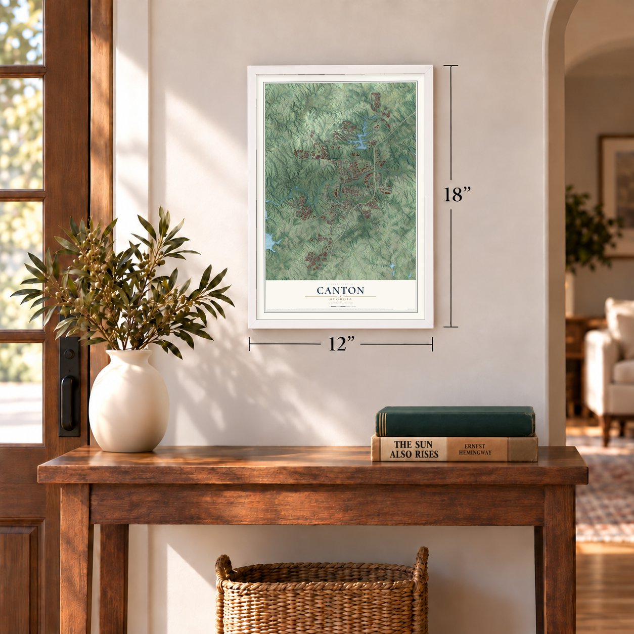
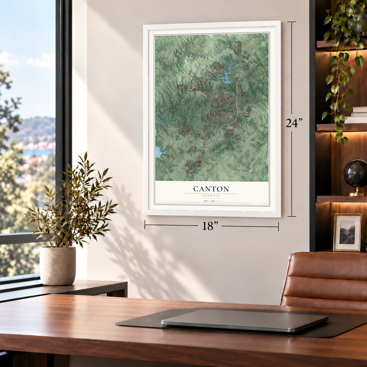
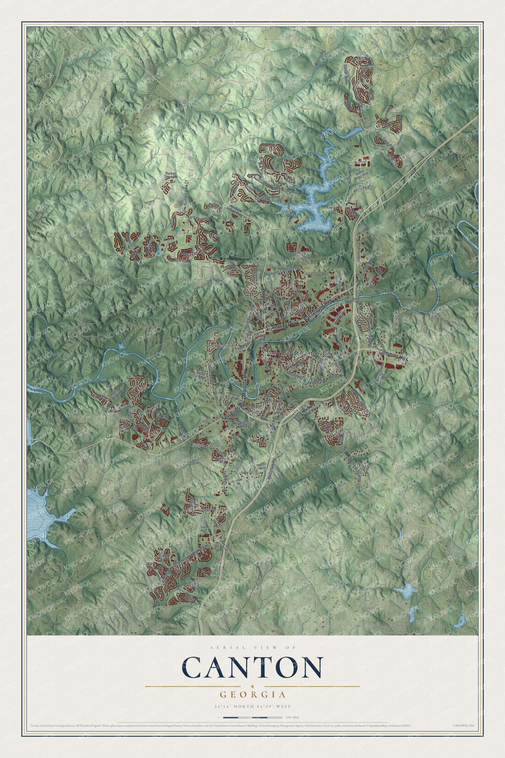
A new map of Canton, Georgia, made in 2026 and printed to order on thick archival matte paper.
12" x 18" Archival Matte Print
A Map of Home. A Work of Art.
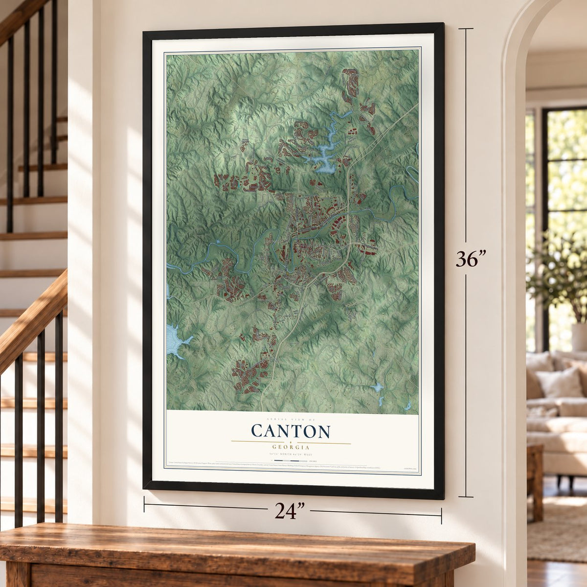
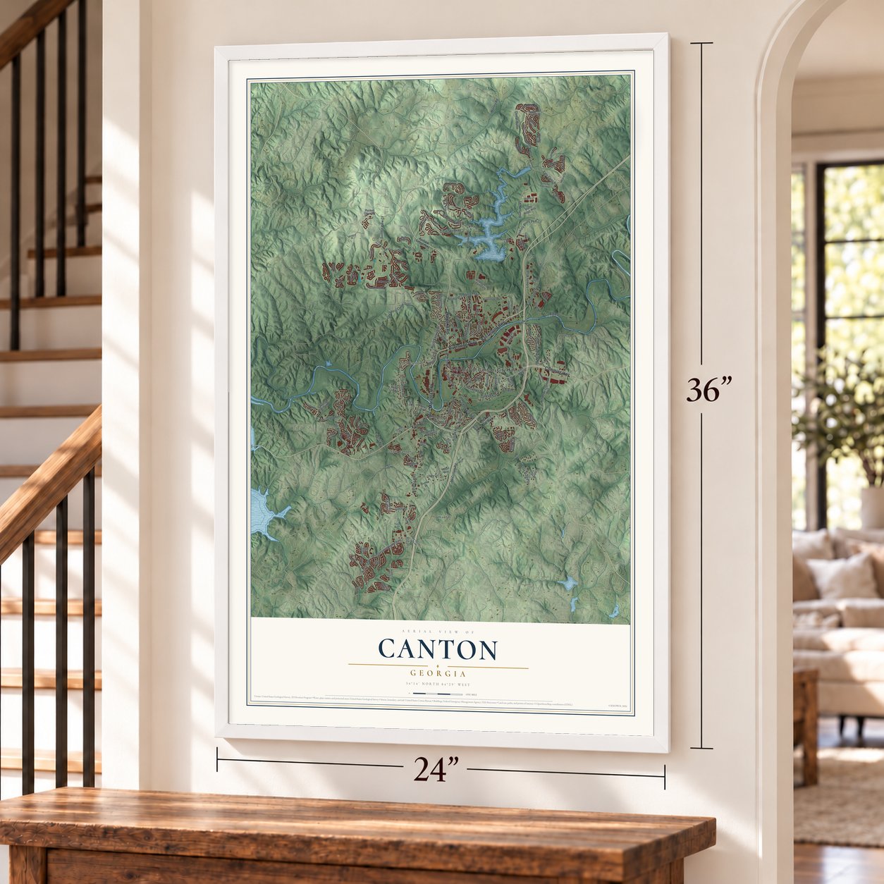
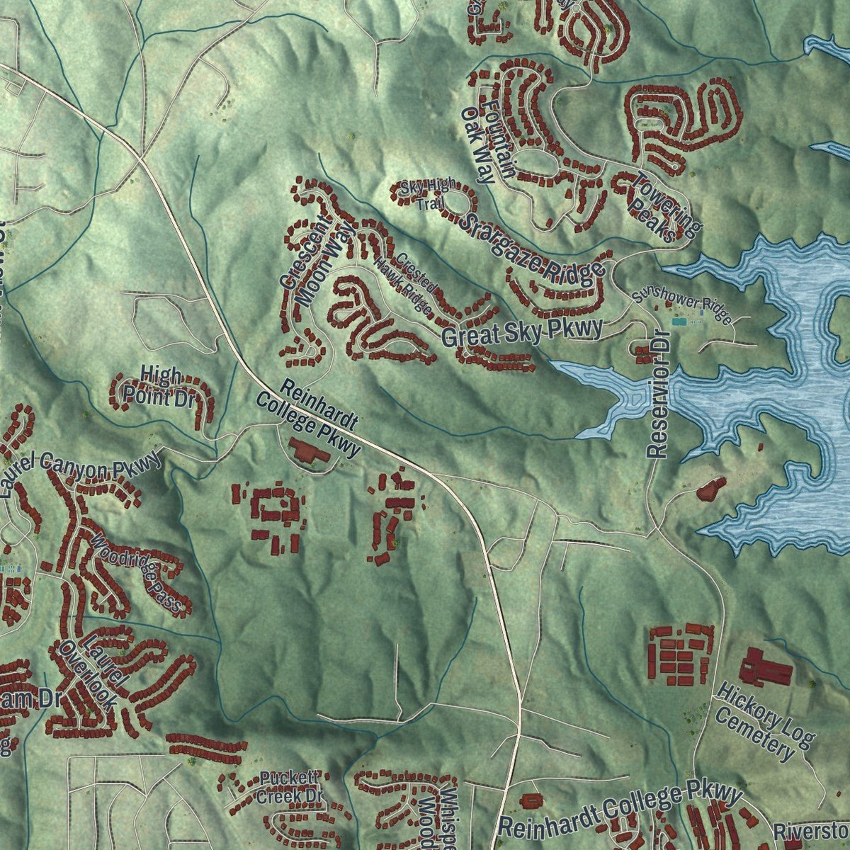
Explore Canton, Georgia from a whole new perspective. Created using aerial imagery and detailed geographic data, this map captures Canton building by building, with labeled streets, familiar landmarks, and shaded topographical relief that highlights the natural contours of the landscape.
Combining modern data with the timeless character of a vintage atlas, this map is just as interesting up close as it is beautiful on the wall. Whether you grew up in Canton, spent memorable years there, or call it home today, this unique map is a great way to celebrate a place that means something to you. Zoom in on the preview to look for your street, and then order a print to put your memories on the wall.
Three ways to hang it
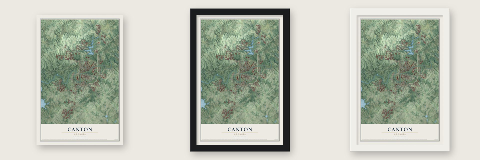
Unframed archival matte, a black wood frame or a white wood frame.
Up close
Geography Worth Displaying
This map was created using accurate cartographic data and authoritative geographic sources, including the U.S. Geological Survey (USGS) and FEMA. The map brings together terrain, waterways, roads, and building detail. The majority of the streets are labeled, houses are accurately depicted, and the topography is derived from government sources. Combining local data with carefully composed color and shading leads to this beautifully detailed Canton artwork for your wall.
Rather than simply showing street outlines, we’ve included as many of the street names as we could reasonably fit on the map while keeping their names legible. Zoom in on the high resolution preview to see exactly what’s on the map. We truly set out to create a statement piece for anyone who loves Canton. So whether it’s for you, or a gift for someone you love, we hope this map of Canton brings back fond memories.
Explore the full map of Canton, Georgia and read about the local places it shows.

About Canton, Georgia
Canton is a city of 32,973 people and the county seat of Cherokee County, with the Etowah River running east to west through its center. The land lay at the heart of the Cherokee Nation, and settlers mostly passed it by until the Georgia Gold Rush of 1829 drew them into the hills. In the summer of 1838 federal troops rounded up the Cherokee who had stayed and held them in forts, and by autumn they had been marched west on the Trail of Tears.
Settlers picked a site for the county seat and courthouse in 1833 and called it Etowah, then Cherokee Courthouse. In 1834 they renamed it Canton, after the Chinese city now called Guangzhou, because some residents hoped to build a silk industry like China's. The silk trade never came, but Canton grew into a mill town, and the Canton Cotton Mills made a denim known around the world as Canton Denim until they closed in 1981.
- Burned in November 1864Canton had about 200 people when Brig. General John E. Smith ordered it burned on October 30, 1864. Confederate guerrillas from the town had been attacking the Western and Atlantic Railroad near Cassville, the Union's supply line from Chattanooga to Atlanta. Between November 1 and 5, 1864, Major Thomas T. Heath led foragers of the Ohio 5th Cavalry through Canton, setting it on fire and targeting Governor Joseph E. Brown's home.
- Recovered as the county seatThe same cavalrymen also burned Cassville, and that town never rebuilt. Canton came back after the fire and recovered as the county seat.
- The site of Fort BuffingtonDuring the Cherokee removal of 1838, the largest and southernmost of the holding forts, Fort Buffington, stood 6 miles east of Canton. None of its timber walls survive, but a large block of green Cherokee marble, quarried near Holly Springs, marks the ground where it most likely stood.
- Heritage Park in 2004In May 2004 the city cut the ribbon on Heritage Park, about 30 acres of walking and bike trails with a natural amphitheater, as the first phase of the Etowah River Greenway. A second phase to the north added about 60 acres of fields for softball, baseball, tennis and soccer.
- Cherokee Poultry on Univeter RoadT.B. Bradshaw founded Cherokee Poultry and built its plant on Univeter Road in 1955. He sold the business to Central Soya in 1962.
Find your street
Names on the Canton map
Every name below is printed on this map. Look for your street, your school, the park where you played, or the pond down the road.
Places and landmarks4
- South Canton
- North Canton
- Univeter
- Hickory Log Cemetery
Streets and roads163
- Ball Ground Highway
- Riverstone Parkway
- Waleska Road
- Cumming Highway
- Marietta Highway
- North Street
- Fate Conn Road
- Ash Street
- Bluffs Parkway
- Great Sky Parkway
- Prominence Point Parkway
- River Green Avenue
- Marietta Road
- Oakdale Road
- Reinhardt College Parkway
- Reservior Drive
- York Drive
- Hickory Bluffs Parkway
- Killian Road
- Towne Mill Avenue
- Keeter Road
- Old Shoal Creek Trail
- Longview Drive
- North Etowah Drive
- Governors Walk Drive
- Rose Ridge Drive
- Ivey Drive
- Liberty Boulevard
- Lakeview Drive
- Hickory Flat Highway
Show all 163 streets
- McCollum Road
- Summit View Court
- Denali Butte
- Cherokee Street
- Center Street
- Srargaze Ridge
- Ridge Road
- Valdosta Drive
- Railroad Street
- Killian Street
- Westview Street
- Balsam Drive
- Worley Road
- McLain Street
- Archer Street
- Muriel Street
- Laurel Street
- Rex Lane
- Knox Bridge Highway
- East Main Street
- Waleska Street
- Northside-Cherokee Boulevard
- Laurel Canyon Parkway
- River Bend Way
- Mountain Vista Boulevard
- Springs Crossing
- Whispering Woods Drive
- Riverstone Boulevard
- Fountain Oak Way
- Hospital Road
- Diamond Ridge Avenue
- Sunset Drive
- Towne Mill Crossing
- Breeze Hill Lane
- Rolling Hills Place
- Spring Hill Drive
- High Point Drive
- Etowah Industrial Court
- Ocean Avenue
- Crescent Moon Way
- Laurel Overlook
- Oakside Drive
- Horizon Trail
- Golf Course Road
- Haynes Road
- Bluffs Ridge Way
- Puckett Creek Road
- Winder Trail
- Hemlock Trail
- Laurel Crossing
- Bluffs View Lane
- Lakeside Overlook Drive
- Jackie Moore Lane
- Hilton Way
- Woodland Way
- East Street
- Heard Drive
- Keith Drive
- Travis Tritt Lane
- Sublime Trail
- Generals Place
- Misty Way
- Market Lane
- Bluffs Court
- Ilex Drive
- Orchid Lane
- Towering Peaks
- Drury Lane
- Teasley Street
- India Lane
- Rock Cliff Road
- Breeze Hill Court
- Milton Drive
- Laurel Vw
- Holy Hill Road
- River Terrace
- Cherokee Overlook Drive
- Holly Springs Parkway
- Puckett Creek Drive
- Hidden Lake Circle
- Greenbrier Way
- Laurel Vista Drive
- Riverstone Place
- Woodridge Pass
- Godfrey Trail
- Brooks Drive
- Birch Street
- Waterstone Trail
- Cartersville Street
- Creekside Pass
- Leyland Drive
- Rose Ridge Court
- Morris Hill Drive
- Dorsey Road
- Wildflower Circle
- Lee Trail
- Village Drive
- Hillcrest Lane
- Talcmine Drive
- Britt Street
- Laurel Glory Road
- Bill Smith Drive
- Transit Avenue
- Quincy Place
- Brown Industrial Parkway
- Matthew Drive
- Crested Hawk Ridge
- Northside Parkway
- Midway Avenue
- Technology Ridge Parkway
- Bells Ferry Road
- Legend Creek Drive
- Birchwood Drive
- Brick Mill Road
- Sunshower Ridge
- Rock Creek Lane
- Celebration Song
- Summit Drive
- Roland Drive
- Woodbury Lane
- Heritage Circle
- Goss Street
- Overlook Trail
- Oakview Drive
- Sky High Trail
- Moose Loop
- Diana Drive
- Lawson Drive
- Putnam Drive
- Lauren Lane
- Valley Road
- Oak Street
- Patti Place
Names are listed as they appear on the printed map. Zoom into the product photos to find them.
The art of mapping a place
How This Map Was Made
Real places. Remarkable detail. Discover the layers that turn geographic data into a map of home.

The view from above
Aerial imagery reveals the character of the land: woodland, open fields, and the patterns of a place.

The shape of the land
Elevation data brings hills, valleys, and subtle changes in the landscape into view.

The details of home
Roads, waterways, and building footprints come together to make the map feel unmistakably local.

Geography becomes art
Considered color, shading, and typography bring the layers together in a map made for your wall.


Process illustrated with Mendon, Massachusetts. Aerial imagery: USDA NAIP. Terrain: USGS 3D Elevation Program. Map details and finished artwork: KNOWOL.
The Details
About This Print
Choose an archival matte print, or a black or white Ayous wood frame. The archival matte print is unframed.
Select your size and finish above to see the matching product image and price.
Materials & Craftsmanship
A contemporary map with the character of a classic atlas, printed on archival matte paper. Optional frames are made from Ayous wood.
Your printed map does not include the watermark shown in the full-map preview.
Shipping & Delivery
Free shipping within the United States. Every print is made to order in the USA.
Buying a gift? Add a note in your cart and we'll include it. We never put prices in the package.
Prints ship within 2 to 3 business days. Allow 7 to 10 days total from ordering for delivery. Timing may vary during holidays or periods of high order volume.
Read our shipping policy.
Returns and damaged prints
Each print is made to order. Change-of-mind refunds are not available after production.
If your print arrives damaged, misprinted or incorrect, contact support@knowol.com within 30 days of receiving it. Include your order number, photos and a description of the issue.
Read our full refund and replacement policy. For questions about your order, email support@knowol.com.
Find your town
Looking for another city?
Find a map of home in our Georgia collection, or any town in the country.
Nearby
Maps of towns near Canton
Know someone from one of these towns? Their map makes a great gift.
 Holly Springs
, Georgia
From $39.99See the map
 Waleska
, Georgia
From $39.99See the map
 Ball Ground
, Georgia
From $39.99See the map
More maps nearby: Woodstock, Nelson, Mountain Park, Milton and White.