
Search for another town



Free U.S. delivery 7 to 10 days after you order
Milton, Georgia Map Art
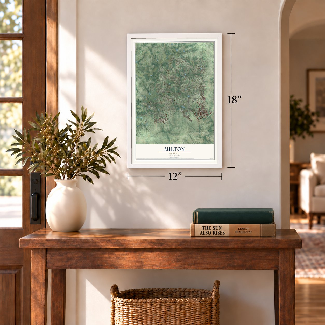
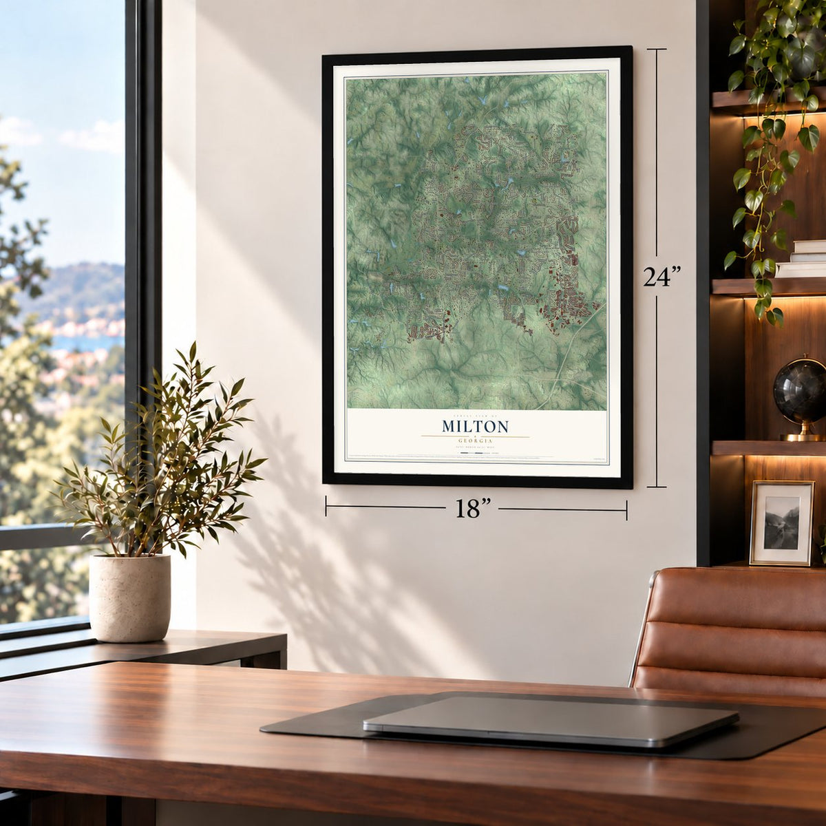
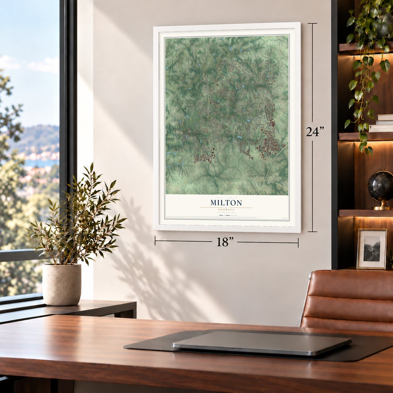
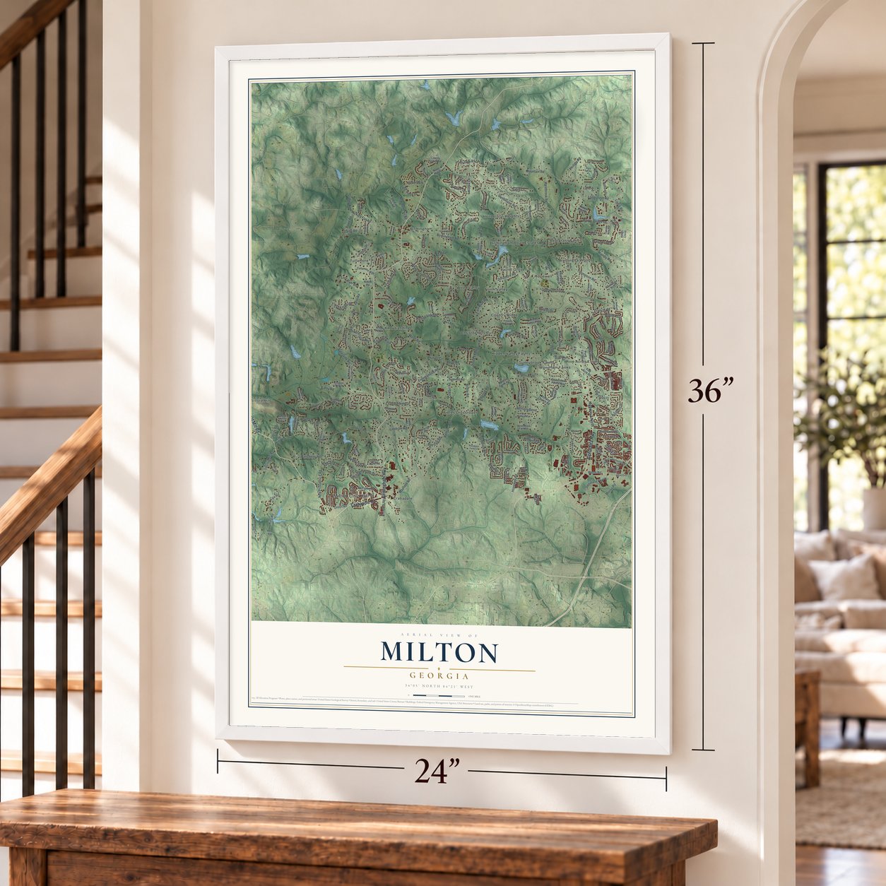
A new map of Milton, Georgia, made in 2026 and printed to order on thick archival matte paper.
12" x 18" Archival Matte Print
A Map of Home. A Work of Art.
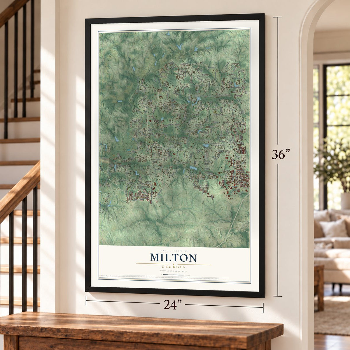
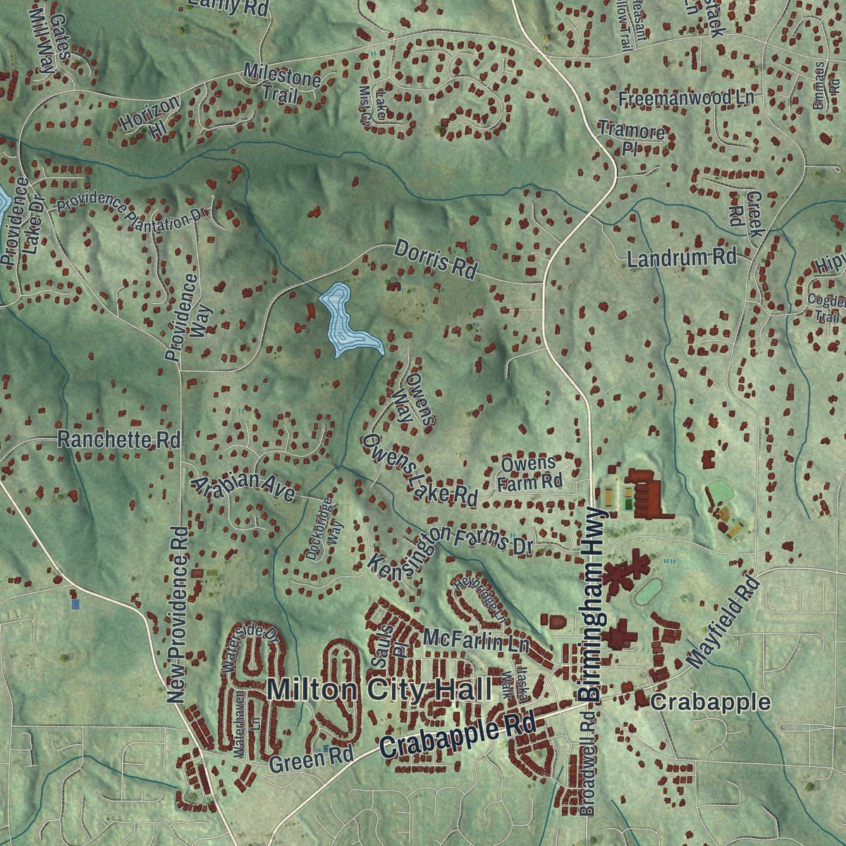
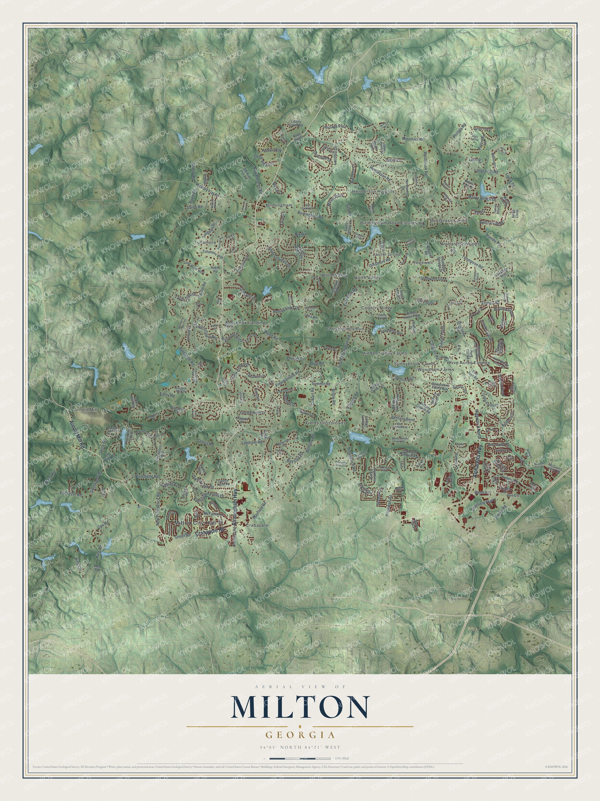
Explore Milton, Georgia from a whole new perspective. Created using aerial imagery and detailed geographic data, this map captures Milton building by building, with labeled streets, familiar landmarks, and shaded topographical relief that highlights the natural contours of the landscape.
Combining modern data with the timeless character of a vintage atlas, this map is just as interesting up close as it is beautiful on the wall. Whether you grew up in Milton, spent memorable years there, or call it home today, this unique map is a great way to celebrate a place that means something to you. Zoom in on the preview to look for your street, and then order a print to put your memories on the wall.
Three ways to hang it
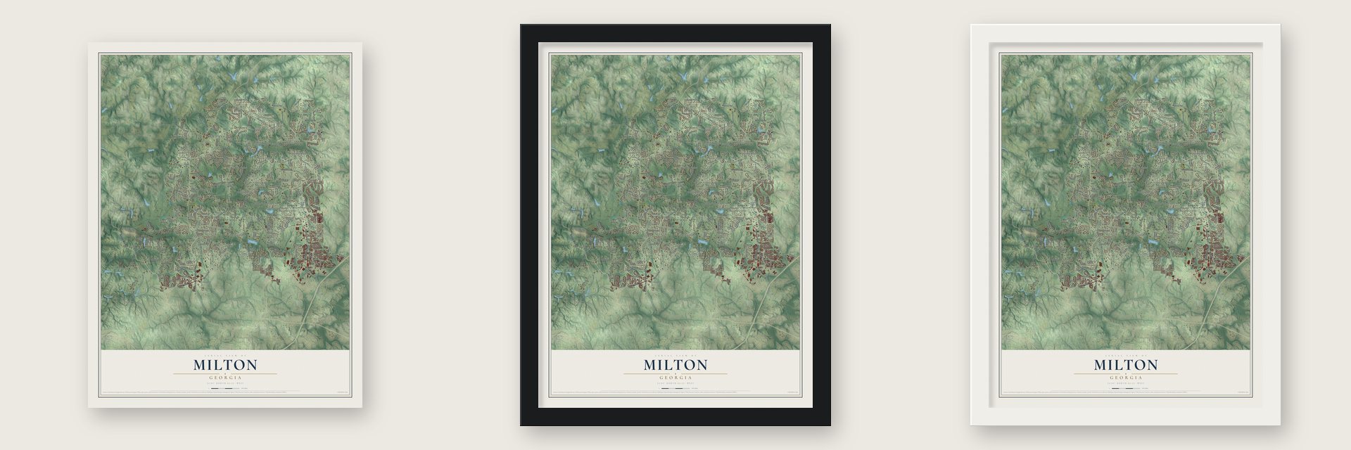
Unframed archival matte, a black wood frame or a white wood frame.
Up close
Geography Worth Displaying
This map was created using accurate cartographic data and authoritative geographic sources, including the U.S. Geological Survey (USGS) and FEMA. The map brings together terrain, waterways, roads, and building detail. The majority of the streets are labeled, houses are accurately depicted, and the topography is derived from government sources. Combining local data with carefully composed color and shading leads to this beautifully detailed Milton artwork for your wall.
Rather than simply showing street outlines, we’ve included as many of the street names as we could reasonably fit on the map while keeping their names legible. Zoom in on the high resolution preview to see exactly what’s on the map. We truly set out to create a statement piece for anyone who loves Milton. So whether it’s for you, or a gift for someone you love, we hope this map of Milton brings back fond memories.
Explore the full map of Milton, Georgia and read about the local places it shows.

About Milton, Georgia
Milton is a city of 41,296 people in Fulton County, about 30 miles north of downtown Atlanta. It is named for John Milton, a hero of the Revolutionary War. Milton County, created in 1857, carried his name too and covered the land where the city now stands. The Great Depression, the boll weevil and a long drought left that county unable to pay its way, so in 1932 it was dissolved and folded into Fulton County.
The area stayed rural for decades, even as Atlanta grew fast. Early in the 21st century, many residents felt that county leaders far away were not paying attention to the north end of Fulton County. State Representative Jan Jones filed a bill for a new city in January 2005, giving people a full year to weigh it. Voters approved cityhood on July 18, 2006, and Milton was incorporated on December 1, 2006.
- A city by a wide marginOn March 9, 2006, the bill for Milton passed the Georgia House 127 to 21 and the State Senate 49 to 0. Governor Sonny Perdue signed it on March 28, and 85 percent of voters said yes at the polls that July. Joe Lockwood won the first mayoral race and led the city for its first 15 years. Peyton Jamison followed him as mayor.
- Police and fire in 2007City leaders first worked out of converted office space. Milton started its own police force on May 1, 2007, and its own fire department 16 days later. The city later moved into buildings it owned, with a new city hall that opened in 2017 and a Public Safety Complex that opened in 2020.
- From cotton fields to horse farmsAfter the Cherokee were forced out, Georgia gave away this land by lottery in 1832. Settlers cleared the forests for small farms, and cotton became the main cash crop. Highway 9 arrived in the 1920s and brought cars. Later, zoning favored large lots on septic systems, which kept room for horse farms and country living.
Find your street
Names on the Milton map
Every name below is printed on this map. Look for your street, your school, the park where you played, or the pond down the road.
Places and landmarks22
- Milton City Hall
- Alpharetta Woods
- Arnold Mill
- Bentgrass Farms
- Birmingham
- Birmingham Road Estates
- Christophers Run
- Country Ridge
- Crabapple
- Fields Crossroads
- Five Acres Estates
- Henderson Heights
Show all 22 places
- Hidden Valley Farms
- Hopewell
- Knox Landing
- Laurel Grove
- North Valley
- Sunnybrook Farms
- Tullamore
- Webb
- Wood Valley
- Wyndham Farms
Streets and roads245
- Birmingham Highway
- Arnold Mill Road
- Crabapple Road
- Alpharetta Highway
- Deerfield Parkway
- Cogburn Road
- Francis Road
- Mayfield Road
- Hopewell Road
- Freemanville Road
- Bethany Road
- New Providence Road
- Providence Road
- Birmingham Road
- Bethany Bend
- South Thompson Road
- Thompson Road
- Dinsmore Road
- Mountain Road
- Wood Road
- Westbrook Road
- Taylor Road
- Creek Club Drive
- Manor Bridge Drive
- Morris Road
- Hickory Flat Road
- White Columns Drive
- Dorris Road
- Batesville Road
- Henderson Road
Show all 245 streets
- Hamby Road
- Quayside Drive
- Ebenezer Road
- Cox Road
- Webb Road
- East Bluff Road
- Rowe Road
- Redd Road
- Glenover Drive
- Longstreet Road
- Heritage Pass
- Nix Road
- Rolling Links Drive
- Triple Crown Drive
- King Road
- Kensington Farms Drive
- Summit Road
- Brittle Road
- Autumn Close
- New Bull Pen Road
- Watsons Bend
- Phillips Circle
- Lost River Bnd
- Timber Point
- Owens Lake Road
- Powers Court Avenue
- Lackey Road
- Earny Road
- Ranchette Road
- Bay Colt Road
- Milton Point
- Laconia Lane
- Phillips Road
- Tullgean Drive
- Landrum Road
- Darby Road
- Cedar Ridge Drive
- Taylor Glen Drive
- Bream Drive
- McFarlin Lane
- Arabian Avenue
- Serenade Court
- Seabiscuit
- Green Road
- Hagood Road
- Sweetapple Road
- Sunfish Bend
- Sable Court
- Day Road
- Cowart Road
- King Circle
- Burdette Court
- Colonial Lane
- Clarity Road
- Hunter Way
- Holly Road
- Land Road
- Basnett Drive
- Donegal Lane
- Kent Court
- Lively Road
- Highway 9 North
- Broadwell Road
- Manor Club Drive
- Providence Lake Drive
- Northwood Drive
- Hopewell Plantation Drive
- Fox Hollow Run
- Hipworth Road
- Old Bull Pen Road
- Glencreek Way
- Oakhurst Leaf Drive
- Avensong Village Circle
- Belleterre Drive
- Treyburn Manor Vw
- Cedar Farms Court
- Bethany Oaks Pointe
- Bethany Church Road
- Highgrove Club Drive
- Deer Trail
- Owens Farm Road
- Richmond Glen Drive
- Neese Road
- Providence Way
- Champions Close
- Barberry Drive
- Haystack Lane
- Burgess Road
- Manorview Lane
- Belford Drive
- Devonshire Farms Way
- Freemanwood Lane
- Providence Oak Street
- Peaks Parkway
- Five Acre Road
- Region Trce
- Tullamore Way
- Cooper Sandy Cv
- Wolf Willow Close Road
- McGinnis Ferry Road
- North Fields Pass
- Bethany Green Court
- Valmont Lane
- Majestic Cv
- Milestone Trail
- Chipping Wood Court
- Double Creek Lane
- Liberty Grove Road
- Tree Loft Road
- Louis Road
- Deer Creek Place
- Muirfield Drive
- Thompson Springs Drive
- Forest Circle
- Knox Hill Drive
- Lathenview Court
- Plantation Trce
- Pony Tail Road
- Gates Mill Way
- Twinrose Place
- Milton Place
- Coach House Lane
- Manor Trce
- Sonata Lane
- Rose Mill Street
- Haven Terrace
- Turtle Creek Lane
- Owens Way
- Killian Lane
- Horizon Hl
- Old Holly Road
- Stafford Drive
- Tramore Place
- Water Oak Place
- Waters Edge Drive
- Creek Road
- Sauls Place
- York Cv
- Kings Close
- Kent Road
- Saddlesprings Drive
- Waterside Drive
- Morning Mountain Way
- Archgate Court
- Providence Plantation Drive
- Greenview Terrace
- Summit View Lane
- Wood Branch Drive
- Tournament Players Drive
- Gunston Hall Circle
- Crooked Stick Drive
- North Park Lane
- Laurel Grove Drive
- Sable Pointe Road
- Arcaro Drive
- Canonero Drive
- Summit Oak Drive
- Segwick Drive
- Oakstone Glen
- Old Northpark Lane
- Cogburn Lane
- Sandy Creek Farm Road
- Bon Endriot Drive
- Hickory Mill Lane
- Bethany Bnd
- Golf Vista Court
- Taylor Lane
- Rolly Drive
- No Place
- Richmond Glen Circle
- Champions View Drive
- Waxmyrtle Road
- Weycroft Circle
- Canterbury Chase
- Nettlebrook Lane
- Heybridge Lane
- Providence Farms Lane
- Brookshade Parkway
- Balley Forrest Drive
- Country Ridge Road
- Sablewood Drive
- Aventide Lane
- Champions Club Drive
- Providence Park Drive
- Blackberry Ridge Trail
- Itaska Walk
- Thorntree Run
- Triple Crown Court
- Winterfield Way
- Hamiota Ridge
- Fieldstone Trail
- Lake Mist Cv
- Kings County Court
- Hopewell Crst
- Flamingo Road
- Pleasant Hollow Trail
- Meadow King Court
- Mc Ginnis Ferry Road
- Dockbridge Way
- Quarterpath Lane
- Waterhaven Lane
- Ebenezer Pond Court
- Fossil Trce
- Hopewell Close Lane
- Gables Run
- Black Oak Road
- Hopewell Grove Drive
- Bayfield Court
- Emmaus Road
- Cogdell Trail
- Madison Hall Lane
- Easy Goer Lane
- Thicket Court
- Wilkie Road
- Henry Lane
Names are listed as they appear on the printed map. Zoom into the product photos to find them.
The art of mapping a place
How This Map Was Made
Real places. Remarkable detail. Discover the layers that turn geographic data into a map of home.

The view from above
Aerial imagery reveals the character of the land: woodland, open fields, and the patterns of a place.

The shape of the land
Elevation data brings hills, valleys, and subtle changes in the landscape into view.

The details of home
Roads, waterways, and building footprints come together to make the map feel unmistakably local.

Geography becomes art
Considered color, shading, and typography bring the layers together in a map made for your wall.


Process illustrated with Mendon, Massachusetts. Aerial imagery: USDA NAIP. Terrain: USGS 3D Elevation Program. Map details and finished artwork: KNOWOL.
The Details
About This Print
Choose an archival matte print, or a black or white Ayous wood frame. The archival matte print is unframed.
Select your size and finish above to see the matching product image and price.
Materials & Craftsmanship
A contemporary map with the character of a classic atlas, printed on archival matte paper. Optional frames are made from Ayous wood.
Your printed map does not include the watermark shown in the full-map preview.
Shipping & Delivery
Free shipping within the United States. Every print is made to order in the USA.
Buying a gift? Add a note in your cart and we'll include it. We never put prices in the package.
Prints ship within 2 to 3 business days. Allow 7 to 10 days total from ordering for delivery. Timing may vary during holidays or periods of high order volume.
Read our shipping policy.
Returns and damaged prints
Each print is made to order. Change-of-mind refunds are not available after production.
If your print arrives damaged, misprinted or incorrect, contact support@knowol.com within 30 days of receiving it. Include your order number, photos and a description of the issue.
Read our full refund and replacement policy. For questions about your order, email support@knowol.com.
Find your town
Looking for another city?
Find a map of home in our Georgia collection, or any town in the country.
Nearby
Maps of towns near Milton
Know someone from one of these towns? Their map makes a great gift.
 Alpharetta
, Georgia
From $39.99See the map
 Mountain Park
, Georgia
From $39.99See the map
 Roswell
, Georgia
From $39.99See the map
More maps nearby: Holly Springs, Johns Creek, Cumming, Woodstock and Canton.