
Search for another town



Free U.S. delivery 7 to 10 days after you order
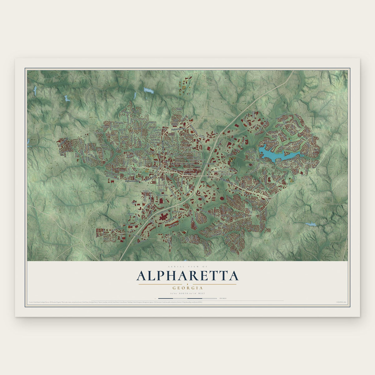
Alpharetta, Georgia Map Art
A new map of Alpharetta, Georgia, made in 2026 and printed to order on thick archival matte paper.
12" x 18" Archival Matte Print
A Map of Home. A Work of Art.
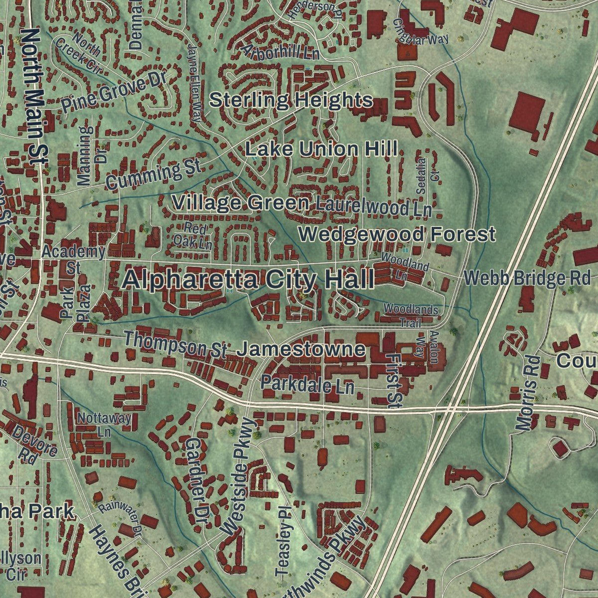
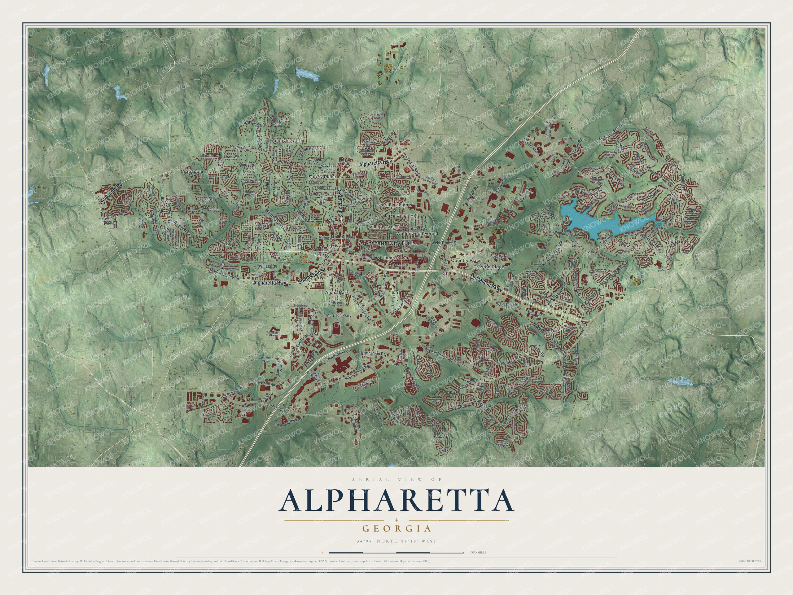
Explore Alpharetta, Georgia from a whole new perspective. Created using aerial imagery and detailed geographic data, this map captures Alpharetta building by building, with labeled streets, familiar landmarks, and shaded topographical relief that highlights the natural contours of the landscape.
Combining modern data with the timeless character of a vintage atlas, this map is just as interesting up close as it is beautiful on the wall. Whether you grew up in Alpharetta, spent memorable years there, or call it home today, this unique map is a great way to celebrate a place that means something to you. Zoom in on the preview to look for your street, and then order a print to put your memories on the wall.
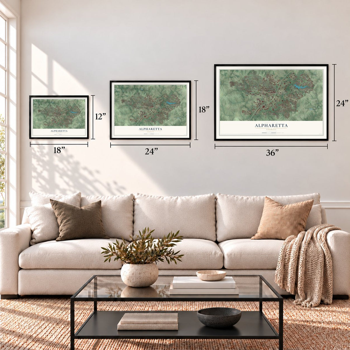
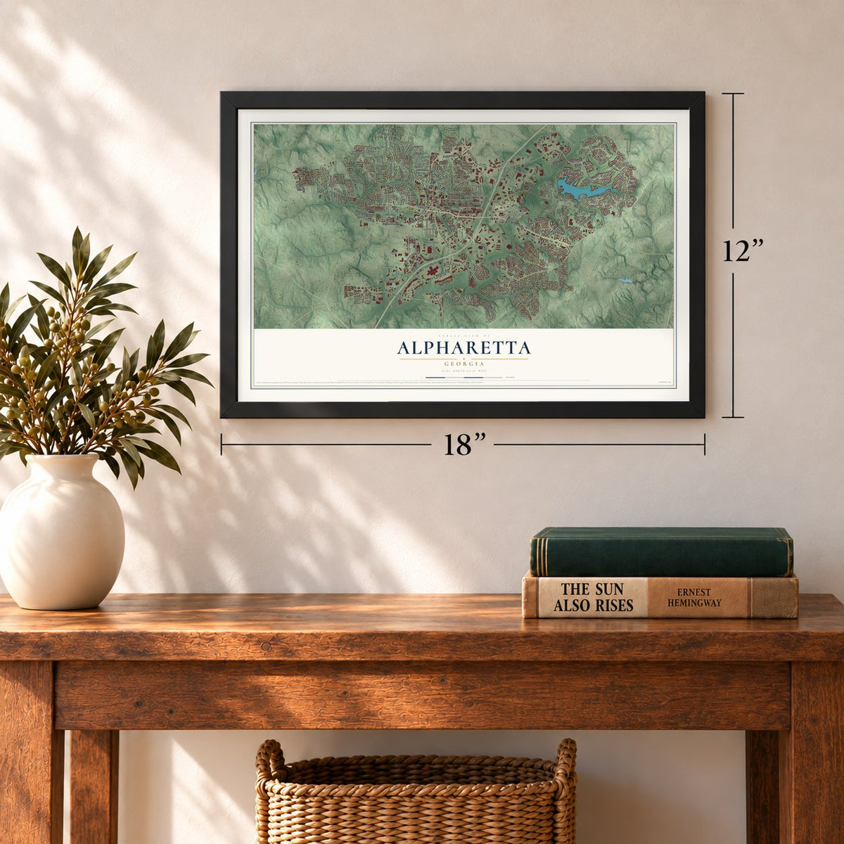
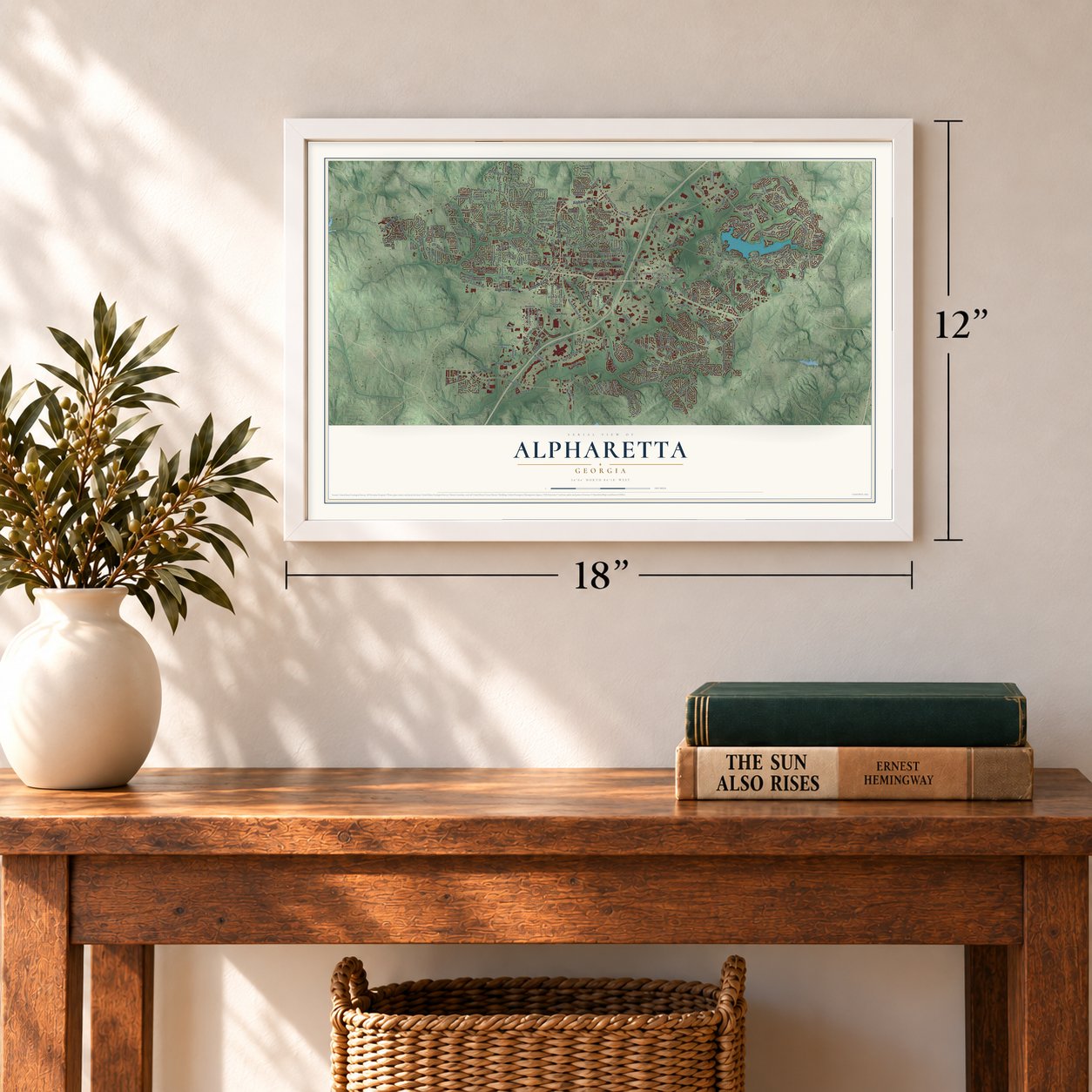
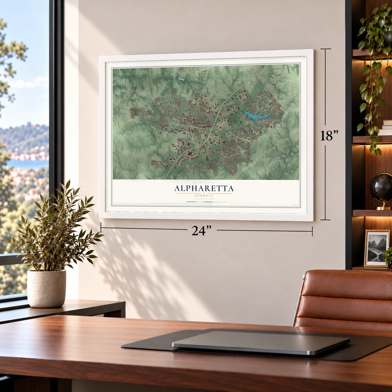
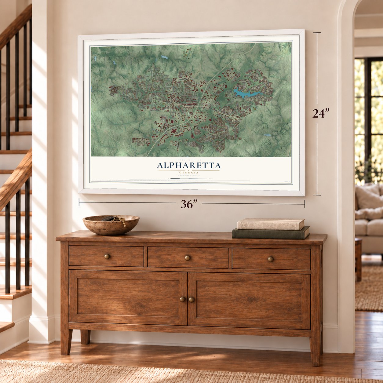
Three ways to hang it
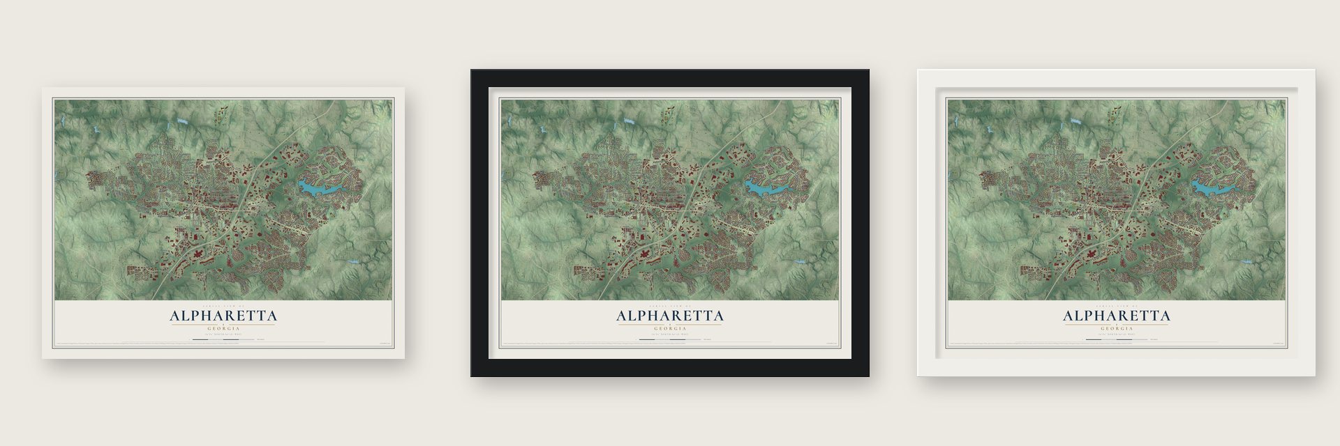
Unframed archival matte, a black wood frame or a white wood frame.
Up close
Geography Worth Displaying
This map was created using accurate cartographic data and authoritative geographic sources, including the U.S. Geological Survey (USGS) and FEMA. The map brings together terrain, waterways, roads, and building detail. The majority of the streets are labeled, houses are accurately depicted, and the topography is derived from government sources. Combining local data with carefully composed color and shading leads to this beautifully detailed Alpharetta artwork for your wall.
Rather than simply showing street outlines, we’ve included as many of the street names as we could reasonably fit on the map while keeping their names legible. Zoom in on the high resolution preview to see exactly what’s on the map. We truly set out to create a statement piece for anyone who loves Alpharetta. So whether it’s for you, or a gift for someone you love, we hope this map of Alpharetta brings back fond memories.
Explore the full map of Alpharetta, Georgia and read about the local places it shows.

About Alpharetta, Georgia
Alpharetta is a city of 65,818 people in northern Fulton County, 26 miles north of downtown Atlanta. In the 1830s the Cherokee were forced out of Georgia under the Indian Removal Act, and pioneers and farmers then moved onto the emptied land along an old Cherokee trail that ran from the North Georgia mountains down to the Chattahoochee River.
The settlement went by the name Milton until July 1858. On December 11, 1858, it was chartered as the city of Alpharetta, with limits reaching half a mile in every direction from the courthouse. Alpharetta served as the seat of Milton County until 1931, when the county, facing bankruptcy in the Great Depression, merged into Fulton County.
- A camp meeting by a springOne of the first lasting landmarks here was the New Prospect Camp Ground, also called the Methodist Camp Ground. It sat beside a natural spring close to today's downtown, and in later years settlers used it as a trading post where they swapped goods with one another.
- A log house from 1833Simeon and Jane Rucker's log house went up in 1833, in the same decade that settlers began farming the land left behind by Cherokee removal. The Simeon and Jane Rucker Log House joined the National Register in 1997.
- Farmers, smiths and millersThe early townspeople were mostly Methodists and Baptists who made their living farming, blacksmithing, milling, keeping stores, doing carpentry and digging ditches, and some of them held a few slaves. In the Civil War, local men went off to fight or served in the home guard, but Union troops never pushed north of Roswell, about six miles to the southwest.
- A song or a Greek letterNo one is sure where the name came from. It may be a version of Alfarata, an Indian girl invented for the 19th-century song "The Blue Juniata," or it may start with alpha, the first letter of the Greek alphabet. The Alpharetta Milton museum says the meaning of the "retta" part is unknown.
- The Mansell House of 1912The Mansell House, a Queen Anne style home built in 1912, now hosts special events in its house and gardens. It is also the home of the Alpharetta Historical Society.
Find your street
Names on the Alpharetta map
Every name below is printed on this map. Look for your street, your school, the park where you played, or the pond down the road.
Places and landmarks14
- Alpharetta City Hall
- Alpharette
- Andover North
- Wills Park
- Alpha Park
- Country Place
- Crabapple
- Jamestowne
- Lake Union Hill
- Preston Ridge
- Sterling Heights
- Surrey Place
Show all 14 places
- Village Green
- Wedgewood Forest
Streets and roads280
- Old Milton Parkway
- North Main Street
- Alpharetta Highway
- South Main Street
- Crabapple Road
- Windward Parkway
- Kimball Bridge Road
- Rucker Road
- Westside Parkway
- Milton Avenue
- Old Roswell Road
- Cogburn Road
- North Point Parkway
- Haynes Bridge Road
- Webb Bridge Road
- Mansell Road
- McGinnis Ferry Road
- Mayfield Road
- Rock Mill Road
- Lake Windward Drive
- Mid Broadwell Road
- North Point Circle
- Southlake Drive
- Clubhouse Drive
- Waters Road
- Morris Road
- Alderman Drive
- Cumming Street
- Douglas Road
- Schooner Ridge
Show all 280 streets
- Northwinds Parkway
- High Hampton Chase
- Park Brooke Trce
- Union Hill Road
- Park Bridge Parkway
- Tuxford Drive
- Gardner Drive
- Briars Bend
- Centennial Drive
- Newport Bay Drive
- Maxwell Road
- Morrison Parkway
- Grey Abbey Drive
- Seale Drive
- Providence Road
- Eversedge Drive
- Canton Street
- Charlotte Drive
- Clipper Bay Drive
- Encore Parkway
- Brookside Parkway
- Wills Road
- Barnesley Lane
- Buice Road
- Bethany Road
- Golf Club Drive
- Birch Rill Drive
- Upper Hembree Road
- Maid Marion Close
- Thompson Street
- North Point Drive
- Pine Grove Drive
- Marconi Drive
- Old Roswell Street
- Big Creek Overlook
- Waters Mill Drive
- North Farm Drive
- Spruell Circle
- Pinehigh Drive
- Timberline Place
- Pineset Drive
- Karen Drive
- Beaver Creek Road
- Sherry Drive
- Harris Road
- Dryden Road
- Laurelwood Lane
- Fanfare Way
- Edison Drive
- Gunter Court
- Willow Tree Way
- Broadwell Road
- Parkdale Lane
- Meadow Drive
- Beragio Place
- Pebble Trail
- Dover Avenue
- Lantern Ridge Court
- Adler Court
- Newcastle Drive
- Harrington Drive
- Pruitt Drive
- Alexander Drive
- Andover Drive
- Ash Rill Drive
- Old Rucker Road
- Mayapple Drive
- Cypress Court
- Salem Drive
- Fox Road
- Bates Road
- Dania Drive
- Marka Lane
- First Street
- Wills Lane
- Wills Drive
- Davis Drive
- Duke Drive
- Sanctuary Parkway
- Academy Street
- Lakewood Parkway
- Hembree Road
- Great Oaks Way
- Traywick Chase
- Crabapple Chase Drive
- Leeward Walk Circle
- Wittenridge Drive
- Greenmont Walk
- Newport Bay Psge
- Pinewalk Forest Circle
- Mayfield Manor Drive
- Cape York Trce
- Lauren Hall Court
- Society Street
- Strath Drive
- Carybell Lane
- Ashleigh Lane
- Mill Creek Avenue
- Lexington Farm Drive
- Jameson Pass
- Windward Concourse
- Old Alabama Road Con
- Lake Shore Landing
- Lynne Circle
- Mayfield Circle
- Center Bridge Road
- Devore Road
- Shady Grove Lane
- Park Brooke Drive
- Marietta Street
- Chantilly Drive
- Chasewood Trail
- Park Glen Drive
- Wynridge Crossing
- Greatwood Crossing
- Rillridge Court
- Bascomb Farm Drive
- Gransley Court
- Chelsey Lane
- Sugar Valley Trail
- Fairfax Drive
- Thornberry Drive
- Rockberry Lane
- Twin Cedar Road
- Dennis Drive
- Hunters Oaks Drive
- Flying Scot Way
- Hill Chase
- Forest Path Lane
- Briers Chute
- Michaela Drive
- Cogburn Ridge Road
- Lakewind Court
- Wallace Woods Lane
- Arborhill Lane
- Market Place
- Bridge Pointe Drive
- Harvest Lane
- Teasley Place
- Warsaw Road
- Brace Ridge
- Stanyan Street
- Denna Drive
- Mariners Ridge
- Manning Drive
- Derby Chase Court
- Burnett Way
- Park Plaza
- Cicero Drive
- Redbud Drive
- Lillian Drive
- Woods Ridge Drive
- Hook Road
- Brooke Drive
- Water Lily Drive
- Dodd Lane
- Mae Lane
- Dunoon Drive
- Allyson Circle
- Lowe Lane
- Spur Lane
- Windward Parkway West
- Summerfield Drive
- Greatwood Manor
- North Hickory Trce
- Bent Creek Manor
- North Creek Circle
- Kimball Crest Drive
- Winthrope Chase Drive
- Waterview Trail
- North Fulton Industrial Boulevard
- Tidewater Way
- Nottaway Lane
- Kingsmark Trail
- Jennifer Oaks Drive
- Morning Mist Drive
- Waters Cove Way
- Somerby Drive
- Bay Pointe Crossing
- Admiral Crossing
- Sandridge Court
- Henley Way
- Welford Trce
- Surrey Court
- Harris Ridge Court
- Arrowood Lane
- Old Morris Road
- Vaughn Drive
- Oak Falls Drive
- Colony Drive
- Red Oak Lane
- Founders Parkway
- Melbourne Trail
- Abernathy Oaks Way
- Grenadier Lane
- Parkmont Drive
- Spring Place Lane
- Rolling Mist Court
- Walnut Creek Drive
- Myers Drive
- Grey Owl Road
- Mill Place
- Noble Court
- Erin Drive
- Houze Road
- Henderson Place
- Webb Bridge Park Road
- Woodland Lane
- Jayne Ellen Way
- Broadwell Oaks Drive
- Windward Plaza
- Blackheath Trce
- Rainwater Drive
- Portmarnock Drive
- Park Creek Drive
- Calypso Drive
- Bannerhorn Run
- Cingular Way
- East Parkside Terrace
- East Fox Court
- Crabapple Meadow Way
- Compass Pointe Crossing
- Jefferson Court
- Lunsford Circle
- Hebden Bridge Lane
- Haynes Forest Drive
- Maple Lane
- Woodlands Trail
- White Oak Pass
- State Bridge Road
- Fieldstone Crossing
- North Trce
- Americas Cup Cv
- Knightsbridge Way
- Pin Oak Lane
- Thornbury Way
- Avalon Way
- Birch Hollow Drive
- Whitestone Place
- Kingsport Drive
- Trammell Drive
- Mainstay Place
- Gleneagles Pointe
- Seven Seas Court
- Millstone Drive
- Sedalia Court
- Haney Drive
- Rumson Lane
- Janis Lane
- Misty Lane
Names are listed as they appear on the printed map. Zoom into the product photos to find them.
The art of mapping a place
How This Map Was Made
Real places. Remarkable detail. Discover the layers that turn geographic data into a map of home.

The view from above
Aerial imagery reveals the character of the land: woodland, open fields, and the patterns of a place.

The shape of the land
Elevation data brings hills, valleys, and subtle changes in the landscape into view.

The details of home
Roads, waterways, and building footprints come together to make the map feel unmistakably local.

Geography becomes art
Considered color, shading, and typography bring the layers together in a map made for your wall.


Process illustrated with Mendon, Massachusetts. Aerial imagery: USDA NAIP. Terrain: USGS 3D Elevation Program. Map details and finished artwork: KNOWOL.
The Details
About This Print
Choose an archival matte print, or a black or white Ayous wood frame. The archival matte print is unframed.
Select your size and finish above to see the matching product image and price.
Materials & Craftsmanship
A contemporary map with the character of a classic atlas, printed on archival matte paper. Optional frames are made from Ayous wood.
Your printed map does not include the watermark shown in the full-map preview.
Shipping & Delivery
Free shipping within the United States. Every print is made to order in the USA.
Buying a gift? Add a note in your cart and we'll include it. We never put prices in the package.
Prints ship within 2 to 3 business days. Allow 7 to 10 days total from ordering for delivery. Timing may vary during holidays or periods of high order volume.
Read our shipping policy.
Returns and damaged prints
Each print is made to order. Change-of-mind refunds are not available after production.
If your print arrives damaged, misprinted or incorrect, contact support@knowol.com within 30 days of receiving it. Include your order number, photos and a description of the issue.
Read our full refund and replacement policy. For questions about your order, email support@knowol.com.
Find your town
Looking for another city?
Find a map of home in our Georgia collection, or any town in the country.
Nearby
Maps of towns near Alpharetta
Know someone from one of these towns? Their map makes a great gift.
 Johns Creek
, Georgia
From $39.99See the map
 Roswell
, Georgia
From $39.99See the map
 Milton
, Georgia
From $39.99See the map
More maps nearby: Peachtree Corners, Berkeley Lake, Mountain Park, Duluth and Dunwoody.