
Search for another town


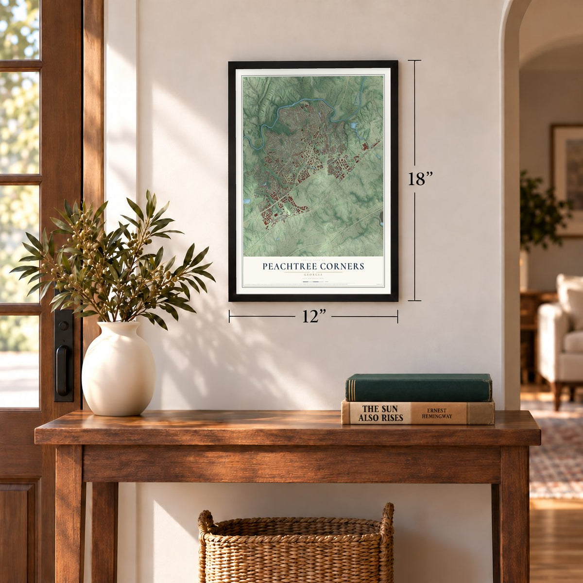
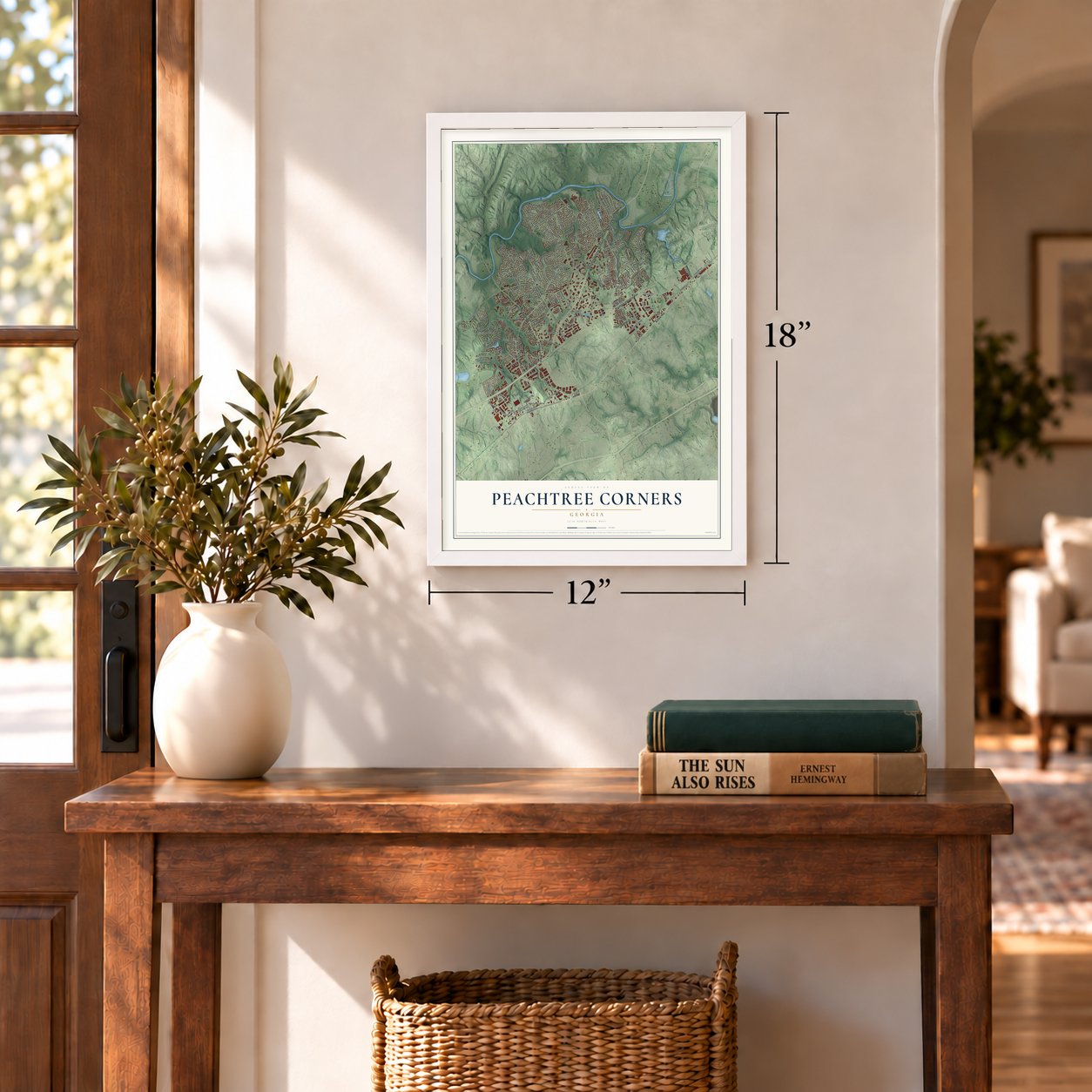
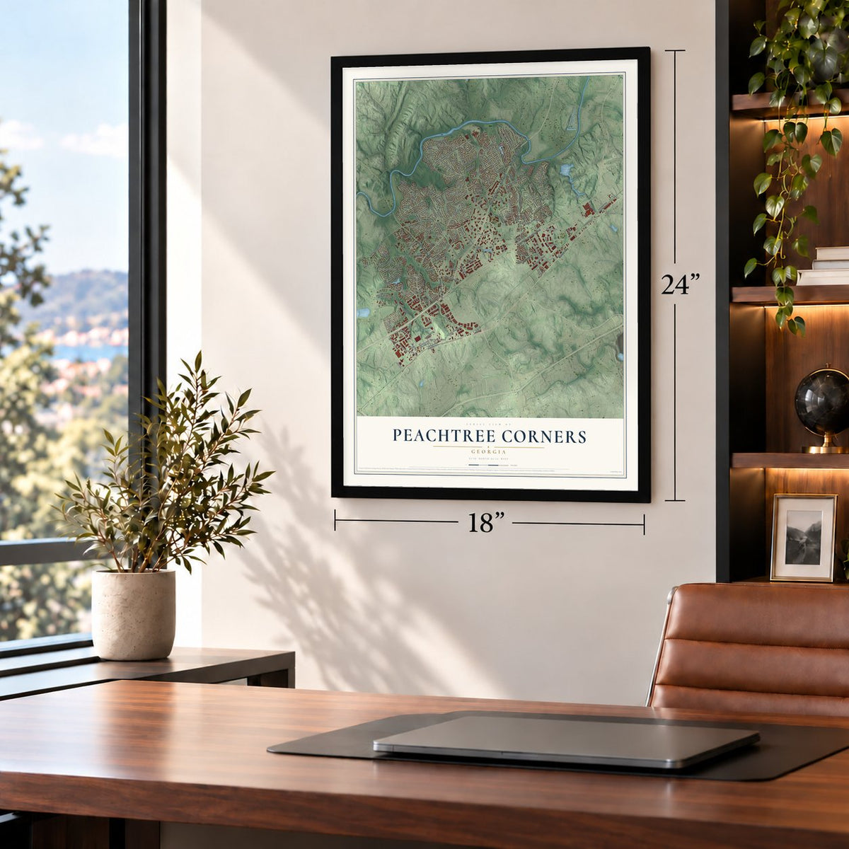
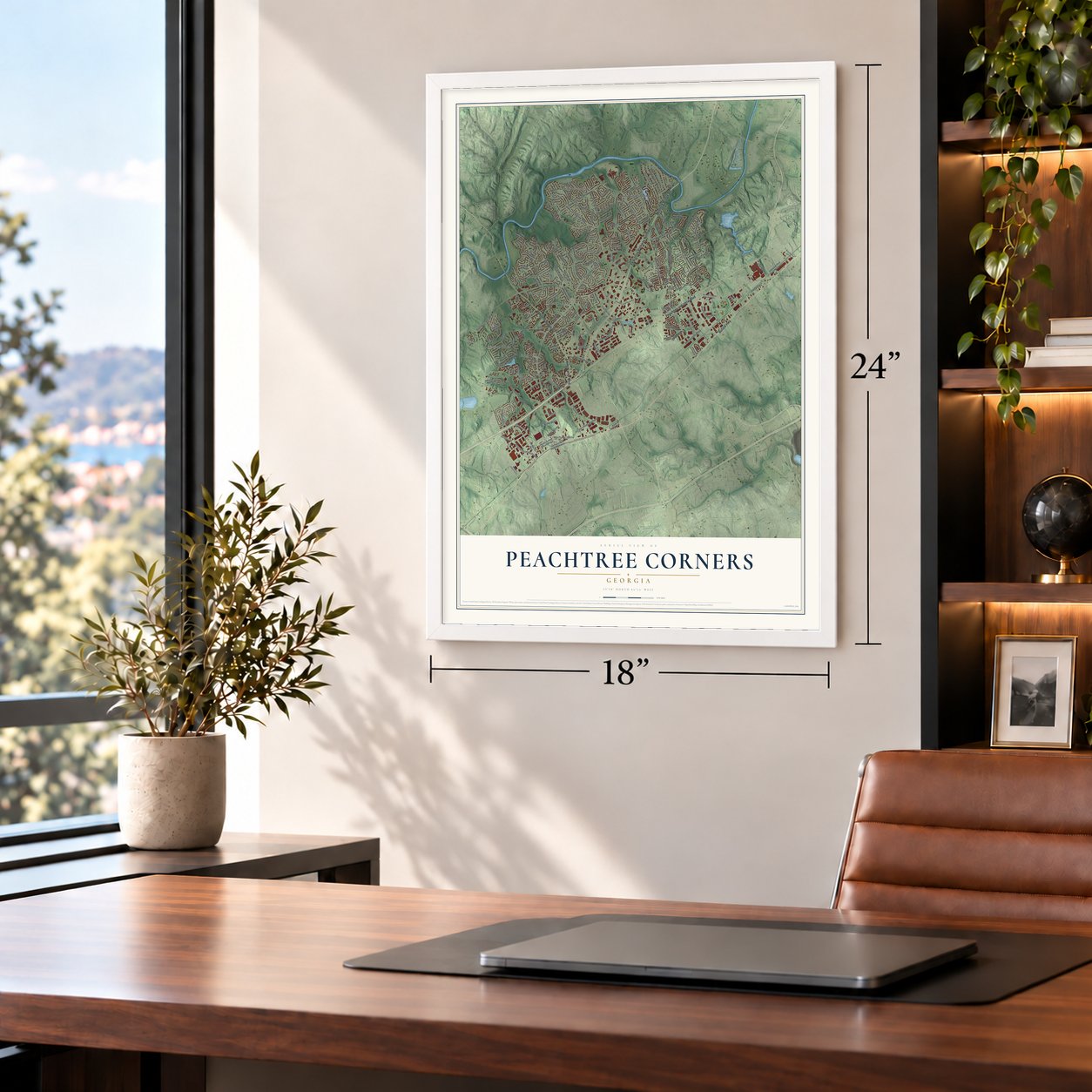
Free U.S. delivery 7 to 10 days after you order
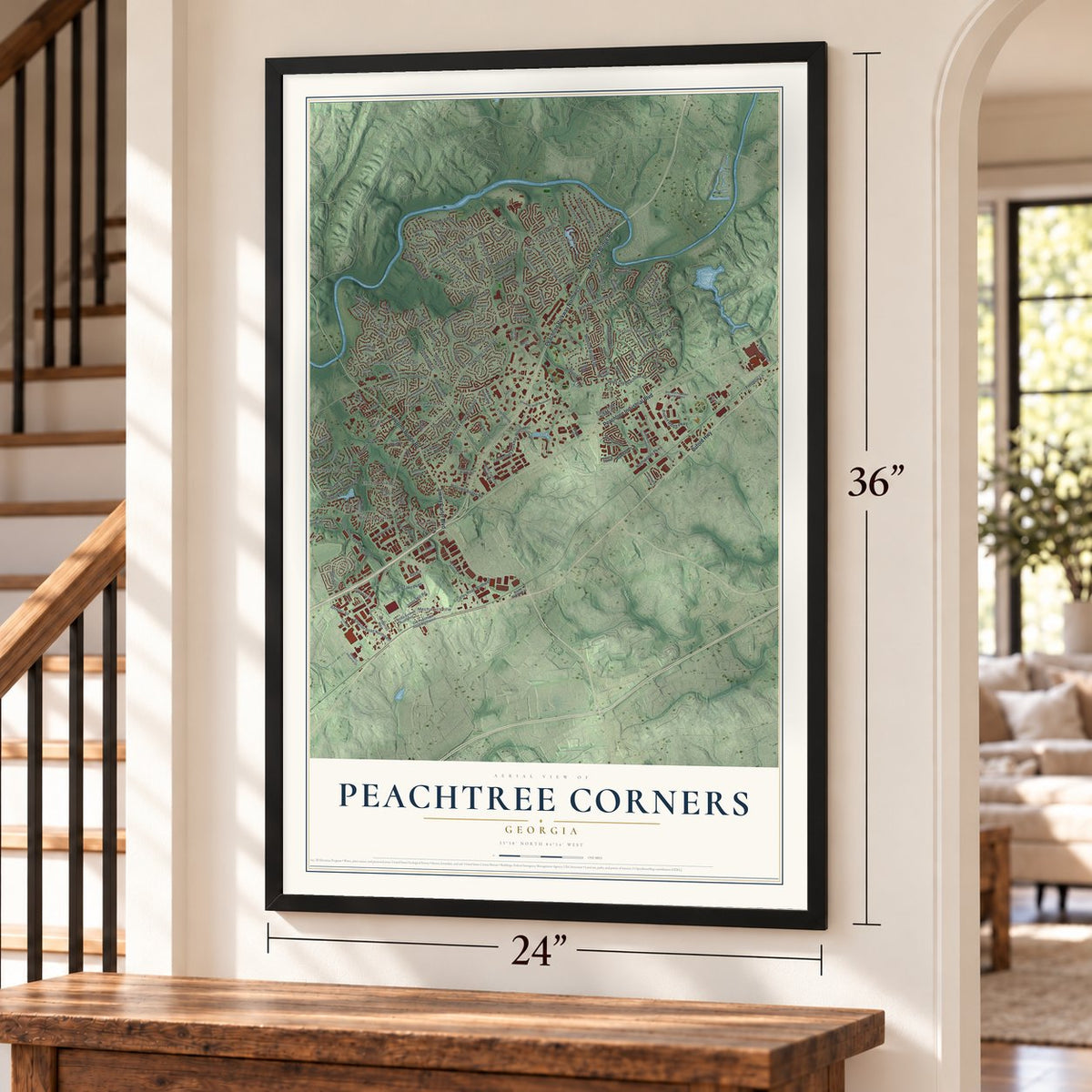
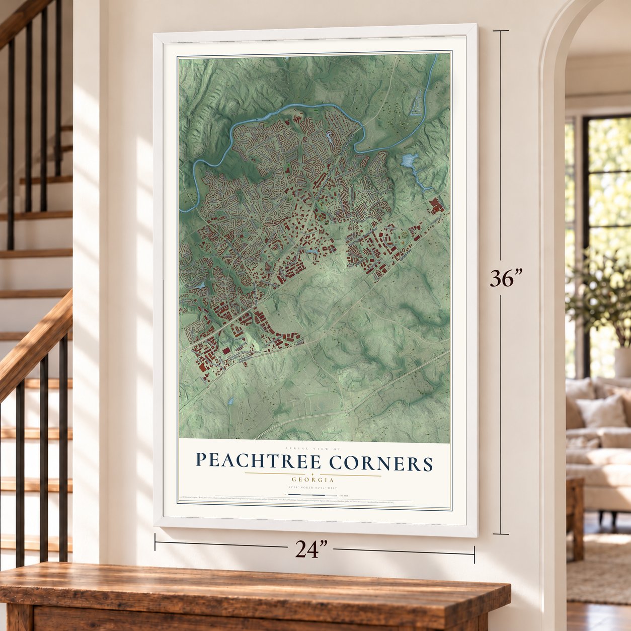
Peachtree Corners, Georgia Map Art
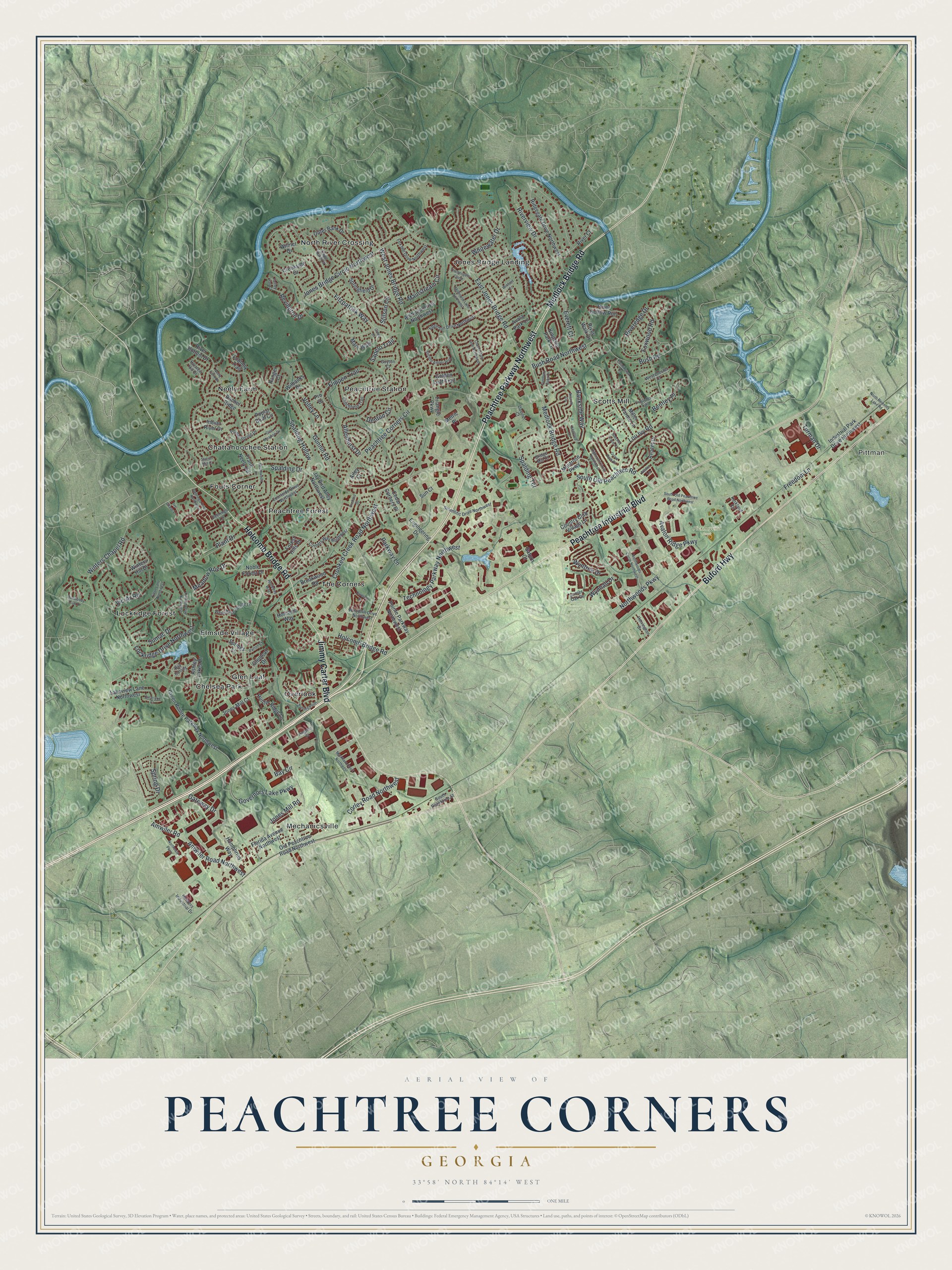
A new map of Peachtree Corners, Georgia, made in 2026 and printed to order on thick archival matte paper.
12" x 18" Archival Matte Print
A Map of Home. A Work of Art.
Explore Peachtree Corners, Georgia from a whole new perspective. Created using aerial imagery and detailed geographic data, this map captures Peachtree Corners building by building, with labeled streets, familiar landmarks, and shaded topographical relief that highlights the natural contours of the landscape.
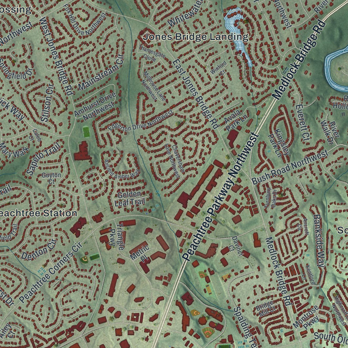
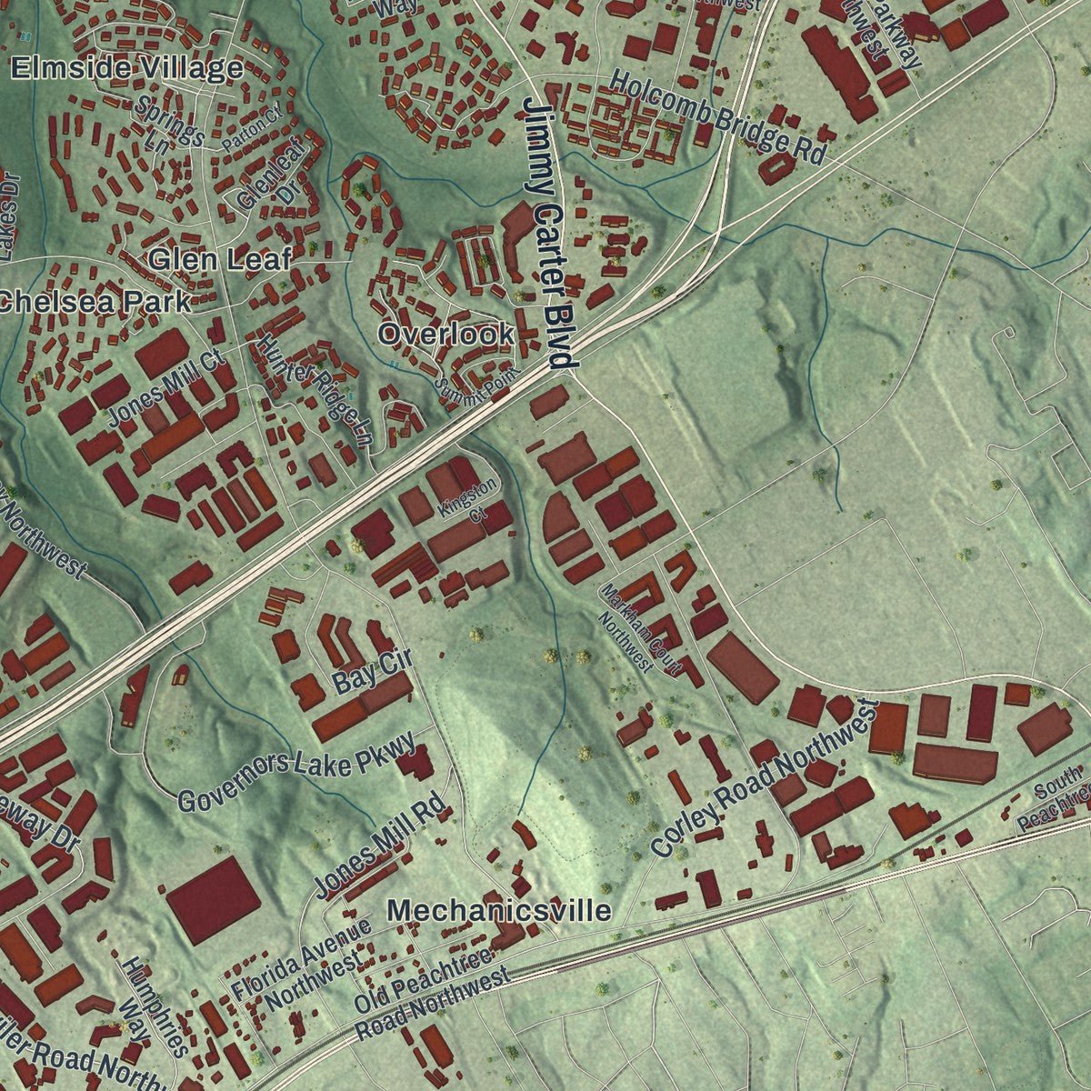
Combining modern data with the timeless character of a vintage atlas, this map is just as interesting up close as it is beautiful on the wall. Whether you grew up in Peachtree Corners, spent memorable years there, or call it home today, this unique map is a great way to celebrate a place that means something to you. Zoom in on the preview to look for your street, and then order a print to put your memories on the wall.
Three ways to hang it
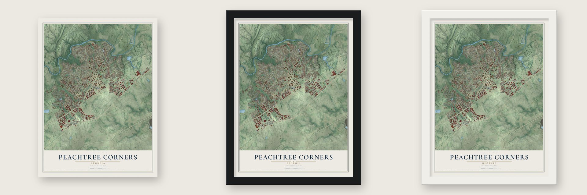
Unframed archival matte, a black wood frame or a white wood frame.
Up close
Geography Worth Displaying
This map was created using accurate cartographic data and authoritative geographic sources, including the U.S. Geological Survey (USGS) and FEMA. The map brings together terrain, waterways, roads, and building detail. The majority of the streets are labeled, houses are accurately depicted, and the topography is derived from government sources. Combining local data with carefully composed color and shading leads to this beautifully detailed Peachtree Corners artwork for your wall.
Rather than simply showing street outlines, we’ve included as many of the street names as we could reasonably fit on the map while keeping their names legible. Zoom in on the high resolution preview to see exactly what’s on the map. We truly set out to create a statement piece for anyone who loves Peachtree Corners. So whether it’s for you, or a gift for someone you love, we hope this map of Peachtree Corners brings back fond memories.
Explore the full map of Peachtree Corners, Georgia and read about the local places it shows.
About Peachtree Corners, Georgia
Peachtree Corners is a city of 42,243 people in Gwinnett County, with the Chattahoochee River running along its northern and western edge. Until 1818 this corner of the county was Creek and Cherokee land, and white families were not allowed to settle here, though a few squatters came anyway. In the early 1800s a road was laid over an old Native American trail between present Buford and present Atlanta, and the farming village of Pinckneyville grew up beside it.
By 1827 Pinckneyville had Washington Academy, the second school in Gwinnett County, on today's Spalding Drive. The village also had a post office, an inn, a saloon, a blacksmith and a carpenter. When a railroad reached nearby Norcross in 1870, every business and many families moved there to trade along the tracks, and the old Pinckneyville land stayed in farms for about a century.
- A planned suburb from 1967In the late 1960s Paul Duke planned a new community on the old Pinckneyville land. He began in 1967 with Technology Park Atlanta, an office campus meant to hire engineers and business graduates from Georgia Tech, the University of Georgia and other schools, and he raised $1.7 million to build it. GE, Scientific Atlanta and Hayes Microcomputer Products were early tenants. In 1968 he formed Peachtree Corners, Inc. to build the homes.
- Neighborhoods of the 1970sThrough the 1970s Jim Cowart built the neighborhoods Duke had planned, starting with Peachtree Station, Chattahoochee Station and Spalding Corners. His houses were more upscale than most in the county, and he put in more sewer pipe than all the rest of Gwinnett.
- Gwinnett's 16th cityHomeowners formed the United Peachtree Corners Civic Association in 1993 to push back on unwanted development. Plans for a city stalled in 1999 and again in 2005, but after Norcross failed to annex part of Technology Park Atlanta, the group tried once more in 2010. Voters approved the city on November 8, 2011, making it Gwinnett's 16th city and, at 43,059 people, its largest. City government began on July 1, 2012.
- Art on the ChattahoocheeEach year Art on the Chattahoochee brings artists, live demonstrations, music and a kids' zone to the riverbank at Jones Bridge Park. The city also holds a summer concert series on the Town Green and the Holiday Glow, when a great tree and a 6-foot Menorah are lit.
Find your street
Names on the Peachtree Corners map
Every name below is printed on this map. Look for your street, your school, the park where you played, or the pond down the road.
Places and landmarks17
- Pittman
- Pickneyville Park
- Chattahoochee Station
- Chelsea Park
- Elmside Village
- Fouts Corner
- Glen Leaf
- Jones Bridge Landing
- Lockridge Forest
- Mechanicsville
- Neely Farm
- North River Crossing
Show all 17 places
- Overlook
- Peachtree Forest
- Peachtree Station
- Scotts Mill
- The Corners
Streets and roads167
- Peachtree Parkway Northwest
- Medlock Bridge Road
- Buford Highway
- Peachtree Industrial Boulevard
- Holcomb Bridge Road
- Jimmy Carter Boulevard
- Winters Chapel Road
- Bush Road Northwest
- Amwiler Road
- Amwiler Road Northwest
- Peachtree Corners Circle
- Spalding Drive
- Jones Mill Road
- Technology Parkway Northwest
- West Jones Bridge Road
- Jones Bridge Circle Northwest
- East Jones Bridge Road
- Allenhurst Drive
- Fitzpatrick Way
- Crooked Creek Road Northwest
- Gunnin Road
- Northwoods Parkway
- Lou Ivy Road
- Flippen Trail
- Governors Lake Parkway
- Lockridge Drive Northwest
- Riverview Drive
- Spring Drive
- South Old Peachtree Road
- Meadow Rue Drive
Show all 167 streets
- Stilson Circle
- Bush Road
- Freedom Lane
- Spalding Hollow
- Bankside Way
- Corley Road Northwest
- Avalon Ridge Parkway
- Riveredge Drive
- Sumac Drive
- Spalding Terrace
- Plant Drive
- Parkway Lane
- Vic-Ar Road
- Mainstream Circle
- Whitewater Drive
- Wyntree Drive
- Foxwood Road
- Bentley Place
- Bay Circle
- Everett Court
- Turman Drive
- Denton Circle
- Revington Drive
- Gateway Drive
- Wynhall Drive
- Sapelo Trail
- Volley Lane
- Hunter Ridge Lane
- Ridgegate Drive Northwest
- Old Peachtree Road Northwest
- Jay Bird Alley Northwest
- River Bottom Drive
- Winters Hill Drive
- Green Pointe Parkway Northwest
- Springs Lane
- Engineering Drive
- Outer Bank Drive
- Frank Neely Road
- Industrial Park Drive Northwest
- Ashley Lakes Drive
- Glenleaf Drive
- Amhurst Drive Northwest
- Rachel Ridge
- Montrose Parkway
- Avocet Drive
- Poplar Bluff Circle
- River Hollow Run
- Florida Avenue Northwest
- Lakeview Lane Northwest
- Pointe Parkway Northwest
- Brookwood Road
- Wilbanks Drive
- Avala Park Lane
- Kingsley Park Lane
- River Court
- Miller Farms Lane
- Noble Forest Drive
- Springfield Drive
- Triangle Parkway
- Holcomb Way
- Humphries Way
- Jones Mill Court
- Wilmer Drive
- Country Club Village Lane
- Cedar Corners Place
- Indian River Drive
- Forest Hills Drive
- Mary Walk
- Loblolly Trail
- Creekside Drive
- Golden Leaf Trail
- River Walk Drive
- Ranger Court
- Metric Place
- Ailey Court
- Pro Drive
- Sun Court
- Saturn Court
- Courtside Drive Northwest
- Clinchfield Trail
- Edgerton Drive Northwest
- Deerings Lane
- Woodhill Drive Northwest
- Scientific Drive Northwest
- Bankers Industrial Drive
- Westchase Village Lane
- Fox Hill Drive Northwest
- Corners Way Northwest
- Bay Colony
- Bridge Mill Court
- Poplar Spring Drive
- South Peachtree Street
- Westchester Court
- Herrington Drive
- Holstein Hill Drive
- Kerkland Circle
- Corner Oak Drive
- Davinci Court
- Cape Kure Court
- Guyton Court
- South Old Peachtree Road Northwest
- Glen Meadow Drive
- Ancroft Circle
- Highcroft Circle Northwest
- Summit Point
- Tilton Lane Northwest
- Northeast Parkway
- Northwoods Circle Northwest
- Kinnard Drive Northwest
- Chaversham Lane Northwest
- Neely Farm Drive
- Parton Court
- Ancient Amber Way
- Deerings Drive Northwest
- Thamesgate Close
- Appletree Way
- Coppedge Trail
- Natchez Trace Court
- Millhouse Lane Northwest
- Heathwood Lane
- Grove Park Drive
- Kingston Court
- North Berkeley Lake Road
- Markham Court Northwest
- Turnbury Oaks Drive
- Orchard Street
- Farmington Lane
- Ivy Chase Lane
- Kiveton Drive
- Dunwoody Club Drive
- Clearlake Court
- Kentford Lane
- Winford Court
- Allston Lane
- Station Mill Court
- Fairley Hall Court
- Caleb Court
Names are listed as they appear on the printed map. Zoom into the product photos to find them.
The art of mapping a place
How This Map Was Made
Real places. Remarkable detail. Discover the layers that turn geographic data into a map of home.

The view from above
Aerial imagery reveals the character of the land: woodland, open fields, and the patterns of a place.

The shape of the land
Elevation data brings hills, valleys, and subtle changes in the landscape into view.

The details of home
Roads, waterways, and building footprints come together to make the map feel unmistakably local.

Geography becomes art
Considered color, shading, and typography bring the layers together in a map made for your wall.


Process illustrated with Mendon, Massachusetts. Aerial imagery: USDA NAIP. Terrain: USGS 3D Elevation Program. Map details and finished artwork: KNOWOL.
The Details
About This Print
Choose an archival matte print, or a black or white Ayous wood frame. The archival matte print is unframed.
Select your size and finish above to see the matching product image and price.
Materials & Craftsmanship
A contemporary map with the character of a classic atlas, printed on archival matte paper. Optional frames are made from Ayous wood.
Your printed map does not include the watermark shown in the full-map preview.
Shipping & Delivery
Free shipping within the United States. Every print is made to order in the USA.
Buying a gift? Add a note in your cart and we'll include it. We never put prices in the package.
Prints ship within 2 to 3 business days. Allow 7 to 10 days total from ordering for delivery. Timing may vary during holidays or periods of high order volume.
Read our shipping policy.
Returns and damaged prints
Each print is made to order. Change-of-mind refunds are not available after production.
If your print arrives damaged, misprinted or incorrect, contact support@knowol.com within 30 days of receiving it. Include your order number, photos and a description of the issue.
Read our full refund and replacement policy. For questions about your order, email support@knowol.com.
Find your town
Looking for another city?
Find a map of home in our Georgia collection, or any town in the country.
Nearby
Maps of towns near Peachtree Corners
Know someone from one of these towns? Their map makes a great gift.
 Norcross
, Georgia
From $39.99See the map
 Berkeley Lake
, Georgia
From $39.99See the map
 Doraville
, Georgia
From $39.99See the map
More maps nearby: Johns Creek, Dunwoody, Duluth, Chamblee and Alpharetta.