
Search for another town




Free U.S. delivery 7 to 10 days after you order
Dunwoody, Georgia Map Art
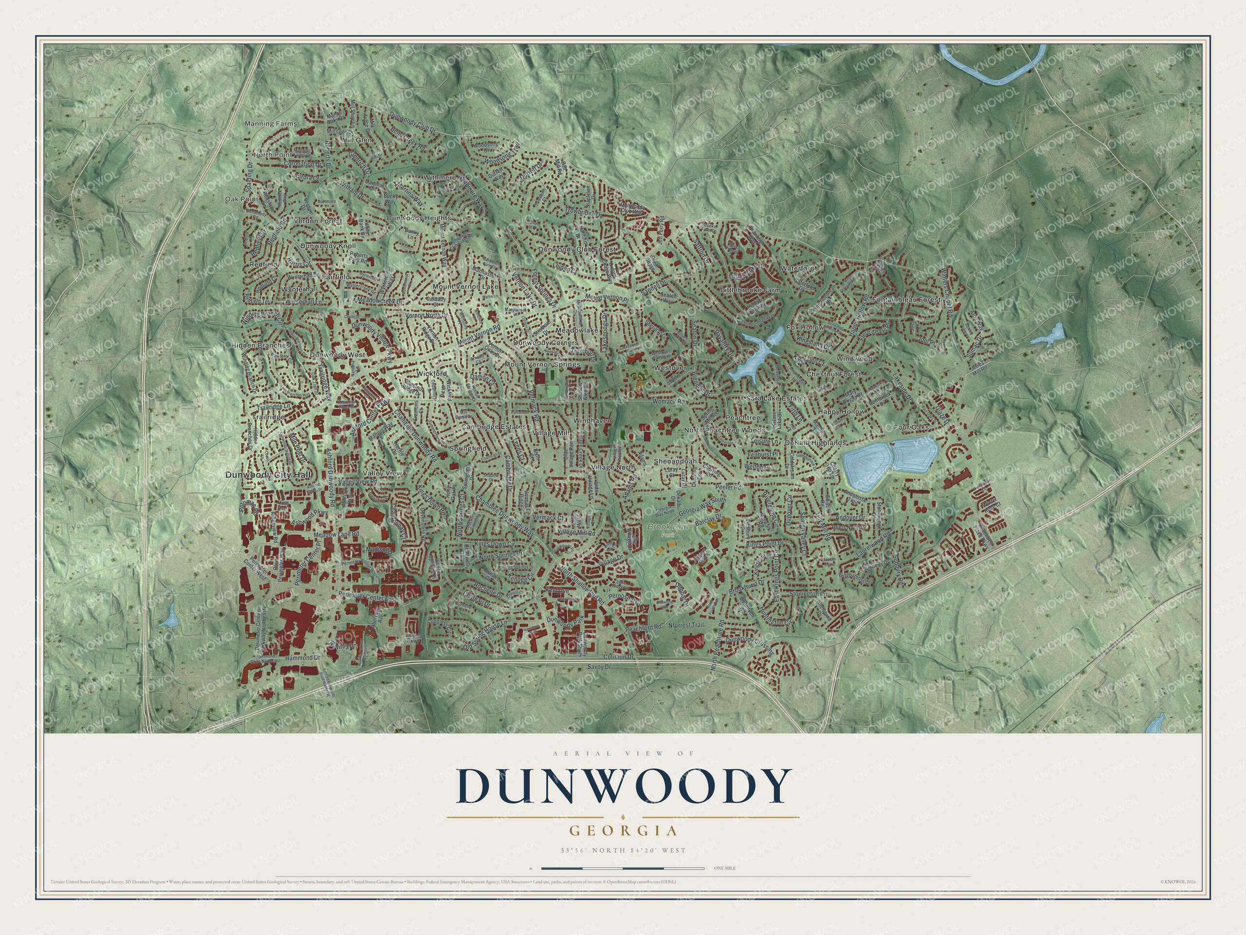
A new map of Dunwoody, Georgia, made in 2026 and printed to order on thick archival matte paper.
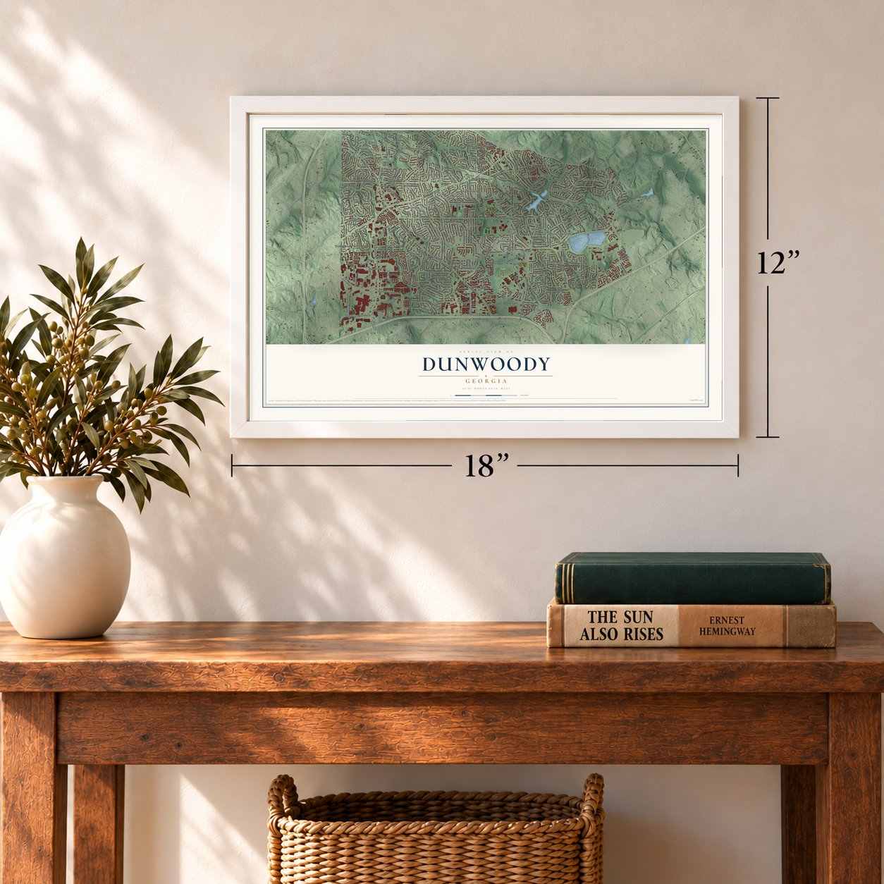
12" x 18" Archival Matte Print
A Map of Home. A Work of Art.
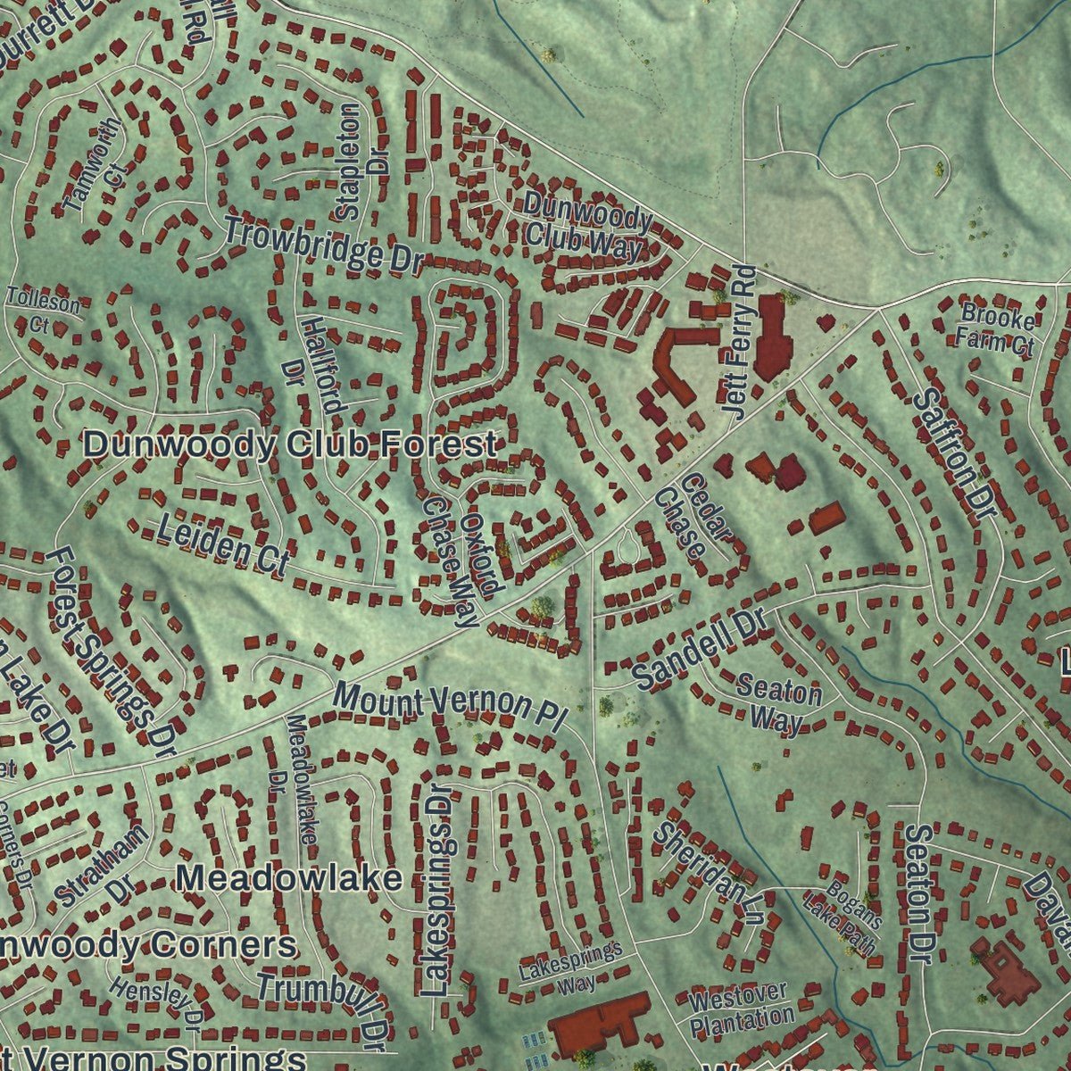
Explore Dunwoody, Georgia from a whole new perspective. Created using aerial imagery and detailed geographic data, this map captures Dunwoody building by building, with labeled streets, familiar landmarks, and shaded topographical relief that highlights the natural contours of the landscape.
Combining modern data with the timeless character of a vintage atlas, this map is just as interesting up close as it is beautiful on the wall. Whether you grew up in Dunwoody, spent memorable years there, or call it home today, this unique map is a great way to celebrate a place that means something to you. Zoom in on the preview to look for your street, and then order a print to put your memories on the wall.
Three ways to hang it
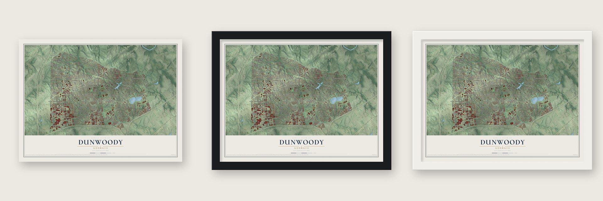
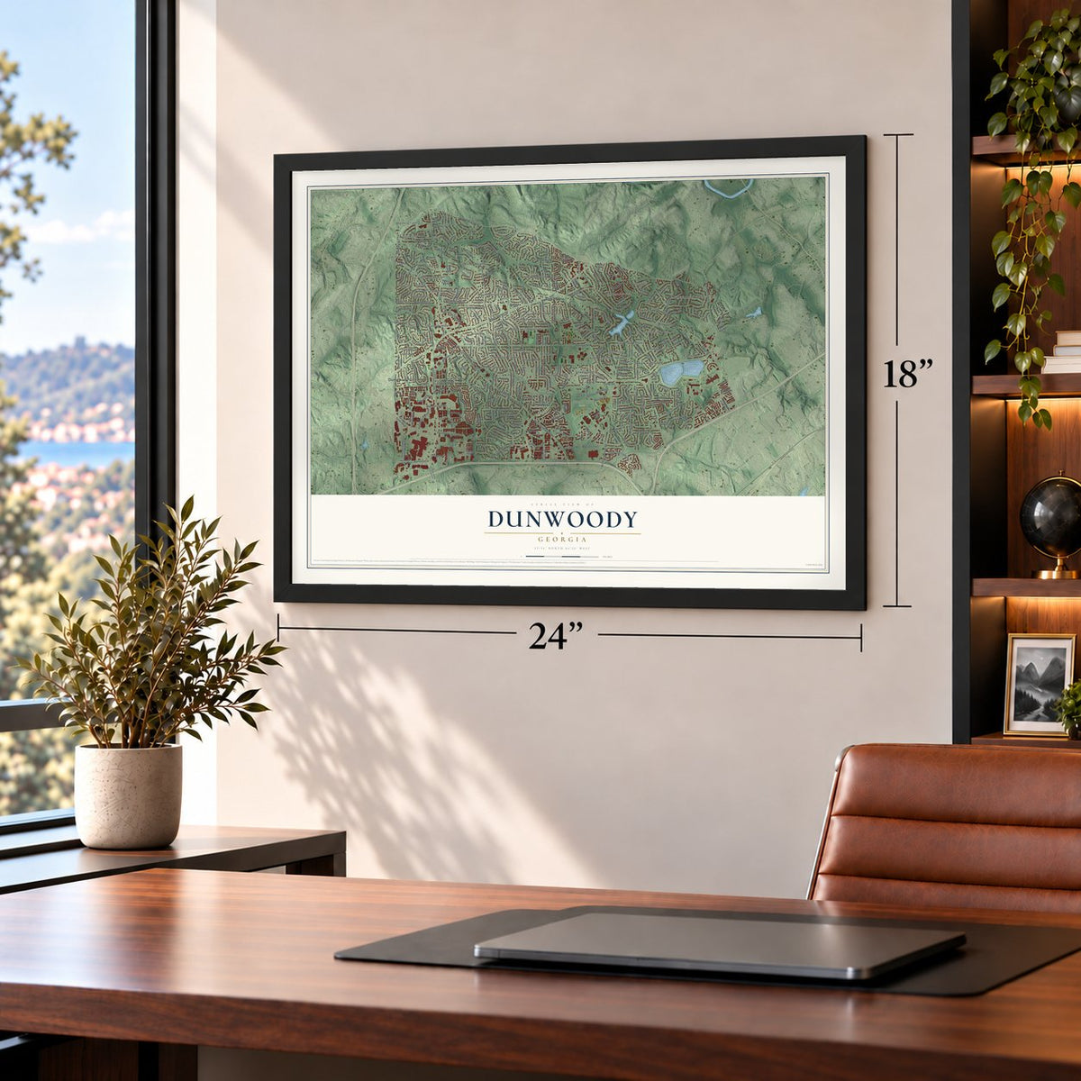
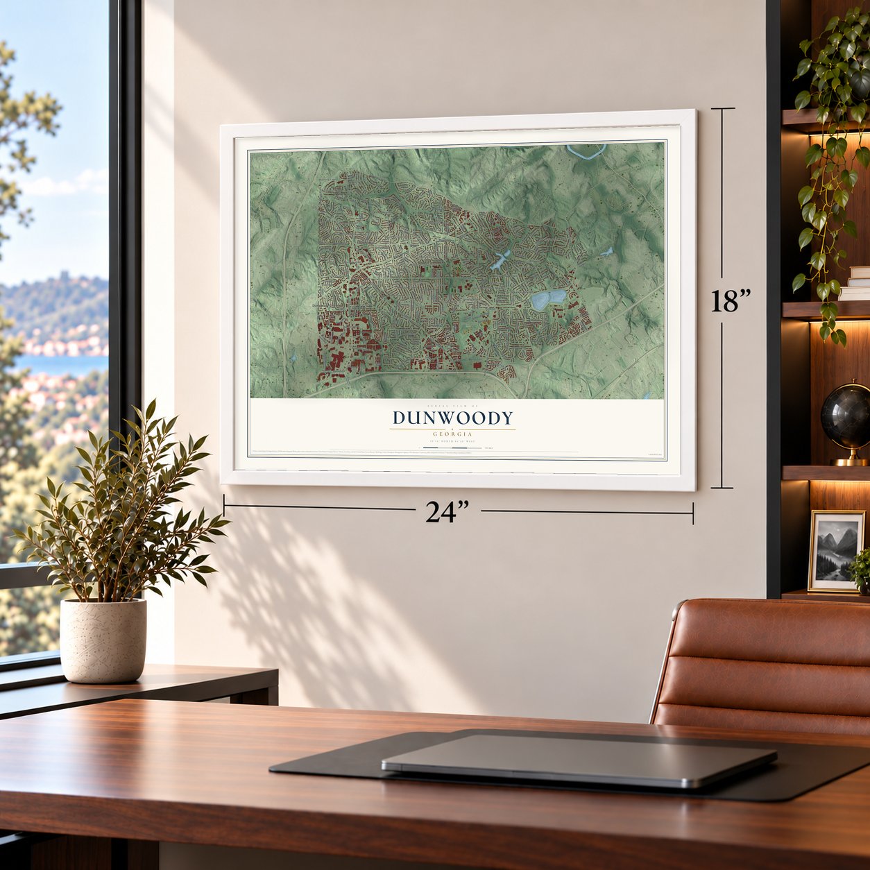
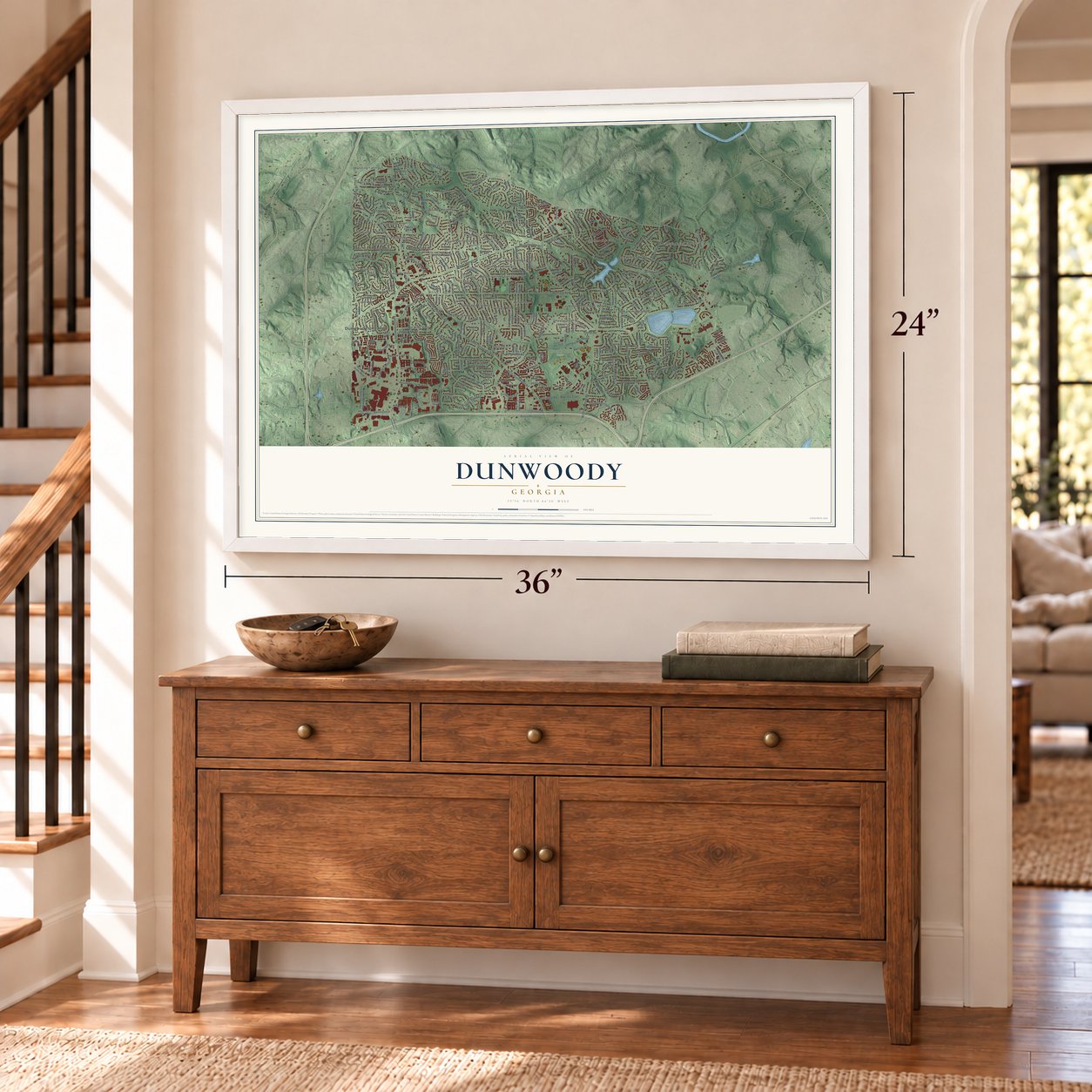
Unframed archival matte, a black wood frame or a white wood frame.
Up close
Geography Worth Displaying
This map was created using accurate cartographic data and authoritative geographic sources, including the U.S. Geological Survey (USGS) and FEMA. The map brings together terrain, waterways, roads, and building detail. The majority of the streets are labeled, houses are accurately depicted, and the topography is derived from government sources. Combining local data with carefully composed color and shading leads to this beautifully detailed Dunwoody artwork for your wall.
Rather than simply showing street outlines, we’ve included as many of the street names as we could reasonably fit on the map while keeping their names legible. Zoom in on the high resolution preview to see exactly what’s on the map. We truly set out to create a statement piece for anyone who loves Dunwoody. So whether it’s for you, or a gift for someone you love, we hope this map of Dunwoody brings back fond memories.
Explore the full map of Dunwoody, Georgia and read about the local places it shows.

About Dunwoody, Georgia
Dunwoody sits at the northern tip of DeKalb County within the Atlanta metropolitan area. Its roots reach the early 1830s, and railroad service later helped shape a small crossroads community. Incorporated on December 1, 2008, the city recorded 51,683 residents in 2020.
- Cityhood in 2008Residents approved cityhood in a July 15, 2008 referendum, and Dunwoody officially became a city that December 1.
- Railroad CrossroadsThe Roswell Railroad began service in 1881, followed today's Chamblee-Dunwoody Road, and operated for 40 years.
- Historic ChurchDating from 1829, Ebenezer Primitive Baptist Church remains active and contains one of the city's oldest cemeteries.
- Perimeter GrowthPerimeter Mall opened in 1971, encouraging substantial office, residential, and commercial development around it.
- Brook Run ParkThe 103-acre Brook Run includes wooded walking trails, a playground, dog park, Veterans Memorial, and community garden.
Find your street
Names on the Dunwoody map
Every name below is printed on this map. Look for your street, your school, the park where you played, or the pond down the road.
Places and landmarks43
- Dunwoody City Hall
- Manning Farms
- Oak Point
- North Point
- Brook Run Park
- Cambridge Estates
- Chestnut Forest
- DeKalb Highlands
- Dunwoody Club Forest
- Dunwoody Corners
- Dunwoody Heights
- Dunwoody Knoll
Show all 43 places
- Dunwoody West
- Fairfield
- Fontainbleau Forest
- Four Oaks
- Fox Hollow
- Happy Hollow
- Hidden Branches
- Littlebrooke Farm
- Meadowlake
- Mill Glen
- Mount Vernon Lake
- Mount Vernon Springs
- North Peachtree Woods
- Peachtree
- Redfield
- Sara Lake Estates
- Shenandoah
- Springfield
- Trailridge
- Valley View
- Verdon Forest
- Village Mill
- Village North
- Waterford
- Westover
- Wickford
- Windhaven
- Windwood
- Withmere
- Wynterhall
- Dunwoody Park
Streets and roads286
- Mount Vernon Road
- Winters Chapel Road
- Meadow Lane Road
- Madison Drive
- Dunwoody Club Drive
- Saffron Drive
- Chamblee Dunwoody Way
- Cotillion Drive
- Chamblee Dunwoody Road
- North Peachtree Road
- Tilly Mill Road
- Peeler Road
- Ashford Dunwoody Road
- Womack Road
- Vermack Road
- Trowbridge Drive
- Happy Hollow Road
- Roberts Drive
- Perimeter Center East
- Savoy Drive
- Lakeside Drive
- Withmere Way
- Mile Post Drive
- North Shallowford Road
- Old Spring House Lane
- Peachford Road
- Georgia Way South
- Cambridge Drive
- Riverglenn Circle
- East Kings Point Circle
Show all 286 streets
- Glaze Drive
- Winding Branch Circle
- North Springs Drive
- Chateau Drive
- Valley View Road
- Kings Down Circle
- Village Drive
- Rochelle Drive
- Meadowcreek Drive
- Lakesprings Drive
- Forest Springs Drive
- Kings Point Drive
- Kings Down Road
- Vernon Lake Drive
- Kingsland Drive
- Huntington Circle
- Laurelwood Road
- Brookhurst Drive
- Seaton Drive
- Ashford Center Parkway
- Barclay Drive
- Brendon Drive
- Hammond Drive
- Bend Creek Road
- Dunwoody Village Parkway
- Chardonnay Court
- Vernon North Drive
- Woodsong Trail
- Glenrich Drive
- Coronation Drive
- Dunover Circle
- Sharon Valley Court
- Redfield Road
- Sandell Drive
- Trumbull Drive
- Dunwoody Crossing
- Witham Drive
- Littlebrooke Drive
- Stonington Road
- Adams Road
- Sudbury Road
- Leeds Court
- Kellogg Circle
- Fleur de Lis Place
- Davantry Drive
- Perimeter Center Place
- Durrett Drive
- Ravinia Drive
- Spalding Drive
- Wynterhall Lane
- Mount Vernon Place
- Trailridge Way
- Potomac Road
- Nforrest Trail
- North Springs Court
- Ashwood Parkway
- Leiden Court
- Redfield Drive
- Kent Avenue
- Andover Drive
- Trailridge Lane
- Pernoshal Court
- Harris Circle
- Sumac Drive
- Martina Way
- Kingsglen Court
- Village Mill Road
- Aurora Court
- Fenhurst Place
- Dunbar Drive
- Welton Place
- Vermack Court
- Damon Court
- Leisure Lane
- Joel Place
- Firth Lane
- Ridgeview Road
- Olde Perimeter Way
- Jones Mill Road
- Mount Vernon Way
- Fontainebleau Drive
- Perimeter Center Parkway Northeast
- Brooke Farm Drive
- Hidden Branches Drive
- Ashford Parkway
- Perimeter Center West
- Oxford Chase Way
- Springfield Drive
- Mill Trace Drive
- Bunky Way
- Holly Bank Circle
- Dunwoody Club Way
- Coldstream Drive
- Vernon Oaks Drive
- Peachtree Place Parkway
- Olde Village Run
- Verdon Drive
- Waterford Drive
- Manhasset Drive
- Wyntercreek Way
- Hallford Drive
- Olde Village Lane
- Village Creek Drive
- Devonshire Road
- Leisure Lake Drive
- Nerine Circle
- Wynterhall Drive
- Asbury Cmns
- Mill Glen Drive
- Winding Branch Drive
- Wickford Way
- Chestnut Ridge Drive
- Cherring Drive
- Stapleton Drive
- Durrett Way
- Abercorn Avenue
- Vernon Ridge Drive
- Amberly Drive
- Shadow Glen Court
- Luray Drive
- Briers North Drive
- Winter Rose Court
- Redfield Court
- Stratham Drive
- Kingsgate Drive
- Andalusia Trail
- Redstone Lane
- Manget Way
- Redfield Terrace
- Dunwoody Park South
- Cherring Lane
- Stonehenge Drive
- Martina Drive
- Edison Road
- Briarleigh Way
- Congress Circle
- Binghamton Drive
- Vermack Ridge
- Seaton Way
- Dunhaven Road
- Mill Shire Lane
- Sheridan Lane
- Macbain Lane
- Jett Ferry Road
- Cherry Hill Lane
- Ball Mill Road
- Orleans Drive
- Village Springs Place
- Woodsong Court
- Bentbrook Drive
- Luray Court
- Arrie Way
- Ellisbury Drive
- Manor Oaks Court
- Shelborne Drive
- Dekalb Drive
- Chadwell Lane
- Spring Mill Cv
- Lake Village Drive
- Mary Briggs Court
- Carnaby Court
- Norwalk Road
- Roberts Park Road
- Framons Court
- Holly Oak Place
- Holly Avenue
- Joel Lane
- Cedar Chase
- Lincoln Parkway
- Blyth Court
- Adams
- Bunky Lane
- Lake Ridge Lane
- Hammond Drive Northeast
- Delverton Drive
- Summerford Drive
- Vernon Springs Drive
- Perimeter Center North
- Manning Farms Court
- Heatherdale Lane
- Mill Brook Drive
- Cedarhurst Drive
- Hensley Drive
- Meadowlake Drive
- Kellogg Springs Drive
- North Peachtree Way
- Buckline Crossing
- Pine Bark Circle
- Oak Trail Drive
- Village North Court
- Glenbonnie Drive
- Wyntercreek Road
- Dunwoody Club Crossing
- Dartford Drive
- Tamworth Court
- Wellshire Place
- Redbark Way
- Glenshire Place
- Georgia Way North
- Sanlee Lane
- Wyntergate Drive
- Dunwoody Road
- Biddle Court
- Manhasset Place
- Westover Plantation
- Nandina Lane
- Rochelle Court
- Shadow Court
- Brooke Farm Court
- Village Court
- Peeler Mill Court
- Arnaud Court
- Ashley Trce
- Kilt Court
- Ashford Dunwoody Road Northeast
- Ravinia Parkway Northeast
- Ashford Gables Drive
- Hidden Branches Circle
- Brooke Ridge Drive
- Four Oaks Drive
- Dunwoody Station Drive
- Corners Drive
- Winterhaven Court
- Twin Branches Way
- North Forest Trail
- West Fontainebleau Drive
- Wellshire Lane
- Village Oaks Drive
- Dunwoody Hollow Drive
- Wyntercreek Lane
- Independence Square
- Courtleigh Drive
- Charmant Place
- Bogans Lake Path
- Chowning Way
- Point Place Avenue
- Wyntercreek Court
- Redfield Circle
- Foxboro Lane
- Parliament Drive
- Malfre Lane
- Mill Gate Drive
- Lakesprings Way
- Lakebrook Court
- Tamassee Court
- Dunwoody Cv
- Orleans Court
- Dunbrooke Lane
- Dunwoody Village Drive
- Manhasett Farm Court
- Kenstone Walk
- Madison Cmns
- Center Drive
- Tolleson Court
- William Court
- Coach Lane
Names are listed as they appear on the printed map. Zoom into the product photos to find them.
The art of mapping a place
How This Map Was Made
Real places. Remarkable detail. Discover the layers that turn geographic data into a map of home.

The view from above
Aerial imagery reveals the character of the land: woodland, open fields, and the patterns of a place.

The shape of the land
Elevation data brings hills, valleys, and subtle changes in the landscape into view.

The details of home
Roads, waterways, and building footprints come together to make the map feel unmistakably local.

Geography becomes art
Considered color, shading, and typography bring the layers together in a map made for your wall.


Process illustrated with Mendon, Massachusetts. Aerial imagery: USDA NAIP. Terrain: USGS 3D Elevation Program. Map details and finished artwork: KNOWOL.
The Details
About This Print
Choose an archival matte print, or a black or white Ayous wood frame. The archival matte print is unframed.
Select your size and finish above to see the matching product image and price.
Materials & Craftsmanship
A contemporary map with the character of a classic atlas, printed on archival matte paper. Optional frames are made from Ayous wood.
Your printed map does not include the watermark shown in the full-map preview.
Shipping & Delivery
Free shipping within the United States. Every print is made to order in the USA.
Buying a gift? Add a note in your cart and we'll include it. We never put prices in the package.
Prints ship within 2 to 3 business days. Allow 7 to 10 days total from ordering for delivery. Timing may vary during holidays or periods of high order volume.
Read our shipping policy.
Returns and damaged prints
Each print is made to order. Change-of-mind refunds are not available after production.
If your print arrives damaged, misprinted or incorrect, contact support@knowol.com within 30 days of receiving it. Include your order number, photos and a description of the issue.
Read our full refund and replacement policy. For questions about your order, email support@knowol.com.
Find your town
Looking for another city?
Find a map of home in our Georgia collection, or any town in the country.
Nearby
Maps of towns near Dunwoody
Know someone from one of these towns? Their map makes a great gift.
 Sandy Springs
, Georgia
From $39.99See the map
 Doraville
, Georgia
From $39.99See the map
 Chamblee
, Georgia
From $39.99See the map
More maps nearby: Peachtree Corners, Brookhaven, Norcross, North Buckhead and Ridgedale Park.