


Search for another town





Free U.S. delivery 7 to 10 days after you order
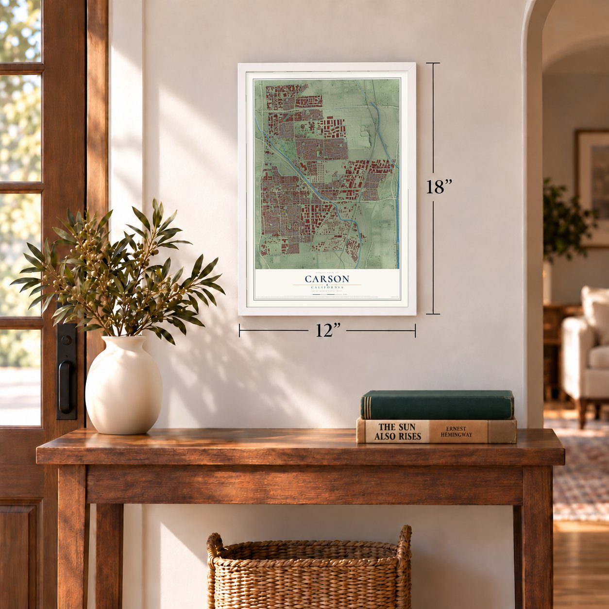
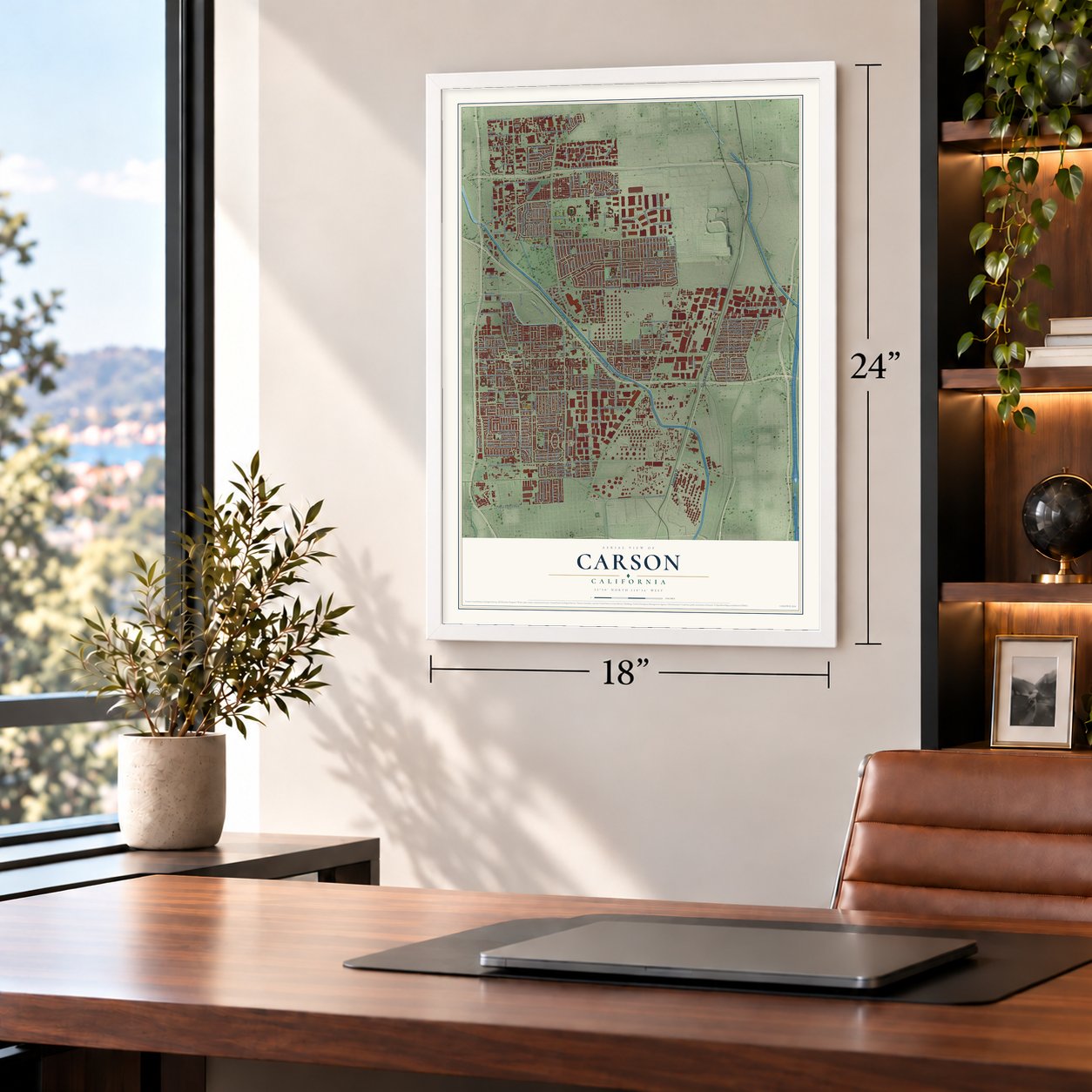
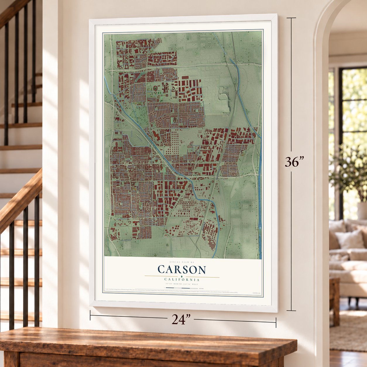
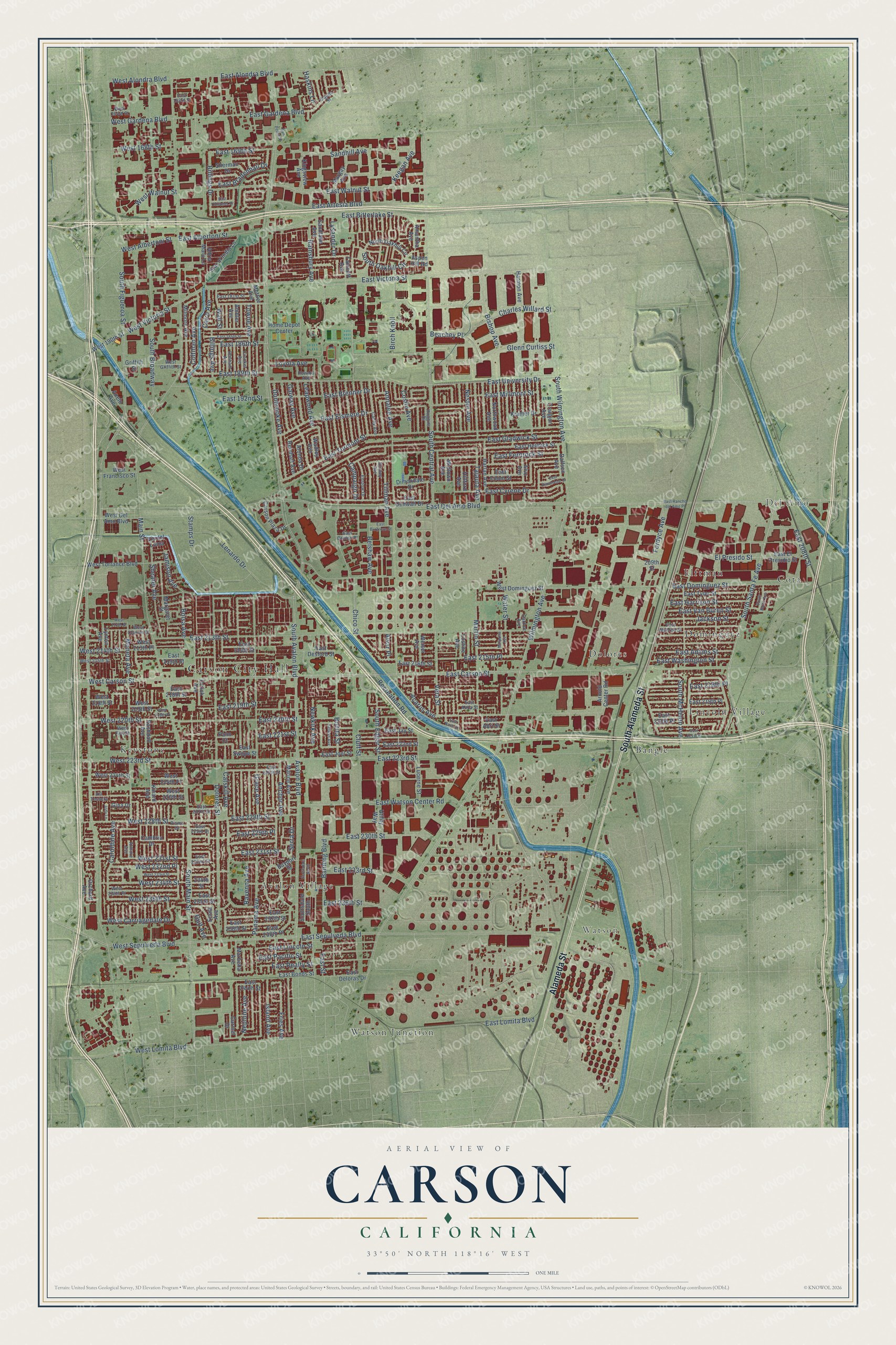
Carson, California Map Art
Building by building, with labeled streets and shaded relief.
12" x 18" Archival Matte Print
A Map of Home. A Work of Art.
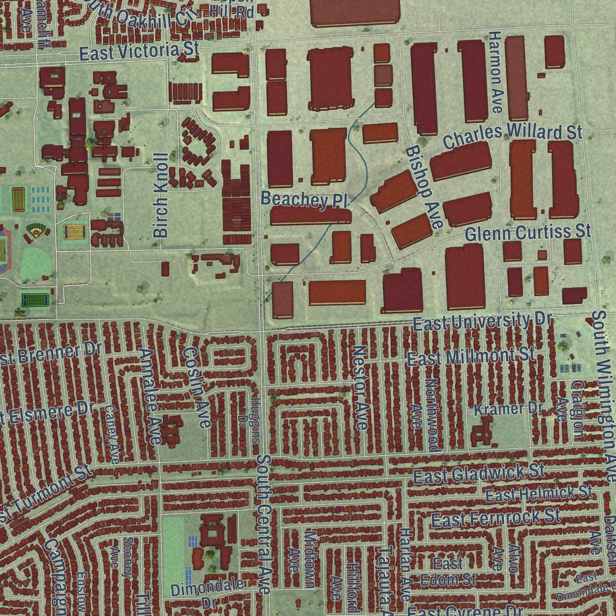
Explore Carson, California from a whole new perspective. Created using aerial imagery and detailed geographic data, this map captures Carson building by building, with labeled streets, familiar landmarks, and shaded topographical relief that highlights the natural contours of the landscape.
Combining modern data with the timeless character of a vintage atlas, this map is just as interesting up close as it is beautiful on the wall. Whether you grew up in Carson, spent memorable years there, or call it home today, this unique map is a great way to celebrate a place that means something to you. Zoom in on the preview to look for your street, and then order a print to put your memories on the wall.
Three ways to hang it
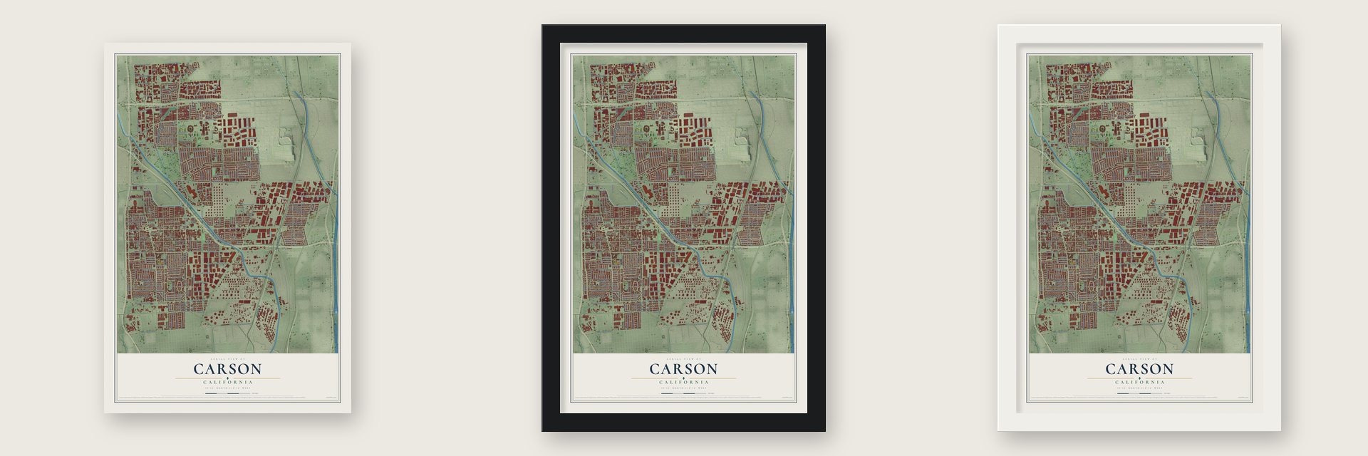
Unframed archival matte, a black wood frame or a white wood frame.
Up close
Geography Worth Displaying
This map was created using accurate cartographic data and authoritative geographic sources, including the U.S. Geological Survey and the Census Bureau. The map brings together terrain, waterways, roads, and building detail. The majority of the streets are labeled, houses are accurately depicted, and the topography is derived from government sources. Combining local data with carefully composed color and shading leads to this beautifully detailed Carson artwork for your wall.
Rather than simply showing street outlines, we’ve included as many of the street names as we could reasonably fit on the map while keeping their names legible. Zoom in on the high resolution preview to see exactly what’s on the map. We truly set out to create a statement piece for anyone who loves Carson. So whether it’s for you, or a gift for someone you love, we hope this map of Carson brings back fond memories.
Read the story behind this map of Carson, California from 2026.

Find your street
Names on the Carson map
Every name below is printed on this map. Look for your street, your school, the park where you played, or the pond down the road.
Places and landmarks12
- Carson City Hall
- Watson
- Del Amo
- Avalon Village
- Bangle
- Cota
- Dolores
- Dominguez
- Elftman
- Keystone
- Lincoln Village
- Watson Junction
Streets and roads271
- South Alameda Street
- Alameda Street
- South Santa Fe Avenue
- Acarus Avenue
- West Alondra Boulevard
- West Carson Street
- South Central Avenue
- East 220th Street
- East Victoria Street
- West 220th Street
- East University Drive
- East Alondra Boulevard
- South Figueroa Street
- Panama Avenue
- South McHelen Avenue
- West Victoria Street
- East 186th Street
- South Avalon Boulevard
- South Main Street
- East Sepulveda Boulevard
- East Del Amo Boulevard
- East 223rd Street
- Wilmington Avenue
- East Carson Street
- Avalon Boulevard
- East Dominguez Street
- East 213th Street
- Dolores Street
- South Broadway
- East Turmont Street
Show all 271 streets
- East Lomita Boulevard
- Moneta Avenue
- East Gladwick Street
- Catskill Avenue
- Grace Avenue
- West Sepulveda Boulevard
- Neptune Avenue
- Ravenna Avenue
- East Walnut Street
- South Wilmington Avenue
- Main Street
- East 230th Street
- East 219th Street
- East Elsmere Drive
- Annalee Avenue
- East Watson Center Road
- Leapwood Avenue
- Anchor Avenue
- East Artesia Boulevard
- Bonita Street
- Fries Avenue
- Caroldale Avenue
- Belshaw Avenue
- East Fernrock Street
- West Lomita Boulevard
- Campaign Drive
- Banning Boulevard
- Lenardo Drive
- East Gardena Boulevard
- East 236th Street
- Island Avenue
- Glenn Curtiss Street
- East 233rd Street
- Martin Street
- East Lincoln Street
- Tillman Avenue
- Vera Street
- East Albertoni Street
- Galway Avenue
- East 215th Place
- Charles Willard Street
- East Realty Street
- Tajauta Avenue
- East Brenner Drive
- East 228th Street
- Stamps Drive
- West 228th Street
- East Pacific Street
- East 218th Place
- East 221st Street
- East Van Buren Street
- West 223rd Street
- Sandhill Avenue
- East 192nd Street
- East Millmont Street
- Dunbrooke Avenue
- Towne Avenue
- West 234th Street
- Water Street
- Shearer Avenue
- Wall Street
- West 231st Street
- East 231st Street
- East 229th Place
- Bolsa Avenue
- East 189th Street
- Jackson Street
- East Cyrene Drive
- East Bitterlake Street
- East Harrison Street
- East Adams Street
- East Washington Street
- Bishop Avenue
- El Presido Street
- West 235th Street
- East 208th Street
- Coltman Avenue
- West 214th Street
- Nestor Avenue
- West Carriagedale Drive
- West 232nd Place
- Gulf Avenue
- East 169th Street
- West Gardena Boulevard
- East Bradenhall Drive
- West 168th Street
- Beachey Place
- Billings Drive
- South Edgar Street
- Fordyce Avenue
- Cairo Avenue
- South Oakhill Circle
- West Albertoni Street
- Rainsbury Avenue
- Chico Street
- Recreation Road
- West Walnut Street
- Birch Knoll
- Lysander Drive
- Newkirk Avenue
- Jamison Avenue
- Coslin Avenue
- Billings Avenue
- Loyola Avenue
- Keegan Avenue
- Serra Drive
- Haskins Lane
- East Street
- Cluff Street
- Alvar Place
- East 244th Street
- East 218th Street
- East Desford Street
- Adria Maru Lane
- Star of India Lane
- East Helmick Street
- Marbella Avenue
- East 222nd Street
- East Denwall Drive
- East 214th Street
- East El Presidio Street
- Marine Avenue
- Wadley Avenue
- Kinard Avenue
- Harlan Avenue
- East Tyler Street
- East 215th Street
- East 238th Street
- Ambler Avenue
- East 238th Place
- Reinhart Avenue
- Amantha Avenue
- Milmore Avenue
- Harmon Avenue
- Kramer Drive
- Orrick Avenue
- Mettler Avenue
- East Joel Street
- East Jay Street
- East 219th Place
- Hillford Avenue
- East 216th Street
- East 237th Street
- East Bonds Street
- Lucerne Street
- Weiser Avenue
- Rashdall Avenue
- Margaret Street
- Dimondale Drive
- Northwood Avenue
- West 219th Street
- West 224th Place
- West Torrance Boulevard
- Griffith Street
- East 220th Place
- West Dominguez Street
- Midtown Avenue
- West Del Amo Boulevard
- West 226th Street
- North Oakhill Circle
- Lostine Avenue
- Dalfsen Avenue
- Vis del Loma
- Orchard Avenue
- Carson Plaza Drive
- East Deloras Drive
- Alvo Avenue
- Arnold Center Road
- Margay Avenue
- West 218th Street
- Anelo Avenue
- Sandlake Avenue
- Sherman Drive
- East Edom Street
- Kingsview Avenue
- West 224th Street
- West Francisco Street
- West 190th Street
- Home Depot Center
- Scottsdale South
- Utility Way
- Alonda Drive
- East Abri Street
- East 235th Street
- Lynton Avenue
- 234th Street
- Enola Avenue
- Craigjon Avenue
- Cambria Drive
- Carmel Drive
- East Swope Street
- Tamcliff Avenue
- Bayport Street
- Palm Court
- West 213th Place
- Aspen Hill Road
- Gina Drive
- 209th Street
- Enslow Drive
- Scobey Avenue
- East Monroe Street
- East 229th Street
- Crocker Avenue
- West 234th Place
- Bonham Avenue
- East 224th Street
- West Griffith Street
- Caney Avenue
- East 232nd Street
- West Clarion Drive
- East Abila Street
- Atmore Avenue
- East 181st Street
- East 163rd Street
- East 227th Street
- West 215th Street
- Huggins Drive
- Claude Street
- West 164th Street
- West Fiat Street
- East Dovlen Place
- Oakfort Avenue
- Pismo Drive
- Via Tessera
- Howard Avenue
- East Dimondale Drive
- East 221st Place
- West 233rd Street
- Millpoint Avenue
- East Bach Street
- East 185th Street
- East Collamer Drive
- Selwyn Avenue
- Scottsdale North
- South Baltic Avenue
- East Burgrove Street
- West 212th Street
- East Rancho del Amo Place
- San Pedro Street
- Jody Lane
- West 219th Place
Names are listed as they appear on the printed map. Zoom into the product photos to find them.
About Carson, California
Carson is a city of 95,558 people in Los Angeles County, 13 miles south of downtown Los Angeles. Tongva people lived on this land for thousands of years before Europeans arrived. In 1784 the King of Spain granted Rancho San Pedro to Juan Dominguez and Manuel Dominguez, and Carson grew up on part of it. The city takes its name from George Henry Carson, who married into the Dominguez family in 1857 and went on to manage the rancho.
In 1846 the Battle of Rancho Domínguez was fought on Dominguez Hill, on the rancho's northwest side, during the Mexican-American War. Drillers came to the same hill looking for oil in 1921. On September 7, 1923, the Burnham Exploration Company and Union Oil struck the first producing well there, Callender No. 1-A, which reached 4,068 feet and gave 1,193 barrels a day. Carson was incorporated as a city on February 20, 1968.
“About a half mile southeast of this spot, on Dominquez Hill in historic Rancho San Pedro, the first air meet in the United States was held during January 10-20, 1910.”
- Cal State Dominguez HillsCalifornia State University, Dominguez Hills started out as South Bay College. It later took the name California State University at Palos Verdes, and it moved to Carson because the mostly Black middle-class suburbs around Los Angeles needed more chances to attend college. Today no single racial or ethnic group makes up a majority of its students.
- Home field of the GalaxyDignity Health Sports Park, the Los Angeles Galaxy's soccer home, also holds a tennis stadium and a track and field facility. The Los Angeles Chargers played NFL games there from 2017 to 2019. Carson backed a $1.2 billion Raiders and Chargers stadium in 2015, but on January 12, 2016, NFL owners chose a rival Inglewood bid. At the 2028 Summer Olympics, the city is set to hold archery, tennis, field hockey, track cycling and rugby sevens.
- Nissan's North American homeNissan once had its North American headquarters in Carson: 13 buildings on 42 acres near the Harbor and San Diego freeways, including a nine-story tower with the company logo. About 1,500 people worked there around 2006. That summer the company finished moving its offices to Franklin, Tennessee, and more than half of the workers stayed in the Los Angeles area.
- A Goodyear blimp baseWingfoot Three, one of the three Goodyear blimps based in the United States, makes its home at the Goodyear Blimp Base Airport in Carson.
- A mayor and a congresswomanGilbert D. Smith was Carson's first African-American mayor. Juanita Millender-McDonald of Carson served in Congress as a Democrat from 1996 to 2007. The singer and actress Brandy and the actor Tommy "Tiny" Lister, an NCAA shot put champion, are among the city's well-known names.
Keep exploring California
Carson is one of 1,990 California towns we've mapped. Every dot on the map is a print of its own.
The search covers every state, California first.
Near Carson
Order 2 or more town maps and save 10%. Shown in the size and finish you picked above, so they hang as a set.
- West Carson 12" x 18" / Archival Matte Print $39.99
- Compton 12" x 18" / Archival Matte Print $39.99
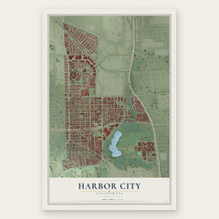
- Harbor City 12" x 18" / Archival Matte Print $39.99
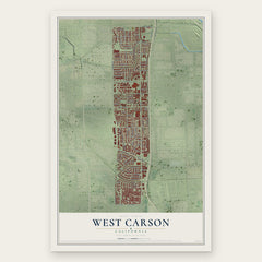
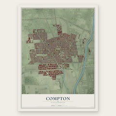
More maps nearby: Bixby Knolls, California Heights, North Long Beach, West Rancho Dominguez and East Rancho Dominguez.
The art of mapping a place
How This Map Was Made
Real places. Remarkable detail. Discover the layers that turn geographic data into a map of home.

The view from above
Aerial imagery reveals the character of the land: woodland, open fields, and the patterns of a place.

The shape of the land
Elevation data brings hills, valleys, and subtle changes in the landscape into view.

The details of home
Roads, waterways, and building footprints come together to make the map feel unmistakably local.

Geography becomes art
Considered color, shading, and typography bring the layers together in a map made for your wall.


Process illustrated with Mendon, Massachusetts. Aerial imagery: USDA NAIP. Terrain: USGS 3D Elevation Program. Map details and finished artwork: KNOWOL.
The Details
About This Print
Choose an archival matte print, or a black or white Ayous wood frame. The archival matte print is unframed.
Select your size and finish above to see the matching product image and price.
Materials & Craftsmanship
A contemporary map with the character of a classic atlas, printed on archival matte paper. Optional frames are made from Ayous wood.
Your printed map does not include the watermark shown in the full-map preview.
Shipping & Delivery
Free shipping within the United States. Every print is made to order in the USA.
Buying a gift? Add a note in your cart and we'll include it. We never put prices in the package.
Prints ship within 2 to 3 business days. Allow 7 to 10 days total from ordering for delivery. Timing may vary during holidays or periods of high order volume.
Read our shipping policy.
Returns and damaged prints
Each print is made to order. Change-of-mind refunds are not available after production.
If your print arrives damaged, misprinted or incorrect, contact support@knowol.com within 30 days of receiving it. Include your order number, photos and a description of the issue.
Read our full refund and replacement policy. For questions about your order, email support@knowol.com.