
Search for another town




Free U.S. delivery 7 to 10 days after you order
Compton, California Map Art
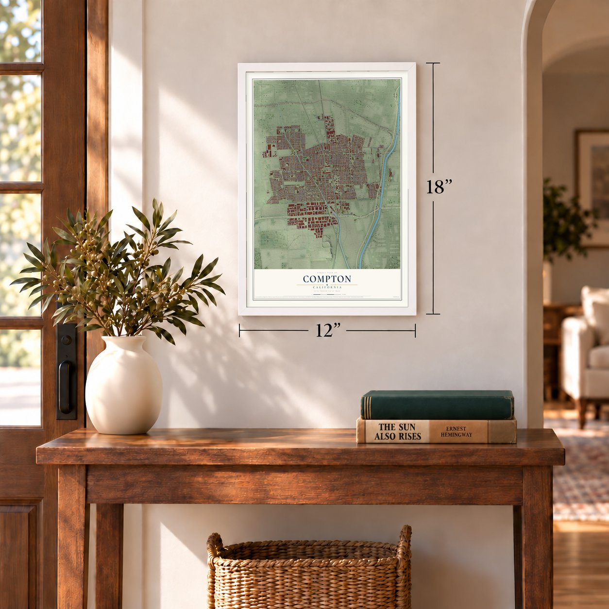
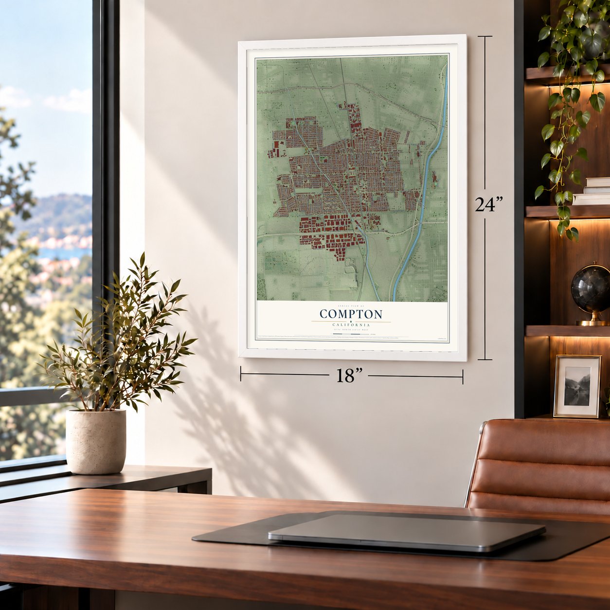
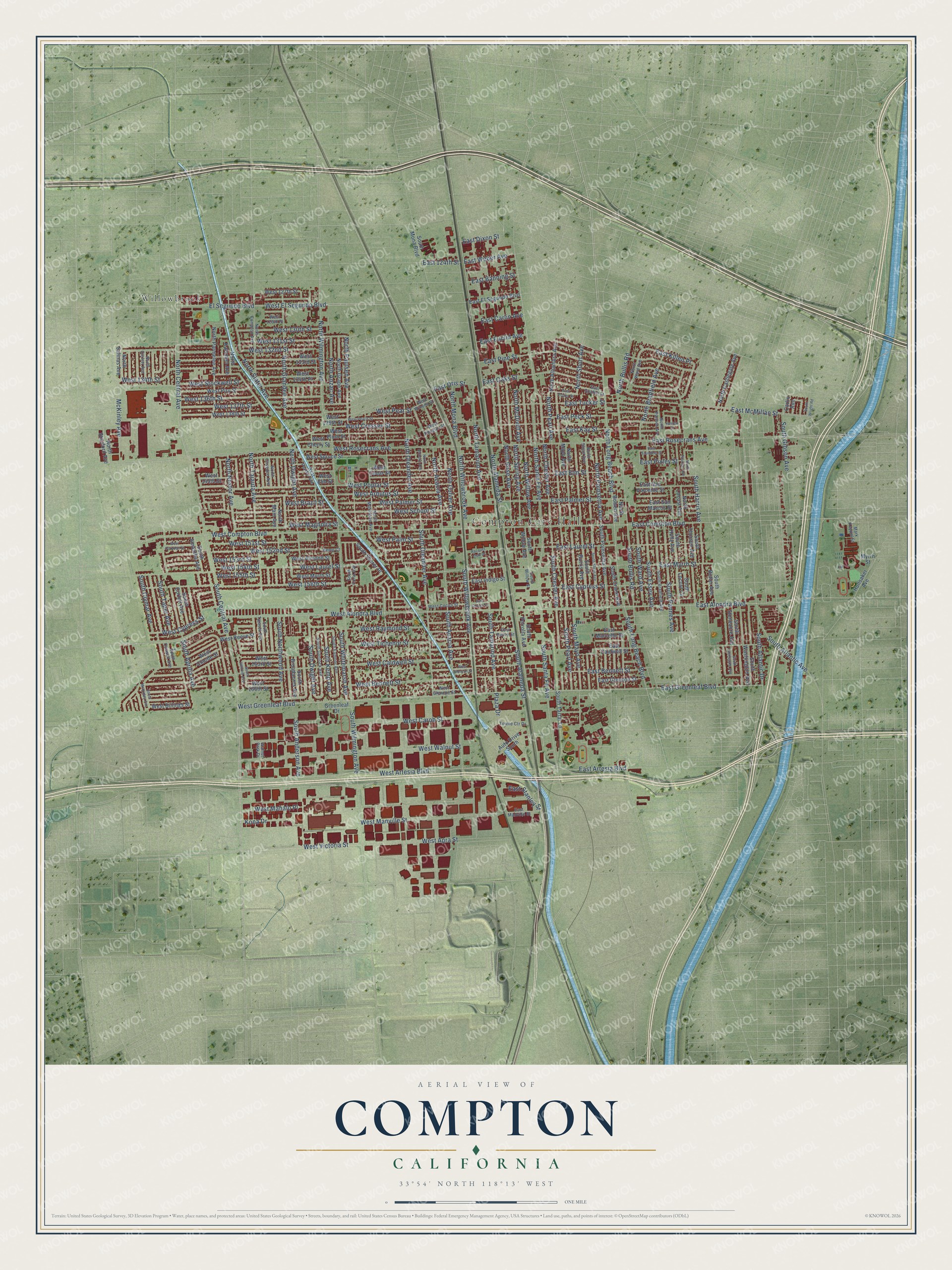
A new map of Compton, California, made in 2026 and printed to order on thick archival matte paper.
12" x 18" Archival Matte Print
A Map of Home. A Work of Art.
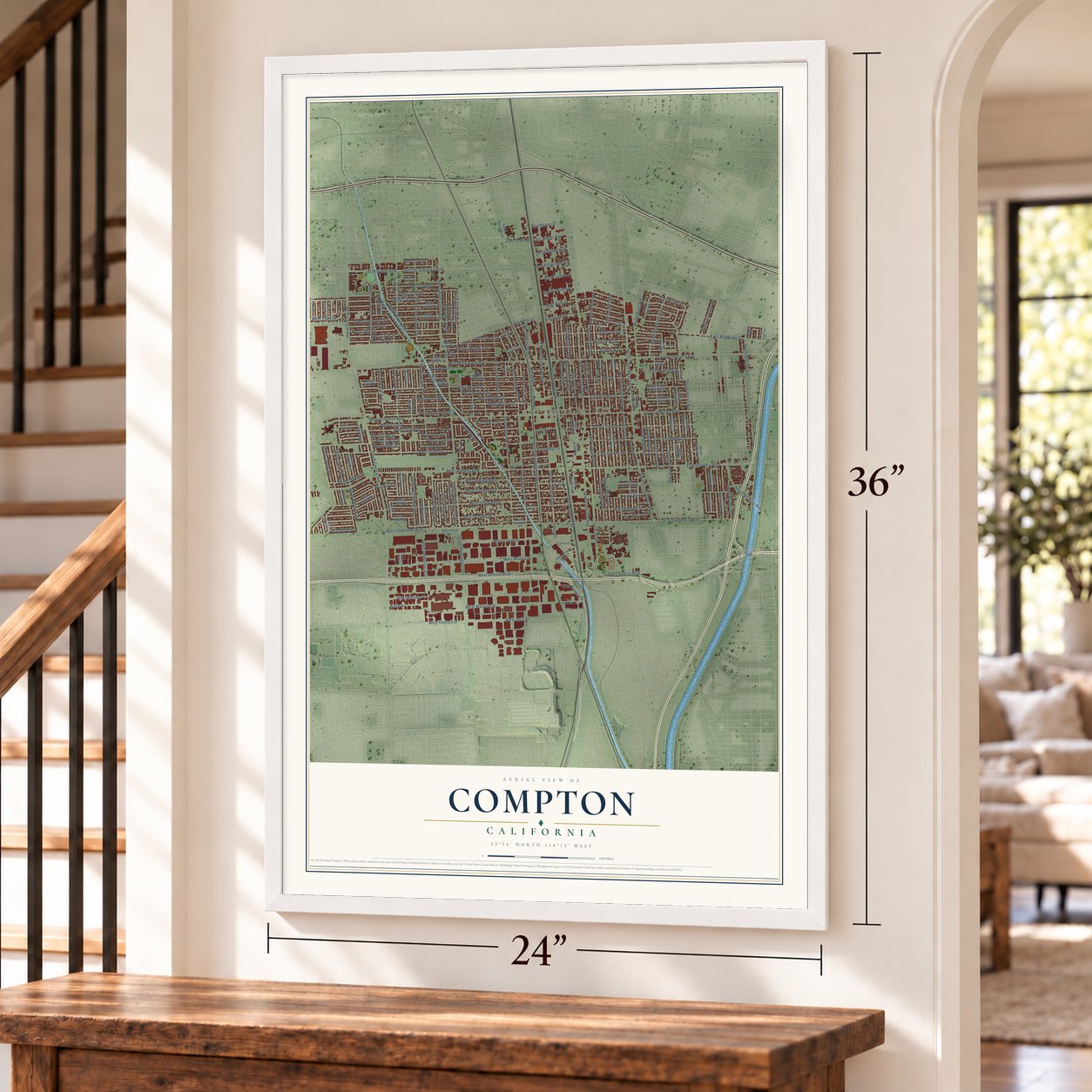
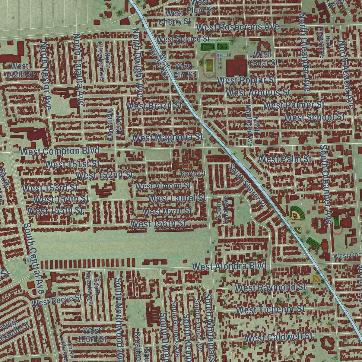
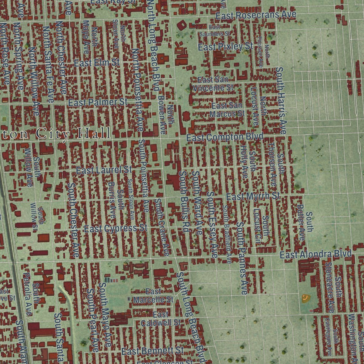
Explore Compton, California from a whole new perspective. Created using aerial imagery and detailed geographic data, this map captures Compton building by building, with labeled streets, familiar landmarks, and shaded topographical relief that highlights the natural contours of the landscape.
Combining modern data with the timeless character of a vintage atlas, this map is just as interesting up close as it is beautiful on the wall. Whether you grew up in Compton, spent memorable years there, or call it home today, this unique map is a great way to celebrate a place that means something to you. Zoom in on the preview to look for your street, and then order a print to put your memories on the wall.
Three ways to hang it
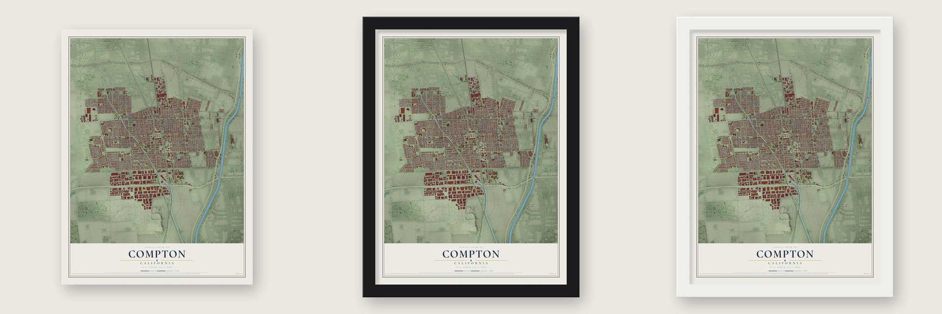
Unframed archival matte, a black wood frame or a white wood frame.
Up close
Geography Worth Displaying
This map was created using accurate cartographic data and authoritative geographic sources, including the U.S. Geological Survey and the Census Bureau. The map brings together terrain, waterways, roads, and building detail. The majority of the streets are labeled, houses are accurately depicted, and the topography is derived from government sources. Combining local data with carefully composed color and shading leads to this beautifully detailed Compton artwork for your wall.
Rather than simply showing street outlines, we’ve included as many of the street names as we could reasonably fit on the map while keeping their names legible. Zoom in on the high resolution preview to see exactly what’s on the map. We truly set out to create a statement piece for anyone who loves Compton. So whether it’s for you, or a gift for someone you love, we hope this map of Compton brings back fond memories.
Read the story behind this map of Compton, California from 2026.

About Compton, California
Compton is a city of 95,740 people in southern Los Angeles County, south of downtown Los Angeles. The Tongva people lived here first. In 1784 the Spanish Crown granted the land to the soldier Juan José Domínguez as part of Rancho San Pedro. In 1867 Griffith Dickenson Compton brought 30 pioneers south from Stockton by wagon train. They hoped to earn a living some other way than the worn-out gold fields.
The first winters were cold and wet. Settlers spent nearly a week going to the mountains near Pasadena and back to gather firewood. Many wanted to leave, but they stayed because there were general stores in Los Angeles and Wilmington close enough to reach. The town was laid out in lots in 1869. On May 11, 1888, residents incorporated it as a city, the eighth in the county.
- From Gibsonville to ComptonThe settlement was first called Gibsonville, for one of the tract owners, and then Comptonville. Yuba County already had a Camptonville, so the name was cut to Compton to avoid confusion. The 1923 county history says the town took its name from G. D. Compton.
- A city that nearly vanishedIn 1890 residents voted to give up large parts of Compton. When that year closed, only eighty acres and five voters remained, too few to fill a city government. In 1906 the lawyers Emmett Wilson and E.T. Sherer sued to undo the 1890 elections. Compton grew back to 600 acres, and voters filled its offices again.
- Richland FarmsGriffith D. Compton asked that some of the land be kept only for farming, and that land became Richland Farms. Its large lots left room for a barn, livestock and food for a family. Black families arriving from the rural South in the 1950s found a home there, and it is still a small pocket of farmland inside the city.
- First Black mayorIn 1969 Douglas Dollarhide became mayor of Compton. He was the first Black man to win the mayor's office in a metropolitan California city. In 1973 Doris A. Davis beat him and became the first Black woman to lead a metropolitan American city.
- Where N.W.A beganEazy-E, MC Ren, Dr. Dre, Ice Cube and DJ Yella began their careers here as N.W.A. Coolio, DJ Quik, The Game, Kendrick Lamar, YG, Vince Staples and Roddy Ricch also got their start in Compton, and many of them wrote about its streets in their lyrics.
Find your street
Names on the Compton map
Every name below is printed on this map. Look for your street, your school, the park where you played, or the pond down the road.
Places and landmarks2
- Compton City Hall
- Willowbrook
Streets and roads228
- South Central Avenue
- East Greenleaf Boulevard
- North Willowbrook Avenue
- West Greenleaf Boulevard
- West Alondra Boulevard
- East Alondra Boulevard
- West Compton Boulevard
- North Long Beach Boulevard
- South Long Beach Boulevard
- South Atlantic Avenue
- North Short Avenue
- West El Segundo Boulevard
- West Artesia Boulevard
- East Killen Place
- East Compton Boulevard
- Kona Drive
- Plaza Drive
- South Alameda Street
- North Alameda Street
- East Rosecrans Avenue
- West Caldwell Street
- South Willowbrook Avenue
- South Wilmington Avenue
- North Central Avenue
- North Wilmington Avenue
- East McMillan Street
- West Rosecrans Avenue
- South Santa Fe Avenue
- West Poplar Street
- East Myrrh Street
Show all 228 streets
- South Acacia Avenue
- West Tichenor Street
- West Walnut Street
- West School Street
- West Palmer Street
- West Raymond Street
- West Arbutus Street
- South Harris Avenue
- West Bennett Street
- West 156th Street
- East Pine Street
- West Magnolia Street
- West 134th Street
- North Bullis Road
- East Palmer Street
- North Santa Fe Avenue
- North Bradfield Avenue
- East Laurel Street
- West Victoria Street
- West 132nd Street
- South Oleander Avenue
- East Cypress Street
- East Elm Street
- South Pearl Avenue
- South Mayo Avenue
- North Paulsen Avenue
- West 154th Street
- North Grandee Avenue
- West Stockwell Street
- West 137th Street
- El Segundo Boulevard
- East Tucker Street
- North Rose Avenue
- West Manville Street
- West 131st Street
- South Chester Avenue
- West 152nd Street
- North Culver Avenue
- South Aprilia Avenue
- South Tamarind Avenue
- West Laurel Street
- North Spring Avenue
- East Artesia Boulevard
- North Willow Avenue
- North Chester Avenue
- North Pearl Avenue
- North Oleander Avenue
- North Acacia Avenue
- North Tamarind Avenue
- South Dwight Avenue
- West Cypress Street
- East Bennett Street
- West 136th Street
- South Gibson Avenue
- East Oaks Street
- West Carob Street
- West Cressey Street
- South Kemp Avenue
- South Pannes Avenue
- East Peck Street
- West 151st Street
- South Northwood Avenue
- North Nestor Avenue
- East Kay Street
- South Bullis Road
- South Clymar Avenue
- West Brazil Street
- North Tajauta Avenue
- North Dwight Avenue
- West 130th Street
- South Essey Avenue
- North Slater Avenue
- West Palm Street
- North Poinsettia Avenue
- West 153rd Street
- South Ward Avenue
- McKinley Avenue
- West Apra Street
- South Whitemarsh Avenue
- North Anzac Avenue
- South Atlantic Drive
- South Anderson Avenue
- East Carlin Avenue
- South Taper Avenue
- West Mahalo Place
- East Weber Avenue
- North McDivitt Avenue
- East Oris Street
- North Mona Boulevard
- East Stanley Street
- East Banning Street
- East Euclid Avenue
- West 155th Street
- East Pixley Street
- West Pear Street
- East Dixon Street
- East 124th Street
- East El Segundo Boulevard
- North Alhambra Avenue
- North Stanford Avenue
- North Locust Avenue
- West Billings Street
- North Maie Avenue
- East Caldwell Street
- West Spruce Street
- South Poinsettia Avenue
- West 138th Street
- West 133rd Street
- South Thorson Avenue
- West Elm Street
- South Burris Avenue
- North Parmelee Avenue
- West Claude Street
- West Almond Street
- West Reeve Street
- West Cedar Street
- South Amantha Avenue
- West Cherry Street
- West Plum Street
- South Washington Avenue
- South Stoneacre Avenue
- South Butler Avenue
- North Mayo Avenue
- South Holly Avenue
- West Myrrh Street
- West Piru Street
- East San Vincente Street
- North Grape Avenue
- West 134th Place
- North Kalsman Avenue
- North Castlegate Avenue
- Auto Drive South
- East Marcelle Street
- East San Marcus Street
- South Tartar Lane
- East Glencoe Street
- South Willow Avenue
- South Crane Avenue
- North Bowen Avenue
- South Petrolia Avenue
- South Broadacres Avenue
- South Sherer Place
- Greenleaf Drive
- South Corlett Avenue
- East Indigo Street
- North Salinas Avenue
- South Locust Circle
- West 163rd Street
- West 127th Street
- West 166th Street
- South Mona Boulevard
- Hunsaker Avenue
- West 145th Street
- Carlin Avenue
- West 139th Street
- Myrrh Street
- North Matthisen Avenue
- South Tajauta Avenue
- South Bradfield Avenue
- South Caswell Avenue
- North Sloan Avenue
- North Compton Avenue
- South Gunlock Avenue
- South Exmoor Avenue
- North Pannes Avenue
- West Cocoa Street
- East Golden Street
- East Reeve Street
- North Corlett Avenue
- West Glencoe Street
- North Ward Avenue
- South Coral Avenue
- East Manville Street
- North Cliveden Avenue
- West Pacific Avenue
- Towne Ctr Drive
- Mark Keppel Street
- West Douglas Street
- West Winona Street
- South Willow Street
- Kemp Court
- Walnut Park Drive
- West 129th Place
- East Poppy Street
- South Sloan Avenue
- Racquet Club Drive
- South Castlegate Avenue
- West Peach Street
- East Saunders Street
- South Hillford Avenue
- South McKinley Avenue
- West Johnson Street
- West Corydon Street
- East Cocoa Street
- North Thorson Avenue
- North Hickory Avenue
- South Wright Road
- Keeton Street
Names are listed as they appear on the printed map. Zoom into the product photos to find them.
The art of mapping a place
How This Map Was Made
Real places. Remarkable detail. Discover the layers that turn geographic data into a map of home.

The view from above
Aerial imagery reveals the character of the land: woodland, open fields, and the patterns of a place.

The shape of the land
Elevation data brings hills, valleys, and subtle changes in the landscape into view.

The details of home
Roads, waterways, and building footprints come together to make the map feel unmistakably local.

Geography becomes art
Considered color, shading, and typography bring the layers together in a map made for your wall.


Process illustrated with Mendon, Massachusetts. Aerial imagery: USDA NAIP. Terrain: USGS 3D Elevation Program. Map details and finished artwork: KNOWOL.
The Details
About This Print
Choose an archival matte print, or a black or white Ayous wood frame. The archival matte print is unframed.
Select your size and finish above to see the matching product image and price.
Materials & Craftsmanship
A contemporary map with the character of a classic atlas, printed on archival matte paper. Optional frames are made from Ayous wood.
Your printed map does not include the watermark shown in the full-map preview.
Shipping & Delivery
Free shipping within the United States. Every print is made to order in the USA.
Buying a gift? Add a note in your cart and we'll include it. We never put prices in the package.
Prints ship within 2 to 3 business days. Allow 7 to 10 days total from ordering for delivery. Timing may vary during holidays or periods of high order volume.
Read our shipping policy.
Returns and damaged prints
Each print is made to order. Change-of-mind refunds are not available after production.
If your print arrives damaged, misprinted or incorrect, contact support@knowol.com within 30 days of receiving it. Include your order number, photos and a description of the issue.
Read our full refund and replacement policy. For questions about your order, email support@knowol.com.
Find your town
Looking for another city?
Find a map of home in our California collection, or any town in the country.
Nearby
Maps of towns near Compton
Know someone from one of these towns? Their map makes a great gift.
 East Rancho Dominguez
, California
From $39.99See the map
 Willowbrook
, California
From $39.99See the map
 West Rancho Dominguez
, California
From $39.99See the map
More maps nearby: Lynwood, Watts, Paramount, Carson and South Gate.