
Search for another town





Free U.S. delivery 7 to 10 days after you order
Lynwood, California Map Art
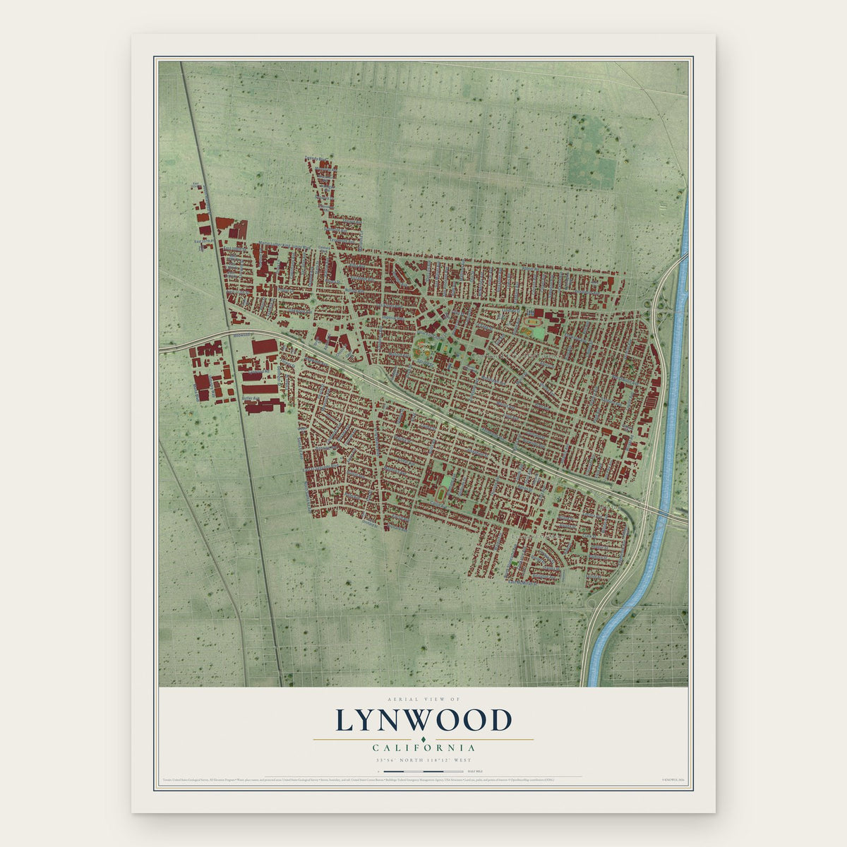
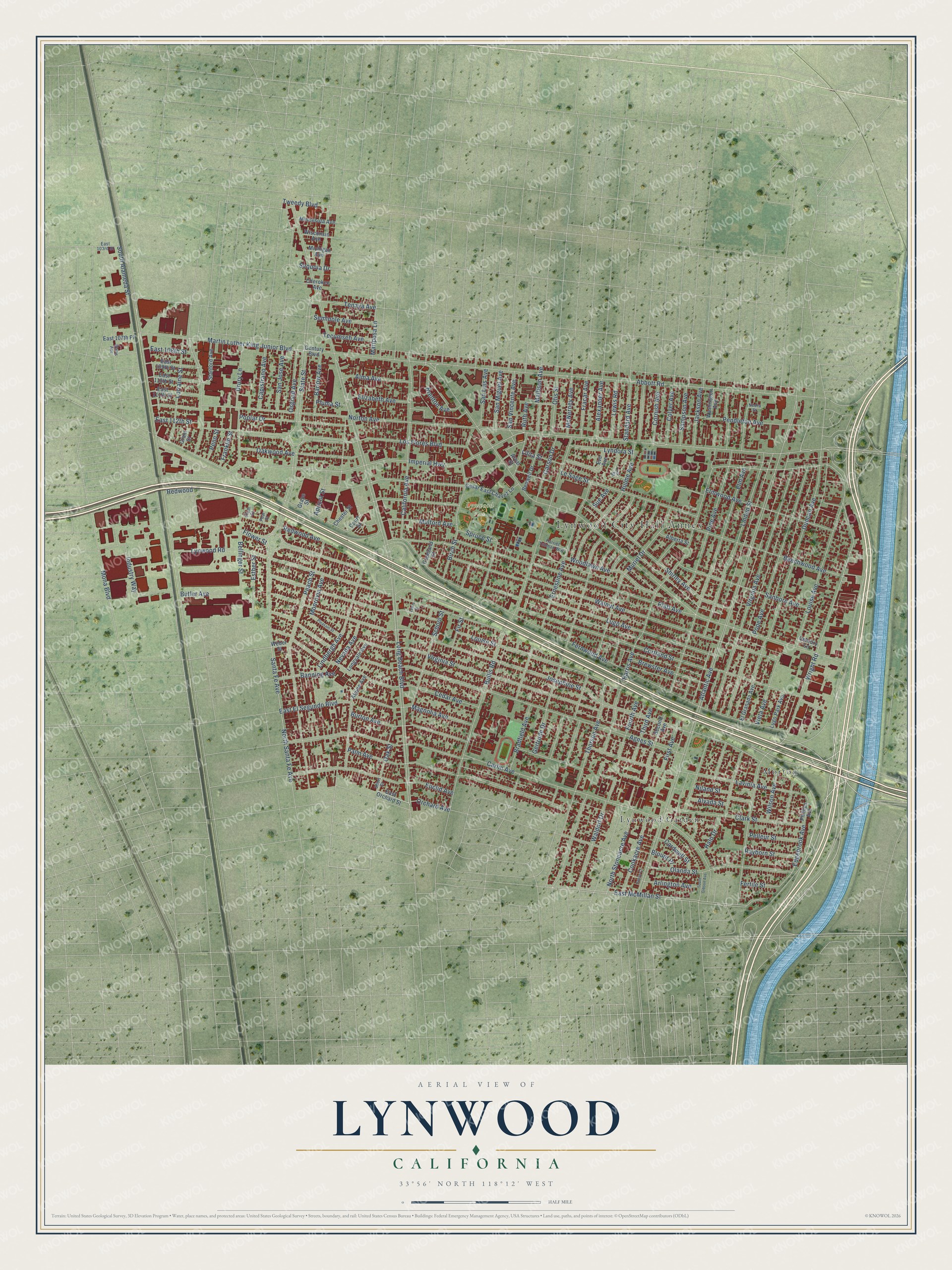
A new map of Lynwood, California, made in 2026 and printed to order on thick archival matte paper.
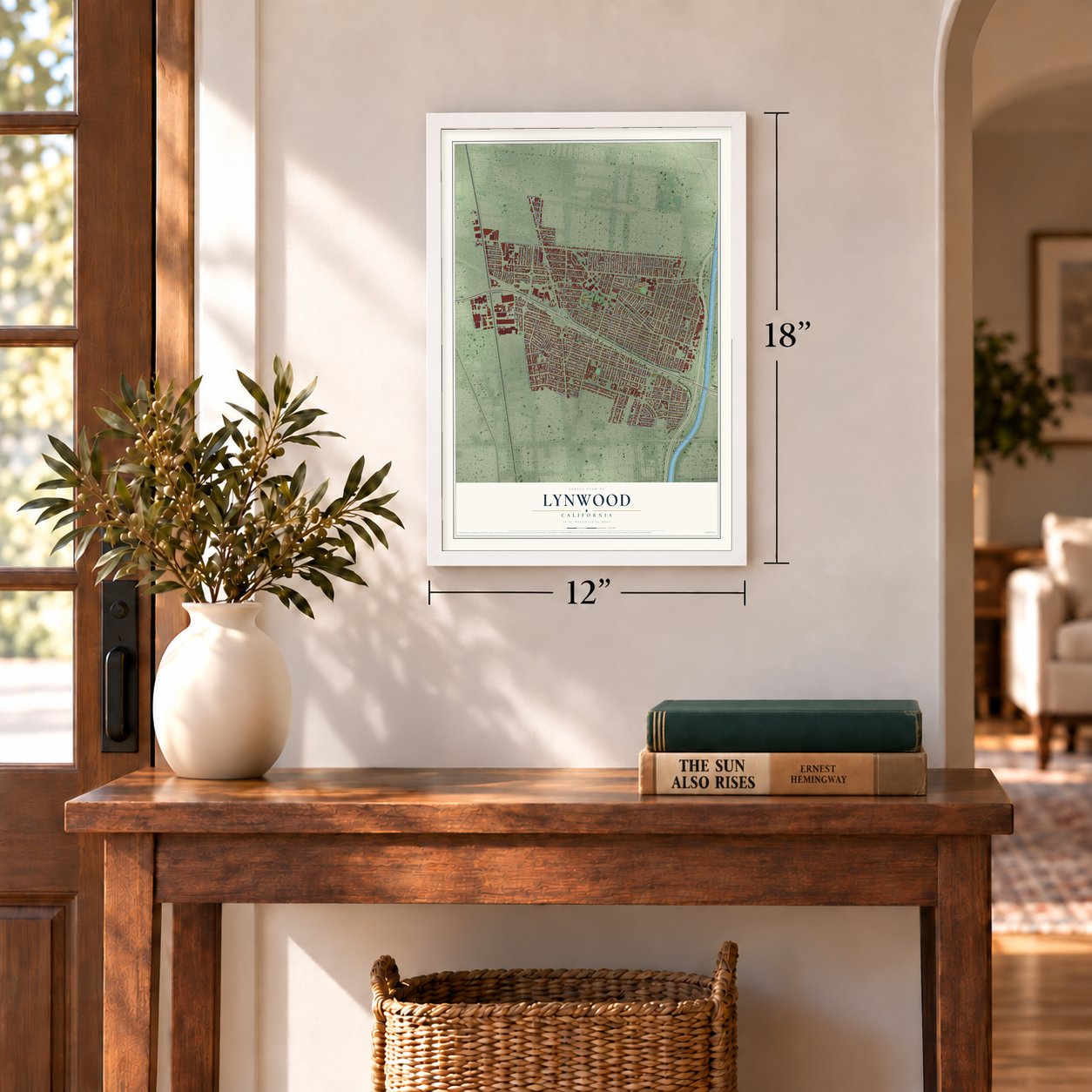
12" x 18" Archival Matte Print
A Map of Home. A Work of Art.
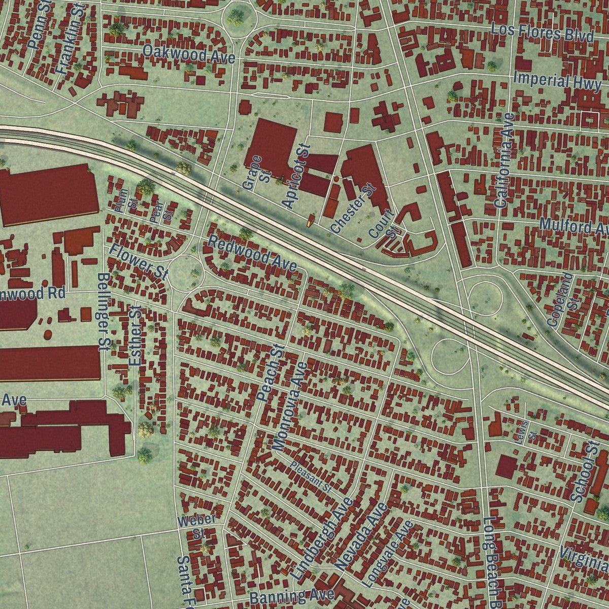
Explore Lynwood, California from a whole new perspective. Created using aerial imagery and detailed geographic data, this map captures Lynwood building by building, with labeled streets, familiar landmarks, and shaded topographical relief that highlights the natural contours of the landscape.
Combining modern data with the timeless character of a vintage atlas, this map is just as interesting up close as it is beautiful on the wall. Whether you grew up in Lynwood, spent memorable years there, or call it home today, this unique map is a great way to celebrate a place that means something to you. Zoom in on the preview to look for your street, and then order a print to put your memories on the wall.
Three ways to hang it
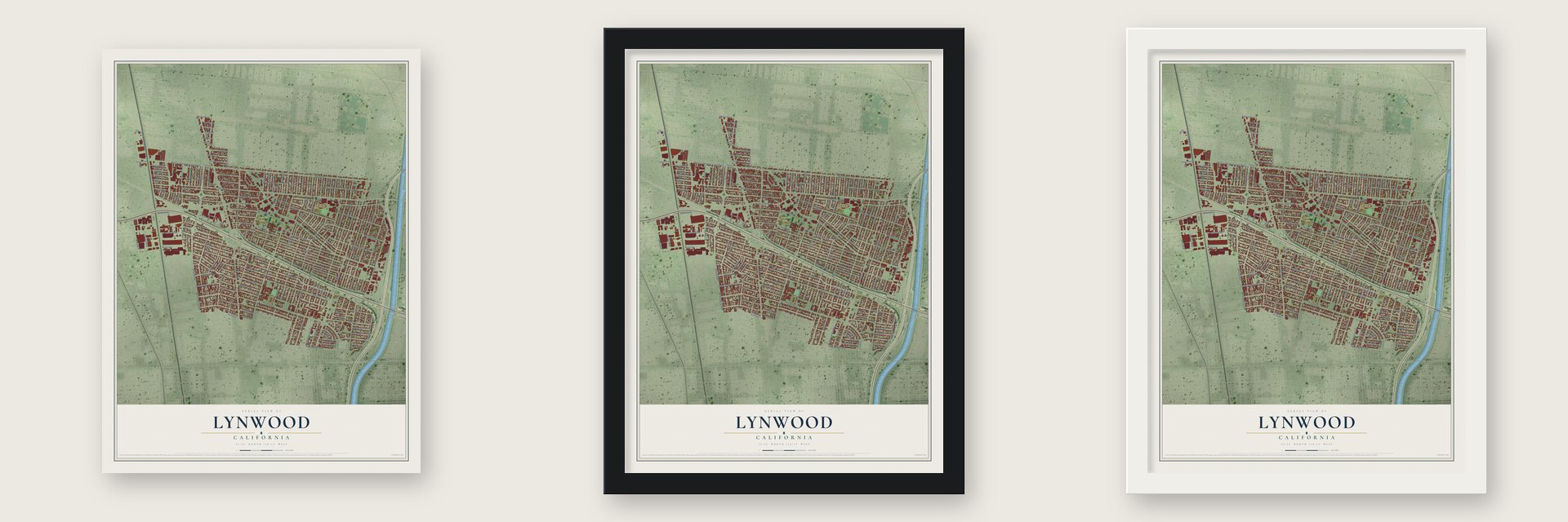
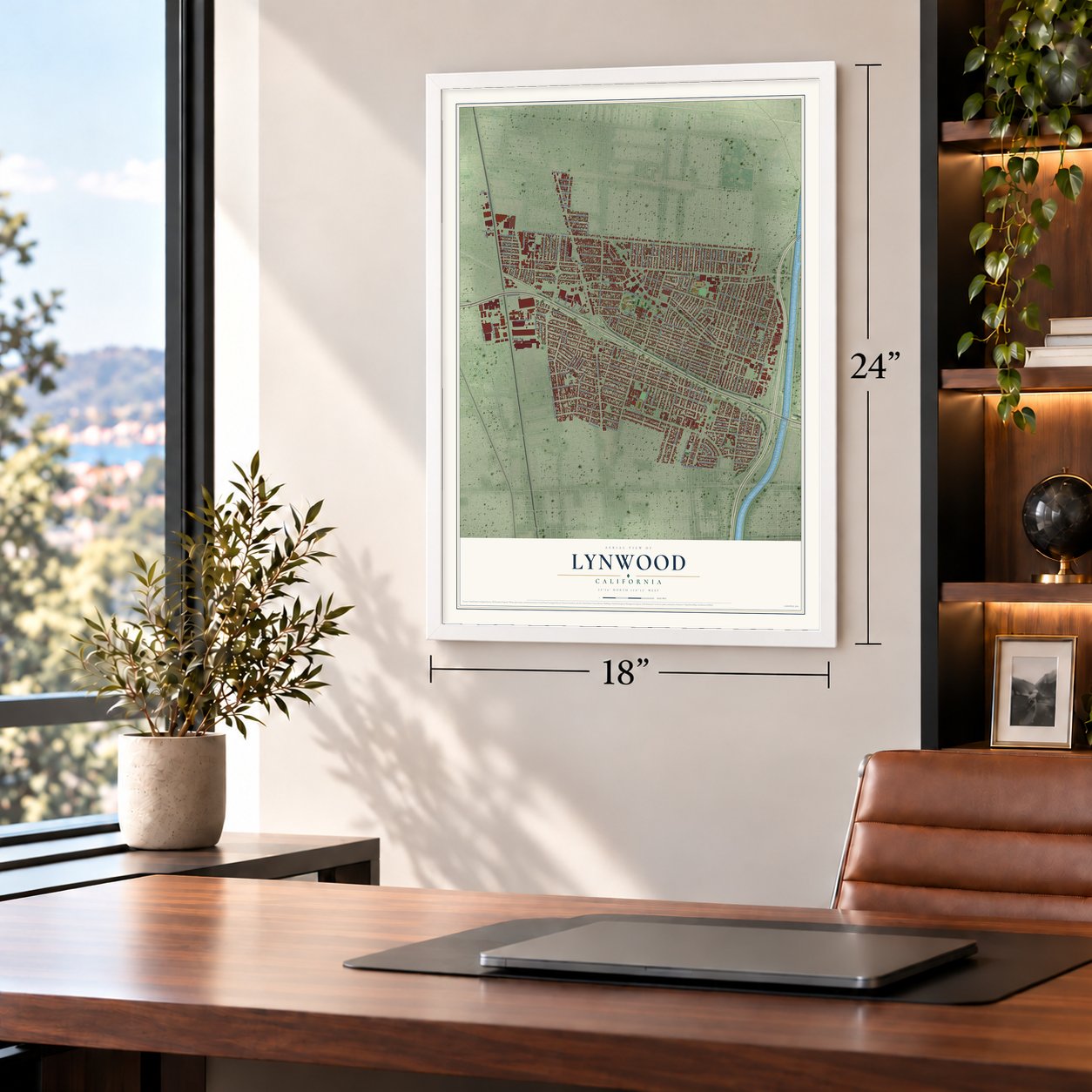
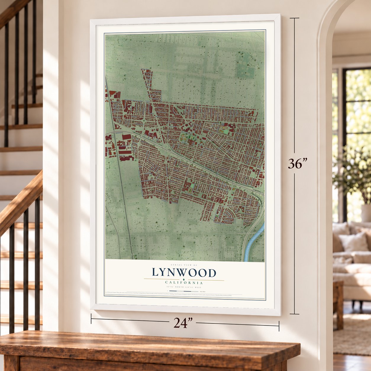
Unframed archival matte, a black wood frame or a white wood frame.
Up close
Geography Worth Displaying
This map was created using accurate cartographic data and authoritative geographic sources, including the U.S. Geological Survey and the Census Bureau. The map brings together terrain, waterways, roads, and building detail. The majority of the streets are labeled, houses are accurately depicted, and the topography is derived from government sources. Combining local data with carefully composed color and shading leads to this beautifully detailed Lynwood artwork for your wall.
Rather than simply showing street outlines, we’ve included as many of the street names as we could reasonably fit on the map while keeping their names legible. Zoom in on the high resolution preview to see exactly what’s on the map. We truly set out to create a statement piece for anyone who loves Lynwood. So whether it’s for you, or a gift for someone you love, we hope this map of Lynwood brings back fond memories.
Read the story behind this map of Lynwood, California from 2026.

About Lynwood, California
Lynwood is a city of 67,265 people in Los Angeles County, between South Gate and Compton in the Los Angeles Basin. Its ground was once part of Rancho San Antonio. In 1810 the king of Spain rewarded Don Antonio Maria Lugo for his military service with 11 square leagues, or 29,514 acres, and that rancho later became Lynwood and its neighbors, from Bell and Maywood to Montebello and South Gate.
Early in the 20th century, a landowner named Charles H. Sessions ran a dairy creamery here and named it for his wife, Lynne Wood. The Pacific Electric Railway then gave the dairy's name to its local station. When the town incorporated in 1921, it took the same name, Lynwood.
- A depot from 1917The Pacific Electric Railway built the Lynwood depot in 1917 for its Santa Ana Line. Interurban trains stopped there on their way to Los Angeles and nearby towns. The depot joined the National Register in 1974.
- New leaders from 1983Lynwood was once mostly non-Hispanic white. Voters seated a Black member on the city council for the first time in 1983, and two years later, in December 1985, Robert Henning took office as Lynwood's first Black mayor. Evelyn Wells and Paul Richards were among the Black mayors who came after him, and in 1997 Armando Rea became the city's first Latino mayor.
- Plaza MéxicoThis shopping mall at 3100 E Imperial Highway was designed after the plazas of Mexico, and it holds events that celebrate Mexican traditions. Lynwood also keeps three sister cities in Mexico: Aguascalientes, Zacatecas and Talpa de Allende.
Find your street
Names on the Lynwood map
Every name below is printed on this map. Look for your street, your school, the park where you played, or the pond down the road.
Places and landmarks4
- Lynwood City Hall Annex
- Lynwood Park
- Lynwood Gardens
- Morton
Streets and roads179
- Orchard Avenue
- Imperial Highway
- Edgebrook Avenue
- Los Flores Boulevard
- State Street
- Wright Road
- Ruth Avenue
- Harris Avenue
- Abbott Road
- East McMillan Street
- Mona Boulevard
- North Stoneacre Avenue
- Atlantic Avenue
- Martin Luther King Junior Boulevard
- South Alameda Street
- Fernwood Avenue
- Long Beach Boulevard
- Josephine Street
- Carlin Avenue
- Beechwood Avenue
- Norton Avenue
- Bullis Road
- Peach Street
- Walnut Avenue
- Louise Street
- Virginia Avenue
- Agnes Street
- Lynwood Road
- Cortland Street
- Virginia Street
Show all 179 streets
- Platt Avenue
- Santa Fe Avenue
- Duncan Avenue
- Elm Avenue
- Pope Avenue
- Sanborn Avenue
- Louise Avenue
- Lugo Avenue
- Muriel Drive
- Cedar Avenue
- Palm Avenue
- Gertrude Drive
- Lavinia Avenue
- Thorson Avenue
- Ernestine Avenue
- Olanda Street
- Pine Avenue
- Hulme Avenue
- California Avenue
- Linden Street
- Flower Street
- Magnolia Avenue
- Le Sage Street
- Shirley Avenue
- Euclid Avenue
- Cornish Avenue
- Bellinger Street
- North Santa Fe Avenue
- Clark Street
- Elmwood Avenue
- Pendleton Avenue
- Oakwood Avenue
- Burton Avenue
- Birch Street
- Seminole Avenue
- Industry Way
- Poplar Drive
- Waldorf Drive
- Spruce Street
- Lorraine Street
- Sampson Avenue
- School Street
- Woodlawn Avenue
- Mulford Avenue
- Colyer Avenue
- Alma Avenue
- Lindbergh Avenue
- Jackson Avenue
- Bradfield Avenue
- Redwood Avenue
- Cookacre Avenue
- San Jose Avenue
- Niland Street
- Lilita Street
- Brewster Avenue
- East 108th Street
- First Avenue
- East El Segundo Boulevard
- Fir Street
- Elizabeth Avenue
- Capistrano Avenue
- Banning Avenue
- Mallison Avenue
- Carson Drive
- San Luis Avenue
- Otis Street
- McNerney Avenue
- San Miguel Avenue
- Alexander Avenue
- San Vincente Avenue
- Brenton Avenue
- Tenaya Avenue
- Oak Street
- Lyndora Street
- Drury Lane
- Pelleur Street
- Osgood Avenue
- Barlow Avenue
- Rayborn Street
- Butler Avenue
- Standard Avenue
- Lewis Road
- Fracar Avenue
- Fourth Avenue
- Mariposa Lane
- Alvada Street
- Third Avenue
- Tecumseh Avenue
- Tweedy Boulevard
- Franklin Street
- Cardwell Street
- Arlington Avenue
- Wilson Avenue
- Nevada Avenue
- Esther Street
- Monrovia Avenue
- Sue Avenue
- Halo Drive
- Vieta Avenue
- Fertile Street
- East 112th Street
- Penn Street
- Apricot Street
- Sequoia Drive
- Pluma Street
- Blount Place
- Redwood
- East Orchard Street
- Phillips Avenue
- Century Boulevard
- Alpine Avenue
- Second Avenue
- Benwell Drive
- Cesar East Chavez Lane
- East 109th Street
- East 110th Street
- East 111th Street
- Stanford Avenue
- El Granada Avenue
- Minnesota Avenue
- Lugo Park Avenue
- Washington Avenue
- Wisconsin Avenue
- Longvale Avenue
- Alberta Street
- East 107th Place
- Michigan Avenue
- Chester Street
- Cherokee Avenue
- Copeland Street
- Court Street
- Arval Street
- Century Lane
- Weber Street
- Grant Street
- Grape Street
- Eve Avenue
- Harriet Tubman Way
- East 103rd Street
- Watts Avenue
- Ira Street
- Short Street
- Nedra Street
- Plum Street
- Pear Street
- Pleasant Street
- South Gibson Avenue
- Lewis Street
- Hansa Court
Names are listed as they appear on the printed map. Zoom into the product photos to find them.
The art of mapping a place
How This Map Was Made
Real places. Remarkable detail. Discover the layers that turn geographic data into a map of home.

The view from above
Aerial imagery reveals the character of the land: woodland, open fields, and the patterns of a place.

The shape of the land
Elevation data brings hills, valleys, and subtle changes in the landscape into view.

The details of home
Roads, waterways, and building footprints come together to make the map feel unmistakably local.

Geography becomes art
Considered color, shading, and typography bring the layers together in a map made for your wall.


Process illustrated with Mendon, Massachusetts. Aerial imagery: USDA NAIP. Terrain: USGS 3D Elevation Program. Map details and finished artwork: KNOWOL.
The Details
About This Print
Choose an archival matte print, or a black or white Ayous wood frame. The archival matte print is unframed.
Select your size and finish above to see the matching product image and price.
Materials & Craftsmanship
A contemporary map with the character of a classic atlas, printed on archival matte paper. Optional frames are made from Ayous wood.
Your printed map does not include the watermark shown in the full-map preview.
Shipping & Delivery
Free shipping within the United States. Every print is made to order in the USA.
Buying a gift? Add a note in your cart and we'll include it. We never put prices in the package.
Prints ship within 2 to 3 business days. Allow 7 to 10 days total from ordering for delivery. Timing may vary during holidays or periods of high order volume.
Read our shipping policy.
Returns and damaged prints
Each print is made to order. Change-of-mind refunds are not available after production.
If your print arrives damaged, misprinted or incorrect, contact support@knowol.com within 30 days of receiving it. Include your order number, photos and a description of the issue.
Read our full refund and replacement policy. For questions about your order, email support@knowol.com.
Find your town
Looking for another city?
Find a map of home in our California collection, or any town in the country.
Nearby
Maps of towns near Lynwood
Know someone from one of these towns? Their map makes a great gift.
 South Gate
, California
From $39.99See the map
 Willowbrook
, California
From $39.99See the map
 East Rancho Dominguez
, California
From $39.99See the map
More maps nearby: Compton, Watts, Paramount, Cudahy and Walnut Park.