
Search for another town





Free U.S. delivery 7 to 10 days after you order
Paramount, California Map Art
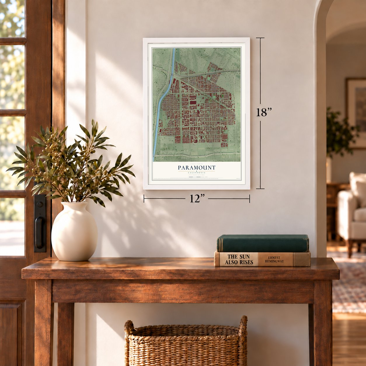
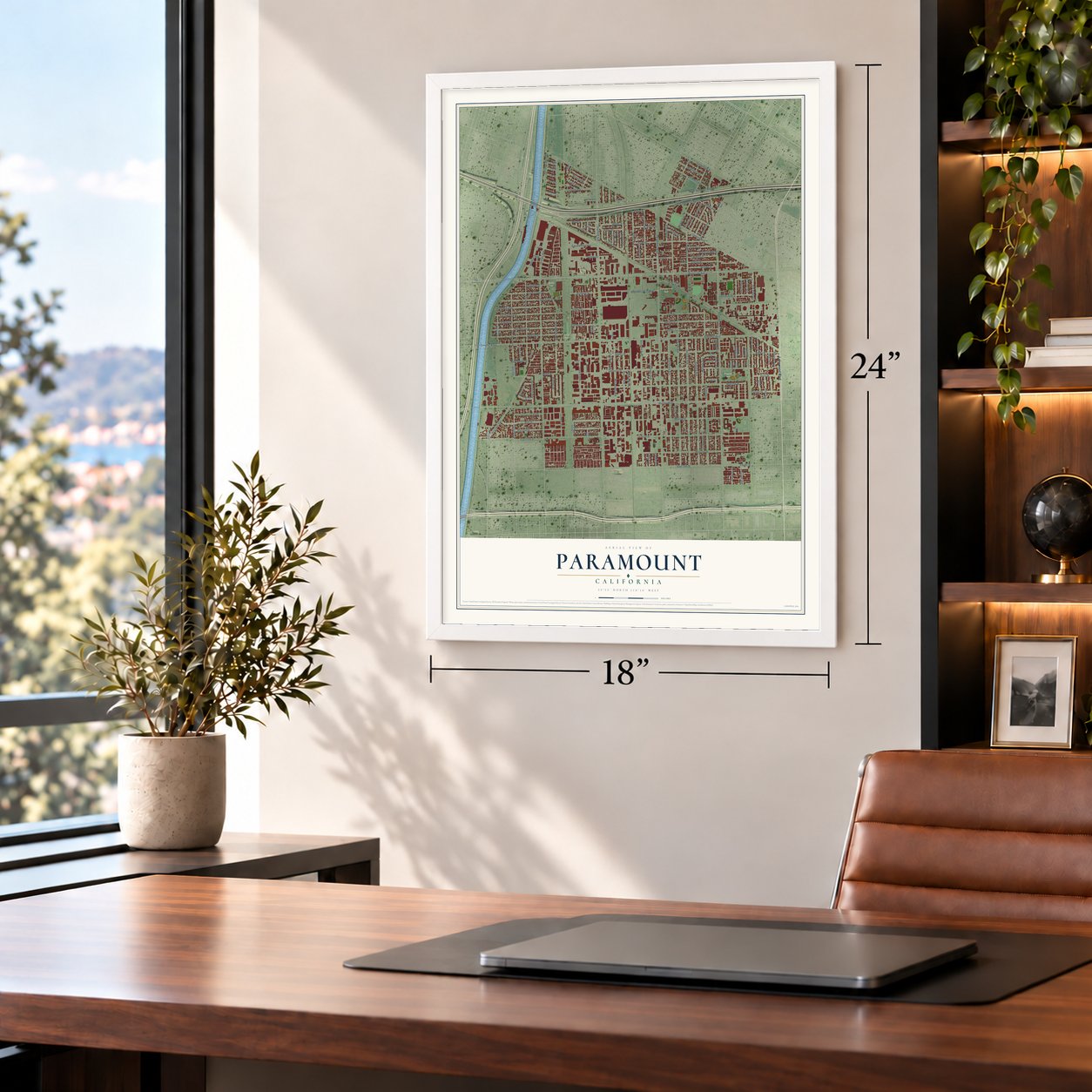
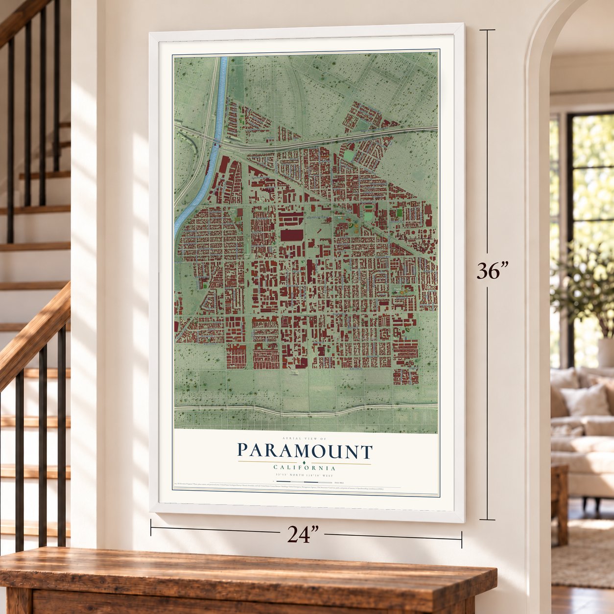
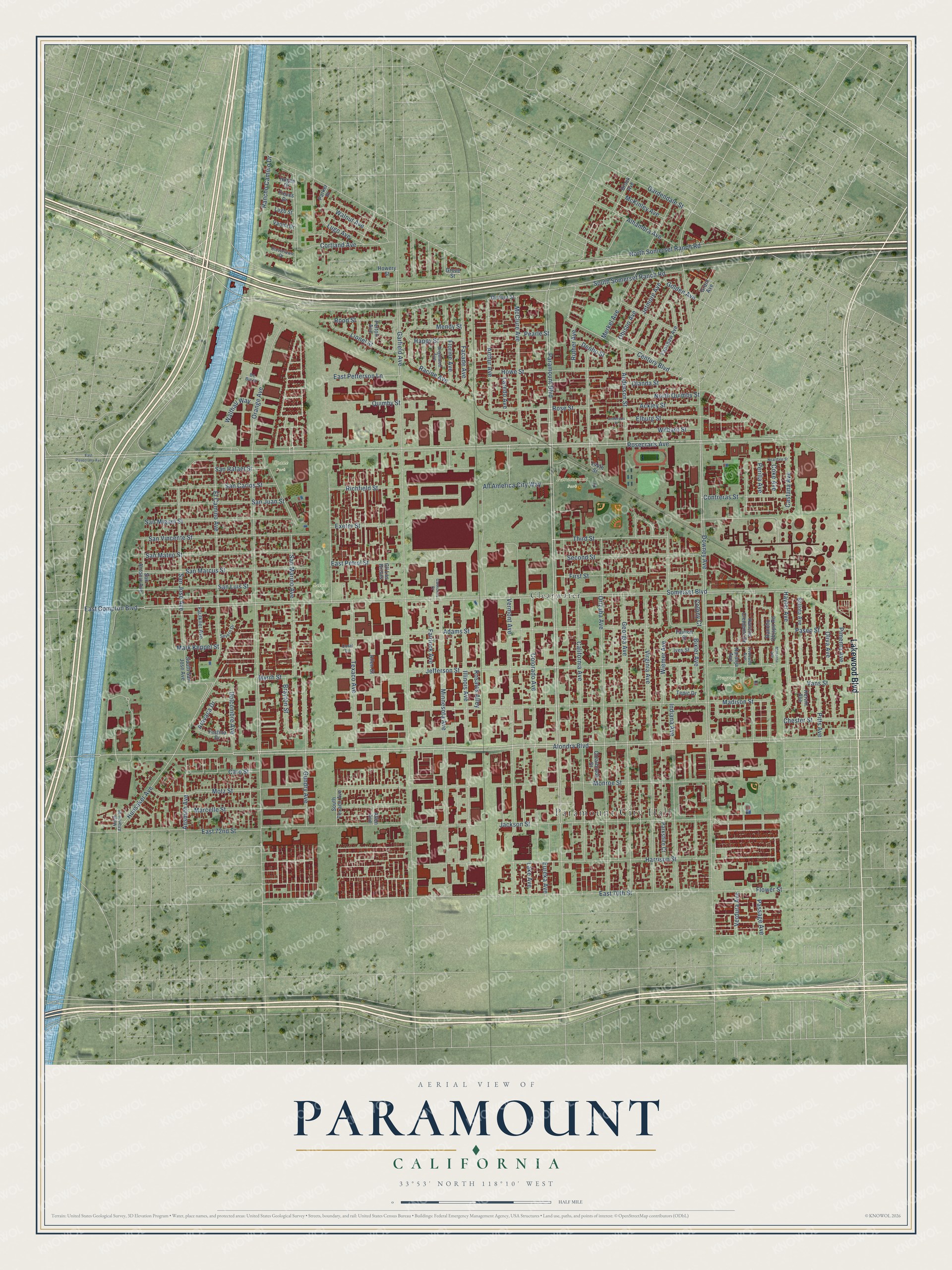
A new map of Paramount, California, made in 2026 and printed to order on thick archival matte paper.
12" x 18" Archival Matte Print
A Map of Home. A Work of Art.
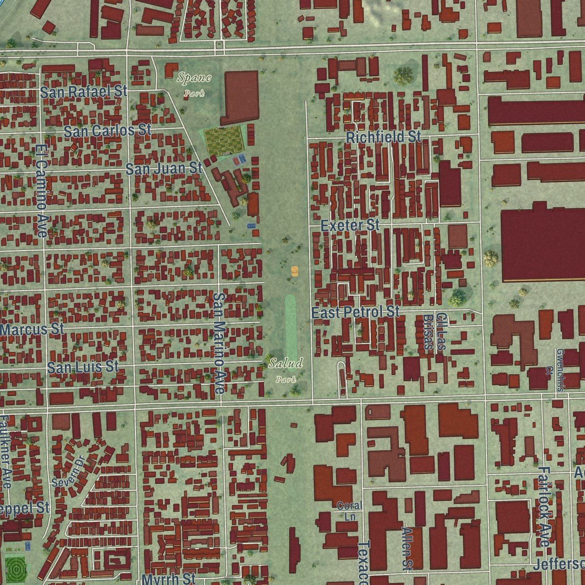
Explore Paramount, California from a whole new perspective. Created using aerial imagery and detailed geographic data, this map captures Paramount building by building, with labeled streets, familiar landmarks, and shaded topographical relief that highlights the natural contours of the landscape.
Combining modern data with the timeless character of a vintage atlas, this map is just as interesting up close as it is beautiful on the wall. Whether you grew up in Paramount, spent memorable years there, or call it home today, this unique map is a great way to celebrate a place that means something to you. Zoom in on the preview to look for your street, and then order a print to put your memories on the wall.
Three ways to hang it
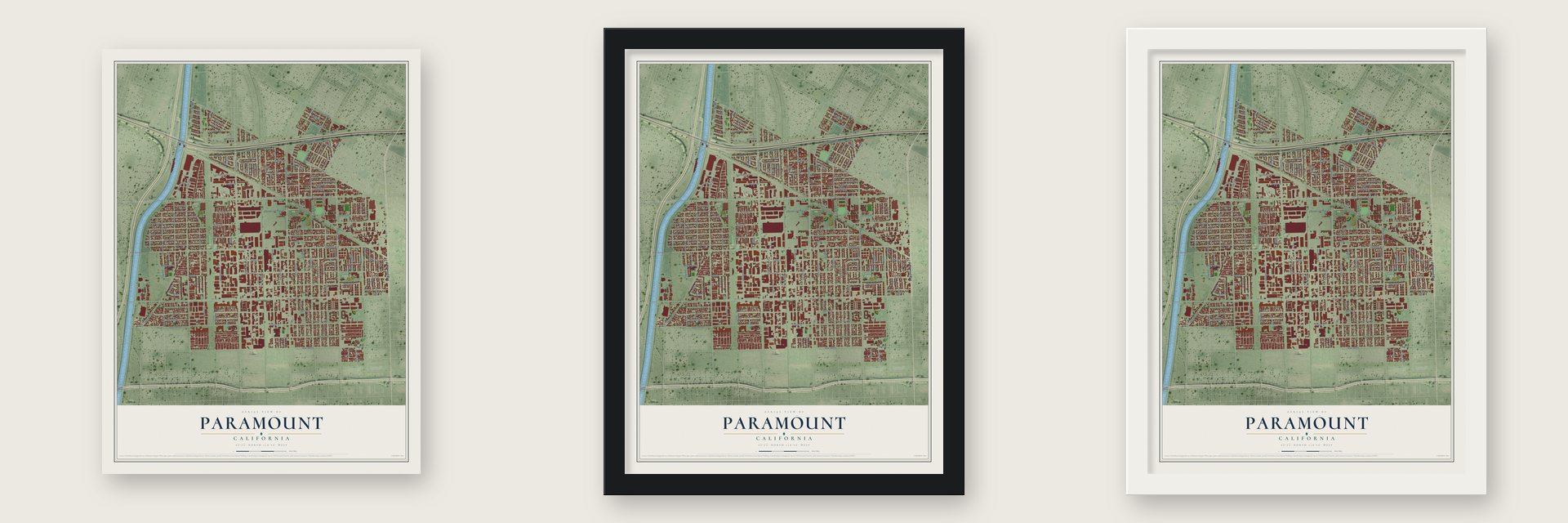
Unframed archival matte, a black wood frame or a white wood frame.
Up close
Geography Worth Displaying
This map was created using accurate cartographic data and authoritative geographic sources, including the U.S. Geological Survey and the Census Bureau. The map brings together terrain, waterways, roads, and building detail. The majority of the streets are labeled, houses are accurately depicted, and the topography is derived from government sources. Combining local data with carefully composed color and shading leads to this beautifully detailed Paramount artwork for your wall.
Rather than simply showing street outlines, we’ve included as many of the street names as we could reasonably fit on the map while keeping their names legible. Zoom in on the high resolution preview to see exactly what’s on the map. We truly set out to create a statement piece for anyone who loves Paramount. So whether it’s for you, or a gift for someone you love, we hope this map of Paramount brings back fond memories.
Read the story behind this map of Paramount, California from 2026.

About Paramount, California
Paramount is a city of 53,733 people in Los Angeles County, between Compton and Long Beach. Mexican settlers of New Spain first recorded this ground in 1781. In 1784 King Carlos III granted the two ranchos that covered it, Rancho San Pedro on the west and Rancho Los Nietos on the east.
Two farm towns, Hynes and Clearwater, later grew up here. In 1948 the Postmaster General ordered their post offices merged, and the joined community took its name from Paramount Boulevard, its main north and south street. To head off annexation by Long Beach, Bellflower and South Gate, residents ran a "Save Paramount for Paramount" campaign, and the city incorporated on January 30, 1957.
- The Hay TreeA camphor tree about 50 feet tall stands on a lawn in downtown Paramount. Hay traders from Hynes and Clearwater gathered beneath it every working day to settle the going price, and New York mercantile markets quoted their figures as the world's standard for hay. The tree is now a California State Historical Landmark.
- Home of the ZamboniFrank Joseph Zamboni Jr. invented the ice resurfacing machine, and his company started in Paramount. Zamboni & Co. still has its headquarters here and sells its machines around the world. Since 1939 the family has also run Iceland, a skating rink fitted with improvements that Frank Zamboni patented.
- The last dairy, 1977Hay and dairy farming carried Paramount's economy until land here grew too costly to farm. One by one the dairies shut down, and the city's last one closed in 1977.
- A second SinaloaMany families in Paramount trace their roots to the Mexican state of Sinaloa. Restaurants across the city serve food estilo sinaloense, which means Sinaloan style. Paramount's sister city is Tepic, Mexico.
Find your street
Names on the Paramount map
Every name below is printed on this map. Look for your street, your school, the park where you played, or the pond down the road.
Places and landmarks6
- Paramount City Hall
- Paramount Park
- Progress Park
- Salud Park
- Spane Park
- Clearwater
Streets and roads158
- Lakewood Boulevard
- Rosecrans Avenue
- Third Street
- Alondra Boulevard
- Indiana Avenue
- Arthur Avenue
- Somerset Boulevard
- Orange Avenue
- East 70th Street
- Motz Street
- Vermont Avenue
- East 72nd Street
- Passage Avenue
- Ansmith Avenue
- Downey Avenue
- Garfield Avenue
- Paramount Boulevard
- Century Boulevard
- Orizaba Avenue
- Madison Street
- Jackson Street
- Jefferson Street
- Gundry Avenue
- Monroe Street
- Georgia Avenue
- Virginia Avenue
- Adams Street
- Texaco Avenue
- California Avenue
- Minnesota Avenue
Show all 158 streets
- North Somerset Ranch Road
- Colorado Avenue
- Illinois Avenue
- Harrison Street
- Hunsaker Avenue
- El Camino Avenue
- Wiemer Avenue
- Marcelle Street
- Hayter Avenue
- San Luis Street
- All America City Way
- San Mateo Street
- San Marcus Street
- Howe Street
- San Vincente Street
- Merkel Avenue
- San Jose Avenue
- Fairlock Avenue
- Second Street
- San Miguel Street
- South Somerset Ranch Road
- Racine Avenue
- Gardendale Street
- Castana Avenue
- Facade Avenue
- San Juan Street
- Elburg Street
- McClure Avenue
- Cortland Avenue
- San Carlos Street
- First Street
- Anderson Street
- Chester Street
- East Compton Boulevard
- Ruther Avenue
- Rose Street
- Jetmore Avenue
- Golden Avenue
- Alhambra Avenue
- Lionel Street
- Perilla Avenue
- Rood Street
- Mendy Street
- Oliva Avenue
- Contreras Street
- Bixler Avenue
- Florine Avenue
- Delcombre Avenue
- Walnut Avenue
- Flower Street
- North Quimby Street
- Ackley Street
- Wilbarn Street
- Caro Street
- East Petterson Lane
- East Petrol Street
- Richfield Street
- Exeter Street
- Verdura Avenue
- San Marino Avenue
- McKinley Avenue
- Obispo Avenue
- Paseo Street
- Vans Street
- Rancho Camino Drive
- Olanda Street
- Myrrh Street
- Pearle Street
- Happy Street
- Pitts Avenue
- Brayton Street
- Denbo Street
- Aravaca Drive
- San Rafael Street
- Mark Keppel Street
- Lugo Avenue
- Walthall Way
- Colony Court
- Pimenta Avenue
- Rosales Alley
- Laredo Avenue
- Coke Avenue
- Quimby Street
- Lake Avenue
- Eureka Avenue
- Denver Street
- Fanshaw Avenue
- Bellota Avenue
- San Antonio Avenue
- Brock Avenue
- Rancho Clemente Drive
- Faulkner Avenue
- Parkshire Court
- South Texaco Avenue
- Clearbrook Street
- Kervin Avenue
- Festina Drive
- South San Jose Avenue
- Naranja Avenue
- Tepic Drive
- Rancho Obispo Road
- Fairton Street
- Pelton Avenue
- Howery Street
- Grant Avenue
- Ives Street
- Vanna Drive
- Allen Street
- Lugo Street
- Allen Avenue
- Treves Drive
- Parker Place
- Cll Las Brisas
- Hogee Drive
- Grove Street
- 144th Street
- Brightwell Avenue
- North Atlantic Place
- Cloverlawn Drive
- Severn Drive
- Avocado Avenue
- De Bie Drive
- Coral Lane
- Neardale Street
- East Rosecrans Avenue
- Gwenchris Court
- Manzana Avenue
- Anderson Place
Names are listed as they appear on the printed map. Zoom into the product photos to find them.
The art of mapping a place
How This Map Was Made
Real places. Remarkable detail. Discover the layers that turn geographic data into a map of home.

The view from above
Aerial imagery reveals the character of the land: woodland, open fields, and the patterns of a place.

The shape of the land
Elevation data brings hills, valleys, and subtle changes in the landscape into view.

The details of home
Roads, waterways, and building footprints come together to make the map feel unmistakably local.

Geography becomes art
Considered color, shading, and typography bring the layers together in a map made for your wall.


Process illustrated with Mendon, Massachusetts. Aerial imagery: USDA NAIP. Terrain: USGS 3D Elevation Program. Map details and finished artwork: KNOWOL.
The Details
About This Print
Choose an archival matte print, or a black or white Ayous wood frame. The archival matte print is unframed.
Select your size and finish above to see the matching product image and price.
Materials & Craftsmanship
A contemporary map with the character of a classic atlas, printed on archival matte paper. Optional frames are made from Ayous wood.
Your printed map does not include the watermark shown in the full-map preview.
Shipping & Delivery
Free shipping within the United States. Every print is made to order in the USA.
Buying a gift? Add a note in your cart and we'll include it. We never put prices in the package.
Prints ship within 2 to 3 business days. Allow 7 to 10 days total from ordering for delivery. Timing may vary during holidays or periods of high order volume.
Read our shipping policy.
Returns and damaged prints
Each print is made to order. Change-of-mind refunds are not available after production.
If your print arrives damaged, misprinted or incorrect, contact support@knowol.com within 30 days of receiving it. Include your order number, photos and a description of the issue.
Read our full refund and replacement policy. For questions about your order, email support@knowol.com.
Find your town
Looking for another city?
Find a map of home in our California collection, or any town in the country.
Nearby
Maps of towns near Paramount
Know someone from one of these towns? Their map makes a great gift.
 East Rancho Dominguez
, California
From $39.99See the map
 Bellflower
, California
From $39.99See the map
 Lynwood
, California
From $39.99See the map
More maps nearby: Downey, South Gate, Compton, Willowbrook and Lakewood.