
Search for another town



Free U.S. delivery 7 to 10 days after you order
Centereach, New York Map Art
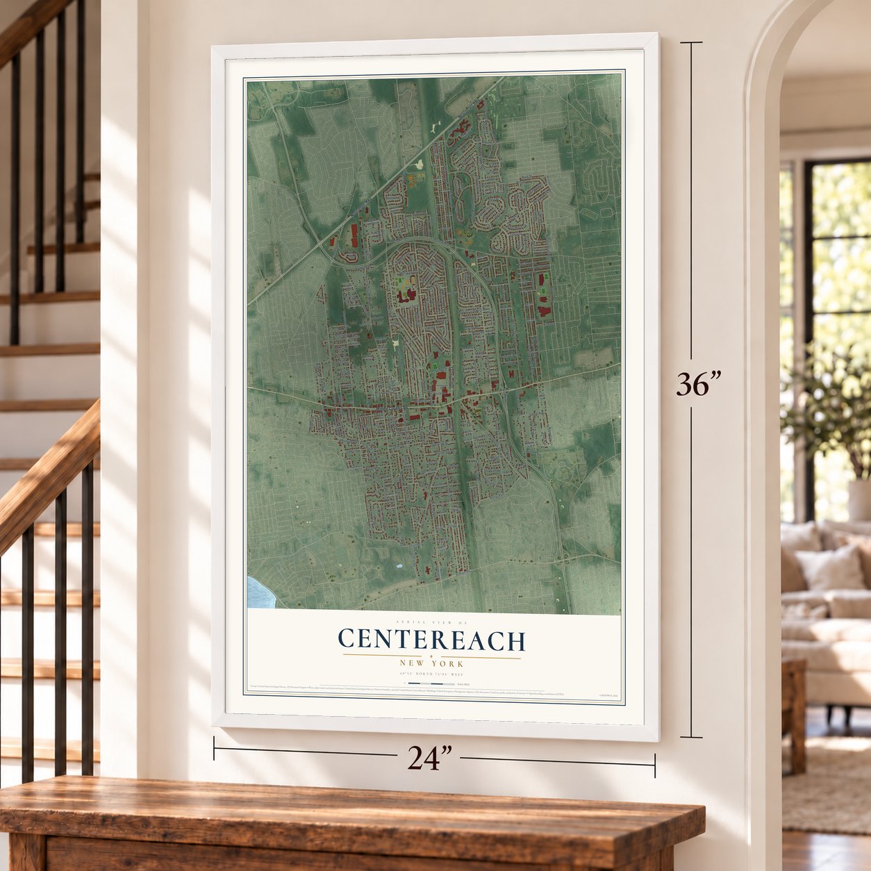
Building by building, with labeled streets and shaded relief.
12" x 18" Archival Matte Print
A Map of Home. A Work of Art.
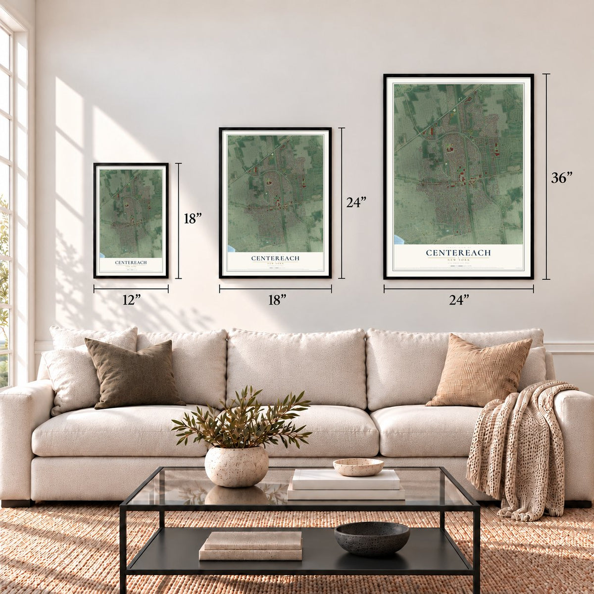
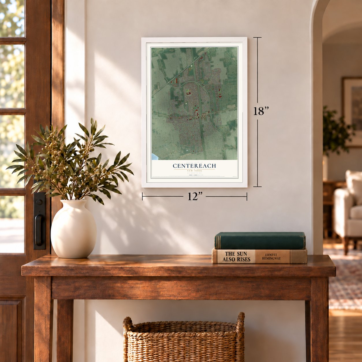
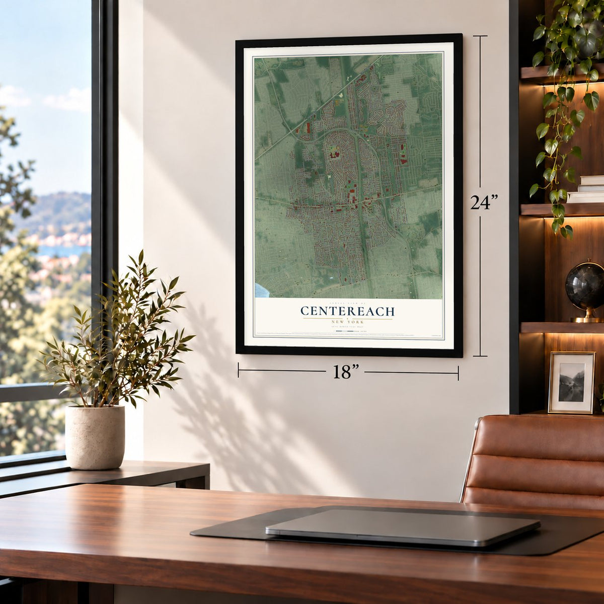
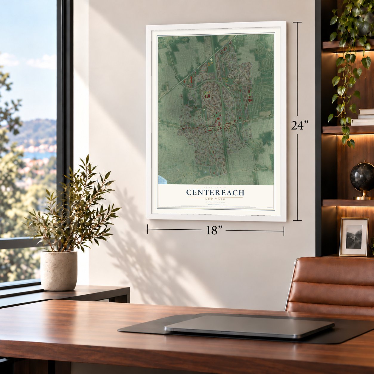
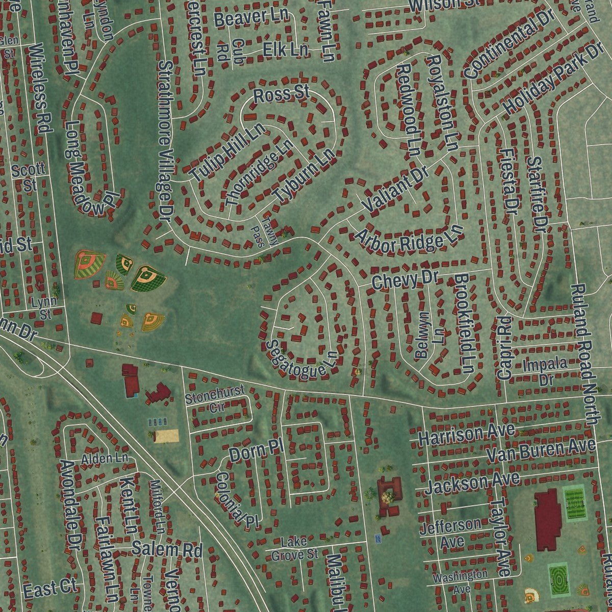
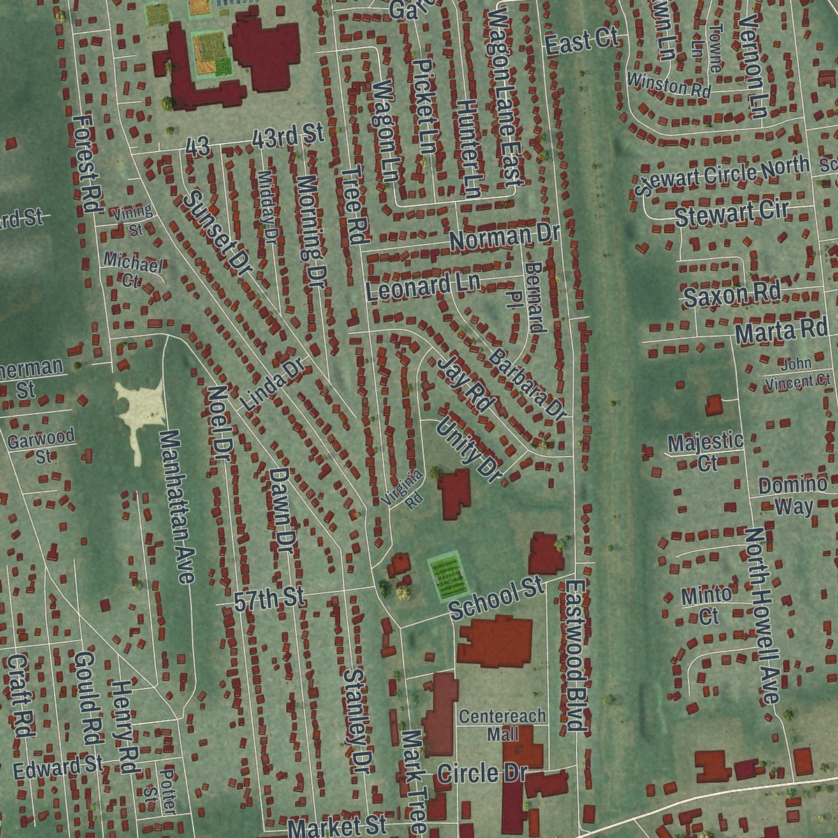
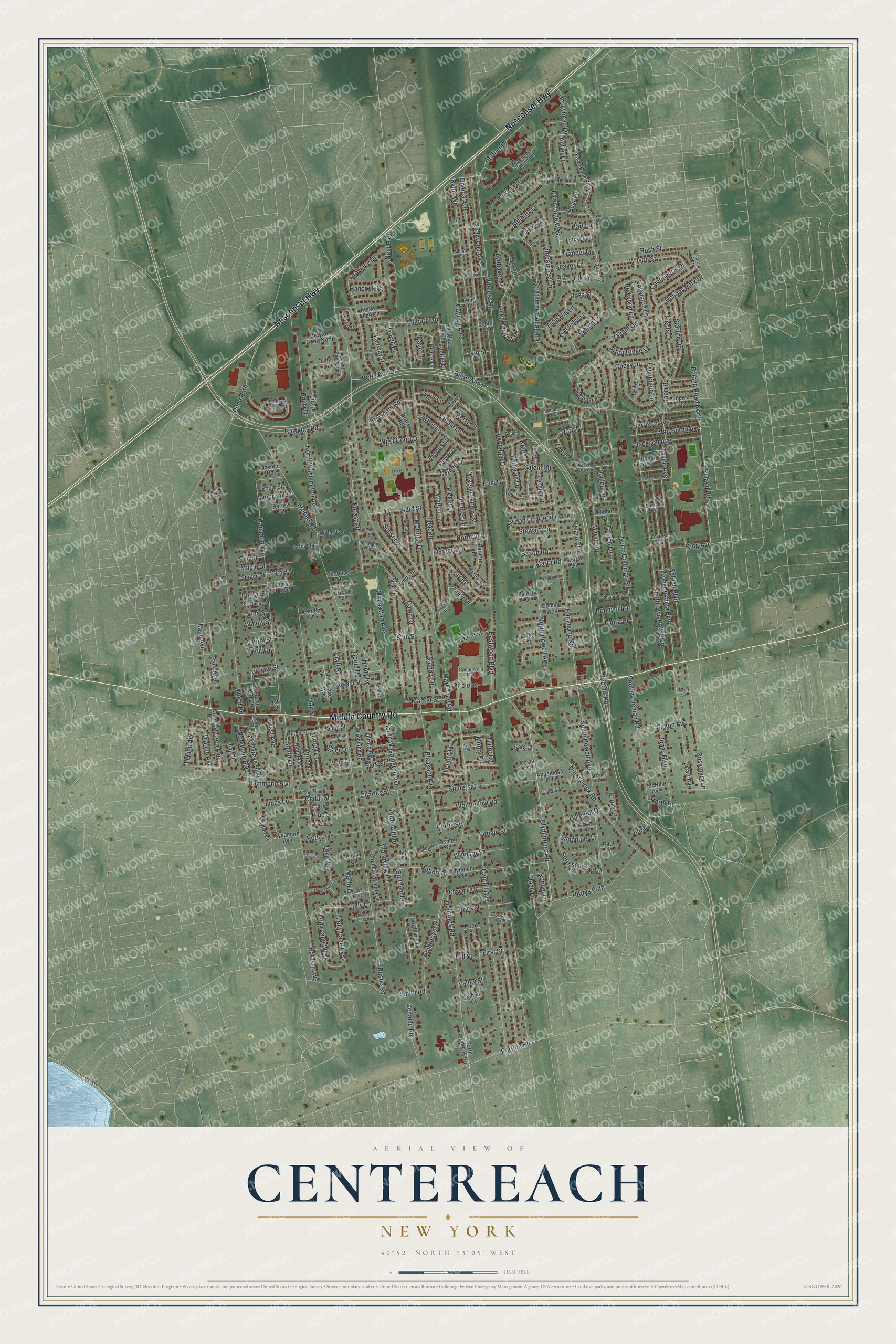
Explore Centereach, New York from a whole new perspective. Created using aerial imagery and detailed geographic data, this map captures Centereach building by building, with labeled streets, familiar landmarks, and shaded topographical relief that highlights the natural contours of the landscape.
Combining modern data with the timeless character of a vintage atlas, this map is just as interesting up close as it is beautiful on the wall. Whether you grew up in Centereach, spent memorable years there, or call it home today, this unique map is a great way to celebrate a place that means something to you. Zoom in on the preview to look for your street, and then order a print to put your memories on the wall.
Three ways to hang it
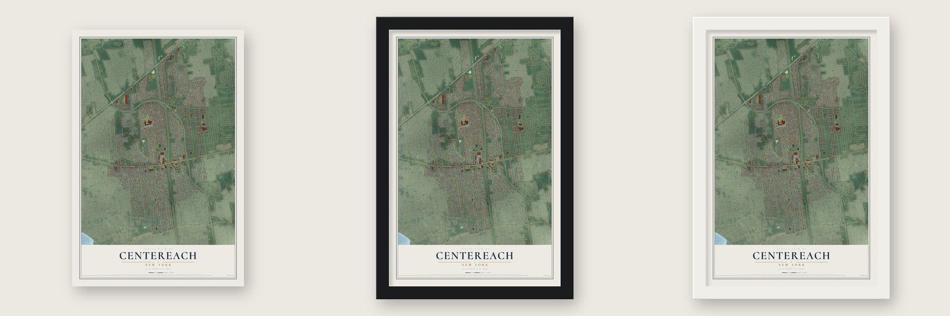
Unframed archival matte, a black wood frame or a white wood frame.
Up close
Geography Worth Displaying
This map was created using accurate cartographic data and authoritative geographic sources, including the U.S. Geological Survey (USGS) and FEMA. The map brings together terrain, waterways, roads, and building detail. The majority of the streets are labeled, houses are accurately depicted, and the topography is derived from government sources. Combining local data with carefully composed color and shading leads to this beautifully detailed Centereach artwork for your wall.
Rather than simply showing street outlines, we’ve included as many of the street names as we could reasonably fit on the map while keeping their names legible. Zoom in on the high resolution preview to see exactly what’s on the map. We truly set out to create a statement piece for anyone who loves Centereach. So whether it’s for you, or a gift for someone you love, we hope this map of Centereach brings back fond memories.
Explore the full map of Centereach, New York and read about the local places it shows.

Find your street
Names on the Centereach map
Every name below is printed on this map. Look for your street, your school, the park where you played, or the pond down the road.
Streets and roads329
- Nesconset Highway
- Middle Country Road
- Horseblock Road
- Blydenburg Road
- Ross Street
- Wagon Lane East
- Nicolls Road
- Hawkins Road
- Mark Tree Road
- Holbrook Road
- Eastwood Boulevard
- Hammond Road
- Oxhead Road
- Tree Road
- Fawn Lane
- Rustic Road
- Strathmore Village Drive
- North Coleman Road
- Ruland Road
- Ruland Road North
- Wood Road
- Smithtown Polk Boulevard
- Hammond Lane
- Wireless Road
- North Washington Avenue
- Balin Avenue
- Oneida Avenue
- Bellwood Avenue
- Forest Road
- South Coleman Road
Show all 329 streets
- South Howell Avenue
- Ronkonkoma Boulevard
- Selden Boulevard
- Smith Lane
- Stanley Drive
- Patricia Lane
- Wagon Lane
- Avondale Drive
- South Washington Avenue
- Holiday Park Drive
- Long Meadow Place
- Cayuga Avenue
- Bette Ann Drive
- Betty Ann Drive
- Oak Street
- Pleasant Avenue
- Tyburn Lane
- Province Drive
- Fawn Lane West
- Rosemary Lane
- Park Street
- Joan Avenue
- North Howell Avenue
- Noel Drive
- Portion Road
- Holbrook Avenue
- Woodview Lane
- West Court Drive
- Smith Road
- Lake Grove Boulevard
- Dawn Drive
- Manhattan Avenue
- Emily Drive
- Hettys Path
- Stewart Circle
- Brookfield Lane
- Royalston Lane
- Songsparrow Lane
- Sunset Drive
- Timbercrest Lane
- Balaton Avenue
- Gould Road
- Main Avenue
- Wilson Street
- Starfire Drive
- Cenacle Road
- Neal Path
- Clinton Avenue
- Kejaro Court
- Jonas Boulevard
- Marlin Road
- Mather Drive
- Valley Street
- Stethem Drive
- Jay Road
- Charles Street
- Arbor Ridge Lane
- Daell Lane
- Pond Path
- Craft Road
- Valiant Drive
- Saddle Lane
- Arbor Lane
- Hancock Court
- Tulip Hill Lane
- Milburn Road
- Van Buren Avenue
- Jackson Avenue
- Harrison Avenue
- Wolfhollow Road
- Morning Drive
- Somerset Street
- Fiesta Drive
- Robert Drive
- Taylor Avenue
- Cedar Street
- Lily Drive
- Henry Road
- Park Avenue
- Hunter Lane
- Rego Avenue
- Ulrich Road
- Garden Lane
- Continental Drive
- 43rd Street
- Simon Avenue
- Tudor Road
- Lucille Drive
- Woodland Boulevard
- School Street
- Dorn Place
- Lolly Lane East
- Lolly Lane West
- Norman Drive
- Windsor Street
- Lynhaven Place
- Millbury Lane
- Tarpon Lane
- Fairway Drive
- Lolly Lane
- Picket Lane
- Bowdoin Road
- Rush Street
- Fairlawn Lane
- Marta Road
- Chevy Drive
- Green Place
- Arrowhead Lane
- Antler Lane
- Dianne Avenue
- Reizen Avenue
- Richmond Boulevard
- Rondel Lane
- Dixie Lane
- Trapper Lane
- Anne Road
- Audrey Lane
- Lehigh Avenue
- Circle Drive
- 57th Street
- Firdale Street
- Leonard Lane
- Lenore Lane
- Antona Boulevard
- Beaver Lane
- Market Street
- Marfo Lane
- Redwood Lane
- Forrest Avenue
- King Avenue
- Bruce Drive
- Saxon Road
- Spur Lane
- Vernon Lane
- Camelot Drive
- Sandpiper Lane
- Elk Lane
- Walnut Street
- Salem Road
- Woods Lane
- Bonnybill Drive
- Lynbrook Street
- Hart Lane
- Libes Lane
- Laura Drive
- Malibu Lane
- Dave Lane
- Capri Road
- Pine Street
- Bear Lane
- Berry Lane
- Monty Road
- First Street
- Silver Drive
- Unity Drive
- North Road
- Maple Street
- Curtis Street
- Ovid Street
- Kent Lane
- Elm Street
- Poplar Street
- Willow Street
- Laurel Street
- Vine Street
- Hill Street
- Holly Street
- East Court
- Taj Court
- Rose Court
- Fawn Lane East
- Segatogue Lane
- Chatham Woods Drive
- Northfield Drive
- Champlin Street
- Ozark Street
- Plymouth Street
- Woodland Road
- Barbara Drive
- Stewart Circle North
- Setauket Avenue
- Edward Street
- Layton Lane
- Brayton Court North
- Minerva Lane
- Majestic Court
- Barrow Court
- Crown Acres Road
- North Holbrook Road
- Helen Street
- Thornridge Lane
- Myrtle de Young Lane
- Bernard Place
- Drake Road
- Belwyn Lane
- Flower Lane
- Sycamore Avenue
- Arthur Lane
- Lyndon Lane
- Booth Street
- Carriage Lane
- Tracker Lane
- Impala Drive
- Jefferson Avenue
- Ethan Allan Court
- Willard Street
- Colonial Place
- Stirrup Lane
- Domino Way
- Lehman Avenue
- Harriet Street
- Spruce Street
- Appaloosa Trail
- Smith Street
- Jeremy Court
- Linda Drive
- Gaynor Road
- Dolphin Drive
- Rosa Court
- Scott Street
- Sherman Street
- Coles Drive
- Minto Court
- McNeil Avenue
- Daniel Court
- Loretta Court
- Taurgo Lane
- Kismet Street
- Cub Road
- Kara Court
- Vera Court
- Graces Way
- King Street
- Paul Court
- Costa Court
- Doe Lane
- Peak Street
- Lilly Drive
- Ivy Court
- Ash Street
- Centereach Mall
- Sunflower Ridge Road
- Stonehurst Circle
- Shamrock Lane
- Midday Drive
- Marblestone Lane
- Oak Avenue
- Brayton Court South
- Winston Road
- Lake Grove Street
- Garden Street
- Stillhunter Lane
- Towne Lane
- Alden Lane
- Nostrand Avenue
- Sycamore Street
- Milford Lane
- Emery Avenue
- Hessian Court
- Mariel Court
- Lynn Street
- Crossover Road
- Debron Court
- Michael Court
- Garwood Street
- Bellrose Avenue
- Stephen Avenue
- Summit Street
- Almike Drive
- Scotty Lane
- Potter Street
- View Court
- Washington Avenue
- Virginia Road
- Grand Offenbach Street
- Saint Charles Place
- Court Street
- Van Bergen Boulevard
- Springbriar Lane
- White Birch Drive
- Butler Court
- Piedmont Court
- Sleepy Hollow Road
- Henry Street
- John Vincent Court
- Hattie Lane
- Colleen Court
- Vining Street
- Saljon Court
- Holly Road
- Tamara Court
- Glen Street
- Powers Avenue
- Dycke Street
- Tawny Pass
- Callan Lane
- Eaton Lane
- John Street
- Link Lane
Names are listed as they appear on the printed map. Zoom into the product photos to find them.
About Centereach, New York
Centereach was first called West Middle Island, and later mostly New Village. Then people learned another village had that name too. So in 1916 the hamlet became Centereach. The name points to its central spot on Long Island and means center reached.
- A state first in townIn 1998 Centereach became home to New York State's first single-point urban interchange. It joined Middle Country Road and Nicolls Road.
Keep exploring New York
Centereach is one of 2,165 New York towns we've mapped. Every dot on the map is a print of its own.
The search covers every state, New York first.
Near Centereach
Order 2 or more town maps and save 10%. Shown in the size and finish you picked above, so they hang as a set.
- Selden 12" x 18" / Archival Matte Print $39.99
- Lake Grove 12" x 18" / Archival Matte Print $39.99
- Farmingville 12" x 18" / Archival Matte Print $39.99

More maps nearby: Lake Ronkonkoma, Terryville, Stony Brook University, Stony Brook and St. James.
The art of mapping a place
How This Map Was Made
Real places. Remarkable detail. Discover the layers that turn geographic data into a map of home.

The view from above
Aerial imagery reveals the character of the land: woodland, open fields, and the patterns of a place.

The shape of the land
Elevation data brings hills, valleys, and subtle changes in the landscape into view.

The details of home
Roads, waterways, and building footprints come together to make the map feel unmistakably local.

Geography becomes art
Considered color, shading, and typography bring the layers together in a map made for your wall.


Process illustrated with Mendon, Massachusetts. Aerial imagery: USDA NAIP. Terrain: USGS 3D Elevation Program. Map details and finished artwork: KNOWOL.
The Details
About This Print
Choose an archival matte print, or a black or white Ayous wood frame. The archival matte print is unframed.
Select your size and finish above to see the matching product image and price.
Materials & Craftsmanship
A contemporary map with the character of a classic atlas, printed on archival matte paper. Optional frames are made from Ayous wood.
Your printed map does not include the watermark shown in the full-map preview.
Shipping & Delivery
Free shipping within the United States. Every print is made to order in the USA.
Buying a gift? Add a note in your cart and we'll include it. We never put prices in the package.
Prints ship within 2 to 3 business days. Allow 7 to 10 days total from ordering for delivery. Timing may vary during holidays or periods of high order volume.
Read our shipping policy.
Returns and damaged prints
Each print is made to order. Change-of-mind refunds are not available after production.
If your print arrives damaged, misprinted or incorrect, contact support@knowol.com within 30 days of receiving it. Include your order number, photos and a description of the issue.
Read our full refund and replacement policy. For questions about your order, email support@knowol.com.