
Search for another town





Free U.S. delivery 7 to 10 days after you order
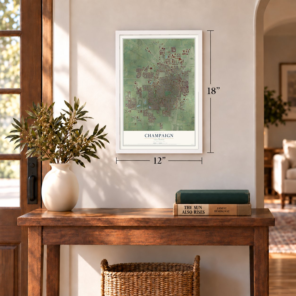
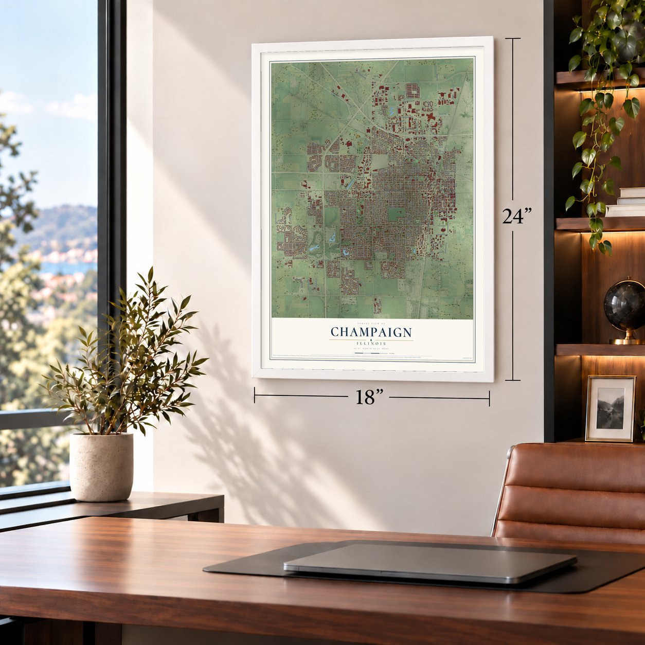
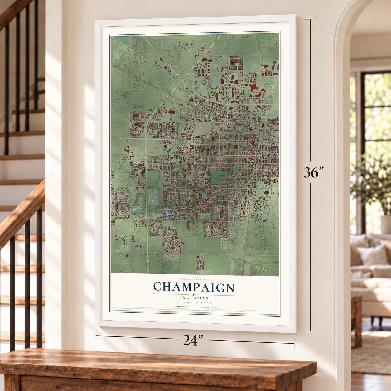
Champaign, Illinois Map Art
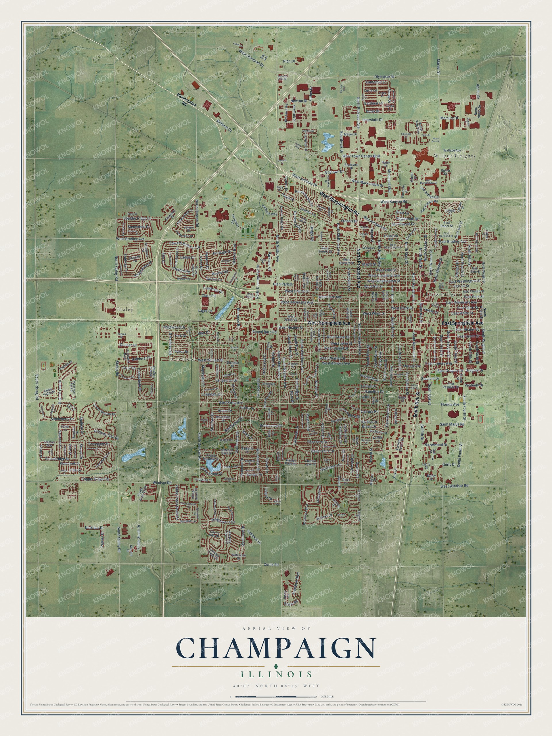
A new map of Champaign, Illinois, made in 2026 and printed to order on thick archival matte paper.
12" x 18" Archival Matte Print
A Map of Home. A Work of Art.
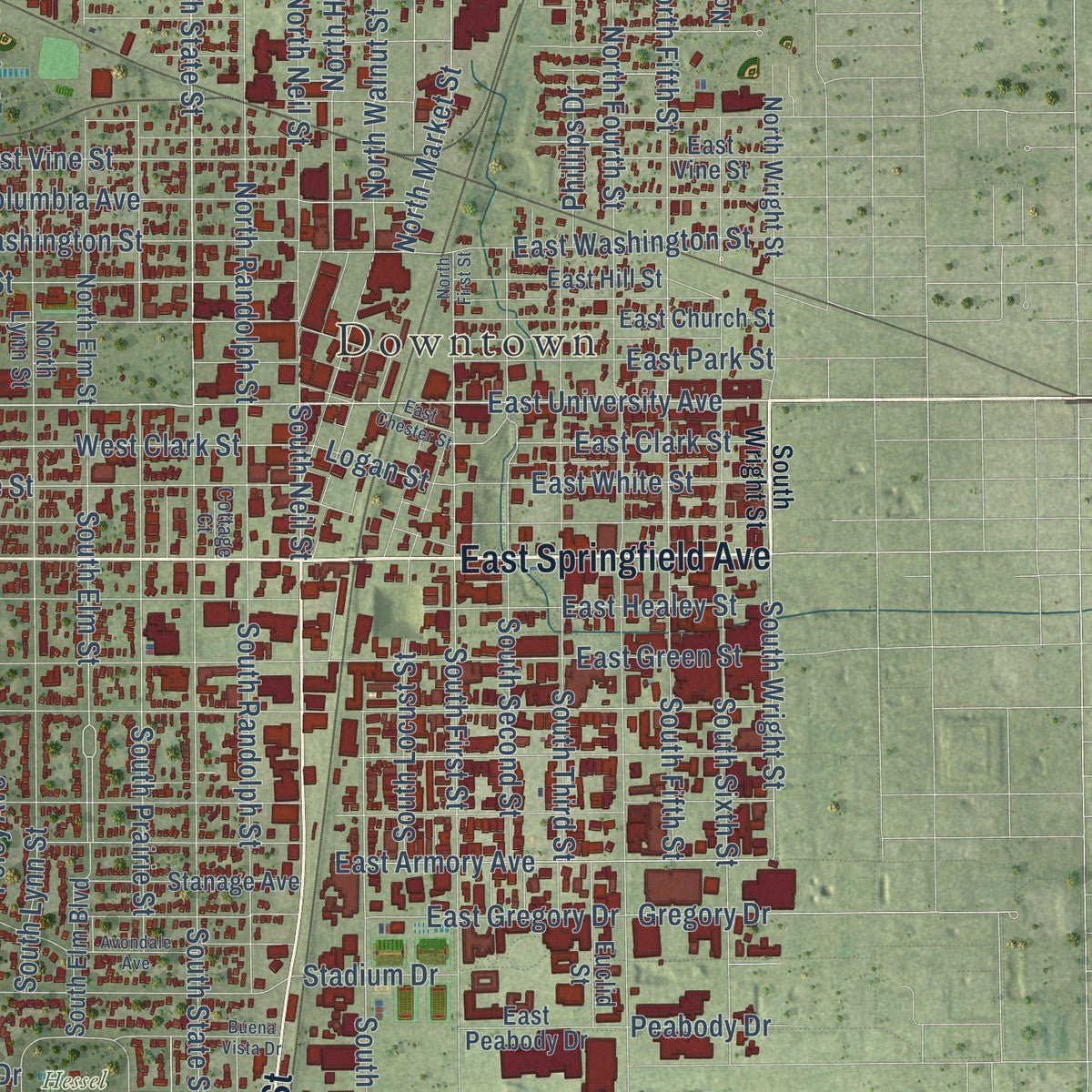
Explore Champaign, Illinois from a whole new perspective. Created using aerial imagery and detailed geographic data, this map captures Champaign building by building, with labeled streets, familiar landmarks, and shaded topographical relief that highlights the natural contours of the landscape.
Combining modern data with the timeless character of a vintage atlas, this map is just as interesting up close as it is beautiful on the wall. Whether you grew up in Champaign, spent memorable years there, or call it home today, this unique map is a great way to celebrate a place that means something to you. Zoom in on the preview to look for your street, and then order a print to put your memories on the wall.
Three ways to hang it
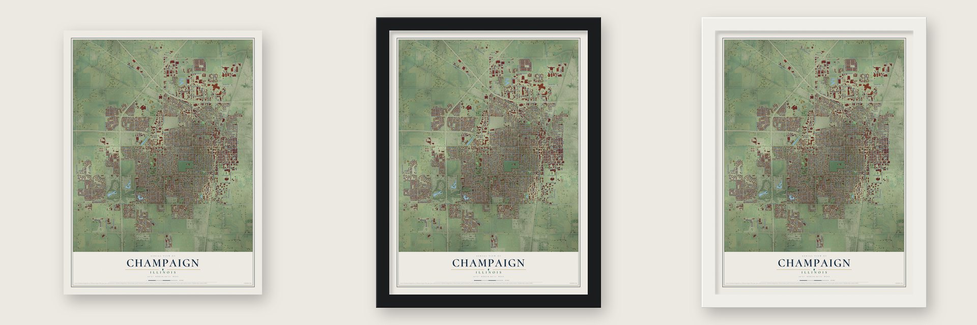
Unframed archival matte, a black wood frame or a white wood frame.
Up close
Geography Worth Displaying
This map was created using accurate cartographic data and authoritative geographic sources, including the U.S. Geological Survey and the Census Bureau. The map brings together terrain, waterways, roads, and building detail. The majority of the streets are labeled, houses are accurately depicted, and the topography is derived from government sources. Combining local data with carefully composed color and shading leads to this beautifully detailed Champaign artwork for your wall.
Rather than simply showing street outlines, we’ve included as many of the street names as we could reasonably fit on the map while keeping their names legible. Zoom in on the high resolution preview to see exactly what’s on the map. We truly set out to create a statement piece for anyone who loves Champaign. So whether it’s for you, or a gift for someone you love, we hope this map of Champaign brings back fond memories.
Read the story behind this map of Champaign, Illinois from 2026.

About Champaign, Illinois
Champaign is a city in Champaign County, Illinois. The 2020 census recorded 88,302 residents.
- 88,302 residents in 2020For the 2020 census, the recorded population of Champaign was 88,302.
- A Champaign County cityChampaign is a city in Champaign County, Illinois.
- 23.14 square milesTotal area reported for the community is 23.14 square miles.
- Founding yearThe founding of Champaign dates to 1855.
Find your street
Names on the Champaign map
Every name below is printed on this map. Look for your street, your school, the park where you played, or the pond down the road.
Places and landmarks7
- Downtown
- Staley
- Kenwood
- Dodds Park
- Hessel Park
- Zahnd Park
- Wilbur Heights
Streets and roads424
- West Bloomington Road
- North Prospect Avenue
- East Springfield Avenue
- South Neil Street
- West Springfield Avenue
- Olympian Drive
- West University Avenue
- East University Avenue
- North State Street
- Clayton Boulevard
- Bloomington Road
- Edward Hoffman Drive
- Clayton Road
- Erin Drive
- West Olympian Drive
- West Windsor Road
- South Wright Street
- Valley Brook Drive
- Balmoral Drive
- Boardwalk Drive
- East Bradley Avenue
- West Bradley Avenue
- South Mattis Avenue
- North Mattis Avenue
- Pomona Drive
- West Marketview Drive
- Valley Brook South Drive
- West Church Street
- Fox Drive
- North Hickory Street
Show all 424 streets
- Savanna Drive
- South Elm Street
- Lauterbur Lane
- Market Street
- Bellamy Drive
- Irvine Road
- Strand Drive
- Windsor Road
- South Duncan Road
- West John Street
- West Kirby Avenue
- Curtis Road
- West William Street
- North Market Street
- South Prospect Avenue
- North Neil Street
- South First Street
- West Anthony Drive
- Staley Road
- West Green Street
- West Healey Street
- West Clark Street
- Interstate Drive
- North Duncan Road
- Devonshire Drive
- Scottsdale Drive
- West White Street
- Crescent Drive
- West Washington Street
- Mayfair Road
- South Rising Road
- South State Street
- West Columbia Avenue
- Galen Drive
- South Fourth Street
- Broadmoor Drive
- West Park Avenue
- South Staley Road
- West Charles Street
- Sangamon Drive
- Baytown Drive
- South Oak Street
- North McKinley Avenue
- Mullikin Drive
- West Daniel Street
- Kenwood Road
- South Sixth Street
- West Hill Street
- Southwood Drive
- North Willis Street
- North Staley Road
- West Vine Street
- North Walnut Street
- South Randolph Street
- South Lynn Street
- South New Street
- South Prairie Street
- Clover Lane
- South Third Street
- Paula Drive
- Lynwood Drive
- Winchester Drive
- Cobblefield Drive
- South Second Street
- Boulder Ridge Drive
- Stonebridge Drive
- Lincolnshire Drive
- East Washington Street
- North Country Fair Drive
- East Green Street
- English Oak Drive
- Garden Hills Drive
- Fields South Drive
- Hessel Boulevard
- North Fourth Street
- South Fifth Street
- North Fifth Street
- Joanne Lane
- North Randolph Street
- Hedge Road
- Hollycrest Drive
- West Town Center Boulevard
- Hallbeck Drive
- East Armory Avenue
- Rebecca Drive
- Florida Avenue
- North Harris Avenue
- Maple Street
- Stratford Drive
- South Western Avenue
- Sedgegrass Drive
- Saint Marys Road
- Harrington Drive
- Edgebrook Drive
- Griffith Drive
- South Pine Street
- Brittany Trail Drive
- South Westlawn Avenue
- Colleen Drive
- West Kenyon Road
- Moreland Boulevard
- South Locust Street
- Lawndale Drive
- Parkland Court
- Waverly Drive
- Robert Drive
- Farber Drive
- Wynstone Drive
- South Victor Street
- East Healey Street
- East Clark Street
- Maplepark Drive
- Hazelwood Drive
- South Fair Street
- Lakeside Drive
- Peach Street
- East Park Street
- Gerty Drive
- East White Street
- Freedom Boulevard
- Theodore Drive
- Newton Drive
- West Armory Avenue
- Nicklaus Drive
- Hagan Street
- Glen Park Drive
- Sumac Drive
- Cambridge Drive
- Brett Drive
- Copper Ridge Road
- Trailway Drive
- Foley Avenue
- Sandcherry Drive
- Crail Road
- Holiday Drive
- Wedgewood Drive
- Ironwood Lane
- Palmer Drive
- East Gregory Drive
- Heritage Drive
- Apollo Drive
- Natalie Drive
- Sussex Court
- Noel Drive
- Crossgate Drive
- Honeysuckle Lane
- Vale Street
- Doisy Drive
- Goldenview Drive
- Bardeen Lane
- Rion Drive
- Luria Lane
- Park Haven Drive
- Clark Road
- Breen Drive
- Rachel Road
- Ventura Road
- Hundman Drive
- Mercury Drive
- Round Barn Road
- Ridgewood Drive
- Peabody Drive
- Hamilton Drive
- Phillips Drive
- Brookwood Drive
- Sandstone Drive
- Seaton Court
- Stadium Drive
- York Drive
- Arden Drive
- Midwest Court
- Ladue Drive
- Logan Street
- Leeper Drive
- Shapp Drive
- Briar Lane
- Francis Drive
- Gregory Drive
- Valley Road
- Balboa Drive
- La Sell Drive
- Blair Drive
- Eagle Road
- Villa Drive
- Lager Drive
- Ivy Court
- Rose Drive
- Perimeter Road
- Prairie Meadow Drive
- Star Avenue
- Cherry Hills Drive
- South Elm Boulevard
- Oak Street
- Weeping Cherry Drive
- Waters Edge Road
- Melrose Drive
- Fields Drive South
- Talans Drive
- Linden Drive
- Baytowne Drive
- West Union Street
- West Eureka Street
- South Willis Street
- South Russell Street
- North Elm Street
- North Sixth Street
- Branch Road
- Parkland Way
- Alton Drive
- Hunter Pond Run
- Bluegrass Lane
- Sheridan Drive
- East Church Street
- Windward Boulevard
- Champaign Street
- West Harvard Street
- North Wright Street
- Crestwood Drive
- Foothill Drive
- East Hill Street
- Cypress Creek Road
- Frank Drive
- Abbey Fields Drive
- North Lynn Street
- North Russell Street
- North Apollo Drive
- North Draper Avenue
- Wallace Avenue
- Barberry Drive
- Corey Lane
- Carriage Centre Court
- Curtis Meadow Drive
- Summit Ridge Road
- Garden Lane
- Lincoln Place
- Cynthia Drive
- Bonnie Blair Drive
- Robeson Park Drive
- Sandhill Lane
- East Kenyon Road
- East Anthony Drive
- Rosewood Drive
- Campbell Drive
- Timberline Drive
- North Oak Street
- Prestwick Point
- Elmwood Drive
- Research Road
- Euclid Street
- Valerie Drive
- Flora Drive
- North New Street
- Richards Lane
- Watermark Drive
- East Vine Street
- Stanage Avenue
- Village Green Place
- Newmark Drive
- Creve Coeur Drive
- McDonald Drive
- Mission Drive
- Ashley Lane
- Sterling Drive
- Lakeview Drive
- Louisiana Avenue
- Crossing Court
- Juniper Drive
- Jeanne Street
- Stillwater Drive
- Harbor Point Drive
- Worcester Drive
- Vahalla Drive
- East Peabody Drive
- Farley Lane
- Stoneway Court
- Country Lane
- Meijer Drive
- Waterville Drive
- Daffodil Lane
- Ryder Lane
- Center Drive
- Dodds Drive
- Country Lake Drive
- East Roper Street
- Sylvan Drive
- Rodney Drive
- Briarwood Drive
- Benodot Street
- Emmas Way
- Liberty Circle
- David Drive
- Gerty Street
- Ross Drive
- Pinnacle Drive
- Eisner Drive
- Carver Drive
- Alma Drive
- Bailey Drive
- Peifer Lane
- Cedar Street
- Alder Lane
- Kearns Drive
- West Beardsley Avenue
- North James Street
- Centennial Drive
- South Draper Avenue
- Southmoor Drive
- East Garwood Street
- Holly Hill Drive
- South Garfield Avenue
- Clearwater Drive
- Nobel Drive
- Turnberry Drive
- Krebs Drive
- Countrybend Lane
- Sheridan Road
- Greendale Drive
- Sherwood Terrace
- Stanlay Lane
- Old Warson Road
- East Marketview Drive
- Springhill Lane
- Kankakee Drive
- Crabapple Lane
- Belmore Drive
- Brittany Drive
- Thomas Drive
- Wyndemere Point Drive
- Emerald Drive
- Fairfax Drive
- Slate Drive
- Parkside Terrace
- Pioneer Street
- Lovie Lane
- Ayrshire Drive
- West Park Court
- Gunn Drive
- Salisbury Street
- Gemini Court
- Anita Drive
- Leahs Lane
- Kelly Court
- Mitchell Court
- Cottage Court
- Cone Drive
- Sierra Court
- Oak
- Allison Lane
- Greencroft Drive
- Wilshire Court
- Chestnut Grove Drive
- Dogwood Drive
- Avondale Avenue
- North Fair Street
- Buena Vista Drive
- Old Farm Road
- South Edwin Street
- Chickory Drive
- Big Pine Trail
- South Highland Street
- Sunview Drive
- Georgetown Drive
- Casselbury Lane
- Kenny Avenue
- North First Street
- East Chester Street
- Queens Way
- Augusta Drive
- Woodridge Road
- Edinburgh Drive
- Bristol Road
- Aspen Drive
- Arrow Road
- Willowpark Drive
- Doverbrook Drive
- Wiggins Street
- Maywood Drive
- Covington Drive
- Sandcherry Court
- Rockdale Drive
- Dennison Drive
- Twins Drive
- Newbury Road
- Nottingham Drive
- Oakcrest Drive
- Waterbury Place
- Cornell Drive
- Industrial Park Road
- Redwood Drive
- Wood Duck Drive
- Dobbins Drive
- Sparton Court
- Osage Drive
- Teal Cv
Names are listed as they appear on the printed map. Zoom into the product photos to find them.
The art of mapping a place
How This Map Was Made
Real places. Remarkable detail. Discover the layers that turn geographic data into a map of home.

The view from above
Aerial imagery reveals the character of the land: woodland, open fields, and the patterns of a place.

The shape of the land
Elevation data brings hills, valleys, and subtle changes in the landscape into view.

The details of home
Roads, waterways, and building footprints come together to make the map feel unmistakably local.

Geography becomes art
Considered color, shading, and typography bring the layers together in a map made for your wall.


Process illustrated with Mendon, Massachusetts. Aerial imagery: USDA NAIP. Terrain: USGS 3D Elevation Program. Map details and finished artwork: KNOWOL.
The Details
About This Print
Choose an archival matte print, or a black or white Ayous wood frame. The archival matte print is unframed.
Select your size and finish above to see the matching product image and price.
Materials & Craftsmanship
A contemporary map with the character of a classic atlas, printed on archival matte paper. Optional frames are made from Ayous wood.
Your printed map does not include the watermark shown in the full-map preview.
Shipping & Delivery
Free shipping within the United States. Every print is made to order in the USA.
Buying a gift? Add a note in your cart and we'll include it. We never put prices in the package.
Prints ship within 2 to 3 business days. Allow 7 to 10 days total from ordering for delivery. Timing may vary during holidays or periods of high order volume.
Read our shipping policy.
Returns and damaged prints
Each print is made to order. Change-of-mind refunds are not available after production.
If your print arrives damaged, misprinted or incorrect, contact support@knowol.com within 30 days of receiving it. Include your order number, photos and a description of the issue.
Read our full refund and replacement policy. For questions about your order, email support@knowol.com.
Find your town
Looking for another city?
Find a map of home in our Illinois collection, or any town in the country.
Nearby
Maps of towns near Champaign
Know someone from one of these towns? Their map makes a great gift.
 Savoy
Savoy, Illinois
From $39.99See the map
 Urbana
, Illinois
From $39.99See the map
 Bondville
, Illinois
From $39.99See the map
More maps nearby: Mahomet, Seymour, Lake of the Woods, Tolono and Philo.