
Search for another town





Free U.S. delivery 7 to 10 days after you order
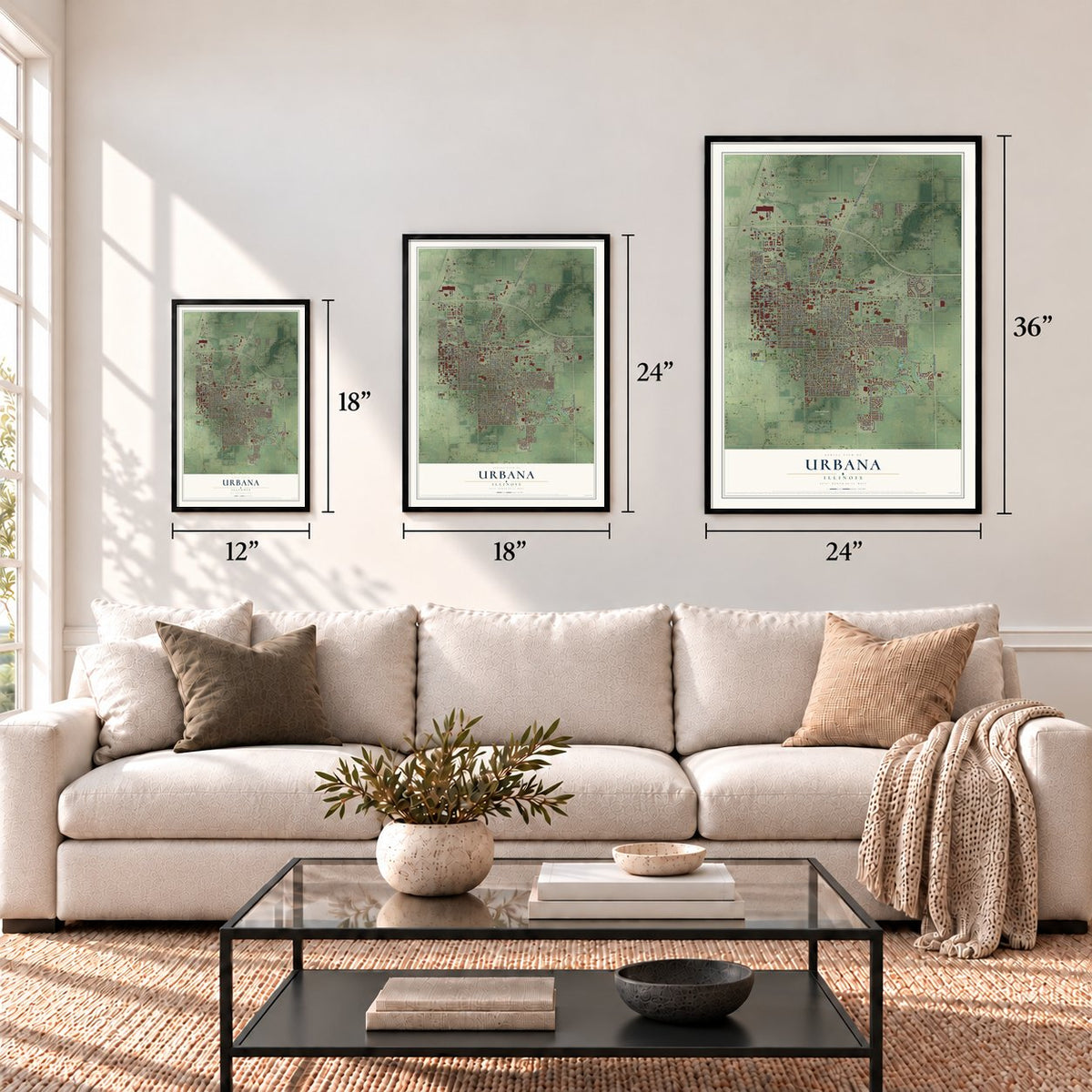
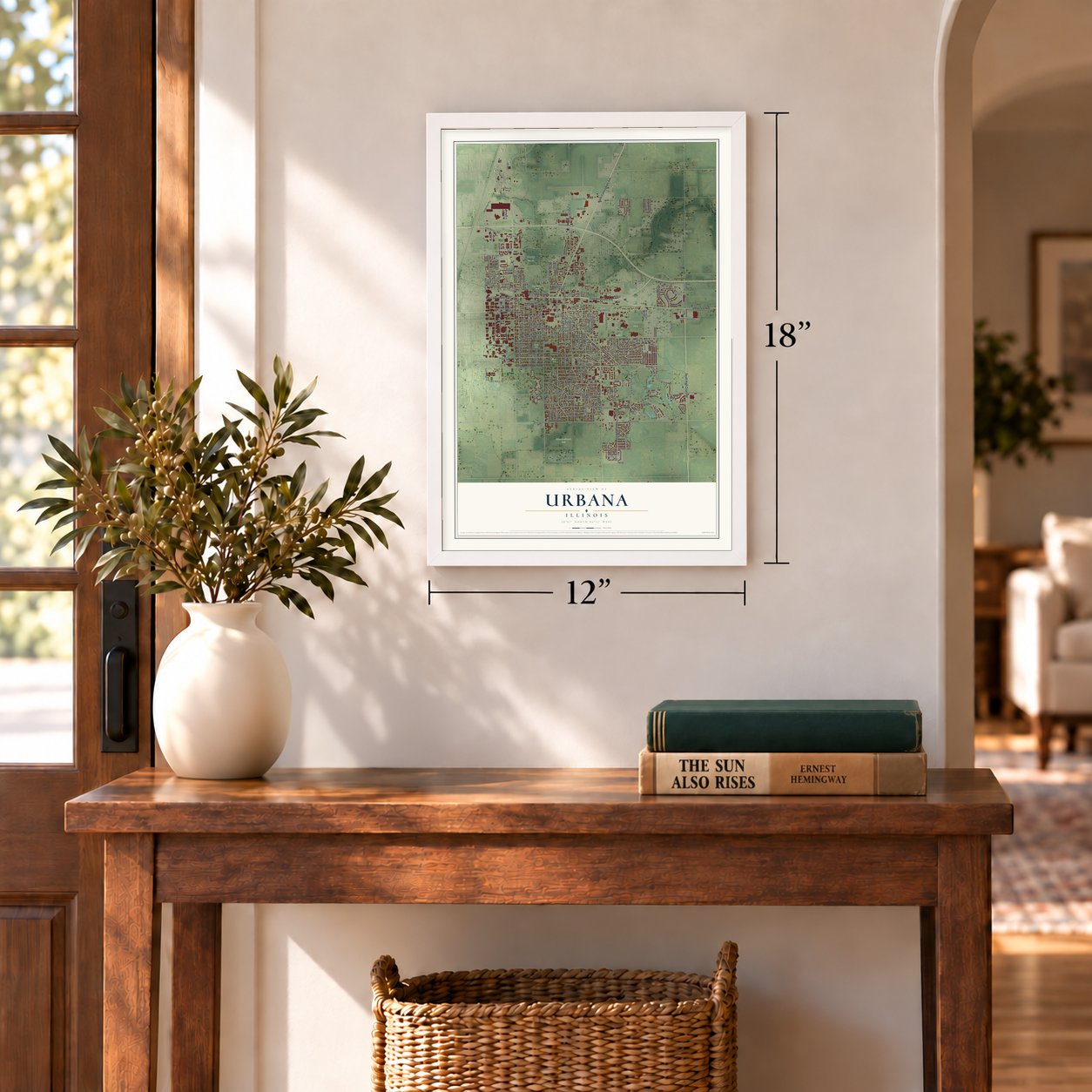
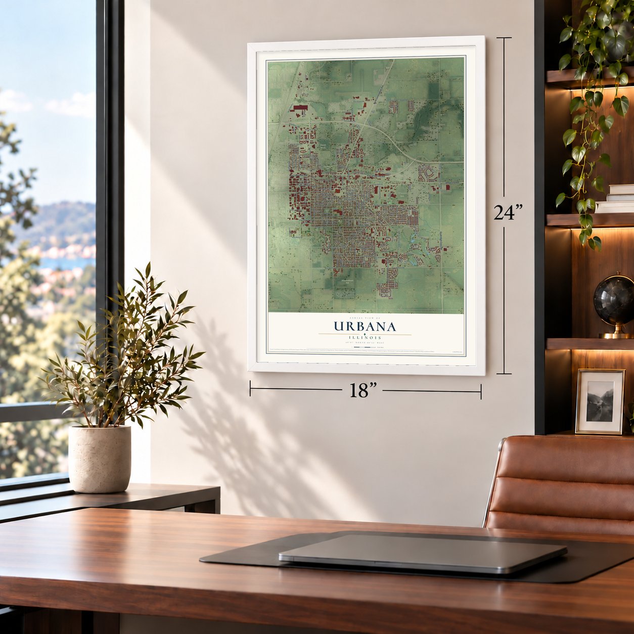
Urbana, Illinois Map Art
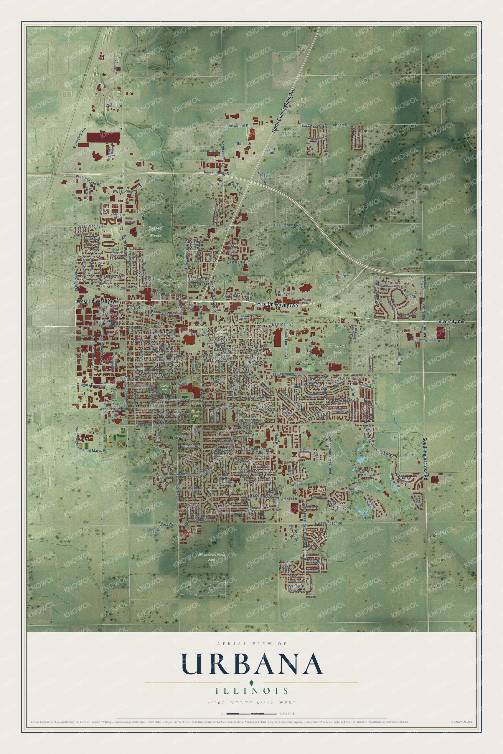
A new map of Urbana, Illinois, made in 2026 and printed to order on thick archival matte paper.
12" x 18" Archival Matte Print
A Map of Home. A Work of Art.
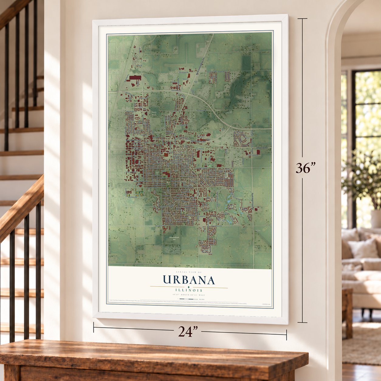
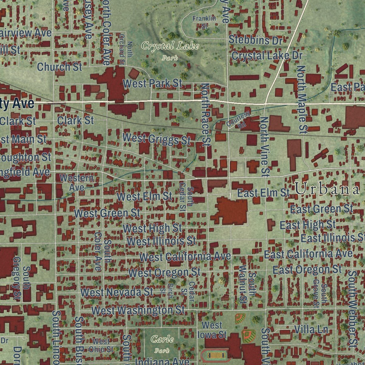
Explore Urbana, Illinois from a whole new perspective. Created using aerial imagery and detailed geographic data, this map captures Urbana building by building, with labeled streets, familiar landmarks, and shaded topographical relief that highlights the natural contours of the landscape.
Combining modern data with the timeless character of a vintage atlas, this map is just as interesting up close as it is beautiful on the wall. Whether you grew up in Urbana, spent memorable years there, or call it home today, this unique map is a great way to celebrate a place that means something to you. Zoom in on the preview to look for your street, and then order a print to put your memories on the wall.
Three ways to hang it
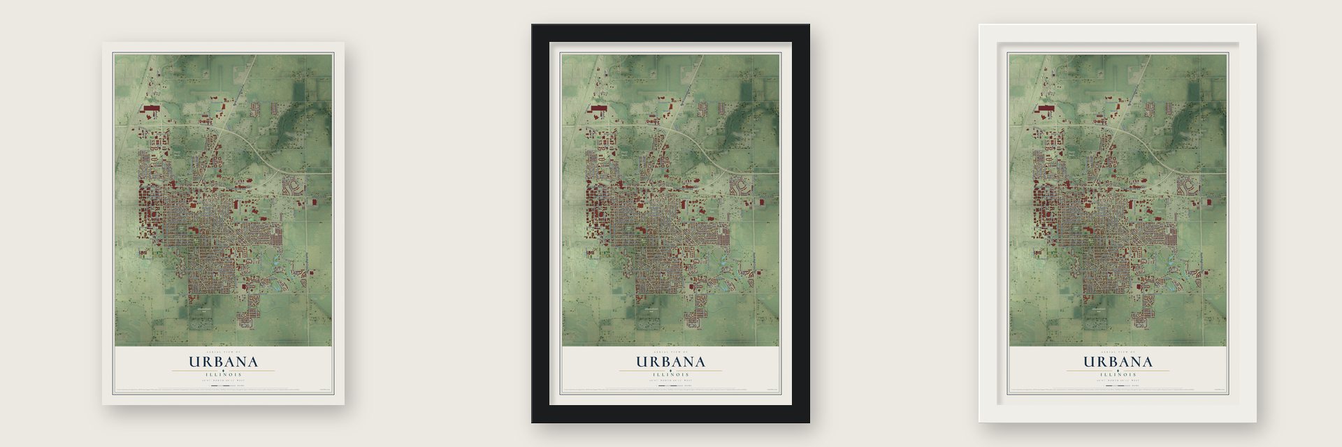
Unframed archival matte, a black wood frame or a white wood frame.
Up close
Geography Worth Displaying
This map was created using accurate cartographic data and authoritative geographic sources, including the U.S. Geological Survey and the Census Bureau. The map brings together terrain, waterways, roads, and building detail. The majority of the streets are labeled, houses are accurately depicted, and the topography is derived from government sources. Combining local data with carefully composed color and shading leads to this beautifully detailed Urbana artwork for your wall.
Rather than simply showing street outlines, we’ve included as many of the street names as we could reasonably fit on the map while keeping their names legible. Zoom in on the high resolution preview to see exactly what’s on the map. We truly set out to create a statement piece for anyone who loves Urbana. So whether it’s for you, or a gift for someone you love, we hope this map of Urbana brings back fond memories.
Read the story behind this map of Urbana, Illinois from 2026.
About Urbana, Illinois
Urbana is a city of 38,336 people and the county seat of Champaign County. Europeans first settled here in 1822, when the place was known as Big Grove, and the county's first schoolhouse went up near William Tompkins's settlement a year before the county was formed. When Champaign County was organized in 1833, its seat was laid out on 40 acres, half given by William T. Webber and half by M. W. Busey, who is counted as the city's founder.
State Senator John W. Vance had written the law creating the county, so the new seat took the name of his hometown, Urbana, Ohio. Residents celebrated the new town for the first time on July 4, 1833, and stores opened the next year. The Illinois Central's Chicago branch was expected to run through Urbana, but it was built two miles west on flatter ground, and a rival town called West Urbana grew up around its 1854 depot.
- A courthouse to keep the seatWest Urbana took the name Champaign in 1861. Worried about losing the county seat to its growing neighbor, Urbana tore down its courthouse, then only 10 years old, and put up a much larger and fancier one. The county seat stayed in Urbana.
- A university in 1868Clark Griggs worked to bring the state's new agricultural school to Champaign-Urbana. Illinois Industrial University opened in 1868 with 77 students and grew into the University of Illinois Urbana-Champaign, whose main campus sits on the line between the two cities. The Clark R. Griggs House in Urbana joined the National Register in 1978.
- The fire of October 9, 1871Children playing with matches started a fire that burned much of downtown Urbana. It broke out one day after the Great Chicago Fire began, but the two had nothing to do with each other; both spread on high winds during a severe drought.
- A hotel for homecomingUrbana architect Joseph Royer designed the Urbana Lincoln Hotel in the Tudor Revival style, and it opened its first rooms on November 1, 1923, in time to house visitors for the university's homecoming game. A convention center in the Bavarian style was added in the 1970s.
- Candlestick Lane, about 1961Every December the families of Grant Place and nearby homes on Fairlawn and Eastern Drives fill their yards with Christmas lights and figures. Around 1961 the Illinois Power Company held a contest for the best decorated house, and the neighbors used their prize money to buy electric candlesticks for every home. The city puts up red and green street signs for the season.
Find your street
Names on the Urbana map
Every name below is printed on this map. Look for your street, your school, the park where you played, or the pond down the road.
Places and landmarks9
- Urbana City Hall
- Mira
- Busey Woods
- Crystal Lake Park
- Meadowbrook Park
- Prairie Park
- Weaver Park
- Blair Park
- Carle Park
Streets and roads257
- East University Avenue
- West University Avenue
- University Avenue
- North Cunningham Avenue
- South High Cross Road
- East Main Street
- East Fairlawn Drive
- North Broadway Avenue
- East Perkins Road
- Briarcliff Drive
- Pfeffer Road
- East California Avenue
- West Florida Avenue
- Grange Drive
- North Vine Street
- South Myra Ridge Drive
- South Philo Road
- North Willow Road
- East Colorado Avenue
- East McHenry Street
- South Kinch Street
- South Stone Creek Boulevard
- North Lincoln Avenue
- South Race Street
- East Windsor Road
- East Washington Street
- East Stone Creek Boulevard
- South Vine Street
- South Anderson Street
- East Florida Avenue
Show all 257 streets
- Philo Road
- South Cottage Grove Avenue
- East Anthony Drive
- East Michigan Avenue
- South Orchard Street
- East Mumford Drive
- Airport Road
- South Lincoln Avenue
- East Airport Road
- West Pennsylvania Avenue
- West Green Street
- Springfield Avenue
- North Goodwin Avenue
- South Lynn Street
- Myra Ridge Drive
- South Goodwin Avenue
- South Busey Avenue
- West Oregon Street
- North Coler Avenue
- West Main Street
- West Nevada Street
- West Park Street
- West Illinois Street
- East Green Street
- North Mathews Avenue
- West Delaware Avenue
- East Illinois Street
- East Oregon Street
- West Stoughton Street
- East Scovill Street
- South Lierman Avenue
- North Busey Avenue
- North Romine Street
- West Bradley Avenue
- West Kenyon Road
- West Vermont Avenue
- West Michigan Avenue
- West California Avenue
- North Oak Street
- Church Street
- East Kerr Avenue
- West High Street
- South Webber Street
- Harding Drive
- Burlison Drive
- Butzow Drive
- Smith Road
- West Washington Street
- West Elm Street
- Hill Street
- Orchard Drive
- Illini Airport Road
- Trails Drive
- South Poplar Street
- Fairview Avenue
- Saint Marys Road
- South Glover Avenue
- North Wright Street
- Eliot Drive
- East Silver Street
- Silver Street
- Kinch Street
- East Elm Street
- Willard Street
- High Cross Road
- South Mathews Avenue
- North Abbey Road
- Pond Street
- Obrien Drive
- North Maple Street
- Gregory Drive
- East Beringer Circle
- Division Avenue
- West Killarney Street
- Brighton Drive
- Rutherford Drive
- Montgomery Street
- Vawter Street
- Cureton Drive
- Lanore Drive
- Abercorn Street
- North Race Street
- East Park Street
- West Windsor Road
- West Clark Street
- East High Street
- Colorado Avenue
- Easy Street
- Wabash Avenue
- Somerset Drive
- West Griggs Street
- Hunter Street
- Golfview Drive
- Crystal Lake Drive
- Marc Trail
- Skyline Drive
- Haydon Drive
- Villa Lane
- Fieldcrest Drive
- Indiana Avenue
- Montclair Road
- Tatman Drive
- Dorner Drive
- Burkwood Drive
- Saline Court
- Amber Lane
- Stebbins Drive
- Boulder Drive
- Clark Street
- Harmon
- Horizon Lane
- Vernon Drive
- Eureka Street
- Sunny Lane
- Somer Drive
- Ellis Drive
- Kingston Drive
- East George Huff Drive
- West George Huff Drive
- East Pennsylvania Avenue
- South Maple Street
- Rainbow View Court
- Country Squire Drive
- East Amber Lane
- West Iowa Street
- Art Bartell Road
- South Frontage Road
- East Castlerock Drive
- South Coler Avenue
- West Eads Street
- North High Cross Road
- North Boyden Street
- South Muirfield Place
- North Linview Avenue
- East Vermont Avenue
- North Kenyon Road
- Susan Stone Drive
- South Gregory Street
- East Holmes Street
- Western Avenue
- South Smith Road
- North Beringer Circle
- Melrose Boulevard
- College Court
- Lantern Hill Drive
- Eastern Drive
- South Wright Street
- Lincolnwood Drive
- Stone Creek Boulevard
- Ivanhoe Way
- Stricker Lane
- Memory Lane
- Stillwater Landing
- North Federal Drive
- Hazelwood Drive
- Cobble Creek Drive
- Bohn Circle
- Mitchem Drive
- Beeson Drive
- South Walnut Street
- Cottage Grove Avenue
- Newport Drive
- Pleasant Street
- Tatman Court
- South Dodson Drive
- Rutledge Drive
- Wilson Road
- Tremont Street
- Weaver Drive
- Ridge Park Drive
- North Shore Drive
- South Wiley Drive
- Clarion Road
- Rocky Lane
- Berkley Avenue
- Vance Road
- Baronry Drive
- Lucas Street
- Barr Street
- Mills Drive
- Oak Street
- East Harding Drive
- South Grove Street
- Boudreau Drive
- Prairie Winds Circle
- West Gregory Drive
- Carle Avenue
- Cedar Street
- East Delaware Avenue
- Orchard Place
- East Water Street
- Prairie Green Drive
- West Beardsley Avenue
- West Ohio Street
- Lexington Drive
- South Burlison Drive
- Fairfield Drive
- Johnson Avenue
- Shurts Street
- Silver Hill Drive
- Evergreen Court East
- Larch Place
- Hawthorne Drive
- Grant Place
- Wyld Drive
- Geraldine Avenue
- Meadow Drive
- Eagle Ridge Court
- South Cedar Street
- Morrow Court
- Lydia Court
- Myra Station Road
- East Country Club Road
- Birch Street
- Melrose Village Circle
- North Orchard Street
- East Sunnycrest Drive
- Fletcher Street
- Reinhold Drive
- Peabody Drive
- West Beverly Drive
- Eagle Ridge Road
- Plantation Point
- Laurel Drive
- Franklin Street
- Courtesy Road
- Hillshire Drive
Names are listed as they appear on the printed map. Zoom into the product photos to find them.
The art of mapping a place
How This Map Was Made
Real places. Remarkable detail. Discover the layers that turn geographic data into a map of home.

The view from above
Aerial imagery reveals the character of the land: woodland, open fields, and the patterns of a place.

The shape of the land
Elevation data brings hills, valleys, and subtle changes in the landscape into view.

The details of home
Roads, waterways, and building footprints come together to make the map feel unmistakably local.

Geography becomes art
Considered color, shading, and typography bring the layers together in a map made for your wall.


Process illustrated with Mendon, Massachusetts. Aerial imagery: USDA NAIP. Terrain: USGS 3D Elevation Program. Map details and finished artwork: KNOWOL.
The Details
About This Print
Choose an archival matte print, or a black or white Ayous wood frame. The archival matte print is unframed.
Select your size and finish above to see the matching product image and price.
Materials & Craftsmanship
A contemporary map with the character of a classic atlas, printed on archival matte paper. Optional frames are made from Ayous wood.
Your printed map does not include the watermark shown in the full-map preview.
Shipping & Delivery
Free shipping within the United States. Every print is made to order in the USA.
Buying a gift? Add a note in your cart and we'll include it. We never put prices in the package.
Prints ship within 2 to 3 business days. Allow 7 to 10 days total from ordering for delivery. Timing may vary during holidays or periods of high order volume.
Read our shipping policy.
Returns and damaged prints
Each print is made to order. Change-of-mind refunds are not available after production.
If your print arrives damaged, misprinted or incorrect, contact support@knowol.com within 30 days of receiving it. Include your order number, photos and a description of the issue.
Read our full refund and replacement policy. For questions about your order, email support@knowol.com.
Find your town
Looking for another city?
Find a map of home in our Illinois collection, or any town in the country.
Nearby
Maps of towns near Urbana
Know someone from one of these towns? Their map makes a great gift.
 Champaign
, Illinois
From $39.99See the map
 Savoy
Savoy, Illinois
From $39.99See the map
 Philo
Philo, Illinois
From $39.99See the map
More maps nearby: St. Joseph, Sidney, Tolono, Bondville and Thomasboro.