
Search for another town





Free U.S. delivery 7 to 10 days after you order
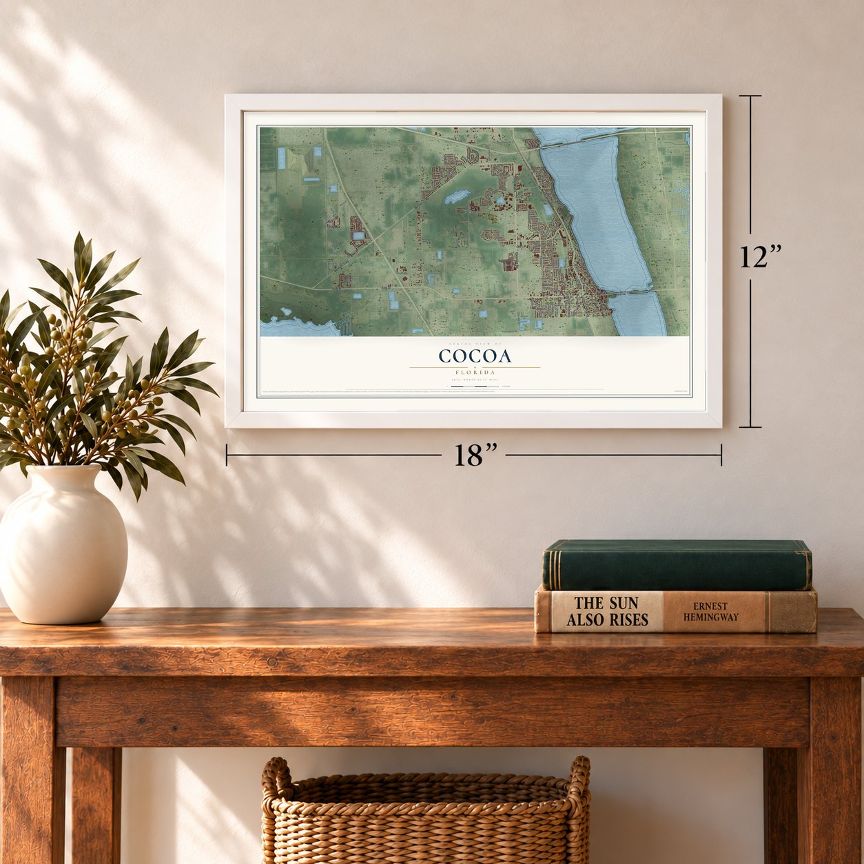
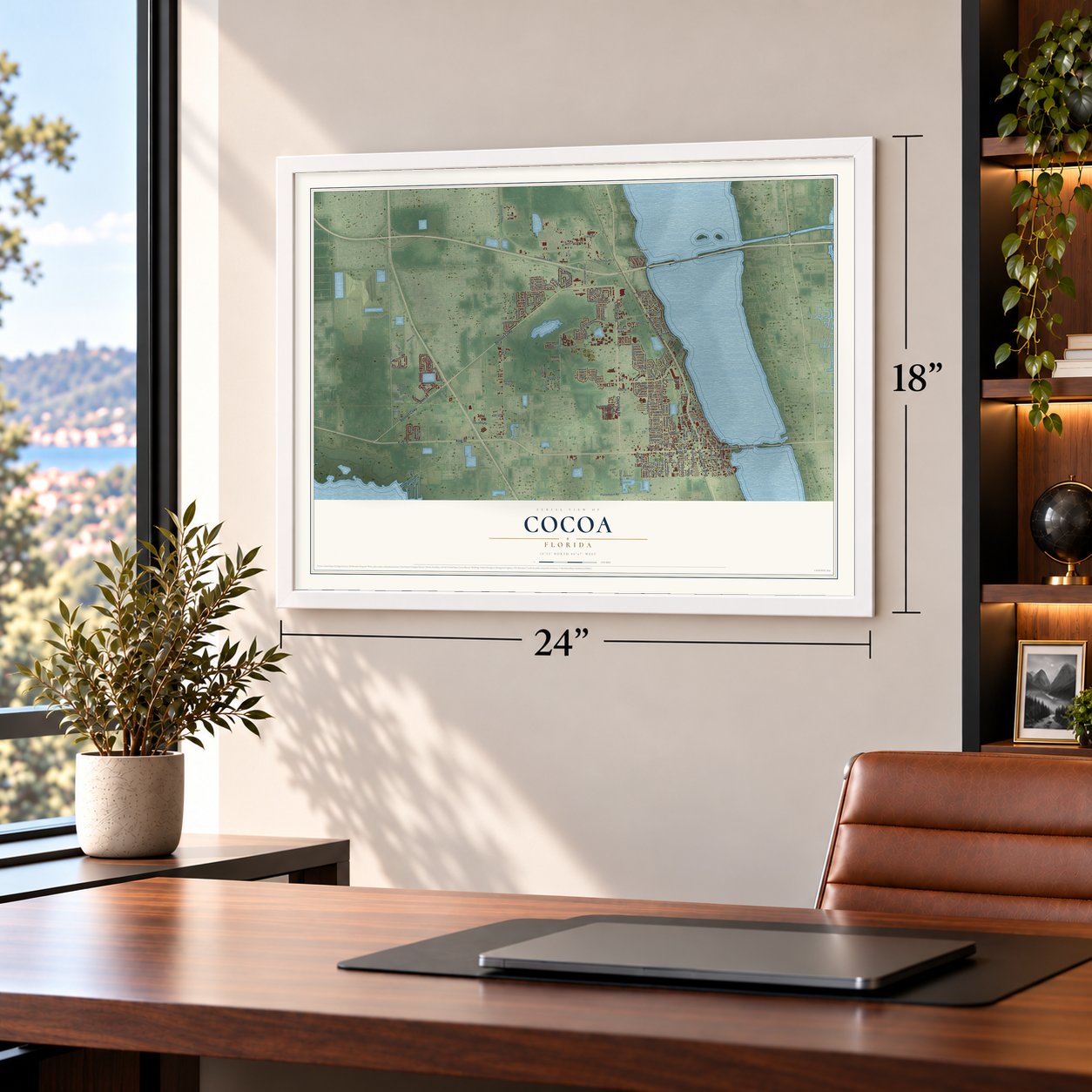
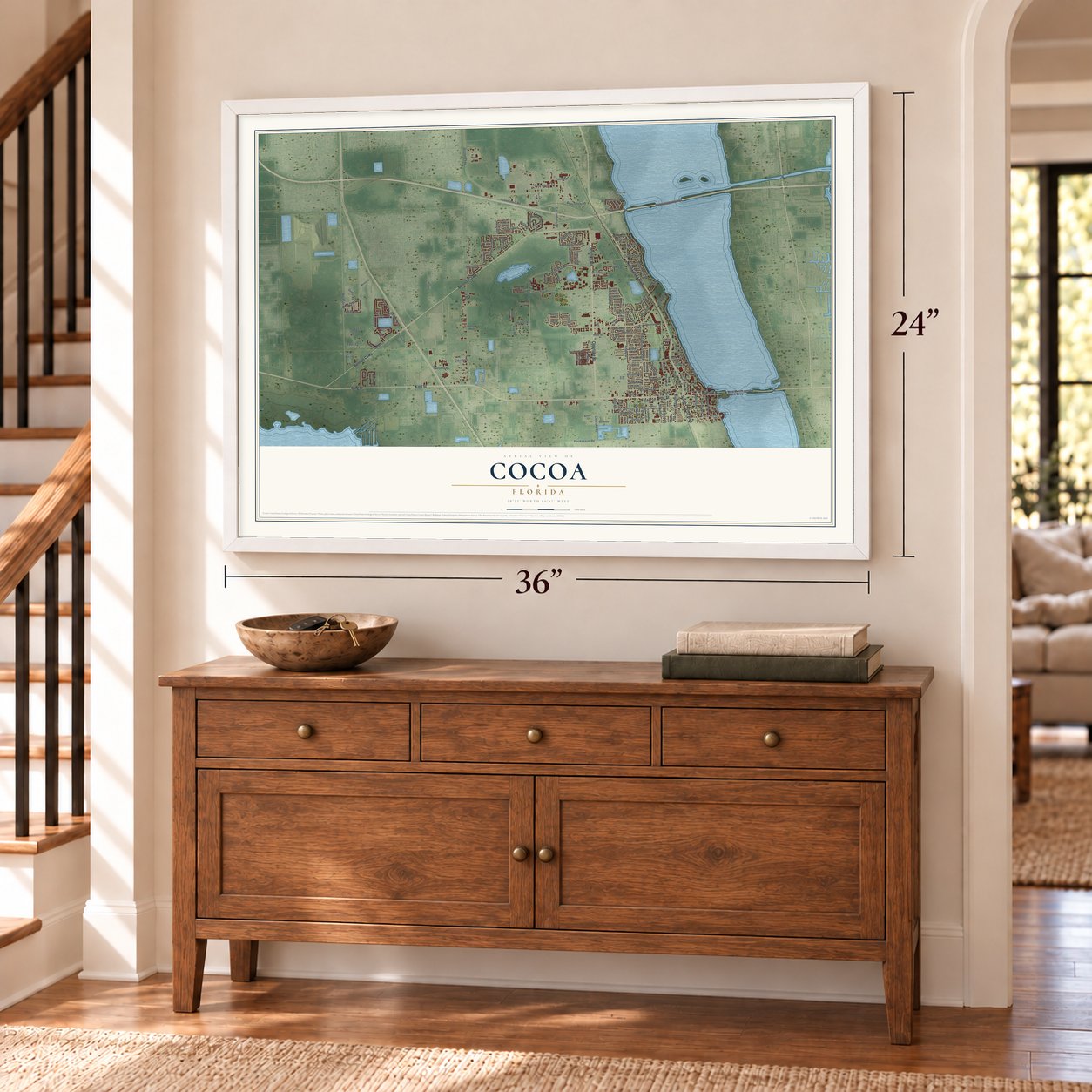
Cocoa, Florida Map Art
A new map of Cocoa, Florida, made in 2026 and printed to order on thick archival matte paper.
12" x 18" Archival Matte Print
A Map of Home. A Work of Art.
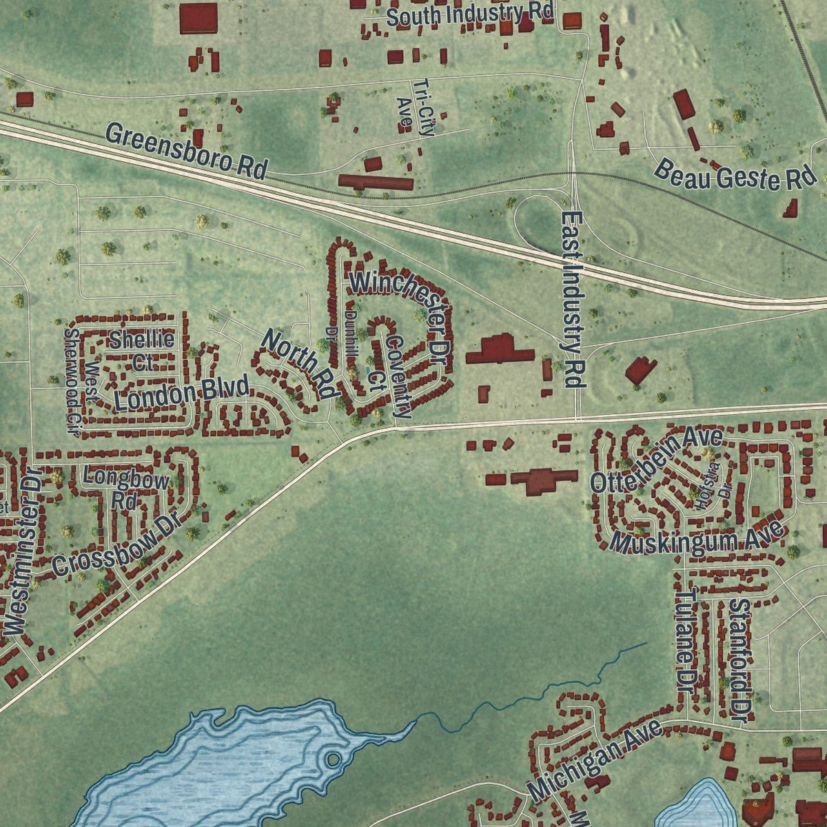
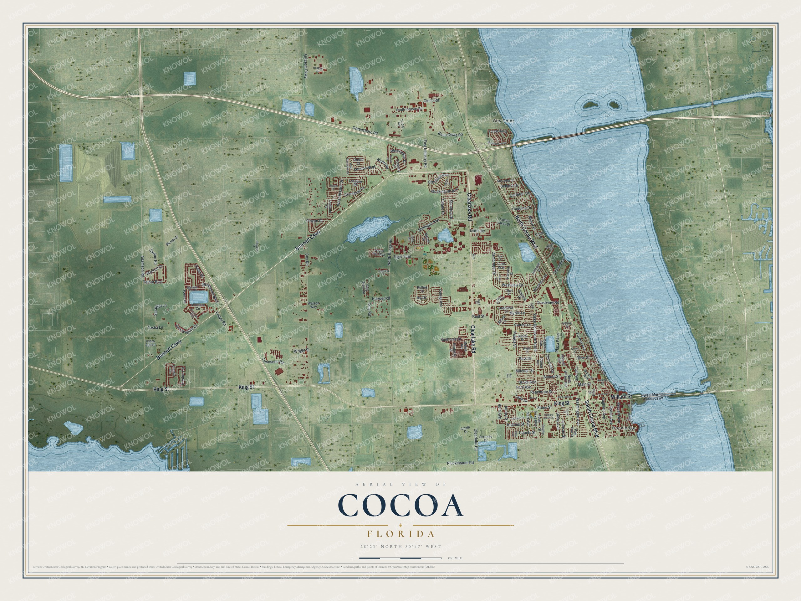
Explore Cocoa, Florida from a whole new perspective. Created using aerial imagery and detailed geographic data, this map captures Cocoa building by building, with labeled streets, familiar landmarks, and shaded topographical relief that highlights the natural contours of the landscape.
Combining modern data with the timeless character of a vintage atlas, this map is just as interesting up close as it is beautiful on the wall. Whether you grew up in Cocoa, spent memorable years there, or call it home today, this unique map is a great way to celebrate a place that means something to you. Zoom in on the preview to look for your street, and then order a print to put your memories on the wall.
Three ways to hang it
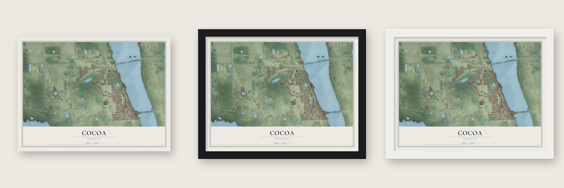
Unframed archival matte, a black wood frame or a white wood frame.
Up close
Geography Worth Displaying
This map was created using accurate cartographic data and authoritative geographic sources, including the U.S. Geological Survey (USGS) and FEMA. The map brings together terrain, waterways, roads, and building detail. The majority of the streets are labeled, houses are accurately depicted, and the topography is derived from government sources. Combining local data with carefully composed color and shading leads to this beautifully detailed Cocoa artwork for your wall.
Rather than simply showing street outlines, we’ve included as many of the street names as we could reasonably fit on the map while keeping their names legible. Zoom in on the high resolution preview to see exactly what’s on the map. We truly set out to create a statement piece for anyone who loves Cocoa. So whether it’s for you, or a gift for someone you love, we hope this map of Cocoa brings back fond memories.
Explore the full map of Cocoa, Florida and read about the local places it shows.

About Cocoa, Florida
Cocoa is a city of 19,041 people in Brevard County, on the Indian River. Old-timers disagree about the name. Some say it came from a Baker's Cocoa tin nailed to a river piling that served as the mailbox. Others credit an early riverside hotel called the Cocoa House, or a woman on the bank who handed hot cocoa to passing sailors. S. F. Travis Hardware opened in 1885 and still does business. Fire wiped out most of the business district in 1890. New building followed once the Jacksonville, St. Augustine and Indian River Railway reached Cocoa, and the city received its charter on October 1, 1895.
A few months before the charter, the Great Freeze of the winter of 1894 and 1895 had killed the citrus crop and pushed many grove workers into other jobs, and by 1903 only 382 people were left. Growth returned in the 1910s. A state directory for 1911 and 1912 counted 550 residents, an estimate put 1,800 here by 1925, and the town kept growing through the Great Depression to 2,200 by 1930. The space program brought the biggest change. Crowds came to watch launches from Cape Canaveral, and the population, which stood at 3,098 in 1940, had reached 12,244 by 1960.
- The Aladdin Theater, 1924The Aladdin Theater opened on August 18, 1924, at 300 Brevard Avenue, showing silent films alongside live performers. It went by other names over the years before it became the Cocoa Village Playhouse. A restoration from 1985 through 1989 brought it back, and in the 1993 movie Matinee it played the part of a theater in Key West. The Aladdin is on the National Register.
- A coquina house from 1916Edward Postell Porcher was a citrus grower credited as the first to wash, grade and inspect his fruit. In 1916 he built his house on Delannoy Avenue from coquina rock dug nearby. The city bought it in the 1950s and ran City Hall from it, and the Porcher House is now on the National Register.
- Astros spring trainingCocoa put up a ballpark for the Houston Colt .45s and held its dedication on March 15, 1964. The club kept training here after it took the name Houston Astros. Early in the 1980s the city asked the team to cover repairs the stadium needed, and in 1985 the Astros answered by moving their camp to Osceola County Stadium in Kissimmee. After that, the county government took over talks with major league teams.
- The Angel of Platform 6Abbie Sweetwine grew up in Cocoa and became an Army and later Air Force nurse. The nickname Angel of Platform 6 came from a British paper, the Daily Mirror, and her team gets credit for leading Britain to use paramedics. She retired a major in 1969 and came home.
- A Medal of Honor soldierEmory L. Bennett's family moved to Cocoa in 1937, and he worked at their fish market on the Indian River before finishing Cocoa High School in 1948. Fighting in Korea in 1951, he stayed back to cover his company as it pulled out and was killed, and he received the Medal of Honor. His statue stands in Cocoa Riverfront Park, and he is buried in Pinecrest Cemetery.
Find your street
Names on the Cocoa map
Every name below is printed on this map. Look for your street, your school, the park where you played, or the pond down the road.
Places and landmarks2
- Rockledge
- City Point
Streets and roads159
- Bennett Causeway
- Willard Street
- South Cocoa Boulevard
- King Street
- North Cocoa Boulevard
- Clearlake Road
- North Range Road
- Forrest Avenue
- Michigan Avenue
- East Industry Road
- Indian River Drive
- Cox Road
- Grissom Parkway
- Dixon Boulevard
- Pineda Street
- Fiske Boulevard North
- Peachtree Street
- Talbot Boulevard
- Adamson Road
- Cidco Road
- Stone Street
- School Street
- Greensboro Road
- Townsend Road
- Otterbein Avenue
- Outer Drive
- Plaza Parkway
- Saratoga Lane
- Cambridge Drive
- London Boulevard
Show all 159 streets
- Florida Avenue
- Varr Avenue
- Blake Avenue
- Woodsmill Boulevard
- Dryden Circle
- Friday Road
- Brevard Avenue
- Washington Avenue
- Pluckebaum Road
- Hughlett Avenue
- Beau Geste Road
- Tiger Trail
- Myrtle Lane
- Aurora Street
- Olive Street
- Westminster Drive
- Mitchell Street
- Westview Drive
- Crossbow Drive
- Tulane Drive
- Extravagant Court
- Winchester Drive
- Hooper Road
- Sunhome Street
- Mycroft Drive
- Holmes Street
- Ivy Drive
- Saxton Road
- Main Street
- Lake Drive
- Grove Avenue
- Fern Avenue
- Muskingum Avenue
- Coquina Drive
- Manor Drive
- Crestview Road
- Carleton Drive
- Pinyon Drive
- Johnson Street
- Churchill Drive
- Gray Road
- Tasha Lane
- Stanford Drive
- Bellaire Drive
- Counts Street
- Taft Avenue
- North Road
- Wright Street
- Reid Street
- Ruth Avenue
- Park Drive
- Bristol Drive
- College Avenue
- Prospect Avenue
- Sorrento Drive
- Cocoa Lakes Drive
- South Fiske Boulevard
- Amalfi Drive
- Cressa Circle
- Willow Lane
- Japonica Lane
- Brilliance Circle
- Cypress Lane
- University Lane
- Scenic Drive
- South Industry Road
- Audubon Drive
- Thomas Avenue
- North Wilson Avenue
- Forest Hill Drive
- Hillsdale Drive
- Brunson Boulevard
- Mercer Drive
- Kensington Drive
- Harvard Drive
- Longbow Road
- Cocoa Bay Boulevard
- Avon Place
- Indian Circle
- Kimberly Street
- Paw Paw Street
- Mobile Avenue
- Mc Leod Drive
- Scotland Road
- Gary Hunt Road
- Circle Drive
- Duke Way
- First Street
- Shearer Boulevard
- Morely Drive
- Donley Street
- Coventry Court
- Rollins Drive
- Shellie Court
- Watson Way
- Hydro Age Lane
- Iona Drive
- Cocoa Place
- Tech Place
- West Merritt Island Causeway
- West Sherwood Circle
- Ox Bow Circle
- Jackson Street
- Westchester Drive
- Meridian Run Drive
- Riverside Drive
- West Point Drive
- Precious Boulevard
- Fairfield Drive
- Ixora Avenue
- Yale Lane
- Alligator Lane
- Tri-City Avenue
- High Street
- Tulip Lane
- Emory Lane
- Barbara Jenkins Street
- Saint Johns Street
- Dunhill Drive
- Parapet Drive
- Riveredge Boulevard
- Ohio Street
- Grimes Street
- Center Street
- Hofstra Drive
- Mulberry Street
- Loquat Street
- Tate Street
- Bay Avenue
Names are listed as they appear on the printed map. Zoom into the product photos to find them.
The art of mapping a place
How This Map Was Made
Real places. Remarkable detail. Discover the layers that turn geographic data into a map of home.

The view from above
Aerial imagery reveals the character of the land: woodland, open fields, and the patterns of a place.

The shape of the land
Elevation data brings hills, valleys, and subtle changes in the landscape into view.

The details of home
Roads, waterways, and building footprints come together to make the map feel unmistakably local.

Geography becomes art
Considered color, shading, and typography bring the layers together in a map made for your wall.


Process illustrated with Mendon, Massachusetts. Aerial imagery: USDA NAIP. Terrain: USGS 3D Elevation Program. Map details and finished artwork: KNOWOL.
The Details
About This Print
Choose an archival matte print, or a black or white Ayous wood frame. The archival matte print is unframed.
Select your size and finish above to see the matching product image and price.
Materials & Craftsmanship
A contemporary map with the character of a classic atlas, printed on archival matte paper. Optional frames are made from Ayous wood.
Your printed map does not include the watermark shown in the full-map preview.
Shipping & Delivery
Free shipping within the United States. Every print is made to order in the USA.
Buying a gift? Add a note in your cart and we'll include it. We never put prices in the package.
Prints ship within 2 to 3 business days. Allow 7 to 10 days total from ordering for delivery. Timing may vary during holidays or periods of high order volume.
Read our shipping policy.
Returns and damaged prints
Each print is made to order. Change-of-mind refunds are not available after production.
If your print arrives damaged, misprinted or incorrect, contact support@knowol.com within 30 days of receiving it. Include your order number, photos and a description of the issue.
Read our full refund and replacement policy. For questions about your order, email support@knowol.com.
Find your town
Looking for another city?
Find a map of home in our Florida collection, or any town in the country.
Nearby
Maps of towns near Cocoa
Know someone from one of these towns? Their map makes a great gift.
 Cocoa West
, Florida
From $39.99See the map
 Tropical Park
, Florida
From $39.99See the map
 Rockledge
, Florida
From $39.99See the map
More maps nearby: Sharpes, West Canaveral Groves, North Merritt Island, Merritt Island and Port St. John.