
Search for another town





Free U.S. delivery 7 to 10 days after you order
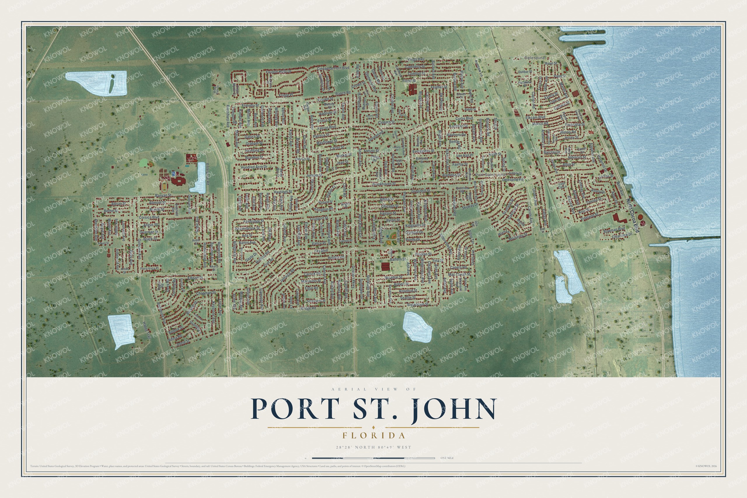
Port St. John, Florida Map Art
Building by building, with labeled streets and shaded relief.
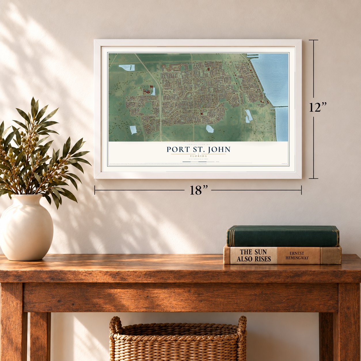
12" x 18" Archival Matte Print
A Map of Home. A Work of Art.
Explore Port St. John, Florida from a whole new perspective. Created using aerial imagery and detailed geographic data, this map captures Port St. John building by building, with labeled streets, familiar landmarks, and shaded topographical relief that highlights the natural contours of the landscape.
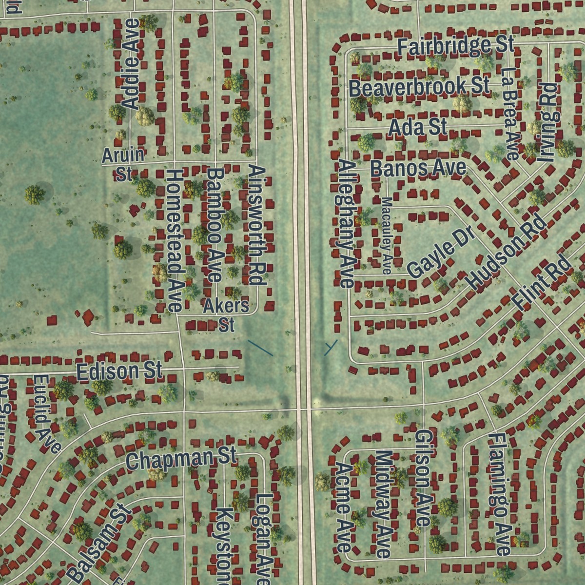
Combining modern data with the timeless character of a vintage atlas, this map is just as interesting up close as it is beautiful on the wall. Whether you grew up in Port St. John, spent memorable years there, or call it home today, this unique map is a great way to celebrate a place that means something to you. Zoom in on the preview to look for your street, and then order a print to put your memories on the wall.
Three ways to hang it
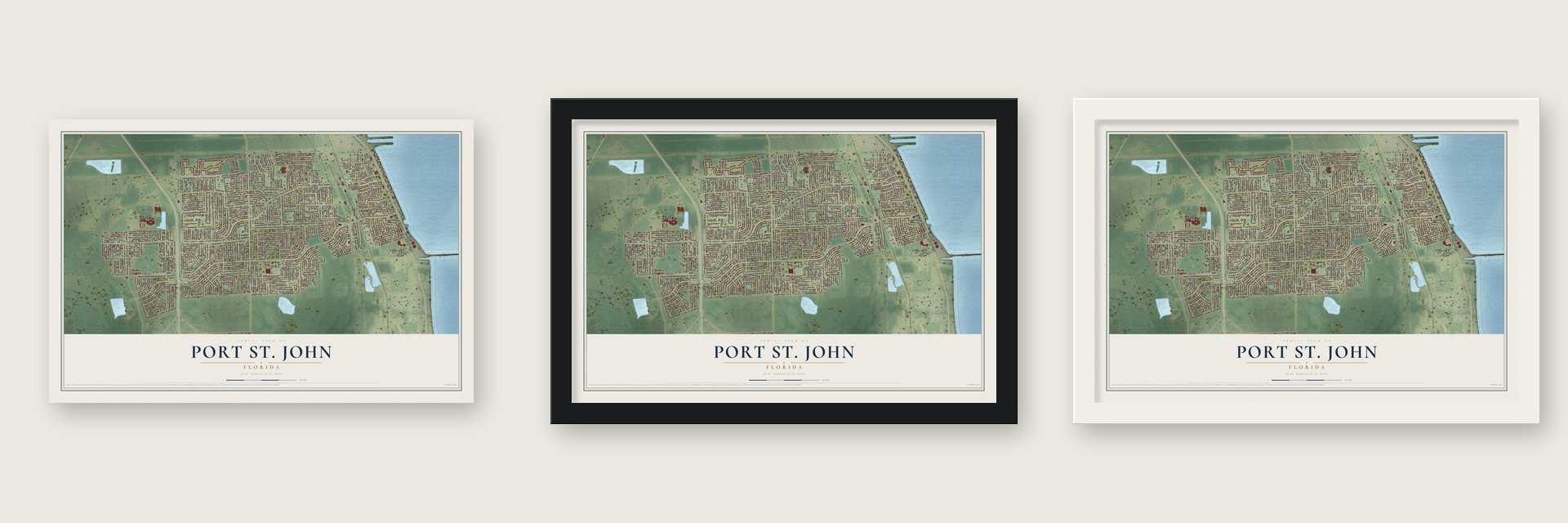
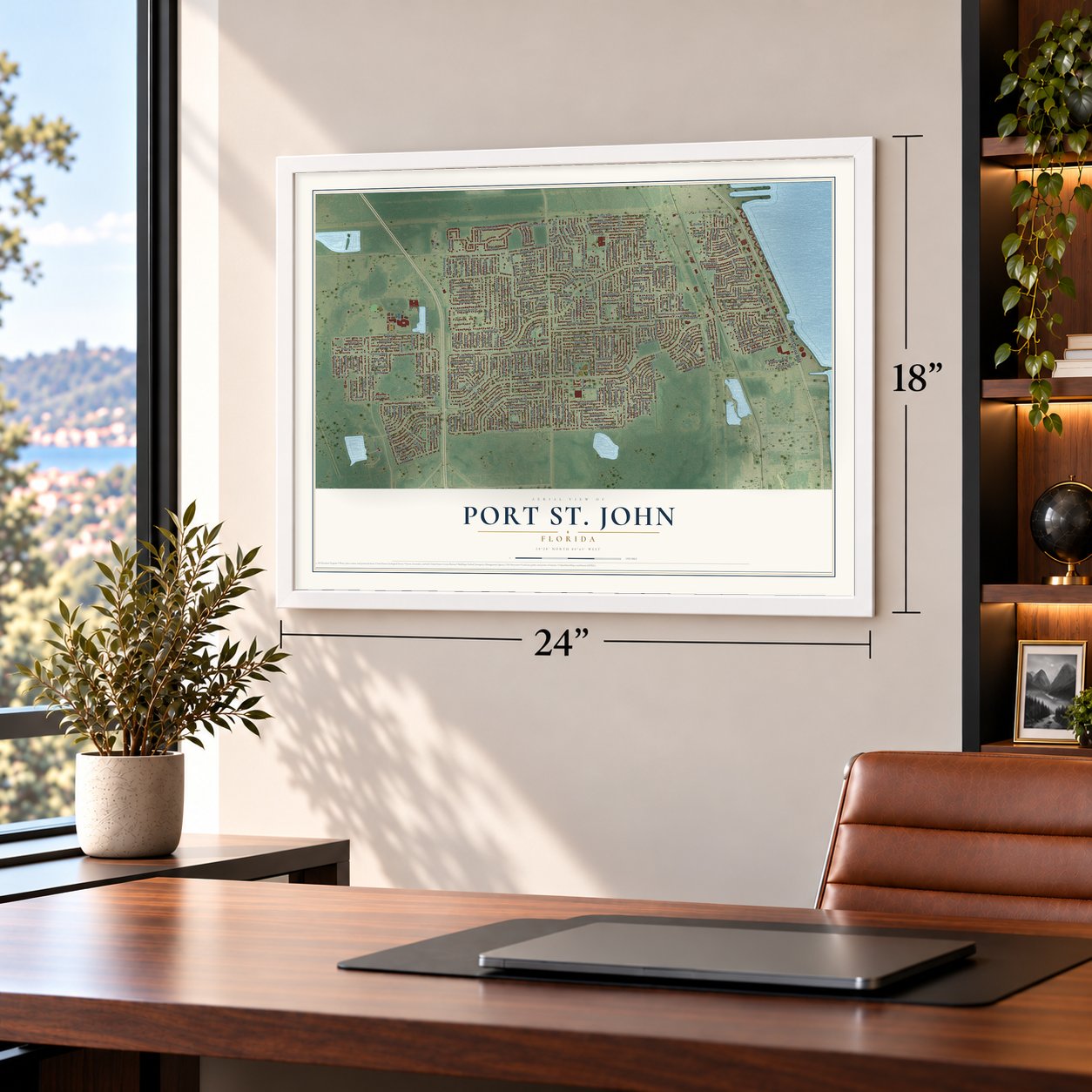
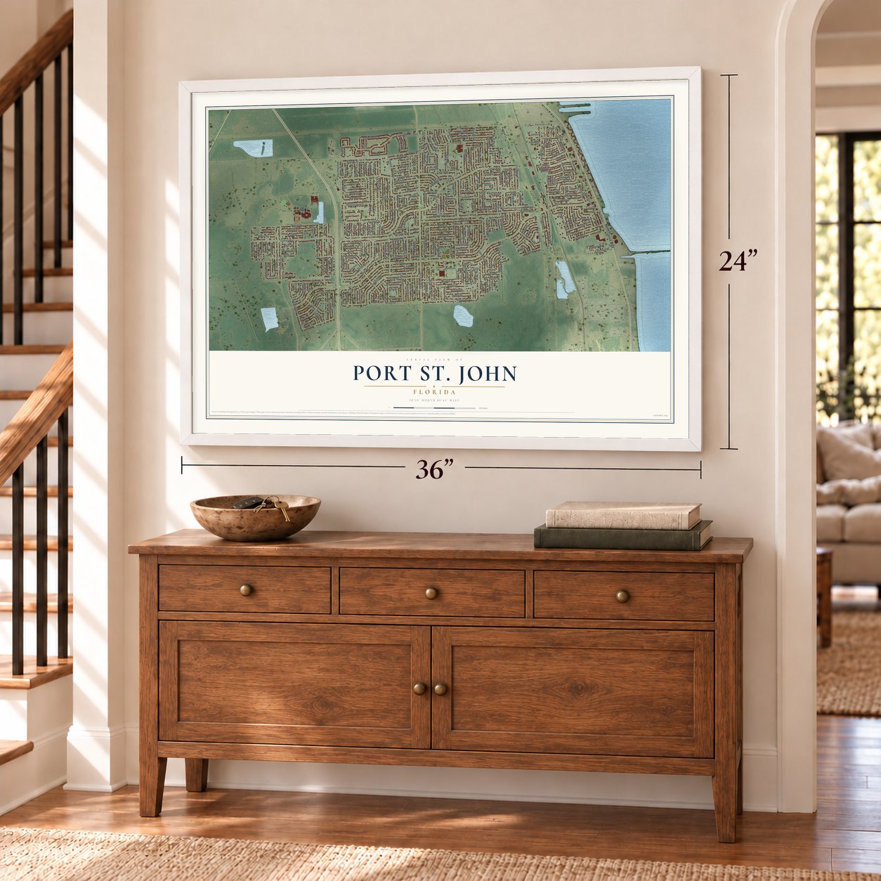
Unframed archival matte, a black wood frame or a white wood frame.
Up close
Geography Worth Displaying
This map was created using accurate cartographic data and authoritative geographic sources, including the U.S. Geological Survey and the Census Bureau. The map brings together terrain, waterways, roads, and building detail. The majority of the streets are labeled, houses are accurately depicted, and the topography is derived from government sources. Combining local data with carefully composed color and shading leads to this beautifully detailed Port St. John artwork for your wall.
Rather than simply showing street outlines, we’ve included as many of the street names as we could reasonably fit on the map while keeping their names legible. Zoom in on the high resolution preview to see exactly what’s on the map. We truly set out to create a statement piece for anyone who loves Port St. John. So whether it’s for you, or a gift for someone you love, we hope this map of Port St. John brings back fond memories.
Read the story behind this map of Port St. John, Florida from 2026.

Find your street
Names on the Port St. John map
Every name below is printed on this map. Look for your street, your school, the park where you played, or the pond down the road.
Places and landmarks2
- Delespine
- Port Saint John
Streets and roads320
- North Cocoa Boulevard
- Banyan Street
- Baltimore Avenue
- Edison Street
- Friendly Street
- Adele Street
- Aberdeen Avenue
- Kaylor Avenue
- Alleghany Avenue
- Carole Avenue
- Bowman Boulevard
- Logan Avenue
- Alamosa Street
- Ainsworth Road
- Fruitport Street
- Vineland Street
- Fairbridge Street
- Sugartown Street
- Juper Road
- Acme Avenue
- Crest Avenue
- Fay Boulevard
- Curtis Boulevard
- Ranch Road
- Grissom Parkway
- Kings Highway
- Falcon Boulevard
- Golfview Avenue
- Cinnamon Fern Boulevard
- Jamaica Road
Show all 320 streets
- Homestead Avenue
- Hundred Acre Drive
- Bridge Road
- Holden Road
- Stillwater Avenue
- Corsica Boulevard
- Delespine Road
- Song Drive
- Carrick Road
- Ackerman Avenue
- Greenhill Street
- Flint Road
- Bright Avenue
- Yaupon Holly Drive
- Deer Lane
- Ponds Drive
- Alfred Street
- Cairo Road
- Bamboo Avenue
- Arabella Lane
- Betty Avenue
- Hudson Road
- Briggs Avenue
- Camberly Street
- Piedras Street
- Bryant Road
- Chapman Street
- Enterprise Road
- Belfast Avenue
- Elkcam Boulevard
- Carlowe Avenue
- Patricia Street
- Comfort Street
- Olympic Drive
- Carillon Avenue
- Miramar Street
- Robert Street
- Capron Road
- Pluto Avenue
- Mayflower Street
- Sunflower Drive
- Macco Road
- Pleasant Avenue
- Ember Avenue
- Aron Street
- Barclay Drive
- Jumper Street
- Skyway Drive
- Everglades Street
- Leonard Avenue
- Flood Street
- West Baker Circle
- Cecil Road
- Kingsville Drive
- Poinsetta Street
- Hastings Street
- Amor Drive
- Caliph Avenue
- Hartford Road
- Balsam Street
- Allmont Street
- Scotland Street
- Cinema Street
- Cedar Avenue
- Dallas Avenue
- Glenwood Road
- Orchid Avenue
- Aires Avenue
- Manth Avenue
- Balboa Street
- Fecco Street
- Hibiscus Street
- Alcazar Avenue
- Addie Avenue
- Balfern Street
- Happy Trail
- Alden Avenue
- Oakland Street
- Carter Street
- Rena Avenue
- Everett Street
- Doreen Road
- Brookhaven Street
- Altura Drive
- Fringe Place
- Barbara Road
- Amesbury Avenue
- Clearfield Avenue
- Cannon Avenue
- Palm Street
- Covina Street
- Bismark Road
- Kingdom Avenue
- Keystone Avenue
- Albin Street
- Seattle Street
- Rosebud Street
- Anecia Avenue
- Hartman Street
- Buxton Avenue
- Fairsun Street
- Chicago Street
- Darien Road
- Arequipa Road
- Hunt Road
- Galleon Street
- Alderwood Avenue
- West Avenue
- Gilson Avenue
- Waterloo Avenue
- Banos Avenue
- Brandt Street
- Holly Avenue
- Clearview Drive
- Corning Road
- Cardiff Avenue
- Banbury Avenue
- Bethel Street
- Ackard Avenue
- Hemsing Street
- Datura Street
- Graham Street
- Tope Street
- Adina Road
- Gillette Avenue
- Monterey Street
- Aloha Avenue
- Brandon Street
- Banks Avenue
- Fresno Street
- Bayfront Road
- Aberfoyle Avenue
- East Baker Circle
- Bumelia Drive
- Camilo Road
- Opal Avenue
- Market Street
- Irving Road
- Fairchild Avenue
- Lindsay Avenue
- Byron Street
- Arbor Avenue
- Calais Avenue
- Haverhill Drive
- Mac Tavish Street
- Corto Road
- Achilles Road
- Maravoss Street
- Flamingo Avenue
- Andover Street
- Wilderness Avenue
- Coker Avenue
- Fuller Avenue
- Export Avenue
- Jablo Avenue
- Arlington Road
- Ada Street
- Beaverbrook Street
- Glenhaven Avenue
- Hogan Place
- Jersey Street
- Espanol Avenue
- Feather Street
- Canela Road
- Marvin Avenue
- Depot Avenue
- Fairfax Street
- Illinois Road
- Beard Avenue
- Harold Avenue
- Eastman Street
- Dees Road
- Quito Avenue
- Elgin Road
- Ester Road
- Muller Avenue
- Dane Avenue
- Frisco Street
- Cable Avenue
- Gayle Drive
- Kimball Avenue
- Addax Avenue
- Milton Avenue
- Joshua Place
- Freeport Road
- Bevil Avenue
- La Fair Street
- Bartow Avenue
- Adrian Street
- Oakwood Avenue
- Vance Place
- Kuesaw Lane
- Whitney Avenue
- Tina Street
- Venus Avenue
- Brack Street
- Batavia Avenue
- Angus Street
- Apple Avenue
- Dearman Street
- Duncan Avenue
- Devon Street
- Airlift Street
- Alton Terrace
- Eyerly Street
- Dock Avenue
- Haven Avenue
- Dixie Avenue
- Ash Avenue
- Emil Avenue
- Crown Street
- Bentley Road
- Granite Lane
- Wien Lane
- Midway Avenue
- Lee Hall Place
- Spring Street
- Jean Street
- Harp Avenue
- Avon Street
- Juanita Street
- Aledo Street
- Manila Drive
- Miraflores Avenue
- Janina Road
- Calusa Avenue
- Bonanza Street
- Greenwood Avenue
- Aruin Street
- Camel Circle
- Camden Avenue
- Abisco Road
- La Brea Avenue
- Dodge Road
- Camio Avenue
- Calmoso Avenue
- Arborwood Avenue
- Havana Drive
- Boston Road
- Bancroft Avenue
- Sanbourne Street
- Madison Street
- Payne Avenue
- Quechua Road
- Barranco Avenue
- Sandhill Drive
- Flora Vista Place
- Jenkins Avenue
- Degan Road
- Bermuda Avenue
- Albanene Avenue
- Anne Avenue
- Beggs Terrace
- Adobe Avenue
- Garfield Street
- Elliot Avenue
- Glover Street
- Euclid Avenue
- Canoni Place
- Kanawha Street
- Brayfield Avenue
- Dunbar Street
- Sweet Bay Court
- Akers Street
- Badger Avenue
- Melody Street
- Amity Avenue
- Crepe Myrtle Court
- Bogey Place
- Arton Street
- Ivan Street
- Cool Cat Lane
- Isla Terrace
- Adkins Street
- Bird Street
- Ponce de Leon Avenue
- Haddington Drive
- Bridal Path Lane
- Hackberry Road
- Oakridge Avenue
- Patrick Lane
- Adams Place
- Naranja Avenue
- Fisherman Lane
- Macauley Avenue
- Glentry Avenue
- Dill Avenue
- Ancona Road
- Albany Street
- Jasmine Avenue
Names are listed as they appear on the printed map. Zoom into the product photos to find them.
About Port St. John, Florida
Port St. John is a census-designated place of 23,474 people in Brevard County, between Titusville and Cocoa on the Indian River. It grew fast in the early 2000s: the census counted 12,267 people here in 2010, and the count nearly doubled over the next ten years.
Its land history goes back to Spanish Florida. In 1817 Governor Jose Coppinger granted a huge tract south of Titusville to Joseph Delespine, a French physician, and the neighborhood of Delespine on the river's west bank still carries his name.
- The Delespine Grant of 1817The tract that Governor Jose Coppinger gave Joseph Delespine ranked among the largest grants Spain ever made. Florida Place Names puts it at 42,000 acres, while the WPA's 1941 land grant map gives 43,000. Part of that grant lies under the Indian River neighborhood of Delespine, on the river's west side, which still bears the French doctor's name.
- Voters said no to cityhoodIn 2002 five residents formed Port St. John For Tomorrow to make the area a city, and their plan took in Delespine, Williams Point, Hardeeville, Frontenac and part of Sharpes without asking those communities first. Brevard County paid the University of Central Florida for a feasibility study, which state reviewers in Tallahassee called "deeply flawed." In November 2002 voters rejected incorporation 73% to 27%, and state law then barred another attempt for ten years.
- A top school in 2009In 2009 Atlantis Elementary was picked as one of 12 schools in the country honored for character development, school culture and academics, and it was the only Florida school on that list. The state had rated it an A school every year from 2000 through 2009.
Keep exploring Florida
Port St. John is one of 1,067 Florida towns we've mapped. Every dot on the map is a print of its own.
The search covers every state, Florida first.
Near Port St. John
Order 2 or more town maps and save 10%. Shown in the size and finish you picked above, so they hang as a set.
- Sharpes 12" x 18" / Archival Matte Print $39.99
- North Merritt Island 12" x 18" / Archival Matte Print $39.99
- West Canaveral Groves 12" x 18" / Archival Matte Print $39.99


More maps nearby: Titusville, Cocoa, Cocoa West, Tropical Park and Audubon.
The art of mapping a place
How This Map Was Made
Real places. Remarkable detail. Discover the layers that turn geographic data into a map of home.

The view from above
Aerial imagery reveals the character of the land: woodland, open fields, and the patterns of a place.

The shape of the land
Elevation data brings hills, valleys, and subtle changes in the landscape into view.

The details of home
Roads, waterways, and building footprints come together to make the map feel unmistakably local.

Geography becomes art
Considered color, shading, and typography bring the layers together in a map made for your wall.


Process illustrated with Mendon, Massachusetts. Aerial imagery: USDA NAIP. Terrain: USGS 3D Elevation Program. Map details and finished artwork: KNOWOL.
The Details
About This Print
Choose an archival matte print, or a black or white Ayous wood frame. The archival matte print is unframed.
Select your size and finish above to see the matching product image and price.
Materials & Craftsmanship
A contemporary map with the character of a classic atlas, printed on archival matte paper. Optional frames are made from Ayous wood.
Your printed map does not include the watermark shown in the full-map preview.
Shipping & Delivery
Free shipping within the United States. Every print is made to order in the USA.
Buying a gift? Add a note in your cart and we'll include it. We never put prices in the package.
Prints ship within 2 to 3 business days. Allow 7 to 10 days total from ordering for delivery. Timing may vary during holidays or periods of high order volume.
Read our shipping policy.
Returns and damaged prints
Each print is made to order. Change-of-mind refunds are not available after production.
If your print arrives damaged, misprinted or incorrect, contact support@knowol.com within 30 days of receiving it. Include your order number, photos and a description of the issue.
Read our full refund and replacement policy. For questions about your order, email support@knowol.com.