


Search for another town





Free U.S. delivery 7 to 10 days after you order
Cohasset, Massachusetts Map Art
Building by building, with labeled streets and shaded relief.
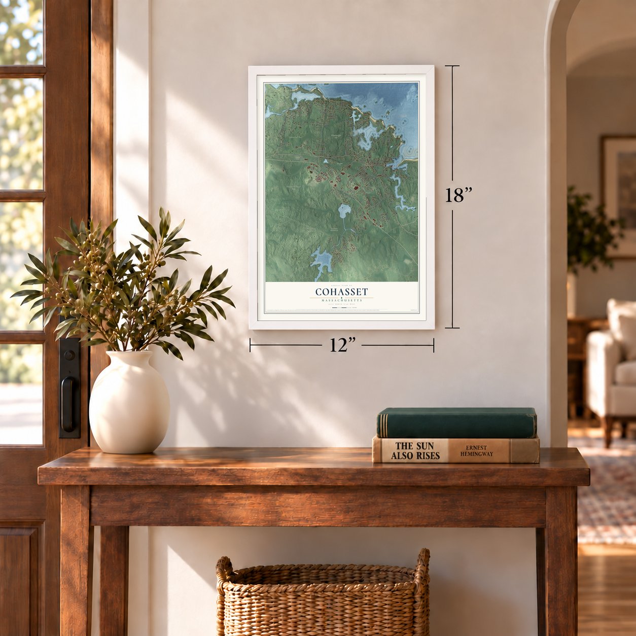
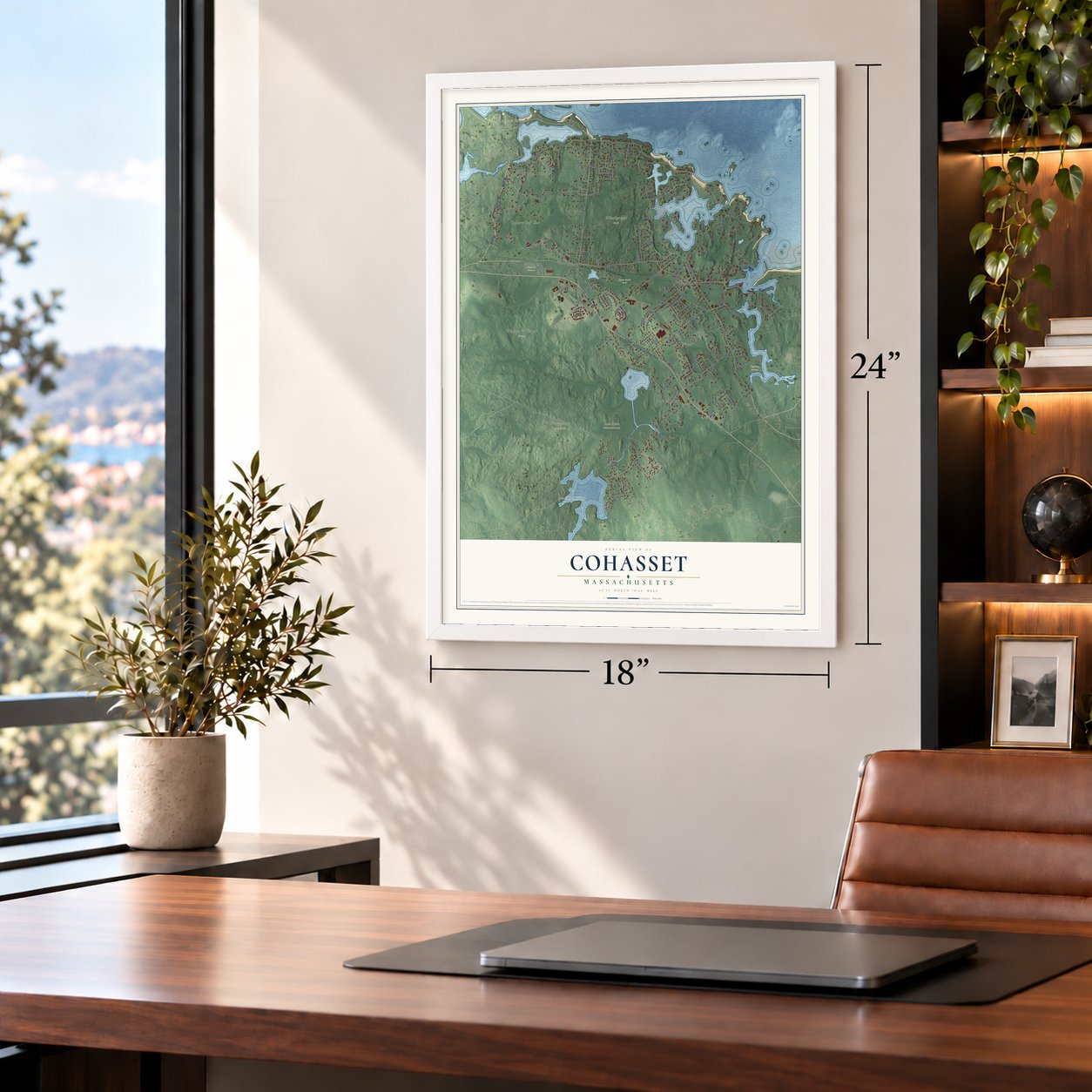
12" x 18" Archival Matte Print
A Map of Home. A Work of Art.
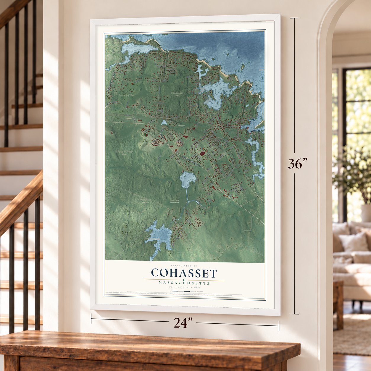
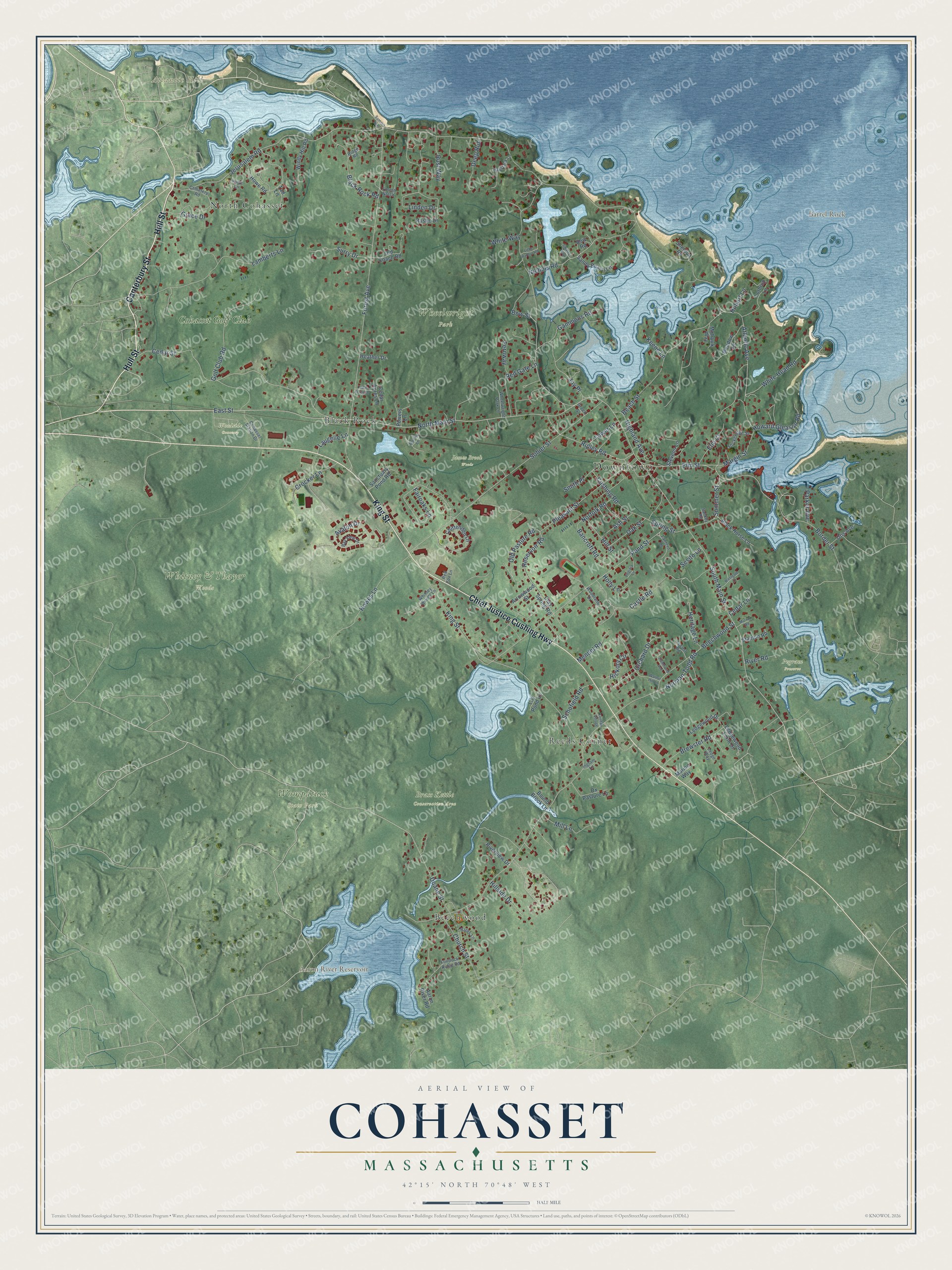
Explore Cohasset, Massachusetts from a whole new perspective. Created using aerial imagery and detailed geographic data, this map captures Cohasset building by building, with labeled streets, familiar landmarks, and shaded topographical relief that highlights the natural contours of the landscape.
Combining modern data with the timeless character of a vintage atlas, this map is just as interesting up close as it is beautiful on the wall. Whether you grew up in Cohasset, spent memorable years there, or call it home today, this unique map is a great way to celebrate a place that means something to you. Zoom in on the preview to look for your street, and then order a print to put your memories on the wall.
Three ways to hang it
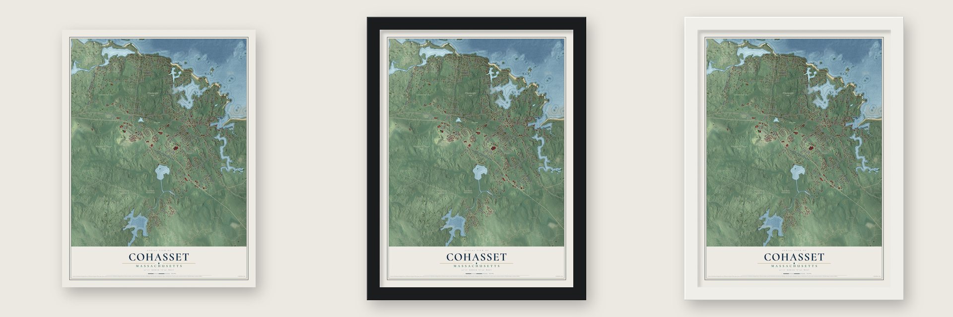
Unframed archival matte, a black wood frame or a white wood frame.
Up close
Geography Worth Displaying
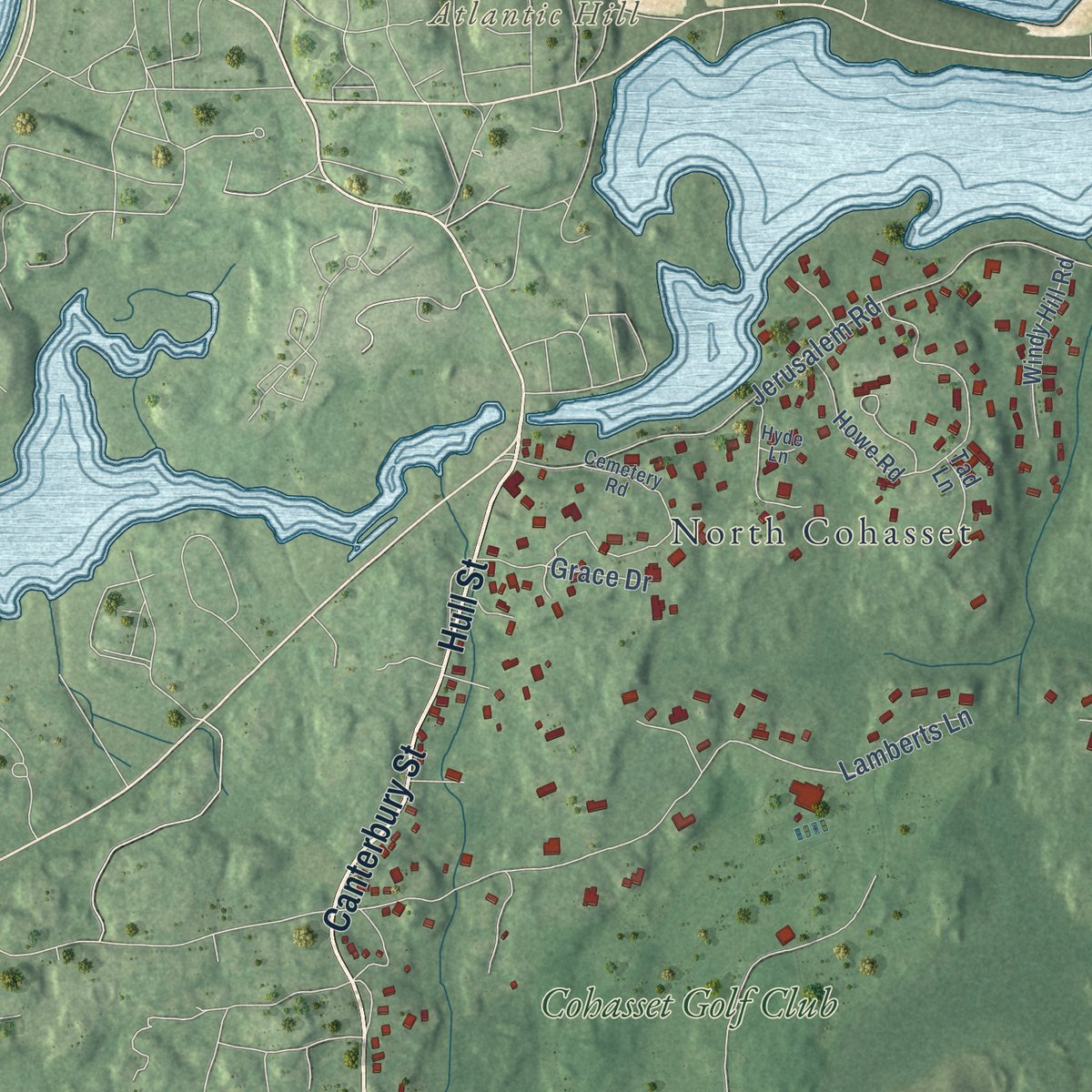
This map was created using accurate cartographic data and authoritative geographic sources, including the U.S. Geological Survey (USGS) and FEMA. The map brings together terrain, waterways, roads, and building detail. The majority of the streets are labeled, houses are accurately depicted, and the topography is derived from government sources. Combining local data with carefully composed color and shading leads to this beautifully detailed Cohasset artwork for your wall.
Rather than simply showing street outlines, we’ve included as many of the street names as we could reasonably fit on the map while keeping their names legible. Zoom in on the high resolution preview to see exactly what’s on the map. We truly set out to create a statement piece for anyone who loves Cohasset. So whether it’s for you, or a gift for someone you love, we hope this map of Cohasset brings back fond memories.
Explore the full map of Cohasset, Massachusetts and read about the local places it shows.

Find your street
Names on the Cohasset map
Every name below is printed on this map. Look for your street, your school, the park where you played, or the pond down the road.
Places and landmarks16
- Downtown
- Atlantic Hill
- Barrel Rock
- Aaron River Reservoir
- Brass Kettle Conservation Area
- James Brook Woods
- Pegram Preserve
- Wheelwright Park
- Whitney & Thayer Woods
- Wompatuck State Park
- Woodside Cemetery
- Reeds Corner
Show all 16 places
- North Cohasset
- Beechwood
- Black Rock
- Cohasset Golf Club
Streets and roads136
- Hull Street
- Canterbury Street
- Chief Justice Cushing Highway
- King Street
- East Street
- North Main Street
- Ripley Road
- Doane Street
- South Main Street
- Cedar Street
- Forest Avenue
- Reservoir Road
- Summer Street
- Old Pasture Road
- Orchard Drive
- White Head Road
- Surry Drive
- Jerusalem Road
- Beechwood Street
- Atlantic Avenue
- Sohier Street
- Pond Street
- Howes Lane
- Lamberts Lane
- Golf Club Road
- Linden Drive
- Border Street
- Fairoaks Lane
- Beach Street
- Avalon Drive
Show all 136 streets
- Castle Road
- Nichols Road
- Pleasant Street
- Black Rock Road
- Highland Avenue
- Joy Place
- Elm Street
- Gammons Road
- Cushing Road
- Spring Street
- Brewster Road
- Red Gate Lane
- Crocker Lane
- Howard Gleason Road
- Bow Street
- Church Street
- Smith Place
- Norman Todd Road
- Bancroft Road
- Margin Street
- Heritage Lane
- Hickory Circle
- Schofield Road
- Elm Court
- Deep Run
- Hillside Drive
- Oak Street
- Rust Way
- Norfolk Road
- Mendel Road
- Grace Drive
- Hill Street
- Tower Lane
- Ash Street
- Laugelle Lane
- Mill Lane
- Fernway
- Cedar Lane
- Parker Avenue
- Holly Lane
- Keene Lane
- River Road
- White Way
- Sesito Lane
- Hobart Lane
- Arrowwood Street
- Clay Spring Road
- Howe Road
- Chittenden Lane
- Lothrop Lane
- Aaron River Road
- Old Coach Road
- Meadow Lane
- Black Horse Lane
- Windy Hill Road
- Ledgewood Drive
- Ox Pasture Lane
- Sanctuary Pond Road
- Sandy Beach Lane
- Stevens Lane
- Rustic Drive
- Riverview Drive
- Otis Avenue
- Stanton Road
- Ledgewood Farm Drive
- Heather Drive
- Powers Lane
- Mohawk Way
- Bow Road
- Lily Pond Lane
- Bound Brook Lane
- Sheldon Road
- Cedar Acres Lane
- Tad Lane
- Marion Way
- Cemetery Road
- Stockbridge Street
- Rocky Lane
- Cohasset Station Drive
- Flintlock Ridge Road
- Woodland Drive
- Lantern Lane
- Haystack Lane
- Wheelwright Park Lane
- Forest Notch
- Bay View Drive
- Whitney Woods Lane
- Ledge Way
- Hyde Lane
- Locust Road
- Bates Lane
- Ingram Lane
- Sankey Road
- Green Street
- Ridge Road
- Red Fox Lane
- Summit Avenue
- Walnut Hill Lane
- Little Harbor Road
- Virginia Lane
- Westgate Lane
- Hammond Avenue
- Cedar Acres Drive
- Murray Road
- Smalzel Way
- Kendall Village
Names are listed as they appear on the printed map. Zoom into the product photos to find them.
About Cohasset, Massachusetts
Cohasset is a town of 8,381 people in Norfolk County, on the South Shore's rocky corner, where Boston Harbor gives way to Massachusetts Bay. It entered the written record in 1614, when Captain John Smith's ship met four Native Americans in a canoe at Quonahasit and his men shot two of them. By 1634 a list of New England settlements called "Conihosset" a noted habitation. The name comes from Conahasset, a Massachusett word that may mean "long rocky place" or "fishing promontory."
In January 1670 a special town meeting handed out shares of this land to the "Conahasset Partners," mostly big landowners from Hingham, and nobody asked the Native people living here. Hingham's town clerk, Daniel Cushing, took the most shares, 35, and its minister, the Reverend Peter Hobart, took 25. Cohasset stayed the eastern part of Hingham for another century. Its people won the right to build a second meetinghouse in 1713, and in 1770 they broke away as a town of their own, though the state's list gives 1775 as the year of incorporation.
- A county exclave since 1803Cohasset began in Suffolk County. When the southern part of Suffolk became Norfolk County in 1793, the new county took in Cohasset, Hingham and Hull. Ten years later Hingham and Hull chose to join Plymouth County instead, and Cohasset was left as an island of Norfolk County, separated from the rest of it. It still belongs to Norfolk County today.
- A common set aside in 1670The proprietors cut many lots into long, narrow strips so that more of them faced a road and fewer sat behind other lots. In that first division they also kept land for Cohasset Common. Main Street, then hardly more than a path for cattle, was laid out as a real road beside it in 1685. Houses, churches and the town hall, most of them from the mid-1700s to the mid-1800s, now face the 24-acre Common.
- The first settler's graveIbrook Tower, who first settled Cohasset, rests in Cohasset Central Cemetery near Joy Place. So does Margaret, his wife, and her burial in 1705 opened the ground. Levi B. Gaylord, Cohasset's only Medal of Honor recipient, and the Civil War general Zealous Bates Tower lie there as well. A Celtic Cross raised in 1914 marks the graves of Irish immigrants who died when their ship wrecked off this coast in 1849.
- Cohasset PunchIn the 1890s Lewis Williams, a Chicago saloonkeeper, visited his friend the actor William H. Crane at Crane's home in Cohasset and asked for a new drink. The rum punch made there took the town's name and became a favorite back in Chicago, and from 1899 its label showed the lighthouse on Minot's Ledge. The brand was dropped in the late 1980s, then brought back by new owners in 2024.
Keep exploring Massachusetts
Cohasset is one of 470 Massachusetts towns we've mapped. Every dot on the map is a print of its own.
The search covers every state, Massachusetts first.
Near Cohasset
Order 2 or more town maps and save 10%. Shown in the size and finish you picked above, so they hang as a set.
- North Scituate 12" x 18" / Archival Matte Print $39.99
- Scituate 12" x 18" / Archival Matte Print $39.99
- Hingham 12" x 18" / Archival Matte Print $39.99
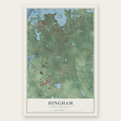
More maps nearby: Norwell, Hull, Weymouth, Marshfield Hills and Hanover.
The art of mapping a place
How This Map Was Made
Real places. Remarkable detail. Discover the layers that turn geographic data into a map of home.

The view from above
Aerial imagery reveals the character of the land: woodland, open fields, and the patterns of a place.

The shape of the land
Elevation data brings hills, valleys, and subtle changes in the landscape into view.

The details of home
Roads, waterways, and building footprints come together to make the map feel unmistakably local.

Geography becomes art
Considered color, shading, and typography bring the layers together in a map made for your wall.


Process illustrated with Mendon, Massachusetts. Aerial imagery: USDA NAIP. Terrain: USGS 3D Elevation Program. Map details and finished artwork: KNOWOL.
The Details
About This Print
Choose an archival matte print, or a black or white Ayous wood frame. The archival matte print is unframed.
Select your size and finish above to see the matching product image and price.
Materials & Craftsmanship
A contemporary map with the character of a classic atlas, printed on archival matte paper. Optional frames are made from Ayous wood.
Your printed map does not include the watermark shown in the full-map preview.
Shipping & Delivery
Free shipping within the United States. Every print is made to order in the USA.
Buying a gift? Add a note in your cart and we'll include it. We never put prices in the package.
Prints ship within 2 to 3 business days. Allow 7 to 10 days total from ordering for delivery. Timing may vary during holidays or periods of high order volume.
Read our shipping policy.
Returns and damaged prints
Each print is made to order. Change-of-mind refunds are not available after production.
If your print arrives damaged, misprinted or incorrect, contact support@knowol.com within 30 days of receiving it. Include your order number, photos and a description of the issue.
Read our full refund and replacement policy. For questions about your order, email support@knowol.com.