
Search for another town


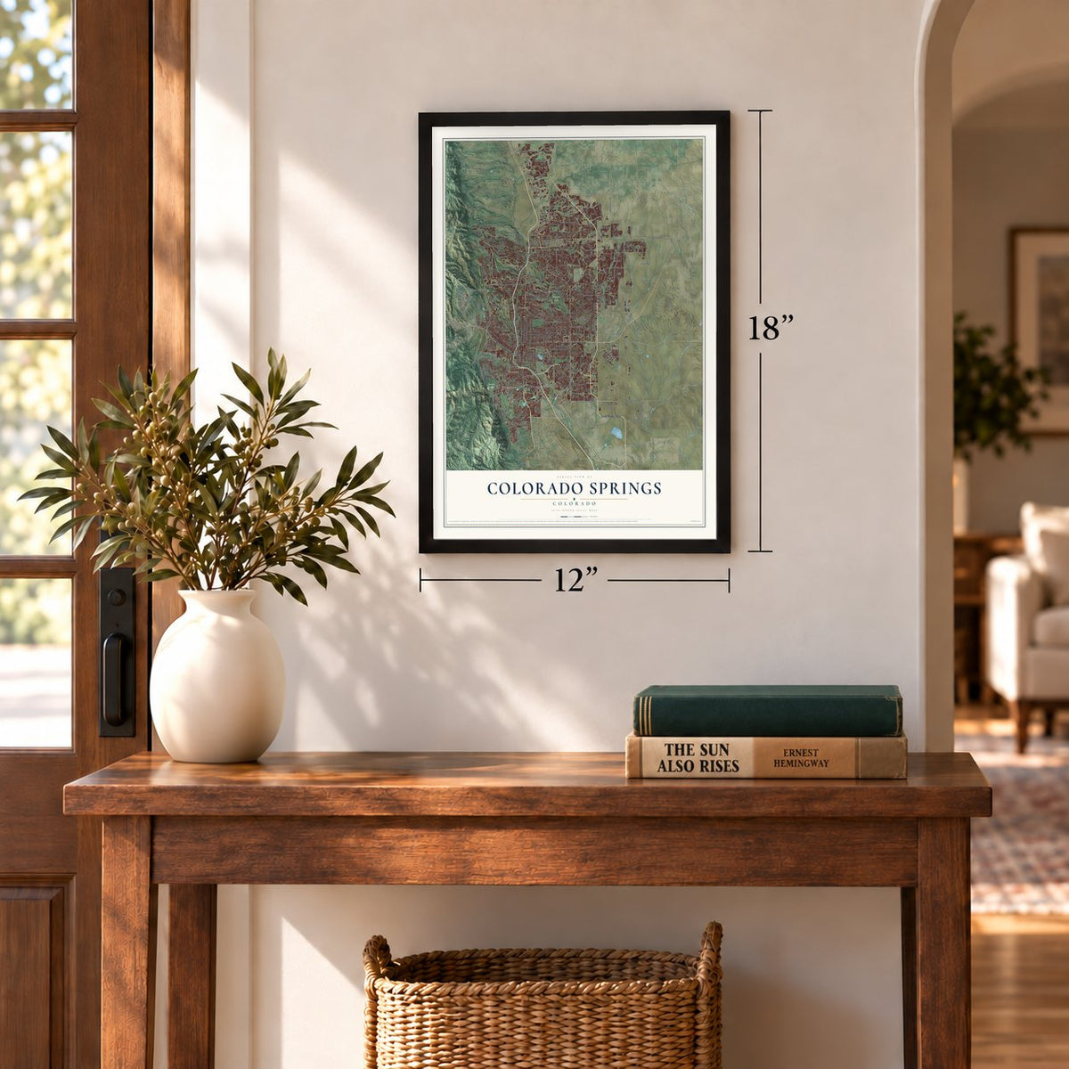
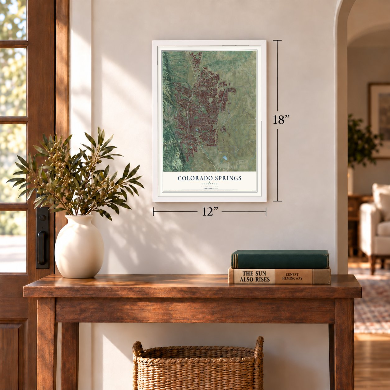

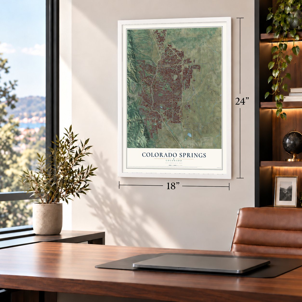
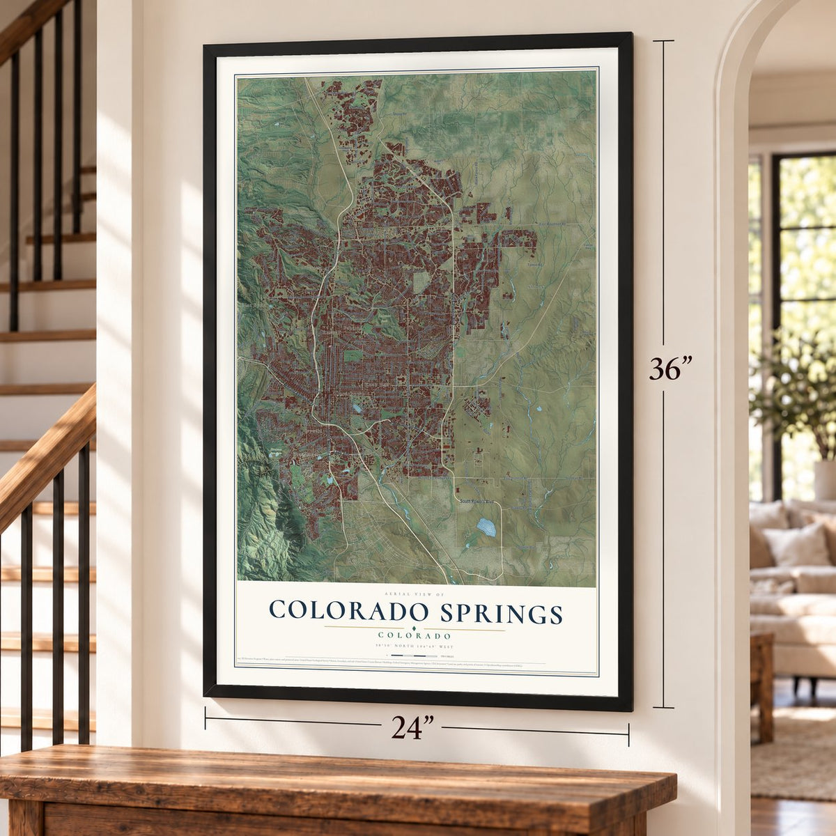
Free U.S. delivery 7 to 10 days after you order
Colorado Springs, Colorado Map Art
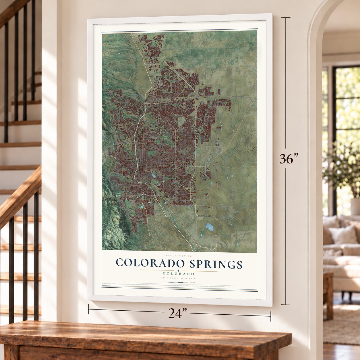
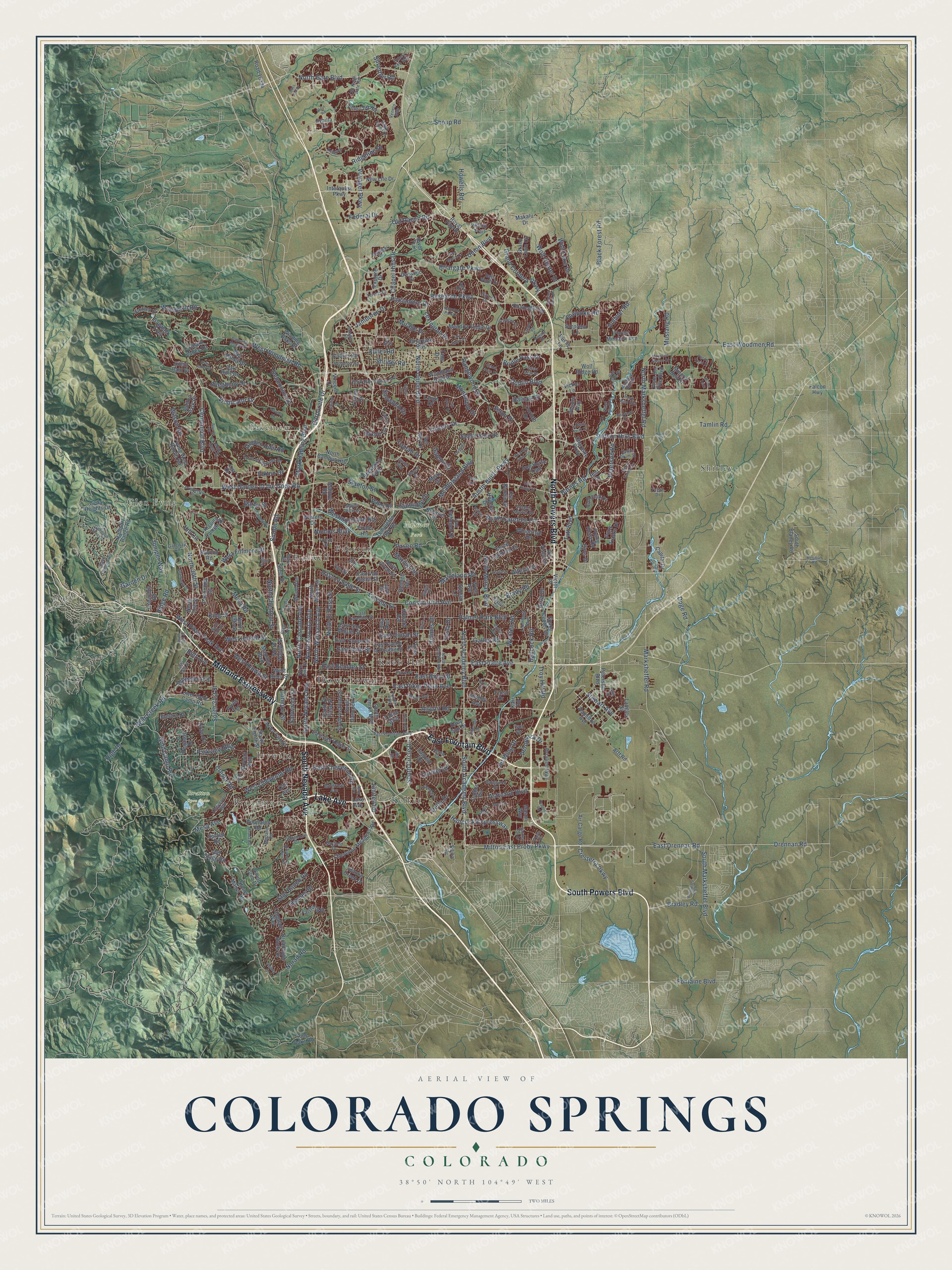
A new map of Colorado Springs, Colorado, made in 2026 and printed to order on thick archival matte paper.
12" x 18" Archival Matte Print
A Map of Home. A Work of Art.
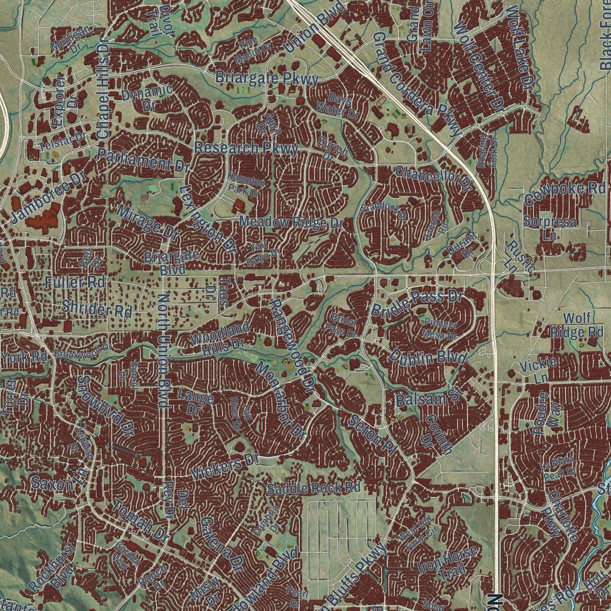
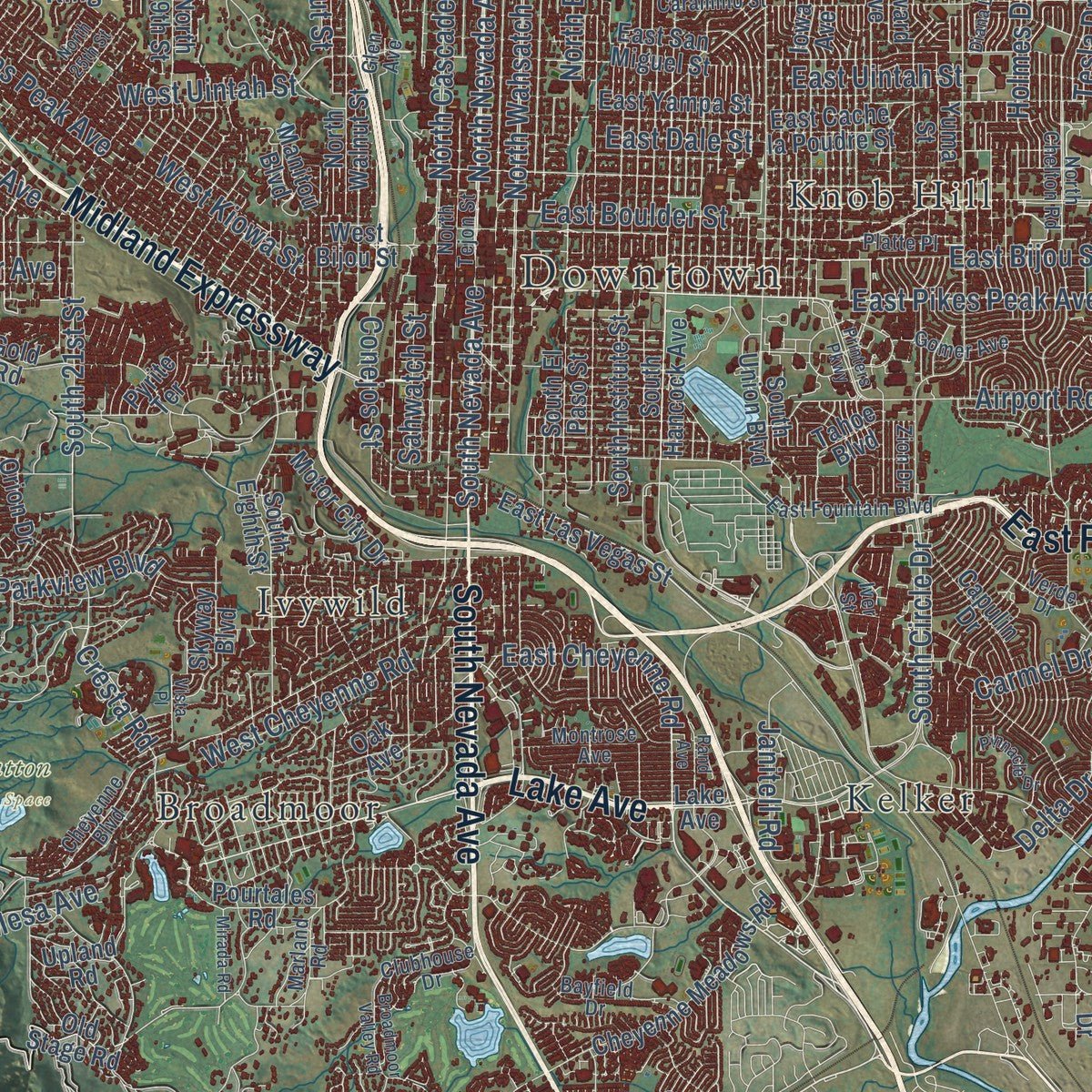
Explore Colorado Springs, Colorado from a whole new perspective. Created using aerial imagery and detailed geographic data, this map captures Colorado Springs building by building, with labeled streets, familiar landmarks, and shaded topographical relief that highlights the natural contours of the landscape.
Combining modern data with the timeless character of a vintage atlas, this map is just as interesting up close as it is beautiful on the wall. Whether you grew up in Colorado Springs, spent memorable years there, or call it home today, this unique map is a great way to celebrate a place that means something to you. Zoom in on the preview to look for your street, and then order a print to put your memories on the wall.
Three ways to hang it
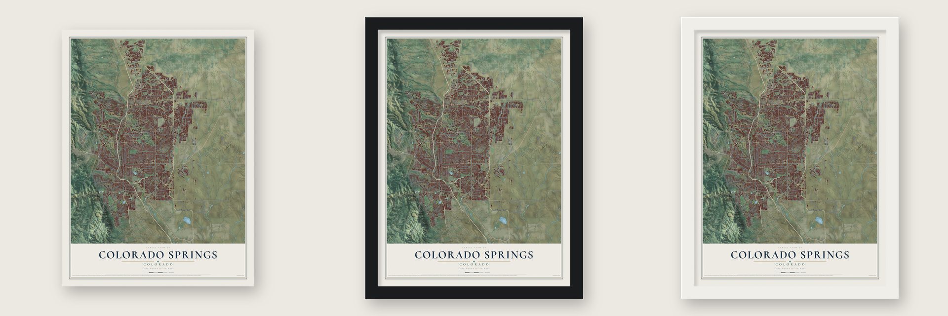
Unframed archival matte, a black wood frame or a white wood frame.
Up close
Geography Worth Displaying
This map was created using accurate cartographic data and authoritative geographic sources, including the U.S. Geological Survey and the Census Bureau. The map brings together terrain, waterways, roads, and building detail. The majority of the streets are labeled, houses are accurately depicted, and the topography is derived from government sources. Combining local data with carefully composed color and shading leads to this beautifully detailed Colorado Springs artwork for your wall.
Rather than simply showing street outlines, we’ve included as many of the street names as we could reasonably fit on the map while keeping their names legible. Zoom in on the high resolution preview to see exactly what’s on the map. We truly set out to create a statement piece for anyone who loves Colorado Springs. So whether it’s for you, or a gift for someone you love, we hope this map of Colorado Springs brings back fond memories.
Read the story behind this map of Colorado Springs, Colorado from 2026.

About Colorado Springs, Colorado
Colorado Springs is a city of 478,961 people and the seat of El Paso County, on Fountain Creek at the foot of Pikes Peak. The industrialist William Jackson Palmer founded it in 1871, when his Colorado Springs Company platted a settlement called Fountain Colony downstream from Colorado City and renamed it Colorado Springs later that year. Its post office opened on December 1, 1871, and Palmer offered land to any church willing to move its congregation here.
The older Colorado City had been organized in 1859, during the Pikes Peak Gold Rush, and it was the capital of Colorado Territory from 1861 until the capital went to Golden in 1862. In 1873 the county seat moved from Colorado City to the new town. English settlers came in such numbers that locals nicknamed the place "Little London," and Colorado Springs was incorporated on June 19, 1886.
“COLORADO SPRINGS (5,900 alt., 33,237 pop.), seat of El Paso County, a tailor-made resort and residential city, lies on a broad rolling plain near the base of Pikes Peak.”
- 275 mining brokersThe Broadmoor suburb, with its own casino, was developed by the Broadmoor Land Company and opened in 1891. Mining money poured through the city in those years, and by December 12, 1895, Colorado Springs had four mining exchanges and 275 mining brokers.
- Tesla's lab on Knob HillLightning strikes this part of the country more often than almost anywhere else in the United States, and that is why Nikola Tesla chose Colorado Springs for his electrical experiments. His Tesla Experimental Station ran on Knob Hill from 1899 to 1901.
- An Army camp in 1941The military came with World War II. Camp Carson opened in 1941 and grew into Fort Carson, a base of 135,000 acres, and the Army Air Forces named Peterson Field beside the city airport in December 1942. During the Cold War, NORAD set up its hardened command center inside Cheyenne Mountain, and the city donated the land for the Air Force Academy. In 1977 most of the old Ent Air Force Base became a U.S. Olympic training center.
- The Waldo Canyon fireOn June 23, 2012, a wildfire broke out 4 miles northwest of the city. By the time it was over, it had destroyed 347 homes and killed two people in Colorado Springs, and 32,000 residents had been evacuated. It was the most destructive fire in Colorado history until the Black Forest Fire the next year.
Find your street
Names on the Colorado Springs map
Every name below is printed on this map. Look for your street, your school, the park where you played, or the pond down the road.
Places and landmarks12
- Downtown
- Palmer Park
- Stratton Open Space
- Broadmoor
- Glen Eyrie
- Ivywild
- Kelker
- Knob Hill
- Papeton
- Pikeview
- Roswell
- Shirley
Streets and roads394
- North Powers Boulevard
- South Powers Boulevard
- Lake Avenue
- East Fountain Boulevard
- Midland Expressway
- South Nevada Avenue
- North Nevada Avenue
- Hancock Expressway
- Drennan Road
- East Drennan Road
- East Pikes Peak Avenue
- South Circle Drive
- East Bijou Street
- Milton East Proby Parkway
- East Cheyenne Road
- Corporate Drive
- Marksheffel Road
- South Marksheffel Boulevard
- Briargate Parkway
- East Uintah Street
- East Woodmen Road
- North Union Boulevard
- Austin Bluffs Parkway
- North Academy Boulevard
- Dublin Boulevard
- Centennial Boulevard
- East Platte Avenue
- Tutt Boulevard
- Research Parkway
- Voyager Parkway
Show all 394 streets
- South Academy Boulevard
- Peterson Road
- Barnes Road
- Old Ranch Road
- Constitution Avenue
- North Gate Boulevard
- Airport Road
- Vickers Drive
- Stetson Hills Boulevard
- Chapel Hills Drive
- West Garden of the Gods Road
- Rangewood Drive
- North Carefree Circle
- Woodmen Road
- North Marksheffel Road
- West Woodmen Road
- Mesa Road
- Palmer Park Boulevard
- Mark Dabling Boulevard
- Flintridge Drive
- North Chestnut Street
- Lexington Drive
- Hill Circle
- North 30th Street
- North Cascade Avenue
- Paseo Road
- Tamlin Road
- Bridle Pass Drive
- Black Forest Road
- West Pikes Peak Avenue
- Federal Drive
- North El Paso Street
- North Wahsatch Avenue
- Stewart Avenue
- Allegheny Drive
- Astrozon Boulevard
- Jet Wing Drive
- Gold Camp Road
- Galley Road
- West Kiowa Street
- East Dale Street
- East Boulder Street
- North Murray Boulevard
- Delmonico Drive
- Cresterra Parkway
- Union Boulevard
- West Uintah Street
- West Cheyenne Road
- West Fillmore Street
- Garden Drive
- Sinton Road
- Fuller Road
- Cresta Road
- Shrider Road
- Wooten Road
- Star Ranch Road
- Delta Drive
- Montarbor Drive
- Aeroplaza Drive
- Mirage Drive
- Grand Cordera Parkway
- Janitell Road
- Cowpoke Road
- Ridgeline Drive
- La Salle Street
- South 21st Street
- Maizeland Road
- Golden Hills Road
- Wilson Road
- Juniper Way
- Stanton Street
- Mesa Avenue
- Wolf Center Drive
- Westmoreland Road
- Ridge Road
- Bradley Road
- Howells Road
- High Drive
- Elkton Drive
- Carmel Drive
- Brady Road
- Meadowland Boulevard
- Vindicator Drive
- Norad Road
- Wolf Lake Drive
- Tesla Drive
- Parliament Drive
- Wheeler Avenue
- Parkview Boulevard
- Holmes Drive
- Babcock Road
- Vollmer Road
- Snowbird Drive
- Bear Creek Road
- East La Salle Street
- Troy Hill Road
- Conejos Street
- Fontaine Boulevard
- Galena Drive
- Alteza Drive
- Palm Drive
- Shoup Road
- Jamboree Drive
- Tomah Drive
- Sahwatch Street
- King Street
- Silverton Road
- Nichols Boulevard
- Balsam Street
- Thames Drive
- Darby Street
- Mustang Road
- Marilyn Road
- Bott Avenue
- Doge Road
- Seton Place
- Bula Drive
- Saxon Lane
- East Las Vegas Street
- Space Center Drive
- South Hancock Avenue
- South Union Boulevard
- Cedar Heights Drive
- Templeton Gap Road
- North Circle Drive
- Rampart Range Road
- East San Miguel Street
- Interquest Parkway
- Broadmoor Bluffs Drive
- West Bijou Street
- North Weber Street
- Flying West Ranch Road
- Oro Blanco Drive
- Briargate Boulevard
- Pony Tracks Drive
- North 31st Street
- Farthing Drive
- East Cache la Poudre Street
- Oak Hills Drive
- Vista del Pico Boulevard
- South Eighth Street
- East Yampa Street
- Royal Pine Drive
- Orion Drive
- South Carefree Circle
- Chancellor Drive
- Rockhurst Boulevard
- Saddle Rock Road
- Kissing Camels Drive
- Wood Avenue
- Iron Horse Trail
- Charlotte Parkway
- Cheyenne Meadows Road
- North Walnut Street
- Bennett Avenue
- Iowa Avenue
- Air Cargo Road
- Meadow Ridge Drive
- Lower Gold Camp Road
- Peterson Boulevard
- East Van Buren Street
- Stone Manor Heights
- Big Valley Drive
- Whimsical Drive
- Yuma Street
- South El Paso Street
- South Club Drive
- Rio Vista Drive
- Woodland Hills Drive
- North 19th Street
- Capulin Drive
- Winding Oaks Drive
- Explorer Drive
- South Institute Street
- Orchard Valley Road
- New Life Drive
- Del Rey Drive
- Capital Drive
- Electra Drive
- Aviation Way
- Forest Meadow Avenue
- Vincent Drive
- South Blaney Road
- Grand Lawn Circle
- Jon Street
- Manitou Boulevard
- Pegasus Drive
- Lark Drive
- Poudre Way
- Motor City Drive
- Van Teylingen Drive
- Upland Road
- Skyway Boulevard
- Silent Rain Drive
- Vine Cliff Heights
- Old Stage Road
- Pourtales Road
- Dynamic Drive
- Collins Road
- Road 16334
- North Campus Heights
- Mineral Belt Drive
- Langley Street
- Mallow Road
- Sybilla Lane
- Panorama Drive
- Golf Club Drive
- Hopeful Drive
- Brenner Place
- Flying Horse Road
- Columbia Road
- Sawback Trail
- Victor Place
- Misty Drive
- Langdale Way
- Pine Oaks Road
- Piros Drive
- Sussex Lane
- Corinth Drive
- Hamilton Avenue
- Lange Drive
- Ashton Park Place
- Howard Avenue
- Makalu Drive
- Falcon Highway
- Winters Drive
- Tahoe Boulevard
- Wolf Ridge Road
- Turret Drive
- Canoe Creek Drive
- Sorpresa Lane
- Shelley Avenue
- Rustic Lane
- Mason Way
- Vickie Lane
- Wold Avenue
- Steel Drive
- List Drive
- York Road
- Pirate Heights
- Inwood Road
- Cather Circle
- Oak Avenue
- Arff Road
- Pyrite Terrace
- Frost Drive
- Holt Drive
- Early Sun Drive
- Divot Trail
- Taos Drive
- Notch Trail
- Karr Road
- Silica Drive
- Ivor Drive
- Durant Drive
- North Chelton Road
- Black Canyon Road
- North Tejon Street
- Cheyenne Boulevard
- East Caramillo Street
- Mount View Lane
- Verde Drive
- Blodgett Drive
- Payton Circle
- Fourth Street
- Point of the Pines Drive
- Otis Street
- Telstar Drive
- Alpine Drive
- Mustang Rim Drive
- Marland Road
- Kettle Drum Street
- Gatewood Drive
- Wagon Master Drive
- Bell Drive
- Quiet Pond Place
- Platte Place
- Lehmberg Boulevard
- Bayfield Drive
- Goddard Street
- Clubhouse Drive
- Dancing Horse Drive
- Bays Water Drive
- Mule Deer Drive
- Montrose Avenue
- Venhorst Road
- Gomer Avenue
- Kelso Place
- Old North Gate Road
- Zurich Drive
- Mulligan Drive
- Ranch Drive
- Glen Avenue
- Honey Run Way
- Hawk Stone Drive
- Veneto Way
- Main Street
- Gateway Road
- April Drive
- Iver Street
- Zion Drive
- Zircon Drive
- Ferber Drive
- Viero Drive
- Ute Drive
- South 31st Street
- Broadmoor Valley Road
- Meridian Road
- Aerospace Boulevard
- Issaquah Drive
- Cathedral Spires Drive
- Printers Parkway
- South 26th Street
- Pine Manor Drive
- Vondelpark Drive
- North 25th Street
- West Old Farm Circle
- Oak Valley Drive
- Paisley Drive
- Desert Varnish Drive
- Pioneer Mesa Drive
- Lehman Drive
- Shalimar Drive
- Pearl Drive
- Stout Road
- Moffat Circle
- Culebra Avenue
- Brookwood Drive
- Chambers Drive
- Mountain Spruce Drive
- Arrowswest Drive
- Zeppelin Road
- La Plata Peak Drive
- Sage Street
- Braddock Drive
- Sproul Lane
- Pacific Crest Drive
- Pinnacle Drive
- Cambria Drive
- Fall River Drive
- Mirada Road
- Chapman Drive
- Bourke Drive
- Hawk Wind Boulevard
- Bass Pro Drive
- Rand Avenue
- Hampton Park Drive
- Hollow Road
- Monica Drive
- Diana Lane
- Fair Dawn Drive
- French Road
- Solar Ridge Drive
- Roaring Fork Drive
- Spotted Tail Drive
- Galway Drive
- Gold Drop Drive
- Vista Place
- Bridal Pass Drive
- Vis del Terra
- Garden Way
- Perfect Vw
- Huber Road
- Byron Drive
Names are listed as they appear on the printed map. Zoom into the product photos to find them.
The art of mapping a place
How This Map Was Made
Real places. Remarkable detail. Discover the layers that turn geographic data into a map of home.

The view from above
Aerial imagery reveals the character of the land: woodland, open fields, and the patterns of a place.

The shape of the land
Elevation data brings hills, valleys, and subtle changes in the landscape into view.

The details of home
Roads, waterways, and building footprints come together to make the map feel unmistakably local.

Geography becomes art
Considered color, shading, and typography bring the layers together in a map made for your wall.


Process illustrated with Mendon, Massachusetts. Aerial imagery: USDA NAIP. Terrain: USGS 3D Elevation Program. Map details and finished artwork: KNOWOL.
The Details
About This Print
Choose an archival matte print, or a black or white Ayous wood frame. The archival matte print is unframed.
Select your size and finish above to see the matching product image and price.
Materials & Craftsmanship
A contemporary map with the character of a classic atlas, printed on archival matte paper. Optional frames are made from Ayous wood.
Your printed map does not include the watermark shown in the full-map preview.
Shipping & Delivery
Free shipping within the United States. Every print is made to order in the USA.
Buying a gift? Add a note in your cart and we'll include it. We never put prices in the package.
Prints ship within 2 to 3 business days. Allow 7 to 10 days total from ordering for delivery. Timing may vary during holidays or periods of high order volume.
Read our shipping policy.
Returns and damaged prints
Each print is made to order. Change-of-mind refunds are not available after production.
If your print arrives damaged, misprinted or incorrect, contact support@knowol.com within 30 days of receiving it. Include your order number, photos and a description of the issue.
Read our full refund and replacement policy. For questions about your order, email support@knowol.com.
Find your town
Looking for another city?
Find a map of home in our Colorado collection, or any town in the country.
Nearby
Maps of towns near Colorado Springs
Know someone from one of these towns? Their map makes a great gift.
 Cimarron Hills
, Colorado
From $39.99See the map
 Stratmoor
, Colorado
From $39.99See the map
 Manitou Springs
, Colorado
From $39.99See the map
More maps nearby: Security-Widefield, Air Force Academy, Rock Creek Park, Gleneagle and Fort Carson.