
Search for another town





Free U.S. delivery 7 to 10 days after you order
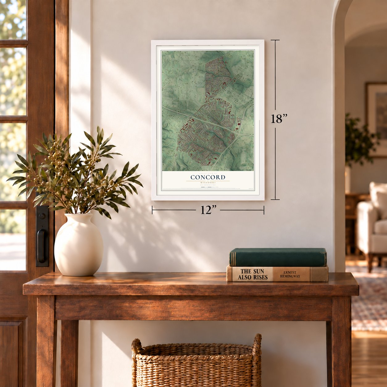
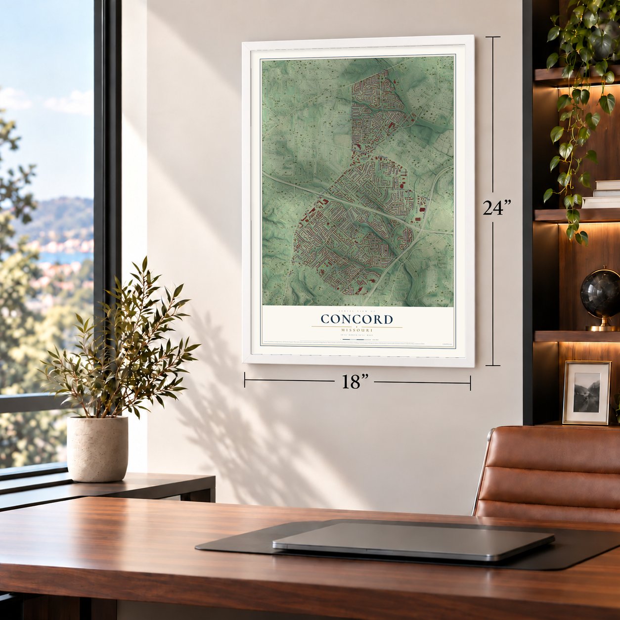
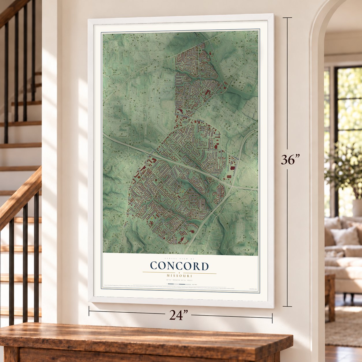
Concord, Missouri Map Art
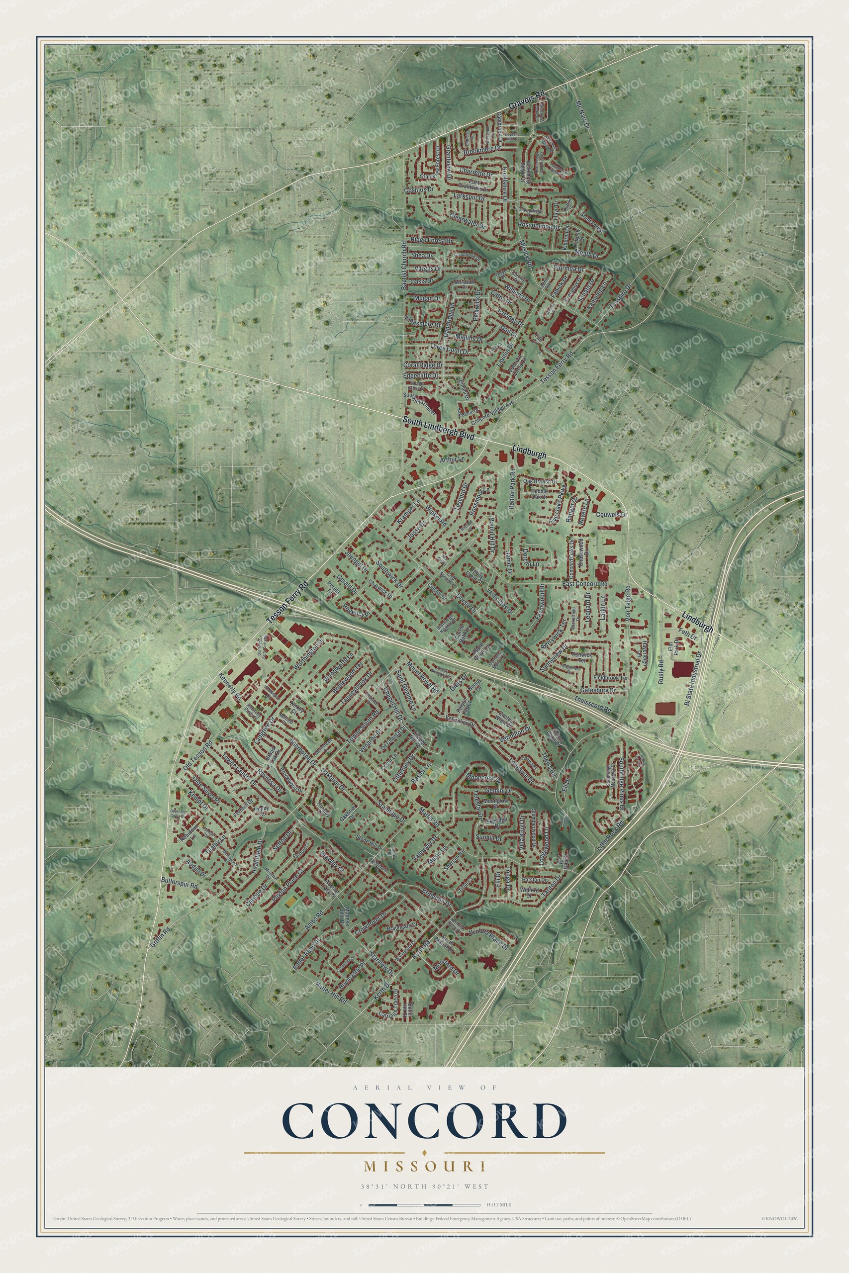
A new map of Concord, Missouri, made in 2026 and printed to order on thick archival matte paper.
12" x 18" Archival Matte Print
A Map of Home. A Work of Art.
This beautifully detailed map of Concord, Missouri was created in 2026 using aerial imagery combined with modern topographical, census, street and landmark data. It's a modern aerial view of Concord in St. Zoom in on the preview and look for your block.
Three ways to hang it
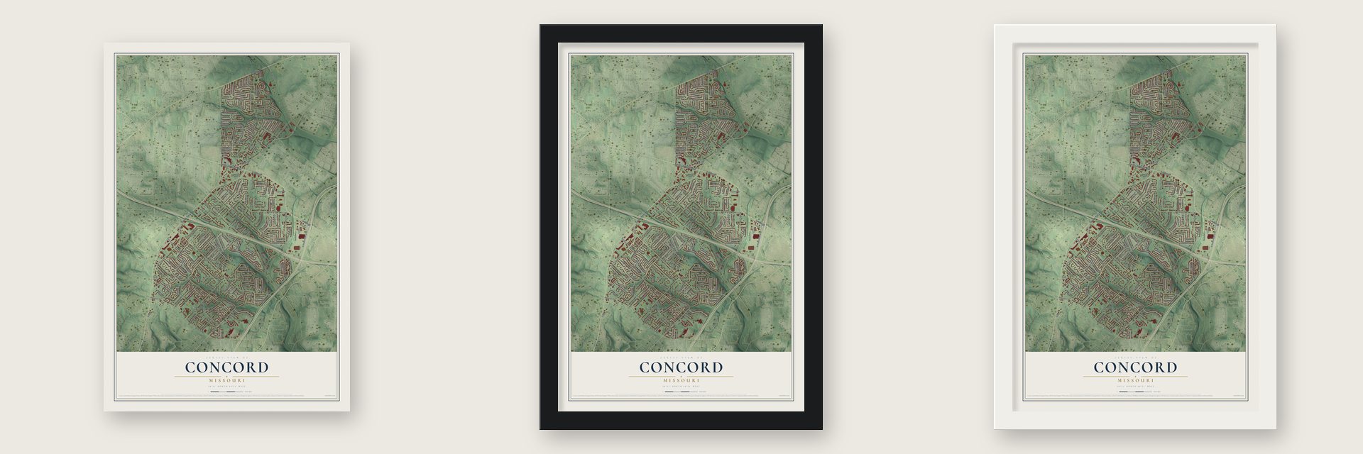
Unframed archival matte, a black wood frame or a white wood frame.
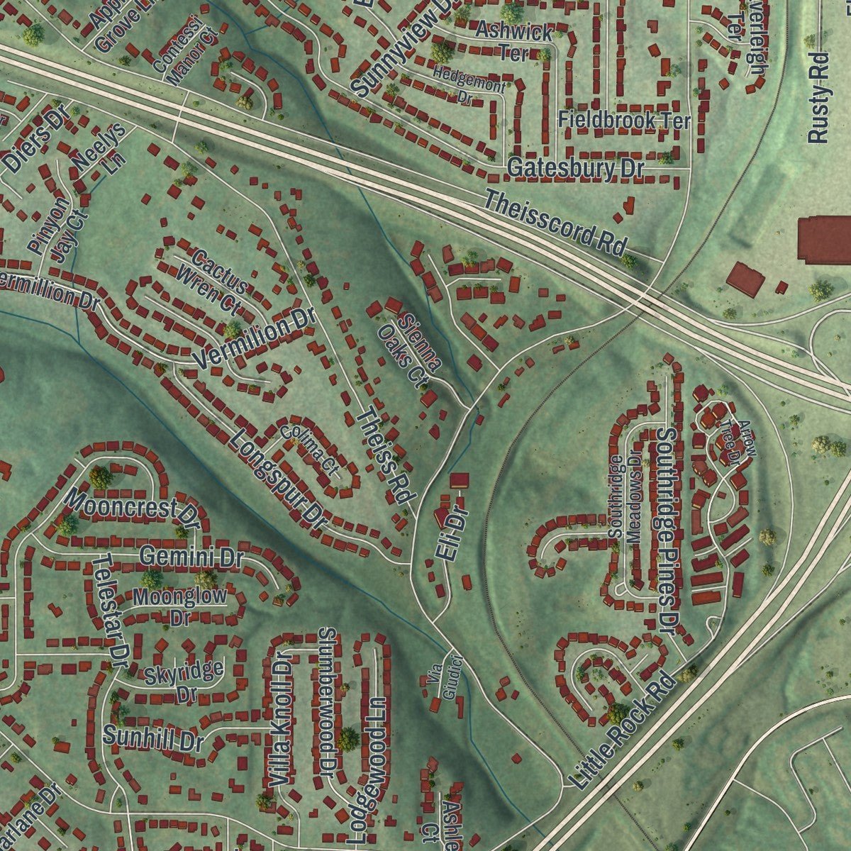
Up close
Real geography. Art worth displaying.
This map was created using accurate cartographic data and authoritative geographic sources, including the U.S. Geological Survey and the Census Bureau. The map brings together terrain, waterways, roads, and building detail. The majority of the streets are labeled, houses are accurately depicted, and the topography is derived from government sources. Combining local data with carefully composed color and shading leads to this beautifully detailed Concord artwork for your wall.
Rather than simply showing street outlines, we’ve included as many of the street names as we could reasonably fit on the map while keeping their names legible. Zoom in on the high resolution preview to see exactly what’s on the map. We truly set out to create a statement piece for anyone who loves Concord. So whether it’s for you, or a gift for someone you love, we hope this map of Concord brings back fond memories.
Read the story behind this map of Concord, Missouri from 2026.

About Concord, Missouri
Within St. Louis County, Concord is classified as a Missouri census_designated_place. A total of 17,668 people lived here when the 2020 census was taken. Historical and geographic accounts add that its reported area is 5.5 square miles.
- 17,668 residentsThis was the population recorded by the 2020 United States census.
- St. Louis CountyThis is the Missouri county that contains Concord.
- 5.5 square milesThe Census Bureau gives this figure for the community?s total area.
Find your street
Names on the Concord map
Every name below is printed on this map. Look for your street, your school, the park where you played, or the pond down the road.
Streets and roads234
- Lindburgh
- Tesson Ferry Road
- South Lindbergh Boulevard
- Gravois Road
- Towne South Road
- Little Rock Road
- Towne Centre Drive
- Telestar Drive
- Butler Hill Road
- Worthington Drive
- Florinda Drive
- Mattis Road
- Theiss Road
- Baptist Church Road
- East Concord Road
- Musick Road
- Von Talge Road
- Old Tesson Road
- Kerth Drive
- Kerth Road
- Ambs Road
- Lavinia Drive
- Valmeyer Drive
- Langtree Drive
- Meath Drive
- Theisscord Road
- Brunston Drive
- Larkspur Drive
- Dandridge Drive
- Tarlton Drive
Show all 234 streets
- Gerald Drive
- Stanhope Drive
- Sunnyview Drive
- Vermilion Drive
- Caribee Drive
- Bi State Industrial Drive
- Chapel Hill Drive
- Villa Knoll Drive
- Tescord Drive
- Rossmoor Lane
- Dorclin Lane
- Roscommon Drive
- Gatesbury Drive
- Tesshire Drive
- Bridlewood Terrace
- Kempf Drive
- Three Court Drive
- Reynosa Drive
- Longspur Drive
- Peyton Place Court
- Five Oaks Parkway
- Rusty Road
- Faraday Drive
- Tauneybrook Drive
- Brookmere Drive
- Knollshire Drive
- Clearwater Drive
- Vargas Drive
- Heathfield Drive
- Griffin Road
- Oakbriar Drive
- Southwick Drive
- Southridge Pines Drive
- Crownover Drive
- Littlebury Drive
- Audjill Drive
- Dorsie Drive
- Sherborne Drive
- Gemini Drive
- Charrette Drive
- Pickwick Drive
- Round Hill Drive
- Revere Lane
- Berrywick Terrace
- Butler Bend Drive
- Coral Ridge Drive
- Tealby Lane
- Bohrer Park Road
- Mallory Drive
- Olde Silver Place
- Edgecliffe Drive
- Butlerspur Road
- Basler Lane
- Mc Nary Drive
- Fawnwood Drive
- Ridge Forest Drive
- Venarde Drive
- Lodgewood Lane
- Bryncastle Place
- Saint Gemme Lane
- Willinda Drive
- Cathy Drive
- Ventura Place Drive
- Starview Drive
- Larkin Lane
- Sunhill Drive
- Woodworth Lane
- Grantview Drive
- Kamping Lane
- Kramper Lane
- Josse Drive
- Leonard Drive
- Mount Royal Road
- Arthur Lane
- Winkel Road
- Oasis Drive
- Shea Drive
- Sonata Drive
- Music Lane
- Mooncrest Drive
- Jamie Drive
- Sefton Drive
- Kennerly Road
- Feth Drive
- Tonga Drive
- Fiji Drive
- Kingsmere Drive
- Regency Place
- Eli Drive
- Mugan Drive
- Juengel Drive
- Diers Drive
- Couwels Drive
- Montford Drive
- Fabick Drive
- Ranger Drive
- Gail Court
- Brawley Court
- Cosmos Drive
- Robidoux Lane
- Concord Village Avenue
- Chapel Hill Road
- Vermillion Drive
- Grantview Forest Drive
- Broad Oak Drive
- Vicksburg Siege Court
- Oakbrier Drive
- Mattese Villa Drive
- Charwick Drive
- Ashwick Terrace
- Skyridge Drive
- Concord Oaks Drive
- Oak Branch Drive
- Sharlane Drive
- East Grantview Drive
- Valley Crest Drive
- Concord Circle Drive
- Southfield Center
- Hursley Drive
- Slumberwood Drive
- Mayo Drive
- Carriage Trace Drive
- De Chantal Drive
- Bimini Drive
- Braungate Drive
- Haverleigh Terrace
- Crecelius Drive
- Pebble Oak Drive
- Elm Park Drive
- Brockwood Drive
- Auburn Trace Drive
- Cambrook Drive
- Grant Forest
- Patston Drive
- Conger Drive
- Fieldbrook Terrace
- Pinyon Jay Court
- Cactus Wren Court
- Stone Hill Drive
- Sienna Oaks Court
- Moonglow Drive
- Chasewood Drive
- Butler Hill Court
- Fernhill Drive
- Perida Court
- Apple Grove Lane
- Kerth Manor Drive
- Valley Crest Court
- Killoren Drive
- Carrie Beth Lane
- Cedar Lane
- Welford Drive
- Neelys Lane
- Kilrush Drive
- Titan Court
- Kirkey Court
- Tealby Court
- Ashley Court
- Fite Circle
- Southridge Meadows Drive
- Lawnbrook Drive
- Bernadine Drive
- Morestead Drive
- Waringford Drive
- Copperfield Drive
- Village Grove Drive
- Kennerly Pines Court
- Miramar Drive
- Kay Berrie Drive
- Milsmar Drive
- Corning Drive
- Cold Springs Lane
- Colima Court
- Wickerfield Drive
- Lavinia Avenue
- Leitrim Drive
- Ambsdale Court
- Rainford Court
- Darfield Court
- Brantleigh Heights Court
- Contessi Manor Court
- Fuchs Road
- Thayer Drive
- Deerfield Circle Drive
- Arrow Tree Drive
- Richmond Calvary Drive
- Marchwood Drive
- Old Tesson Ferry Crossing
- Worthington Circle
- Hedgemont Drive
- Theiss Meadows Drive
- Castlegate Court
- Brittleigh Terrace
- Wickstrom Terrace
- Lavier Court
- Appomattox Station Court
- Foxdale Drive
- Chattanooga Campaign Court
- Wilderness Battle Drive
- Geanlee Drive
- Hayden Hill Drive
- Bayfield Lane
- Via Giudici
- Mar Ann Court
Names are listed as they appear on the printed map. Zoom into the product photos to find them.
The art of mapping a place
How This Map Was Made
Real places. Remarkable detail. Discover the layers that turn geographic data into a map of home.

The view from above
Aerial imagery reveals the character of the land: woodland, open fields, and the patterns of a place.

The shape of the land
Elevation data brings hills, valleys, and subtle changes in the landscape into view.

The details of home
Roads, waterways, and building footprints come together to make the map feel unmistakably local.

Geography becomes art
Considered color, shading, and typography bring the layers together in a map made for your wall.


Process illustrated with Mendon, Massachusetts. Aerial imagery: USDA NAIP. Terrain: USGS 3D Elevation Program. Map details and finished artwork: KNOWOL.
The Details
About This Print
Choose an archival matte print, or a black or white Ayous wood frame. The archival matte print is unframed.
Select your size and finish above to see the matching product image and price.
Materials & Craftsmanship
A contemporary map with the character of a classic atlas, printed on archival matte paper. Optional frames are made from Ayous wood.
Your printed map does not include the watermark shown in the full-map preview.
Shipping & Delivery
Free shipping within the United States. Every print is made to order in the USA.
Buying a gift? Add a note in your cart and we'll include it. We never put prices in the package.
Prints ship within 2 to 3 business days. Allow 7 to 10 days total from ordering for delivery. Timing may vary during holidays or periods of high order volume.
Read our shipping policy.
Returns and damaged prints
Each print is made to order. Change-of-mind refunds are not available after production.
If your print arrives damaged, misprinted or incorrect, contact support@knowol.com within 30 days of receiving it. Include your order number, photos and a description of the issue.
Read our full refund and replacement policy. For questions about your order, email support@knowol.com.
Find your town
Looking for another city?
Find a map of home in our Missouri collection.
Nearby
Maps of towns near Concord
Know someone from one of these towns? Their map makes a great gift.
 Green Park
, Missouri
From $39.99See the map
 Sappington
, Missouri
From $39.99See the map
 Lakeshire
, Missouri
From $39.99See the map
More maps nearby: Mehlville, Grantwood Village, St. George, Affton and Sunset Hills.