


Search for another town


Free U.S. delivery 7 to 10 days after you order
Copper Hill, New Jersey Map Art
Building by building, with labeled streets and shaded relief.
12" x 18" Archival Matte Print
A Map of Home. A Work of Art.
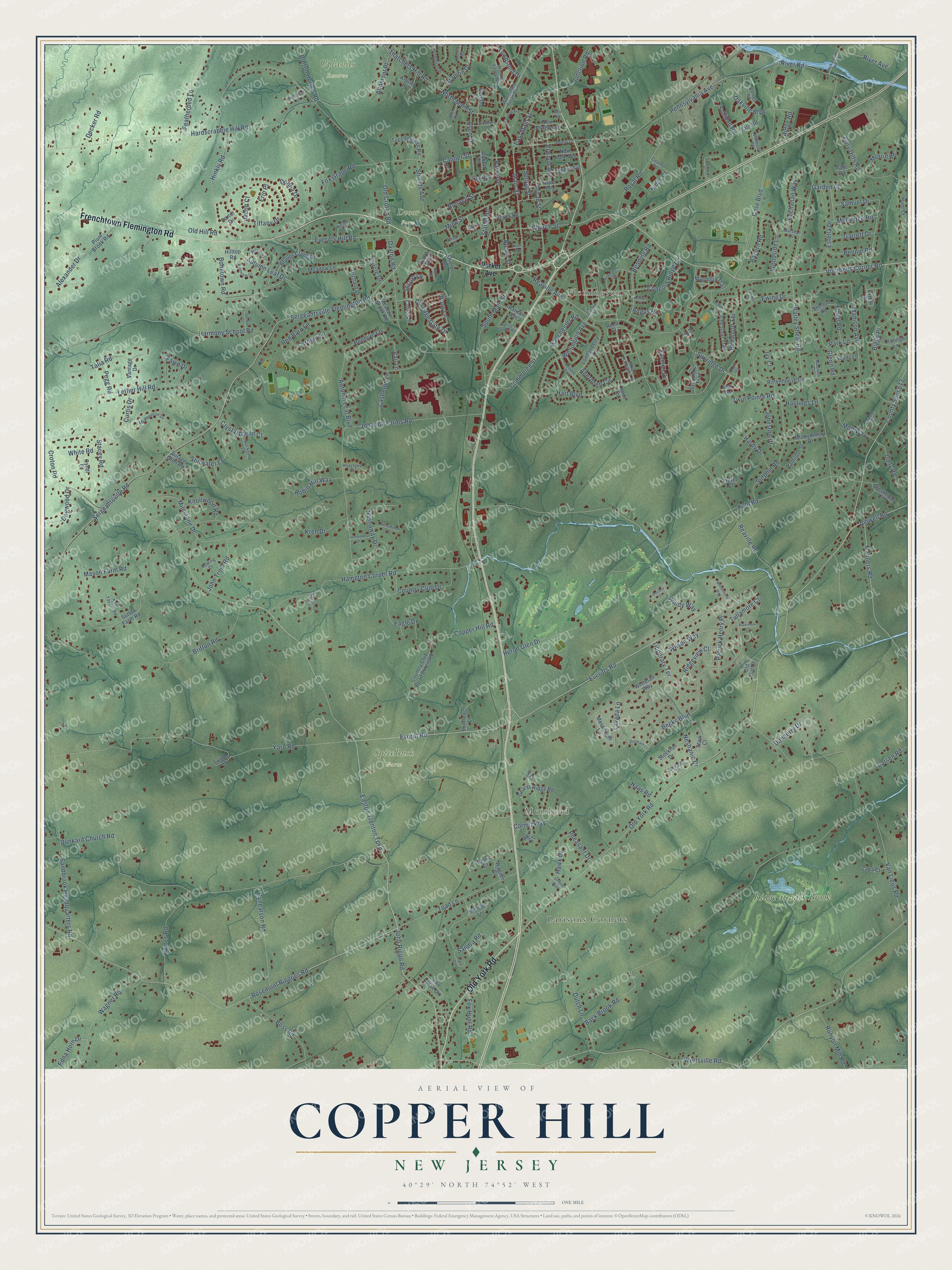
Explore Copper Hill, New Jersey from a whole new perspective. Created using aerial imagery and detailed geographic data, this map captures Copper Hill building by building, with labeled streets, familiar landmarks, and shaded topographical relief that highlights the natural contours of the landscape.
Combining modern data with the timeless character of a vintage atlas, this map is just as interesting up close as it is beautiful on the wall. Whether you grew up in Copper Hill, spent memorable years there, or call it home today, this unique map is a great way to celebrate a place that means something to you. Zoom in on the preview to look for your street, and then order a print to put your memories on the wall.
Three ways to hang it
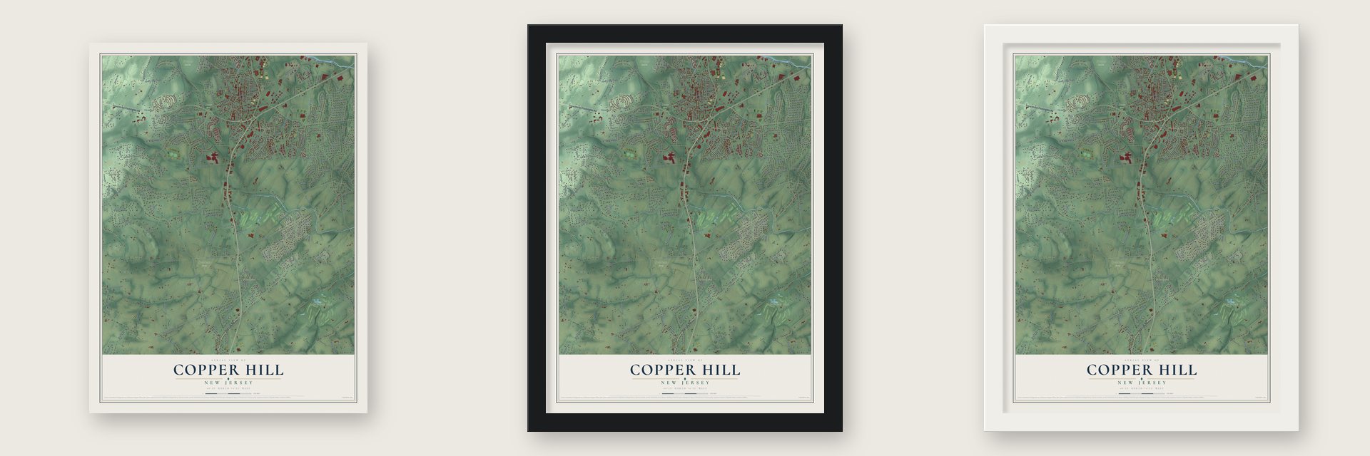
Unframed archival matte, a black wood frame or a white wood frame.
Up close
Geography Worth Displaying
This map was created using accurate cartographic data and authoritative geographic sources, including the U.S. Geological Survey and the Census Bureau. The map brings together terrain, waterways, roads, and building detail. The majority of the streets are labeled, houses are accurately depicted, and the topography is derived from government sources. Combining local data with carefully composed color and shading leads to this beautifully detailed Copper Hill artwork for your wall.
Rather than simply showing street outlines, we’ve included as many of the street names as we could reasonably fit on the map while keeping their names legible. Zoom in on the high resolution preview to see exactly what’s on the map. We truly set out to create a statement piece for anyone who loves Copper Hill. So whether it’s for you, or a gift for someone you love, we hope this map of Copper Hill brings back fond memories.
Read the story behind this map: Detailed Map of Copper Hill, New Jersey.

Find your street
Names on the Copper Hill map
Every name below is printed on this map. Look for your street, your school, the park where you played, or the pond down the road.
Places and landmarks7
- Flemington
- Muirhead
- Dvoor Farm
- SpiceBush Farm
- Uplands Reserve
- Larisons Corners
- Ridge at Back Brook
Streets and roads279
- Frenchtown Flemington Road
- Old York Road
- Sergeantsville Road
- Easton Trenton Turnpike
- Everitts Road
- Voorhees Corner Road
- Samson Drive
- Amwell Road
- South Main Street
- Townsend Drive
- Park Avenue
- Reaville Avenue
- Commerce Street
- Croton Road
- Wertsville Road
- Everitt Road
- Old Croton Road
- Kuhl Road
- Barley Sheaf Road
- Sergeantsville Flemington Road
- Rosemont Ringoes Road
- Reaville Road
- Dunkard Church Road
- Back Brook Road
- Yard Road
- Case Boulevard
- Van Lieus Road
- Johanna Farms Road
- Pennsylvania Avenue
- Hart Boulevard
Show all 279 streets
- Britton Road
- Harmony School Road
- Leffler Hill Road
- Hampton Corner Road
- Sandbrook Headquarters Road
- John Ringo Road
- Madison Avenue
- Mason Farm Road
- Becks Boulevard
- Dayton Road
- Milestone Drive
- Tiffany Drive
- County Spur 613
- River Road
- Manners Road
- Church Street
- Dutch Lane
- Broad Street
- Capner Street
- Hardscrabble Hill Road
- Neshanic Drive
- Toad Lane
- Sutphin Road
- Mott Way
- Bonetown Road
- Sandra Road
- Autumn Leaf Boulevard
- Main Street
- Wagner Road
- Hinkly Road
- Samuel Drive
- Everitts Hill Road
- Decker Road
- Royal Road
- Dory Dilts Road
- Mine Street
- Haines Road
- Old Hill Road
- Vail Lane
- Rynearson Road
- Biggs Place
- Boss Road
- Ewing Drive
- Redwood Terrace
- North Main Street
- Nashaway Drive
- Lavada Lane
- Estella Drive
- Featherbed Lane
- Sunridge Drive
- Country Club Drive
- Reading Road
- Wellington Avenue
- Dogwood Drive
- Ridge Road
- Carriage Gate Drive
- Glenn Road
- Copper Hill Road
- Danberry Drive
- East Main Street
- Heron Glen Drive
- Shields Avenue
- Aberdeen Circle
- River Avenue
- Bonnell Street
- Patrick Henry Place
- Elwood Avenue
- Thatchers Hill Road
- Sullivan Road
- Robin Hill Way
- Woodside Lane
- Stillwater Lane
- Tipperary Terrace
- Fawn Drive
- Autumn Leaf Drive
- Oakville Boulevard
- Runyon Mill Road
- Stirrup Lane
- Wilson Way
- Allen Street
- Stangl Road
- Concord Ridge Road
- Fox Grape Road
- Eagle Drive
- Talia Road
- Hawk Drive
- Johnston Drive
- Dally Road
- Larsen Road
- Pony Lane
- Junction Road
- Buchanan Way
- Barton Hollow Road
- Grandin Drive
- Kren Drive
- John Trout Road
- Cornet Way
- Bacorn Road
- Castleton Lane
- Windy Way
- Donna Drive
- Red Barn Lane
- Carman Lane
- Crystal Glenn Court
- Manchester Road
- Colts Lane
- Knollwood Road
- Alexander Drive
- Edna Horn Drive
- Stacey Road
- Bennie Road
- Merrill Road
- Garrett Drive
- Beehive Lane
- Angus Road
- Altamont Place
- Ridgeview Court
- Tullamore Court
- Molly Bee Road
- Twin Pointe Road
- Fox Hunt Road
- Hardy Drive
- Pheasant Drive
- Garden Place
- Brown Street
- White Road
- Hastings Lane
- Floral Road
- Spring Street
- Curtis Drive
- Pegg Road
- Park Lane
- Haas Road
- Circle Drive
- Jacob Court
- Kings Court
- Erin Place
- Ivy Court
- Parker Avenue
- Elm Terrace
- Forest Drive
- Meadow Lane
- Sutton Farm Road
- Rittenhouse Circle
- Messenger Lane
- Plum Brook Road
- Gearys Ridge Road
- Londonderry Drive
- Tate Road
- Chestnut Trail
- Country Club Road Extended
- Iron Horse Drive
- Beaver Creek Drive
- Tuccamirgan Road
- Emery Avenue
- Whitetail Way
- Court Street
- New York Avenue
- New Jersey Avenue
- Sycamore Trail
- Vantage Drive
- Hamilton Street
- Montgomery Drive
- Dvoor Boulevard
- Meadow Brook Road
- Village Glen Road
- Orchard Drive
- Magnolia Trail
- Stark Court
- Sunflower Lane
- Stockton Drive
- Claridge Lane
- Shields Road
- Raritan Avenue
- Reed Court
- Wagner Court
- Crestmont Court
- Pierce Court
- Shelton Road
- Laga Court
- Shady Lane
- Garden Lane
- Fulper Road
- Cyndi Court
- Fir Court
- Hunt Court
- Carter Drive
- Michael Lane
- Paul Road
- Rex Court
- Hilltop Road
- Bellis Court
- Abbott Court
- Old Mill Court
- Alpine Place
- Leeds Road
- Walter East Foran Boulevard
- Bristol Avenue
- McPherson Drive
- Wooded Valley Way
- Maple Avenue
- Honeyman Drive
- Penny Lane
- Savanna Court
- Barnett Road
- Knoll Tavern Road
- Saratoga Drive
- Indian Plantation Street
- Dewing Court
- Buckeye Lane
- Hart Lane
- Marshall Drive
- Hoagland Court
- Millbrook Road
- Nicole Lane
- Colony Road
- Hillcrest Drive
- Svoboda Road
- Madison Court
- Lowe Court
- Oriole Way
- Yorkshire Drive
- Lexington Circle
- Greenwood Place
- Mulberry Lane
- Kentview Court
- Hopewell Avenue
- Rockafellows Mill Road
- Maple Court
- Persimmon Court
- Manchur Court
- Atkinson Court
- Whitehouse Way
- Monsey Road
- Ironwood Drive
- Corcoran Street
- Denmark Lane
- Spring Garden Road
- Moore Drive
- Dunbar Court
- Riverview Court
- West Road
- Decatur Court
- Grant Avenue
- Deats Lane
- Einstein Court
- Village Court
- Kenner Court
- Bush Road
Names are listed as they appear on the printed map. Zoom into the product photos to find them.
About Copper Hill, New Jersey
Copper Hill took its name from the old copper mines in the area. The community had a post office by 1860. Its station served the Belvidere Delaware Railroad's Flemington branch. Today the Black River and Western Railroad uses that same track.
Keep exploring New Jersey
Copper Hill is one of 990 New Jersey towns we've mapped. Every dot on the map is a print of its own.
The search covers every state, New Jersey first.
Near Copper Hill
Order 2 or more town maps and save 10%. Shown in the size and finish you picked above, so they hang as a set.
- Flemington 12" x 18" / Archival Matte Print $39.99
- Ringoes 12" x 18" / Archival Matte Print $39.99
- East Amwell 12" x 18" / Archival Matte Print $39.99
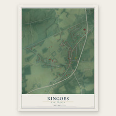
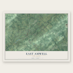
More maps nearby: Three Bridges, Raritan, Delaware, West Amwell and Stockton.
The art of mapping a place
How This Map Was Made
Real places. Remarkable detail. Discover the layers that turn geographic data into a map of home.

The view from above
Aerial imagery reveals the character of the land: woodland, open fields, and the patterns of a place.

The shape of the land
Elevation data brings hills, valleys, and subtle changes in the landscape into view.

The details of home
Roads, waterways, and building footprints come together to make the map feel unmistakably local.

Geography becomes art
Considered color, shading, and typography bring the layers together in a map made for your wall.


Process illustrated with Mendon, Massachusetts. Aerial imagery: USDA NAIP. Terrain: USGS 3D Elevation Program. Map details and finished artwork: KNOWOL.
The Details
About This Print
Choose an archival matte print, or a black or white Ayous wood frame. The archival matte print is unframed.
Select your size and finish above to see the matching product image and price.
Materials & Craftsmanship
A contemporary map with the character of a classic atlas, printed on archival matte paper. Optional frames are made from Ayous wood.
Your printed map does not include the watermark shown in the full-map preview.
Shipping & Delivery
Free shipping within the United States. Every print is made to order in the USA.
Buying a gift? Add a note in your cart and we'll include it. We never put prices in the package.
Prints ship within 2 to 3 business days. Allow 7 to 10 days total from ordering for delivery. Timing may vary during holidays or periods of high order volume.
Read our shipping policy.
Returns and damaged prints
Each print is made to order. Change-of-mind refunds are not available after production.
If your print arrives damaged, misprinted or incorrect, contact support@knowol.com within 30 days of receiving it. Include your order number, photos and a description of the issue.
Read our full refund and replacement policy. For questions about your order, email support@knowol.com.