
Search for another town





Free U.S. delivery 7 to 10 days after you order
Raritan, Hunterdon County, New Jersey Map Art
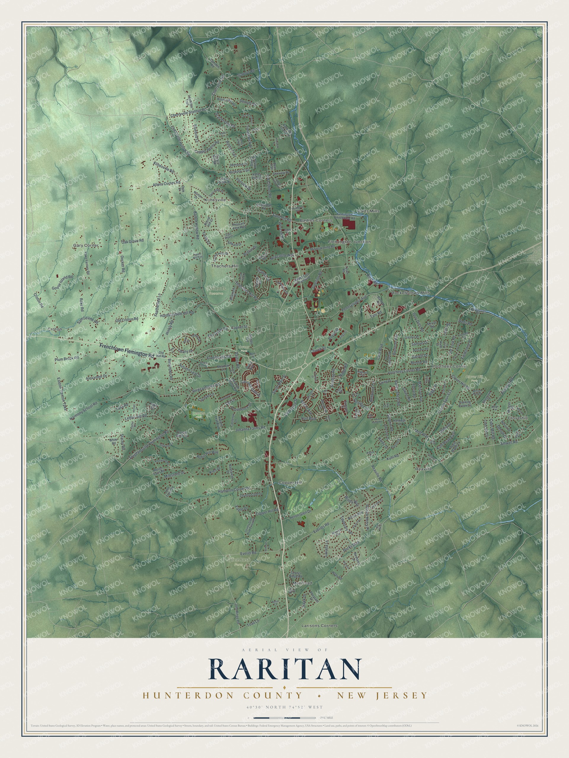
A new map of Raritan, Hunterdon County, New Jersey, made in 2026 and printed to order on thick archival matte paper.
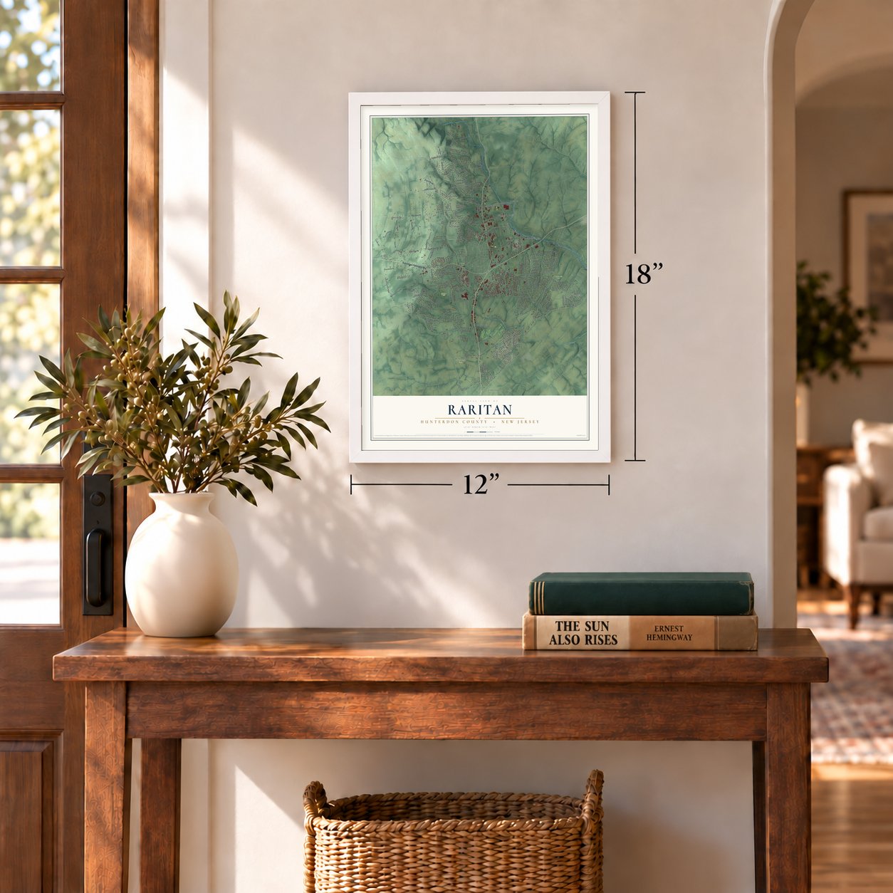
12" x 18" Archival Matte Print
A Map of Home. A Work of Art.
Bring a piece of Raritan home. Whether it’s where you grew up, your current home, or simply a moment in your life, this Raritan, New Jersey map print brings those memories to your wall. Antique-inspired styling and modern geographic detail combine to create artwork that’s beautiful from across the room, with plenty to study and explore when you get up close.
Three ways to hang it
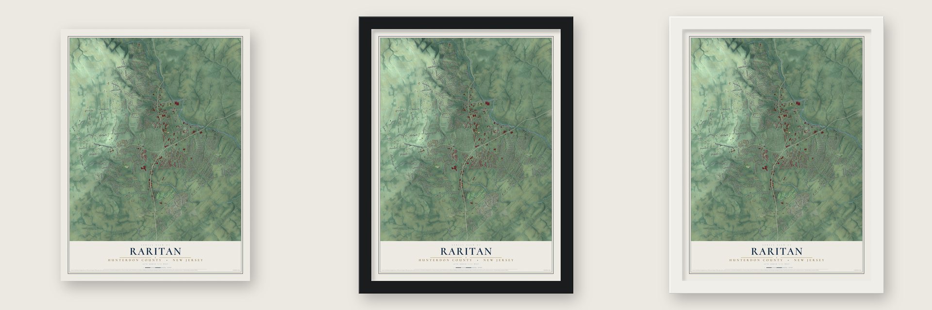
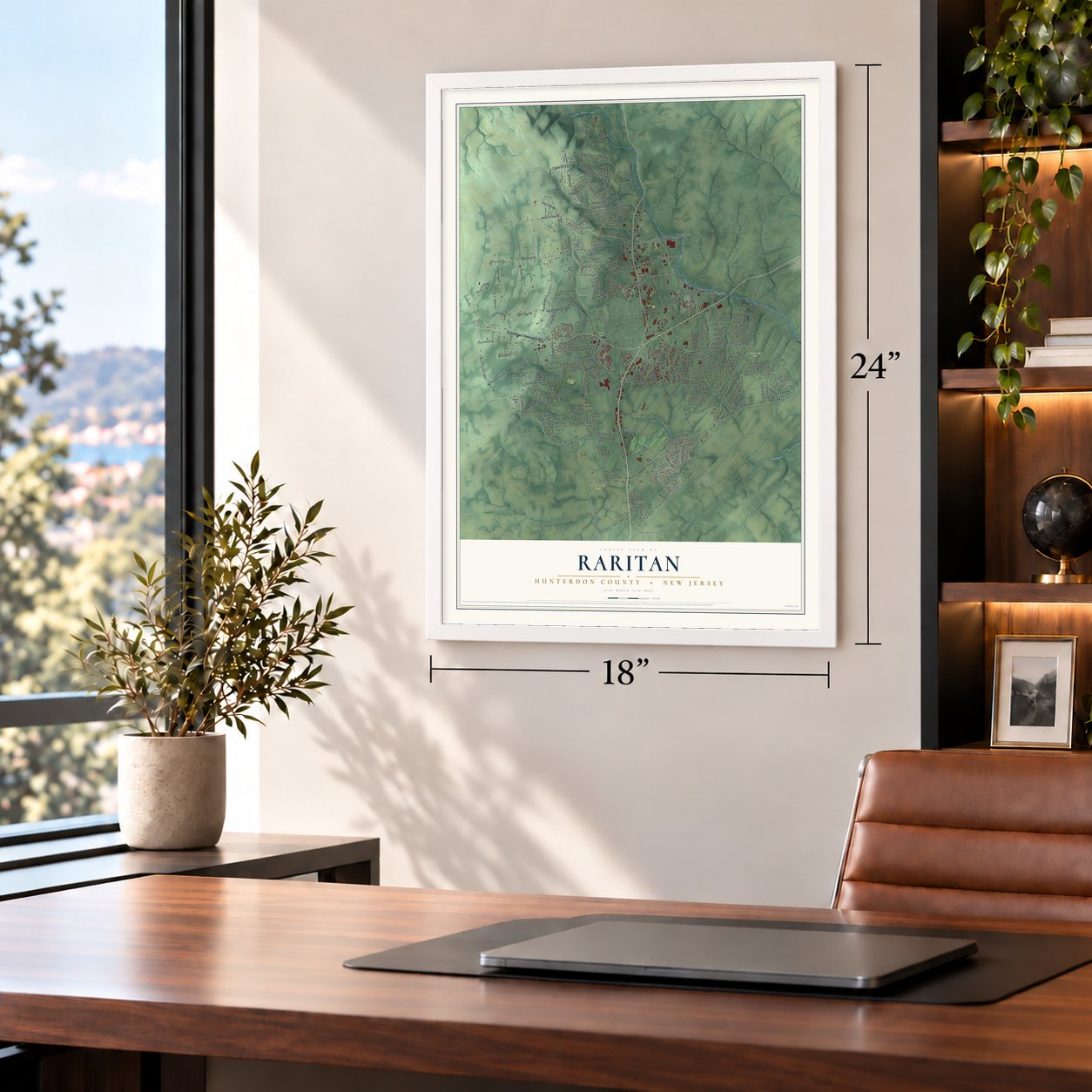
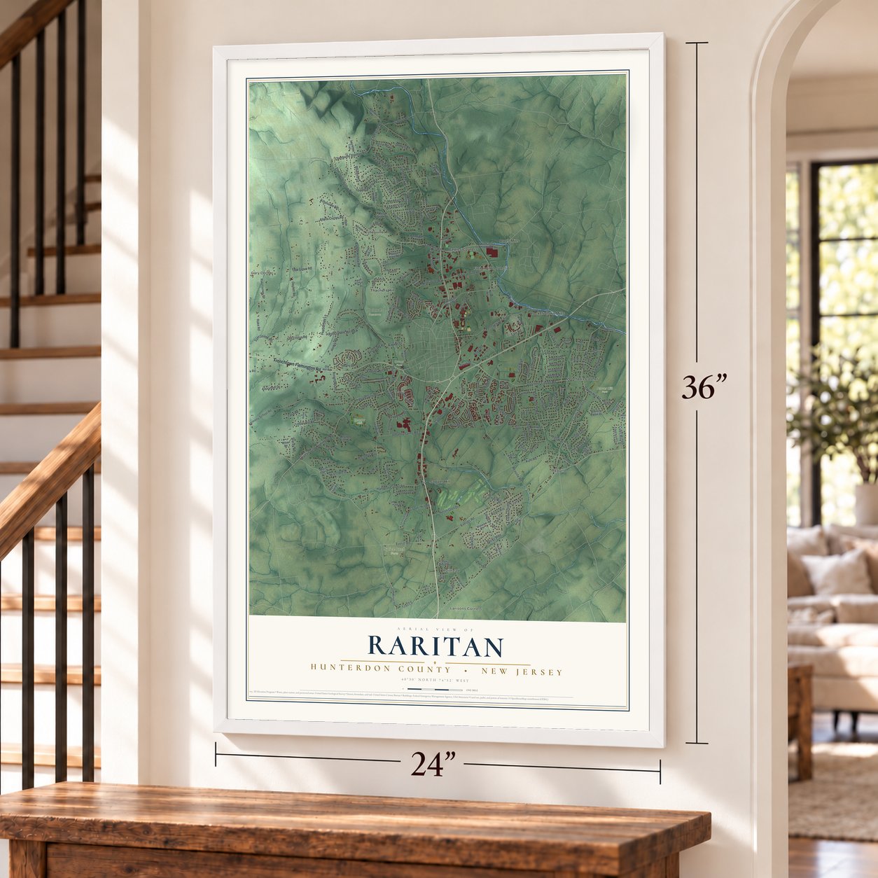
Unframed archival matte, a black wood frame or a white wood frame.
Up close
Real geography. Art worth displaying.
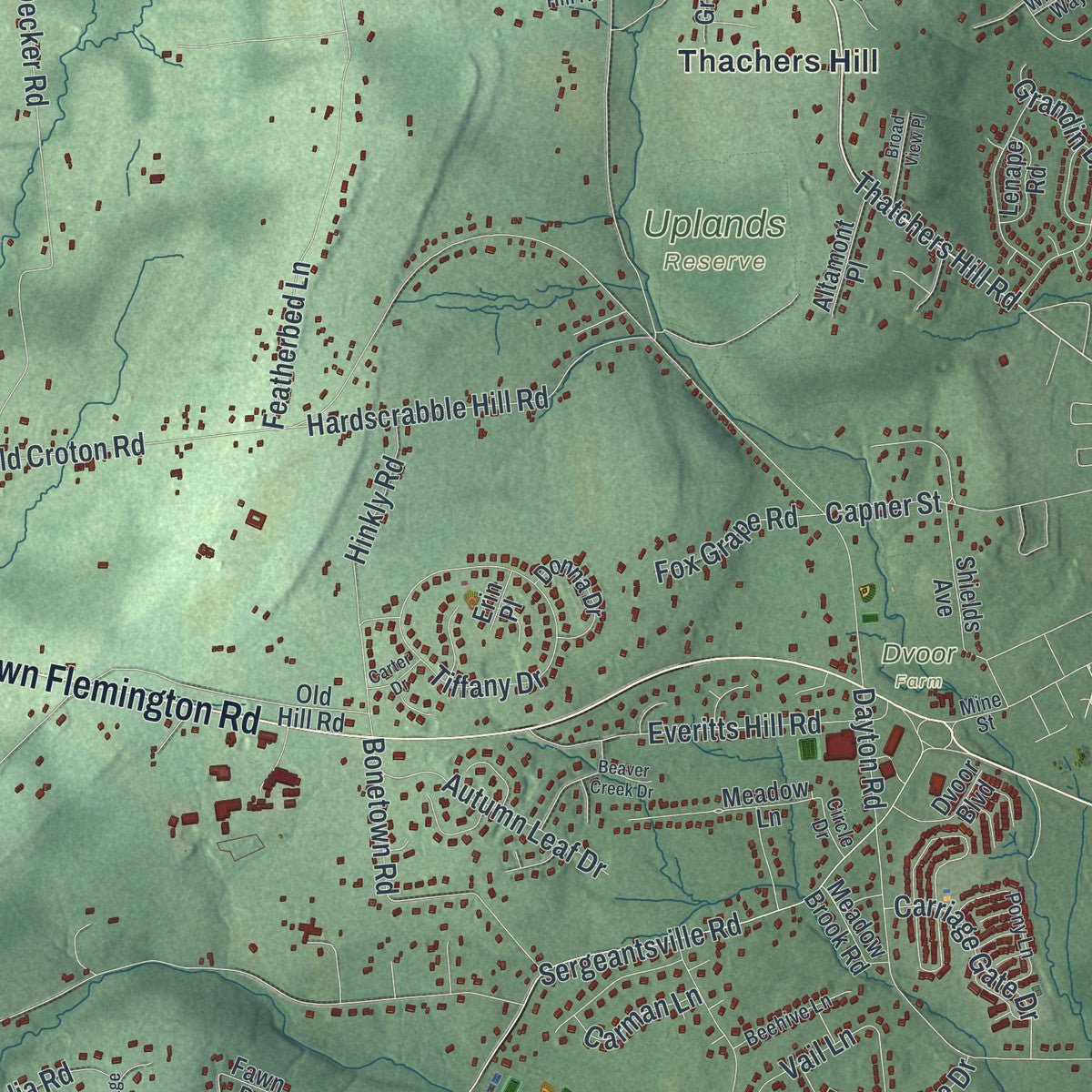
This map was created using accurate cartographic data and authoritative geographic sources, including the U.S. Geological Survey (USGS) and FEMA. The map brings together terrain, waterways, roads, and building detail. The majority of the streets are labeled, houses are accurately depicted, and the topography is derived from government sources. Combining local data with carefully composed color and shading leads to this beautifully detailed Raritan artwork for your wall.
Rather than simply showing street outlines, we’ve included as many of the street names as we could reasonably fit on the map while keeping their names legible. Zoom in on the high resolution preview to see exactly what’s on the map. We truly set out to create a statement piece for anyone who loves Raritan. So whether it’s for you, or a gift for someone you love, we hope this map of Raritan brings back fond memories.
Explore the full map of Raritan, Hunterdon County, New Jersey and read about the local places it shows.

About Raritan, Hunterdon County, New Jersey
Raritan in Hunterdon County includes a network of long-established roads, small communities and public green spaces. Frenchtown Flemington Road and Old York Road connect places such as Bartles Corners, Cloverhill and Copper Hill, while several parks provide familiar local reference points.
- Five named communitiesRaritan includes Bartles Corners, Cloverhill and Copper Hill. Croton and Darts Mills are also identified locally.
- Clover Hill ParkClover Hill Park is one of three local green spaces named in the source article.
- Lenape ParkLenape Park and Uplands Reserve are also identified as local outdoor places.
- Old York RoadOld York Road appears among the principal local routes through Raritan.
Find your street
Names on the Raritan map
Every name below is printed on this map. Look for your street, your school, the park where you played, or the pond down the road.
Places and landmarks19
- Clover Hill Park
- Dvoor Farm
- Lenape Park
- SpiceBush Farm
- Uplands Reserve
- Bartles Corners
- Cloverhill
- Copper Hill
- Croton
- Darts Mills
- Flemington Junction
- Gary Corner
Show all 19 places
- Klinesville
- Larisons Corners
- Muirhead
- Reaville
- Rockefellows Mills
- Thachers Hill
- Voorhees Corner
Streets and roads238
- Frenchtown Flemington Road
- Old York Road
- Amwell Road
- Thatchers Hill Road
- Klinesville Road
- Sand Hill Road
- Junction Road
- Cherryville Stanton Road
- River Road
- Easton Trenton Turnpike
- Voorhees Corner Road
- Commerce Street
- Pennsylvania Avenue
- Everitts Road
- South Main Street
- Old Croton Road
- Croton Road
- Old Clinton Road
- Everitt Road
- Kuhl Road
- Barley Sheaf Road
- Sergeantsville Flemington Road
- Oak Grove Road
- Featherbed Lane
- Reaville Road
- Sergeantsville Road
- Cherryville Hollow Road
- Harmony School Road
- Barton Hollow Road
- Case Boulevard
Show all 238 streets
- Johanna Farms Road
- County Spur 613
- Clover Hill Road
- Hart Boulevard
- Rake Road
- Rustic Trail
- Leffler Hill Road
- Hampton Corner Road
- Copper Penny Road
- Plum Brook Road
- Decker Road
- Madison Avenue
- Cherryville Road
- Becks Boulevard
- Dayton Road
- Milestone Drive
- Allens Corner Road
- Tiffany Drive
- Timberwick Drive
- Newcastle Way
- Dory Dilts Road
- Goose Island Road
- Fairview Drive
- Hardscrabble Hill Road
- Toad Lane
- Sutphin Road
- Mott Way
- Bonetown Road
- Hinkly Road
- Samuel Drive
- Everitts Hill Road
- Royal Road
- Biggs Place
- Grandin Drive
- Plennert Road
- Olden Drive
- Bluebird Court
- Vail Lane
- Redwood Terrace
- Scarlet Oak Road
- Lavada Lane
- Sunridge Drive
- Wescott Drive
- Reading Road
- Alexander Drive
- Ridge Road
- Carriage Gate Drive
- Stanton Road
- Glenn Road
- Cider Mill Road
- Kuhl Road East
- Copper Hill Road
- Heron Glen Drive
- Wells Road
- Dehoff Drive
- Fieldstone Place
- Providence Drive
- Sam Levine Road
- Patrick Henry Place
- Bristol Avenue
- Robin Hill Way
- Tipperary Terrace
- Autumn Leaf Drive
- Tate Road
- Britton Drive
- Demott Road
- Capner Street
- Fox Grape Road
- Eagle Drive
- Talia Road
- Hawk Drive
- Hickory Trail
- Turtle Court
- Kren Drive
- Litton Road
- Windy Way
- Carman Lane
- Stacey Road
- Bennie Road
- Garrett Drive
- Hardy Drive
- Church Street
- Floral Road
- Walter East Foran Boulevard
- Samson Drive
- Hamden Road
- Rake Factory Road
- Minneakoning Road
- Neshanic Drive
- Autumn Leaf Boulevard
- Running Brook Circle
- Old Hill Road
- Ewing Drive
- Nashaway Drive
- Country Club Drive
- Mason Farm Road
- Pleasant View Way
- Valley View Drive
- Flemington Whitehouse Road
- Aberdeen Circle
- Cider Hill Circle
- Sleepy Hollow Drive
- Gearys Ridge Road
- Woodside Lane
- Fawn Drive
- Meadow Lane
- Rolin's Mill Road
- Norton Drive
- Wilson Way
- John Ringo Road
- Nevius Drive
- Johnston Drive
- Buchanan Way
- Shields Avenue
- John Trout Road
- Laurelton Trail
- Starview Drive
- Green Hills Drive
- Morgan Road
- Castleton Lane
- Townsend Drive
- Northridge Road
- Edward Drive
- Donna Drive
- Packerds Island Lane
- Crystal Glenn Court
- Flory's Mill Road
- Merrill Road
- Altamont Place
- Deerpond Court
- Deer Trail
- Pheasant Drive
- Dvoor Boulevard
- Sheppard Drive
- Garden Place
- Meadow Brook Road
- White Road
- Hastings Lane
- Lenape Road
- Cross Creek Drive
- Sugar Maple Lane
- Round Hill Court
- Dale Drive
- Haas Road
- Barnett Road
- Tyson Road
- Fir Court
- Hunt Court
- Erin Place
- Rex Court
- Ivy Court
- Elm Terrace
- Hillsborough Road
- Forest Drive
- Claridge Lane
- Stillwater Lane
- Dally Road
- Pony Lane
- Country Club Road Extended
- Windsor Way
- Knollwood Road
- Cornfield Terrace
- Quail Ridge Drive
- Whitetail Way
- Beehive Lane
- Angus Road
- Tullamore Court
- Sycamore Trail
- Molly Bee Road
- Hamilton Street
- Viking Terrace
- Haven Hill Rise
- Magnolia Trail
- Curtis Drive
- Circle Drive
- Pierce Court
- William Penn Drive
- Gaunt Place
- Kings Court
- East View Court
- Bellis Court
- Alwyn Terrace
- Mine Street
- Yorkshire Drive
- Wellington Avenue
- Beaver Creek Drive
- Covered Bridge Road
- Healthquest Boulevard
- Waldron Lane
- Ups 'N' Downs Court
- Ridgeview Court
- Twin Pointe Road
- Vantage Drive
- Sunflower Lane
- Broad View Place
- Harvest Court
- Rolling Lane
- Reed Court
- Crestmont Court
- Pinewood Court
- Brockton Court
- Jenny Jump Court
- Carter Drive
- Alles Court
- Kuehn Court
- Old Mill Court
- Marys Court
- Leeds Road
Names are listed as they appear on the printed map. Zoom into the product photos to find them.
The art of mapping a place
How This Map Was Made
Real places. Remarkable detail. Discover the layers that turn geographic data into a map of home.

The view from above
Aerial imagery reveals the character of the land: woodland, open fields, and the patterns of a place.

The shape of the land
Elevation data brings hills, valleys, and subtle changes in the landscape into view.

The details of home
Roads, waterways, and building footprints come together to make the map feel unmistakably local.

Geography becomes art
Considered color, shading, and typography bring the layers together in a map made for your wall.


Process illustrated with Mendon, Massachusetts. Aerial imagery: USDA NAIP. Terrain: USGS 3D Elevation Program. Map details and finished artwork: KNOWOL.
The Details
About This Print
Choose an archival matte print, or a black or white Ayous wood frame. The archival matte print is unframed.
Select your size and finish above to see the matching product image and price.
Materials & Craftsmanship
A contemporary map with the character of a classic atlas, printed on archival matte paper. Optional frames are made from Ayous wood.
Your printed map does not include the watermark shown in the full-map preview.
Shipping & Delivery
Free shipping within the United States. Every print is made to order in the USA.
Buying a gift? Add a note in your cart and we'll include it. We never put prices in the package.
Prints ship within 2 to 3 business days. Allow 7 to 10 days total from ordering for delivery. Timing may vary during holidays or periods of high order volume.
Read our shipping policy.
Returns and damaged prints
Each print is made to order. Change-of-mind refunds are not available after production.
If your print arrives damaged, misprinted or incorrect, contact support@knowol.com within 30 days of receiving it. Include your order number, photos and a description of the issue.
Read our full refund and replacement policy. For questions about your order, email support@knowol.com.
Find your town
Looking for another city?
Find a map of home in our New Jersey collection.
Nearby
Maps of towns near Raritan
Know someone from one of these towns? Their map makes a great gift.


