
Search for another town




Free U.S. delivery 7 to 10 days after you order
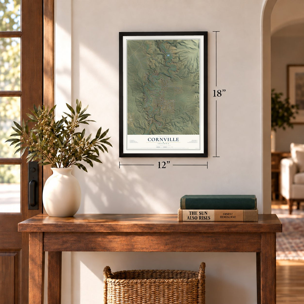
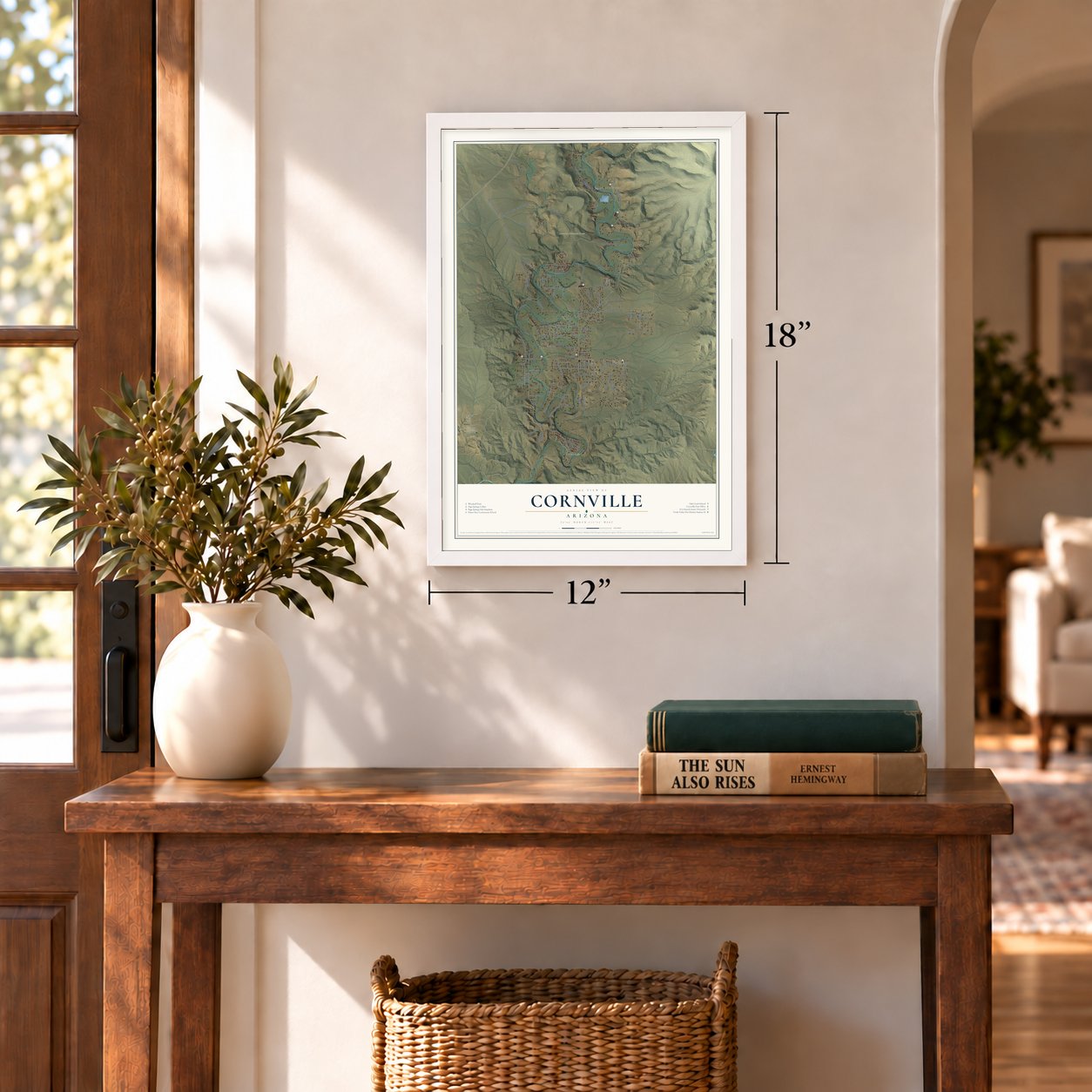
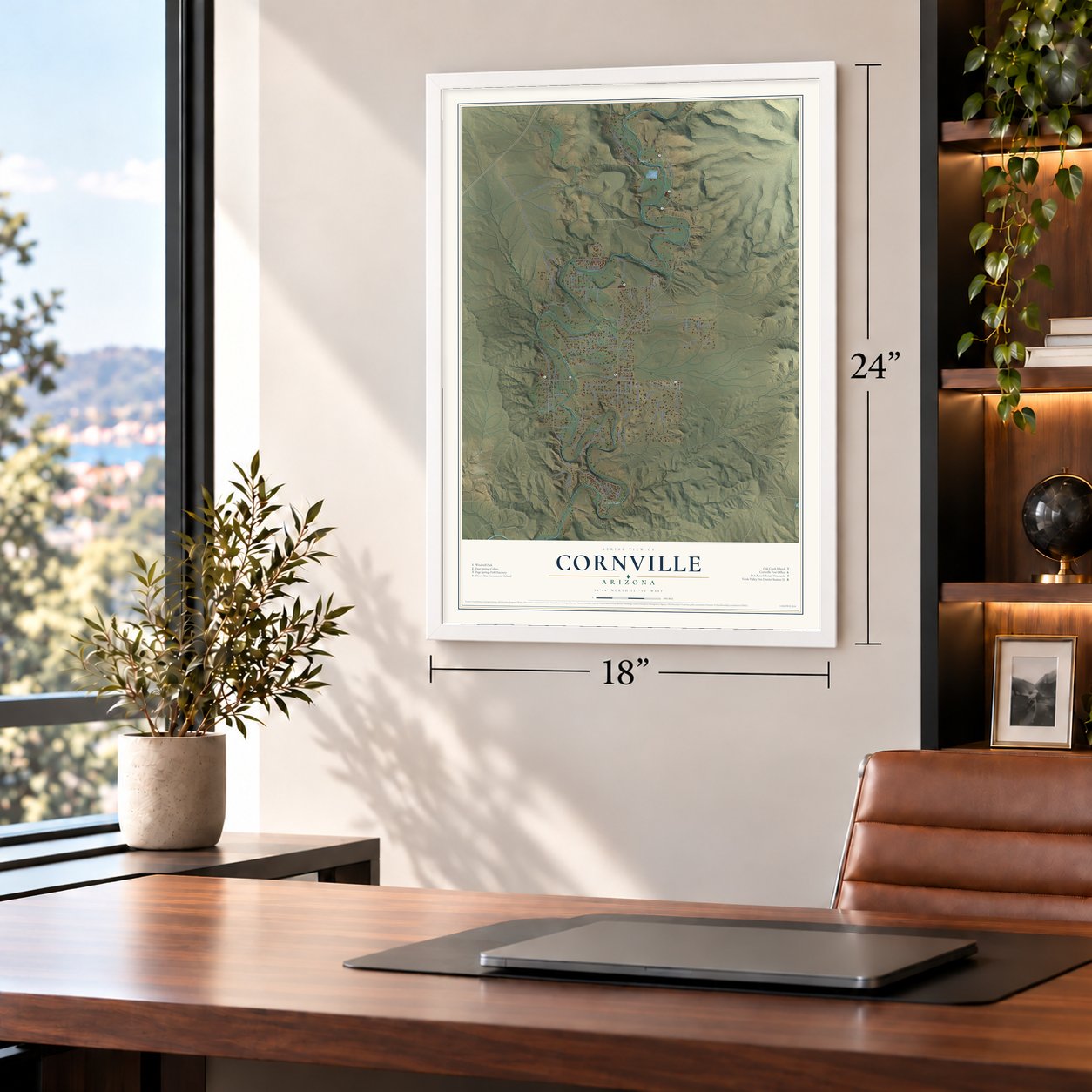
Cornville, Arizona Map Art
Building by building, with labeled streets and shaded relief.
12" x 18" Archival Matte Print
A Map of Home. A Work of Art.
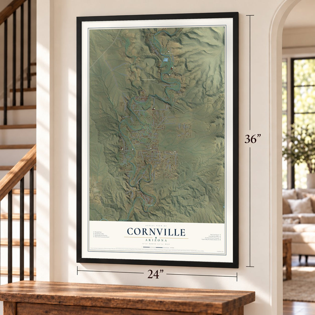
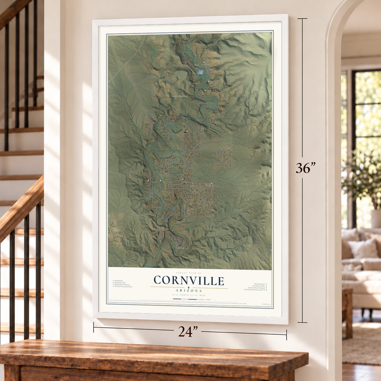
Explore Cornville, Arizona from a whole new perspective. Created using aerial imagery and detailed geographic data, this map captures Cornville building by building, with labeled streets, familiar landmarks, and shaded topographical relief that highlights the natural contours of the landscape.
Combining modern data with the timeless character of a vintage atlas, this map is just as interesting up close as it is beautiful on the wall. Whether you grew up in Cornville, spent memorable years there, or call it home today, this unique map is a great way to celebrate a place that means something to you. Zoom in on the preview to look for your street, and then order a print to put your memories on the wall.

Three ways to hang it
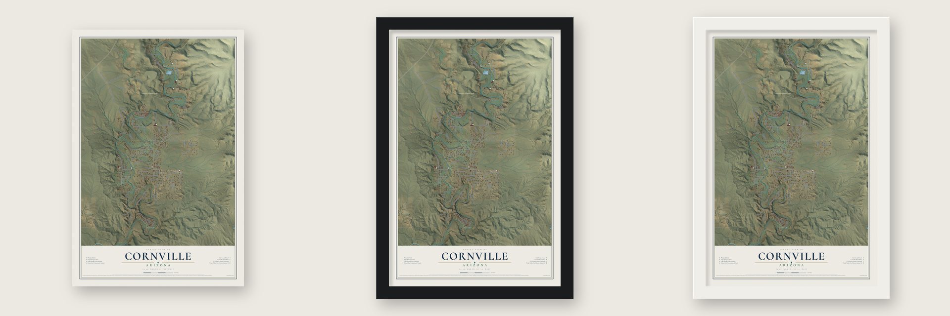
Unframed archival matte, a black wood frame or a white wood frame.
Up close
Geography Worth Displaying
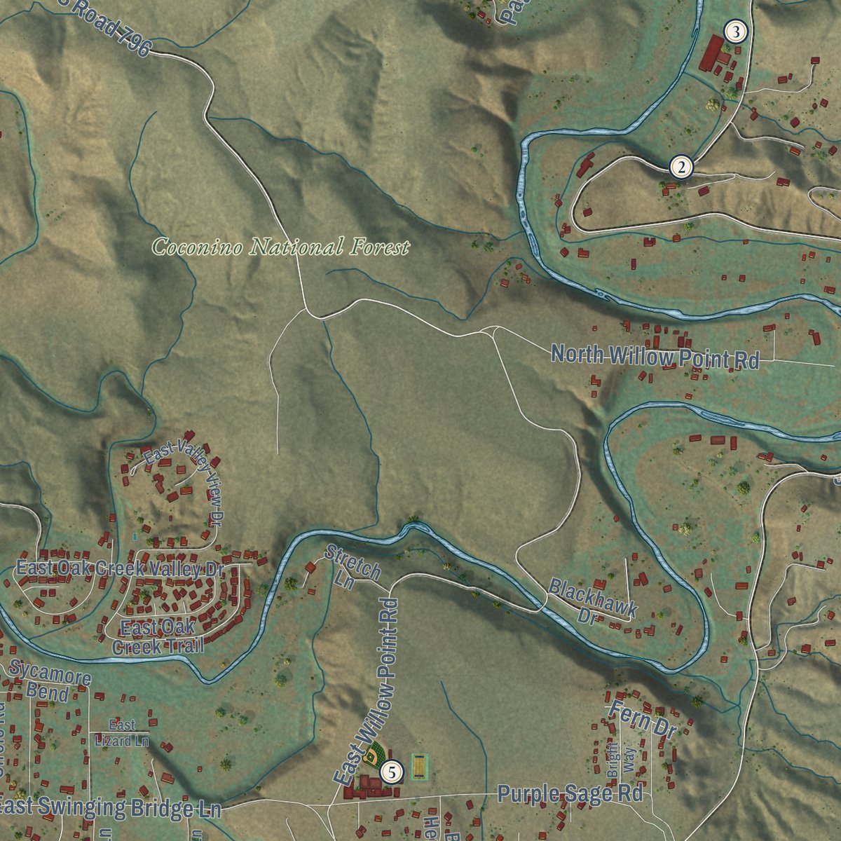
This map was created using accurate cartographic data and authoritative geographic sources, including the U.S. Geological Survey (USGS) and FEMA. The map brings together terrain, waterways, roads, and building detail. The majority of the streets are labeled, houses are accurately depicted, and the topography is derived from government sources. Combining local data with carefully composed color and shading leads to this beautifully detailed Cornville artwork for your wall.
Rather than simply showing street outlines, we’ve included as many of the street names as we could reasonably fit on the map while keeping their names legible. Zoom in on the high resolution preview to see exactly what’s on the map. We truly set out to create a statement piece for anyone who loves Cornville. So whether it’s for you, or a gift for someone you love, we hope this map of Cornville brings back fond memories.
Explore the full map of Cornville, Arizona and read about the local places it shows.

Find your street
Names on the Cornville map
Every name below is printed on this map. Look for your street, your school, the park where you played, or the pond down the road.
Places and landmarks3
- Jordan
- Page Springs
- Coconino National Forest
Streets and roads121
- East Willow Point Road
- FS Road 796
- South Loy Road
- Cornville Road
- East Lee Pasture Road
- North Willow Point Road
- Page Springs Road
- Loy Road
- Oak Creek Valley Road
- Chick Road
- Hillside Drive
- East Swinging Bridge Lane
- South Sugarloaf Road
- East Manley Lane
- Hart Lane
- East Cornville Road
- Forest 119 Road
- North Oak Creek Valley Road
- South Aspaas Road
- South Page Springs Road
- Merritt Ranch Road
- East Plateau Drive
- Winter Sun Drive
- East Waddell Road
- Purple Sage Road
- Sheepshead Crossing Road
- Page Lane
- Mountain View Road
- Circle Drive
- South Kadomoto Drive
Show all 121 streets
- East Willow Drive
- Willow Drive
- Desert Holly Trail
- Angel Crest Drive
- South Loy Street
- South Libby Lane
- Stingray Lane
- Mulcaire Road
- Road
- Derrick Lane
- Mels Road
- Baxter Lane
- Ward Lane
- Ridge Road
- Badger Lane
- Gloria Lane
- Family Lane
- Fuller Lane
- Jojo Lane
- Zale Lane
- Loy Lane
- Fern Drive
- Airstrip
- South Forest View Drive
- Southern Drive
- South Horton Drive
- Eastern Drive
- North Page Springs Road
- East Oak Creek Trail
- South Chick Road
- East Oak Creek Valley Drive
- South Adobe Drive
- Sugarloaf Road
- North Aspaas Road
- South Koch Ranch Road
- North Dancing Apache Road
- North Merritt Ranch Road
- South Merritt Ranch Road
- East Circle Drive
- North Farm Circle Road
- Pear Tree Drive
- South Sexton Ranch Road
- Lolo Mai Road
- Sundance Lane
- Creekside Bend
- Blackhawk Drive
- Blue Heron Drive
- South Solair Drive
- Price Road
- South Ole Paint Way
- South Karlson Drive
- Sycamore Bend
- Stretch Lane
- Valley View Road
- East Adams Lane
- South Coyote Lane
- East Garden Lane
- Alvey Lane
- East Rhodes Road
- Lady Bug Lane
- Ash Lane
- Western Drive
- East Pear Tree Drive
- East Valley View Drive
- Raby Heights Drive
- East Mingus View Drive
- South Bright Star Lane
- Bent Creek Lane
- Hilltop Lane
- Dees Road
- South Waddup Lane
- South Central Drive
- Libby Lane
- Cardinal Way
- Oak Bend Drive
- Marsh Lane
- Cherokee Way
- Elizabeth Lane
- Bonito Ranch Loop
- Hidden View Drive
- Spring Creek Ranch Road
- East Rindone Lane
- Schwab Lane
- Bright Way
- New Moon Court
- Brookside Drive
- Lichlyter Place
- Raven Roost Road
- East Lizard Lane
- South Laura Lane
- Eden Lane
Names are listed as they appear on the printed map. Zoom into the product photos to find them.
About Cornville, Arizona
Cornville is an unincorporated community of 3,362 people in Yavapai County, on Oak Creek between Sedona and Cottonwood. Andrew Jackson, a Virginian who had served as a Confederate captain, came to lower Oak Creek with his wife, Margaret, in the spring of 1876. More families joined them by the next spring: the Tiptons, Pages, Munds, Copples, Mullhollands and Dickinsons. The newcomers soon dug a ditch to water farms on the creek's west bank.
A post office opened on May 11, 1887, and Samuel Dickinson ran it until 1907. When cattle profits fell and the Great Depression hit, many families lived off small farms, while others found work at the mines and smelters in Jerome, Clarkdale and Cottonwood. Cornville remained a farming town until retirees and commuters started moving in, in large numbers, by the late 1960s.
“but they were so wrought up over the stories of massacres and murders that the Indians themselves were in the greatest danger.”
- Sinagua, Yavapai and Dilzhe'eThe Sinagua farmed the land around the Cornville Bridge, and some Hopi clans say they descend from them. The Spanish explorer Antonio de Espejo came through on May 7 or 8, 1583, heading toward the future site of Jerome. In 1875 the U.S. Army marched the area's Yavapai and Apache people to the San Carlos Reservation, but many Dilzhe'e hid along lower Oak Creek, and in 1876 numbers of them still lived nearby.
- Cohnville or CornvilleForest ranger L.J. Putsch wrote that the pioneers asked for Cohnville, after a local family, and accepted Cornville when Washington misread it. The 1880 census lists no Cohn or Kohn family in the area, though. Another theory points to settler James Dunning Tewksbury, born in Cornville, Maine, in 1823. Postmaster Samuel Dickinson most likely sent in the name.
- How Page Springs got its nameIn 1878 Benjamin Coppel sold his proved homestead at the spring to two partners, Mr. Cone and Mr. Houghton. They farmed it for a year, rented it to a family from Arkansas, and around 1880 sold their shares to James Page. Today the Arizona Game and Fish Department runs a large fish hatchery there, with trails and bird-watching spots along the creek.
- Eliphante, begun in 1987Michael Kahn and Leda Livant Kahn began building Eliphante, a sculptural village covering three acres, in 1987. They worked on it for nearly three decades, coating rebar and pipe with concrete and pressing in glass, wood, rock and bits of pottery. The rock entrance of the main building looks like a trunk, which gave the place its name.
- McCain's Sedona CabinSenator John McCain kept a home on Oak Creek near Page Springs, which reporters called his "Sedona Cabin." In 2008 he and his running mate, Sarah Palin, prepared there for their debates, and he died in that home on August 25, 2018.
Keep exploring Arizona
Cornville is one of 519 Arizona towns we've mapped. Every dot on the map is a print of its own.
The search covers every state, Arizona first.
Near Cornville
Order 2 or more town maps and save 10%. Shown in the size and finish you picked above, so they hang as a set.
- Verde Village 12" x 18" / Archival Matte Print $39.99
- Yavapai-Apache Nation 12" x 18" / Archival Matte Print $39.99
- Cottonwood 12" x 18" / Archival Matte Print $39.99
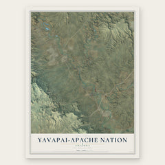

More maps nearby: Red Rock, Clarkdale, Village of Oak Creek, Lake Montezuma and Sedona.
The art of mapping a place
How This Map Was Made
Real places. Remarkable detail. Discover the layers that turn geographic data into a map of home.

The view from above
Aerial imagery reveals the character of the land: woodland, open fields, and the patterns of a place.

The shape of the land
Elevation data brings hills, valleys, and subtle changes in the landscape into view.

The details of home
Roads, waterways, and building footprints come together to make the map feel unmistakably local.

Geography becomes art
Considered color, shading, and typography bring the layers together in a map made for your wall.


Process illustrated with Mendon, Massachusetts. Aerial imagery: USDA NAIP. Terrain: USGS 3D Elevation Program. Map details and finished artwork: KNOWOL.
The Details
About This Print
Choose an archival matte print, or a black or white Ayous wood frame. The archival matte print is unframed.
Select your size and finish above to see the matching product image and price.
Materials & Craftsmanship
A contemporary map with the character of a classic atlas, printed on archival matte paper. Optional frames are made from Ayous wood.
Your printed map does not include the watermark shown in the full-map preview.
Shipping & Delivery
Free shipping within the United States. Every print is made to order in the USA.
Buying a gift? Add a note in your cart and we'll include it. We never put prices in the package.
Prints ship within 2 to 3 business days. Allow 7 to 10 days total from ordering for delivery. Timing may vary during holidays or periods of high order volume.
Read our shipping policy.
Returns and damaged prints
Each print is made to order. Change-of-mind refunds are not available after production.
If your print arrives damaged, misprinted or incorrect, contact support@knowol.com within 30 days of receiving it. Include your order number, photos and a description of the issue.
Read our full refund and replacement policy. For questions about your order, email support@knowol.com.