
Search for another town



Free U.S. delivery 7 to 10 days after you order
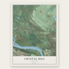
Crystal Hill, Arkansas Map Art
Building by building, with labeled streets and shaded relief.
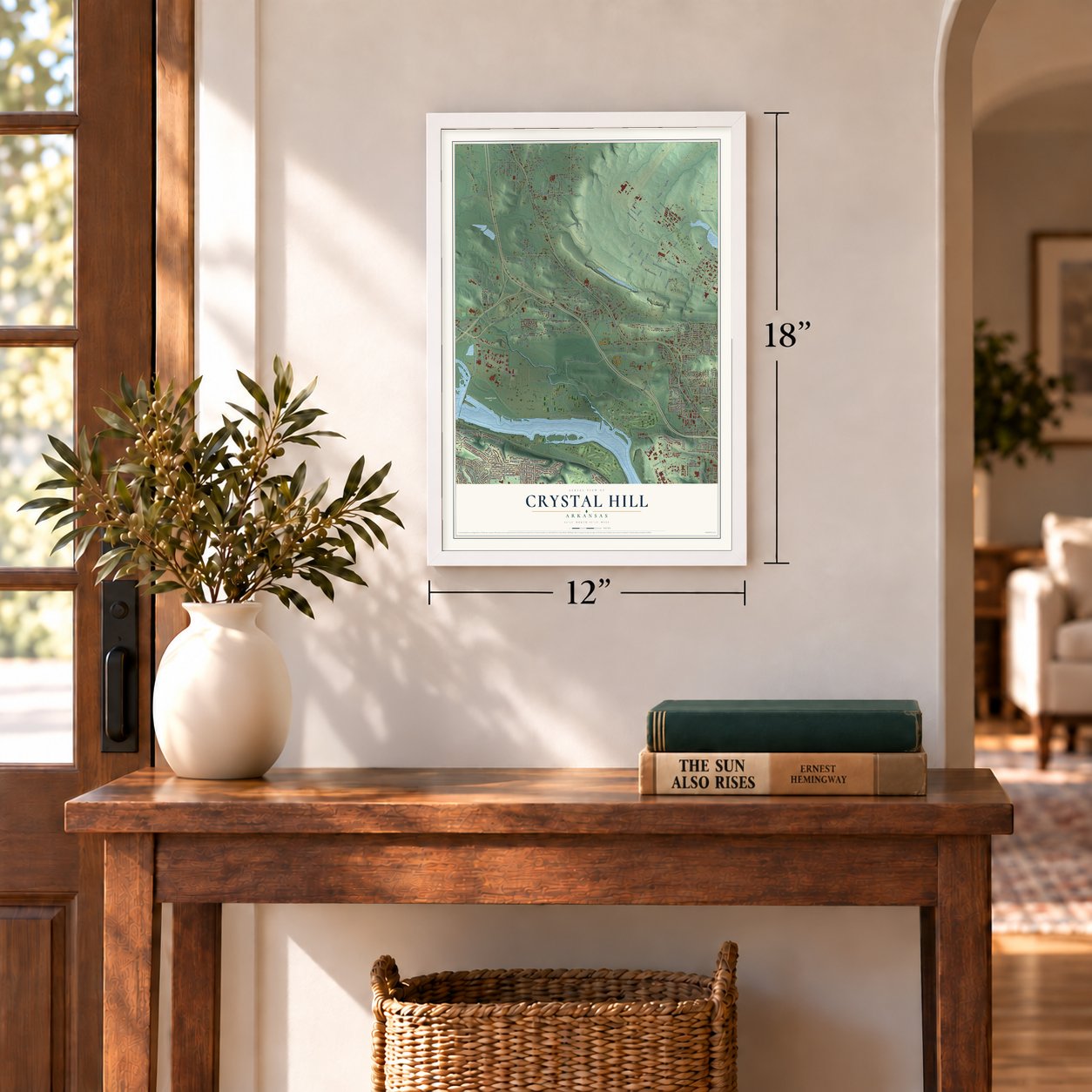
12" x 18" Archival Matte Print
A Map of Home. A Work of Art.
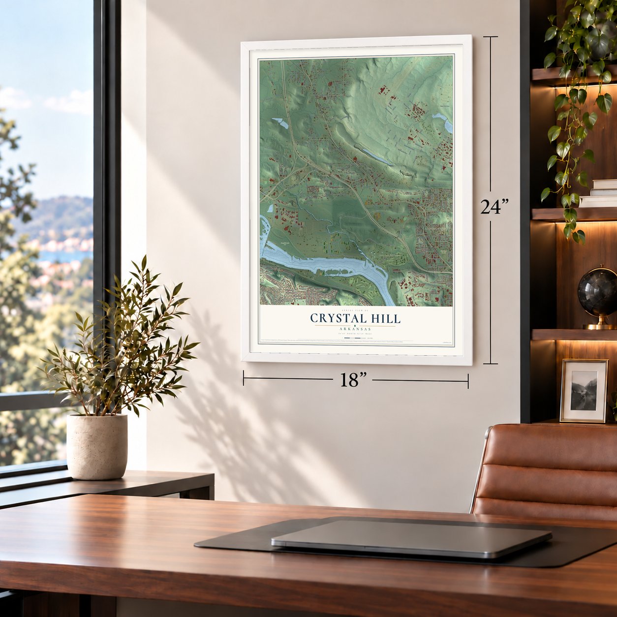
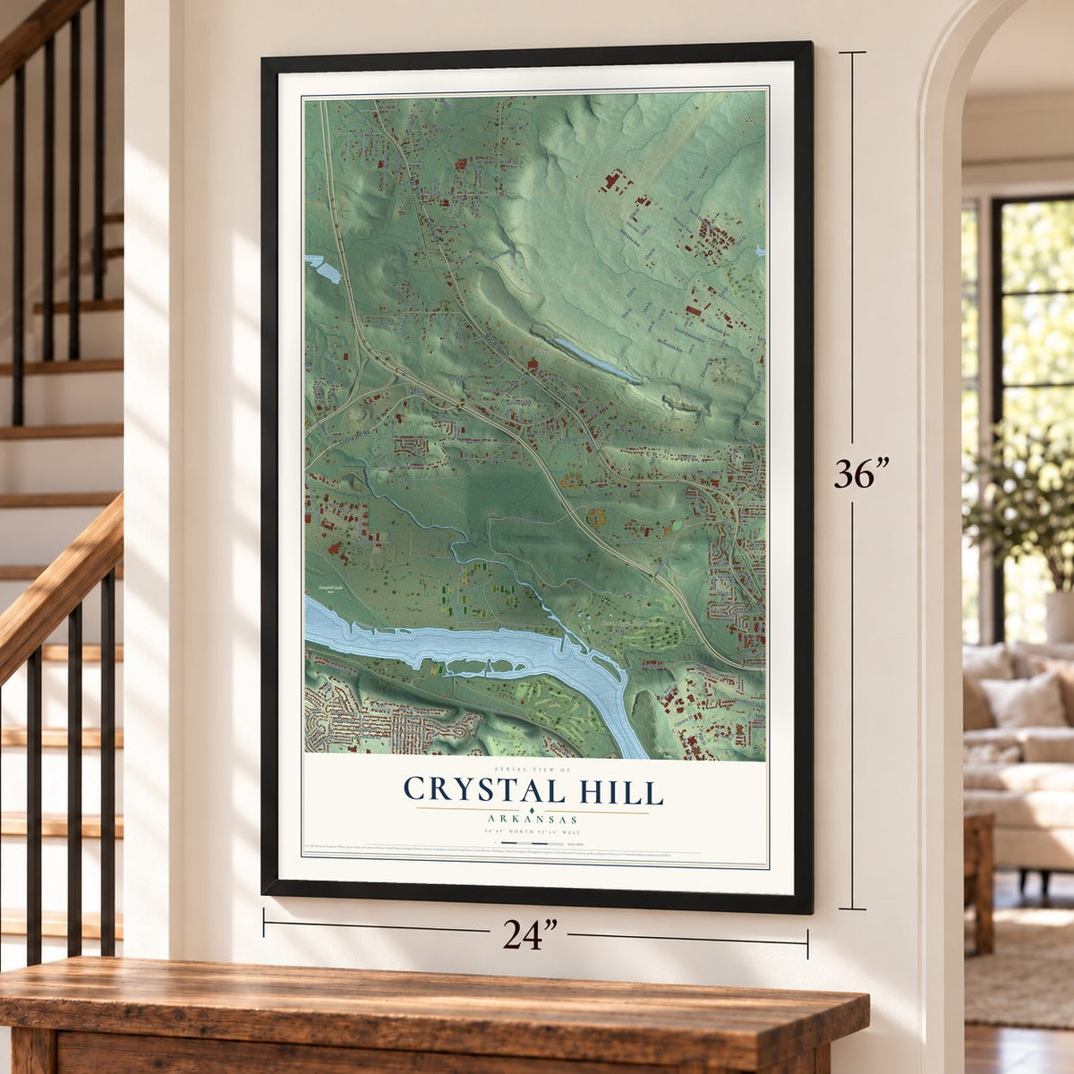
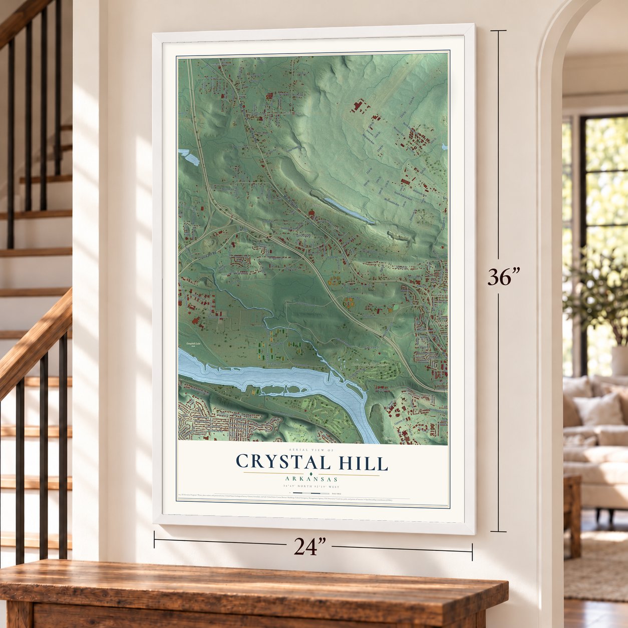
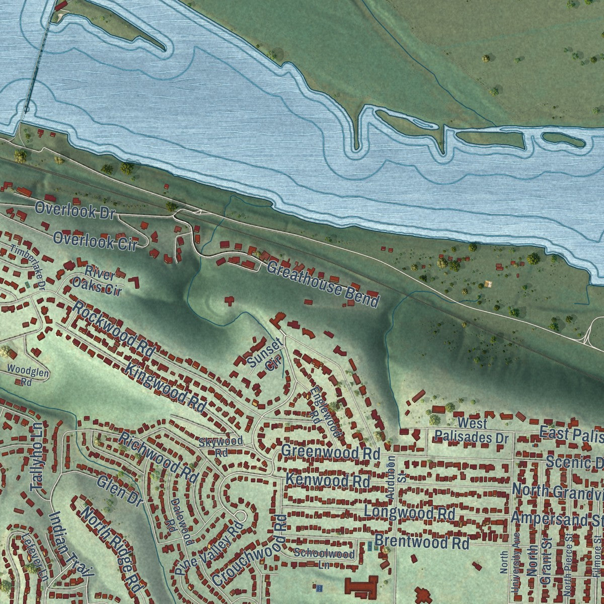
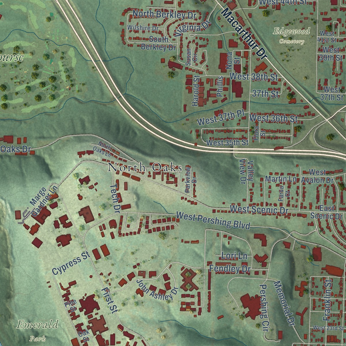
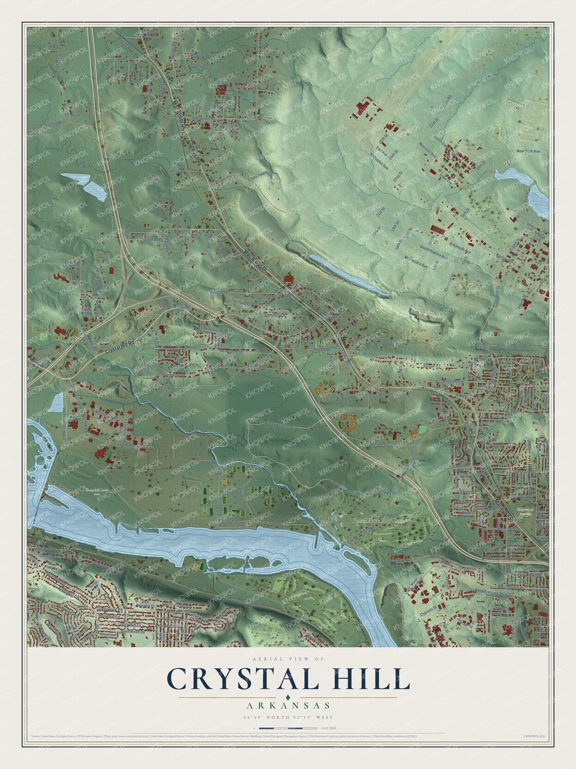
Explore Crystal Hill, Arkansas from a whole new perspective. Created using aerial imagery and detailed geographic data, this map captures Crystal Hill building by building, with labeled streets, familiar landmarks, and shaded topographical relief that highlights the natural contours of the landscape.
Combining modern data with the timeless character of a vintage atlas, this map is just as interesting up close as it is beautiful on the wall. Whether you grew up in Crystal Hill, spent memorable years there, or call it home today, this unique map is a great way to celebrate a place that means something to you. Zoom in on the preview to look for your street, and then order a print to put your memories on the wall.
Three ways to hang it
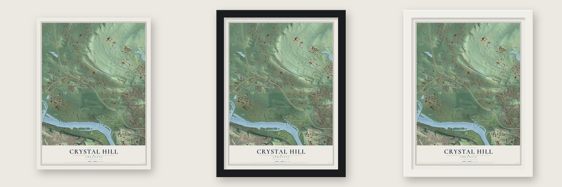
Unframed archival matte, a black wood frame or a white wood frame.
Up close
Geography Worth Displaying
This map was created using accurate cartographic data and authoritative geographic sources, including the U.S. Geological Survey and the Census Bureau. The map brings together terrain, waterways, roads, and building detail. The majority of the streets are labeled, houses are accurately depicted, and the topography is derived from government sources. Combining local data with carefully composed color and shading leads to this beautifully detailed Crystal Hill artwork for your wall.
Rather than simply showing street outlines, we’ve included as many of the street names as we could reasonably fit on the map while keeping their names legible. Zoom in on the high resolution preview to see exactly what’s on the map. We truly set out to create a statement piece for anyone who loves Crystal Hill. So whether it’s for you, or a gift for someone you love, we hope this map of Crystal Hill brings back fond memories.
Read the story behind this map: Detailed Map of Crystal Hill, Arkansas.
Find your street
Names on the Crystal Hill map
Every name below is printed on this map. Look for your street, your school, the park where you played, or the pond down the road.
Places and landmarks11
- Arrowhead Manor
- Oak Grove
- Amboy
- Jeffrey
- Campbell Lake Park
- Edgewood Cemetery
- Emerald Park
- North Oaks
- Haig
- Burns Park Golf Course
- Elks Park
Streets and roads286
- Crystal Hill Road
- Conway Highway
- Mac Arthur Drive
- Macarthur Drive
- Kelly Road
- Doyle Venable Drive
- Northshore
- Forest Road
- 25th Street
- Goalie Road
- West Military Drive
- Arlene Layman Drive
- Burns Park Drive
- Northshore Drive
- Indian Trail
- East Military Drive
- 23rd Street
- Scenic Drive
- Overlook Drive
- Military Road
- Buffalo Trail
- Tournament Drive
- Cato Road
- North Grandview Street
- Rebsamen Park Road
- Young Road
- Missouri Avenue
- Arkansas Avenue
- Oak Grove Road
- South Dakota Avenue
Show all 286 streets
- Arlene Laman Drive
- Kansas Avenue
- Division Street
- Parkway Drive
- Sunset Drive
- Nebraska Avenue
- North Dakota Avenue
- 16th Street
- West Pershing Boulevard
- Bridgeway Road
- Hillard Road
- Sixth Street
- Westwind Drive
- West Scenic Drive
- Short Marche Road
- Minnesota Avenue
- Iowa Avenue
- West 58th Street
- Bay Oaks Drive
- Joe Poch Road
- Trapp Road
- Funland Drive
- 14th Street
- Southwind Drive
- 22nd Street
- Memorial Drive
- Sherman Drive
- First Street
- Prospect Trail
- Vaughn Road
- Lynn Lane
- 20th Street
- Rockwood Road
- Fourth Street
- Birmingham Lane
- Norman Road
- 24th Street
- McMurtrey Drive
- Shamrock Drive
- Francis Street
- Hudman Road
- Donovan Briley Boulevard
- White Oak Drive
- Greenwood Road
- Cook's Landing Road
- East Reed Road
- Kenwood Road
- Greathouse Bend
- Scenic Boulevard
- Eighth Street
- Brentwood Road
- Longwood Road
- Kingwood Road
- Marche Road
- Aspen Drive
- West 36th Street
- 17th Street
- Lee Street
- Eleventh Street
- Bayou Road
- Mundo Road
- Reed Road
- Green Valley Avenue
- New York Avenue
- Windsong Hill Road
- Firestone Lane
- East Palisades Drive
- Texas Avenue
- Seventh Street
- Overlook Circle
- 19th Street
- Caldwell Road
- Jc Heilman Drive
- Richwood Road
- Northshore Place
- Pickard Road
- West 38th Street
- Sonora Drive
- Crystal Street
- Counts Massie Road
- Sherrill Road
- Barberry Street
- Brown Drive
- George Drive
- 18th Street
- East Meadow Lane
- Virginia Drive
- Windsong Drive
- Angela Drive
- Sorenson Street
- Catfish Drive
- West 47th Street
- Ech Street
- Third Street
- Crouchwood Road
- Northshore Lane
- Linda Trapp Circle
- Pershing Circle
- Sheltie Drive
- Tallyho Lane
- Oakland Drive
- North Ridge Road
- High Street
- Mine Hill Drive
- Franklin Street
- Harper Lane
- North Berkley Drive
- East Drive
- Tolliver Lane
- Ampersand Street
- Dublin Avenue
- Leatta Drive
- Bruce Lane
- Louise Street
- Fendley Drive
- Standridge Road
- Theresa Drive
- Nannette Street
- Wilson Street
- Lori Lane
- West 44th Street
- Soccer Avenue
- Drew Lane
- Lewis Lane
- West 37th Place
- Glen Drive
- West Drive
- Elizabeth Lane
- Baxter Lane
- Lumsden Road
- 21st Street
- Cypress Street
- 37th Street
- Tech Drive
- Price Lane
- South Drive
- Stevens Drive
- Lora Drive
- Auburn Drive
- Rye Lane
- Landski Drive
- John Ashley Drive
- Pine Valley Road
- West Palisades Drive
- West 35th Street
- Nona Street
- Championship Drive
- Sierra Madre Drive
- Service Road
- Rock Street
- North Grant Street
- North Taylor Street
- Tenth Street
- Holtdale Lane
- Valley View Drive
- Pine Canyon Road
- Grandview Street
- 13th Street
- Pomegranate Avenue
- Buckles Drive
- Martin Lane
- West 37th Street
- Frank Street
- Mountain Pine Road
- Omaha Avenue
- Rosewood Drive
- Clematis Avenue
- North Shore Drive
- Pump Station Road
- South Berkley Drive
- Marge Gardner Lane
- Shady Wood Drive
- Alamo Lane
- River Oaks Circle
- West Avalon Drive
- Coors Drive
- Copeland Lane
- Aldridge Lane
- Breazeale Lane
- East Avenue
- Harold Street
- Laurel Ridge
- North Drive
- Con Ark Drive
- Bee Jay Lane
- East Scenic Drive
- Idaho Drive
- Reggie Lane
- 15th Street
- Nicole Drive
- West 39th Street
- Sierra Court
- Tonto Trail
- Arizona Avenue
- Utah Street
- Lenel Drive
- Sunset Circle
- Creasy Road
- Ella Court
- Cupid Lane
- Clear Lane
- Bobby Lane
- Phillis
- Taril Lane
- Betts Lane
- Via Lane
- Maumelle Boulevard
- Lefever Lane
- Central Avenue
- Schoolwood Lane
- Dalewood Road
- Augusta Street
- Rivermist Point
- Audubon Street
- Englewood Road
- Galway Street
- Skywood Road
- Wayne Drive
- Bay Oak
- West Holt Dale Lane
- Wilshire Drive
- Farvu Court
- Berry Drive
- Amber Lane
- Parkview Drive
- Del Monte Lane
- Cherry Street
- West 41st Street
- Shadow Cv
- Flora Street
- Pataron Drive
- Equity Lane
- Susan Circle
- Smith Circle
- Neva Road
- Taril Court
- Pine Street
- Oak Street
- Woodglen Road
- North University Avenue
- North Pierce Street
- Augusta Circle
- Blue Ridge Circle
- West Meadow Lane
- South Grandview
- Filmore Street
- North Oaks Lane
- Lonesome Dove
- Timberlake Drive
- West 23rd Street
- Cullum Road
- Vestal Street
- Southpoint Cv
- Ray Street
- Brown Street
- Elaine Street
Names are listed as they appear on the printed map. Zoom into the product photos to find them.
About Crystal Hill, Arkansas
In 1820 Arkansas lawmakers chose to move the territorial capital away from Arkansas Post. Governor James Miller bought land at Crystal Hill, hoping to sell it as the new seat. The vote went to Little Rock instead. Miller built a house and lived here in protest until President Monroe gave him a customs post in Salem, Massachusetts.
Keep exploring Arkansas
Crystal Hill is one of 658 Arkansas towns we've mapped. Every dot on the map is a print of its own.
The search covers every state, Arkansas first.
Near Crystal Hill
Order 2 or more town maps and save 10%. Shown in the size and finish you picked above, so they hang as a set.
- Oak Grove 12" x 18" / Archival Matte Print $39.99
- Cammack Village 12" x 18" / Archival Matte Print $39.99
- Maumelle 12" x 18" / Archival Matte Print $39.99


More maps nearby: North Little Rock, Little Rock, Sherwood, McAlmont and Gibson.
The art of mapping a place
How This Map Was Made
Real places. Remarkable detail. Discover the layers that turn geographic data into a map of home.

The view from above
Aerial imagery reveals the character of the land: woodland, open fields, and the patterns of a place.

The shape of the land
Elevation data brings hills, valleys, and subtle changes in the landscape into view.

The details of home
Roads, waterways, and building footprints come together to make the map feel unmistakably local.

Geography becomes art
Considered color, shading, and typography bring the layers together in a map made for your wall.


Process illustrated with Mendon, Massachusetts. Aerial imagery: USDA NAIP. Terrain: USGS 3D Elevation Program. Map details and finished artwork: KNOWOL.
The Details
About This Print
Choose an archival matte print, or a black or white Ayous wood frame. The archival matte print is unframed.
Select your size and finish above to see the matching product image and price.
Materials & Craftsmanship
A contemporary map with the character of a classic atlas, printed on archival matte paper. Optional frames are made from Ayous wood.
Your printed map does not include the watermark shown in the full-map preview.
Shipping & Delivery
Free shipping within the United States. Every print is made to order in the USA.
Buying a gift? Add a note in your cart and we'll include it. We never put prices in the package.
Prints ship within 2 to 3 business days. Allow 7 to 10 days total from ordering for delivery. Timing may vary during holidays or periods of high order volume.
Read our shipping policy.
Returns and damaged prints
Each print is made to order. Change-of-mind refunds are not available after production.
If your print arrives damaged, misprinted or incorrect, contact support@knowol.com within 30 days of receiving it. Include your order number, photos and a description of the issue.
Read our full refund and replacement policy. For questions about your order, email support@knowol.com.