


Search for another town


Free U.S. delivery 7 to 10 days after you order
Cullman, Alabama Map Art
Building by building, with labeled streets and shaded relief.
12" x 18" Archival Matte Print
A Map of Home. A Work of Art.
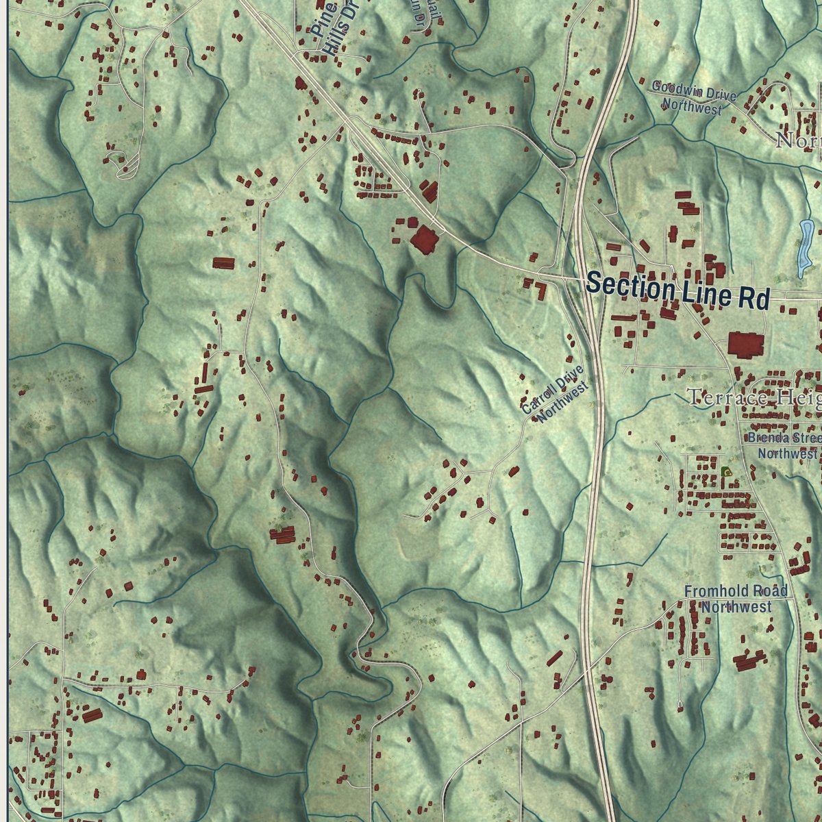
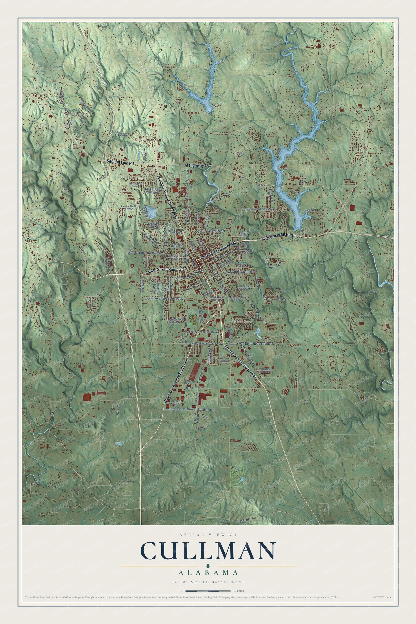
Explore Cullman, Alabama from a whole new perspective. Created using aerial imagery and detailed geographic data, this map captures Cullman building by building, with labeled streets, familiar landmarks, and shaded topographical relief that highlights the natural contours of the landscape.
Combining modern data with the timeless character of a vintage atlas, this map is just as interesting up close as it is beautiful on the wall. Whether you grew up in Cullman, spent memorable years there, or call it home today, this unique map is a great way to celebrate a place that means something to you. Zoom in on the preview to look for your street, and then order a print to put your memories on the wall.
Three ways to hang it

Unframed archival matte, a black wood frame or a white wood frame.
Up close
Geography Worth Displaying
This map was created using accurate cartographic data and authoritative geographic sources, including the U.S. Geological Survey and the Census Bureau. The map brings together terrain, waterways, roads, and building detail. The majority of the streets are labeled, houses are accurately depicted, and the topography is derived from government sources. Combining local data with carefully composed color and shading leads to this beautifully detailed Cullman artwork for your wall.
Rather than simply showing street outlines, we’ve included as many of the street names as we could reasonably fit on the map while keeping their names legible. Zoom in on the high resolution preview to see exactly what’s on the map. We truly set out to create a statement piece for anyone who loves Cullman. So whether it’s for you, or a gift for someone you love, we hope this map of Cullman brings back fond memories.
Read the story behind this map of Cullman, Alabama from 2026.

Find your street
Names on the Cullman map
Every name below is printed on this map. Look for your street, your school, the park where you played, or the pond down the road.
Places and landmarks4
- Carrol Acres
- Northwood
- Terrace Heights
- Southern Pines
Streets and roads97
- Second Avenue Southwest
- Second Avenue Northwest
- Third Street Southeast
- Cherokee Avenue Southwest
- Al Highway 157
- Section Line Road
- Al Highway 69 North
- Fourth Street Southwest
- Third Avenue Southeast
- Main Avenue Southwest
- Industrial Drive
- Old Hanceville Highway
- Welti Road Southeast
- Phelan Road
- Convent Road Northeast
- Rosemont Avenue Northwest
- Hanceville Road Southeast
- Eva Road Northeast
- Olive Street Southwest
- Saint Bernard Drive
- Tenth Street Southeast
- Lessman Street Southwest
- Childhaven Road Northeast
- Oak Drive Northeast
- Warnke Road Northwest
- Sixth Street Southwest
- Bolte Road Southeast
- 24th Street Southwest
- Day Gap Road
- Stephanie Drive
Show all 97 streets
- Reid Road
- 26th Street
- Main Avenue Northwest
- Industrial Park Road
- Saint Joseph Drive Northwest
- Seventh Street Southeast
- Ninth Street Southeast
- Swafford Road Southwest
- Denson Avenue Southwest
- Fifth Street Southeast
- Fourth Avenue Northeast
- Third Avenue Northeast
- Lee Avenue Southwest
- Sportsmans Lake Road
- Beech Avenue Southeast
- 14th Street Southeast
- Sheraton Road Southwest
- Brunner Street Northwest
- Parker Avenue Southwest
- Lincoln Avenue Southwest
- Fairway Drive
- Catoma Lane Northeast
- Dialsdale Drive Southwest
- First Street Southwest
- Logan Avenue Southwest
- Main Avenue Northeast
- Pine Hills Drive
- Stadium Drive Northeast
- Ridge Street Northwest
- Cliff Road Southeast
- Pansy Street Northwest
- Loring Street Northwest
- Short Street Southwest
- 22nd Street Southeast
- Augusta Trail
- Braun Street
- Catoma Lane
- Jane Way
- First Avenue Northwest
- Industrial Drive Southwest
- 23rd Street Southwest
- Woodvale Drive Northwest
- Veigl Avenue Southwest
- Alabama Avenue Southeast
- Fromhold Road Northwest
- Goehler Road Southeast
- 16th Street Southeast
- Lee Lane Southwest
- Waterford Drive
- Parkland Drive
- Crystal Street
- Fromwald Road
- Carroll Drive Northwest
- Third Avenue Southwest
- Ward Avenue Southwest
- Welti Road Southwest
- Deer Run Drive Southwest
- Birmingham Street Southwest
- Quail Run Drive
- Brenda Street Northwest
- Goodwin Drive Northwest
- Brownstone Way
- Old Bolte Road
- Seventh Street
- Legion Drive
- Loch Drive
- Park Avenue
Names are listed as they appear on the printed map. Zoom into the product photos to find them.
About Cullman, Alabama
Cullman is a city of 18,213 people and the seat of Cullman County, on Brindley Mountain in north-central Alabama. Johann Gottfried Cullmann, born in Bavaria, reached America in 1866 and made his home in Cincinnati, where he hoped to build a place for fellow German immigrants. In 1871 he leased or bought 349,000 acres of land owned by the Louisville and Nashville Railroad, whose new line had only recently crossed the wilderness between Decatur and Montgomery.
By January 5, 1873, he had persuaded 15 families in Cincinnati to move south, and the first five arrived by train by April 1873. Cullmann planned half-acre lots and made the streets and avenues 100 feet wide. He was the town's doctor, preacher and judge, and also its ticket agent and real estate dealer. The legislature incorporated the town on March 6, 1875, and in 1877 it created a new county around it, giving both his name with a single n.
“Thrifty German colonists, led by Col. John G. Cullman, in 1873 settled this thinly populated plateau. This section, previously thought unproductive, became famous for its diversified crops.”
- The first church, 1874In February 1874 the North and South Railroad donated lots 154, 155, 180 and 181 so the Evangelical Protestant Church could build Cullman's first church. Henry Dietz, August Henning and George Stoback served as its trustees, and Cullmann himself was a charter member. The congregation moved to 512 Second Avenue East in 1881, and the old church was turned into a house.
- Land, wine and a newspaperCullmann set up the North Alabama Land and Immigration Company, backed by $2.5 million in capital stock, and organized the Wine Company of Cullman to sell wine from the settlers' grapes. His paper, Der Nord Alabama Colonist, printed in German and English, helped the two groups of neighbors understand each other. For years German was the main language in Cullman's stores and churches, until English-speaking newcomers outnumbered the new German arrivals.
- Pimiento peppersFarmers here raised pimiento peppers along with corn, sweet and Irish potatoes, tomatoes, and pole and lima beans. For a time, Cullman grew a large majority of the pimientos in the United States. In the late 1950s poultry took over as the leading industry.
- The Ave Maria GrottoGerman immigrants founded St. Bernard's Monastery, and on its grounds stands the Ave Maria Grotto, with 125 miniature copies of famous religious buildings from around the world. It is the city's main tourist attraction, and it joined the National Register in 1984.
- Oktoberfest and FrankweilerDuring the two world wars, Cullman families lost touch with relatives in Germany and played down their roots. Interest came back in the 1960s as the town prepared for its centennial, and in 1987 Cullman became a sister city of Frankweiler, Cullmann's hometown. Today the city holds an annual Oktoberfest with an honorary Bürgermeister, and since 2011 the festival has been able to serve beer.
Keep exploring Alabama
Cullman is one of 675 Alabama towns we've mapped. Every dot on the map is a print of its own.
The search covers every state, Alabama first.
Near Cullman
Order 2 or more town maps and save 10%. Shown in the size and finish you picked above, so they hang as a set.
- East Point 12" x 18" / Archival Matte Print $39.99
- South Vinemont 12" x 18" / Archival Matte Print $39.99
- Good Hope 12" x 18" / Archival Matte Print $39.99


More maps nearby: Berlin, Welti, West Point, Hanceville and Dodge City.
The art of mapping a place
How This Map Was Made
Real places. Remarkable detail. Discover the layers that turn geographic data into a map of home.

The view from above
Aerial imagery reveals the character of the land: woodland, open fields, and the patterns of a place.

The shape of the land
Elevation data brings hills, valleys, and subtle changes in the landscape into view.

The details of home
Roads, waterways, and building footprints come together to make the map feel unmistakably local.

Geography becomes art
Considered color, shading, and typography bring the layers together in a map made for your wall.


Process illustrated with Mendon, Massachusetts. Aerial imagery: USDA NAIP. Terrain: USGS 3D Elevation Program. Map details and finished artwork: KNOWOL.
The Details
About This Print
Choose an archival matte print, or a black or white Ayous wood frame. The archival matte print is unframed.
Select your size and finish above to see the matching product image and price.
Materials & Craftsmanship
A contemporary map with the character of a classic atlas, printed on archival matte paper. Optional frames are made from Ayous wood.
Your printed map does not include the watermark shown in the full-map preview.
Shipping & Delivery
Free shipping within the United States. Every print is made to order in the USA.
Buying a gift? Add a note in your cart and we'll include it. We never put prices in the package.
Prints ship within 2 to 3 business days. Allow 7 to 10 days total from ordering for delivery. Timing may vary during holidays or periods of high order volume.
Read our shipping policy.
Returns and damaged prints
Each print is made to order. Change-of-mind refunds are not available after production.
If your print arrives damaged, misprinted or incorrect, contact support@knowol.com within 30 days of receiving it. Include your order number, photos and a description of the issue.
Read our full refund and replacement policy. For questions about your order, email support@knowol.com.