
Search for another town





Free U.S. delivery 7 to 10 days after you order
Dallas, Texas Map Art
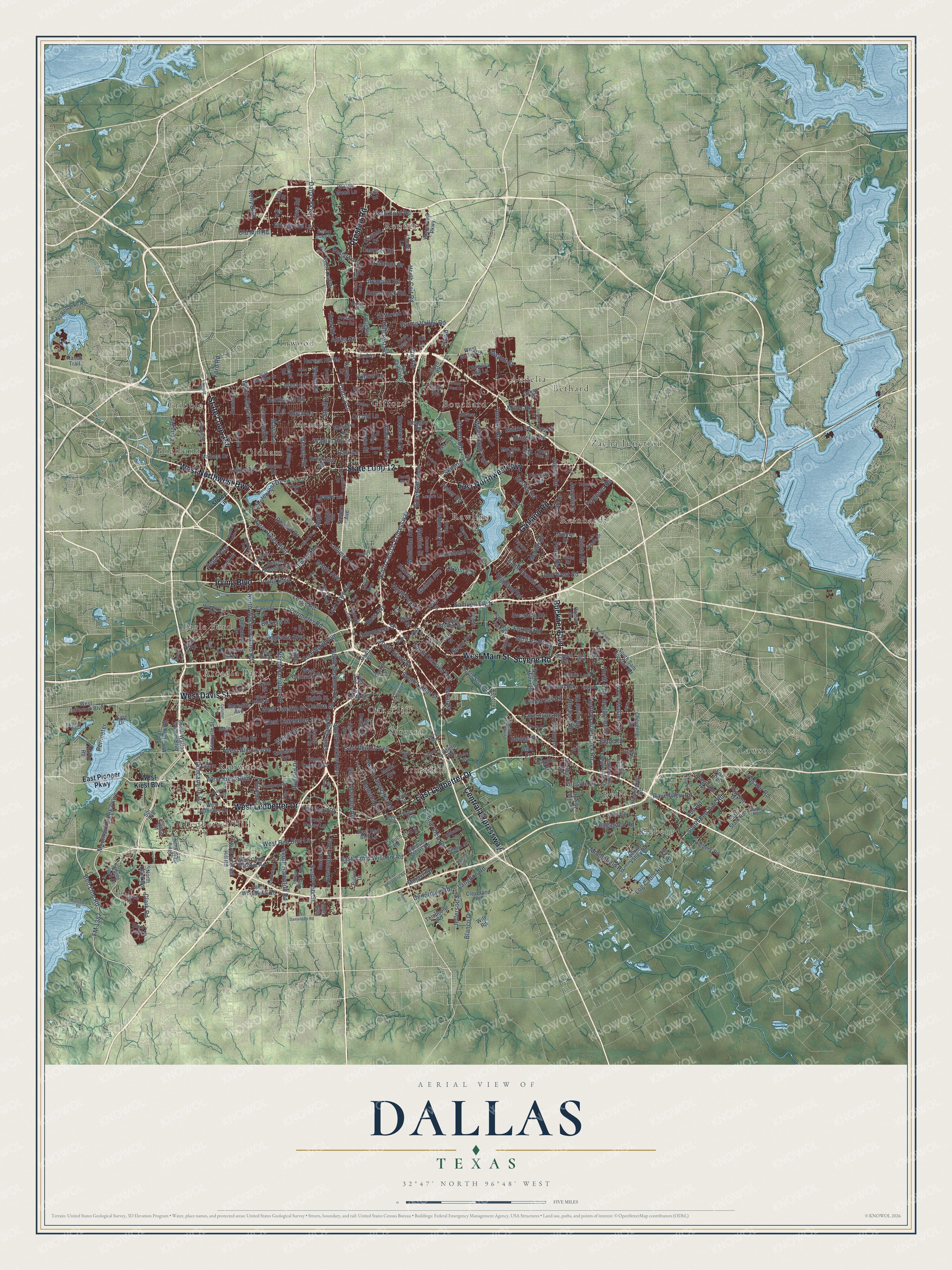
A new map of Dallas, Texas, made in 2026 and printed to order on thick archival matte paper.
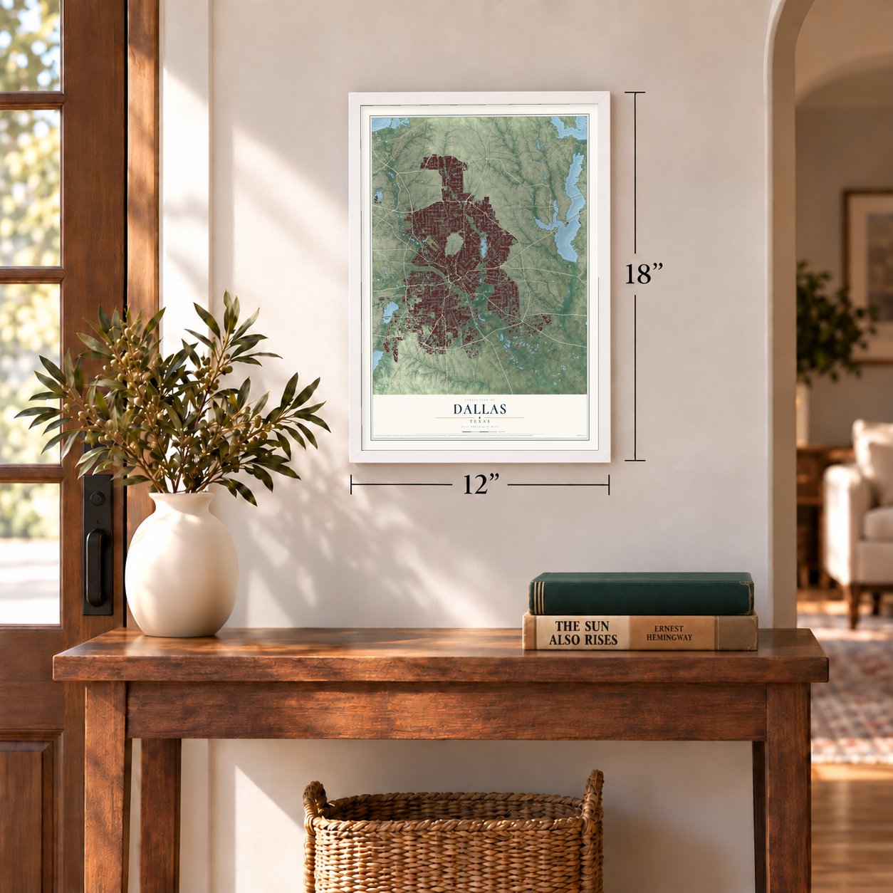
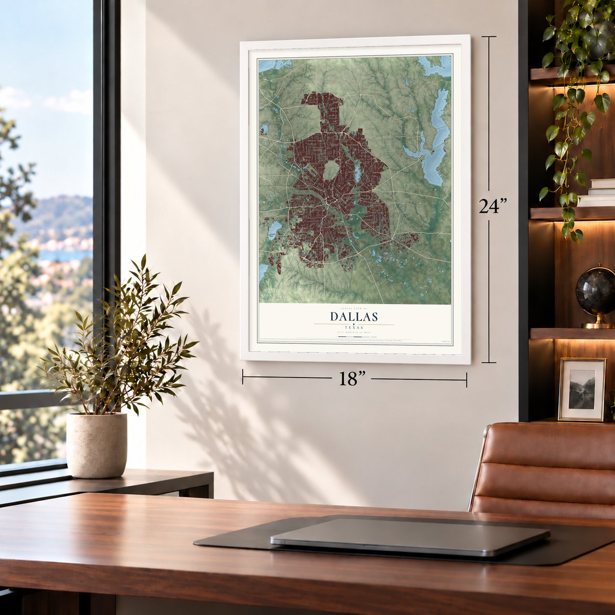
12" x 18" Archival Matte Print
A Map of Home. A Work of Art.
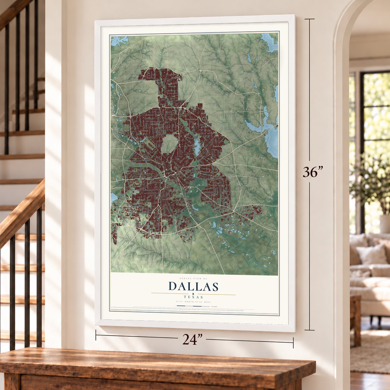
Explore Dallas, Texas from a whole new perspective. Created using aerial imagery and detailed geographic data, this map captures Dallas building by building, with labeled streets, familiar landmarks, and shaded topographical relief that highlights the natural contours of the landscape.
Combining modern data with the timeless character of a vintage atlas, this map is just as interesting up close as it is beautiful on the wall. Whether you grew up in Dallas, spent memorable years there, or call it home today, this unique map is a great way to celebrate a place that means something to you. Zoom in on the preview to look for your street, and then order a print to put your memories on the wall.
Three ways to hang it
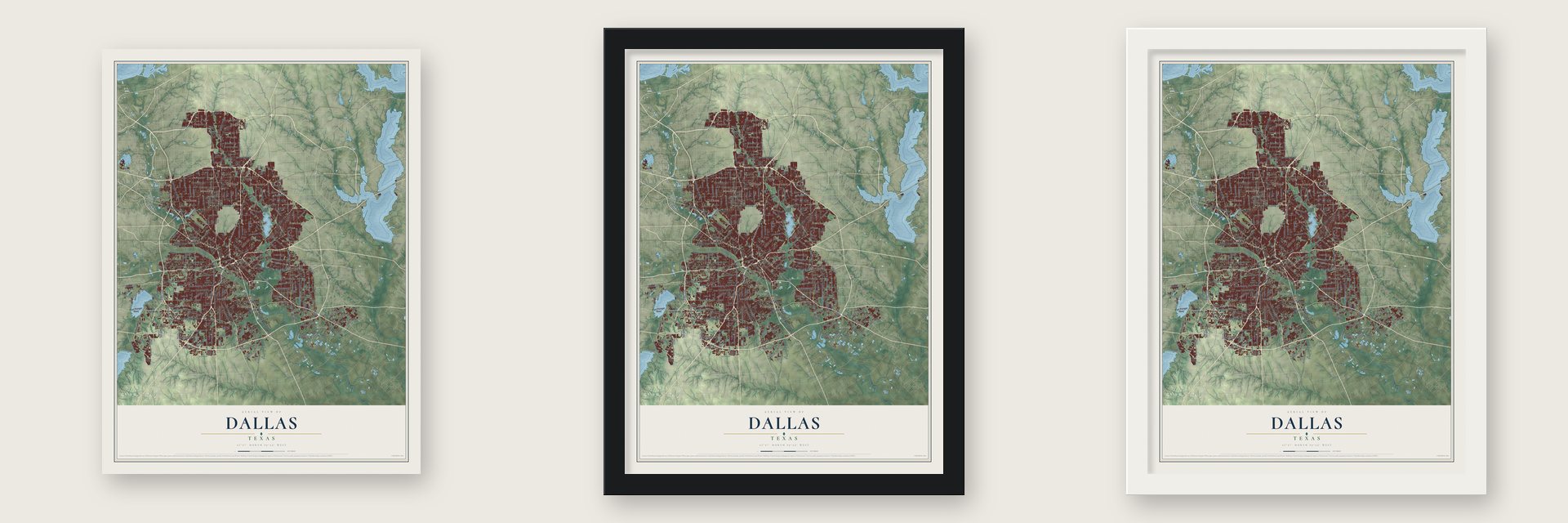
Unframed archival matte, a black wood frame or a white wood frame.
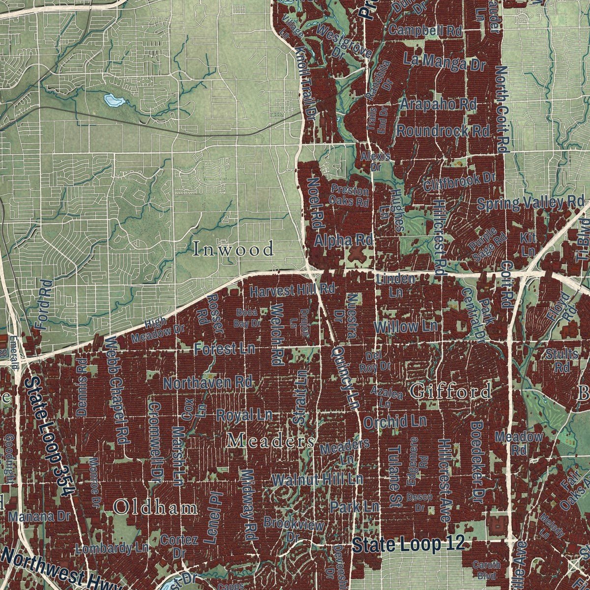
Up close
Geography Worth Displaying
This map was created using accurate cartographic data and authoritative geographic sources, including the U.S. Geological Survey and the Census Bureau. The map brings together terrain, waterways, roads, and building detail. The majority of the streets are labeled, houses are accurately depicted, and the topography is derived from government sources. Combining local data with carefully composed color and shading leads to this beautifully detailed Dallas artwork for your wall.
Rather than simply showing street outlines, we’ve included as many of the street names as we could reasonably fit on the map while keeping their names legible. Zoom in on the high resolution preview to see exactly what’s on the map. We truly set out to create a statement piece for anyone who loves Dallas. So whether it’s for you, or a gift for someone you love, we hope this map of Dallas brings back fond memories.
About Dallas, Texas
Dallas grew from an 1841 settlement into a major North Texas city shaped by railroads, highways, industry, and finance. It was formally incorporated in 1856. In 2020, the Census Bureau recorded a population of 1,304,379.
- Trinity River BeginningsIn 1841, John Neely Bryan established a permanent settlement called Dallas near three forks of the Trinity River.
- Railroad GrowthMajor rail lines helped Dallas become a flourishing business and trading center by the late nineteenth century.
- Oil Finance CenterAfter oil was discovered near Kilgore in 1930, Dallas became a financial center for the Texas and Oklahoma petroleum industry.
- Dealey Plaza, 1963President John F. Kennedy was assassinated on Elm Street as his motorcade passed through Dealey Plaza on November 22, 1963.
- Mavericks MilestonesThe Dallas Mavericks were organized in 1980 and won the NBA championship in 2011.
Find your street
Names on the Dallas map
Every name below is printed on this map. Look for your street, your school, the park where you played, or the pond down the road.
Places and landmarks24
- Arcadia Park
- Audelia
- Bethard
- Bouchard
- Cole
- Eagle Ford
- Fruitdale
- Gifford
- Gribble
- Highland
- Inwood
- Kenwood
Show all 24 places
- Kleberg
- Lawson
- Ledbetter Hills
- Meaders
- Oak Cliff
- Oldham
- Rawlins
- Reinhardt
- Renner
- Rylie
- Sargent
- Zacha Junction
Streets and roads384
- State Loop 12
- West Northwest Highway
- Buckner Boulevard
- East Ledbetter Drive
- East Northwest Highway
- State Loop 354
- West Main Street
- West Ledbetter Drive
- Preston Road
- Garland Road
- Central Expressway
- Scyene Road
- West Davis Street
- Irving Boulevard
- Walnut Hill Lane
- Forest Lane
- Inwood Road
- South Hampton Road
- Skillman Street
- Military Parkway
- North Central Expressway
- Mountain Creek Parkway
- Marsh Lane
- West Illinois Avenue
- Lemmon Avenue
- Belt Line Road
- Lake June Road
- Audelia Road
- South Belt Line Road
- West Red Bird Lane
Show all 384 streets
- East Illinois Avenue
- FM 1382
- Kingsley Road
- Coit Road
- North Hampton Road
- South Lancaster Road
- Walnut Street
- West Clarendon Drive
- Commerce Street
- Oak Lawn Avenue
- Ash Lane
- North Peak Street
- Lasater Road
- Ti Boulevard
- Abrams Road
- Harry Hines Boulevard
- Bruton Road
- North Coit Road
- Miller Road
- North Westmoreland Road
- Forney Road
- Peavy Road
- Kelly Boulevard
- Jupiter Road
- Luna Road
- Royal Lane
- Hillcrest Road
- Midway Road
- Greenville Avenue
- South Polk Street
- Bonnie View Road
- Frankford Road
- Ferguson Road
- Dallas Parkway
- North Prairie Creek Road
- Perimeter Road
- West Kiest Boulevard
- Park Lane
- Denton Drive
- Webb Chapel Road
- Elam Road
- Duncanville Road
- North Masters Drive
- Northaven Road
- Fort Worth Avenue
- Singleton Boulevard
- Hillcrest Avenue
- Arapaho Road
- Regal Row
- South Marsalis Avenue
- Levee Road
- Jefferson Street
- Shiloh Road
- Gaston Avenue
- Alpha Road
- South Lamar Street
- Samuell Boulevard
- Spring Valley Road
- North Saint Augustine Drive
- Easton Road
- Pleasant Drive
- West Twelfth Street
- Ross Avenue
- Maple Avenue
- East Camp Wisdom Road
- Saint Francis Avenue
- John West Road
- Boedeker Drive
- South Beckley Avenue
- Bickers Street
- South Oakland Avenue
- Clark Road
- Edd Road
- Rugged Drive
- Matilda Street
- Noel Road
- Ravenview Road
- Willow Lane
- Log Cabin Road
- Shorecrest Drive
- Perimeter
- Briargrove Lane
- Welch Road
- North Beckley Avenue
- La Vista Drive
- Estate Lane
- Highland Road
- Fisher Road
- Cromwell Drive
- Falls Drive
- Teagarden Road
- White Rock Trail
- Holcomb Road
- Quincy Lane
- Alderson Street
- Strait Lane
- Greenspan Avenue
- Lovers Lane
- South Ervay Street
- Langdon Road
- Blanco Drive
- Wright Street
- McMillan Avenue
- Cedardale Road
- La Manga Drive
- Roundrock Road
- Lakeshore Drive
- Orchid Lane
- Voss Road
- Ramona Avenue
- Fireside Drive
- Middlefield Road
- Joaquin Drive
- Umphress Road
- Mojave Drive
- Bexar Street
- Lenel Place
- Mercer Drive
- Oak Park Drive
- Old Mill Road
- Roper Street
- Hodde Street
- Centre Street
- Tulane Street
- Ford Road
- East Pioneer Parkway
- North Cockrell Hill Road
- South Haskell Avenue
- Main Street
- West Walnut Street
- East Belt Line Road
- Stults Road
- Floyd Road
- Dowdy Ferry Road
- Cadiz Street
- South Second Avenue
- East Red Bird Lane
- Lombardy Lane
- Seagoville Road
- West Camp Wisdom Road
- West Jefferson Boulevard
- North Jim Miller Road
- West Wheatland Road
- Campbell Road
- Simpson Stuart Road
- Plano Road
- Bernal Drive
- South Zang Boulevard
- South Saint Augustine Drive
- South Denley Drive
- Canada Drive
- South Merrifield Road
- Haymarket Road
- Kleberg Road
- West Colorado Boulevard
- Hillburn Drive
- McCree Road
- Eagle Ford Drive
- Jordan Valley Road
- Meadow Road
- Cole Avenue
- South Tyler Street
- Murdock Road
- Rosser Road
- Harvest Hill Road
- West Eighth Street
- Manana Drive
- Alaska Avenue
- Boulder Drive
- Cleveland Road
- Eastern Avenue
- Hughes Lane
- Lawnview Avenue
- Cheyenne Road
- Knoll Trail Drive
- Cox Lane
- West Saner Avenue
- Knoxville Street
- Glenfield Avenue
- Jennie Lee Lane
- Tioga Street
- Racine Drive
- South Walton Walker Boulevard
- Linfield Road
- Vilbig Road
- Marfa Avenue
- Cliffbrook Drive
- Corinth Street
- Westgrove Drive
- Fernald Avenue
- Fair Oaks Avenue
- Millmar Drive
- Telephone Road
- Spring Avenue
- La Reunion Parkway
- Everglade Road
- Record Crossing Road
- Profit Drive
- 52nd Street
- Duffield Drive
- Bennett Avenue
- Brook Valley Lane
- Brookview Drive
- Park Central Drive
- Nuestra Drive
- East Stark Road
- North Clark Road
- South Sam Houston Road
- Chimney Hill Lane
- Willow Wood Lane
- East Tenth Street
- Fish Road
- Meaders Lane
- Terry Street
- Grady Lane
- Buford Drive
- Cypress Avenue
- Aledo Drive
- Oram Street
- Waterview Parkway
- Dennis Road
- Skyfrost Drive
- Esmalda Drive
- Cortez Drive
- Witt Road
- Robin Road
- Ranch Trail
- Moler Street
- Meredith Avenue
- Hardy Road
- Lauder Lane
- Avon Street
- Crouch Road
- Gayglen Drive
- Victory Avenue
- Petal Street
- Carl Street
- Emory Oak Lane
- Catron Drive
- Linden Lane
- Eads Avenue
- Oak Lane
- Bekay Street
- Talco Drive
- Kit Lane
- Atha Drive
- Metz Avenue
- King Drive
- Lina Street
- Spr 408
- Storey Lane
- La Prada Drive
- Edgemere Road
- East Lovers Lane
- Goodnight Lane
- West Ninth Street
- Azalea Lane
- Pierce Street
- Concho Street
- South Masters Drive
- Vail Street
- Pemberton Hill Road
- High Meadow Drive
- Gross Road
- Skyline Road
- Sperry Street
- Overton Road
- Fourth Avenue
- Lone Star Drive
- Del Roy Drive
- Bainbridge Drive
- Indian Ridge Trail
- La Rue Street
- Alexis Drive
- Housley Drive
- Devonshire Drive
- Dolphin Road
- Oakwood Drive
- North Cedar Ridge Drive
- Southwood Drive
- Christie Lane
- Day Street
- Ranchita Drive
- Preston Oaks Road
- Monroe Drive
- Elmira Street
- Mexicana Road
- State Street
- Tavaros Avenue
- Stark Road
- Frio Drive
- Quail Run Street
- Harbor Town Drive
- Purple Sage Road
- Kiwanis Road
- Mehalia Drive
- Hillview Drive
- Etta Drive
- Eagle Drive
- Villa Road
- Nile Drive
- East Danieldale Road
- West Mockingbird Lane
- Wycliff Avenue
- Market Center Boulevard
- Florina Road
- Cedar Crest Boulevard
- Fordham Road
- East Wheatland Road
- Garden Grove Drive
- Emerald Street
- Desco Drive
- Motor Street
- Hickory Street
- Hall Street
- Cedardale Drive
- Hillside Drive
- Sanden Drive
- Round Table Drive
- Winsted Drive
- Mansfield Road
- Caruth Boulevard
- Boca Bay Drive
- North Sam Houston Road
- Country Creek Drive
- Rock Quarry Road
- Melody Lane
- Fieldcrest Drive
- Manor Way
- Tracy Road
- Conway Street
- Aster Street
- Empress Row
- Arden Road
- Barrett Drive
- Amity Lane
- Harter Road
- Village Lane
- Palisade Drive
- Patrol Road
- Calumet Avenue
- Windy Crest Drive
- Quincy Street
- Freddie Street
- Drujon Lane
- Trippie Street
- Trails End Drive
- Burma Road
- Rutz Street
- Capps Drive
- Ovid Avenue
- Riser Street
- Wolf Street
- Holt Drive
Names are listed as they appear on the printed map. Zoom into the product photos to find them.
The art of mapping a place
How This Map Was Made
Real places. Remarkable detail. Discover the layers that turn geographic data into a map of home.

The view from above
Aerial imagery reveals the character of the land: woodland, open fields, and the patterns of a place.

The shape of the land
Elevation data brings hills, valleys, and subtle changes in the landscape into view.

The details of home
Roads, waterways, and building footprints come together to make the map feel unmistakably local.

Geography becomes art
Considered color, shading, and typography bring the layers together in a map made for your wall.


Process illustrated with Mendon, Massachusetts. Aerial imagery: USDA NAIP. Terrain: USGS 3D Elevation Program. Map details and finished artwork: KNOWOL.
The Details
About This Print
Choose an archival matte print, or a black or white Ayous wood frame. The archival matte print is unframed.
Select your size and finish above to see the matching product image and price.
Materials & Craftsmanship
A contemporary map with the character of a classic atlas, printed on archival matte paper. Optional frames are made from Ayous wood.
Your printed map does not include the watermark shown in the full-map preview.
Shipping & Delivery
Free shipping within the United States. Every print is made to order in the USA.
Buying a gift? Add a note in your cart and we'll include it. We never put prices in the package.
Prints ship within 2 to 3 business days. Allow 7 to 10 days total from ordering for delivery. Timing may vary during holidays or periods of high order volume.
Read our shipping policy.
Returns and damaged prints
Each print is made to order. Change-of-mind refunds are not available after production.
If your print arrives damaged, misprinted or incorrect, contact support@knowol.com within 30 days of receiving it. Include your order number, photos and a description of the issue.
Read our full refund and replacement policy. For questions about your order, email support@knowol.com.
Find your town
Looking for another city?
Find a map of home in our Texas collection, or any town in the country.
Nearby
Maps of towns near Dallas
Know someone from one of these towns? Their map makes a great gift.
 Highland Park
, Texas
From $39.99See the map
 University Park
, Texas
From $39.99See the map
 Cockrell Hill
, Texas
From $39.99See the map
More maps nearby: Balch Springs, Mesquite, Hutchins, Garland and Farmers Branch.