


Search for another town





Free U.S. delivery 7 to 10 days after you order
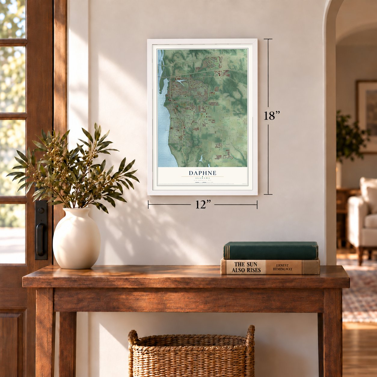
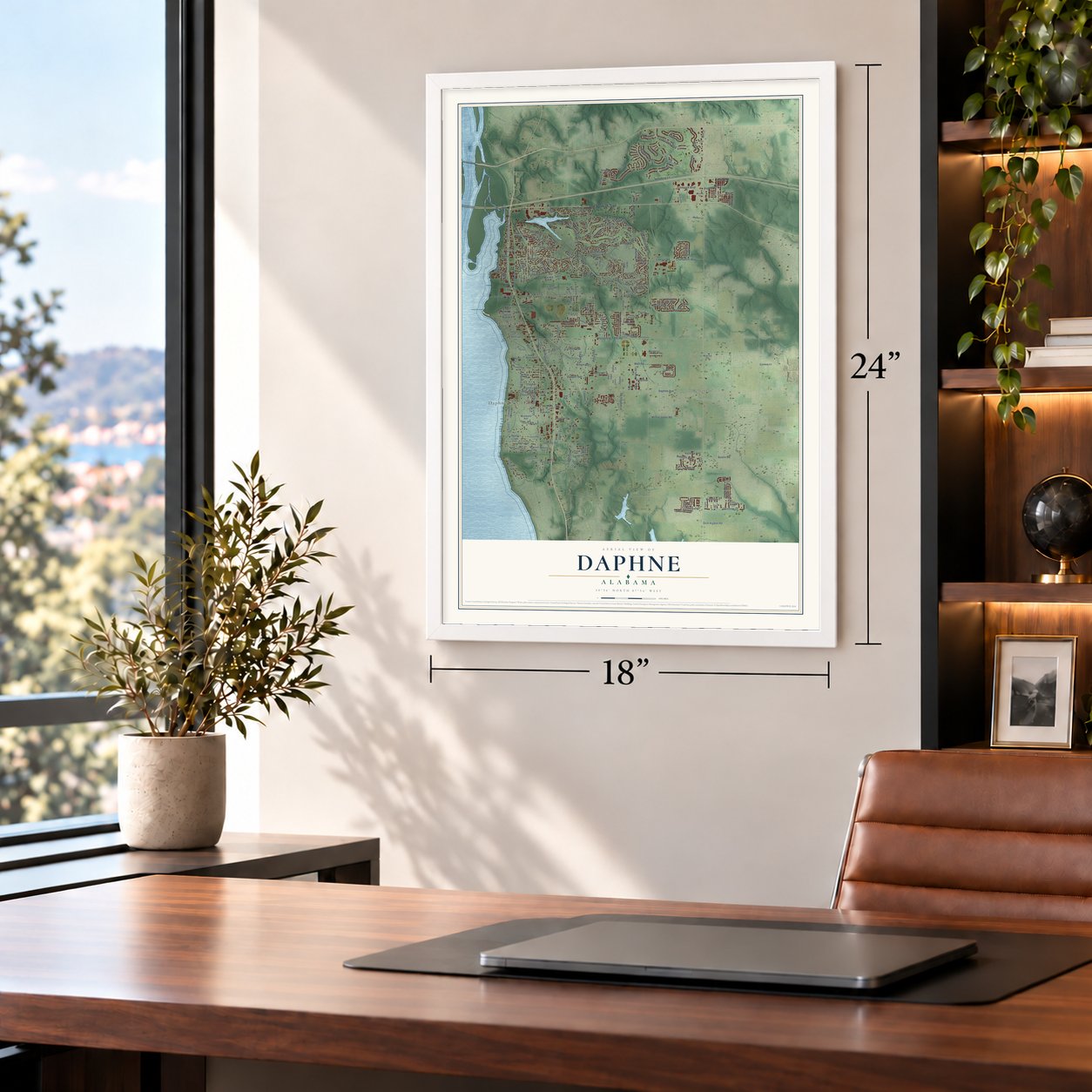
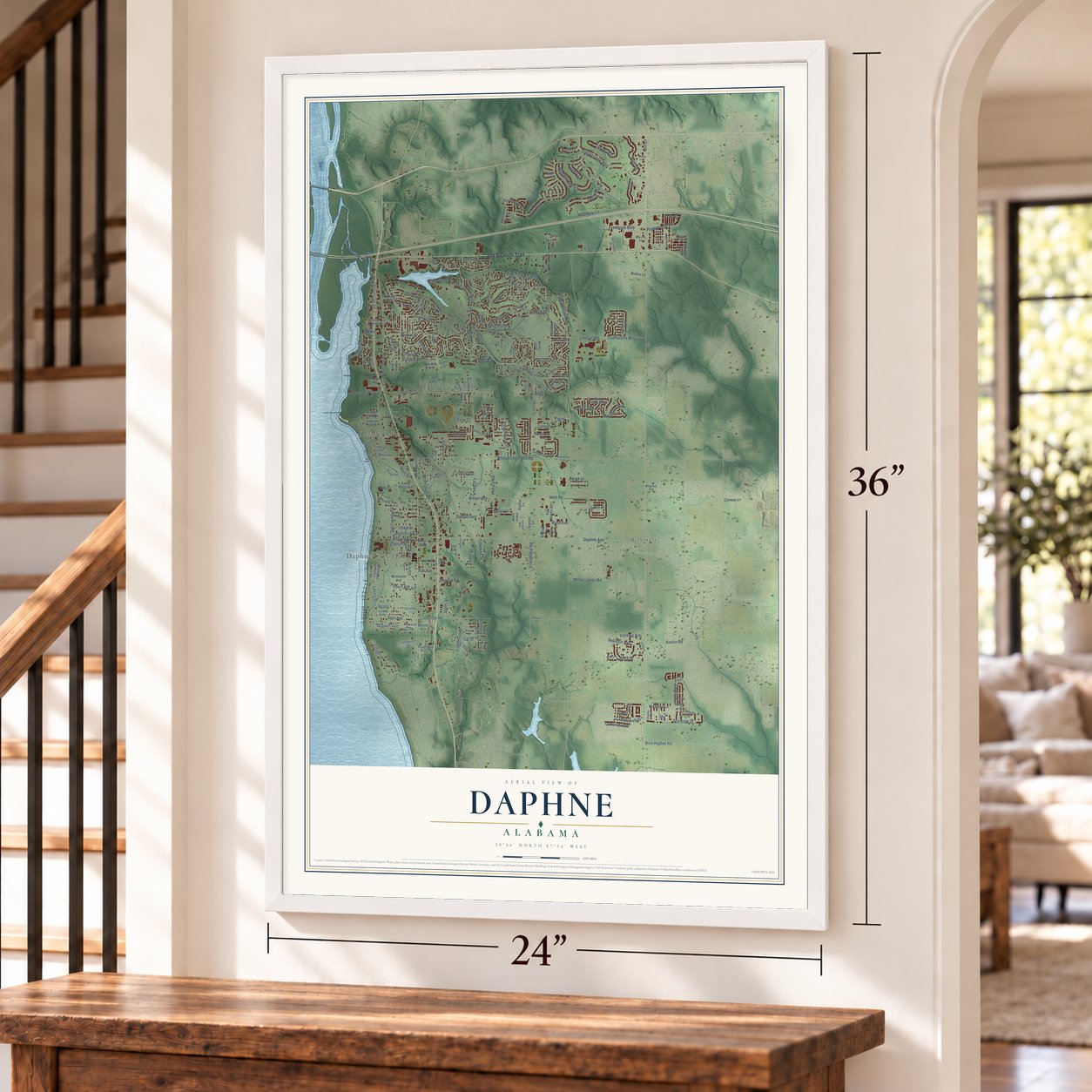
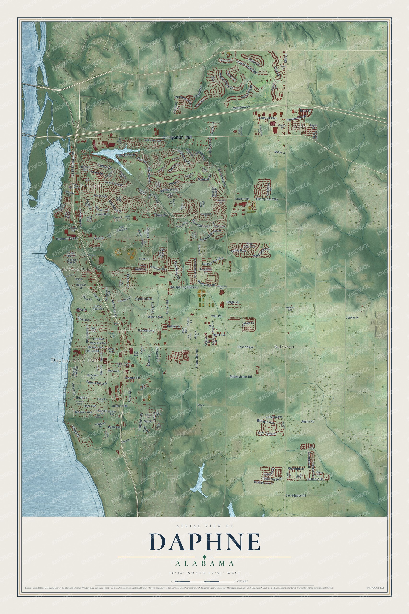
Daphne, Alabama Map Art
Building by building, with labeled streets and shaded relief.
12" x 18" Archival Matte Print
A Map of Home. A Work of Art.
Explore Daphne, Alabama from a whole new perspective. Created using aerial imagery and detailed geographic data, this map captures Daphne building by building, with labeled streets, familiar landmarks, and shaded topographical relief that highlights the natural contours of the landscape.
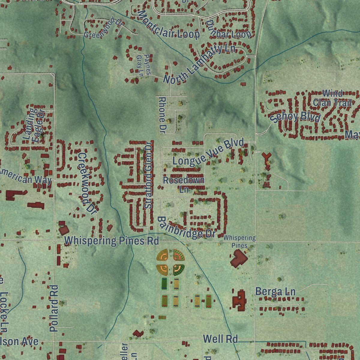
Combining modern data with the timeless character of a vintage atlas, this map is just as interesting up close as it is beautiful on the wall. Whether you grew up in Daphne, spent memorable years there, or call it home today, this unique map is a great way to celebrate a place that means something to you. Zoom in on the preview to look for your street, and then order a print to put your memories on the wall.
Three ways to hang it
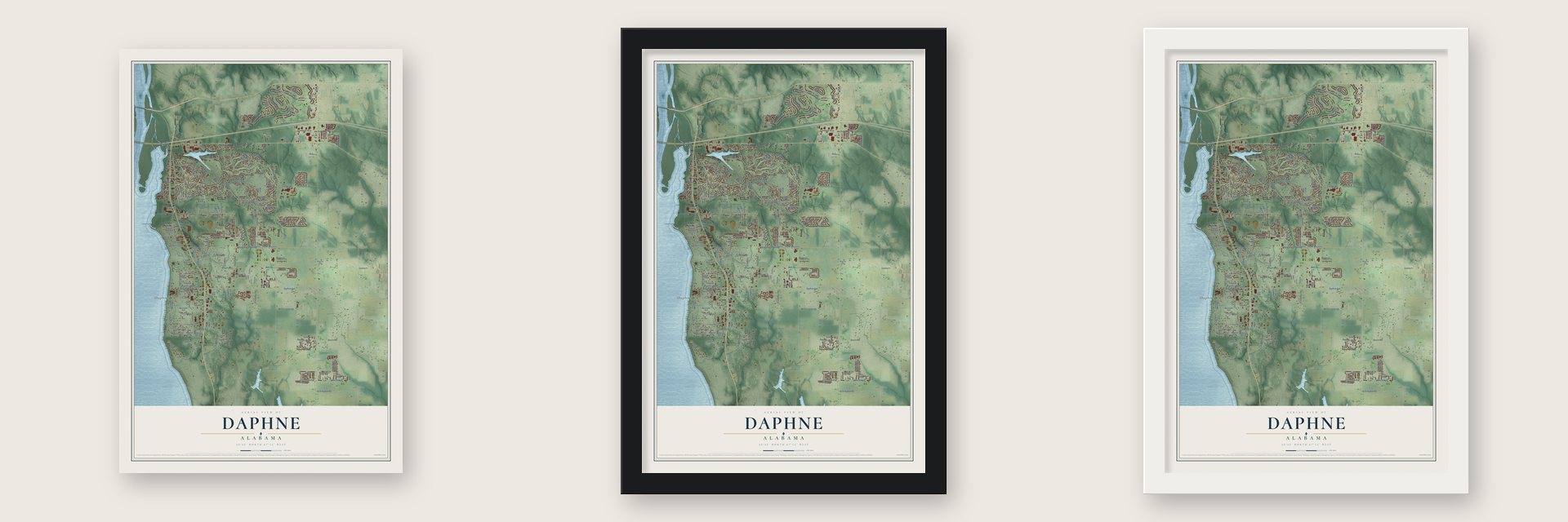
Unframed archival matte, a black wood frame or a white wood frame.
Up close
Geography Worth Displaying
This map was created using accurate cartographic data and authoritative geographic sources, including the U.S. Geological Survey and the Census Bureau. The map brings together terrain, waterways, roads, and building detail. The majority of the streets are labeled, houses are accurately depicted, and the topography is derived from government sources. Combining local data with carefully composed color and shading leads to this beautifully detailed Daphne artwork for your wall.
Rather than simply showing street outlines, we’ve included as many of the street names as we could reasonably fit on the map while keeping their names legible. Zoom in on the high resolution preview to see exactly what’s on the map. We truly set out to create a statement piece for anyone who loves Daphne. So whether it’s for you, or a gift for someone you love, we hope this map of Daphne brings back fond memories.
Read the story behind this map of Daphne, Alabama from 2026.

Find your street
Names on the Daphne map
Every name below is printed on this map. Look for your street, your school, the park where you played, or the pond down the road.
Places and landmarks5
- Daphne City Hall
- Malbis
- Belforest
- Jackson Oak
- Park City
Streets and roads210
- Old Spanish Trail
- Ridgewood Drive
- Bay View Drive
- Lovett Street
- Main Street
- Lawson Road
- Pine Court
- Champions Way
- Daphne Avenue
- Pollard Road
- Timbercreek Boulevard
- Whispering Pines Road
- North Main Street
- Pine Run
- Park Drive
- Rolling Hill Drive
- Old County Road
- Montclair Loop
- Ottawa Drive
- Pinehill Road
- Woodrow Lane
- Milton Jones Road
- Randall Avenue
- Wilson Avenue
- Well Road
- Johnson Road
- Middle Creek Circle
- Parker Lane
- Dunmore Drive
- Fairway Drive
Show all 210 streets
- Bainbridge Drive
- Frederick Boulevard
- Dolive Ridge
- Aspen Circle
- Stanton Road
- Van Avenue
- North Lamhatty Lane
- Sixth Street
- Daphmont Drive
- Village Drive
- Brentwood Drive
- Friendship Road
- Cumbria Drive
- Caroline Avenue
- Bella Drive
- Belrose Avenue
- Maxwell Avenue
- Marchand Avenue
- Worchester Drive
- Longue Vue Boulevard
- Golf Terrace
- Wexford Lane
- Creekwood Drive
- Deer Avenue
- Bellaton Avenue
- Limerick Lane
- US 98 Frontage Road
- Papageorge Street
- Volterra Avenue
- Donna Circle
- Lake Front Drive
- Potters Mill Avenue
- Sehoy Boulevard
- Bayfront Park Drive
- Elise Court
- Hope Drive
- Camberwell Drive
- Avery Lane
- Beall Lane
- Dick Higbee Road
- Persimmon Drive
- Church Street
- Pine Street
- Essex Street
- Jones Street
- Locke Lane
- McPhillips Drive
- Lea Avenue
- Rand Avenue
- Leyland Lane
- Villa Drive
- Marikesh Drive
- Conaway Street
- Parma Drive
- Dewitt Circle
- North Court
- Mill Lane
- Ryan Avenue
- Bellue Lane
- Austin Road
- Laurel Court
- Berga Lane
- Estia Street
- Windsor Drive
- Lakeview Loop
- Grays Lane
- Captain O'Neal Drive
- Landing Eagle Drive
- Jackson Oak Drive
- Lett Avenue
- Canterbury Road
- Buena Vista Drive
- Country Club Drive
- Rosedown Lane
- Maxwell Drive
- Elderberry Drive
- Acorn Knoll Drive
- Stratford Glen Drive
- Tullamore Drive
- Michael Loop
- Papas Street
- Gaskin Lane
- Donette Loop
- Van Buren Street
- McAdams Avenue
- Dunbar Loop
- Rhone Drive
- Magnolia Avenue
- East Bay Drive
- Cobham Park Drive
- Hillwood Drive
- Green Court
- Wind Clan Trail
- American Way
- Dale Road
- Santa Rosa Avenue
- Pub Works Road
- D'Olive Boulevard
- Lancaster Way
- Douglas Road
- Irwin Loop
- Whiting Court
- Carl Davis Road
- Yacht Club Drive
- Camellia Lane
- Saint John Street
- Oak Street
- Conway Lane
- Bancroft Lane
- Ahern Drive
- Tomrick Circle
- Jordan Road
- Cedar Drive
- Equity Drive
- Malbis Lane
- Capital Drive
- Japonica Circle
- Halls Lane
- Carroll Lane
- Meadow Wood Drive
- Tallent Lane
- Flynt Drive
- Third Avenue
- Harbor Place Drive
- Polo Trce
- Zoeller Lane
- Monroe Street
- Profit Drive
- Adams Avenue
- Marie Lane
- Gipson Lane
- Leigh Circle
- Moore Lane
- Manci Avenue
- Ray's Lane
- Ash Court
- Mims Loop
- Greenwood Drive
- Fifth Street
- Kingswood Drive
- Woodside Drive
- Parkwood Avenue
- Beverly Drive
- Schiefflin Lane
- Cherryhill Road
- Dublin Drive
- Kari Lane
- Kasey Court
- Belgrove Avenue
- Hillcrest Circle
- Penny Lane
- Ferncliff Circle
- Glover Lane
- Roper Lane
- Haleys Lane
- Pecan Street
- Twin Lane
- Bayview Drive
- Whispering Pines
- Warren Drive
- Fionn Loop
- Broadmoor Drive
- Durnford Hill Court
- Renaissance Boulevard
- Wal-Mart Drive
- Cypress Avenue
- Oak Bluff Drive
- Green Bay Drive
- Cardinal Lane
- Rolling Hill Circle
- Gilmore Way
- Schooley Circle
- Anchor Cross Boulevard
- Paynes Gray Lane
- Holy Cross Drive
- Dimitrios Avenue
- Hartford Avenue
- Colonial Plaza Drive
- Timber Circle
- Stone Drive
Names are listed as they appear on the printed map. Zoom into the product photos to find them.
About Daphne, Alabama
Daphne is a city of 27,462 people in Baldwin County, set on bluffs that rise as high as 120 feet above the eastern shore of Mobile Bay. Tensaw, Creek, Seminole and Choctaw people lived here before Europeans arrived. Through the early nineteenth century, people knew the area by its three boat landings: Belrose, Hollywood and Shorts.
Rivers and the bay were then the only ways to reach Mobile, so the waterfront settlement made a sensible county seat, and it took on that role in 1868. When the town was settled in 1874, hotel owner William Howard became its postmaster and named it Daphne, perhaps for a shrub his wife admired and planted. Later the railroad favored Bay Minette, and on February 5, 1901, the Alabama Legislature approved moving the county seat there. Daphne's officials refused to hand over the county records, but the records still left town that October.
“Daphne leaders and officials, however, refused to relinquish the county and court records, leading Bay Minette officials to steal the records in the middle of the night in October 1901.”
- The other story of the recordsNot everyone remembered a raid. In 1956, a man who had helped with the move told an interviewer that officials in the two towns had agreed on the plan ahead of time. On the evening of October 11, 1901, workers spent five hours quietly loading the county records into wagons, and the next day they drove them to Bay Minette.
- An Italian colony from 1888Alesandro Mastro Valero bought Daphne land in 1888 for Italian immigrants who wanted farm life, not the North's crowded cities. In 1895 the colonists bought land in today's Old Daphne and built the Church of the Assumption. Father Angelo Chiariglione, a missionary from Torino, was its first resident pastor from 1898 until 1909. That same year Queen Margherita of Italy sent vestments, a chalice, candlesticks and an illuminated missal, now displayed at Christ the King Catholic Church, begun in 1937.
- Incorporated in 1927On July 8, 1927, 41 landowners signed a request to make Daphne an incorporated town of about 500 residents. The town held its first election on September 19, 1927, and chose James M. Voltz as its first mayor. Some unhappy residents tried to undo the incorporation in 1946, but they failed.
- The Jubilee CityOn rare nights, crabs, shrimp and fish crowd into the shallow water along Daphne's shore in huge numbers, and people gather to scoop them up. Biologists think low oxygen in the bay drives the sea life toward the surface. These jubilees gave Daphne its nickname, and the Eastern Shore Jubilee Festival each September draws about 30,000 to 35,000 visitors.
- A Methodist church from 1858Daphne's Old Methodist Church dates from 1858. It joined the National Register in 1980 as the Methodist Episcopal Church, South, and today it houses the Daphne History Museum, with exhibits on the town's cultural past.
Keep exploring Alabama
Daphne is one of 675 Alabama towns we've mapped. Every dot on the map is a print of its own.
The search covers every state, Alabama first.
Near Daphne
Order 2 or more town maps and save 10%. Shown in the size and finish you picked above, so they hang as a set.
- Spanish Fort 12" x 18" / Archival Matte Print $39.99
- Fairhope 12" x 18" / Archival Matte Print $39.99
- Stapleton 12" x 18" / Archival Matte Print $39.99


More maps nearby: Loxley, Silverhill, Point Clear, Rosinton and Robertsdale.
The art of mapping a place
How This Map Was Made
Real places. Remarkable detail. Discover the layers that turn geographic data into a map of home.

The view from above
Aerial imagery reveals the character of the land: woodland, open fields, and the patterns of a place.

The shape of the land
Elevation data brings hills, valleys, and subtle changes in the landscape into view.

The details of home
Roads, waterways, and building footprints come together to make the map feel unmistakably local.

Geography becomes art
Considered color, shading, and typography bring the layers together in a map made for your wall.


Process illustrated with Mendon, Massachusetts. Aerial imagery: USDA NAIP. Terrain: USGS 3D Elevation Program. Map details and finished artwork: KNOWOL.
The Details
About This Print
Choose an archival matte print, or a black or white Ayous wood frame. The archival matte print is unframed.
Select your size and finish above to see the matching product image and price.
Materials & Craftsmanship
A contemporary map with the character of a classic atlas, printed on archival matte paper. Optional frames are made from Ayous wood.
Your printed map does not include the watermark shown in the full-map preview.
Shipping & Delivery
Free shipping within the United States. Every print is made to order in the USA.
Buying a gift? Add a note in your cart and we'll include it. We never put prices in the package.
Prints ship within 2 to 3 business days. Allow 7 to 10 days total from ordering for delivery. Timing may vary during holidays or periods of high order volume.
Read our shipping policy.
Returns and damaged prints
Each print is made to order. Change-of-mind refunds are not available after production.
If your print arrives damaged, misprinted or incorrect, contact support@knowol.com within 30 days of receiving it. Include your order number, photos and a description of the issue.
Read our full refund and replacement policy. For questions about your order, email support@knowol.com.