
Search for another town





Free U.S. delivery 7 to 10 days after you order
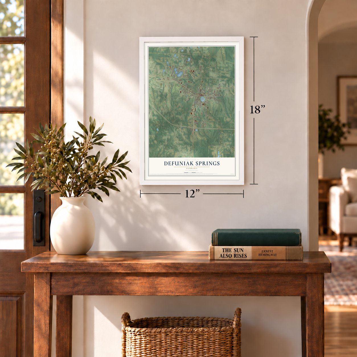
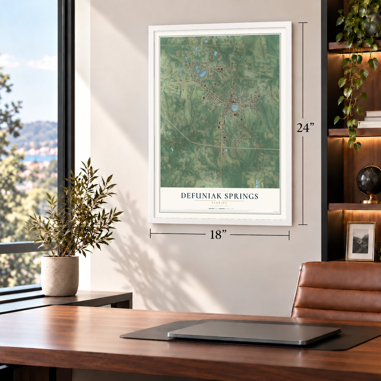
DeFuniak Springs, Florida Map Art
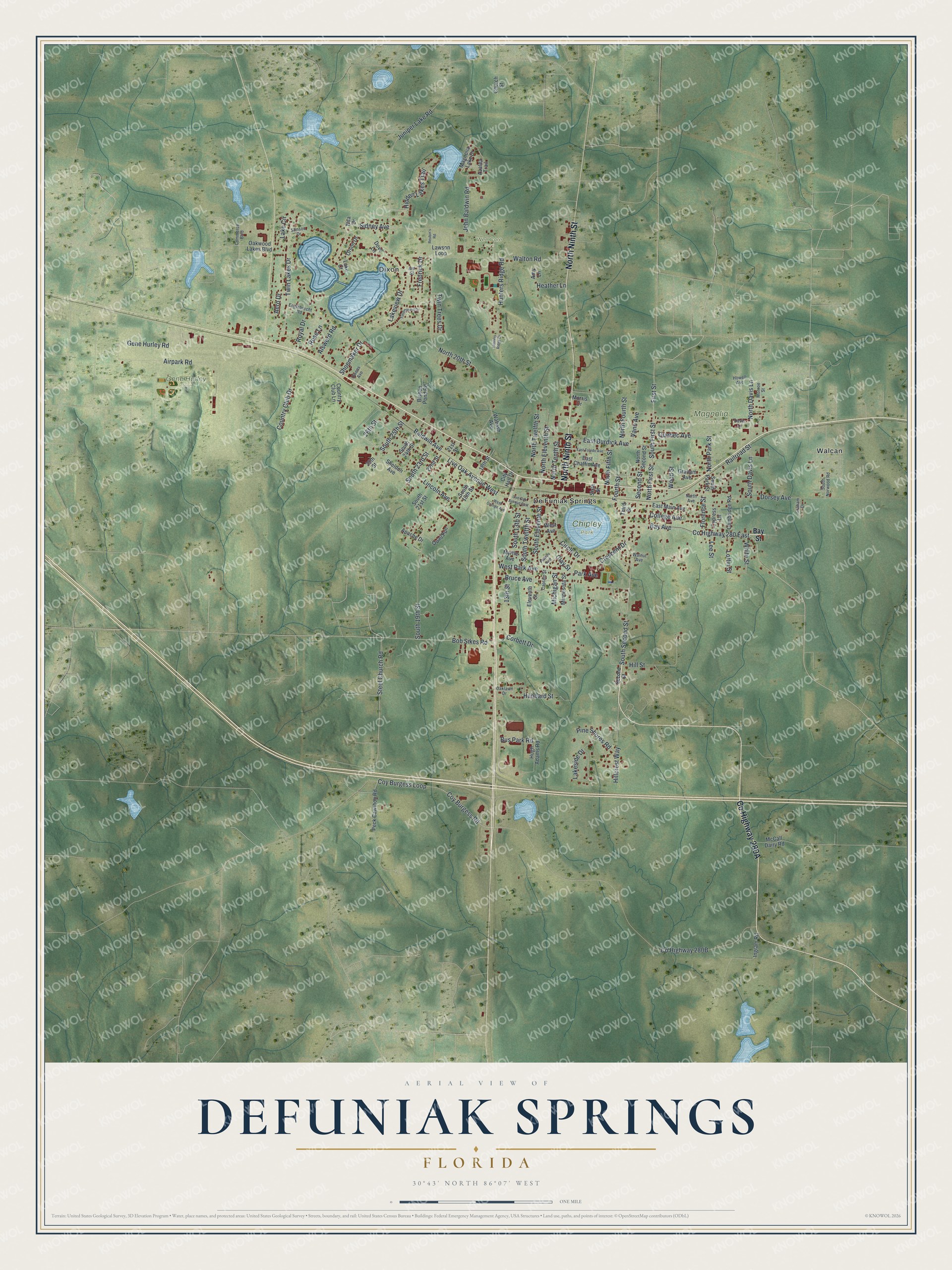
A new map of DeFuniak Springs, Florida, made in 2026 and printed to order on thick archival matte paper.
12" x 18" Archival Matte Print
A Map of Home. A Work of Art.
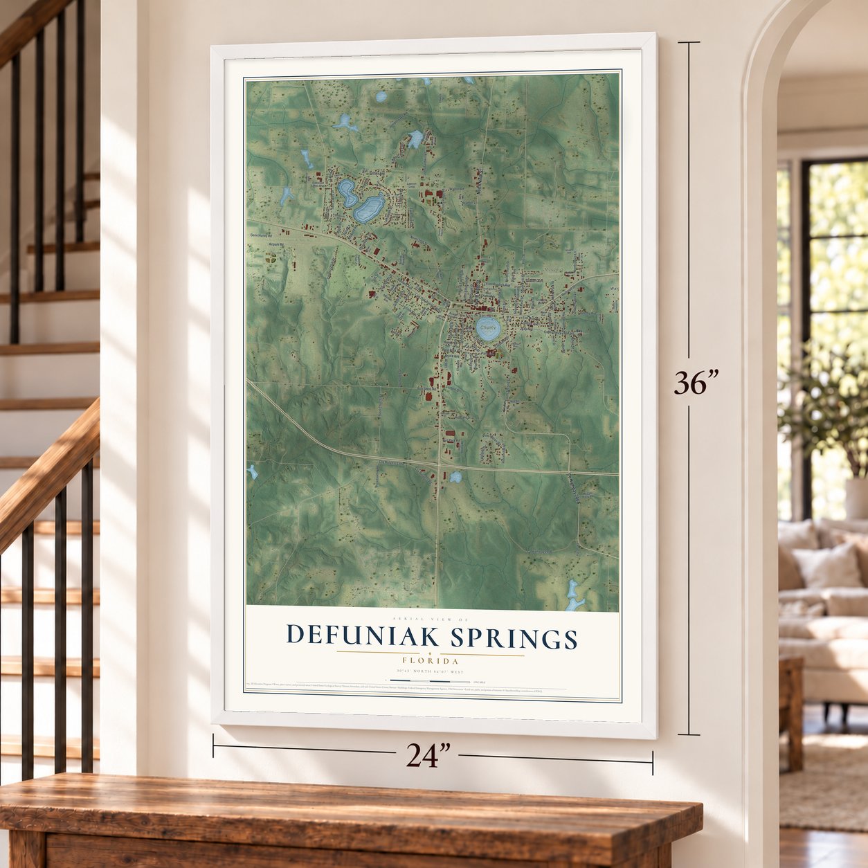
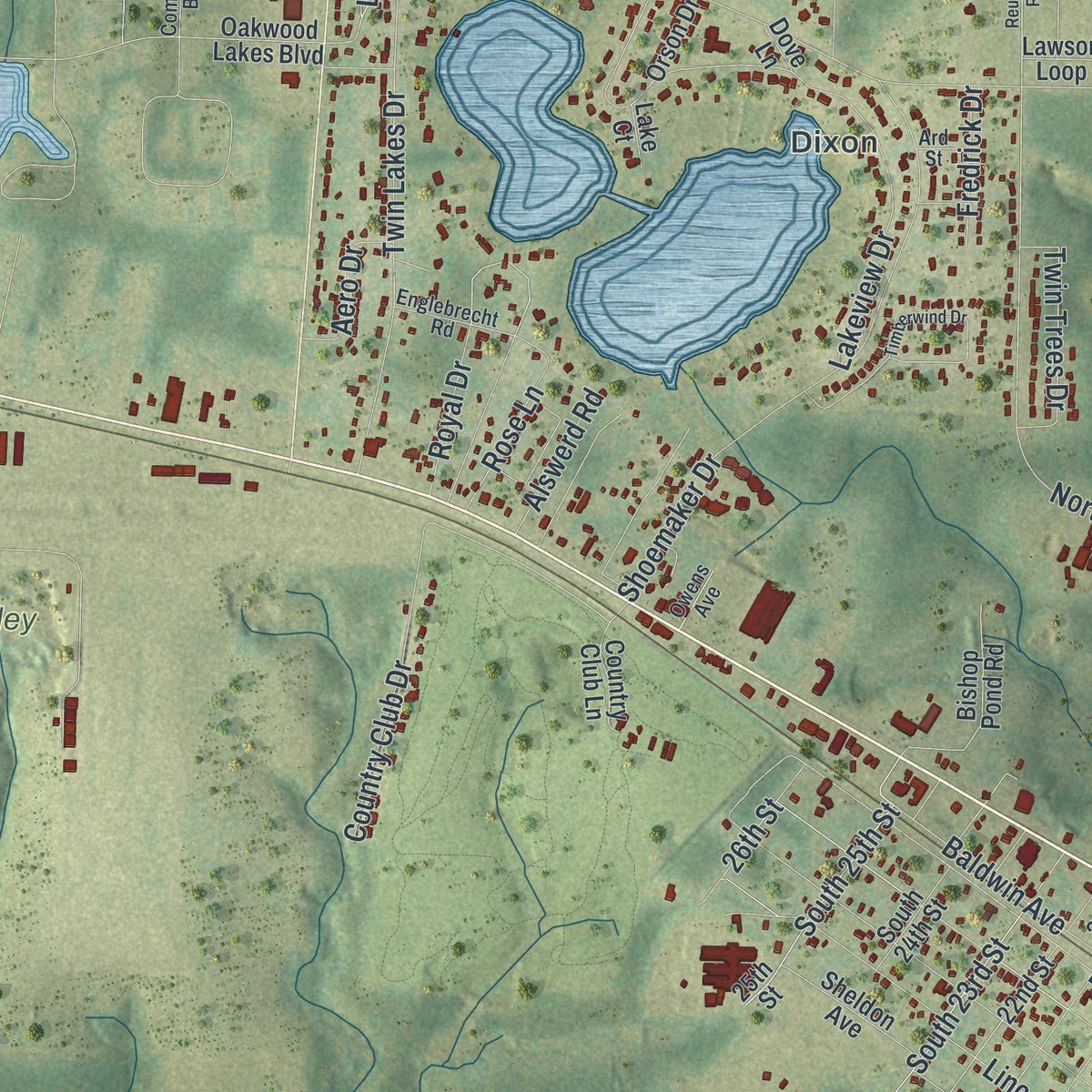
Explore DeFuniak Springs, Florida from a whole new perspective. Created using aerial imagery and detailed geographic data, this map captures DeFuniak Springs building by building, with labeled streets, familiar landmarks, and shaded topographical relief that highlights the natural contours of the landscape.
Combining modern data with the timeless character of a vintage atlas, this map is just as interesting up close as it is beautiful on the wall. Whether you grew up in DeFuniak Springs, spent memorable years there, or call it home today, this unique map is a great way to celebrate a place that means something to you. Zoom in on the preview to look for your street, and then order a print to put your memories on the wall.
Three ways to hang it
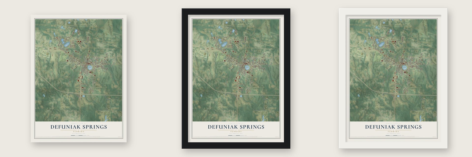
Unframed archival matte, a black wood frame or a white wood frame.
Up close
Geography Worth Displaying
This map was created using accurate cartographic data and authoritative geographic sources, including the U.S. Geological Survey (USGS) and FEMA. The map brings together terrain, waterways, roads, and building detail. The majority of the streets are labeled, houses are accurately depicted, and the topography is derived from government sources. Combining local data with carefully composed color and shading leads to this beautifully detailed DeFuniak Springs artwork for your wall.
Rather than simply showing street outlines, we’ve included as many of the street names as we could reasonably fit on the map while keeping their names legible. Zoom in on the high resolution preview to see exactly what’s on the map. We truly set out to create a statement piece for anyone who loves DeFuniak Springs. So whether it’s for you, or a gift for someone you love, we hope this map of DeFuniak Springs brings back fond memories.
Explore the full map of DeFuniak Springs, Florida and read about the local places it shows.

About DeFuniak Springs, Florida
DeFuniak Springs is a city of 5,919 people and the seat of Walton County, in the Florida Panhandle. In the late 1800s, officers of the Pensacola and Atlantic Railroad, a branch of the Louisville and Nashville, planned the town as a resort around Lake DeFuniak. The name honors one of the L&N's vice-presidents, Frederick R. DeFuniak. Like much of Northwest Florida, it drew most of its early settlers from Scots who had lived in Virginia and the Carolinas.
To give visitors a reason to come and stay, the developers teamed up with the Chautauqua movement. The Florida Chautauqua met here from 1885 to 1922, and thousands of vacationers came for its seminars and classes. In 1909 the Chautauqua Hall of Brotherhood went up beside the lake, with an auditorium for 4,000, and it joined the National Register in 1972. Hurricane Eloise wrecked the auditorium in 1975, so it was razed, but the rest of the hall still stands on Circle Drive, and the Walton County Chamber of Commerce keeps a branch office inside it.
- A library opened in 1887In 1887 local women, later known as the Ladies' Library Association, raised $580 and built a library beside the Chautauqua grounds on lakeside land leased for 25 cents a year. It opened that December with donated books and others bought from the Ladies Reading Club and J. L. Shearer. Members' subscriptions kept it running until the city and county took it over in the 1960s.
- Armor from Palmer CollegeThe old library is now the Walton-DeFuniak Library, and it holds more than 25,000 volumes. Its collection also includes over a hundred old weapons and suits and pieces of armor, all handed down from Palmer College.
- A town of schoolsThe town's founders wanted a place of learning, and four schools opened here in the late 1800s. Florida Normal College trained teachers, and in time it was folded into Florida State University. Palmer Academy, Palmer College and the Thomas Industrial Institute did not survive, because the money troubles of the Great Depression closed them. College Avenue still runs where students once walked to Palmer College.
- Teachers organized in 1886In 1886 teachers from across Florida gathered in DeFuniak Springs and founded the Florida Education Association. The meeting changed the course of public schooling in the state. The association is still the main voice of Florida's educators, and it is affiliated with both the American Federation of Teachers and the National Education Association.
- A nearly round lakeLake DeFuniak, fed by natural springs and covering about 40 acres, is almost perfectly round. Kingsley Lake is the only other spring-fed lake in the world like it. The lake sits inside the 260-acre Chipley Park, and from Thanksgiving to New Year's Day its shores are lit and decorated for what locals call Christmas Reflections.
Find your street
Names on the DeFuniak Springs map
Every name below is printed on this map. Look for your street, your school, the park where you played, or the pond down the road.
Places and landmarks7
- Dixon
- Chipley Park
- Gene Hurley Park
- Magnolia Cemetery
- Wee Care Park
- De Funiak Springs
- Walcan
Streets and roads142
- North Ninth Street
- South Second Street
- Steel Church Road
- Second Street
- South 19th Street
- County Highway 280 East
- Bob Sikes Road
- South 23rd Street
- White Street
- West Park Avenue
- South 25th Street
- Loftin Street
- North Park Street
- Baldwin Avenue
- Walton Road
- North 20th Street
- Hill Street
- Bay Avenue
- Crescent Drive
- Circle Drive
- Hubbard Street
- Live Oak Avenue West
- Gene Hurley Road
- First Street
- South First Street
- Lakeview Drive
- Shoemaker Drive
- Dorsey Avenue
- North First Street
- Twin Lakes Drive
Show all 142 streets
- Lincoln Avenue
- Bruce Avenue
- Coy Burgess Loop
- Country Club Drive
- Lakeside Drive
- Hunters Ridge Road
- South 13th Street
- Airpark Road
- Park Avenue
- East Burdick Avenue
- South Eleventh Street
- Vann Avenue
- North Davis Lane
- North Fourth Street
- Juniper Lake Road
- Coy Burgess Road
- Hidden Lakes Trail
- Sidney Avenue
- College Avenue
- North Twelfth Street
- John Baldwin Road
- North Eleventh Street
- Railroad Street
- South Twelfth Street
- Corbett Drive
- Quebec Avenue
- Florence Street
- Fourth Street
- North Tenth Street
- Hillcrest Way
- South Davis Lane
- North Fifth Street
- Pine Shores Road
- Clay Street
- Michigan Street
- Rose Lane
- Twin Trees Drive
- Wood Street
- Lake Circle
- Bus Park Road
- 26th Street
- Royal Drive
- Aero Drive
- 13th Street
- Alswerd Road
- Fredrick Drive
- Heather Lane
- Lee Street
- Bay Street
- Hugh Adams Road
- Eleventh Street
- East Main Avenue
- Magnolia Lake Drive
- South 21st Street
- 25th Street
- Lawson Loop
- Bishop Pond Road
- Peck Cawthon Road
- Sheldon Avenue
- McCall Dairy Road
- East Chaffin Avenue
- Myrtle Avenue
- Cambridge Road
- South 18th Street
- 22nd Street
- Quail Run
- Country Club Lane
- Apache Drive
- Oakwood Lakes Boulevard
- Minnesota Street
- Graham Avenue
- South 24th Street
- Cypress Lane
- Ingram Road
- North Second Street
- South Park Street
- Orson Drive
- Morris Drive
- 18th Street
- Amy Lane
- Wabash Avenue
- West Avenue
- Church Street
- Azalea Trail
- City Hall Drive
- 21st Street
- Lake Court
- Sixth Street
- Third Street
- Dove Lane
- Nita Drive
- South Norwood Road
- Stinson Drive
- Englebrecht Road
- Commerce Boulevard
- Captain Street
- Howell Avenue
- Monroe Street
- Oaklawn Drive
- North Avenue
- Graham Drive
- Davis Lane
- Owens Avenue
- Walnut Avenue
- Ard Street
- West Orange Avenue
- Timberwind Drive
- Live Oak Avenue East
- East Toledo Avenue
- Hunters Ridge Drive
- Plateau Avenue
- Reubin's Road
Names are listed as they appear on the printed map. Zoom into the product photos to find them.
The art of mapping a place
How This Map Was Made
Real places. Remarkable detail. Discover the layers that turn geographic data into a map of home.

The view from above
Aerial imagery reveals the character of the land: woodland, open fields, and the patterns of a place.

The shape of the land
Elevation data brings hills, valleys, and subtle changes in the landscape into view.

The details of home
Roads, waterways, and building footprints come together to make the map feel unmistakably local.

Geography becomes art
Considered color, shading, and typography bring the layers together in a map made for your wall.


Process illustrated with Mendon, Massachusetts. Aerial imagery: USDA NAIP. Terrain: USGS 3D Elevation Program. Map details and finished artwork: KNOWOL.
The Details
About This Print
Choose an archival matte print, or a black or white Ayous wood frame. The archival matte print is unframed.
Select your size and finish above to see the matching product image and price.
Materials & Craftsmanship
A contemporary map with the character of a classic atlas, printed on archival matte paper. Optional frames are made from Ayous wood.
Your printed map does not include the watermark shown in the full-map preview.
Shipping & Delivery
Free shipping within the United States. Every print is made to order in the USA.
Buying a gift? Add a note in your cart and we'll include it. We never put prices in the package.
Prints ship within 2 to 3 business days. Allow 7 to 10 days total from ordering for delivery. Timing may vary during holidays or periods of high order volume.
Read our shipping policy.
Returns and damaged prints
Each print is made to order. Change-of-mind refunds are not available after production.
If your print arrives damaged, misprinted or incorrect, contact support@knowol.com within 30 days of receiving it. Include your order number, photos and a description of the issue.
Read our full refund and replacement policy. For questions about your order, email support@knowol.com.
Find your town
Looking for another city?
Find a map of home in our Florida collection, or any town in the country.
Nearby
Maps of towns near DeFuniak Springs
Know someone from one of these towns? Their map makes a great gift.
 Ponce de Leon
, Florida
From $39.99See the map
 Mossy Head
, Florida
From $39.99See the map
 Freeport
, Florida
From $39.99See the map
More maps nearby: Westville, Caryville, Paxton, Ebro and Niceville.