
Search for another town





Free U.S. delivery 7 to 10 days after you order
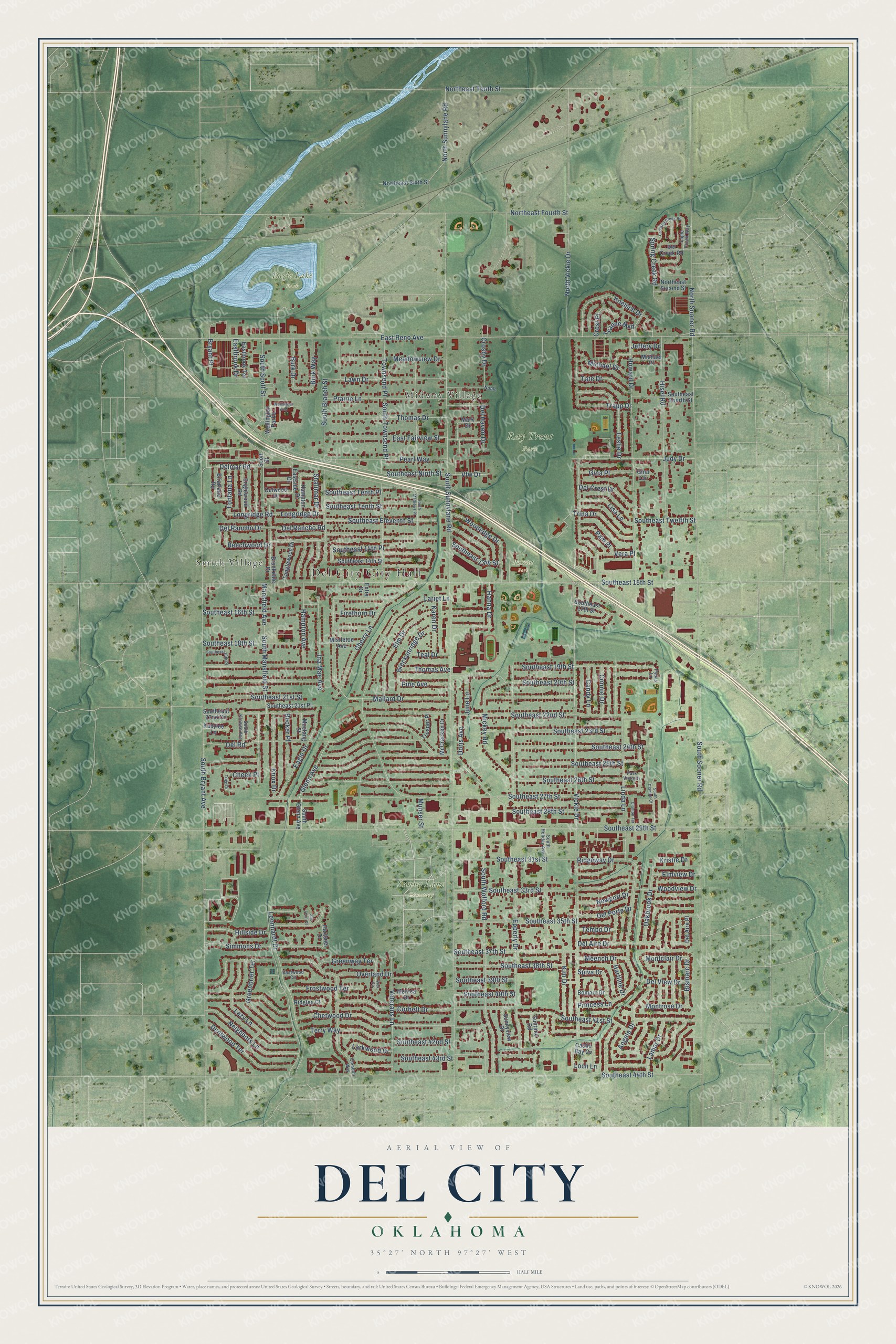
Del City, Oklahoma Map Art
Building by building, with labeled streets and shaded relief.
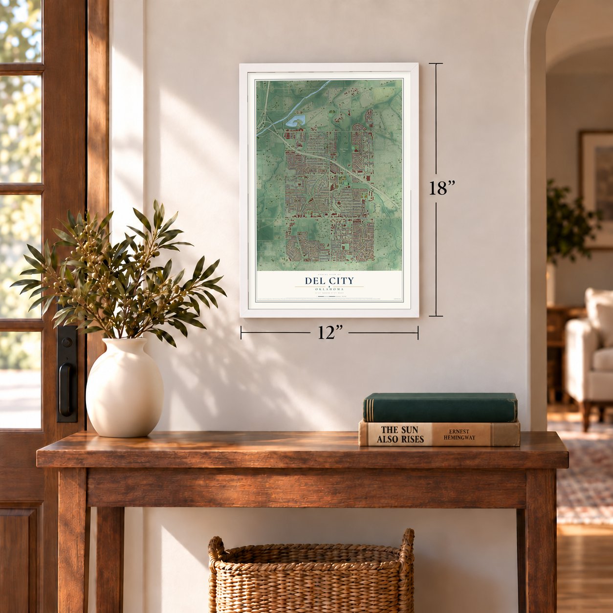
12" x 18" Archival Matte Print
A Map of Home. A Work of Art.
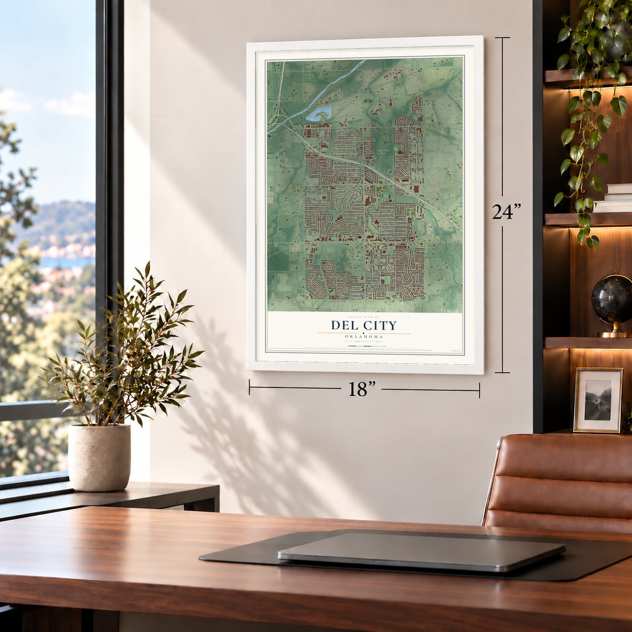
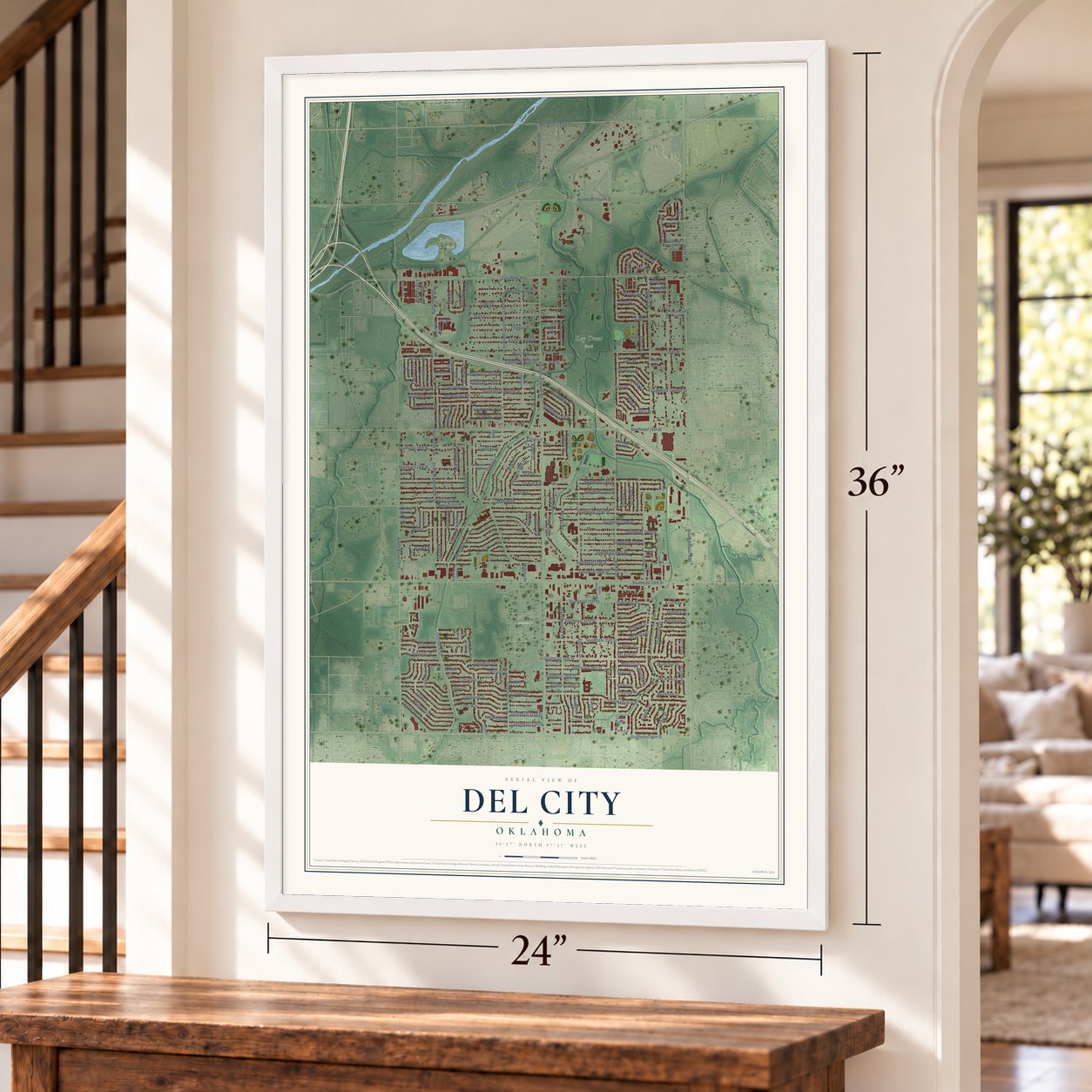
Explore Del City, Oklahoma from a whole new perspective. Created using aerial imagery and detailed geographic data, this map captures Del City building by building, with labeled streets, familiar landmarks, and shaded topographical relief that highlights the natural contours of the landscape.
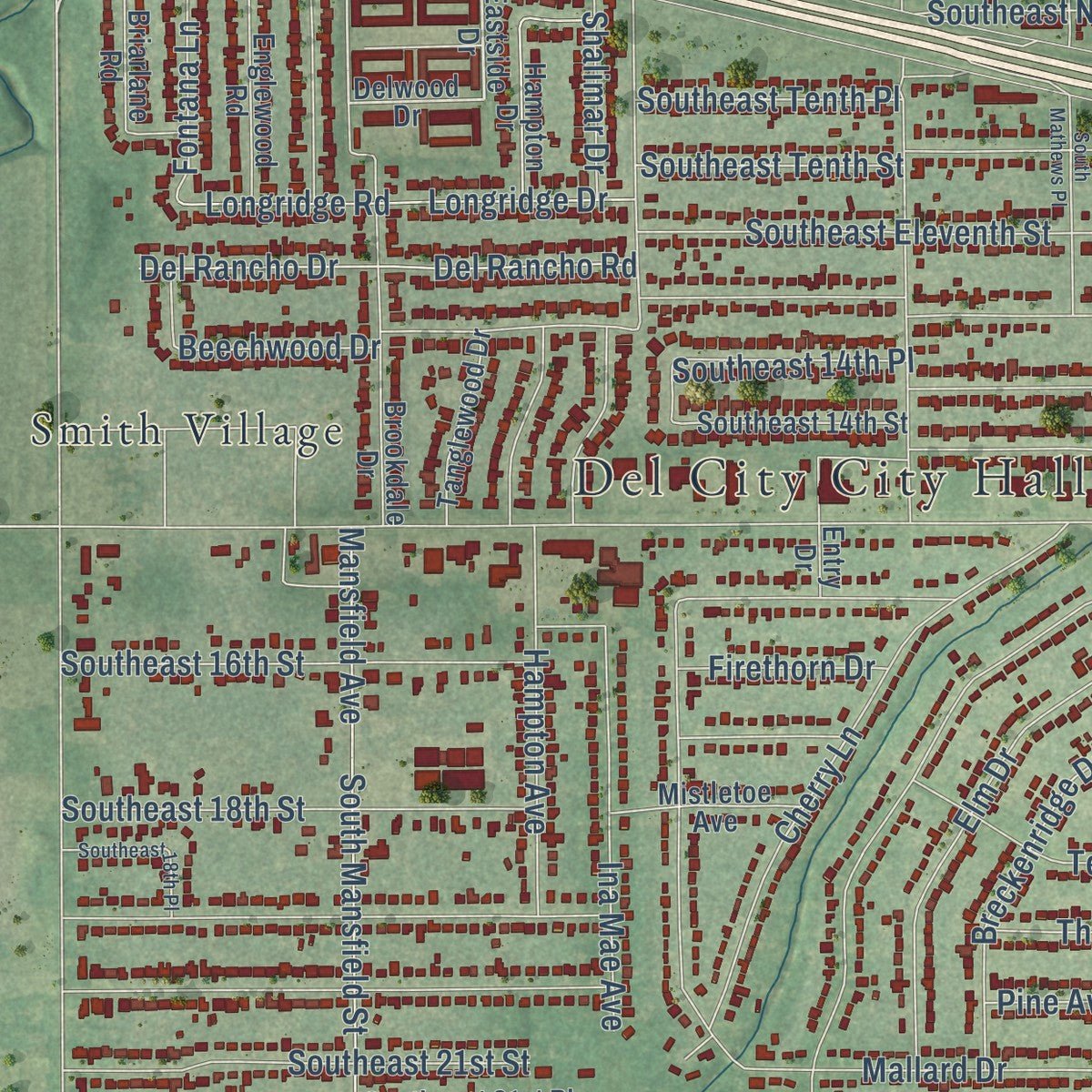
Combining modern data with the timeless character of a vintage atlas, this map is just as interesting up close as it is beautiful on the wall. Whether you grew up in Del City, spent memorable years there, or call it home today, this unique map is a great way to celebrate a place that means something to you. Zoom in on the preview to look for your street, and then order a print to put your memories on the wall.
Three ways to hang it
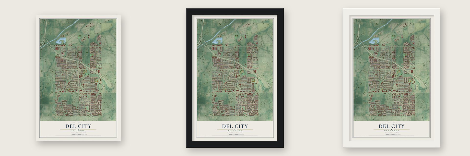
Unframed archival matte, a black wood frame or a white wood frame.
Up close
Geography Worth Displaying
This map was created using accurate cartographic data and authoritative geographic sources, including the U.S. Geological Survey and the Census Bureau. The map brings together terrain, waterways, roads, and building detail. The majority of the streets are labeled, houses are accurately depicted, and the topography is derived from government sources. Combining local data with carefully composed color and shading leads to this beautifully detailed Del City artwork for your wall.
Rather than simply showing street outlines, we’ve included as many of the street names as we could reasonably fit on the map while keeping their names legible. Zoom in on the high resolution preview to see exactly what’s on the map. We truly set out to create a statement piece for anyone who loves Del City. So whether it’s for you, or a gift for someone you love, we hope this map of Del City brings back fond memories.
Read the story behind this map of Del City, Oklahoma from 2026.

Find your street
Names on the Del City map
Every name below is printed on this map. Look for your street, your school, the park where you played, or the pond down the road.
Places and landmarks7
- Del City City Hall
- Midway Village
- Eagle Lake Park
- Ray Trent Park
- Sunny Lane Cemetery
- Patriot Park
- Smith Village
Streets and roads205
- South Bryant Avenue
- Delmar Road
- Southeast 26th Street
- Bismarc Drive
- Montclair Drive
- Vickie Drive
- South Sunnylane Road
- South Sooner Road
- Southeast 29th Street
- Southeast 15th Street
- Southeast 44th Street
- East Reno Avenue
- Epperly Drive
- Southeast 24th Street
- Southeast 22nd Street
- Southeast 27th Street
- Del Road
- Southeast 41st Street
- Northeast Fourth Street
- Southeast 20th Street
- Leonhardt Drive
- Howard Drive
- Mallard Drive
- Southeast 19th Street
- Lariet Lane
- North Sunnylane Road
- North Sooner Road
- North Vickie Drive
- South Wofford Road
- Hisel Road
Show all 205 streets
- Northeast Tenth Street
- Southeast 23rd Street
- Overland Drive
- South Townsend Place
- Southeast Twelfth Street
- Del View Drive
- Southeast 25th Street
- Mansfield Avenue
- South Mansfield Street
- South Branch Street
- Chetwood Drive
- Southeast 21st Street
- Southeast 28th Street
- Oakbrook Drive
- Prairie Lane
- Southeast 43rd Street
- East Fairview Street
- South Scott Street
- Linda Lane
- Southeast 16th Street
- Dentwood Terrace
- Southeast 42nd Street
- Mickey Road
- Southeast 18th Street
- Del Aire Drive
- Cherry Lane
- Hampton Avenue
- Hillside Drive
- Lazy Lane
- Southeast 35th Street
- Southeast 31st Street
- Southeast 33rd Street
- Southeast 37th Street
- Judy Drive
- Thomas Drive
- Woodview Drive
- Pearl Way
- Lawn Drive
- Veterans Lane
- Corbett Drive
- Beechwood Drive
- Simmons Drive
- Spiva Drive
- Southeast Eleventh Street
- Southeast 38th Street
- Neighbors Lane
- Elm Drive
- Southeast 14th Place
- Southeast Tenth Street
- Lamar Drive
- Meadowview Drive
- Del Rancho Drive
- Del Rancho Road
- Southeast Ninth Street
- Newport Drive
- Terry Way
- Woodedge Drive
- Longridge Drive
- Longridge Road
- Greenbrier Terrace
- Leslie Drive
- Angela Drive
- Koelsch Drive
- Glenn Avenue
- Eagle Drive
- Shalimar Drive
- Elmview Drive
- Breckenridge Drive
- Ina Mae Avenue
- Knox Drive
- Trina Drive
- Kim Drive
- Teal Drive
- Southeast 39th Street
- Frostwood Terrace
- Karen Drive
- Southeast Tenth Place
- Princess Lane
- Lisa Lane
- Becker Place
- Del Crest Drive
- Michael Drive
- Southeast 40th Street
- Townsend Place
- Greenway Terrace
- Burk Drive
- Burk Way
- Tate Drive
- Crest Place
- Del Porte Drive
- Del Haven Drive
- Gina Place
- Southeast 13th Street
- Larkwood Drive
- Trapp Drive
- Pine Avenue
- Thomas Avenue
- Crosby Drive
- Candy Lane
- Connie Drive
- Meench Drive
- Bryant Place
- Ridgeway Drive
- Montrose Drive
- Spring Creek Road
- Fontana Lane
- Pam Place
- Firethorn Drive
- Doris Avenue
- Eastbrook Drive
- Hanna Drive
- Kristie Drive
- Vfw Drive
- June Lane
- Hartline Drive
- Tyanne Boulevard
- Vera Place
- Tempo Drive
- Cheek Place
- Munser Street
- Loch Lane
- Jeffery Drive
- Eastside Drive
- Delwood Drive
- Southeast 17th Street
- Southeast 14th Street
- South Glenn Avenue
- Brookdale Drive
- Del Aire Place
- Southeast Fourth Street
- Mark Drive
- Michael Place
- Hampton Drive
- Northeast Sixth Street
- Southeast 21st Place
- Englewood Road
- Briarlane Road
- Tanglewood Drive
- McCracken Drive
- Mistletoe Avenue
- Northeast Second Street
- Eastbrook Terrace
- Wellington Parke
- Sunnyview Drive
- Hartsdel Drive
- Trosper Place
- Bomarc Drive
- Mustang Street
- Scott Street
- Ridglea Court
- Suntane Road
- Southeast 22nd Circle
- Monica Drive
- Kaeylee Lane
- Del Creek Road
- Castle Bay Cv
- Gina Circle
- Entry Drive
- South Holiday Avenue
- Clendon Way
- Noble
- Park Vista Drive
- Eagle Creek Way
- South Krowse Avenue
- Eastwood Circle
- Pybas Lane
- South Clanton Court
- Crooked Creek Road
- South Mathews Place
- Southeast 18th Place
- Clanton Terrace
- Vick Circle
- Wellington Way
- Trigg Drive
- San Leon Court
Names are listed as they appear on the printed map. Zoom into the product photos to find them.
Keep exploring Oklahoma
Del City is one of 887 Oklahoma towns we've mapped. Every dot on the map is a print of its own.
The search covers every state, Oklahoma first.
Near Del City
Order 2 or more town maps and save 10%. Shown in the size and finish you picked above, so they hang as a set.
- Smith Village 12" x 18" / Archival Matte Print $39.99
- Midwest City 12" x 18" / Archival Matte Print $39.99
- Valley Brook 12" x 18" / Archival Matte Print $39.99

More maps nearby: Forest Park, Oklahoma City, Lake Aluma, Spencer and Nicoma Park.
The art of mapping a place
How This Map Was Made
Real places. Remarkable detail. Discover the layers that turn geographic data into a map of home.

The view from above
Aerial imagery reveals the character of the land: woodland, open fields, and the patterns of a place.

The shape of the land
Elevation data brings hills, valleys, and subtle changes in the landscape into view.

The details of home
Roads, waterways, and building footprints come together to make the map feel unmistakably local.

Geography becomes art
Considered color, shading, and typography bring the layers together in a map made for your wall.


Process illustrated with Mendon, Massachusetts. Aerial imagery: USDA NAIP. Terrain: USGS 3D Elevation Program. Map details and finished artwork: KNOWOL.
The Details
About This Print
Choose an archival matte print, or a black or white Ayous wood frame. The archival matte print is unframed.
Select your size and finish above to see the matching product image and price.
Materials & Craftsmanship
A contemporary map with the character of a classic atlas, printed on archival matte paper. Optional frames are made from Ayous wood.
Your printed map does not include the watermark shown in the full-map preview.
Shipping & Delivery
Free shipping within the United States. Every print is made to order in the USA.
Buying a gift? Add a note in your cart and we'll include it. We never put prices in the package.
Prints ship within 2 to 3 business days. Allow 7 to 10 days total from ordering for delivery. Timing may vary during holidays or periods of high order volume.
Read our shipping policy.
Returns and damaged prints
Each print is made to order. Change-of-mind refunds are not available after production.
If your print arrives damaged, misprinted or incorrect, contact support@knowol.com within 30 days of receiving it. Include your order number, photos and a description of the issue.
Read our full refund and replacement policy. For questions about your order, email support@knowol.com.