
Search for another town





Free U.S. delivery 7 to 10 days after you order
Midwest City, Oklahoma Map Art
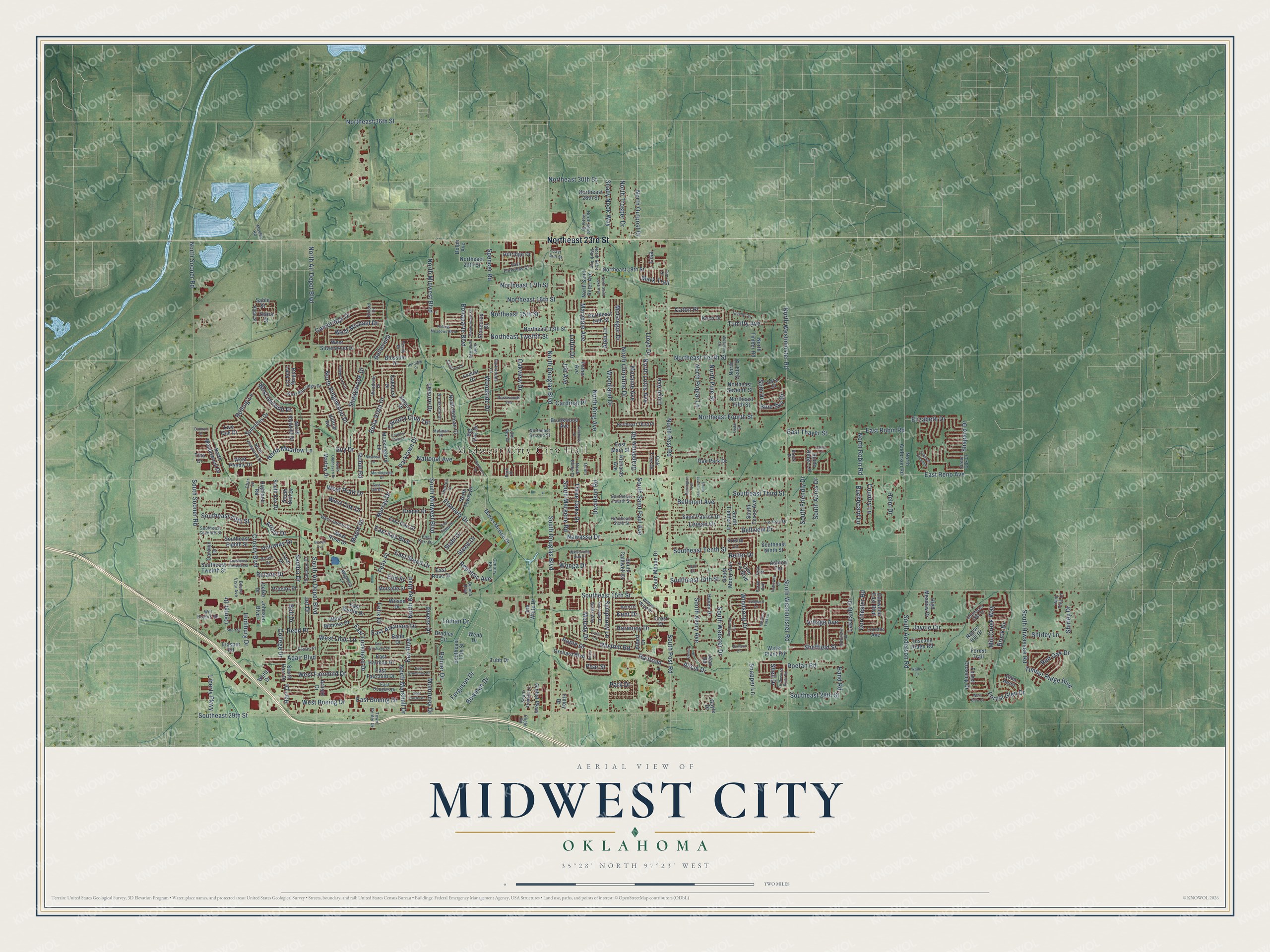
Building by building, with labeled streets and shaded relief.
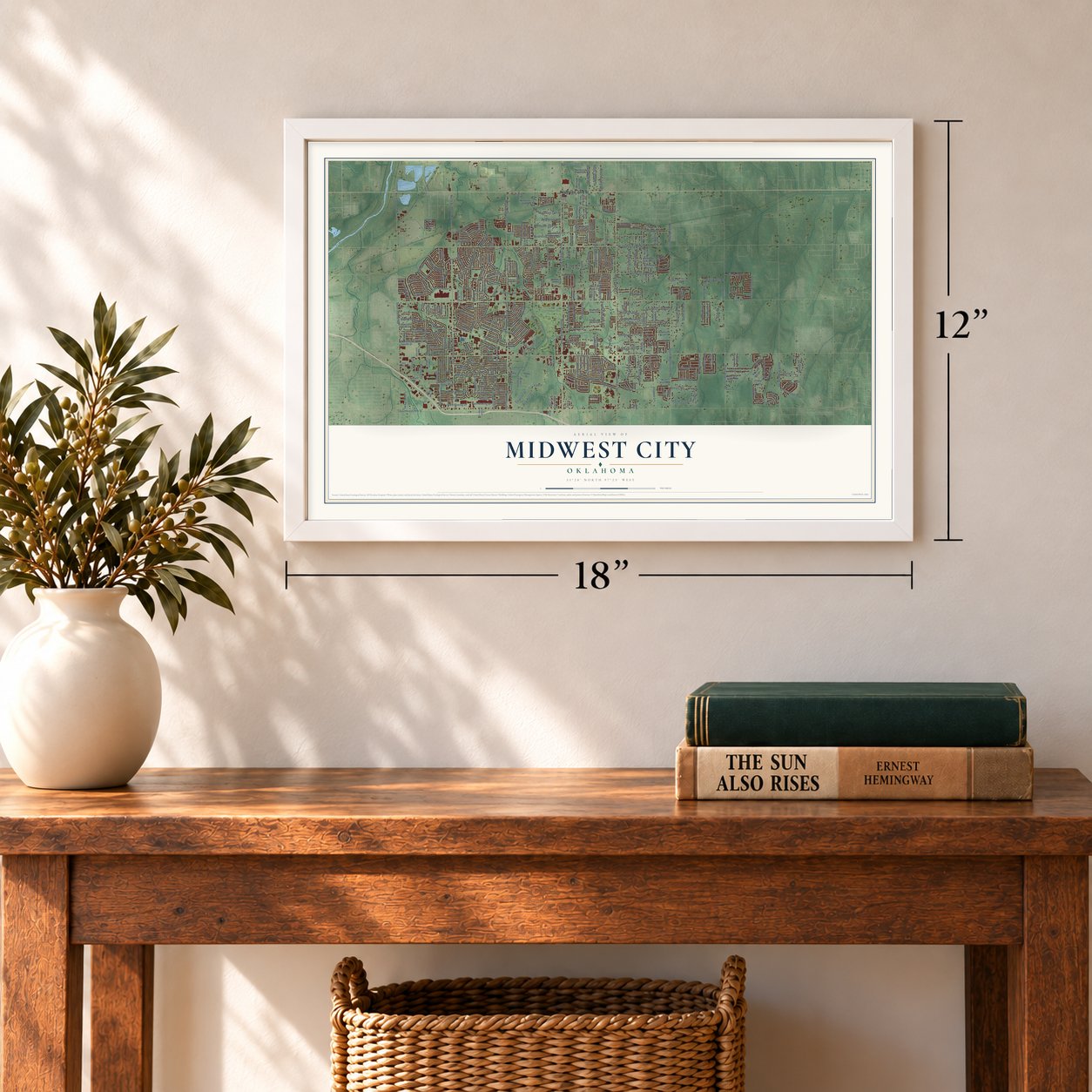
12" x 18" Archival Matte Print
A Map of Home. A Work of Art.
Explore Midwest City, Oklahoma from a whole new perspective. Created using aerial imagery and detailed geographic data, this map captures Midwest City building by building, with labeled streets, familiar landmarks, and shaded topographical relief that highlights the natural contours of the landscape.
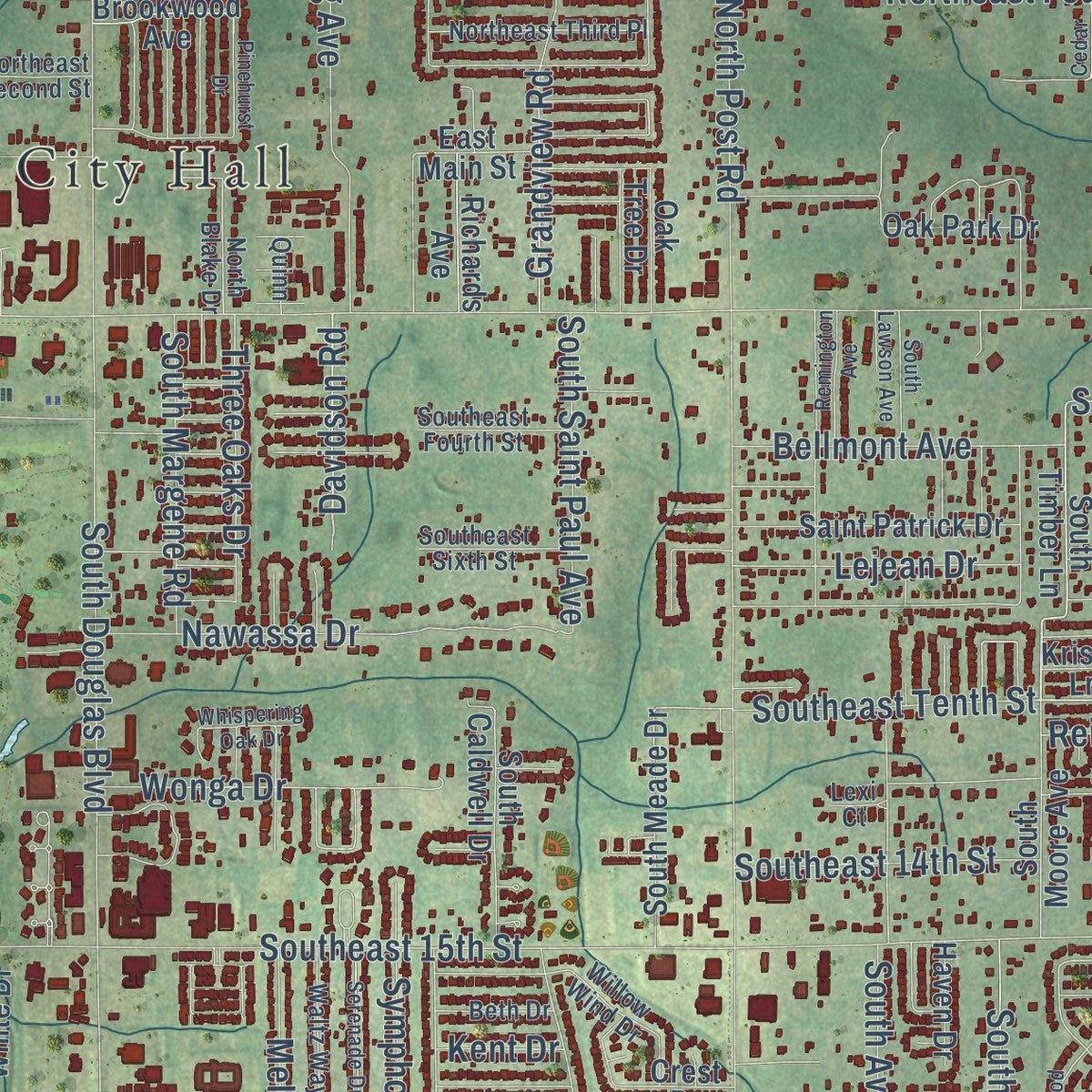
Combining modern data with the timeless character of a vintage atlas, this map is just as interesting up close as it is beautiful on the wall. Whether you grew up in Midwest City, spent memorable years there, or call it home today, this unique map is a great way to celebrate a place that means something to you. Zoom in on the preview to look for your street, and then order a print to put your memories on the wall.
Three ways to hang it
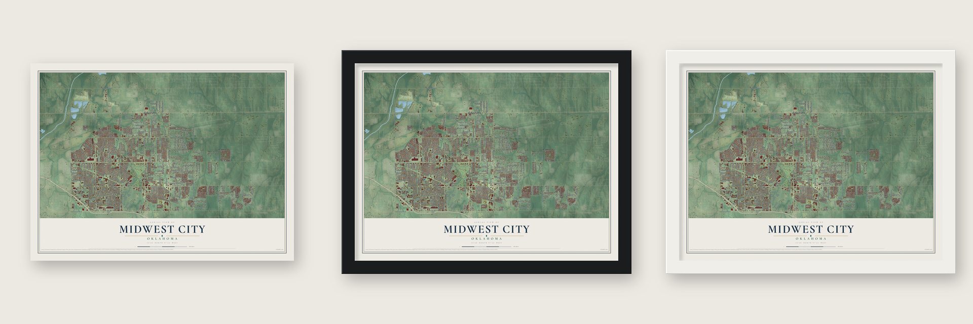
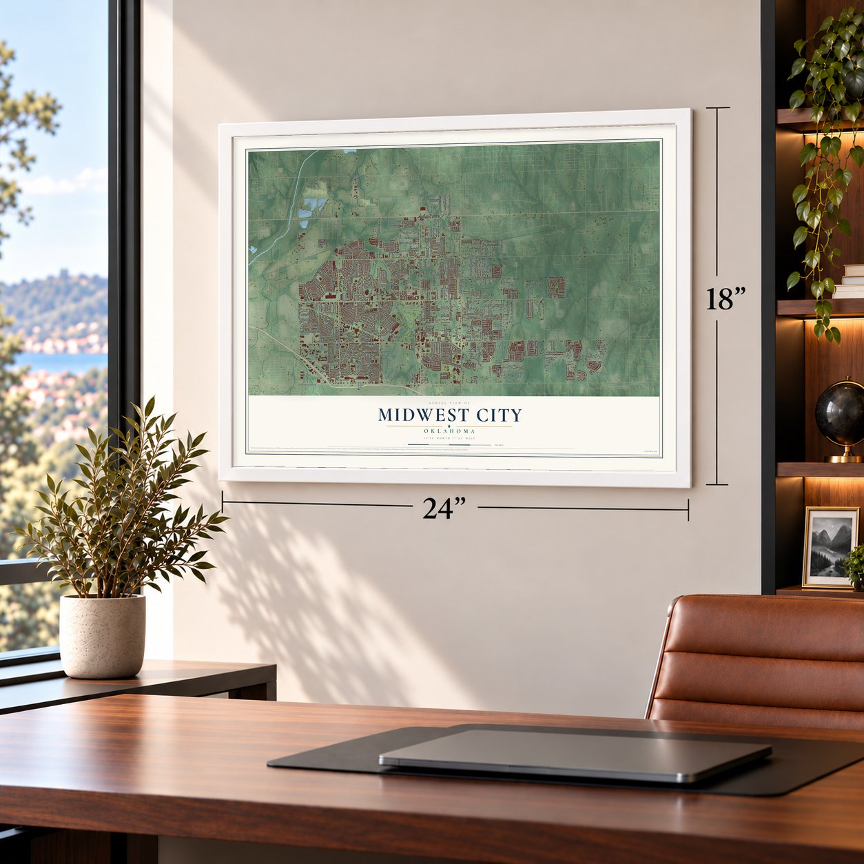
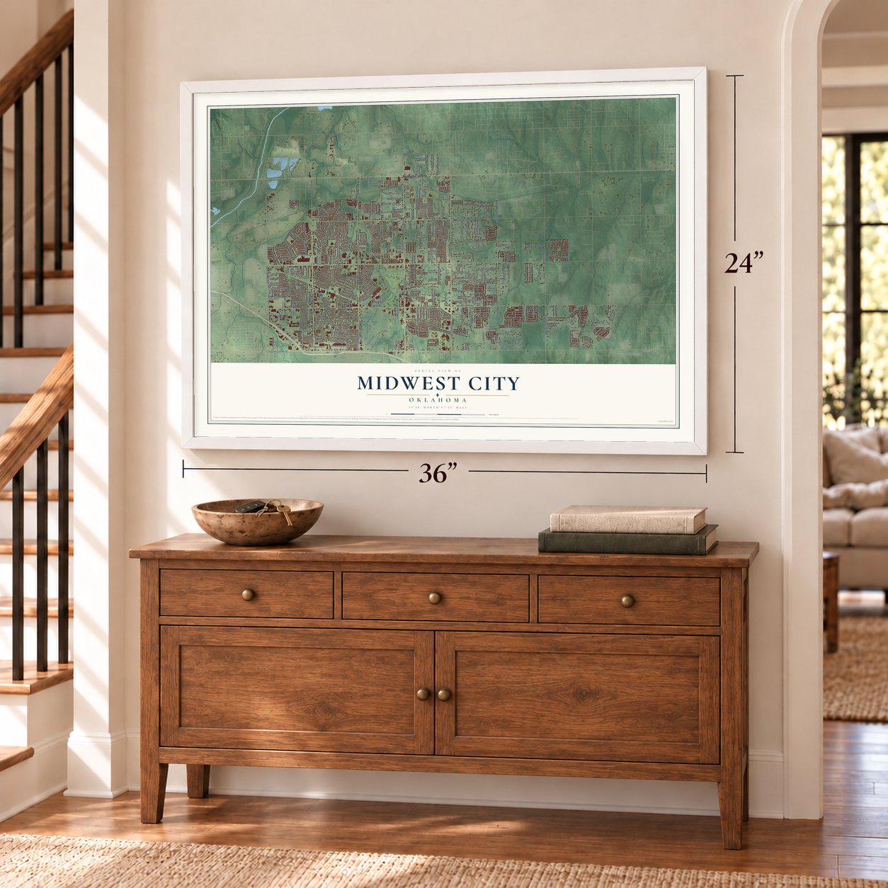
Unframed archival matte, a black wood frame or a white wood frame.
Up close
Geography Worth Displaying
This map was created using accurate cartographic data and authoritative geographic sources, including the U.S. Geological Survey and the Census Bureau. The map brings together terrain, waterways, roads, and building detail. The majority of the streets are labeled, houses are accurately depicted, and the topography is derived from government sources. Combining local data with carefully composed color and shading leads to this beautifully detailed Midwest City artwork for your wall.
Rather than simply showing street outlines, we’ve included as many of the street names as we could reasonably fit on the map while keeping their names legible. Zoom in on the high resolution preview to see exactly what’s on the map. We truly set out to create a statement piece for anyone who loves Midwest City. So whether it’s for you, or a gift for someone you love, we hope this map of Midwest City brings back fond memories.
Read the story behind this map of Midwest City, Oklahoma from 2026.

Find your street
Names on the Midwest City map
Every name below is printed on this map. Look for your street, your school, the park where you played, or the pond down the road.
Places and landmarks1
- Midwest City City Hall
Streets and roads362
- Northeast 23rd Street
- North Key Boulevard
- East Key Boulevard
- Key Boulevard
- Bella Vista Drive
- East Lockheed Drive
- North Lotus Avenue
- Country Club Terrace
- West Idylwild Drive
- Republic Avenue
- Rulane Drive
- Southeast 15th Street
- East Reno Avenue
- Southeast 29th Street
- Northeast Tenth Street
- North Douglas Boulevard
- North Midwest Boulevard
- South Air Depot Boulevard
- South Douglas Boulevard
- North Air Depot Boulevard
- North Sooner Road
- North Post Road
- South Sooner Road
- South Post Road
- South Midwest Boulevard
- South Westminster Road
- Shadybrook Drive
- South Anderson Road
- North Westminster Road
- Sandra Drive
Show all 362 streets
- Timber Ridge Boulevard
- Northeast 16th Street
- Northeast Fourth Street
- Northeast Twelfth Street
- Felix Place
- Woodside Drive
- North King Avenue
- North Christine Drive
- South Avery Avenue
- Ferguson Drive
- Spencer Road
- South Hiwassee Road
- Southeast Third Street
- Southeast Tenth Street
- Harmony Drive
- Maple Drive
- Bellview Drive
- Southeast Fifth Street
- East Steed Drive
- Bowman Drive
- Northeast 36th Street
- Northeast 30th Street
- East Robin Road
- North Robin Road
- Crosby Boulevard
- Nawassa Drive
- Forest Glen Drive
- North Marshall Drive
- Palmer Drive
- North Pine Street
- West Boeing Drive
- Rhythm Road
- Parklawn Drive
- Cardinal Place
- Lloyd Drive
- Cambridge Drive
- North Poplar Lane
- Northeast 17th Street
- National Avenue
- Robin Road
- East Boeing Drive
- North Ridgewood Drive
- North Meadow Lane
- Adair Boulevard
- Wonga Drive
- Elizabeth Drive
- Jaycie Circle
- Country Lane
- Rolling Lane
- Felix Drive
- Center Drive
- South Webster Drive
- Woodland Drive
- Murray Drive
- Bellmont Avenue
- Southeast 14th Street
- West Fairchild Drive
- Moraine Avenue
- Shady Nook Way
- Grandview Road
- Marydale Avenue
- South Margene Road
- Oakview Drive
- South Saint Paul Avenue
- Hudiburg Drive
- North Trosper Drive
- Northeast 15th Street
- Apple Drive
- North Outpost Drive
- Windsong Drive
- East Atkinson Drive
- Tumilty Avenue
- Southeast 28th Street
- Monroney Drive
- West Michael Drive
- Flannery Drive
- Sheffield Street
- Bonaparte Boulevard
- Railroad
- South Friendly Drive
- Caton Place
- Liberty Parkway
- Steed Drive
- Lejean Drive
- Park Drive
- Three Oaks Drive
- Shapard Drive
- Red Oak Drive
- Roefan Road
- Jet Drive
- Helm Drive
- Symphony Lane
- College Drive
- Snapper Lane
- McGregor Drive
- East Thayer Street
- Mill Creek Way
- West Lilac Lane
- Loman Drive
- Bell Drive
- Shirley Drive
- South Acres Drive
- Harr Drive
- Blue Sky Drive
- Melody Drive
- Holoway Drive
- Loftin Drive
- Elm Street
- Buckboard Lane
- West Pratt Drive
- Brook Drive
- Arthur Drive
- Village Avenue
- West Coe Drive
- Dorchester Road
- Lakeside Drive
- Davidson Road
- Shirley Lane
- Givens Drive
- Mark Trail
- Slim Drive
- Alicia Drive
- Leisure Drive
- Alan Lane
- Reed Place
- Bellavista
- Lloyd Avenue
- Hand Road
- Job Avenue
- Stahl Drive
- Pear Street
- Reiter Drive
- Shell Drive
- Kent Drive
- Guy Drive
- Lisa
- Southeast 17th Street
- South Moore Avenue
- North Idylwild Drive
- South Timber Lane
- West Rose Drive
- Northeast Fifth Street
- Southeast Eighth Street
- West Mimosa Drive
- Morris McGee Drive
- Mockingbird Lane
- East Rose Drive
- Northeast 19th Street
- Sunvalley Drive
- East Main Street
- Northeast 13th Street
- Oak Park Drive
- Northeast Seventh Street
- East Harmon Drive
- Southeast Twelfth Street
- North Cedar Drive
- Southeast Ninth Street
- East Fairchild Drive
- North Towry Drive
- North Anderson Road
- North Saint Peter Avenue
- Locust Drive
- Orchard Boulevard
- Albert Drive
- Babb Drive
- Saint Patrick Drive
- Northeast 20th Street
- South Caldwell Drive
- North Meadowood Drive
- North Holman Court
- Wilson Drive
- East Coe Drive
- Gayle Drive
- Crest Drive
- South Harr Drive
- South Meade Drive
- West Silverwood Drive
- Highland Road
- Lynn Fry Boulevard
- Belaire Drive
- South Texas Avenue
- Big Oak Drive
- South Fox Drive
- Rolling Lane Circle
- Stone Ridge Lane
- Stonecrop Drive
- Oakwood East Boulevard
- North Timber Road
- West Peebly Drive
- Blossom Drive
- Moiselle Street
- South Bell Drive
- Global Parkway
- Northeast 28th Street
- Johnson Boulevard
- Brookwood Avenue
- Glen Aeire
- East Myrtle Drive
- Richards Avenue
- Northeast 14th Street
- Draper Drive
- Forest Crossing Drive
- Water Plant Road
- Tuscany Ridge Road
- Trosper Road
- Hillridge Drive
- Live Oak Drive
- Proctor Place
- High Meadow Drive
- Oak Tree Drive
- Bradley Circle
- Treat Drive
- Ashton Terrace
- Marlow Drive
- Carolyn Drive
- Oakhurst Drive
- Esther Avenue
- Lorene Avenue
- Jim White Drive
- Haven Drive
- Oelke Drive
- Native Hill Drive
- Arnold Drive
- Dolph Avenue
- Sara Court
- Koch Drive
- Forest Trail
- Finley Drive
- Hilltop Road
- Kristie Lane
- Zebra Street
- Sable Street
- Tubb Drive
- Jean Road
- Watts Drive
- Webb Drive
- Tina Drive
- Century Boulevard
- Southeast Sixth Street
- East Kerr Drive
- West Blueridge Drive
- East Douglas Drive
- Southeast Fourth Street
- Southeast Seventh Street
- Parkwoods Lane
- Le Jean Drive
- Southeast 18th Street
- Will Rogers Road
- Buena Vista Avenue
- Lyric Lane
- West Jarman Drive
- Willow Wind Drive
- Green Oak Drive
- Northeast Second Street
- Town Center Drive
- Northeast Third Place
- North Viewpoint Drive
- Thorton Drive
- Woodvale Drive
- Foster Place
- Waltz Way
- North Saint Peter Street
- North Saint Mark Avenue
- Brookside Drive
- Thompson Drive
- East Parkridge Drive
- Parkwoods Terrace
- North Blake Drive
- Holman Place
- Rain Tree Lane
- South Debbie Lane
- Beth Drive
- Ocama Boulevard
- Del Rey Drive
- Brown Drive
- Saint John Avenue
- Oxford Drive
- Magnolia Lane
- Penny Drive
- Kudu Street
- Char Lane
- Mosley Road
- East Sun Street
- Quinn
- Parke Avenue
- Tim Drive
- Brack Place
- Lexi Court
- Engle Road
- Park Place
- Tara Drive
- North Glenhaven Drive
- East Grumman Drive
- East Curtis Drive
- North Saint Luke Avenue
- Country Club Circle
- South Lawson Avenue
- Morningside Drive
- East Kittyhawk Drive
- Southeast Eleventh Street
- Serenade Drive
- Songbird Lane
- Ridgehaven Drive
- Meadow Lark Lane
- Goldenrod Lane
- Rolling Meadows Boulevard
- East Towry Drive
- Turtlewood River Road
- Chaucer Crescent
- Meadowpark Drive
- Timmons Drive
- Tumilty Terrace
- Crabtree Cv
- Larkin Lane
- Nottoway Drive
- Huntington Road
- Whispering Oak Drive
- Remington Avenue
- East Gill Drive
- Celina Drive
- Pinehurst Drive
- Wilkinson Drive
- Meadow Lane
- West Glen Court
- Short Street
- Heritage Place
- Cedar Street
- Foxhorn Circle
- Wallis Lane
- Damron Drive
- Bizzell Avenue
- Berry Lane
Names are listed as they appear on the printed map. Zoom into the product photos to find them.
About Midwest City, Oklahoma
From the Oklahoma Historical Society: "In 1948 Midwest City citizens voted to change their form of government to a charter-council-city manager form to manage the continuing growth."
Keep exploring Oklahoma
Midwest City is one of 887 Oklahoma towns we've mapped. Every dot on the map is a print of its own.
The search covers every state, Oklahoma first.
Near Midwest City
Order 2 or more town maps and save 10%. Shown in the size and finish you picked above, so they hang as a set.
- Spencer 12" x 18" / Archival Matte Print $39.99
- Nicoma Park 12" x 18" / Archival Matte Print $39.99
- Del City 12" x 18" / Archival Matte Print $39.99


More maps nearby: Smith Village, Forest Park, Choctaw, Lake Aluma and Valley Brook.
The art of mapping a place
How This Map Was Made
Real places. Remarkable detail. Discover the layers that turn geographic data into a map of home.

The view from above
Aerial imagery reveals the character of the land: woodland, open fields, and the patterns of a place.

The shape of the land
Elevation data brings hills, valleys, and subtle changes in the landscape into view.

The details of home
Roads, waterways, and building footprints come together to make the map feel unmistakably local.

Geography becomes art
Considered color, shading, and typography bring the layers together in a map made for your wall.


Process illustrated with Mendon, Massachusetts. Aerial imagery: USDA NAIP. Terrain: USGS 3D Elevation Program. Map details and finished artwork: KNOWOL.
The Details
About This Print
Choose an archival matte print, or a black or white Ayous wood frame. The archival matte print is unframed.
Select your size and finish above to see the matching product image and price.
Materials & Craftsmanship
A contemporary map with the character of a classic atlas, printed on archival matte paper. Optional frames are made from Ayous wood.
Your printed map does not include the watermark shown in the full-map preview.
Shipping & Delivery
Free shipping within the United States. Every print is made to order in the USA.
Buying a gift? Add a note in your cart and we'll include it. We never put prices in the package.
Prints ship within 2 to 3 business days. Allow 7 to 10 days total from ordering for delivery. Timing may vary during holidays or periods of high order volume.
Read our shipping policy.
Returns and damaged prints
Each print is made to order. Change-of-mind refunds are not available after production.
If your print arrives damaged, misprinted or incorrect, contact support@knowol.com within 30 days of receiving it. Include your order number, photos and a description of the issue.
Read our full refund and replacement policy. For questions about your order, email support@knowol.com.