


Search for another town





Free U.S. delivery 7 to 10 days after you order
Dennis, Massachusetts Map Art
Building by building, with labeled streets and shaded relief.
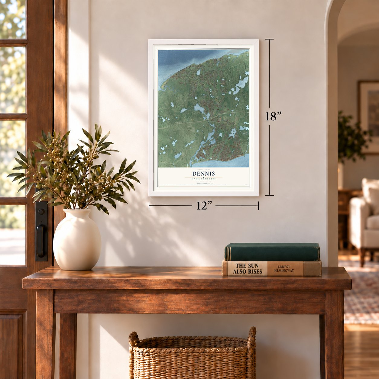
12" x 18" Archival Matte Print
A Map of Home. A Work of Art.
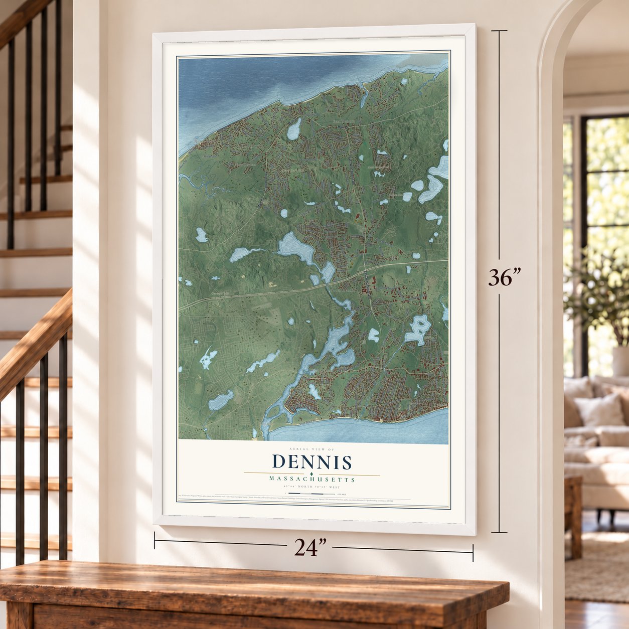
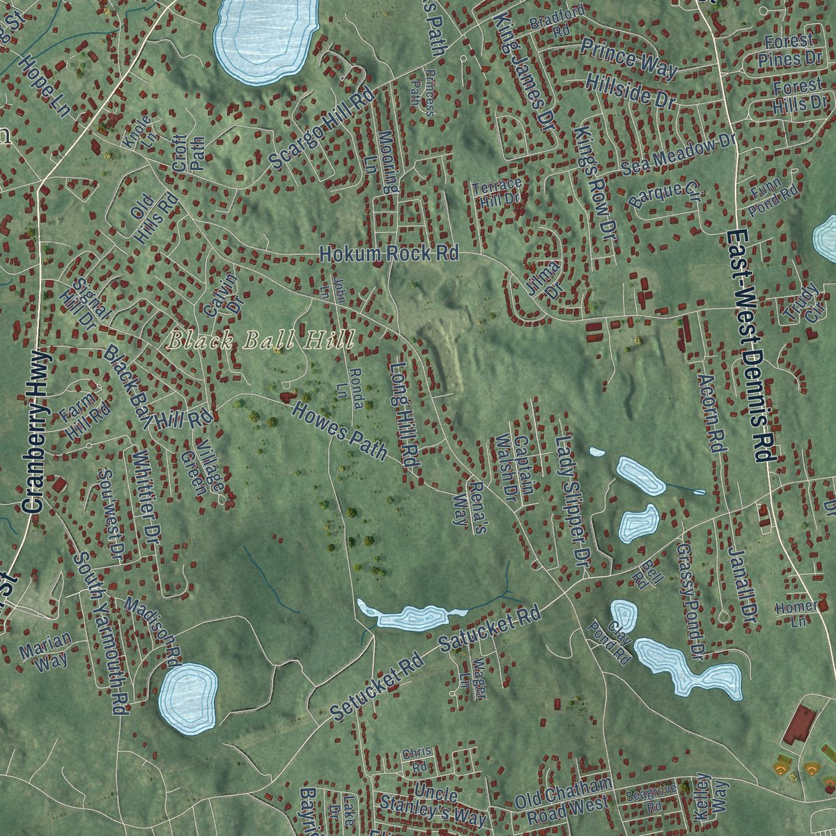
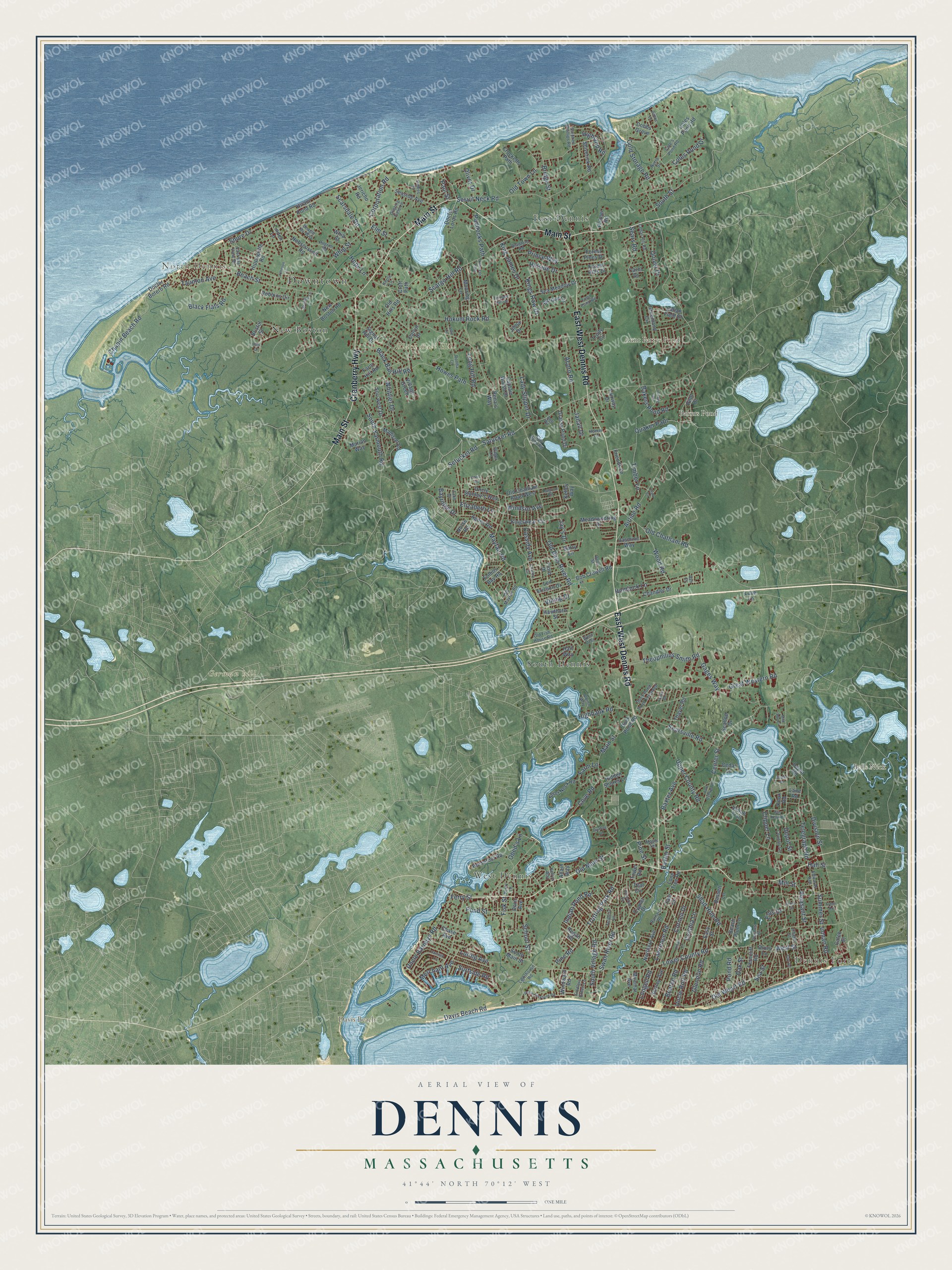
Explore Dennis, Massachusetts from a whole new perspective. Created using aerial imagery and detailed geographic data, this map captures Dennis building by building, with labeled streets, familiar landmarks, and shaded topographical relief that highlights the natural contours of the landscape.
Combining modern data with the timeless character of a vintage atlas, this map is just as interesting up close as it is beautiful on the wall. Whether you grew up in Dennis, spent memorable years there, or call it home today, this unique map is a great way to celebrate a place that means something to you. Zoom in on the preview to look for your street, and then order a print to put your memories on the wall.
Three ways to hang it
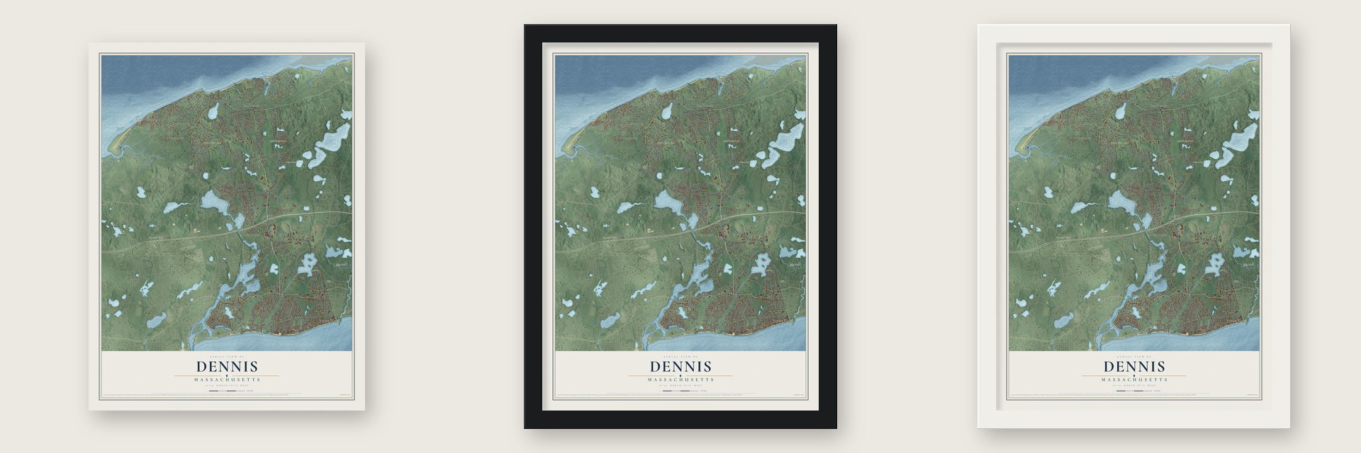
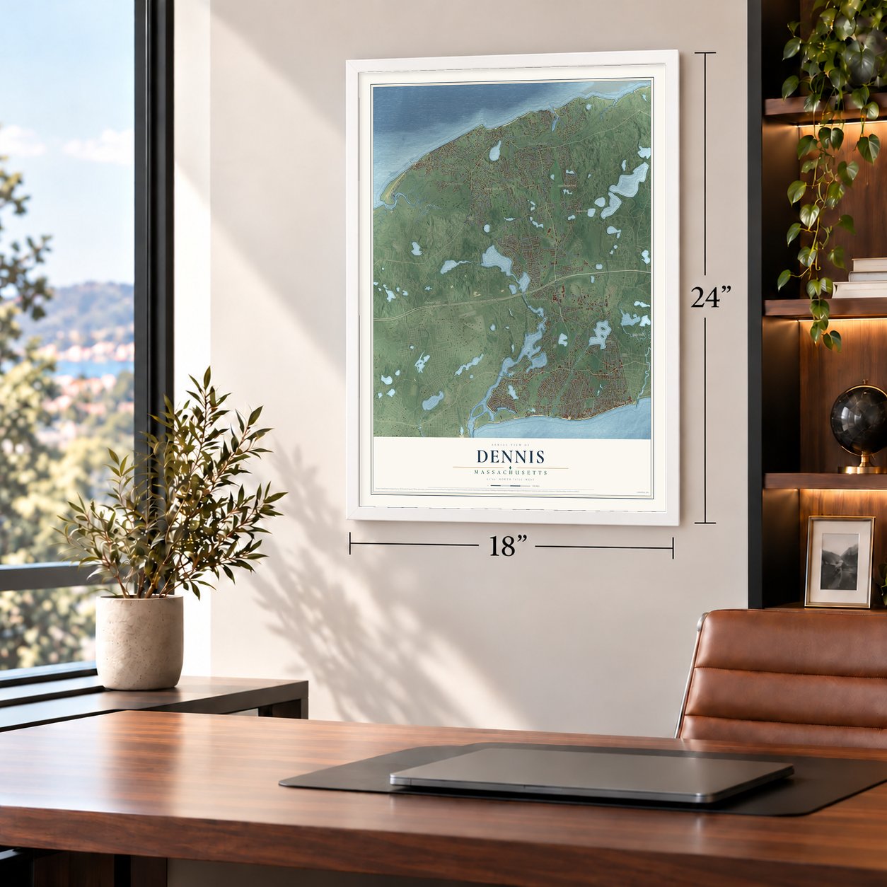
Unframed archival matte, a black wood frame or a white wood frame.
Up close
Geography Worth Displaying
This map was created using accurate cartographic data and authoritative geographic sources, including the U.S. Geological Survey (USGS) and FEMA. The map brings together terrain, waterways, roads, and building detail. The majority of the streets are labeled, houses are accurately depicted, and the topography is derived from government sources. Combining local data with carefully composed color and shading leads to this beautifully detailed Dennis artwork for your wall.
Rather than simply showing street outlines, we’ve included as many of the street names as we could reasonably fit on the map while keeping their names legible. Zoom in on the high resolution preview to see exactly what’s on the map. We truly set out to create a statement piece for anyone who loves Dennis. So whether it’s for you, or a gift for someone you love, we hope this map of Dennis brings back fond memories.
Explore the full map of Dennis, Massachusetts and read about the local places it shows.

Find your street
Names on the Dennis map
Every name below is printed on this map. Look for your street, your school, the park where you played, or the pond down the road.
Places and landmarks13
- Downtown
- North Dennis
- Dennis Port
- Bells Neck
- Black Ball Hill
- Davis Beach
- German hill
- Aunt Pattys Pond
- Bakers Pond
- West Dennis
- South Dennis
- East Dennis
Show all 13 places
- New Boston
Streets and roads259
- Main Street
- East-West Dennis Road
- Cranberry Highway
- Old Main Street
- Trotting Park Road
- Quaker Path
- Davis Beach Road
- Timber Lane
- Pine Road
- Old Bass River Road
- Center Street
- Lower County Road
- Satucket Road
- Airline Road
- Upper County Road
- Depot Street
- Sea Street
- Old Chatham Road
- South Street
- Old Wharf Road
- Hokum Rock Road
- Sesuit Neck Road
- Mayfair Road
- Cove Road
- Scargo Hill Road
- Great Western Road
- Shad Hole Road
- Howes Path
- Loring Avenue
- Division Street
Show all 259 streets
- Setucket Road
- Swan River Road
- Paddocks Path
- Wood Road
- Baxter Avenue
- Baxter Street
- Corporation Road
- School Street
- Beach Street
- Uncle Barneys Road
- Gages Way
- Bridge Street
- Pleasant Street
- Telegraph Road
- Pond Street
- Whig Street
- South Yarmouth Road
- Fisk Street
- King James Drive
- Searsville Road
- Hemlock Lane
- Chapin Beach Road
- Theophilius Smith Road
- Bayridge Drive
- Shore Drive
- Bakers Pond Road
- Black Flats Road
- Sears Road
- South Village Road
- Black Ball Hill Road
- Cornell Drive
- Indian Pond Road
- Quivet Drive
- Taunton Avenue
- Elizabeth Lane
- Cynthia Lane
- Farm Lane
- Cold Storage Road
- Whittier Drive
- Prince Way
- Lawrence Road
- Glendon Road
- Scarsdale Road
- Kings Row Drive
- Acorn Road
- Merchant Avenue
- Hillside Drive
- Cassidy Avenue
- Coles Pond Drive
- Uncle Rolf Road
- Lady Slipper Drive
- Old Town Lane
- Clipper Lane
- Beaten Road
- Pine Street
- Highbank Road
- Highland Road
- Surfside Road
- Hall Street
- Pond Road
- Oak Street
- Hope Lane
- Jay's Drive
- Longell Road
- Long Hill Road
- Windsor Avenue
- Janall Drive
- Inman Road
- Oliver Drive
- Summer Street
- Viking Drive
- Elm Street
- Obed's Lane
- West Street
- Ellis Drive
- Paul Street
- Mill Street
- Ferry Street
- Yale Circle
- Nobscussett Road
- New Boston Road
- Greenland Circle
- Forest Hills Drive
- Indian Trail
- Forest Pines Drive
- Robbins Circle
- Barque Circle
- Chase Avenue
- Doctor Lords Road
- Signal Hill Drive
- Kingswear Circle
- Seaside Avenue
- Old Hills Road
- Calvin Drive
- Hiram Pond Road
- Bob Crowell Road
- Sea Meadow Drive
- Duck Pond Road
- Teal Circle
- Agnes Road
- Chandler Drive
- Fairway Drive
- Crocketts Path
- Coles Pond Road
- Grassy Pond Drive
- Old Chatham Road West
- Northern Avenue
- Madison Road
- Short Neck Road
- Miramar Avenue
- Lone Tree Road
- Jericho Road
- Meadowspring Drive
- Bristol Street
- Uncle Stanley's Way
- Easy Street
- Leif Ericson Drive
- Hippogriffe Road
- Shirley Avenue
- Pilot Drive
- Indian Field Drive
- Jasmine Way
- Croft Path
- Horsefoot Road
- Friends Lane
- Mooring Lane
- Bassett Lane
- Ferncliff Road
- Shiverick Road
- Sou'west Drive
- Doctor Botero Road
- Jilma Drive
- Captain Walsh Drive
- Follins Bay Road
- Barry Lane
- Thayer Road
- Trudy Circle
- Windward Road
- Hawthorn Street
- Beach Plum Lane
- Village Green
- Farm Hill Road
- Allain Way
- Caleb Street
- Hidden Shores Lane
- South Main Street
- Regan Road
- Depot Road
- Marian Way
- Cedar Lane
- Linden Lane
- Fiord Drive
- Palmer Road
- Rena's Way
- Tower Road
- Cygnet Drive
- Cobbs Grove
- Scallop Drive
- Half Way
- Whip Street
- Kelley Way
- Norse Road
- Knox Road
- Doric Avenue
- Carol Drive
- Drury Lane
- Lane Road
- Love Lane
- Old Mayfair Road
- Old Fish House Road
- Trotters Lane
- Cedar Hill Road
- Bradford Road
- Stephen Phillips Road
- North Street
- Pilgrim Road
- Terrace Hill Drive
- Ronda Lane
- East Bay View Road
- Duck Pond Road Extended
- Cole's Pond Road
- Edwards Avenue
- Funn Pond Road
- Fiddlers Green Lane
- Lighthouse Road
- Country Lane
- Grazing Field Lane
- Lake Drive
- Albion Way
- Perry Lane
- Barnard Road
- Wager Lane
- Howes Street
- Chase Street
- Maple Terrace
- Beagle By-Way
- Clay Pond Road
- Dolly Street
- Plashes Drive
- West Over
- Knole Lane
- Kelly's Way
- Homer Lane
- Bell Road
- Ash Court
- Uncle Stephens Road
- Kibby Lane
- Garfield Lane
- Country Circle
- Mild Bay Circle
- Aunt Debbys Road
- Princeton Circle
- Sea Oaks Drive
- Bramble Lane
- Princess Path
- Carr Road
- Seagrove Road
- Johnson Lane
- Cross Street
- Otis Kelly Road
- Quahog Lane
- Arden Road
- Vester Drive
- Trinity Drive
- Dalton Lane
- Clark Circle
- Chris Road
- John Lane
- Patti Drive
Names are listed as they appear on the printed map. Zoom into the product photos to find them.
About Dennis, Massachusetts
Dennis is a town of 14,674 people in Barnstable County, and it stretches across Cape Cod from Cape Cod Bay to Nantucket Sound. In 1639 John Crow, Thomas Howes and William Lumpkin became the first English settlers at Nobscusset, a Native village on land then counted as part of Yarmouth. This eastern end of Yarmouth, called the East Precinct, became its own parish in 1721. Its church was organized in 1727 and ordained Rev. Josiah Dennis on June 22. He preached there for 38 years, and when the precinct broke away as a separate town on June 19, 1793, it took his name.
Because the soil was poor for farming, Dennis made its living at sea. In 1837 the town claimed 150 skippers sailing out of American ports, and eighteen of its vessels, with 247 men aboard, worked the cod and mackerel grounds. The sea took its toll as well, and a gale in 1841 sank four Dennis vessels and drowned twenty-one of the town's men. On land, Henry Hall of North Dennis noticed around 1816 that blowing sand helped his wild cranberries. By 1855 Dennis had 50 of the county's 197 acres of cranberries, more than any other town.
“However, we liked Dennis well, better than any town we had seen on the Cape, it was so novel, and, in that stormy day, so sublimely dreary.”
- Sears's Folly, 1776With the war making salt scarce and costly, Capt. John Sears of Suet built a sun-drying vat in 1776, ten feet by a hundred, with sliding shutters against rain. It leaked, yielding eight bushels the first season, and neighbors called it Sears's Folly. He persisted: thirty bushels the next year, a windmill pump in 1785, a patent in 1799.
- Ships from Sesuit NeckBetween 1850 and 1862 the Shivericks turned out eight ships at East Dennis. Two were the Hippogriffe and the Kit Carson, and the Wild Hunter made it to China. Dennis men captained and manned them.
- Flags for the Boston packetUntil the railroad, sailing packets carried the bay shore's Boston trade. In 1814 Daniel Howes and others won permission for a 600-foot stone and timber pier at Nobscusset Point. A packet entering Nobscusset harbor meant a flag on high ground in northern Dennis. A lookout in a South Dennis windmill by Grand Cove saw it and raised a roadside flag for the rest of town, South Yarmouth and West Harwich.
- The minister's saltboxRev. Josiah Dennis's timber-frame saltbox went up about 1736. It joined the National Register in 1974, and the Dennis Historical Society now runs it as the Josiah Dennis Manse Museum. Beside it stands the West Schoolhouse, a one-room school of about 1770 to 1775 that held classes until 1865. It is the oldest school in Dennis and the last survivor of the town's twelve district schools, and it was moved to the manse grounds in 1973.
- A summer stage since 1927In 1927 Raymond Moore made the Cape Playhouse out of a former Unitarian meeting house, built in 1838, in northern Dennis. Basil Rathbone starred in the first play there. By the town's account, no summer theater in the United States is older.
Keep exploring Massachusetts
Dennis is one of 470 Massachusetts towns we've mapped. Every dot on the map is a print of its own.
The search covers every state, Massachusetts first.
Near Dennis
Order 2 or more town maps and save 10%. Shown in the size and finish you picked above, so they hang as a set.
- South Dennis 12" x 18" / Archival Matte Print $39.99
- East Dennis 12" x 18" / Archival Matte Print $39.99
- West Dennis 12" x 18" / Archival Matte Print $39.99
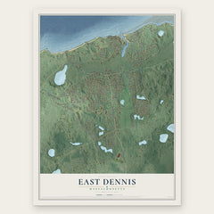

More maps nearby: Yarmouth Port, Dennis Port, South Yarmouth, Yarmouth and Harwich.
The art of mapping a place
How This Map Was Made
Real places. Remarkable detail. Discover the layers that turn geographic data into a map of home.

The view from above
Aerial imagery reveals the character of the land: woodland, open fields, and the patterns of a place.

The shape of the land
Elevation data brings hills, valleys, and subtle changes in the landscape into view.

The details of home
Roads, waterways, and building footprints come together to make the map feel unmistakably local.

Geography becomes art
Considered color, shading, and typography bring the layers together in a map made for your wall.


Process illustrated with Mendon, Massachusetts. Aerial imagery: USDA NAIP. Terrain: USGS 3D Elevation Program. Map details and finished artwork: KNOWOL.
The Details
About This Print
Choose an archival matte print, or a black or white Ayous wood frame. The archival matte print is unframed.
Select your size and finish above to see the matching product image and price.
Materials & Craftsmanship
A contemporary map with the character of a classic atlas, printed on archival matte paper. Optional frames are made from Ayous wood.
Your printed map does not include the watermark shown in the full-map preview.
Shipping & Delivery
Free shipping within the United States. Every print is made to order in the USA.
Buying a gift? Add a note in your cart and we'll include it. We never put prices in the package.
Prints ship within 2 to 3 business days. Allow 7 to 10 days total from ordering for delivery. Timing may vary during holidays or periods of high order volume.
Read our shipping policy.
Returns and damaged prints
Each print is made to order. Change-of-mind refunds are not available after production.
If your print arrives damaged, misprinted or incorrect, contact support@knowol.com within 30 days of receiving it. Include your order number, photos and a description of the issue.
Read our full refund and replacement policy. For questions about your order, email support@knowol.com.