
Search for another town





Free U.S. delivery 7 to 10 days after you order
Dennis Port, Massachusetts Map Art
Building by building, with labeled streets and shaded relief.
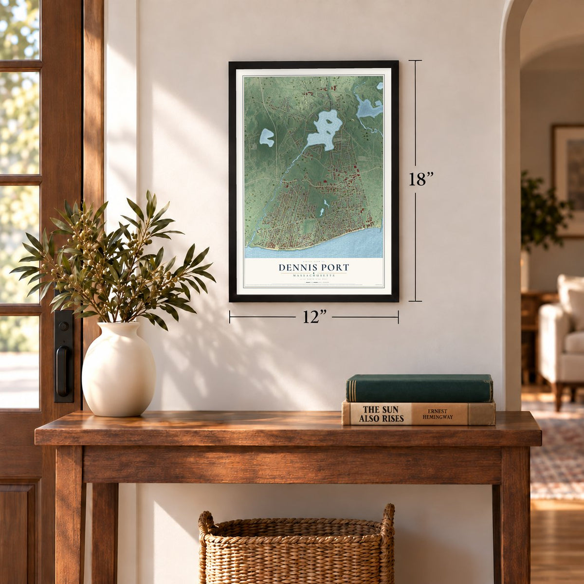
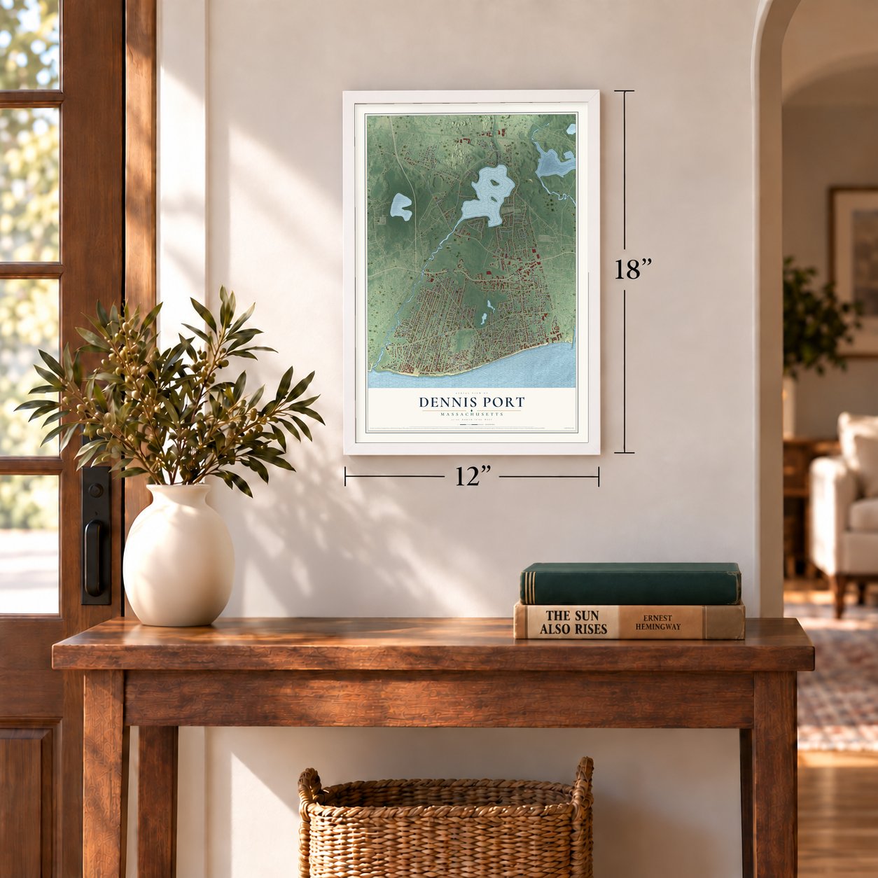
12" x 18" Archival Matte Print
A Map of Home. A Work of Art.
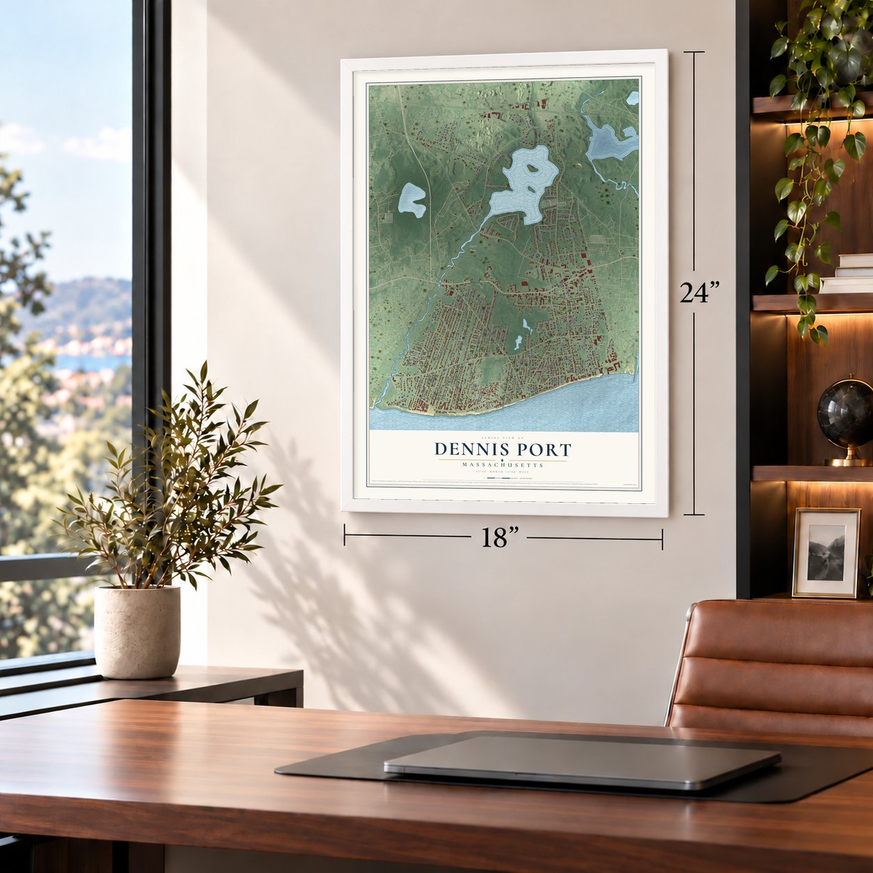
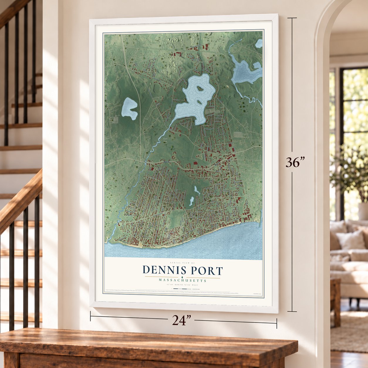
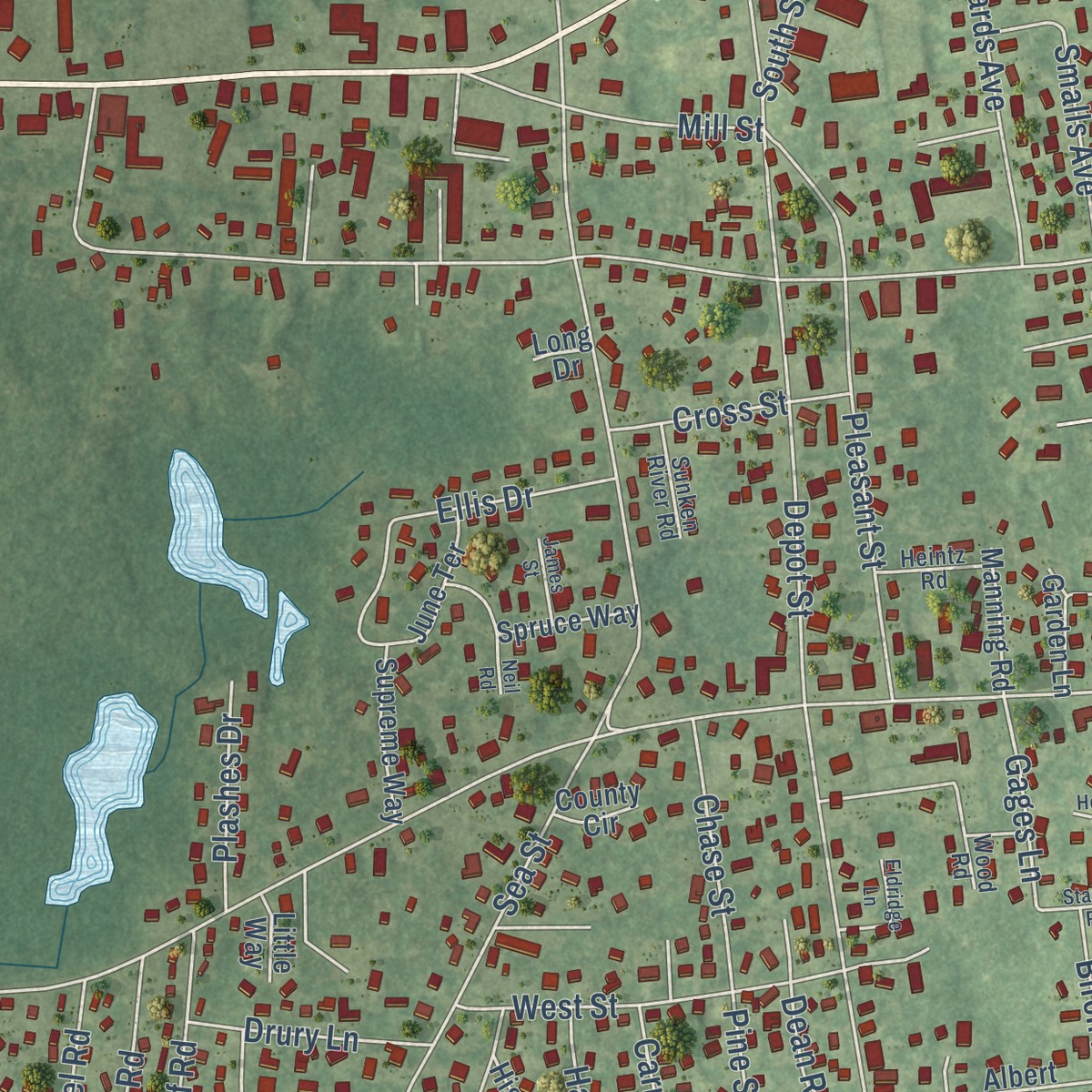
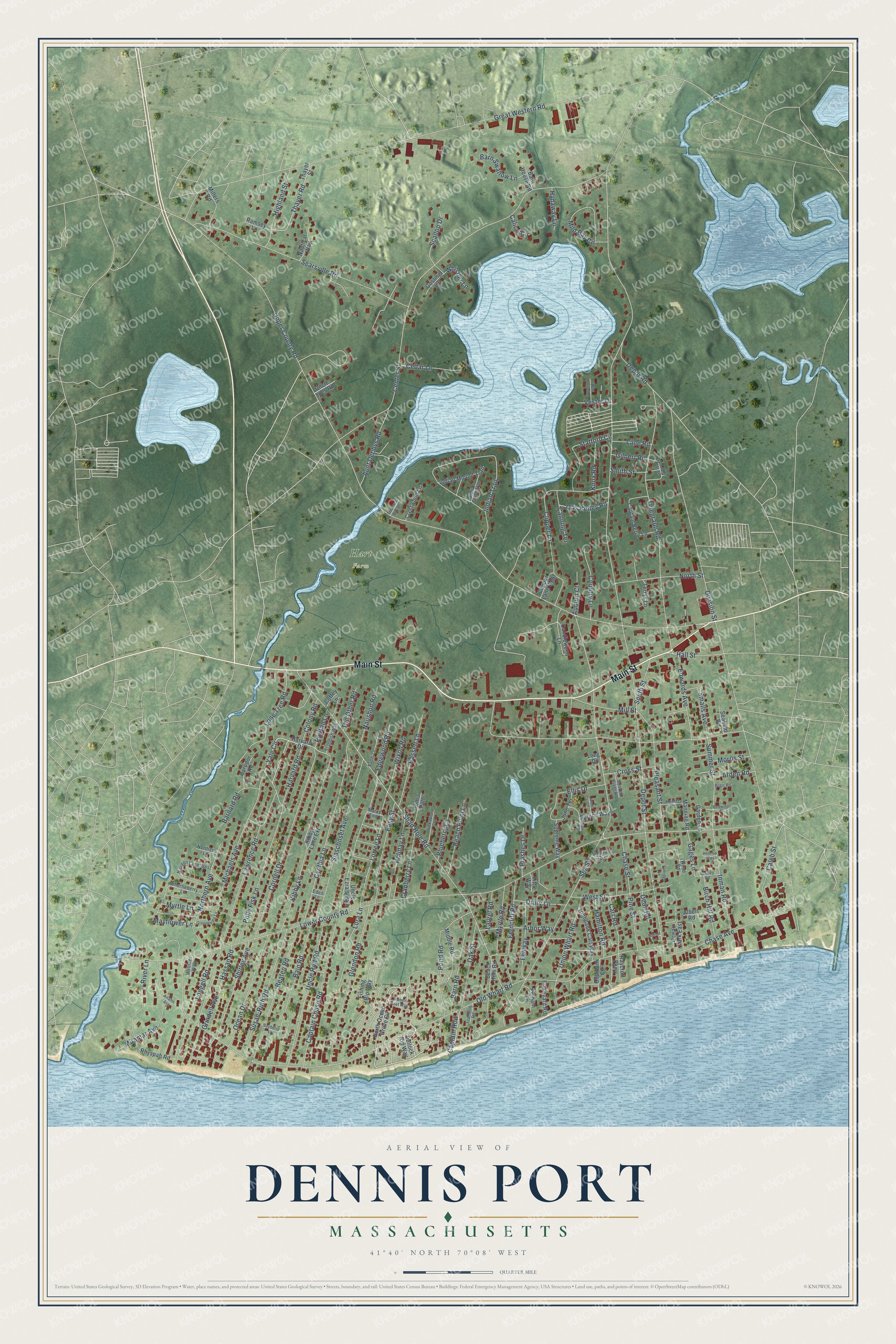
Explore Dennis Port, Massachusetts from a whole new perspective. Created using aerial imagery and detailed geographic data, this map captures Dennis Port building by building, with labeled streets, familiar landmarks, and shaded topographical relief that highlights the natural contours of the landscape.
Combining modern data with the timeless character of a vintage atlas, this map is just as interesting up close as it is beautiful on the wall. Whether you grew up in Dennis Port, spent memorable years there, or call it home today, this unique map is a great way to celebrate a place that means something to you. Zoom in on the preview to look for your street, and then order a print to put your memories on the wall.
Three ways to hang it
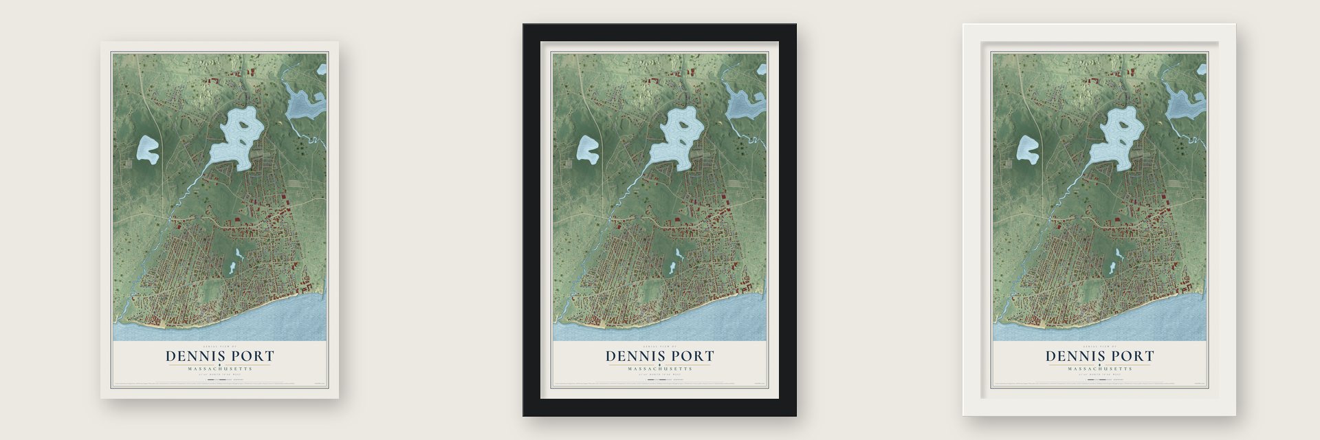
Unframed archival matte, a black wood frame or a white wood frame.
Up close
Geography Worth Displaying
This map was created using accurate cartographic data and authoritative geographic sources, including the U.S. Geological Survey and the Census Bureau. The map brings together terrain, waterways, roads, and building detail. The majority of the streets are labeled, houses are accurately depicted, and the topography is derived from government sources. Combining local data with carefully composed color and shading leads to this beautifully detailed Dennis Port artwork for your wall.
Rather than simply showing street outlines, we’ve included as many of the street names as we could reasonably fit on the map while keeping their names legible. Zoom in on the high resolution preview to see exactly what’s on the map. We truly set out to create a statement piece for anyone who loves Dennis Port. So whether it’s for you, or a gift for someone you love, we hope this map of Dennis Port brings back fond memories.
Read the story behind this map of Dennis Port, Massachusetts from 2026.
Find your street
Names on the Dennis Port map
Every name below is printed on this map. Look for your street, your school, the park where you played, or the pond down the road.
Places and landmarks2
- Hart Farm
- Sea View Park
Streets and roads181
- Main Street
- Yale Circle
- Lorree Lane
- Harvard Road
- Hall Street
- Gages Lane
- Depot Street
- Upper County Road
- Center Street
- Lower County Road
- Old Wharf Road
- Sea Street
- Great Western Road
- Shad Hole Road
- Division Street
- Captain Chase Road
- Telegraph Road
- Searsville Road
- Indian Trail
- Cornell Drive
- Cynthia Lane
- Kibby Lane
- Siasconset Avenue
- Lawrence Road
- Glendon Road
- Michaels Avenue
- Uncle Rolf Road
- Clipper Lane
- Polly Fisk Lane
- Beaten Road
Show all 181 streets
- Susan-Ruth Road
- Chase Avenue
- Pond Road
- Pleasant Street
- Oak Street
- Stafford Circle
- Ocean Drive
- Northern Avenue
- Union Wharf Road
- Miramar Avenue
- Longell Road
- Lone Tree Road
- Mild Bay Circle
- Bain Road
- Inman Road
- Easy Street
- Shirley Avenue
- Barn Road
- Bassett Lane
- Ferncliff Road
- Summer Street
- Colony Road
- Fenway
- North Street
- Edwards Avenue
- Holiday Lane
- Thayer Road
- Lora Lane
- West Street
- Aunt Debbys Road
- Ellis Drive
- Beach Plum Lane
- Highland Street
- Arbor Way
- Country Lane
- Caleb Street
- Cranberry Lane
- Myrtle Road
- Depot Road
- Mill Street
- Smalls Avenue
- Birch Hill Road
- Cedar Lane
- Barnard Road
- Hamilton Road
- Wixon Road
- Barn Swallow Lane
- Chase Street
- Naushon Road
- Carr Road
- Pine Street
- Scallop Drive
- Blueberry Lane
- Edgewood Road
- Canning Terrace
- Cross Street
- Otis Kelley Road
- Knox Road
- Whistler Lane
- Plashes Drive
- South Street
- Hassan Road
- The Other Road
- Captain Row
- Auburn Court
- Hydaway Lane
- Arden Road
- Drury Lane
- Puritan Lane
- Lane Road
- Mayflower Lane
- Morris Street
- Grindell Avenue
- Myrtle Lane
- Laurel Road
- Gilbert Road
- Vester Drive
- Smith Street
- River Lane
- Calico Circle
- Dean Road
- North Ocean Grove Circle
- Harvard Drive
- Uncle Ezra's Path
- Beach Hills Road
- Thayer Street
- Rhyspah Road
- Candlewood Lane
- Captain Berry Lane
- Highbank Circle
- Fishing Rip Way
- Highbank Cart Way
- Middle Road
- Indian Mound Trail
- Spruce Way
- Millers Road
- Crestwood Lane
- Supreme Way
- June Terrace
- Ocean Park East
- Nautical Way
- Tom's Path
- Flakeyard Road
- Carodor Road
- Manning Road
- Clipper Lane West
- Seafield Road
- Terrys Lane
- Garden Lane
- Gosling Lane
- Ramsey Lane
- Barn House Road
- Albert Road
- Pelham Lane
- Raycroft Parkway
- Pollock Rip Way
- Uncle Joes Road
- Kibby Lane Extension
- Coffey Lane
- Little Way
- County Circle
- Long Drive
- Whortleberry Lane
- Nipigon Lane West
- Standish Way
- Indian Chief Trail
- Old Pine Trail
- Wood Road
- Heintz Road
- Sunken River Road
- Webster Way
- Northern Lane
- Franklin Road
- Marks End
- Eden Lane
- Bayberry Lane
- Greeneedle Lane
- Huckleberry Lane
- Bambi Lane
- Stanley Road
- Eldridge Lane
- Aunt Lauras Lane
- Ribbon Reef Way
- James Street
- Regis Road
- Treasure Bay Drive
- Redwing Place
- Helen's Way
- Adams Avenue
- Sunset Lane
- Neil Road
Names are listed as they appear on the printed map. Zoom into the product photos to find them.
About Dennis Port, Massachusetts
Dennis Port is a village of 3,487 people in the town of Dennis, in Barnstable County on Cape Cod, facing Nantucket Sound. The first English colonists here found the land owned by Jacob Crook, so they called this southeast corner Crook's Neck, a name that later shifted to Crocker's Neck. For years its people had to collect their letters at the West Harwich post office.
That changed when Thomas Howes, a retired sea captain, began carrying his neighbors' mail from West Harwich to the general store attached to his Main Street home, a move meant to bring in more customers. He was later made postmaster, and he gave the village its new name, Dennis Port. By the mid-1800s, three wharves, each 600 feet long, ran out into the sound from Depot, Union Wharf and Sea streets, and many vessels counted the village as their home port.
“In the summer of 1888 the shad returned to this shore in great numbers for the first time in many years, and it is thought that one thousand barrels were taken.”
- The Baker wharf of 1849The oldest of the village wharves, the westerly one, went up in 1849. Samuel S. Baker's grandfather and father built it, and by 1890 Baker himself owned it.
- Schooners from EssexThe Dennis Port Fishing Company got its start in 1886, when four schooners were newly built for it at Essex. Two years later, in 1888, it put up a wharf of its own, run by J. P. Edwards, who also kept a fitting store there. From that wharf three of the schooners sailed for mackerel and out to the Banks for cod.
- Warm water on the soundLike the other villages along Nantucket Sound, Dennis Port has warm-water beaches. Many people rank the beaches at Haigis, Sea Street and Glendon Road among the best on Cape Cod for swimming and windsurfing. Most of the houses behind them are beach cottages from the World War II era, built in the Cape Cod style.
Keep exploring Massachusetts
Dennis Port is one of 468 Massachusetts towns we've mapped. Every dot on the map is a print of its own.
The search covers every state, Massachusetts first.
Near Dennis Port
Order 2 or more town maps and save 10%. Shown in the size and finish you picked above, so they hang as a set.
- West Dennis 12" x 18" / Archival Matte Print $39.99
- South Dennis 12" x 18" / Archival Matte Print $39.99
- Dennis 12" x 18" / Archival Matte Print $39.99

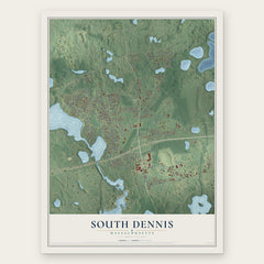
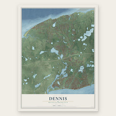
More maps nearby: South Yarmouth, Harwich Port, Harwich, Yarmouth and East Dennis.
The art of mapping a place
How This Map Was Made
Real places. Remarkable detail. Discover the layers that turn geographic data into a map of home.

The view from above
Aerial imagery reveals the character of the land: woodland, open fields, and the patterns of a place.

The shape of the land
Elevation data brings hills, valleys, and subtle changes in the landscape into view.

The details of home
Roads, waterways, and building footprints come together to make the map feel unmistakably local.

Geography becomes art
Considered color, shading, and typography bring the layers together in a map made for your wall.


Process illustrated with Mendon, Massachusetts. Aerial imagery: USDA NAIP. Terrain: USGS 3D Elevation Program. Map details and finished artwork: KNOWOL.
The Details
About This Print
Choose an archival matte print, or a black or white Ayous wood frame. The archival matte print is unframed.
Select your size and finish above to see the matching product image and price.
Materials & Craftsmanship
A contemporary map with the character of a classic atlas, printed on archival matte paper. Optional frames are made from Ayous wood.
Your printed map does not include the watermark shown in the full-map preview.
Shipping & Delivery
Free shipping within the United States. Every print is made to order in the USA.
Buying a gift? Add a note in your cart and we'll include it. We never put prices in the package.
Prints ship within 2 to 3 business days. Allow 7 to 10 days total from ordering for delivery. Timing may vary during holidays or periods of high order volume.
Read our shipping policy.
Returns and damaged prints
Each print is made to order. Change-of-mind refunds are not available after production.
If your print arrives damaged, misprinted or incorrect, contact support@knowol.com within 30 days of receiving it. Include your order number, photos and a description of the issue.
Read our full refund and replacement policy. For questions about your order, email support@knowol.com.