
Search for another town

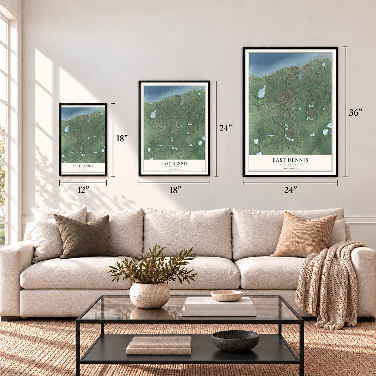
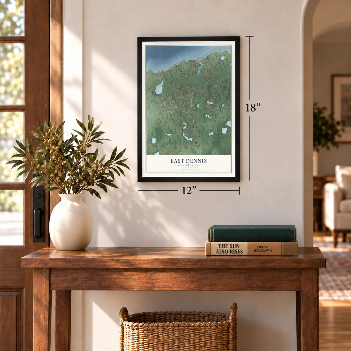
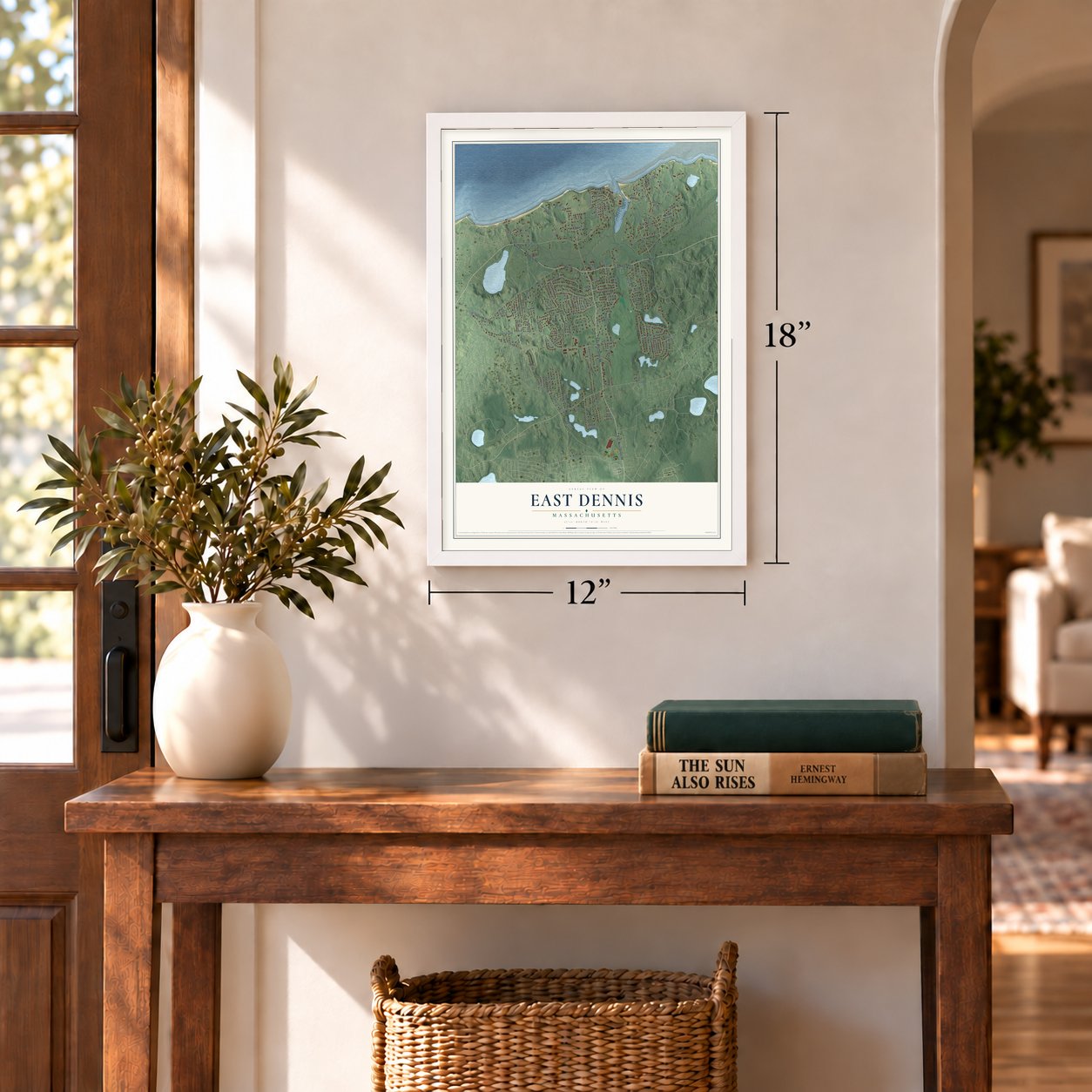

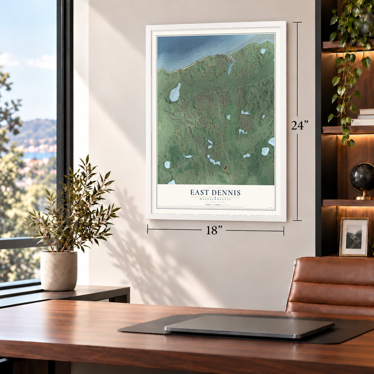

Free U.S. delivery 7 to 10 days after you order
East Dennis, Massachusetts Map Art
Building by building, with labeled streets and shaded relief.
12" x 18" Archival Matte Print
A Map of Home. A Work of Art.
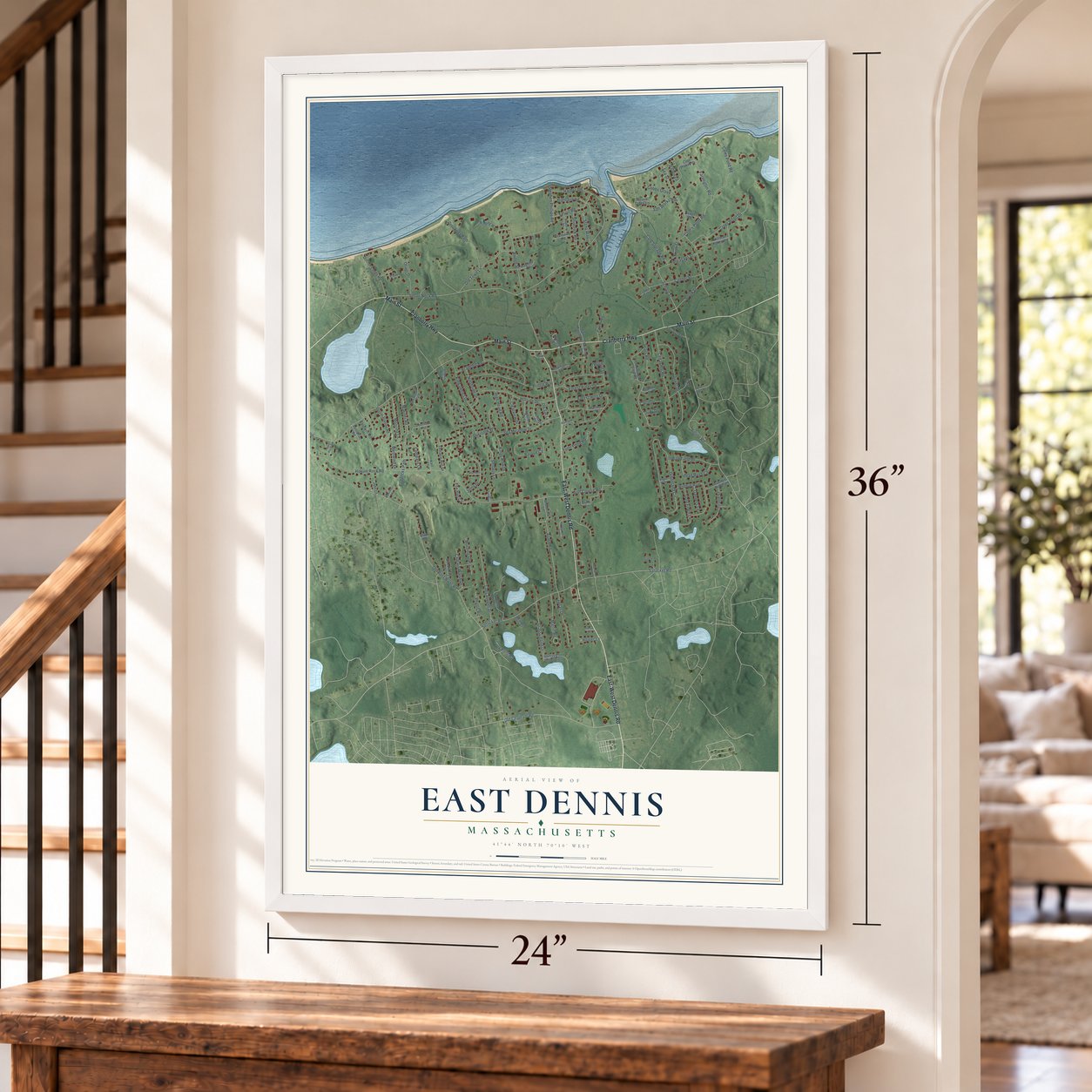
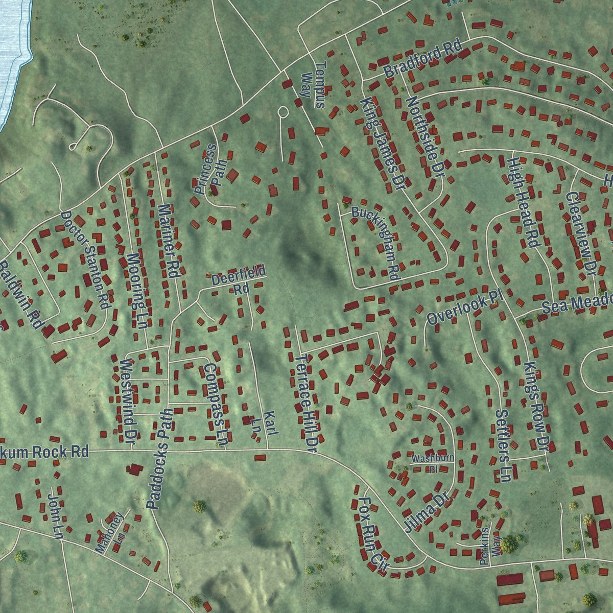
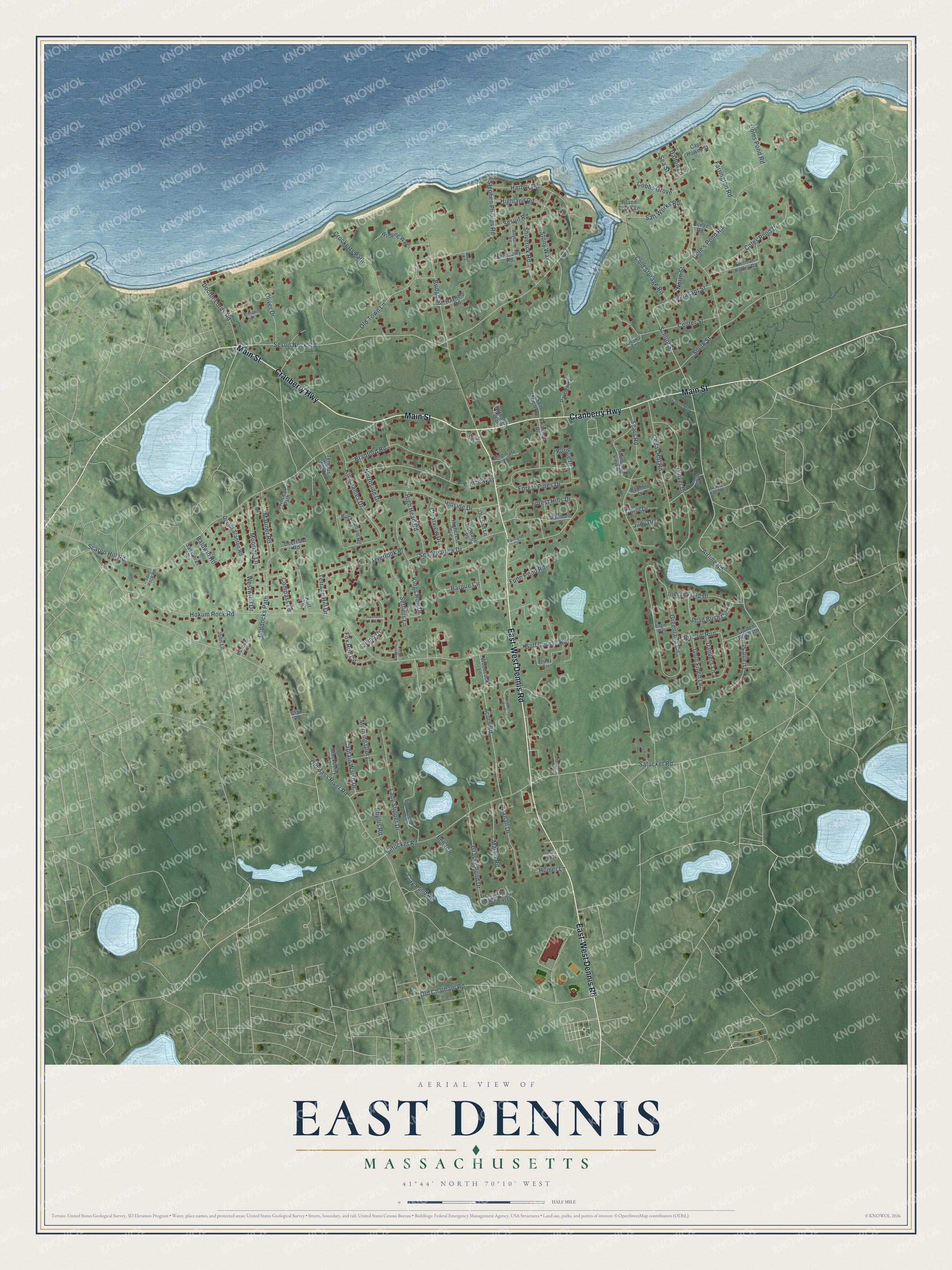
Explore East Dennis, Massachusetts from a whole new perspective. Created using aerial imagery and detailed geographic data, this map captures East Dennis building by building, with labeled streets, familiar landmarks, and shaded topographical relief that highlights the natural contours of the landscape.
Combining modern data with the timeless character of a vintage atlas, this map is just as interesting up close as it is beautiful on the wall. Whether you grew up in East Dennis, spent memorable years there, or call it home today, this unique map is a great way to celebrate a place that means something to you. Zoom in on the preview to look for your street, and then order a print to put your memories on the wall.
Three ways to hang it
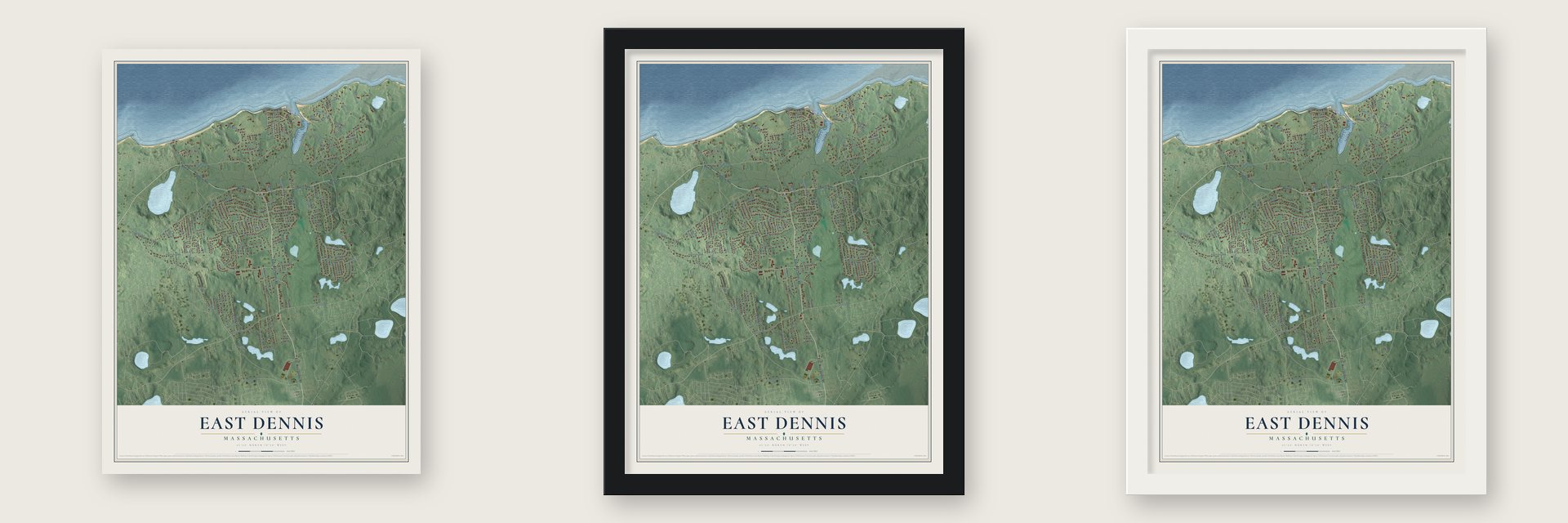
Unframed archival matte, a black wood frame or a white wood frame.
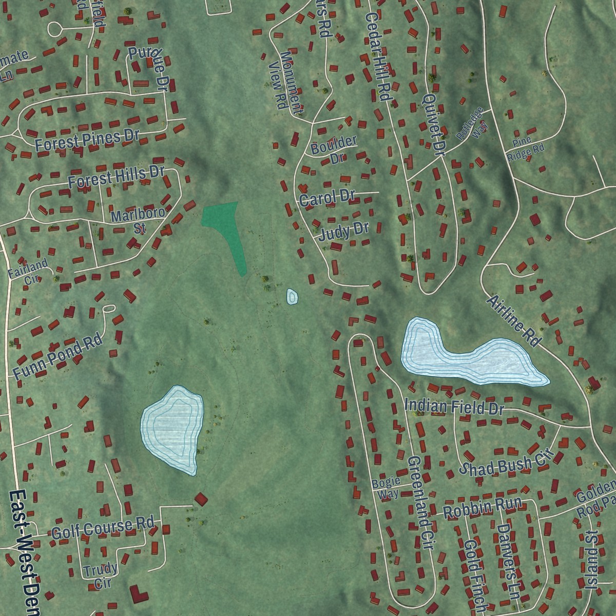
Up close
Geography Worth Displaying
This map was created using accurate cartographic data and authoritative geographic sources, including the U.S. Geological Survey and the Census Bureau. The map brings together terrain, waterways, roads, and building detail. The majority of the streets are labeled, houses are accurately depicted, and the topography is derived from government sources. Combining local data with carefully composed color and shading leads to this beautifully detailed East Dennis artwork for your wall.
Rather than simply showing street outlines, we’ve included as many of the street names as we could reasonably fit on the map while keeping their names legible. Zoom in on the high resolution preview to see exactly what’s on the map. We truly set out to create a statement piece for anyone who loves East Dennis. So whether it’s for you, or a gift for someone you love, we hope this map of East Dennis brings back fond memories.
Read the story behind this map of East Dennis, Massachusetts from 2026.

Find your street
Names on the East Dennis map
Every name below is printed on this map. Look for your street, your school, the park where you played, or the pond down the road.
Streets and roads136
- East-West Dennis Road
- Cranberry Highway
- Main Street
- Airline Road
- School Street
- Sesuit Neck Road
- Coles Pond Road
- Cole's Pond Road
- Old Bass River Road
- Satucket Road
- Hokum Rock Road
- South Street
- Scargo Hill Road
- Greenland Circle
- Bridge Street
- Sea Street
- Forest Hills Drive
- King James Drive
- Old Chatham Road
- Paddocks Path
- Forest Pines Drive
- Sears Road
- Barque Circle
- Quivet Drive
- Cedar Hill Road
- Cold Storage Road
- Prince Way
- Bradford Road
- Stephen Phillips Road
- Kings Row Drive
Show all 136 streets
- Acorn Road
- Hillside Drive
- Coles Pond Drive
- Lady Slipper Drive
- Old Town Lane
- Robbin Run
- Terrace Hill Drive
- Sea Meadow Drive
- Highland Road
- Crocketts Path
- Harbor Road
- Grassy Pond Drive
- Janall Drive
- Indian Field Drive
- Doctor Lords Road
- Settlers Lane
- Baldwin Road
- Shad Bush Circle
- Mooring Lane
- Oliver Drive
- Farrington Road
- Sesuit Road
- Shiverick Road
- Gold Finch Lane
- Jilma Drive
- Captain Walsh Drive
- Northside Drive
- High Head Road
- Mariner Road
- Martin Road
- Funn Pond Road
- Pleasant Street
- Salt Works Road
- Island Street
- Center Street
- Westwind Drive
- Morning Glory
- Golf Course Road
- Clearview Drive
- Fox Run Circle
- Stony Way
- Compass Lane
- North Street
- Phyllis Road
- Purdue Drive
- Danvers Lane
- Cobbs Grove
- Overlook Place
- Clay Pond Road
- Setucket Road
- Carol Drive
- Homer Lane
- Dalton Lane
- Judy Drive
- Bell Road
- Stillman Kelley Road
- Doctor Stanton Road
- Monument View Road
- Trudy Circle
- Capt Howes Street
- Winding Way
- Grassy Pond Drive East
- Briarfield Road
- Palmer Road
- Highcrest Avenue
- Princess Path
- Salt Marsh Road
- Marlboro Street
- Buckingham Road
- Heritage Place
- Golden Rod Path
- Cranberry Road
- Woodcock Lane
- Blackberry Lane
- Hayfield Road
- Nuthatch Way
- Shipmate Lane
- Old Salt Lane
- Deerfield Road
- Hedge Road
- Sassafras Road
- Island Creek Lane
- Tempus Way
- Boulder Drive
- John Lane
- Clair Road
- Karl Lane
- Strawberry Lane
- Bayberry Road
- Split Rock Road
- Mahoney Lane
- Creek's End
- Fairland Circle
- Bogie Way
- Perkins Way
- Music Lane
- Simmons Pond Road West
- Rutledge Way
- Old County Way
- Greenview Drive
- Prospect Street
- Greenwood Road
- Washburn Place
- Pine Ridge Road
- Brassie Road
- Joyce Circle
Names are listed as they appear on the printed map. Zoom into the product photos to find them.
About East Dennis, Massachusetts
East Dennis is a village of 2,585 people in the town of Dennis, in Barnstable County, with Cape Cod Bay along its northern shore. It was settled in the 1630s, and its homes grew up in a chain of settlements on two necks of land, Sesuet and Quivet. By 1776 its people were making salt from seawater, and in 1820 Asa Shiverick started the shipyard that would send Dennis crews to sea.
- The Shiverick shipyardAsa Shiverick built his first house on Sesuet neck in 1820 and began building ships on his own land nearby. Between 1850 and 1862 the yard, on the meadow beside the family home, launched eight ships: the Revenue, the Hippogriffe, the Belle of the West, the Kit Carson, the Wild Hunter, the Webfoot, the Christopher Hall and the Ellen Sears. The first one sailed to Boston to be rigged, and steamers towed the rest there.
- Salt from the sun, 1776Salt making began here as early as 1776, with seawater left in vats to evaporate in the sun. John Sears kept improving his works and received a patent in 1799, and he helped others who made salt the same way. In time, vats covered all of Quivet neck along the bay and most of Sesuet neck.
- We Chose Cape Cod, 1953Scott Corbett, who wrote 69 children's books and six novels, lived in East Dennis. His 1953 book We Chose Cape Cod describes the village in close detail.
Keep exploring Massachusetts
East Dennis is one of 461 Massachusetts towns we've mapped. Every dot on the map is a print of its own.
The search covers every state, Massachusetts first.
Near East Dennis
Order 2 or more town maps and save 10%. Shown in the size and finish you picked above, so they hang as a set.
- Dennis 12" x 18" / Archival Matte Print $39.99
- South Dennis 12" x 18" / Archival Matte Print $39.99
- Yarmouth Port 12" x 18" / Archival Matte Print $39.99

More maps nearby: West Dennis, Dennis Port, Brewster, Harwich and South Yarmouth.
The art of mapping a place
How This Map Was Made
Real places. Remarkable detail. Discover the layers that turn geographic data into a map of home.

The view from above
Aerial imagery reveals the character of the land: woodland, open fields, and the patterns of a place.

The shape of the land
Elevation data brings hills, valleys, and subtle changes in the landscape into view.

The details of home
Roads, waterways, and building footprints come together to make the map feel unmistakably local.

Geography becomes art
Considered color, shading, and typography bring the layers together in a map made for your wall.


Process illustrated with Mendon, Massachusetts. Aerial imagery: USDA NAIP. Terrain: USGS 3D Elevation Program. Map details and finished artwork: KNOWOL.
The Details
About This Print
Choose an archival matte print, or a black or white Ayous wood frame. The archival matte print is unframed.
Select your size and finish above to see the matching product image and price.
Materials & Craftsmanship
A contemporary map with the character of a classic atlas, printed on archival matte paper. Optional frames are made from Ayous wood.
Your printed map does not include the watermark shown in the full-map preview.
Shipping & Delivery
Free shipping within the United States. Every print is made to order in the USA.
Buying a gift? Add a note in your cart and we'll include it. We never put prices in the package.
Prints ship within 2 to 3 business days. Allow 7 to 10 days total from ordering for delivery. Timing may vary during holidays or periods of high order volume.
Read our shipping policy.
Returns and damaged prints
Each print is made to order. Change-of-mind refunds are not available after production.
If your print arrives damaged, misprinted or incorrect, contact support@knowol.com within 30 days of receiving it. Include your order number, photos and a description of the issue.
Read our full refund and replacement policy. For questions about your order, email support@knowol.com.