
Search for another town





Free U.S. delivery 7 to 10 days after you order
Denton, Texas Map Art
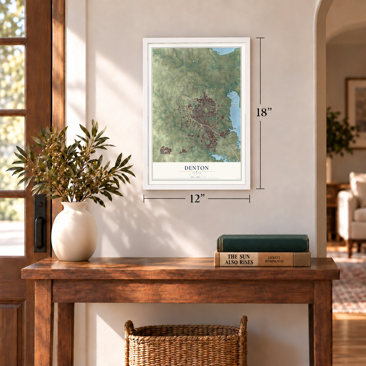
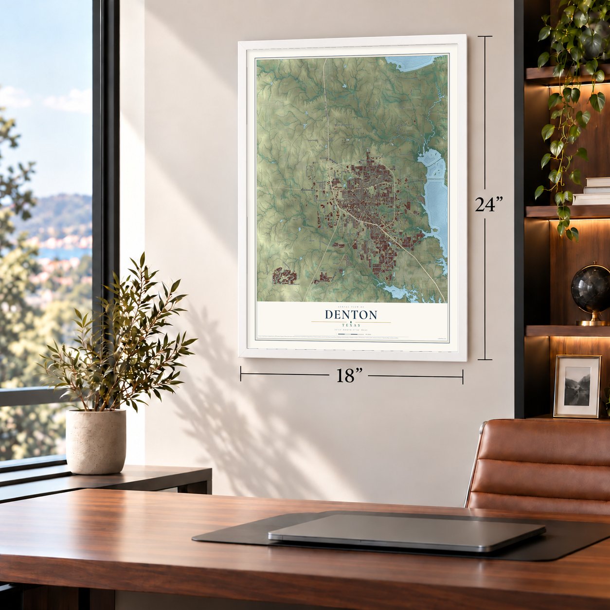
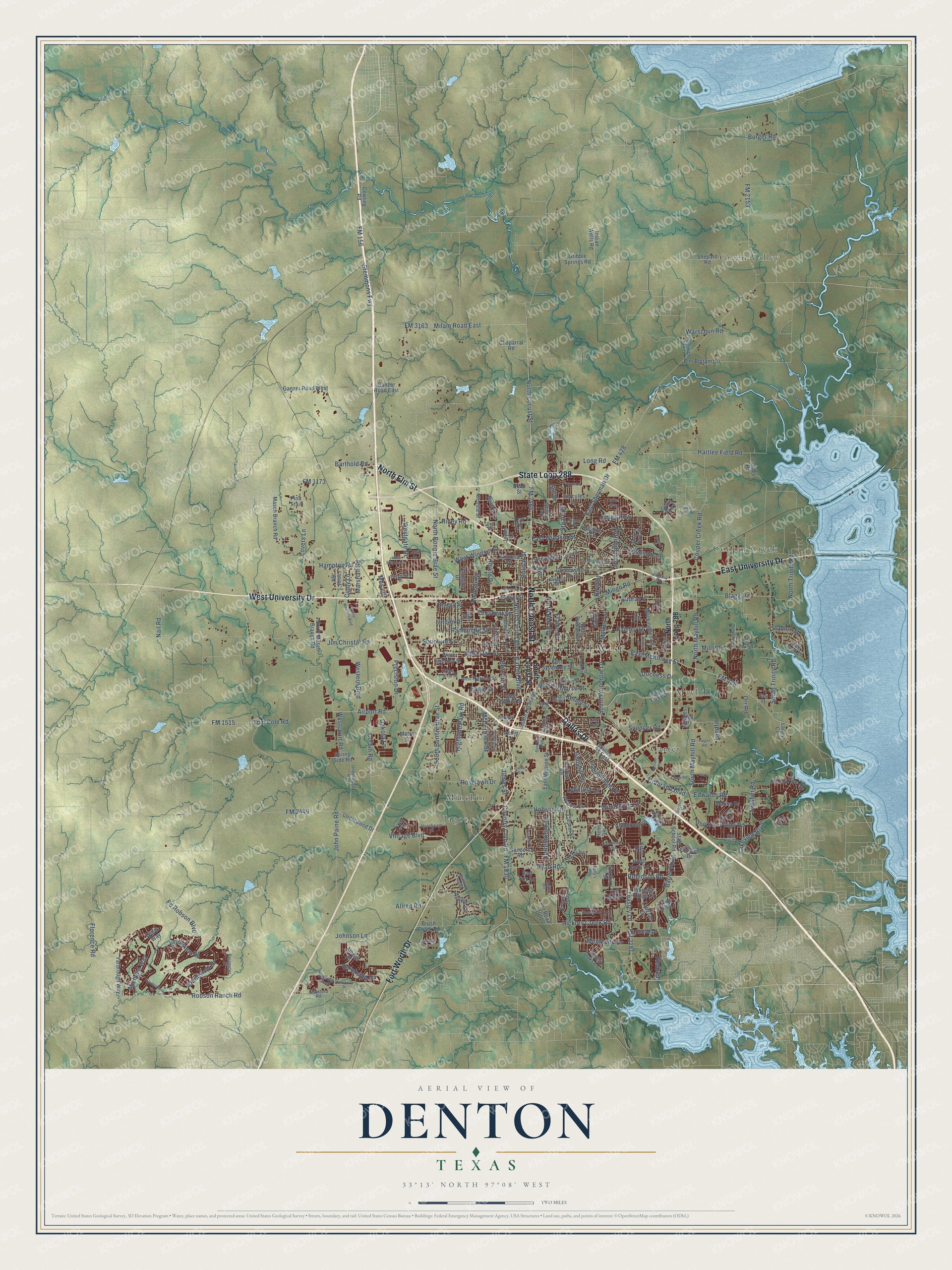
A new map of Denton, Texas, made in 2026 and printed to order on thick archival matte paper.
12" x 18" Archival Matte Print
A Map of Home. A Work of Art.
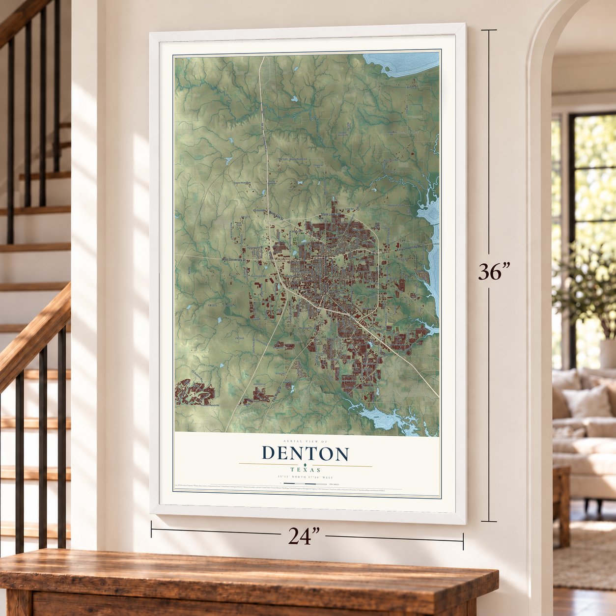
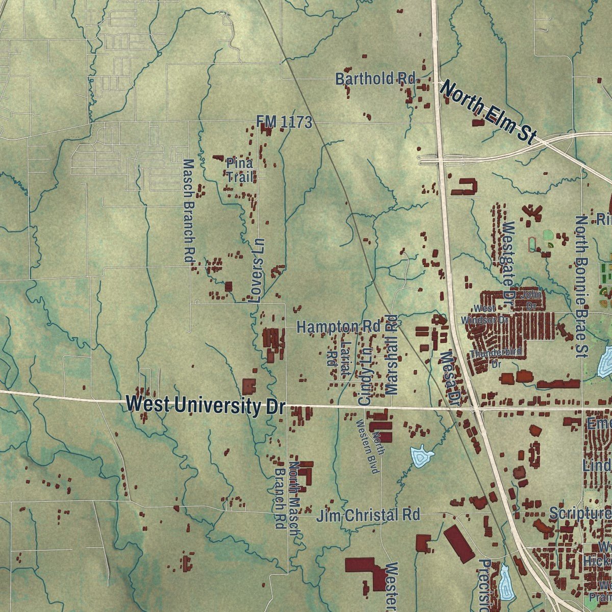
Explore Denton, Texas from a whole new perspective. Created using aerial imagery and detailed geographic data, this map captures Denton building by building, with labeled streets, familiar landmarks, and shaded topographical relief that highlights the natural contours of the landscape.
Combining modern data with the timeless character of a vintage atlas, this map is just as interesting up close as it is beautiful on the wall. Whether you grew up in Denton, spent memorable years there, or call it home today, this unique map is a great way to celebrate a place that means something to you. Zoom in on the preview to look for your street, and then order a print to put your memories on the wall.
Three ways to hang it
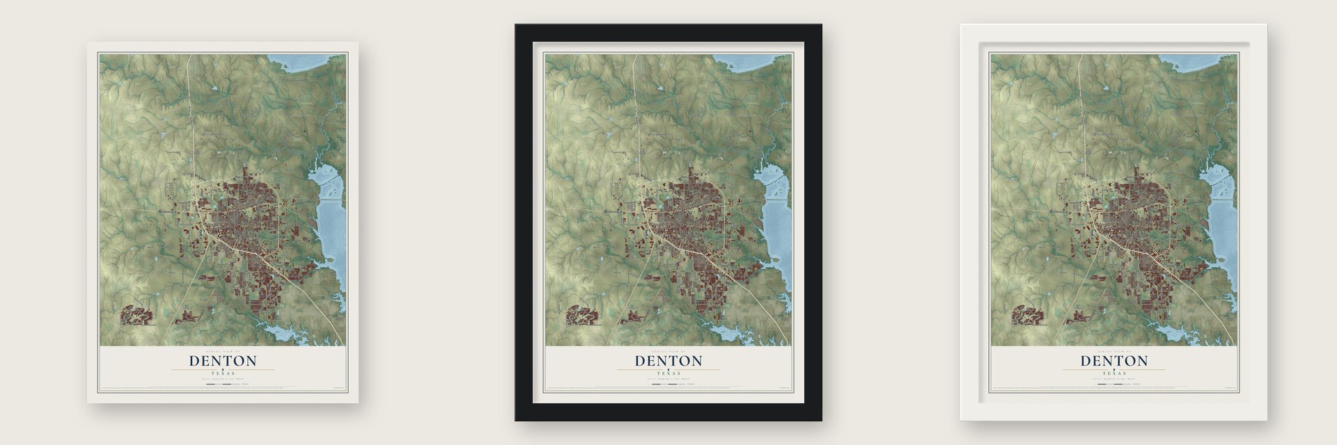
Unframed archival matte, a black wood frame or a white wood frame.
Up close
Geography Worth Displaying
This map was created using accurate cartographic data and authoritative geographic sources, including the U.S. Geological Survey and the Census Bureau. The map brings together terrain, waterways, roads, and building detail. The majority of the streets are labeled, houses are accurately depicted, and the topography is derived from government sources. Combining local data with carefully composed color and shading leads to this beautifully detailed Denton artwork for your wall.
Rather than simply showing street outlines, we’ve included as many of the street names as we could reasonably fit on the map while keeping their names legible. Zoom in on the high resolution preview to see exactly what’s on the map. We truly set out to create a statement piece for anyone who loves Denton. So whether it’s for you, or a gift for someone you love, we hope this map of Denton brings back fond memories.
About Denton, Texas
Denton is the county seat of Denton County, positioned near the county's center and part of the Dallas-Fort Worth metropolitan area. Founded in 1857 for its civic role, the city incorporated in 1866. The Census Bureau recorded 139,869 residents in 2020.
- County Seat OriginsResidents selected a centrally located townsite in 1857, and Hiram Cisco, William Woodruff, and William Loving contributed 100 acres for the new community.
- Railroads Spur GrowthTwo railways reached Denton in 1881, helping its population rise from 1,194 in 1880 to 2,558 in 1890.
- Two UniversitiesNorth Texas Normal College opened in 1890, followed in 1903 by the Girls' Industrial College, now the University of North Texas and Texas Woman's University.
- Municipal UtilitiesSince 1905, Denton has owned its water and electric utilities.
- Civil Defense CenterIn 1954, a federal civil defense regional office relocated from Dallas to Denton; a substantial underground shelter was finished several years afterward.
Find your street
Names on the Denton map
Every name below is printed on this map. Look for your street, your school, the park where you played, or the pond down the road.
Places and landmarks7
- City Hall West
- Carter
- Cooper Creek
- Green Valley
- Jagoe
- Mayhill
- Minchin
Streets and roads262
- State Loop 288
- Fort Worth Drive
- Dallas Drive
- North Locust Street
- North Elm Street
- West University Drive
- East University Drive
- Teasley Lane
- FM 2181
- Colorado Boulevard
- West Oak Street
- Carroll Boulevard
- South Woodrow Lane
- Audra Lane
- North Bonnie Brae Street
- North Carroll Boulevard
- Paisley Street
- Mulkey Lane
- Milam Road East
- FM 428
- FM 2164
- FM 426
- East McKinney Street
- FM 1515
- South Bonnie Brae Street
- Jim Christal Road
- East Sherman Drive
- Lakeview Boulevard
- John Paine Road
- FM 2449
Show all 262 streets
- FM 2153
- Mingo Road
- Ed Robson Boulevard
- Montecito Drive
- Robson Ranch Road
- Hartlee Field Road
- North Bell Avenue
- Vintage Boulevard
- South Mayhill Road
- Tom Cole Road
- FM 3163
- East Windsor Street
- West Windsor Street
- Hickory Creek Road
- Ryan Road
- FM 1830
- Country Club Road
- Kings Row
- Stuart Road
- Airport Road
- Corbin Road
- Michelle Way
- Roselawn Drive
- Bernard Street
- Swisher Road
- Bolivar Street
- Spencer Road
- Edwards Road
- Blagg Road
- North Mayhill Road
- Emerson Lane
- Barrel Strap
- Hollyhill Lane
- Panhandle Street
- Nottingham Drive
- Crescent Street
- North Trinity Road
- FM 1173
- Scripture Street
- Barthold Road
- Stemmons Fwy
- Mills Road
- Crestview Drive
- Allred Road
- Highland Park Road
- Grandview Drive
- Lovers Lane
- Marshall Road
- Malone Street
- Western Boulevard
- Morse Street
- Cooper Creek Road
- Hobson Lane
- Eagle Drive
- Wind River Lane
- South Trinity Road
- Southridge Drive
- Riney Road
- Linden Drive
- McCormick Street
- Emery Street
- Pockrus Paige Road
- Westgate Drive
- Forrestridge Drive
- Fulton Street
- Long Road
- Robinson Road
- Brookside Drive
- Nail Road
- Hinkle Drive
- Stallion Street
- Landfill
- Florence Road
- Warschun Road
- Argyle Lane
- Frame Street
- Westcourt Road
- Lynhurst Lane
- Precision Drive
- Orr Road
- Hampton Road
- Duchess Drive
- FM 156
- James Street
- Dakota Lane
- Johnson Lane
- Boyd Street
- Cindy Lane
- Burger Road
- Redbud
- Kerley Street
- Mesa Drive
- Wye Street
- South Locust Street
- North Loop 288
- West Hickory Street
- South I- 35 East
- State School Road
- Shady Oaks Drive
- North Masch Branch Road
- Ganzer Road East
- Underwood Drive
- Mockingbird Lane
- Hercules Lane
- Masch Branch Road
- Cowling Road
- East Mission Street
- North Ruddell Street
- Yarbrough Way
- Lipizzan Drive
- Ganzer Road West
- Brush Creek Road
- Greenwood Drive
- Shepard Road
- Lariat Road
- Collins Road
- East Sycamore Street
- Wheeler Ridge Drive
- Seven Oaks Lane
- Alice Street
- West Collins Street
- Spring Side Road
- Elm Bottom Circle
- Bishop Pine Road
- Pvt Road 1001
- Clubhouse Drive
- Laney Circle
- Coronado Drive
- Mimosa Drive
- Gribble Springs Road
- Heather Lane
- Parkside Drive
- Indian Wells Road
- Carmel Street
- Athens Drive
- Pine Hills Lane
- Sanders Road
- Chaparral Road
- Nicosia Street
- Fairfax Road
- Bridges Street
- North Forty Lane
- Beatriz Drive
- Beall Street
- Marina Drive
- Oak Creek Lane
- Sunset Street
- Abbots Lane
- Ocean Drive
- Roxbury Street
- Atlas Drive
- Kirby Drive
- Joyce Lane
- Willet Way
- Winston Drive
- Del Mar Court
- Acme Street
- Helm Lane
- Grant Parkway
- Red Fox Lane
- Peach Street
- Metro Street
- Hill Street
- Susie Lane
- Pina Trail
- Mayhill Road
- West Highland Street
- Mistywood Lane
- West Prairie Street
- Lindsey Street
- Unicorn Lake Boulevard
- Crawford Road
- Underwood Road
- Riverchase Trail
- Seville Road
- Wilson Street
- Virginia Circle
- Fairway Drive
- Green Valley Circle
- Hornbeam Street
- Centre Place Drive
- Roaring Creek
- Roberts Street
- Broken Bow Street
- Pace Drive
- Perimeter Street
- Palo Verde Drive
- Sierra Drive
- Evers Parkway
- First Street
- Shadow Trail
- Del Rey Drive
- Sun Ray Drive
- Autumn Oak Drive
- Fry Street
- Del Drive
- Brinker Road
- Southerland Drive
- Winthrop Hill Road
- North Western Boulevard
- Foster Road
- Leafy Lane
- Ranchman Boulevard
- West Windsor Drive
- Gober Street
- Cunningham Road
- Cardinal Drive
- West Sherman Drive
- Smith Street
- South Ruddell Street
- Silver Dome Road
- Creekway Drive
- Thunderbird Drive
- Jacqueline Drive
- Quail Creek Road
- Joshua Street
- Vinyard Way
- Belmont Street
- Sam Bass Boulevard
- Liveoak Street
- Megan Street
- Brittany Drive
- Dixon Lane
- Mounts Street
- Duffy's Way
- Thistle Hill
- John Drive
- Daniel Street
- Echo Hill Lane
- Cyrus Way
- Frost Lane
- Deer Trail
Names are listed as they appear on the printed map. Zoom into the product photos to find them.
The art of mapping a place
How This Map Was Made
Real places. Remarkable detail. Discover the layers that turn geographic data into a map of home.

The view from above
Aerial imagery reveals the character of the land: woodland, open fields, and the patterns of a place.

The shape of the land
Elevation data brings hills, valleys, and subtle changes in the landscape into view.

The details of home
Roads, waterways, and building footprints come together to make the map feel unmistakably local.

Geography becomes art
Considered color, shading, and typography bring the layers together in a map made for your wall.


Process illustrated with Mendon, Massachusetts. Aerial imagery: USDA NAIP. Terrain: USGS 3D Elevation Program. Map details and finished artwork: KNOWOL.
The Details
About This Print
Choose an archival matte print, or a black or white Ayous wood frame. The archival matte print is unframed.
Select your size and finish above to see the matching product image and price.
Materials & Craftsmanship
A contemporary map with the character of a classic atlas, printed on archival matte paper. Optional frames are made from Ayous wood.
Your printed map does not include the watermark shown in the full-map preview.
Shipping & Delivery
Free shipping within the United States. Every print is made to order in the USA.
Buying a gift? Add a note in your cart and we'll include it. We never put prices in the package.
Prints ship within 2 to 3 business days. Allow 7 to 10 days total from ordering for delivery. Timing may vary during holidays or periods of high order volume.
Read our shipping policy.
Returns and damaged prints
Each print is made to order. Change-of-mind refunds are not available after production.
If your print arrives damaged, misprinted or incorrect, contact support@knowol.com within 30 days of receiving it. Include your order number, photos and a description of the issue.
Read our full refund and replacement policy. For questions about your order, email support@knowol.com.
Find your town
Looking for another city?
Find a map of home in our Texas collection, or any town in the country.
Nearby
Maps of towns near Denton
Know someone from one of these towns? Their map makes a great gift.
 Krum
Krum, Texas
From $39.99See the map
 Corinth
, Texas
From $39.99See the map
 Shady Shores
, Texas
From $39.99See the map
More maps nearby: Argyle, Cross Roads, Lantana, Copper Canyon and Bartonville.