
Search for another town





Free U.S. delivery 7 to 10 days after you order
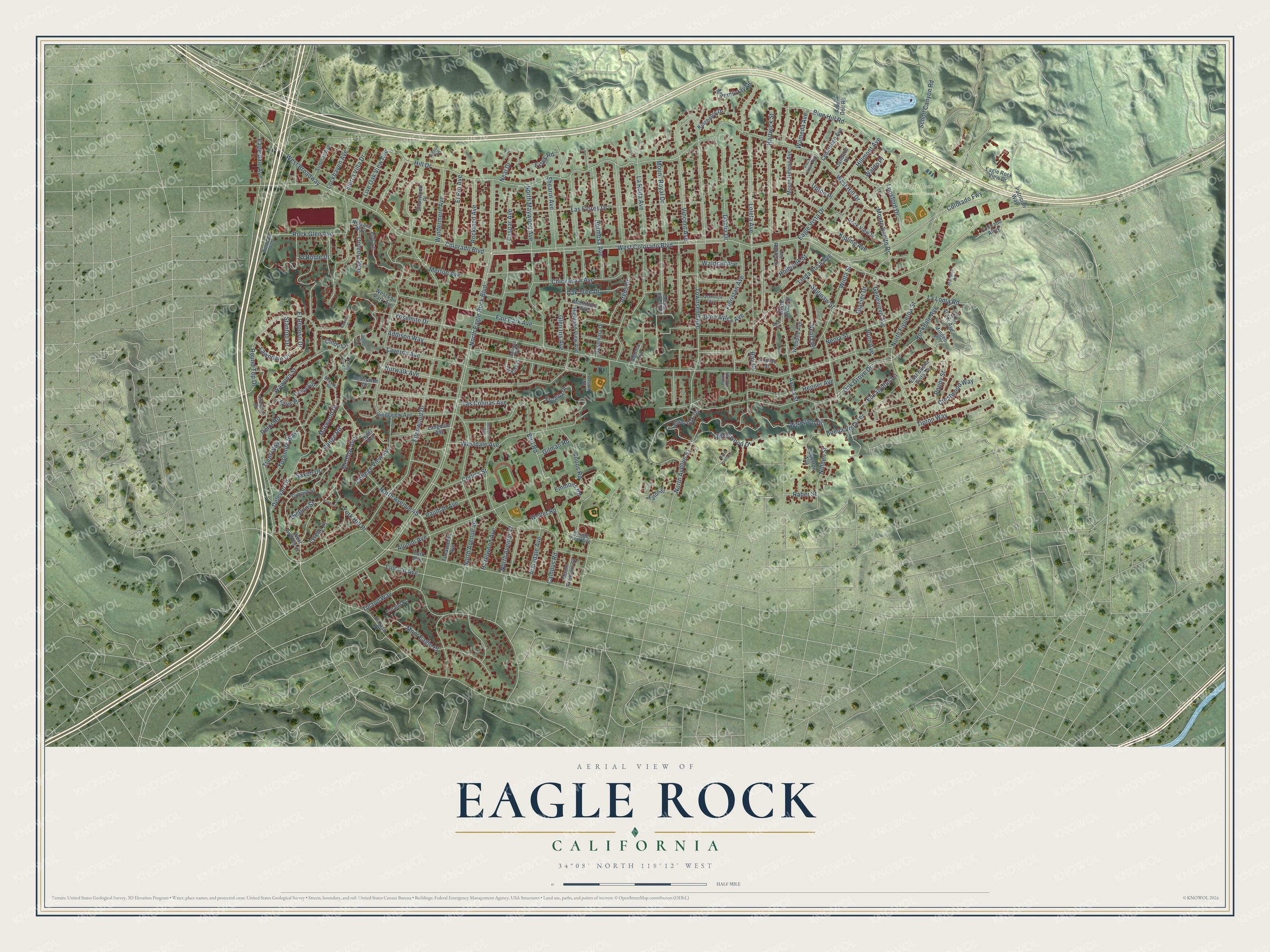
Eagle Rock, California Map Art
Building by building, with labeled streets and shaded relief.
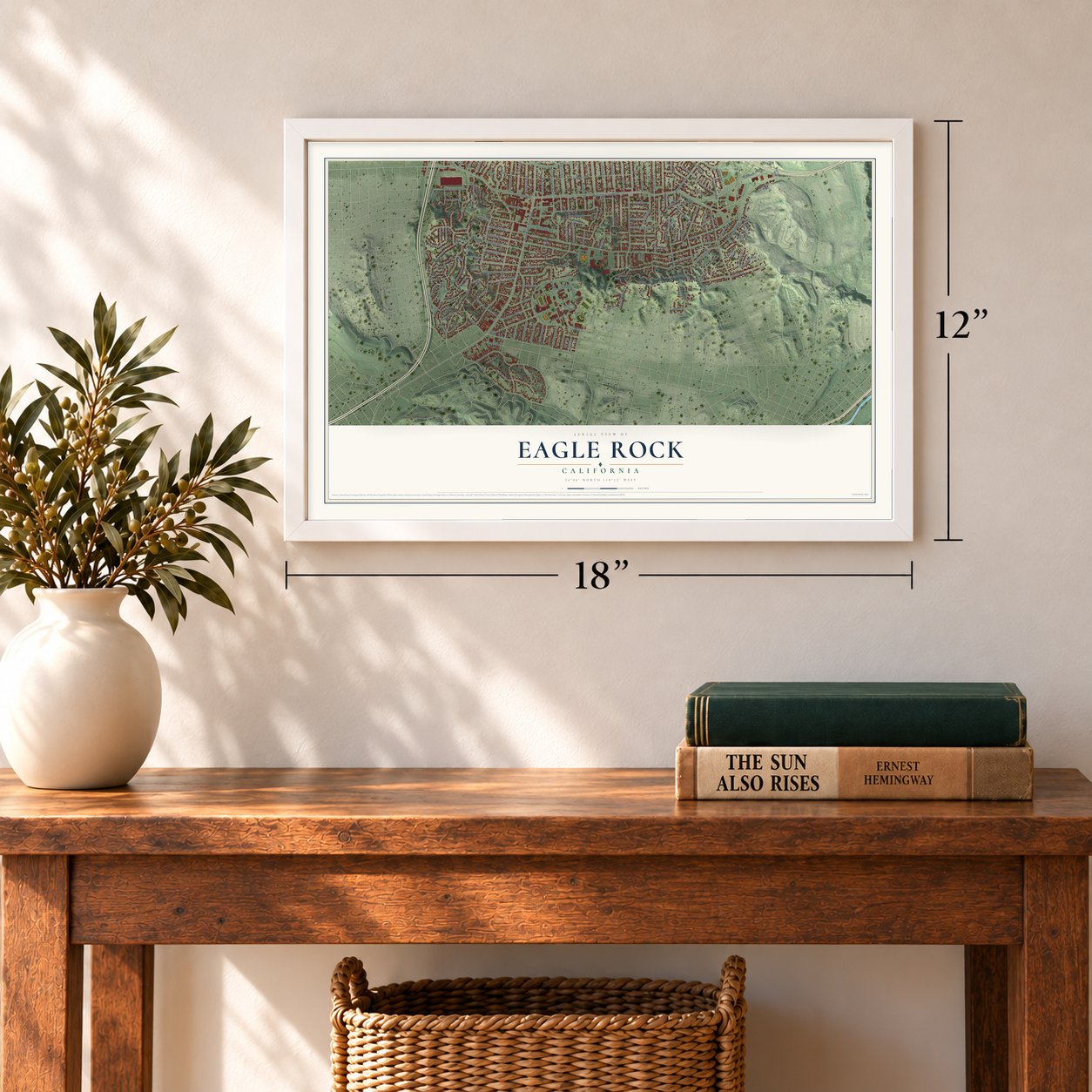
12" x 18" Archival Matte Print
A Map of Home. A Work of Art.
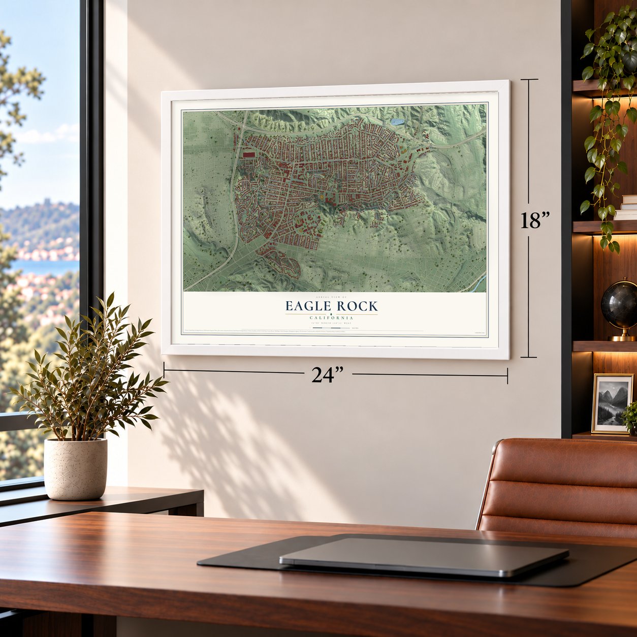
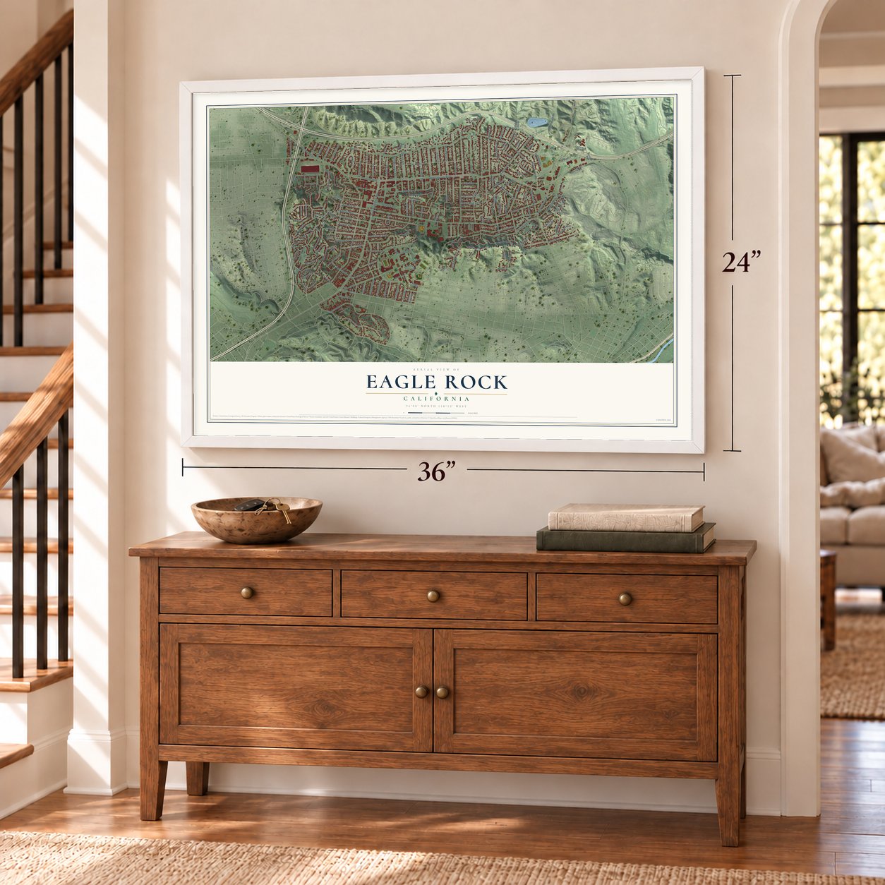
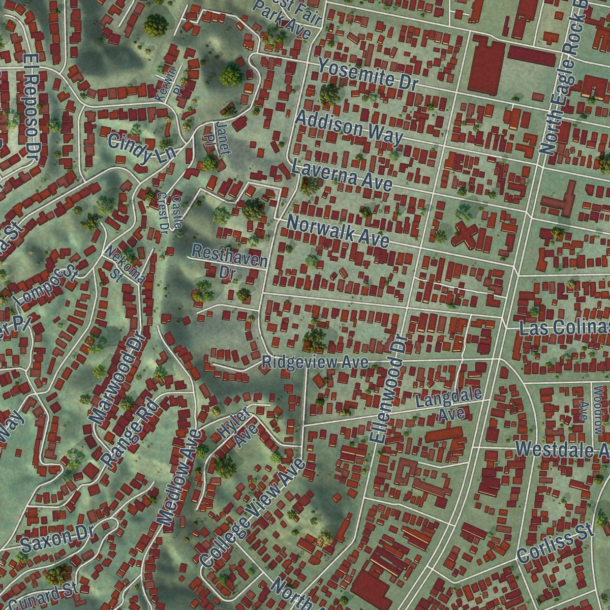
Explore Eagle Rock, California from a whole new perspective. Created using aerial imagery and detailed geographic data, this map captures Eagle Rock building by building, with labeled streets, familiar landmarks, and shaded topographical relief that highlights the natural contours of the landscape.
Combining modern data with the timeless character of a vintage atlas, this map is just as interesting up close as it is beautiful on the wall. Whether you grew up in Eagle Rock, spent memorable years there, or call it home today, this unique map is a great way to celebrate a place that means something to you. Zoom in on the preview to look for your street, and then order a print to put your memories on the wall.
Three ways to hang it
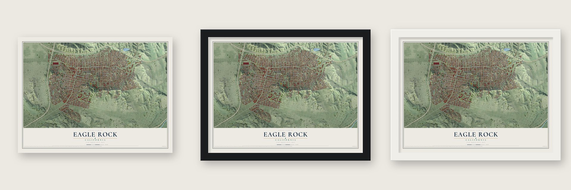
Unframed archival matte, a black wood frame or a white wood frame.
Up close
Geography Worth Displaying
This map was created using accurate cartographic data and authoritative geographic sources, including the U.S. Geological Survey and the Census Bureau. The map brings together terrain, waterways, roads, and building detail. The majority of the streets are labeled, houses are accurately depicted, and the topography is derived from government sources. Combining local data with carefully composed color and shading leads to this beautifully detailed Eagle Rock artwork for your wall.
Rather than simply showing street outlines, we’ve included as many of the street names as we could reasonably fit on the map while keeping their names legible. Zoom in on the high resolution preview to see exactly what’s on the map. We truly set out to create a statement piece for anyone who loves Eagle Rock. So whether it’s for you, or a gift for someone you love, we hope this map of Eagle Rock brings back fond memories.
Read the story behind this map of Eagle Rock, California from 2026.

Find your street
Names on the Eagle Rock map
Every name below is printed on this map. Look for your street, your school, the park where you played, or the pond down the road.
Places and landmarks1
- Eagle Rock Recreation Center
Streets and roads180
- Colorado Boulevard
- Poppy Street
- West Colorado Boulevard
- Glacier Drive
- Hill Drive
- Norwalk Avenue
- Mount Royal Drive
- North Eagle Rock Boulevard
- Yosemite Drive
- Las Flores Drive
- Townsend Avenue
- Ellenwood Drive
- North Figueroa Street
- College View Avenue
- Colorado Fwy
- Oak Grove Drive
- Wawona Street
- Campus Road
- La Roda Avenue
- Fair Park Avenue
- Vincent Avenue
- Wildwood Drive
- Loleta Avenue
- Scholl Canyon Road
- Linda Rosa Avenue
- Hartwick Street
- West Hill Drive
- Yosemite Way
- Eagle Vista Drive
- North Avenue 46
Show all 180 streets
- Addison Way
- Argus Drive
- Chickasaw Avenue
- North Avenue 45
- Round Top Drive
- North Maywood Avenue
- Dahlia Drive
- Buena Vista Terrace
- Medlow Avenue
- Neola Street
- Las Colinas Avenue
- Tipton Way
- Wiota Street
- Mont Eagle Place
- Toland Way
- Hermosa Avenue
- Sierra Villa Drive
- Merton Avenue
- Delevan Drive
- Floristan Avenue
- Alumni Avenue
- Coons Road
- Silverwood Drive
- Lockhaven Avenue
- Laverna Avenue
- Crestwood Way
- Avoca Street
- Kipling Avenue
- Glen Iris Avenue
- Loy Lane
- Shearin Avenue
- Genevieve Avenue
- Monte Bonito Drive
- El Roble Drive
- Blue Hill Road
- Caspar Avenue
- West Broadway
- Corliss Street
- Hepner Avenue
- Estes Road
- Bird Road
- Rockdale Avenue
- Glen Aylsa Avenue
- Neola Place
- Nolden Street
- Marwood Drive
- Windermere Avenue
- Rock Glen Avenue
- La Loma Road
- Range Road
- El Rio Avenue
- Paulhan Avenue
- Rockland Avenue
- Westdale Avenue
- Upton Place
- Saginaw Street
- Armadale Avenue
- Weller Road
- Oak Tree Drive
- Emmons Road
- Live Oak View Avenue
- Saxon Drive
- El Reposo Drive
- North Avenue 51
- Hazelwood Avenue
- Eucalyptus Lane
- Eagledale Avenue
- Lawndale Drive
- Fyler Place
- Delor Road
- Lincoln Avenue
- Onteora Way
- North Avenue 47
- Holbrook Street
- Lunsford Drive
- Hillmont Avenue
- Waldran Avenue
- Maemurray Drive
- Ruth Avenue
- Dicturn Street
- Lytelle Place
- Wameda Avenue
- Trent Way
- Stanton Drive
- Gilman Road
- York Hill Place
- Neal Drive
- Raber Street
- Waldo Place
- Cindy Lane
- Ray Court
- East Buena Vista Terrace
- Glen Arbor Avenue
- Ridgeview Avenue
- Highland View Avenue
- Mount Helena Avenue
- Escarpa Drive
- Langdale Avenue
- West Avenue 42
- El Paso Drive
- Upperton Avenue
- Palmer Drive
- Kincheloe Drive
- York Boulevard
- Eagle Rock View Drive
- Cedaredge Avenue
- Cunard Street
- Arbor Dell Road
- Patrician Way
- Hyler Avenue
- Rock View Street
- Wicopee Avenue
- Ellenwood Place
- Los Robles Street
- Eaton Street
- Lompoc Street
- Silver Oak Terrace
- Sumner Avenue
- Tonawanda Avenue
- Candace Place
- Rosemary Drive
- Mount Pleasant Street
- West Fair Park Avenue
- Montiflora Avenue
- North Avoca Street
- Minden Place
- Niagara Way
- Range View Avenue
- Resthaven Drive
- Colorado Alley
- Conrad Street
- Toland Place
- Algoma Avenue
- Olson Street
- Grandola Avenue
- Del Rosa Drive
- Hilltop Road
- Nekoma Street
- Rock View Terrace
- Delaware Avenue
- Delrosa Walk
- Rock Row Drive
- Janet Place
- Lick Street
- North Avenue 52
- Castle Crest Drive
- Banbury Place
- Woodrow Avenue
- Brampton Road
- Kerwin Place
Names are listed as they appear on the printed map. Zoom into the product photos to find them.
About Eagle Rock, California
Eagle Rock is a Northeast Los Angeles neighborhood named for the large boulder whose shadow resembles an eagle. The community had a brief life as an independent city before joining Los Angeles, and Occidental College remains one of its best-known institutions.
- Named for Eagle RockA shadow on the neighborhood's namesake boulder resembles an eagle.
- Cityhood in 1911Eagle Rock incorporated as an independent city in 1911.
- Joined Los AngelesResidents approved annexation to Los Angeles in 1923.
- Occidental CollegeThe college makes its home in the neighborhood.
Keep exploring California
Eagle Rock is one of 1,990 California towns we've mapped. Every dot on the map is a print of its own.
The search covers every state, California first.
Near Eagle Rock
Order 2 or more town maps and save 10%. Shown in the size and finish you picked above, so they hang as a set.
- Glassell Park 12" x 18" / Archival Matte Print $39.99
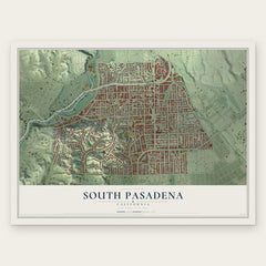
- South Pasadena 12" x 18" / Archival Matte Print $39.99
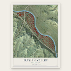
- Elysian Valley 12" x 18" / Archival Matte Print $39.99

More maps nearby: Madison Heights, Glendale, Oak Knoll, Pasadena and Lincoln Heights.
The art of mapping a place
How This Map Was Made
Real places. Remarkable detail. Discover the layers that turn geographic data into a map of home.

The view from above
Aerial imagery reveals the character of the land: woodland, open fields, and the patterns of a place.

The shape of the land
Elevation data brings hills, valleys, and subtle changes in the landscape into view.

The details of home
Roads, waterways, and building footprints come together to make the map feel unmistakably local.

Geography becomes art
Considered color, shading, and typography bring the layers together in a map made for your wall.


Process illustrated with Mendon, Massachusetts. Aerial imagery: USDA NAIP. Terrain: USGS 3D Elevation Program. Map details and finished artwork: KNOWOL.
The Details
About This Print
Choose an archival matte print, or a black or white Ayous wood frame. The archival matte print is unframed.
Select your size and finish above to see the matching product image and price.
Materials & Craftsmanship
A contemporary map with the character of a classic atlas, printed on archival matte paper. Optional frames are made from Ayous wood.
Your printed map does not include the watermark shown in the full-map preview.
Shipping & Delivery
Free shipping within the United States. Every print is made to order in the USA.
Buying a gift? Add a note in your cart and we'll include it. We never put prices in the package.
Prints ship within 2 to 3 business days. Allow 7 to 10 days total from ordering for delivery. Timing may vary during holidays or periods of high order volume.
Read our shipping policy.
Returns and damaged prints
Each print is made to order. Change-of-mind refunds are not available after production.
If your print arrives damaged, misprinted or incorrect, contact support@knowol.com within 30 days of receiving it. Include your order number, photos and a description of the issue.
Read our full refund and replacement policy. For questions about your order, email support@knowol.com.