
Search for another town





Free U.S. delivery 7 to 10 days after you order
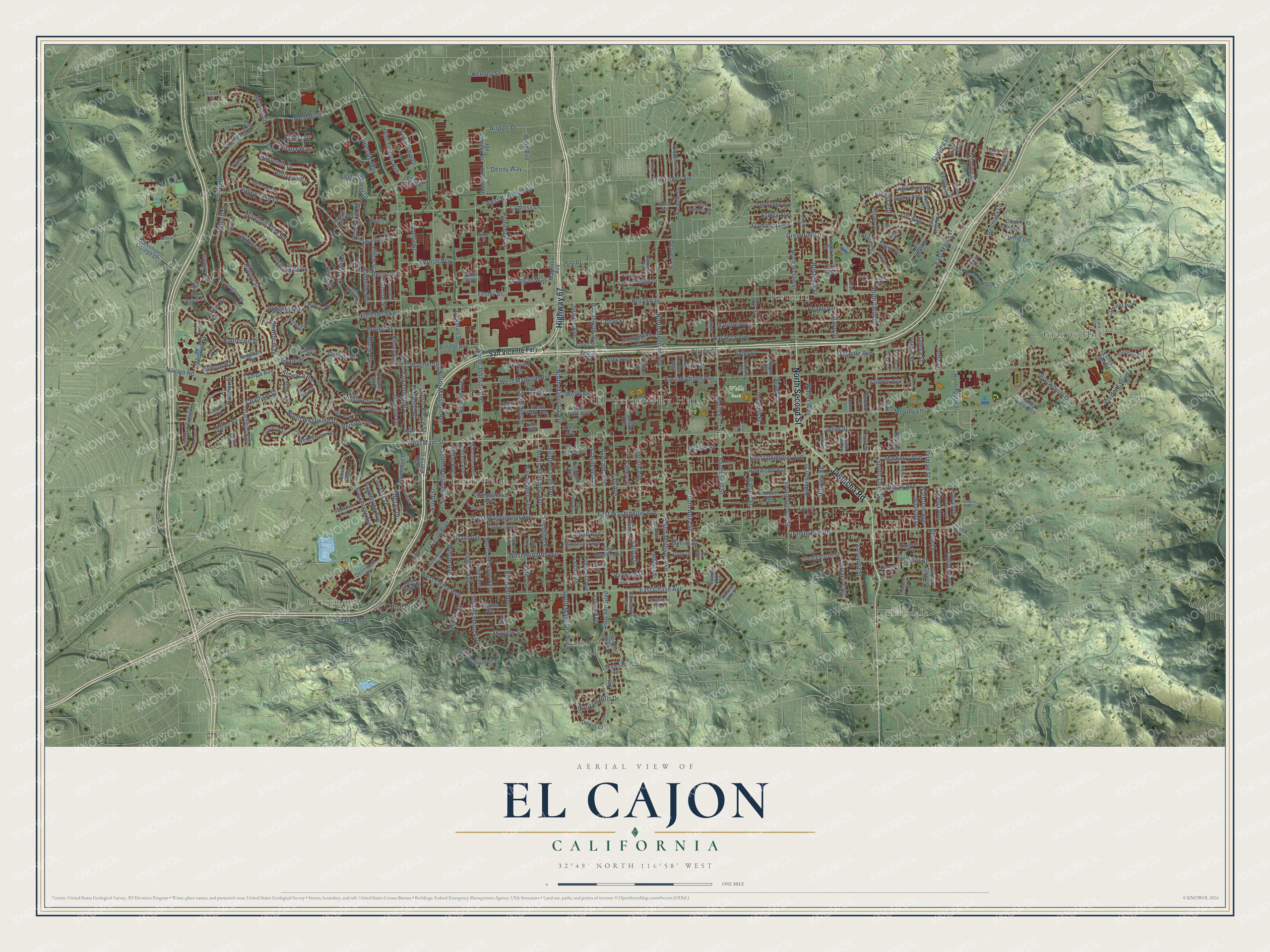
El Cajon, California Map Art
Building by building, with labeled streets and shaded relief.
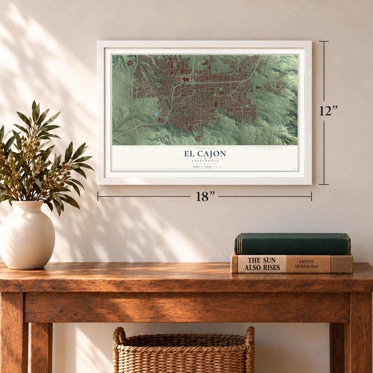
12" x 18" Archival Matte Print
A Map of Home. A Work of Art.
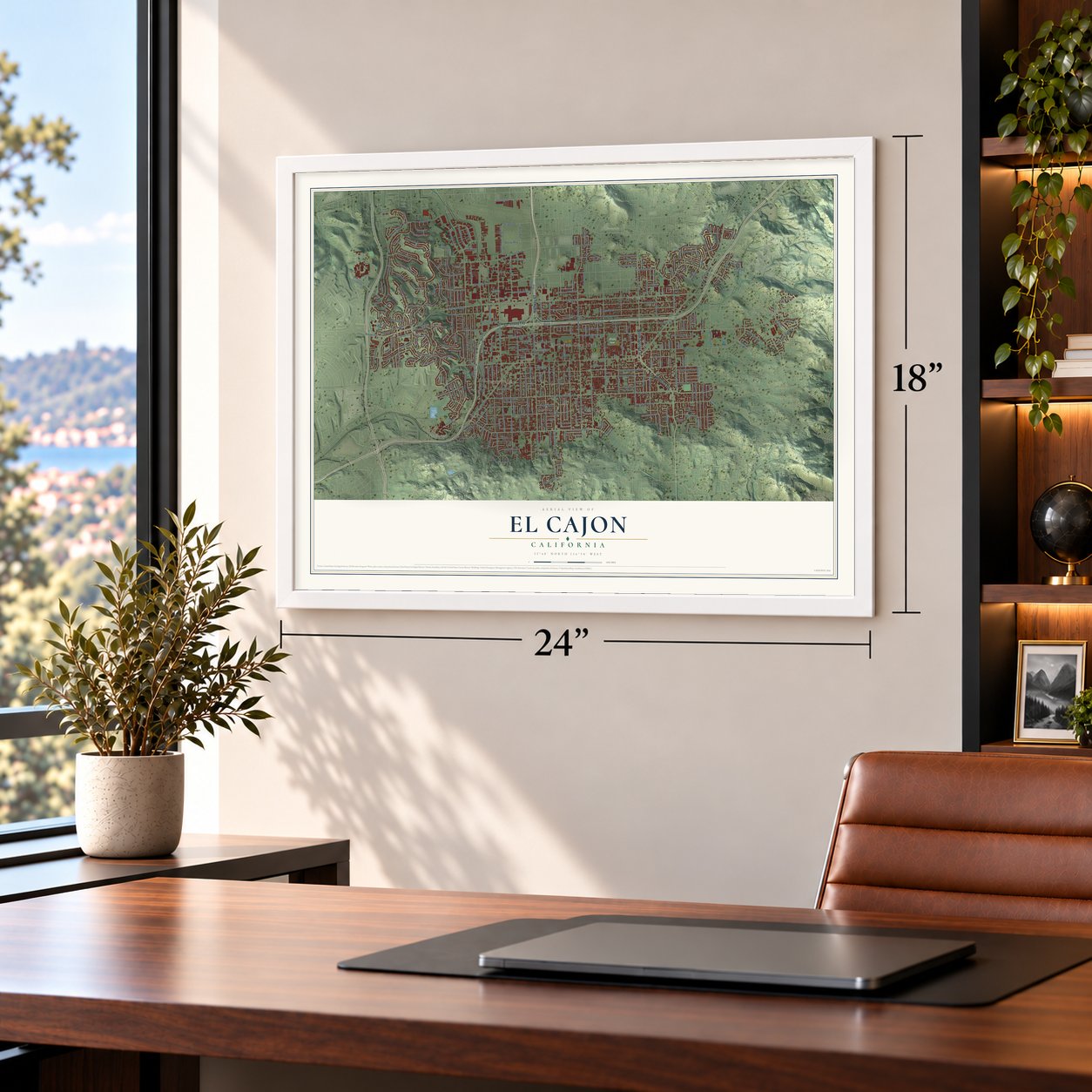
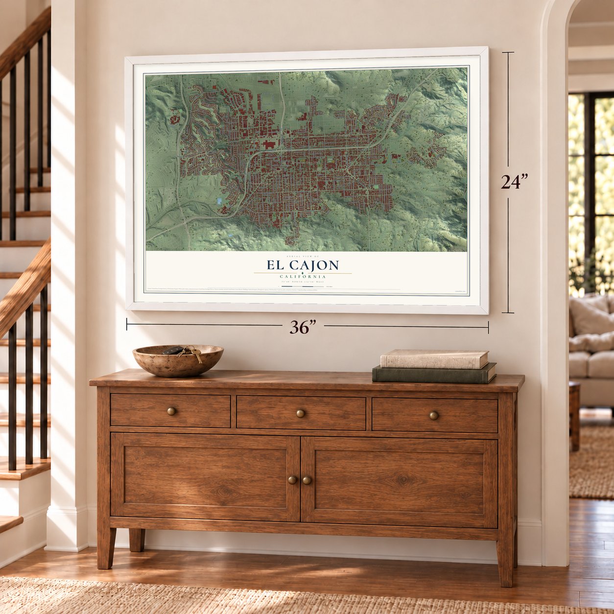
Explore El Cajon, California from a whole new perspective. Created using aerial imagery and detailed geographic data, this map captures El Cajon building by building, with labeled streets, familiar landmarks, and shaded topographical relief that highlights the natural contours of the landscape.
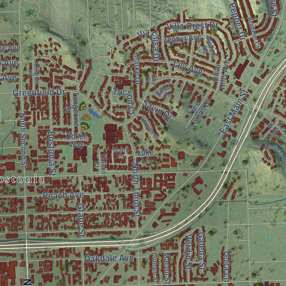
Combining modern data with the timeless character of a vintage atlas, this map is just as interesting up close as it is beautiful on the wall. Whether you grew up in El Cajon, spent memorable years there, or call it home today, this unique map is a great way to celebrate a place that means something to you. Zoom in on the preview to look for your street, and then order a print to put your memories on the wall.
Three ways to hang it
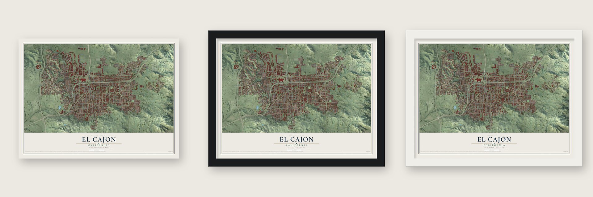
Unframed archival matte, a black wood frame or a white wood frame.
Up close
Geography Worth Displaying
This map was created using accurate cartographic data and authoritative geographic sources, including the U.S. Geological Survey and the Census Bureau. The map brings together terrain, waterways, roads, and building detail. The majority of the streets are labeled, houses are accurately depicted, and the topography is derived from government sources. Combining local data with carefully composed color and shading leads to this beautifully detailed El Cajon artwork for your wall.
Rather than simply showing street outlines, we’ve included as many of the street names as we could reasonably fit on the map while keeping their names legible. Zoom in on the high resolution preview to see exactly what’s on the map. We truly set out to create a statement piece for anyone who loves El Cajon. So whether it’s for you, or a gift for someone you love, we hope this map of El Cajon brings back fond memories.
Read the story behind this map of El Cajon, California from 2026.

Find your street
Names on the El Cajon map
Every name below is printed on this map. Look for your street, your school, the park where you played, or the pond down the road.
Places and landmarks7
- El Cajon City Hall
- Hillsdale
- Wells Park
- Bostonia
- Cajon Heights
- Granite Hills
- Grossmont
Streets and roads352
- Highway 67
- Jamacha Road
- North Second Street
- West Main Street
- North Magnolia Avenue
- North Johnson Avenue
- North Westwind Drive
- Salina Street
- South Magnolia Avenue
- East Chase Avenue
- South Johnson Avenue
- Cosmo Avenue
- Condor Avenue
- East Main Street
- East Madison Avenue
- Fletcher Parkway
- East Washington Avenue
- Greenfield Drive
- North Marshall Avenue
- Broadway
- North Cuyamaca Street
- East Lexington Avenue
- Granite Hills Drive
- Fanita Drive
- North Mollison Avenue
- Hacienda Drive
- El Cajon Boulevard
- Naranca Avenue
- Peach Avenue
- Windmill View Road
Show all 352 streets
- Murray Drive
- Ballantyne Street
- Emerald Avenue
- South Orange Avenue
- South Mollison Avenue
- North Third Street
- West Chase Avenue
- Weld Boulevard
- Marline Avenue
- North First Street
- Avocado Avenue
- Lincoln Avenue
- South Anza Street
- Vernon Way
- Garfield Avenue
- Taft Avenue
- West Bradley Avenue
- Avocado Boulevard
- Prescott Avenue
- Graves Avenue
- Brockton Street
- Melody Lane
- Dewane Drive
- Chatham Street
- Eastside Road
- El Monte Road
- West Renette Avenue
- Gustavo Street
- West Washington Avenue
- Tyrone Street
- Oakdale Avenue
- Ballard Street
- South Second Street
- Pioneer Way
- North Pierce Street
- Gillespie Way
- Arnele Avenue
- Dorothy Street
- Swallow Drive
- Alveda Avenue
- Petree Street
- Redwood Avenue
- Whitsett Drive
- Katherine Street
- Ellen Lane
- Wagner Drive
- Lemon Avenue
- Farrington Drive
- Finch Street
- Lily Avenue
- Aldwych Road
- Valley Lake Drive
- Fesler Street
- South Third Street
- South Marshall Avenue
- West Madison Avenue
- Chambers Street
- Vis del Escuela
- Sunshine Street
- Van Houten Avenue
- Live Oak Drive
- South Sunshine Avenue
- South First Street
- Cedar Street
- Reuben Fleet Drive
- Waterloo Avenue
- Pine Drive
- Jasmine Street
- Claydelle Avenue
- Merritt Drive
- Grape Street
- Heron Avenue
- El Rey Avenue
- Flume Drive
- Oro Street
- Airport Drive
- Millar Avenue
- John Towers Avenue
- Grant Avenue
- Pepper Drive
- Terrace Crst
- Rippey Street
- Hawthorne Avenue
- Kenney Street
- Dumar Avenue
- Australia Street
- Wing Avenue
- Sharon Way
- Shady Lane
- Bostonia Street
- Bermuda Lane
- Lostinda Street
- Patricia Lane
- Wilson Avenue
- Nielsen Street
- Front Street
- Orlando Street
- Cypress Lane
- Hardin Drive
- Decker Street
- Skyview Street
- Grafton Street
- South Lemon Avenue
- Friendship Drive
- Alderson Street
- Fayette Street
- Littleton Road
- Navajo Road
- Evilo Street
- Medford Street
- Hillsmont Drive
- Brookhurst Drive
- Markerry Avenue
- Joliet Street
- Altozano Drive
- Coogan Way
- Via Elisa Drive
- Horizon Hills Drive
- Mary Street
- Honey Hill Road
- Mundy Terrace
- Villa Crest Drive
- Flamingo Avenue
- Hosmer Street
- Raleigh Avenue
- Ventana Way
- Estela Drive
- Denny Way
- Erin Drive
- Filbert Street
- Tucson Court
- Lindell Avenue
- Joey Avenue
- Walter Way
- Flying Hills Lane
- Jackman Street
- Leslie Road
- Estes Street
- Galway Place
- Wells Avenue
- Berenda Place
- Craigmont Street
- Terra Lane
- Verdin Street
- El Pico Drive
- Dilman Street
- Tampa Avenue
- Grouse Street
- Lorna Avenue
- Sterling Drive
- Galena Street
- Denver Lane
- Prince Street
- Savin Drive
- Betts Street
- San Vicente Fwy
- Magnolia Avenue
- Grossmont College Drive
- Aster Avenue
- East Park Avenue
- Dryden Road
- Kimberly Woods Drive
- Travelodge Drive
- Blackthorne Avenue
- East Renette Avenue
- Sandalwood Drive
- Valley Rim Road
- Chamberlain Avenue
- Richfield Avenue
- Andover Road
- Helix View Drive
- Camelot Parkway
- Valley View Boulevard
- Laguna Avenue
- Olive Hills Avenue
- Garden Grove Lane
- Denise Lane
- East Bradley Avenue
- West Park Avenue
- Wichita Avenue
- Valley Village Drive
- Wedgemere Road
- Minnesota Avenue
- Clarke Drive
- North Fourth Street
- Silvery Lane
- Swift Lane
- Wisconsin Avenue
- Dawnridge Avenue
- Peppervilla Drive
- Hillsview Road
- Willis Road
- Powell Drive
- Roanoke Road
- Compton Street
- Tangerine Street
- Joe Crosson Drive
- Shadow Road
- Tres Lomas Drive
- Avenue Abajo
- Boyington Place
- Buckeye Drive
- South Pierce Street
- Dennstedt Place
- Zephyr Avenue
- Pillsbury Lane
- Lauree Street
- Raymond Street
- Cll del Conejo
- Needham Road
- Hills Lane Drive
- Joe Crossen Drive
- Hart Drive
- Cajon Greens Drive
- Glenhill Road
- Garden Glen Lane
- Lomacita Terrace
- Gray Drive
- Billings Street
- Balsam Drive
- Coker Way
- Bert Acosta Street
- Calvin Lane
- Dewitt Court
- Bearing Lane
- Skywood Drive
- Wayne Avenue
- Highland Avenue
- Macon Street
- La Rue Way
- Anjuli Court
- Burnaby Street
- Hihill Way
- Lloyd Street
- Carter Street
- Lura Avenue
- Beech Street
- Rea Avenue
- Dorado Lane
- Laurel Lane
- Jeffree Street
- Eldon Court
- Gable Way
- Luke Lane
- Gull Place
- Lund Street
- Galt Drive
- Grossmont Avenue
- Horizon Heights Circle
- Primrose Drive
- Hills Lake Drive
- Charles Way
- Richardson Avenue
- Arnheim Court
- Dichter Street
- Deerhaven Street
- Elizabeth Way
- East Douglas Avenue
- La Sombra Drive
- Meadow Road
- Avenue Ladera
- Farview Street
- Cajon View Drive
- View Way
- Lavala Lane
- Bathurst Place
- Wayside Avenue
- South Ivory Avenue
- South Gina Avenue
- Roberta Avenue
- Jefferson Avenue
- Durham Street
- Belmore Court
- Scranton Street
- Ladysmith Drive
- Milford Place
- Manor Drive
- Cono Drive
- Soma Place
- Latisha Place
- Spinel Avenue
- Burnet Street
- Rancho Valle Court
- Pfeifer Lane
- Linda Way
- Coleen Court
- Eula Lane
- Comet Lane
- Admin Drive
- Harry Street
- Coy Court
- Hub Court
- Hill Street
- Loma Portal Drive
- Teatro Circle
- Cloverleaf Drive
- Thrasher Way
- Sierra Circle
- Blackbird Street
- Mahogany Drive
- Blanchard Road
- Herbert Street
- Gorsline Drive
- South Stephanie Lane
- Franklin Avenue
- Arlington Place
- Sunrise Shadow Court
- Nidrah Street
- Russell Road
- Via Loma Vis
- Goulburn Court
- Nugent Court
- Bellaire Court
- Tulsa Street
- Ajay Street
- Dehesa Road
- Steele Street
- Carlow Way
- Safari Drive
- Circle Drive
- Conn Place
- Provo Street
Names are listed as they appear on the printed map. Zoom into the product photos to find them.
About El Cajon, California
El Cajon is a city of 106,215 people in San Diego County, about 17 miles east of downtown San Diego. Its name is Spanish for "the box," because foothills close in the valley around it. In the early 19th century, mission padres looking for pasture brought cattle here, since the hills kept the herds from wandering off and caught what little rain fell.
In 1845 Governor Pio Pico took the mission's lands and granted 11 square leagues of the valley to Dona Maria Antonio Estudillo, paying off a $500 debt the government owed. Los Angeles developer Isaac Lankershim bought most of the rancho in 1868 and hired Amaziah Lord Knox, a New Englander, to manage it. Knox opened a hotel in 1876, and the crossroads around it was known as Knox's Corners before it took the valley's name. El Cajon became a city in 1912 and was known for its grapes, avocados and citrus for the first half of the 20th century.
- A dollar a night at Knox'sKnox's hotel served travelers on the road between San Diego and Julian, where gold had turned up in 1869. A guest and a horse could stay for $1 a night. By 1878 the valley had 25 families, and part of the hotel lobby became their post office, with Knox as the first postmaster.
- Named for its shapeThe name El Cajón was first written down on September 10, 1821, as another name for the Santa Mónica rancho, describing its boxed-in valley. Maps from 1873 and 1875 shortened it to Cajon, and in 1905 banker and historian Zoeth Skinner Eldredge pushed to restore the full name, El Cajon. Locals still call the city the Box.
- Mother Goose Parade since 1946Every Sunday before Thanksgiving since 1946, El Cajon has held its Mother Goose Parade, which organizers call the biggest in San Diego County. More than 100 entries take part, from marching bands and riders on horseback to giant helium balloons and Santa Claus.
- Cajon Speedway, 1961 to 2005Earle Brucker Jr., a member of the El Cajon Stock Car Racing Association, opened a 70-acre race track here in 1961, and his son Steve Brucker later owned it. Cars raced on it until 2005, when the track shut down after Steve's death. A museum now stands on the site and keeps the original entrance sign, which called it the fastest paved oval in the West.
Keep exploring California
El Cajon is one of 1,990 California towns we've mapped. Every dot on the map is a print of its own.
The search covers every state, California first.
Near El Cajon
Order 2 or more town maps and save 10%. Shown in the size and finish you picked above, so they hang as a set.
- Bostonia 12" x 18" / Archival Matte Print $39.99
- Casa de Oro-Mount Helix 12" x 18" / Archival Matte Print $39.99
- Winter Gardens 12" x 18" / Archival Matte Print $39.99


More maps nearby: Granite Hills, Rancho San Diego, Santee, La Mesa and Lakeside.
The art of mapping a place
How This Map Was Made
Real places. Remarkable detail. Discover the layers that turn geographic data into a map of home.

The view from above
Aerial imagery reveals the character of the land: woodland, open fields, and the patterns of a place.

The shape of the land
Elevation data brings hills, valleys, and subtle changes in the landscape into view.

The details of home
Roads, waterways, and building footprints come together to make the map feel unmistakably local.

Geography becomes art
Considered color, shading, and typography bring the layers together in a map made for your wall.


Process illustrated with Mendon, Massachusetts. Aerial imagery: USDA NAIP. Terrain: USGS 3D Elevation Program. Map details and finished artwork: KNOWOL.
The Details
About This Print
Choose an archival matte print, or a black or white Ayous wood frame. The archival matte print is unframed.
Select your size and finish above to see the matching product image and price.
Materials & Craftsmanship
A contemporary map with the character of a classic atlas, printed on archival matte paper. Optional frames are made from Ayous wood.
Your printed map does not include the watermark shown in the full-map preview.
Shipping & Delivery
Free shipping within the United States. Every print is made to order in the USA.
Buying a gift? Add a note in your cart and we'll include it. We never put prices in the package.
Prints ship within 2 to 3 business days. Allow 7 to 10 days total from ordering for delivery. Timing may vary during holidays or periods of high order volume.
Read our shipping policy.
Returns and damaged prints
Each print is made to order. Change-of-mind refunds are not available after production.
If your print arrives damaged, misprinted or incorrect, contact support@knowol.com within 30 days of receiving it. Include your order number, photos and a description of the issue.
Read our full refund and replacement policy. For questions about your order, email support@knowol.com.