
Search for another town

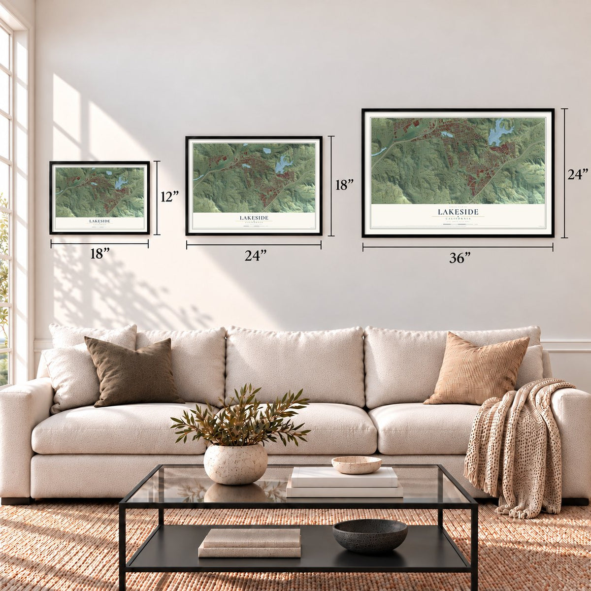

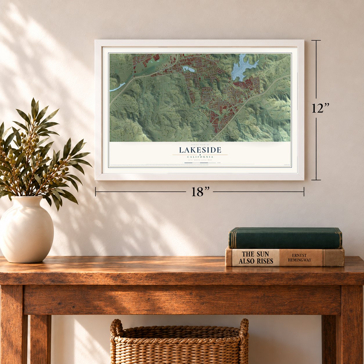

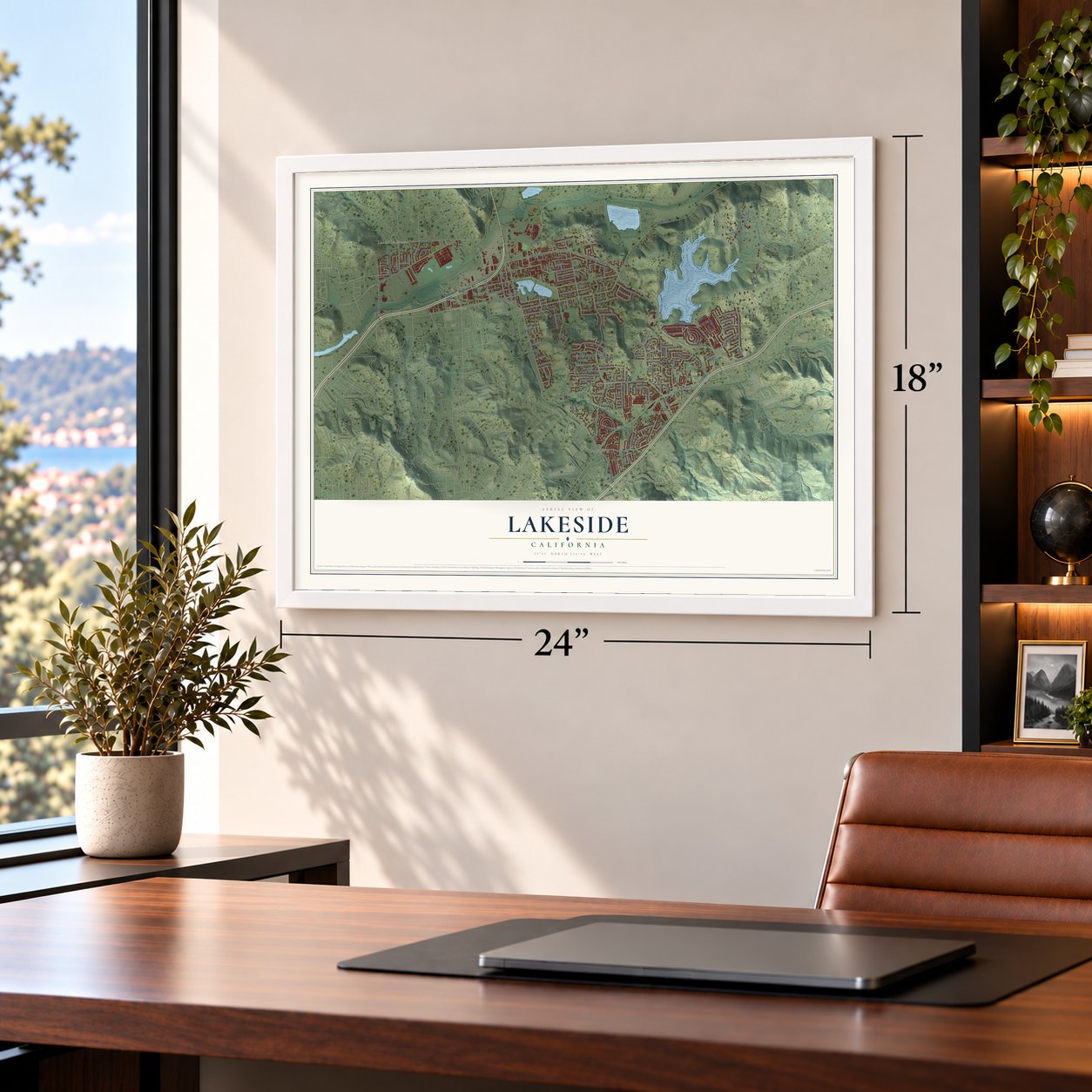
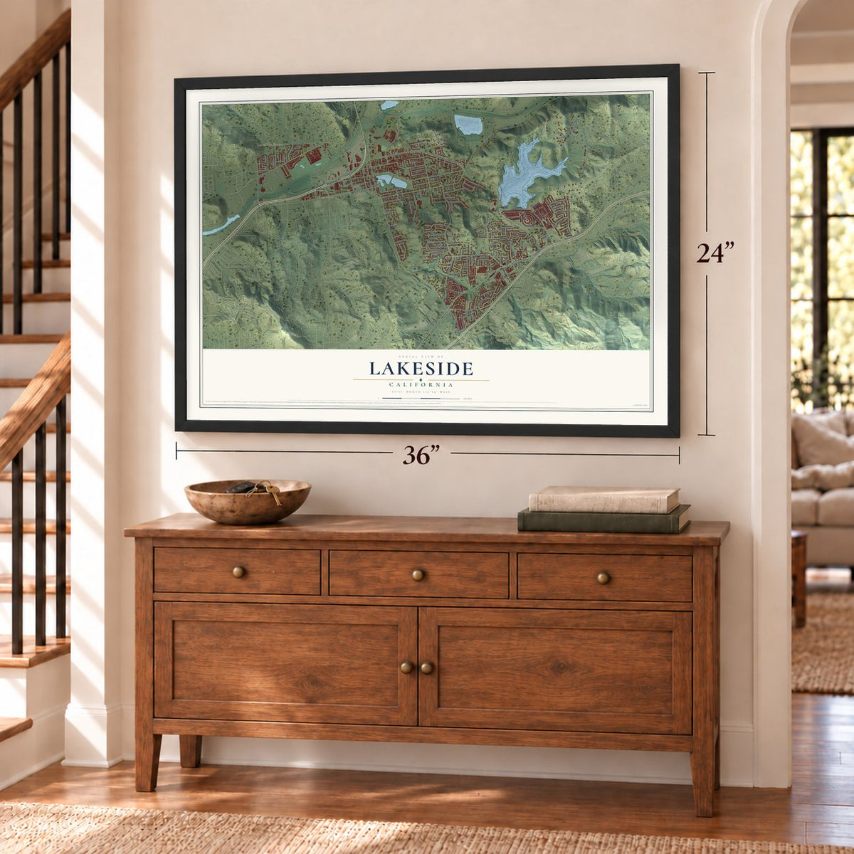

Free U.S. delivery 7 to 10 days after you order
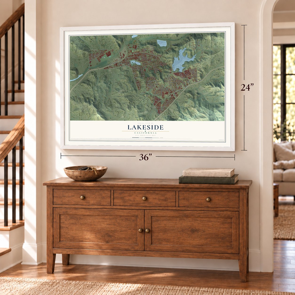
Lakeside, California Map Art
Building by building, with labeled streets and shaded relief.
12" x 18" Archival Matte Print
A Map of Home. A Work of Art.
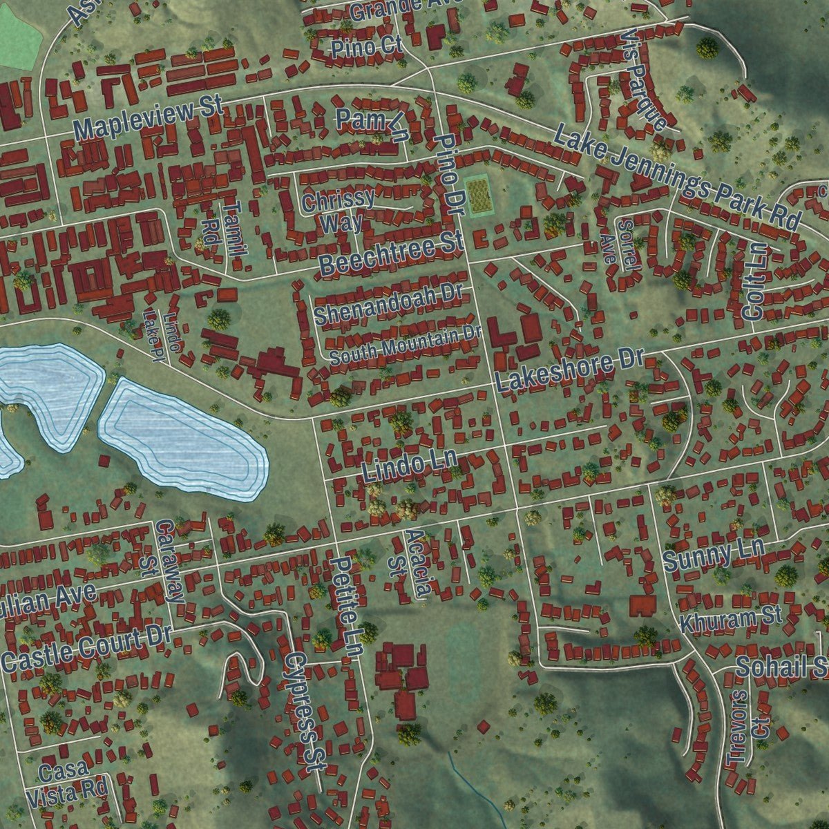
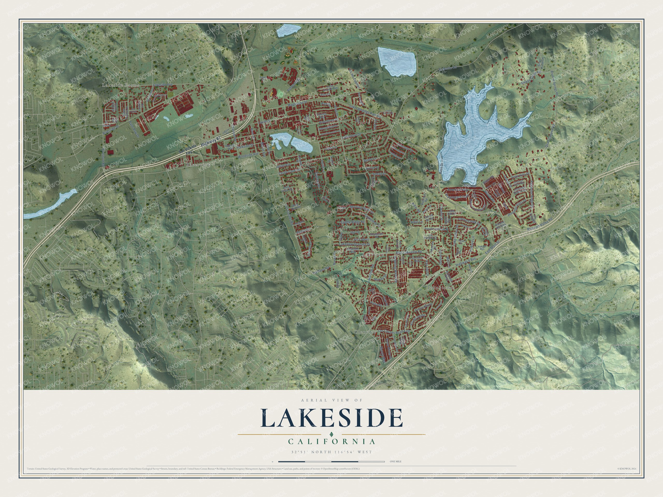
Explore Lakeside, California from a whole new perspective. Created using aerial imagery and detailed geographic data, this map captures Lakeside building by building, with labeled streets, familiar landmarks, and shaded topographical relief that highlights the natural contours of the landscape.
Combining modern data with the timeless character of a vintage atlas, this map is just as interesting up close as it is beautiful on the wall. Whether you grew up in Lakeside, spent memorable years there, or call it home today, this unique map is a great way to celebrate a place that means something to you. Zoom in on the preview to look for your street, and then order a print to put your memories on the wall.
Three ways to hang it
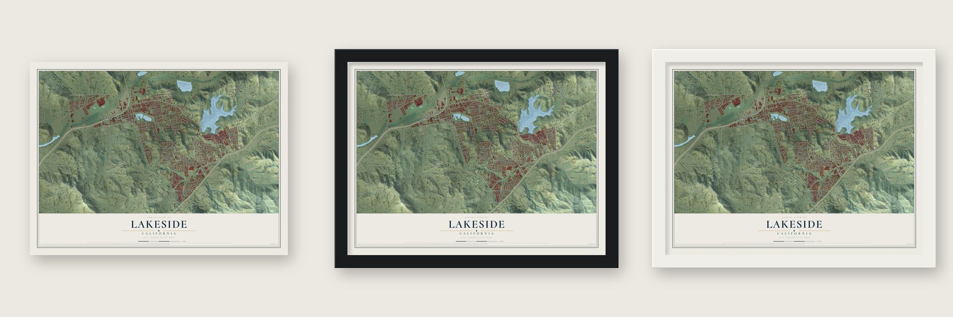
Unframed archival matte, a black wood frame or a white wood frame.
Up close
Geography Worth Displaying
This map was created using accurate cartographic data and authoritative geographic sources, including the U.S. Geological Survey and the Census Bureau. The map brings together terrain, waterways, roads, and building detail. The majority of the streets are labeled, houses are accurately depicted, and the topography is derived from government sources. Combining local data with carefully composed color and shading leads to this beautifully detailed Lakeside artwork for your wall.
Rather than simply showing street outlines, we’ve included as many of the street names as we could reasonably fit on the map while keeping their names legible. Zoom in on the high resolution preview to see exactly what’s on the map. We truly set out to create a statement piece for anyone who loves Lakeside. So whether it’s for you, or a gift for someone you love, we hope this map of Lakeside brings back fond memories.
Read the story behind this map of Lakeside, California from 2026.

Find your street
Names on the Lakeside map
Every name below is printed on this map. Look for your street, your school, the park where you played, or the pond down the road.
Places and landmarks7
- Lakeside Farms
- Glenview
- Johnstown
- Lakeview
- Riverview
- Como Lake
- Crater Lake
Streets and roads152
- Highway 67
- Highway 8 Bus
- East Main Street
- Vine Street
- East Lakeview Road
- Geneva
- Cheryl Creek Drive
- Albert Street
- Los Coches Road
- Lake Jennings Park Road
- Lakeview Road
- El Monte Road
- Lakeshore Drive
- Woodside Avenue
- Mapleview Street
- Julian Avenue
- Quail Canyon Road
- Pino Drive
- Riverside Drive
- Lakeside Avenue
- Palomino Ridge Drive
- Riverford Road
- Laurel Street
- Ashwood Street
- Los Coches Road East
- Bass Drive
- Bass Road
- Channel Road
- Blossom Valley Road
- Ha Hana Road
Show all 152 streets
- Beechtree Street
- Sleepy Creek Road
- Lindo Lane
- Adlai Road
- Petite Lane
- Palm Row Drive
- Castle Court Drive
- Maine Avenue
- Harritt Road
- Pony Express Circle
- American Way
- Cypress Street
- Telkaif Street
- Pinkard Lane
- Morning Glory Drive
- Lake Valley Road
- Goldentop Drive
- Jennings Vista Drive
- Lakeview Granada Drive
- Stagecoach Trail
- Choisser Lane
- Snow White Drive
- Oak Drive
- Marjay Drive
- Parkside Street
- Vis del Capitan
- River Street
- Bubbling Wells Road
- Sunny Lane
- Vis del Verde
- Sohail Street
- Idyl Drive
- Saddle Ridge Road
- Pana Drive
- Vista Hills Drive
- Sleepy Way
- Kay Jay Lane
- Vis Ladero
- Deanly Street
- Dulene Drive
- Adlai Lane
- Rodeo Drive
- Dalai
- Pam Lane
- Mitzi Lane
- Colt Lane
- Idyl Place
- San Vicente Fwy
- Altar
- Cmt Rio
- El Nopal
- Paseo Park Drive
- Audubon Road
- Blossom Springs Road
- Vis Camino
- Calleja Risa
- Sinsonte Lane
- Paseo Palmas Drive
- Vecinio del Este Place
- Cuesta del Sol
- El Dorado Parkway
- Clearlake Way
- Casa Grande Avenue
- Shenandoah Drive
- Silver Creek Lane
- Avenue Marco
- Jennings Vista Trail
- Manajo Road
- Roberts Way
- Via del Luz
- Adlai Terrace
- Scotsman Road
- Lakeview Terrace
- Casa Vista Road
- Jack Oak Lane
- Las Potras Way
- Rock Acre Drive
- Cunning Lane
- Vis Parque
- Vis Entrada
- La Familia Court
- Lenteja Lane
- West Rim Road
- Chrissy Way
- Caraway Street
- Tiffany Park Place
- Khuram Street
- Rio Camino
- Trevors Court
- Rancho del Villa
- Bower Lane
- Acacia Street
- Pino Court
- Tamil Road
- Elm Court
- Pinkard Way
- Shalyn Drive
- Jennings Vista Way
- New Bedford Court
- South Mountain Drive
- Cll de Buena Fe
- Deanly Way
- Gaucho Lane
- Freedom Hill
- Shayann Lane
- El Cerro Drive
- Sombria Road
- Rio Fondo
- Sarah Drive
- Wyeth Road
- Currant Court
- Timber Road
- Sorrel Avenue
- Marvejo
- Industry Road
- Colorama Way
- Laurel Canyon Road
- Rancho Mirage Lane
- Via Consuelo
- Lindo Lake Place
- Las Milpas
- Gotta Place
Names are listed as they appear on the printed map. Zoom into the product photos to find them.
About Lakeside, California
Lakeside is a community of 21,152 people in San Diego County, in the western foothills of the Cuyamaca Mountains. Before Europeans arrived, the Kumeyaay lived here, and they called the small natural lake at its center Ha Ptur, meaning lake or circular water. That lake is Lindo Lake today, and the town took its name from it.
In 1886 the El Cajon Valley Land Company bought 6,600 acres around Lindo Lake and began selling the land as a new town. The company spent $50,000 on the Lakeside Hotel, a Victorian inn with 80 rooms. A rail line reached Lakeside in 1889, and new shops and businesses opened near it, so the settlement grew into a busy town.
- A racetrack around the lakeJohn H. Gay bought the Lakeside Hotel in 1904 and made the park around Lindo Lake part of his fenced estate. He circled the water with a track for cars and horses, and Barney Oldfield set a land speed record there at its opening in 1907. Trains carried big crowds, millionaires and celebrities to the races. Gay wanted the inn and the track torn down after his death, and both came down when he died in 1920.
- A cowboy and rodeo townRanches and plenty of horses earned Lakeside its name as a cowboy town. Volunteers with the El Capitan Stadium Association run the 8-acre Lakeside Rodeo Grounds and give the rental money to local youth sports, service groups and education grants. The Lakeside Rodeo, sanctioned by the PRCA and usually held on the last weekend in April, often draws over 20,000 people.
- El Capitan High since 1959El Capitan High School opened in 1959. It shares its name with the local nickname for El Cajon Mountain, which rises northeast of town and reminded people of the famous cliff in Yosemite. A trail from Lakeside climbs to its summit.
- An astronaut and a rock singerLakeside's notable people include Frederick W. Sturckow, a Marine Corps officer and NASA astronaut, and Doug Ingle, a founding member and the first singer of Iron Butterfly. Joan Embery, the animal and environmental advocate who often appeared on The Tonight Show, is from Lakeside too.
Keep exploring California
Lakeside is one of 1,927 California towns we've mapped. Every dot on the map is a print of its own.
The search covers every state, California first.
Near Lakeside
Order 2 or more town maps and save 10%. Shown in the size and finish you picked above, so they hang as a set.
- Winter Gardens 12" x 18" / Archival Matte Print $39.99
- Eucalyptus Hills 12" x 18" / Archival Matte Print $39.99
- Blossom Valley 12" x 18" / Archival Matte Print $39.99


More maps nearby: Bostonia, Granite Hills, Harbison Canyon, Crest and Santee.
The art of mapping a place
How This Map Was Made
Real places. Remarkable detail. Discover the layers that turn geographic data into a map of home.

The view from above
Aerial imagery reveals the character of the land: woodland, open fields, and the patterns of a place.

The shape of the land
Elevation data brings hills, valleys, and subtle changes in the landscape into view.

The details of home
Roads, waterways, and building footprints come together to make the map feel unmistakably local.

Geography becomes art
Considered color, shading, and typography bring the layers together in a map made for your wall.


Process illustrated with Mendon, Massachusetts. Aerial imagery: USDA NAIP. Terrain: USGS 3D Elevation Program. Map details and finished artwork: KNOWOL.
The Details
About This Print
Choose an archival matte print, or a black or white Ayous wood frame. The archival matte print is unframed.
Select your size and finish above to see the matching product image and price.
Materials & Craftsmanship
A contemporary map with the character of a classic atlas, printed on archival matte paper. Optional frames are made from Ayous wood.
Your printed map does not include the watermark shown in the full-map preview.
Shipping & Delivery
Free shipping within the United States. Every print is made to order in the USA.
Buying a gift? Add a note in your cart and we'll include it. We never put prices in the package.
Prints ship within 2 to 3 business days. Allow 7 to 10 days total from ordering for delivery. Timing may vary during holidays or periods of high order volume.
Read our shipping policy.
Returns and damaged prints
Each print is made to order. Change-of-mind refunds are not available after production.
If your print arrives damaged, misprinted or incorrect, contact support@knowol.com within 30 days of receiving it. Include your order number, photos and a description of the issue.
Read our full refund and replacement policy. For questions about your order, email support@knowol.com.