


Search for another town





Free U.S. delivery 7 to 10 days after you order
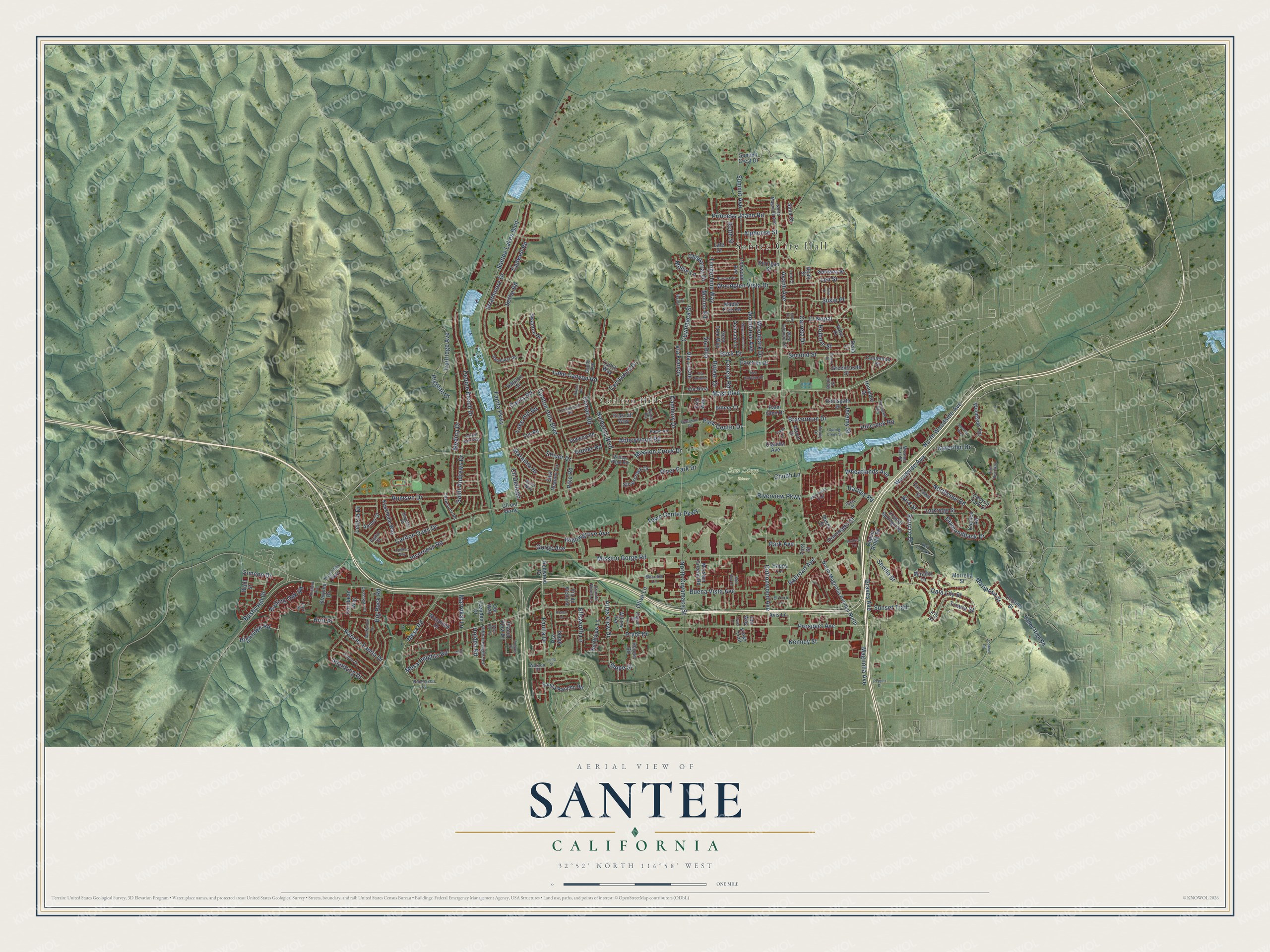
Santee, California Map Art
Building by building, with labeled streets and shaded relief.
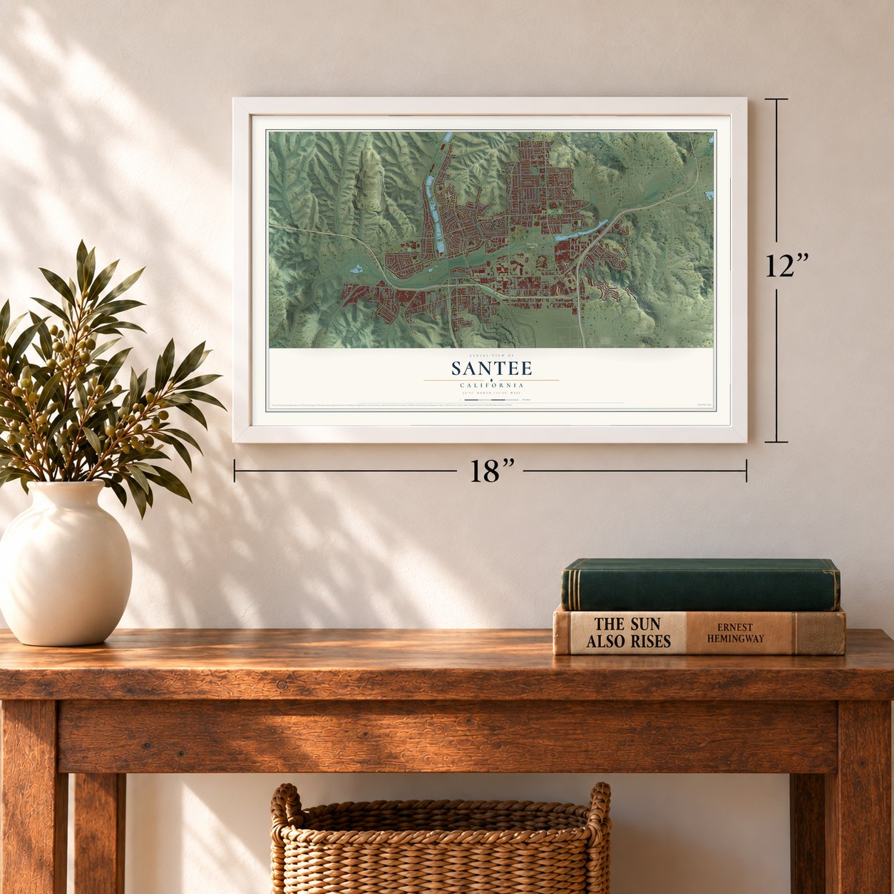
12" x 18" Archival Matte Print
A Map of Home. A Work of Art.
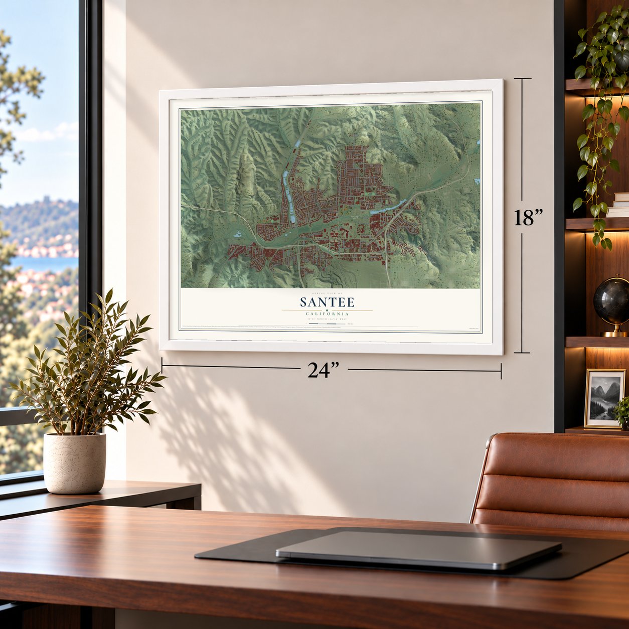
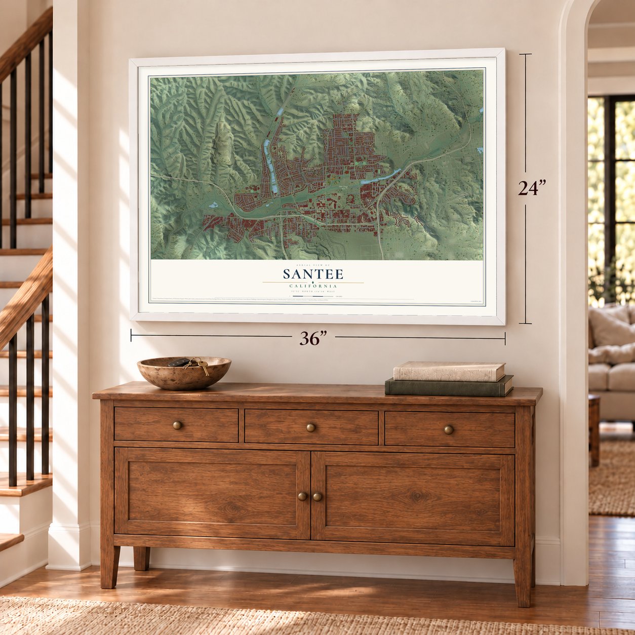
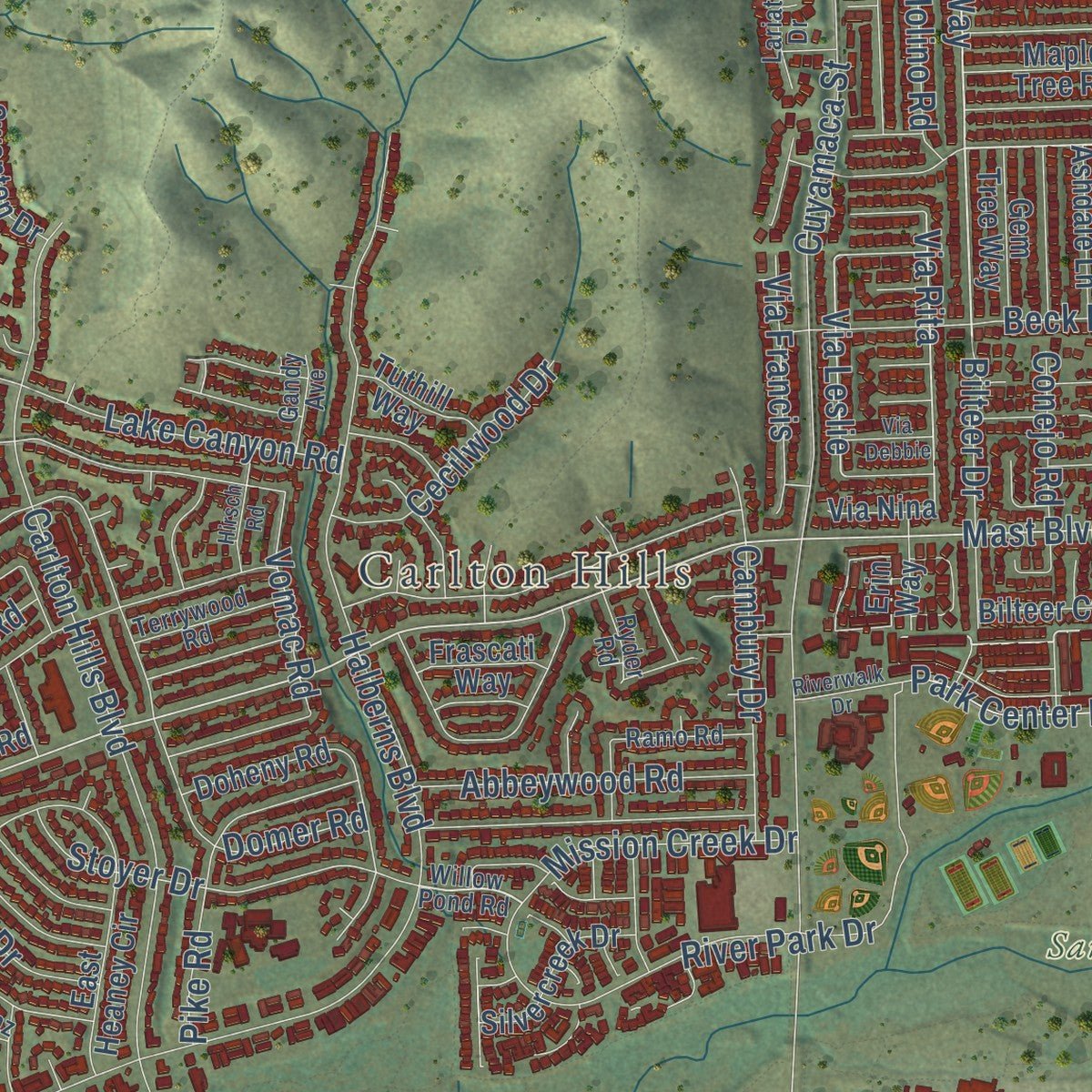
Explore Santee, California from a whole new perspective. Created using aerial imagery and detailed geographic data, this map captures Santee building by building, with labeled streets, familiar landmarks, and shaded topographical relief that highlights the natural contours of the landscape.
Combining modern data with the timeless character of a vintage atlas, this map is just as interesting up close as it is beautiful on the wall. Whether you grew up in Santee, spent memorable years there, or call it home today, this unique map is a great way to celebrate a place that means something to you. Zoom in on the preview to look for your street, and then order a print to put your memories on the wall.
Three ways to hang it
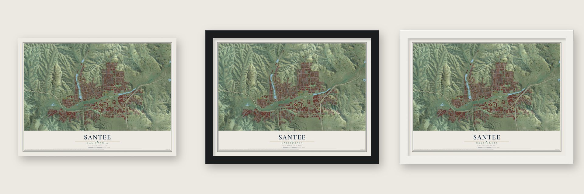
Unframed archival matte, a black wood frame or a white wood frame.
Up close
Geography Worth Displaying
This map was created using accurate cartographic data and authoritative geographic sources, including the U.S. Geological Survey and the Census Bureau. The map brings together terrain, waterways, roads, and building detail. The majority of the streets are labeled, houses are accurately depicted, and the topography is derived from government sources. Combining local data with carefully composed color and shading leads to this beautifully detailed Santee artwork for your wall.
Rather than simply showing street outlines, we’ve included as many of the street names as we could reasonably fit on the map while keeping their names legible. Zoom in on the high resolution preview to see exactly what’s on the map. We truly set out to create a statement piece for anyone who loves Santee. So whether it’s for you, or a gift for someone you love, we hope this map of Santee brings back fond memories.
Read the story behind this map of Santee, California from 2026.

Find your street
Names on the Santee map
Every name below is printed on this map. Look for your street, your school, the park where you played, or the pond down the road.
Places and landmarks3
- Santee City Hall
- Carlton Hills
- San Diego River
Streets and roads235
- El Nopal
- Timberlane Way
- Mast Boulevard
- Via Rita
- Via Leslie
- Mission Gorge Road
- Magnolia Avenue
- Prospect Avenue
- Carlton Oaks Drive
- North Cuyamaca Street
- Fanita Parkway
- Carlton Hills Boulevard
- Woodside Avenue
- Pebble Beach Drive
- Strathmore Drive
- Fanita Drive
- North Woodside Avenue
- Cottonwood Avenue
- Halberns Boulevard
- Medina Drive
- River Park Drive
- Settle Road
- Riverview Parkway
- Mesa Road
- Town Center Parkway
- Graves Avenue
- Rumson Drive
- Cuyamaca Street
- Second Street
- Lake Canyon Road
Show all 235 streets
- Ruocco Drive
- Domer Road
- Princess Joann Road
- Woodglen Vista Drive
- Buena Vista Avenue
- Park Center Drive
- Big Rock Road
- Sevilla Street
- Willowgrove Avenue
- Inverness Road
- Rancho Fanita Drive
- Railroad Avenue
- Mariposa Street
- Northcote Road
- Jeremy Street
- Stoyer Drive
- Karerllyn Drive
- Atlas View Drive
- Saint Andrews Drive
- Woodpark Drive
- Kenney Street
- Beck Drive
- Santee Lakes Boulevard
- Coronado Street
- Summit Avenue
- Simeon Drive
- Cala Lily Street
- Cambury Drive
- Len Street
- Hightail Drive
- Diamondback Drive
- Pike Road
- Trailridge Avenue
- Bushy Hill Drive
- Woodrose Avenue
- Susie Place
- Carreta Drive
- Cadwell Road
- Abbeywood Road
- Rolling Oak Road
- Braverman Drive
- Mesa Heights Road
- Highridge Road
- Mission Creek Drive
- Cecilwood Drive
- Bilteer Drive
- Maranda Drive
- Olive Lane
- Gorge Avenue
- Shantung Drive
- Wheatlands Avenue
- Via Francis
- Park Avenue
- Hillcreek Road
- Leticia Drive
- Ellsworth Lane
- Holborn Street
- Lake Hill Road
- Chaparral Drive
- Vomac Road
- Avanti Avenue
- Sunset Trail
- Conejo Road
- Chubb Lane
- Alphonse Street
- Pryor Drive
- Keith Street
- Molino Road
- Hartley Road
- Carita Road
- Triana Street
- Marrokal Lane
- Mollie Lane
- Cll Dellago
- Holden Road
- Bird Street
- Britt Place
- Slope Street
- Galston Drive
- North Magnolia Avenue North
- Canyon Park Drive
- East Heaney Circle
- Summit Crest Drive
- Ironwood Avenue
- Santana Street
- Redwood Drive
- Camden Drive
- Ramsgate Drive
- Kerrigan Street
- Valley High Road
- Ocotillo Street
- Carefree Drive
- Northview Lane
- Fanita Rancho Road
- Kaschube Way
- Claudia Avenue
- Amino Drive
- Copper Ridge Road
- Woodside Terrace
- Silvercreek Drive
- Maple Tree Road
- Mission Greens Road
- Pso Ladera
- Placid View Drive
- Greencastle Street
- Larkridge Street
- Gem Tree Way
- Ashdale Lane
- Rhone Road
- Carribean Way
- Cll del Verde
- Les Road
- Swanton Drive
- Sierra Street
- Doheny Road
- Crystal Springs Road
- Willow Terrace
- Valor Place
- Woodvale Drive
- Lafe Drive
- Tuthill Way
- Columbus Street
- Frascati Way
- Bilteer Court
- Happy Lane
- Wahl Street
- Morrella Street
- Fairlawn Street
- Mavin Drive
- Mirador Lane
- Our Way
- Hinsdale Street
- Starpine Drive
- Avis Lane
- Delia Lane
- Via Nina
- Via de Victoria
- Koonce Road
- Sima Court
- Palm Glen Drive
- Kings Trail
- Healy Street
- Erin Way
- Ian Way
- First Street
- Iris Street
- Willow Pond Road
- North Magnolia Avenue
- West Hills Parkway
- Poplin Drive
- Clifford Heights Road
- Watson Place
- Bundy Drive
- West Glendon Circle
- Oakbourne Road
- Lark Street
- Terrywood Road
- Dalehurst Road
- Ramo Road
- Crossway Court
- Isaac Street
- Ramhaven Lane
- Granite House Lane
- Mission Park Place
- Ryder Road
- Lariat Drive
- Maccool Lane
- Gandy Avenue
- Argent Street
- Goyette Place
- El Toro Lane
- Len Court
- Arnaz Way
- Praful Court
- Bend Street
- Bell Collo Lane
- Riverwalk Drive
- Waynecrest Lane
- Julio Place
- Matterhorn Drive
- Burrock Drive
- Ramsgate Way
- Dobyns Drive
- Cleary Street
- Hirsch Road
- High Rise Way
- Honey Lane
- Bell Gardens Drive
- Wild Horse Trail
- Spring Creek Drive
- Blue Boy Lane
- Via Debbie
- Oconnell Road
- Griffith Park Way
- Security Way
- Lomker Way
- Frank Lane
- Kingbird Avenue
- Pepper Drive
- Andrea Terrace
- Dove Hill Drive
- Lund Street
- Josie Jo Lane
- Louis Lane
- Tyler Street
Names are listed as they appear on the printed map. Zoom into the product photos to find them.
About Santee, California
Santee is a city of 60,037 people in San Diego County, and the San Diego River runs through its middle. The Kumeyaay people lived here first, and they built a village called Sinyeweche beside the river. In 1877 the rancher George A. Cowles bought 4,000 acres to plant vineyards. The settlement that grew up around his land was called Cowlestown, and the Cuyamaca Railroad tied it to the outside world.
Cowles died in 1887. Three years later his widow, Jennie, married Milton Santee, and she worked hard to have the town renamed for her new husband. The citizens agreed in 1893, though not happily, according to historian Harriette Wade. Santee stayed unincorporated for most of the next century. Residents turned down cityhood once, then approved it three years later, in 1980.
“Santee was a terminal for the railway and a rallying point for the surrounding country, especially since it was located near the San Diego River.”
- A Pete Dye coursePete Dye designed the 18-hole championship course at Carlton Oaks Golf Course and Lodge. In 1974 it hosted both the NCAA Western Region Finals and the NCAA Championship.
- Three Olympic TrialsA 1-km race walking loop, certified by World Athletics, runs along Riverview Parkway and Town Center Parkway. Race walkers competed there for Olympic spots in the 50k event in 2012, 2016 and 2020.
- Lakes of recycled waterPadre Dam Municipal Water District owns and runs Santee Lakes Recreation Preserve, 190 acres where people fish, camp, picnic and watch birds. Its seven lakes are filled with recycled water and kept stocked with fish all year, and the park has 300 campsites with full hookups.
- A star on Rattlesnake MountainRattlesnake Mountain, 1,198 feet high, is the highest point in Santee and the home of the Sky Ranch neighborhood. Each holiday season a large lighted star shines from its top.
Keep exploring California
Santee is one of 1,990 California towns we've mapped. Every dot on the map is a print of its own.
The search covers every state, California first.
Near Santee
Order 2 or more town maps and save 10%. Shown in the size and finish you picked above, so they hang as a set.
- Eucalyptus Hills 12" x 18" / Archival Matte Print $39.99
- Bostonia 12" x 18" / Archival Matte Print $39.99
- Winter Gardens 12" x 18" / Archival Matte Print $39.99


More maps nearby: El Cajon, Scripps Ranch, Lakeside, Navajo and Tierrasanta.
The art of mapping a place
How This Map Was Made
Real places. Remarkable detail. Discover the layers that turn geographic data into a map of home.

The view from above
Aerial imagery reveals the character of the land: woodland, open fields, and the patterns of a place.

The shape of the land
Elevation data brings hills, valleys, and subtle changes in the landscape into view.

The details of home
Roads, waterways, and building footprints come together to make the map feel unmistakably local.

Geography becomes art
Considered color, shading, and typography bring the layers together in a map made for your wall.


Process illustrated with Mendon, Massachusetts. Aerial imagery: USDA NAIP. Terrain: USGS 3D Elevation Program. Map details and finished artwork: KNOWOL.
The Details
About This Print
Choose an archival matte print, or a black or white Ayous wood frame. The archival matte print is unframed.
Select your size and finish above to see the matching product image and price.
Materials & Craftsmanship
A contemporary map with the character of a classic atlas, printed on archival matte paper. Optional frames are made from Ayous wood.
Your printed map does not include the watermark shown in the full-map preview.
Shipping & Delivery
Free shipping within the United States. Every print is made to order in the USA.
Buying a gift? Add a note in your cart and we'll include it. We never put prices in the package.
Prints ship within 2 to 3 business days. Allow 7 to 10 days total from ordering for delivery. Timing may vary during holidays or periods of high order volume.
Read our shipping policy.
Returns and damaged prints
Each print is made to order. Change-of-mind refunds are not available after production.
If your print arrives damaged, misprinted or incorrect, contact support@knowol.com within 30 days of receiving it. Include your order number, photos and a description of the issue.
Read our full refund and replacement policy. For questions about your order, email support@knowol.com.