
Search for another town




Free U.S. delivery 7 to 10 days after you order
Erwin, Tennessee Map Art
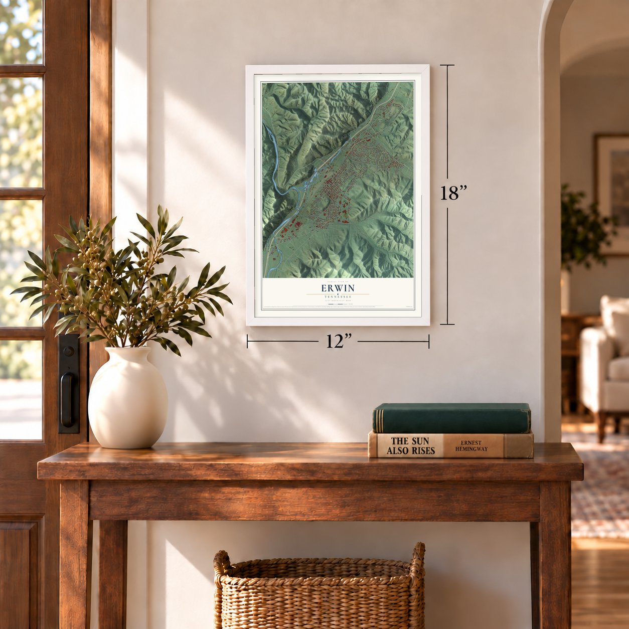
A new map of Erwin, Tennessee, made in 2026 and printed to order on thick archival matte paper.
12" x 18" Archival Matte Print
A Map of Home. A Work of Art.
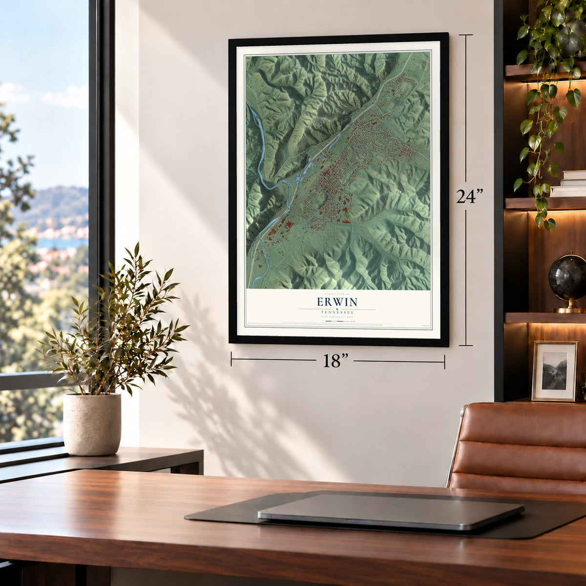
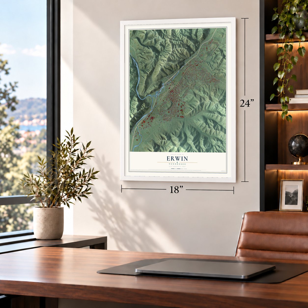
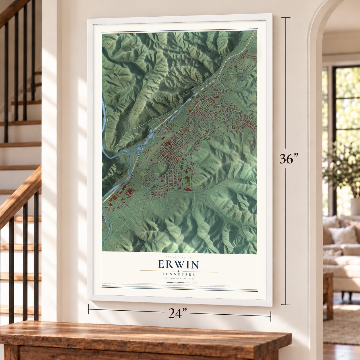
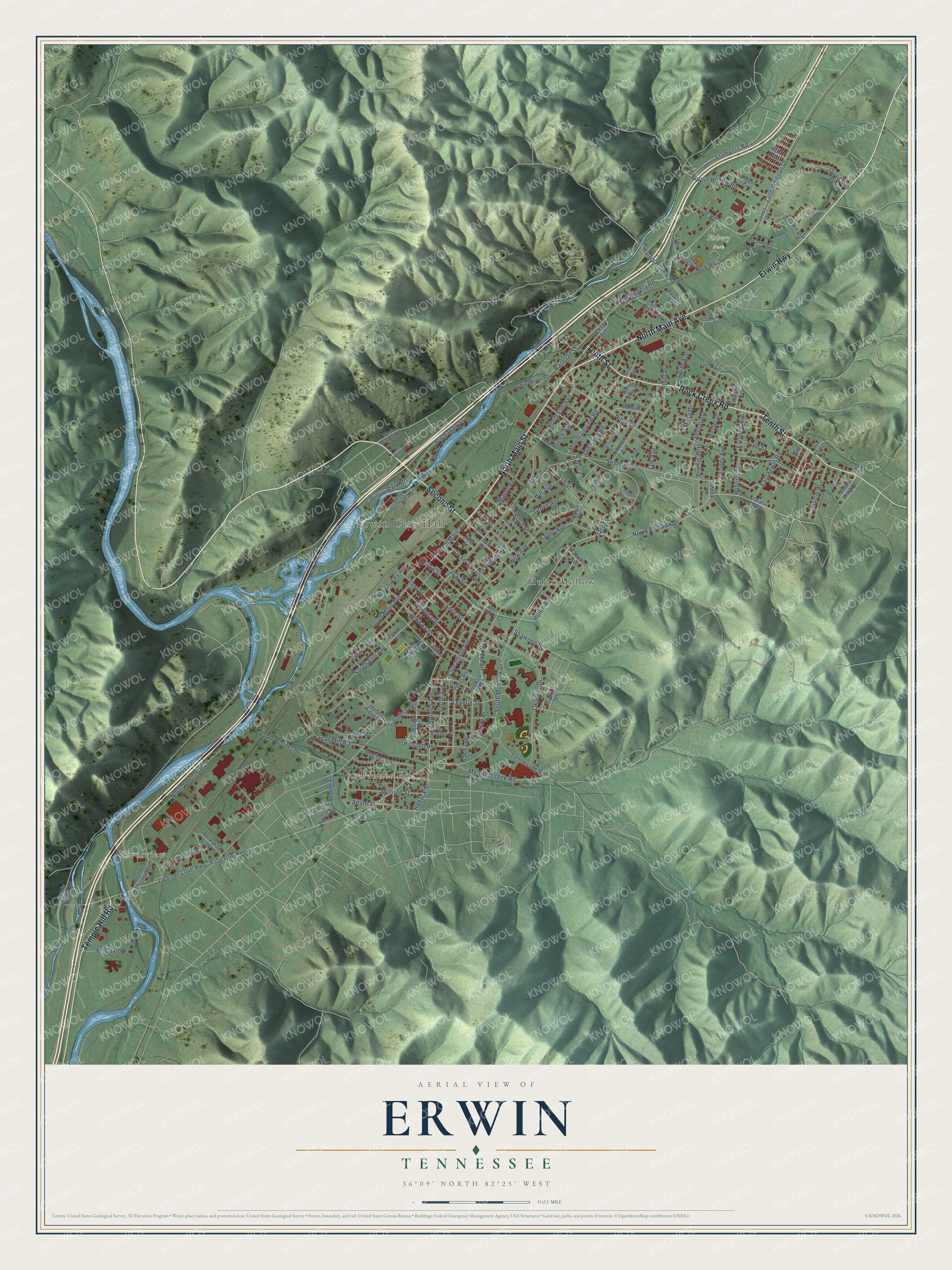
Explore Erwin, Tennessee from a whole new perspective. Created using aerial imagery and detailed geographic data, this map captures Erwin building by building, with labeled streets, familiar landmarks, and shaded topographical relief that highlights the natural contours of the landscape.
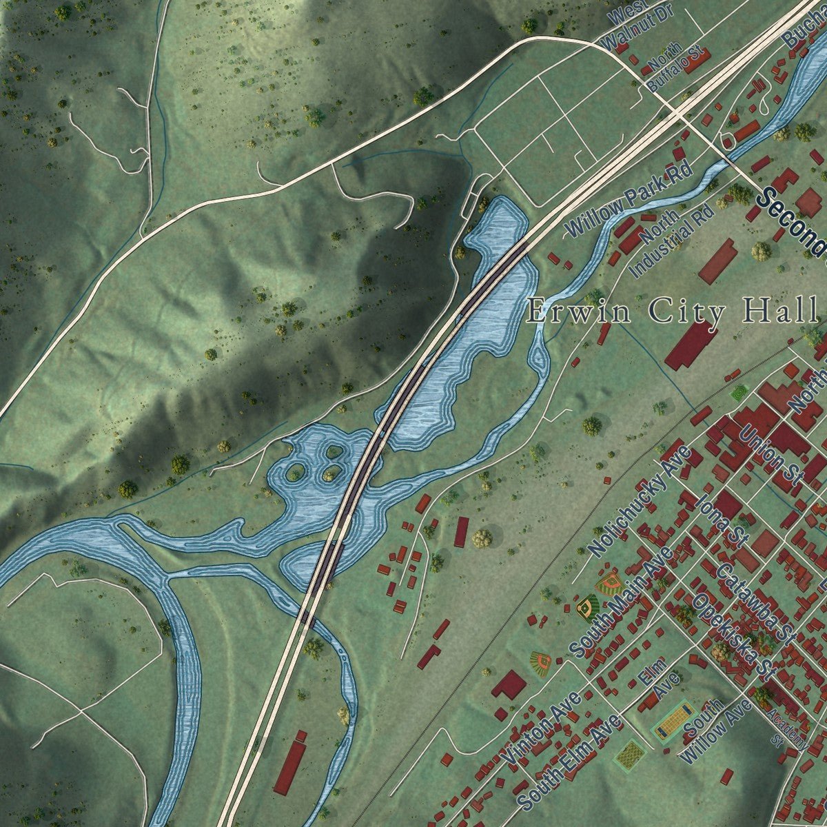
Combining modern data with the timeless character of a vintage atlas, this map is just as interesting up close as it is beautiful on the wall. Whether you grew up in Erwin, spent memorable years there, or call it home today, this unique map is a great way to celebrate a place that means something to you. Zoom in on the preview to look for your street, and then order a print to put your memories on the wall.
Three ways to hang it
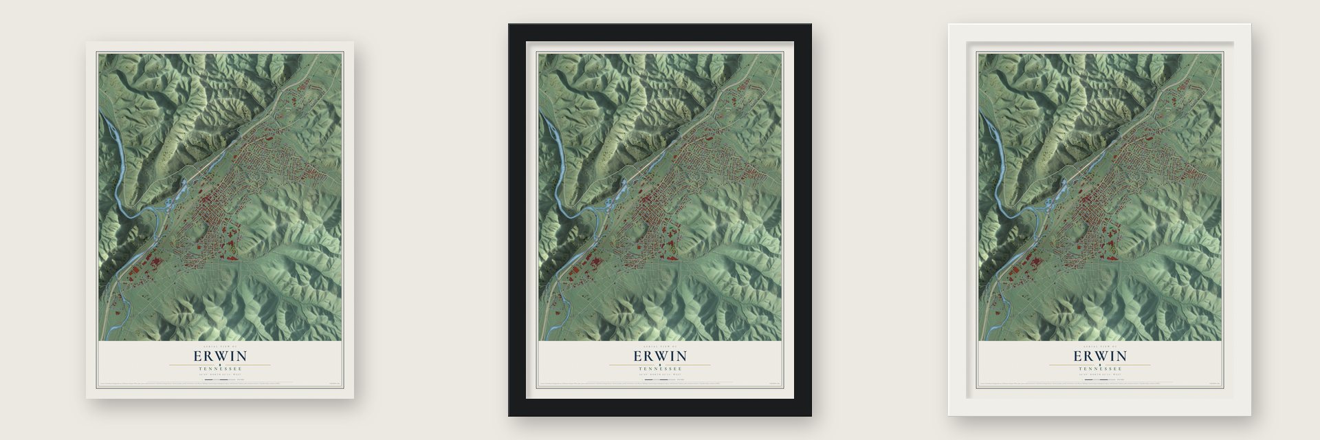
Unframed archival matte, a black wood frame or a white wood frame.
Up close
Geography Worth Displaying
This map was created using accurate cartographic data and authoritative geographic sources, including the U.S. Geological Survey and the Census Bureau. The map brings together terrain, waterways, roads, and building detail. The majority of the streets are labeled, houses are accurately depicted, and the topography is derived from government sources. Combining local data with carefully composed color and shading leads to this beautifully detailed Erwin artwork for your wall.
Rather than simply showing street outlines, we’ve included as many of the street names as we could reasonably fit on the map while keeping their names legible. Zoom in on the high resolution preview to see exactly what’s on the map. We truly set out to create a statement piece for anyone who loves Erwin. So whether it’s for you, or a gift for someone you love, we hope this map of Erwin brings back fond memories.
Read the story behind this map of Erwin, Tennessee from 2026.

About Erwin, Tennessee
Erwin is a town of 6,083 people and the county seat of Unicoi County, set in a valley where North Indian Creek meets the Nolichucky River. Its name comes from a post office error. On December 5, 1879, the town was named Ervin to honor D.J.N. Ervin, who had given 15 acres of land for the county seat, but postal officials wrote it down as Erwin, and nobody ever fixed the spelling.
Trains first came through in 1890 on the Charleston, Cincinnati and Chicago Railroad, but that company broke up before the year was out. The Ohio River and Charleston Railway bought its assets in 1893 and failed as well. The Carolina, Clinchfield and Ohio Railway finally finished its line in 1909 and made Erwin its headquarters, reached Elkhorn City, Kentucky, in 1915, and took the name Clinchfield Railroad in 1924. The rail yard kept working under CSX until October 2015, when the company shut it down and more than 300 people lost their jobs.
- Blue Ridge dishesThe railroad was the town's main employer until 1916, when Southern Potteries opened a plant on Ohio Avenue. Its workers painted dishes by hand in a pattern line called Blue Ridge, which sold across the country in the late 1930s and 1940s. The plant closed in 1957, and collectors of antique dishware still look for the pieces.
- Uranium work since 1957In 1957, just as the pottery shut down, W. R. Grace and Company's Davison Chemical Division built a plant in Erwin. Today it is Nuclear Fuel Services. The plant prepares enriched uranium to be made into reactor fuel and blends high-enriched uranium down to a low-enriched form for commercial nuclear reactors.
- Mary the elephant, 1916In 1916 Mary, an elephant with the Sparks World Famous Shows circus, killed her handler, Walter Eldridge, in Kingsport after he reportedly struck her with a hook. Towns threatened to turn the circus away, so owner Charlie Sparks chose to hang her in Erwin, home of the region's largest rail yard and a 100-ton crane car strong enough to lift the five-ton animal. About 2,500 people came to watch.
- An elephant festival since 2015Since 2015 the town has held a yearly elephant festival. Artists paint fiberglass elephants for it, and the elephants are auctioned for The Elephant Sanctuary in Hohenwald.
- Champions in 1943Erwin fielded Appalachian League baseball teams during the 1940s. The Erwin Mountaineers played in 1940. The Erwin Aces, a Chicago Cubs farm club, took the league's playoff championship in 1943, and the Erwin Cubs followed them in 1944.
Find your street
Names on the Erwin map
Every name below is printed on this map. Look for your street, your school, the park where you played, or the pond down the road.
Places and landmarks5
- Erwin City Hall
- Riverview
- Fishery Park
- Banner Hill
- Hulan Hollow
Streets and roads146
- Second Street
- North Main Street
- North Main Avenue
- Erwin Highway
- Rock Creek Road
- Tenth Street
- Temple Hill Road
- North Mohawk Drive
- Zane Whitson Drive
- Old Fishery Road
- North Elm Avenue
- Hoback Street
- Stampers Road
- South Elm Avenue
- Levelin Street
- Carolina Avenue
- Asheville Highway
- Jackson Love Highway
- North Industrial Drive
- Seventh Street
- South Mohawk Drive
- Ohio Avenue
- South Main Avenue
- Pippin Hollow Road
- Love Street
- Ninth Street
- Vinton Avenue
- New Avenue
- Gay Street
- Spring Street
Show all 146 streets
- Opekiska Street
- Galax Drive
- Okolona Drive
- Tennessee Road
- Railroad Street
- Prince Avenue
- Catawba Street
- Sinasta Drive
- Nolichucky Avenue
- Higgins Avenue
- Mountainview Road
- Boyd Street
- Martins Creek Road
- Union Street
- Clinchfield Avenue
- Ash Street
- Harris Hollow Road
- Spruce Drive
- Broyles Avenue
- Spar Mill Road
- Buchanan Street
- Toney Avenue
- Monroe Street
- Roberts Street
- Hulen Avenue
- East Erwin Road
- Valley Avenue
- North Willow Avenue
- Elliot Avenue
- Adam Street
- Maple Avenue
- Jones Road
- Hughes Lane
- Fishery Park Road
- Holly Avenue
- Yelton Avenue
- Myrtle Avenue
- Brown Road
- Willow Park Road
- South Avenue
- Holston Avenue
- Fanning Avenue
- Hill Avenue
- McDavid Lane
- Unaka Way
- Mesa Drive
- Shawnee Street
- Ford Street
- Iona Street
- Grove Avenue
- Old Farm Road
- Smith Avenue
- Quail Run
- Lyle Road
- Lee Avenue
- Staley Lane
- Third Street
- Diana Avenue
- Jackson Avenue
- West Walnut Drive
- South Willow Avenue
- Simmons Avenue
- Horton Ridge Road
- Witcher Lane
- Tucker Street
- Berkshire Drive
- North Industrial Road
- Oneega Avenue
- Banner Springs Road
- Park Street
- Watauga Avenue
- Casey Jones Road
- Unaka View Drive
- Pippin Circle
- South Industrial Drive
- Lattie Miller Road
- Witcher Street
- Balsam Drive
- Wapika Avenue
- Fender Lane
- Sandy Bottom Road
- Hemlock Street
- Obrien Avenue
- Lewis Lane
- Cedar Avenue
- Coffee Street
- First Street
- Elm Avenue
- Valley View Drive
- Norris Street
- Tipton Street
- Jones Drive
- Edney Lane
- Chestoa Pike
- North Buffalo Street
- Chestnut Avenue
- Old Stage Road
- Pine Street
- Sarah Day Road
- Robbins Avenue
- Woodland Drive
- Rex Lewis Lane
- Buckeye Avenue
- Broad Street
- Red Rock Drive
- Mc Nabb Street
- Signal Lane
- Union Way Street
- Academy Street
- Hendren Road
- Johnson Loop Road
- Federal Hatchery Road
- Lacy Street
- Clover Drive
- School Street
- White Street
Names are listed as they appear on the printed map. Zoom into the product photos to find them.
The art of mapping a place
How This Map Was Made
Real places. Remarkable detail. Discover the layers that turn geographic data into a map of home.

The view from above
Aerial imagery reveals the character of the land: woodland, open fields, and the patterns of a place.

The shape of the land
Elevation data brings hills, valleys, and subtle changes in the landscape into view.

The details of home
Roads, waterways, and building footprints come together to make the map feel unmistakably local.

Geography becomes art
Considered color, shading, and typography bring the layers together in a map made for your wall.


Process illustrated with Mendon, Massachusetts. Aerial imagery: USDA NAIP. Terrain: USGS 3D Elevation Program. Map details and finished artwork: KNOWOL.
The Details
About This Print
Choose an archival matte print, or a black or white Ayous wood frame. The archival matte print is unframed.
Select your size and finish above to see the matching product image and price.
Materials & Craftsmanship
A contemporary map with the character of a classic atlas, printed on archival matte paper. Optional frames are made from Ayous wood.
Your printed map does not include the watermark shown in the full-map preview.
Shipping & Delivery
Free shipping within the United States. Every print is made to order in the USA.
Buying a gift? Add a note in your cart and we'll include it. We never put prices in the package.
Prints ship within 2 to 3 business days. Allow 7 to 10 days total from ordering for delivery. Timing may vary during holidays or periods of high order volume.
Read our shipping policy.
Returns and damaged prints
Each print is made to order. Change-of-mind refunds are not available after production.
If your print arrives damaged, misprinted or incorrect, contact support@knowol.com within 30 days of receiving it. Include your order number, photos and a description of the issue.
Read our full refund and replacement policy. For questions about your order, email support@knowol.com.
Find your town
Looking for another city?
Find a map of home in our Tennessee collection, or any town in the country.
Nearby
Maps of towns near Erwin
Know someone from one of these towns? Their map makes a great gift.
 Banner Hill
, Tennessee
From $39.99See the map
 Embreeville
, Tennessee
From $39.99See the map
 Unicoi
, Tennessee
From $39.99See the map
More maps nearby: Telford, Jonesborough, Pine Crest, Johnson City and Central.