
Search for another town


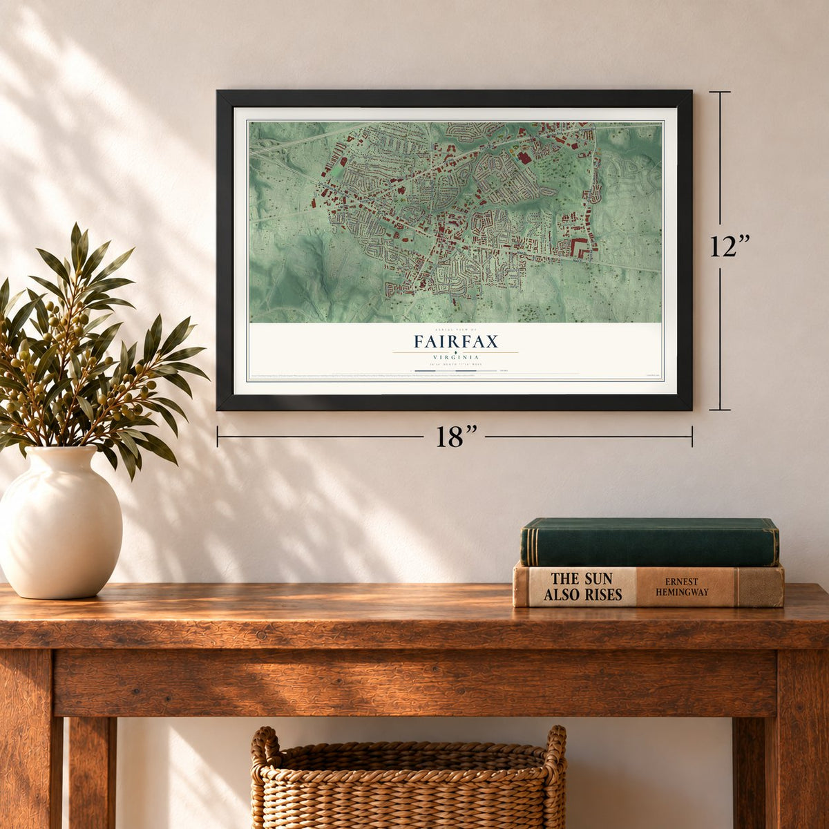
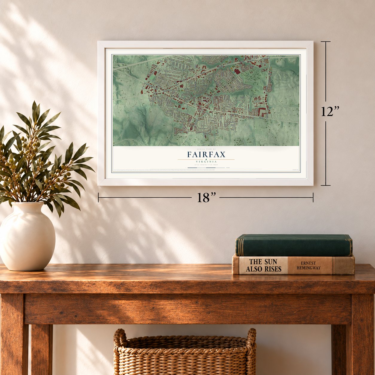
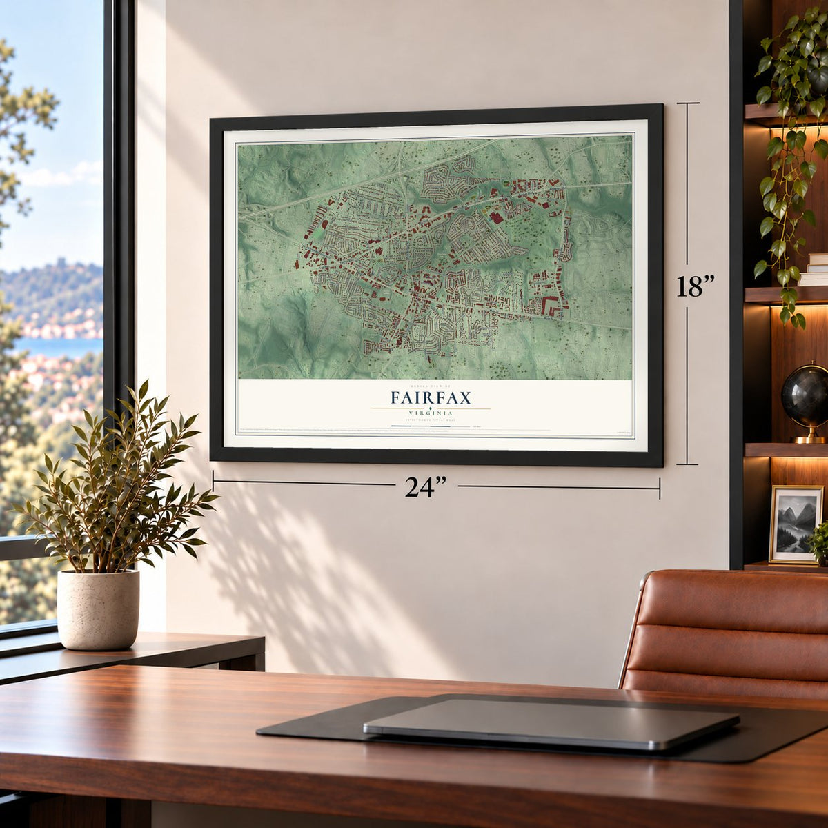
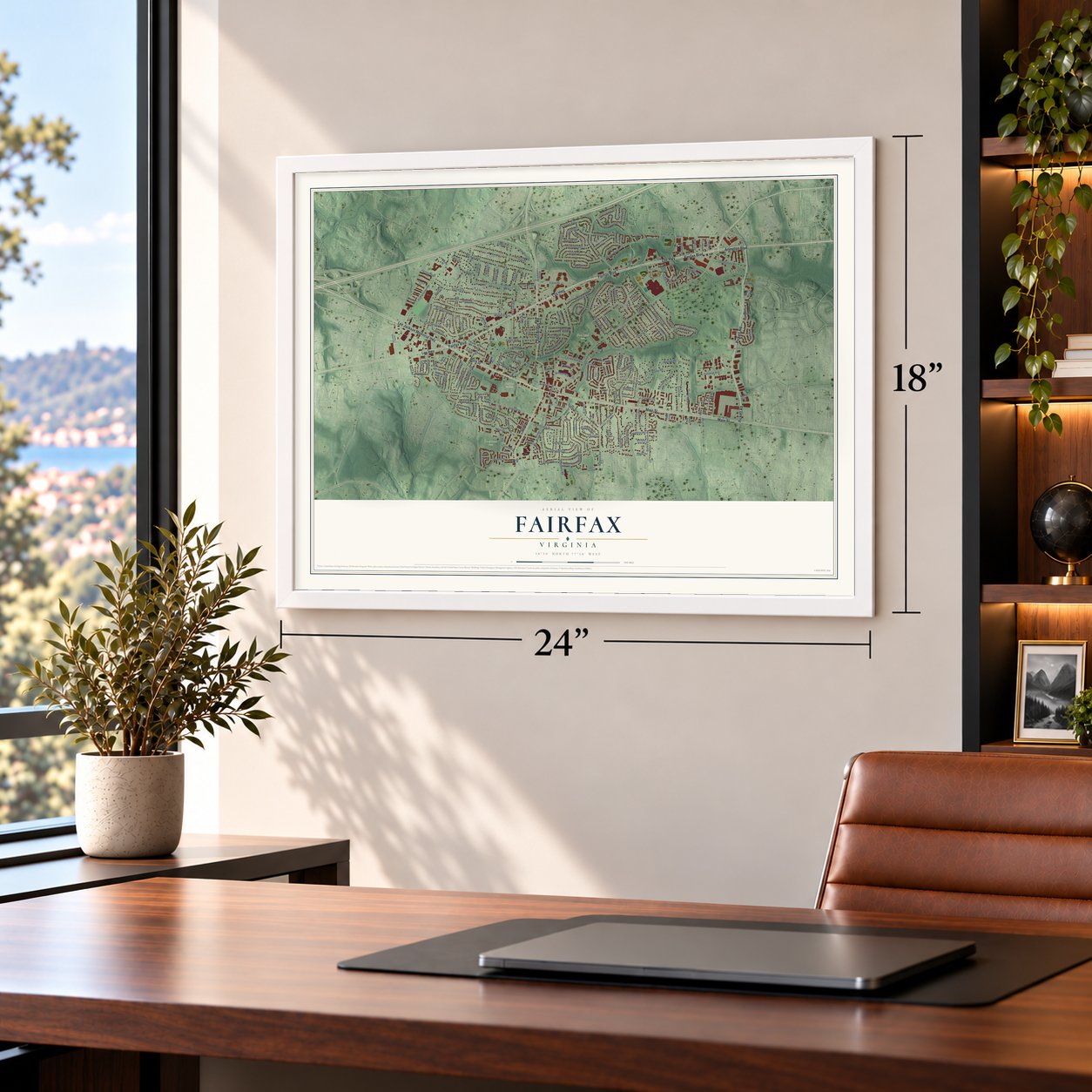


Free U.S. delivery 7 to 10 days after you order
Fairfax, Virginia Map Art
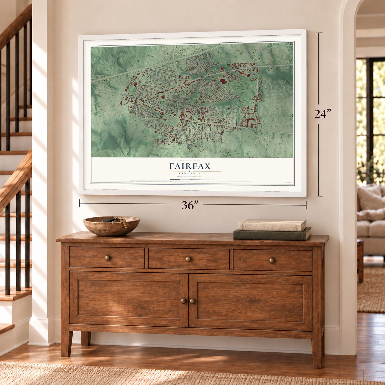
A new map of Fairfax, Virginia, made in 2026 and printed to order on thick archival matte paper.
12" x 18" Archival Matte Print
A Map of Home. A Work of Art.
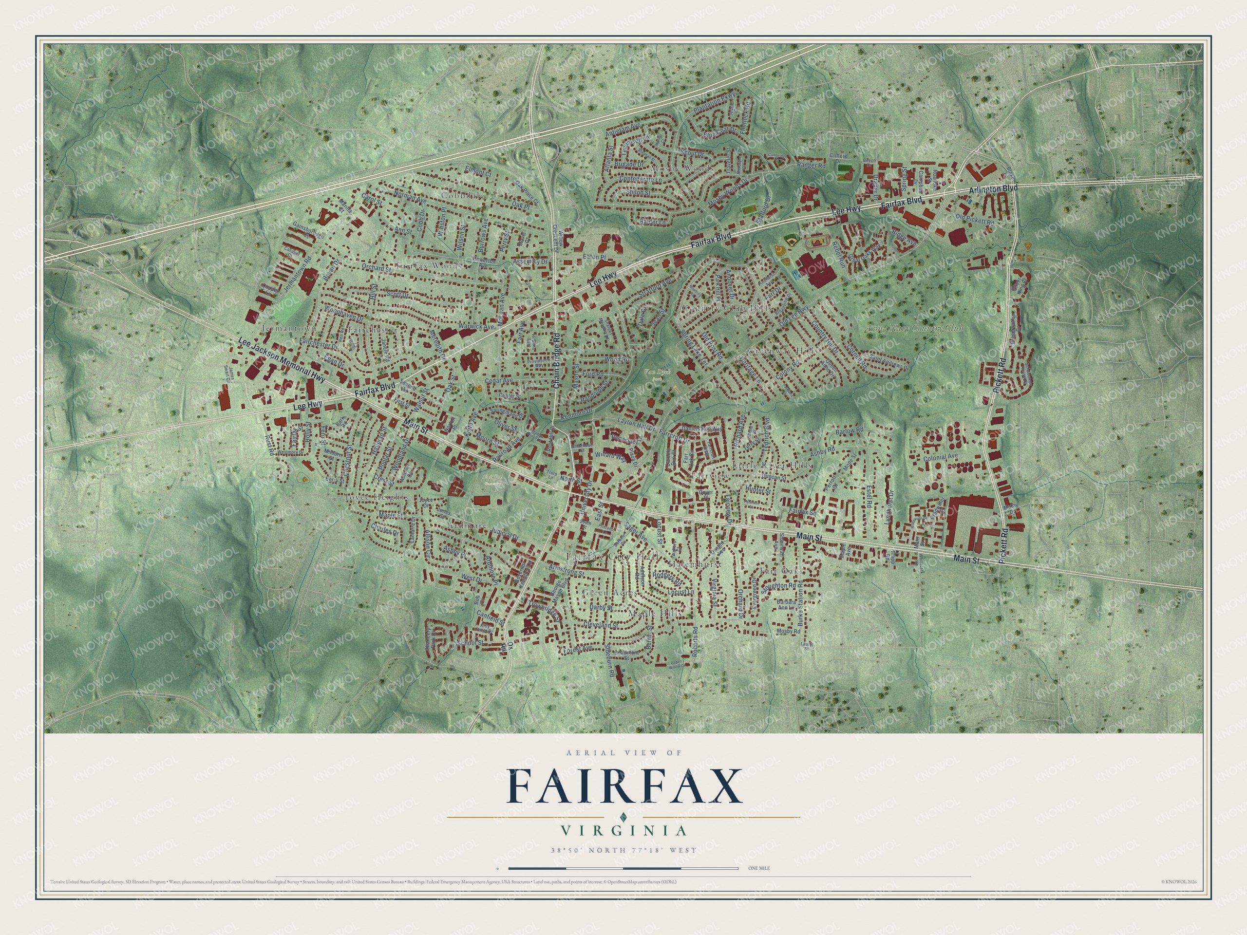
Explore Fairfax, Virginia from a whole new perspective. Created using aerial imagery and detailed geographic data, this map captures Fairfax building by building, with labeled streets, familiar landmarks, and shaded topographical relief that highlights the natural contours of the landscape.
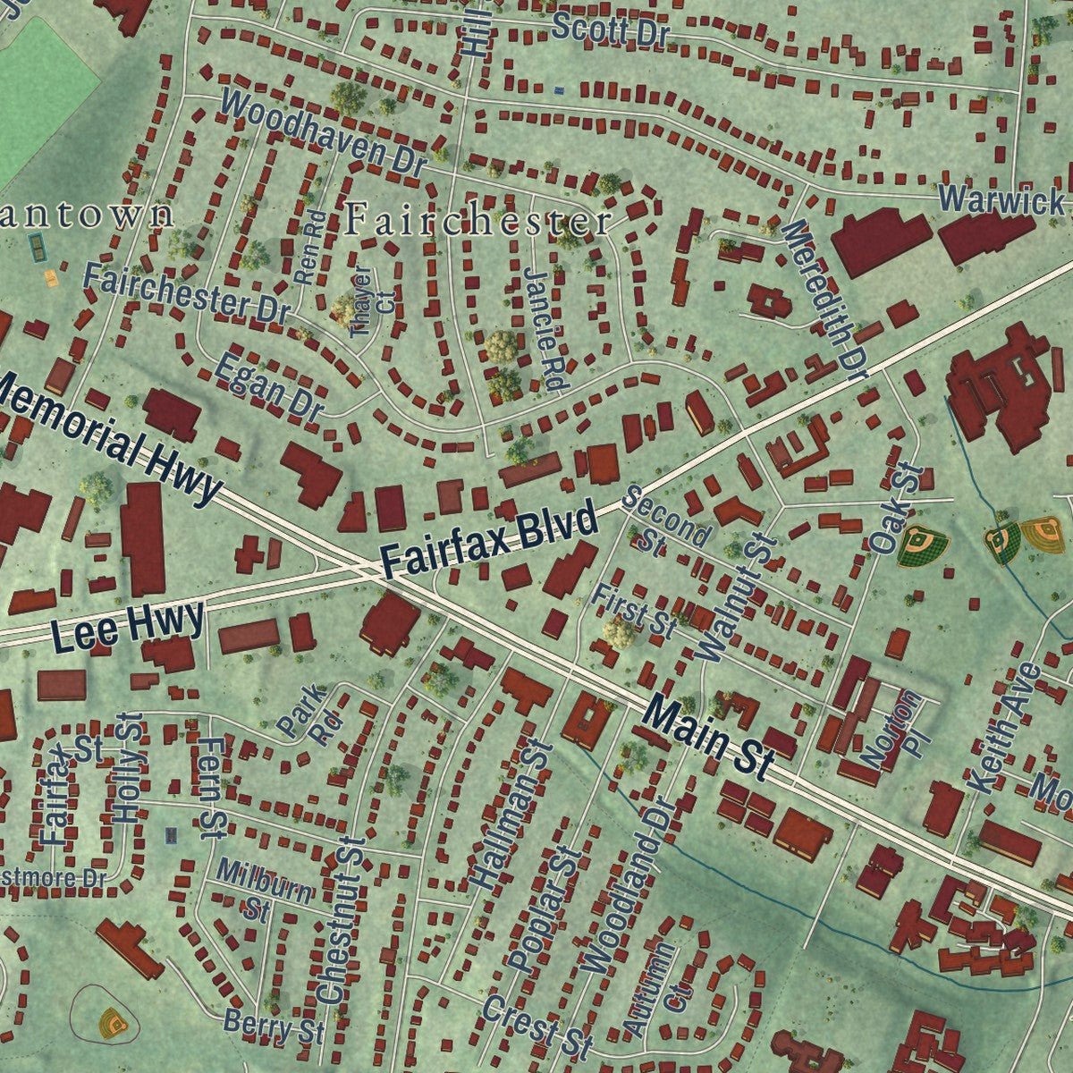
Combining modern data with the timeless character of a vintage atlas, this map is just as interesting up close as it is beautiful on the wall. Whether you grew up in Fairfax, spent memorable years there, or call it home today, this unique map is a great way to celebrate a place that means something to you. Zoom in on the preview to look for your street, and then order a print to put your memories on the wall.
Three ways to hang it
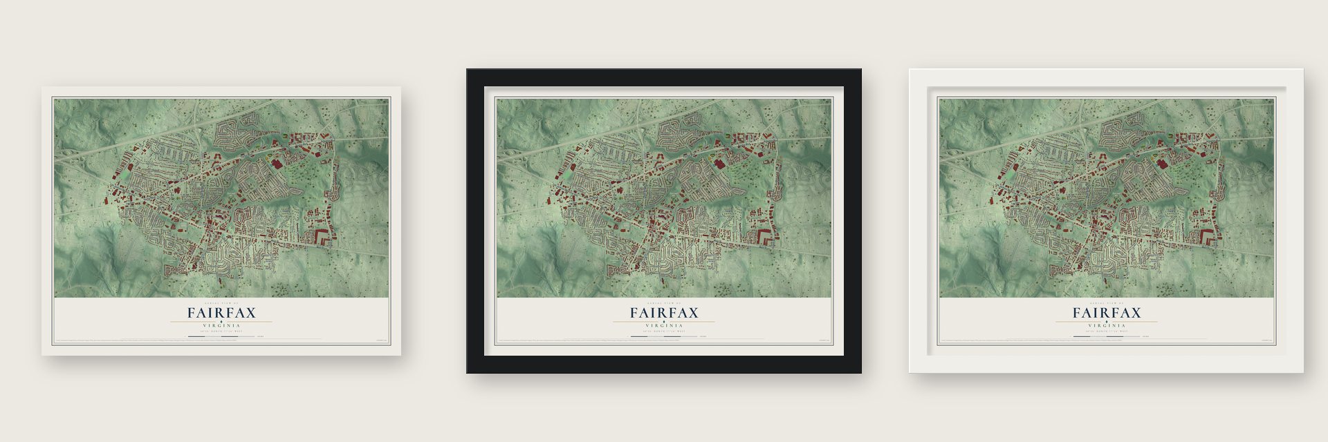
Unframed archival matte, a black wood frame or a white wood frame.
Up close
Geography Worth Displaying
This map was created using accurate cartographic data and authoritative geographic sources, including the U.S. Geological Survey and the Census Bureau. The map brings together terrain, waterways, roads, and building detail. The majority of the streets are labeled, houses are accurately depicted, and the topography is derived from government sources. Combining local data with carefully composed color and shading leads to this beautifully detailed Fairfax artwork for your wall.
Rather than simply showing street outlines, we’ve included as many of the street names as we could reasonably fit on the map while keeping their names legible. Zoom in on the high resolution preview to see exactly what’s on the map. We truly set out to create a statement piece for anyone who loves Fairfax. So whether it’s for you, or a gift for someone you love, we hope this map of Fairfax brings back fond memories.
Read the story behind this map of Fairfax, Virginia from 2026.

About Fairfax, Virginia
Fairfax is an independent city of 24,146 people, 14 miles west of Washington, D.C., and the seat of Fairfax County. The city and the county are both named for the Scottish nobleman Thomas Fairfax, 6th Lord Fairfax of Cameron, whose Northern Neck Proprietary covered more than five million acres. The county court first met near present-day Tysons in 1742 and then moved to Alexandria in 1752.
In 1790 Virginia gave up the Alexandria site for the new national capital, so the General Assembly ordered a courthouse in the middle of the county. It went up at a crossroads on land given by town founder Richard Ratcliffe, and the court first met there on April 21, 1800. The legislature created the town of Providence around it in 1805. The town was incorporated as Fairfax in 1874, and a court order made it a city in 1961, separate from the county but still its seat.
“Without losing a man or firing a shot, Mosby and his Rangers rode into and out of the garrisoned village at Fairfax Court House and captured Union Brig. General Stoughton in his bed, as well as two captains, thirty enlisted men, and fifty-eight horses.”
- Civil War at the courthouseOn June 1, 1861, a Union scouting party clashed with local militia at Fairfax Court House in the first land battle of the Civil War. Neither side won, but John Quincy Marr fell on the courthouse grounds, the first Confederate officer casualty in battle. The courthouse changed hands again and again. On June 27, 1863, Union troops lost a second fight here, and the delay it cost cavalry chief Jeb Stuart hurt Robert E. Lee at Gettysburg days later.
- A schoolhouse from 1873Fairfax Public School cost $2,750 to build in 1873 and is the oldest two-story building in the city. After its years as an elementary school it held special education, adult education and police academy training, and on July 4, 1992, it opened as the Fairfax Museum and Visitor Center.
- A town hall given in 1902Joseph Edward Willard built the town hall in 1900 and gave it to the town two years later. The Old Town Hall now holds the Huddleston Library and the Fairfax Art League. In 1904 a trolley line linked Fairfax to Washington.
- 500 vendors every OctoberOn the second Saturday in October, Old Town Fairfax holds a Fall Festival where more than 500 vendors sell arts, crafts and food to crowds of 35,000 to 45,000. The city's Independence Day parade and fireworks are the largest hometown celebration in the Washington region.
Find your street
Names on the Fairfax map
Every name below is printed on this map. Look for your street, your school, the park where you played, or the pond down the road.
Places and landmarks20
- Fairfax City Hall
- Providence Park
- Van Dyck Park
- Fairfax Cemetery
- Ardmore
- Cobbdale
- Country Club Hills
- Fair Oaks
- Fairchester
- Fairfax Woods
- Fairview
- Green Acres
Show all 20 places
- Greenway Hills
- Halemhurst
- Jermantown
- Joyce Heights
- Little River Hills
- Maple Hills
- Mosby Woods
- Army Navy Country Club
Streets and roads216
- Main Street
- Fairfax Boulevard
- Lee Highway
- Lee Jackson Memorial Highway
- Chain Bridge Road
- Pickett Road
- Arlington Boulevard
- Old Lee Highway
- Judicial Drive
- Fairfax Square
- East Street
- Roberts Road
- Oak Place
- Jermantown Road
- University Drive
- Farrcroft Drive
- Ranger Road
- Sideburn Road
- Berritt Street
- Orchard Drive
- Maple Street
- Warwick Avenue
- Orchard Street
- Spring Lake Terrace
- Plantation Parkway
- Norman Avenue
- Hill Street
- Forest Avenue
- Burrows Avenue
- Woodland Drive
Show all 216 streets
- Stratford Avenue
- Sager Avenue
- West Drive
- Fairchester Drive
- Colony Road
- Country Hill Drive
- Scott Drive
- Cornell Road
- Bevan Drive
- School Street
- Estel Road
- Tedrich Boulevard
- Burke Station Road
- Woodhaven Drive
- Cedar Avenue
- Hallman Street
- McLean Avenue
- Virginia Street
- Rebel Run
- Confederate Lane
- Shiloh Street
- Ashby Road
- Chestnut Street
- Cleveland Street
- Scout Drive
- Eaton Place
- Oak Street
- Old Post Road
- Egan Drive
- Jean Street
- Layton Hall Drive
- Darby Street
- Allison Circle
- Antietam Avenue
- Barlow Road
- Fairview Drive
- Locust Lane
- Keith Avenue
- Blue Coat Drive
- Armstrong Street
- Lyndhurst Drive
- Crest Street
- Poplar Street
- Fern Street
- Mason Street
- Colonial Avenue
- Randolph Street
- Carol Street
- Walnut Street
- Stafford Drive
- Richard Avenue
- Dale Drive
- Oliver Street
- Raider Lane
- Ashby Place
- Mosby Woods Drive
- Andover Drive
- Wood Road
- Old Pickett Road
- Ann Street
- Heritage Lane
- Cobb Drive
- Rust Road
- Atlanta Street
- Ford Road
- North Street
- Trowbridge Street
- Wilson Street
- Brigade Drive
- Tecumseh Lane
- Draper Drive
- Charles Drive
- Perry Street
- Railroad Avenue
- Willard Way
- Assembly Drive
- Stoughton Road
- Farr Avenue
- Kenmore Drive
- Moore Street
- Meredith Drive
- Rodgers Road
- Spring Street
- Ardmore Place
- Locust Street
- Fairfax Street
- Canfield Street
- Flintlock Road
- Ridge Avenue
- Winston Place
- Holly Street
- Elmont Court
- Farr Drive
- Hunter Street
- Ox Road
- Blake Lane
- Jones Street
- Howerton Avenue
- Trapp Road
- George Mason Boulevard
- Duncan Street
- Queen Anne Drive
- Addison Road
- Gainsborough Court
- Bradwater Street
- Park Road
- Great Oaks Way
- Democracy Lane
- Saint Andrews Drive
- Lamarre Drive
- Chancery Park Drive
- Mode Street
- Daniels Run Way
- Farr Oak Circle
- Park Hill Place
- Stonewall Avenue
- Silver King Court
- Second Street
- Springmann Drive
- Center Street
- First Street
- Evergreen Drive
- Dwight Avenue
- Norton Place
- Beaumont Street
- Mosby Road
- Willow Crescent Drive
- Jancie Road
- Oak Place Court
- Preservation Drive
- Cover Place
- Milburn Street
- Berry Street
- Terry Street
- Copper Lane
- Daniels Run Court
- Governor Yeardley Lane
- Campbell Drive
- Plaza Drive
- Rust Hill Place
- Traveler Street
- Roanoke Street
- Perrott Court
- Joyce Drive
- Barbara Ann Lane
- Clifford Drive
- Maple Avenue
- Autumn Court
- Marilta Court
- Mavis Court
- Mathy Drive
- Bob Court
- Whitacre Road
- Laurel Street
- Pinehurst Avenue
- Providence Way
- Schuerman House Drive
- James Swart Circle
- Kitty Pozer Drive
- Barbour Drive
- Westmore Drive
- Ren Road
- Broadview Drive
- Sharpes Meadow Lane
- Cavalier Court
- Truro Lane
- Whitehead Street
- Walters Court
- Jessie Court
- Howsen Avenue
- Farrcroft Green
- Thayer Court
- Anne Place
- Armory Court
- South Street
- Beech Drive
- Aspen Willow Drive
- Wilcoxson Drive
- Parklane Road
- Sherman Street
- Cambridge Court
- Newbury Road
- Meadow Bridge Lane
- Princeton Lane
- Peterson Street
- Musket Court
Names are listed as they appear on the printed map. Zoom into the product photos to find them.
The art of mapping a place
How This Map Was Made
Real places. Remarkable detail. Discover the layers that turn geographic data into a map of home.

The view from above
Aerial imagery reveals the character of the land: woodland, open fields, and the patterns of a place.

The shape of the land
Elevation data brings hills, valleys, and subtle changes in the landscape into view.

The details of home
Roads, waterways, and building footprints come together to make the map feel unmistakably local.

Geography becomes art
Considered color, shading, and typography bring the layers together in a map made for your wall.


Process illustrated with Mendon, Massachusetts. Aerial imagery: USDA NAIP. Terrain: USGS 3D Elevation Program. Map details and finished artwork: KNOWOL.
The Details
About This Print
Choose an archival matte print, or a black or white Ayous wood frame. The archival matte print is unframed.
Select your size and finish above to see the matching product image and price.
Materials & Craftsmanship
A contemporary map with the character of a classic atlas, printed on archival matte paper. Optional frames are made from Ayous wood.
Your printed map does not include the watermark shown in the full-map preview.
Shipping & Delivery
Free shipping within the United States. Every print is made to order in the USA.
Buying a gift? Add a note in your cart and we'll include it. We never put prices in the package.
Prints ship within 2 to 3 business days. Allow 7 to 10 days total from ordering for delivery. Timing may vary during holidays or periods of high order volume.
Read our shipping policy.
Returns and damaged prints
Each print is made to order. Change-of-mind refunds are not available after production.
If your print arrives damaged, misprinted or incorrect, contact support@knowol.com within 30 days of receiving it. Include your order number, photos and a description of the issue.
Read our full refund and replacement policy. For questions about your order, email support@knowol.com.
Find your town
Looking for another city?
Find a map of home in our Virginia collection, or any town in the country.
Nearby
Maps of towns near Fairfax
Know someone from one of these towns? Their map makes a great gift.
 George Mason
, Virginia
From $39.99See the map
 Mantua
, Virginia
From $39.99See the map
 Long Branch
, Virginia
From $39.99See the map
More maps nearby: Kings Park West, Oakton, Merrifield, Fair Oaks and Braddock.