


Search for another town





Free U.S. delivery 7 to 10 days after you order
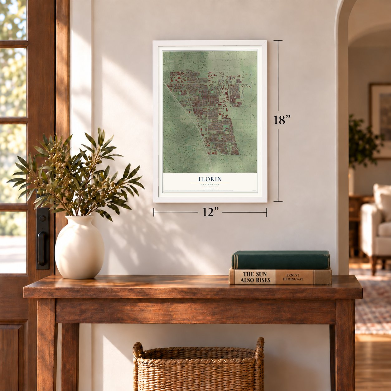
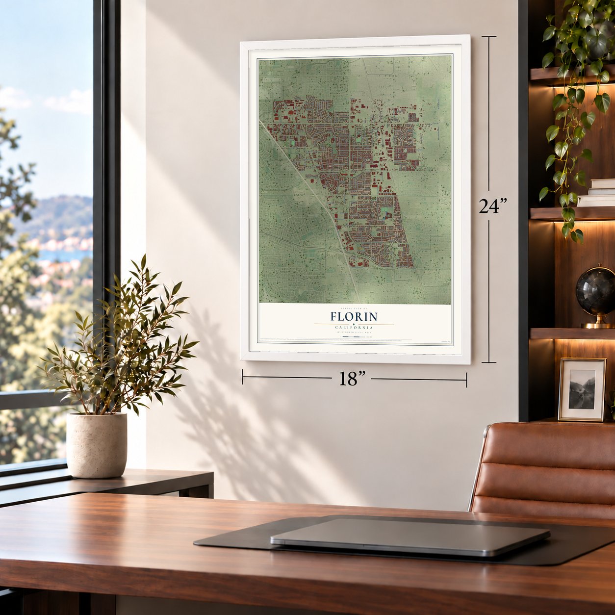
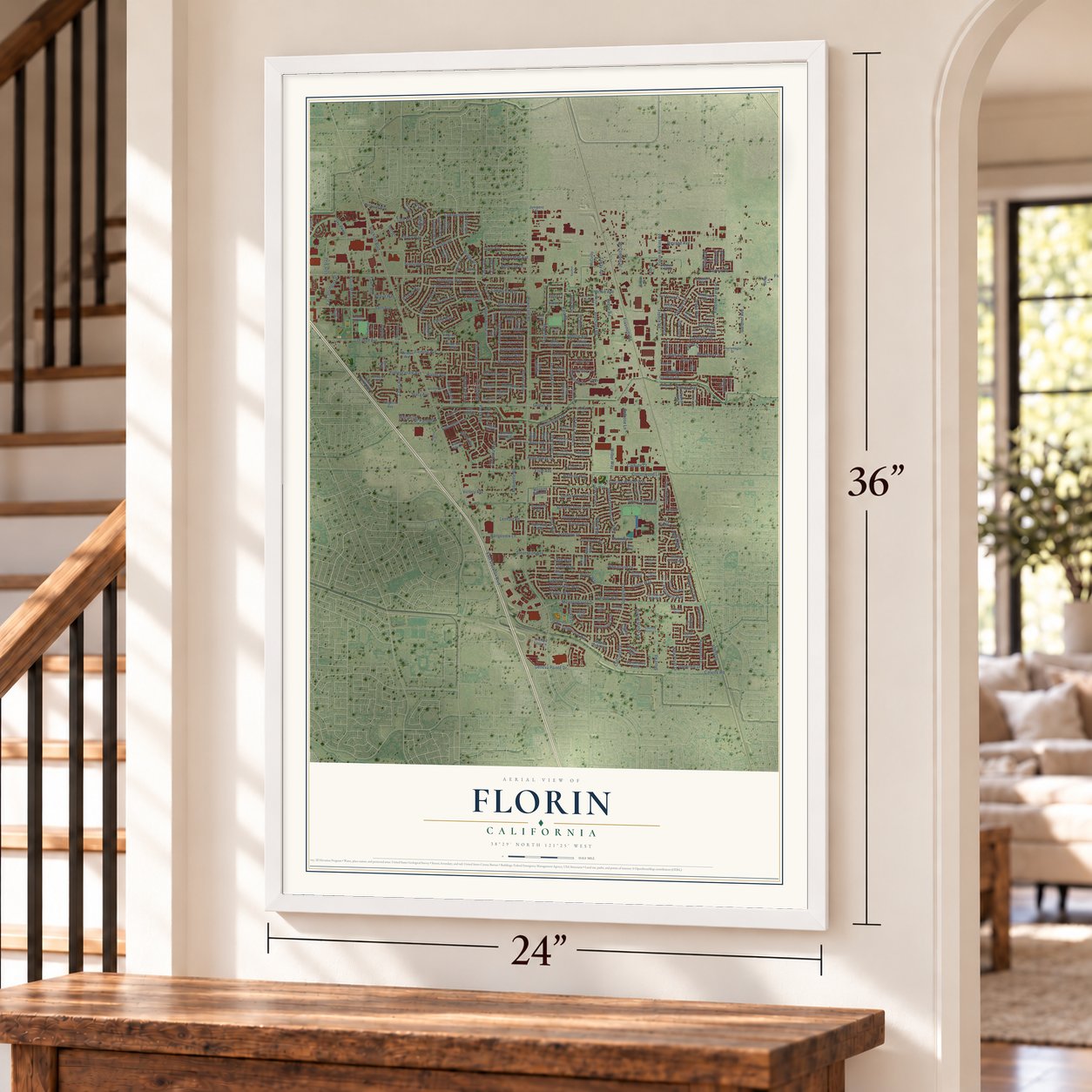
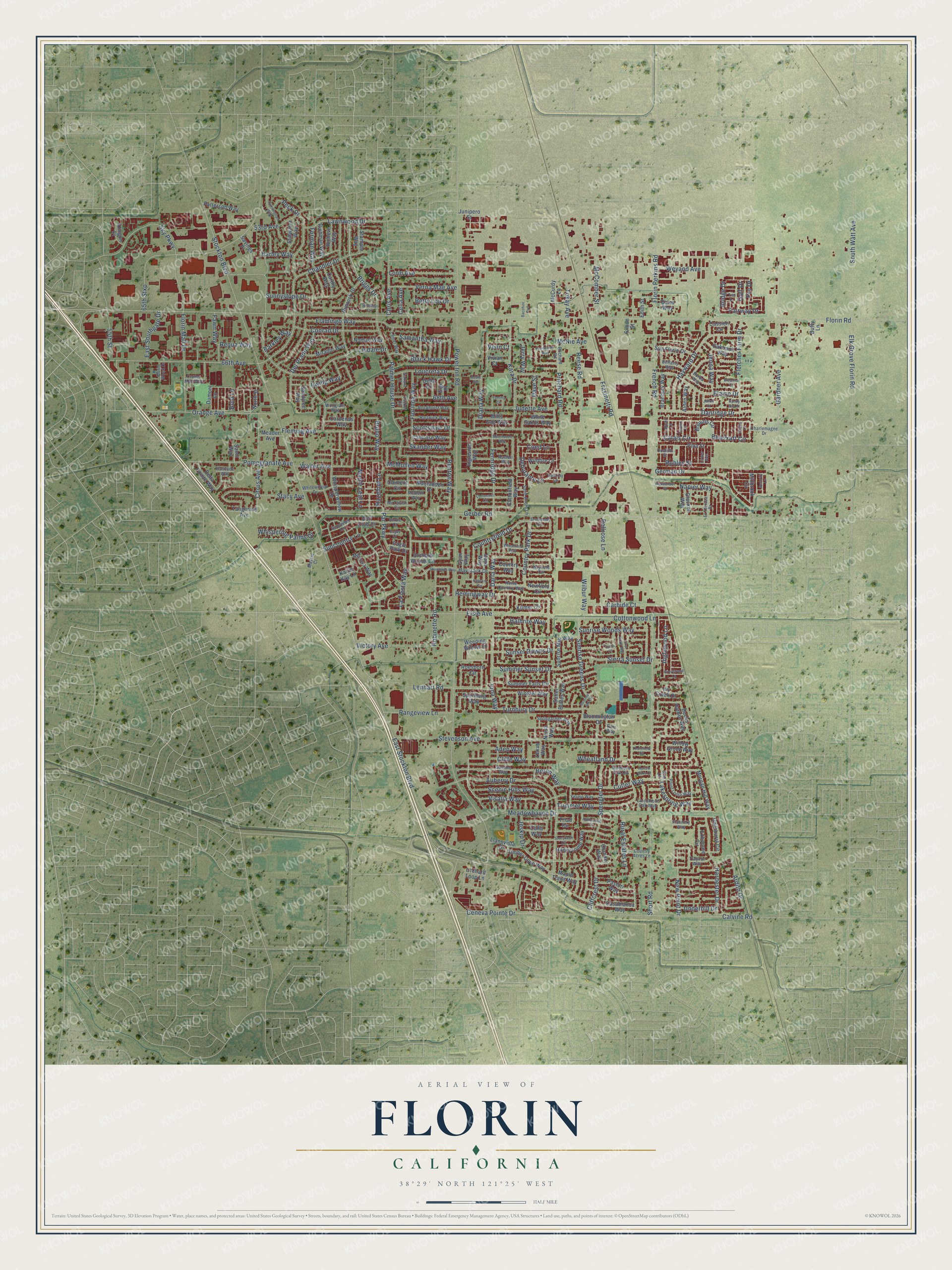
Florin, California Map Art
Building by building, with labeled streets and shaded relief.
12" x 18" Archival Matte Print
A Map of Home. A Work of Art.
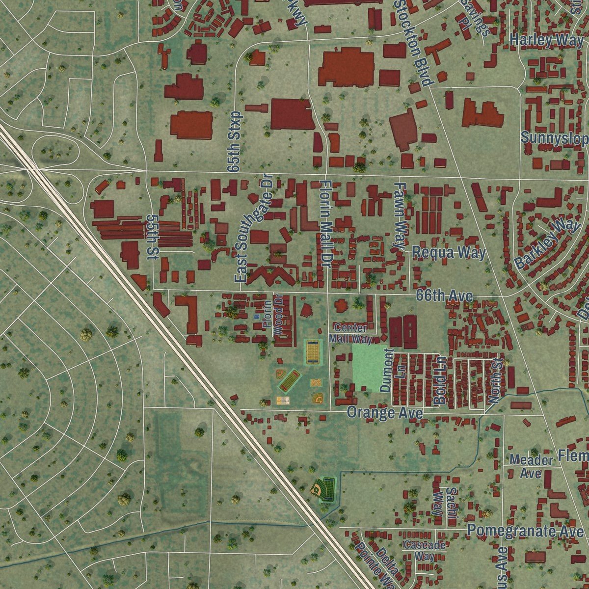
Explore Florin, California from a whole new perspective. Created using aerial imagery and detailed geographic data, this map captures Florin building by building, with labeled streets, familiar landmarks, and shaded topographical relief that highlights the natural contours of the landscape.
Combining modern data with the timeless character of a vintage atlas, this map is just as interesting up close as it is beautiful on the wall. Whether you grew up in Florin, spent memorable years there, or call it home today, this unique map is a great way to celebrate a place that means something to you. Zoom in on the preview to look for your street, and then order a print to put your memories on the wall.
Three ways to hang it
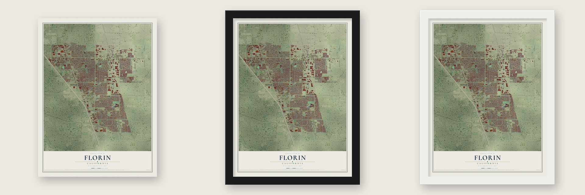
Unframed archival matte, a black wood frame or a white wood frame.
Up close
Geography Worth Displaying
This map was created using accurate cartographic data and authoritative geographic sources, including the U.S. Geological Survey and the Census Bureau. The map brings together terrain, waterways, roads, and building detail. The majority of the streets are labeled, houses are accurately depicted, and the topography is derived from government sources. Combining local data with carefully composed color and shading leads to this beautifully detailed Florin artwork for your wall.
Rather than simply showing street outlines, we’ve included as many of the street names as we could reasonably fit on the map while keeping their names legible. Zoom in on the high resolution preview to see exactly what’s on the map. We truly set out to create a statement piece for anyone who loves Florin. So whether it’s for you, or a gift for someone you love, we hope this map of Florin brings back fond memories.
Read the story behind this map of Florin, California from 2026.

Find your street
Names on the Florin map
Every name below is printed on this map. Look for your street, your school, the park where you played, or the pond down the road.
Streets and roads287
- Spengler Drive
- Visalia Way
- Briggs Drive
- Countryfield Drive
- Maple Leaf Lane
- Hazelnut Lane
- Florin Road
- Power Inn Road
- Stockton Boulevard
- Gerber Road
- Calvine Road
- Elsie Avenue
- Stevenson Avenue
- Lindale Drive
- Gardner Avenue
- Auberry Drive
- Palmer House Drive
- Cottonwood Lane
- Elk Grove Florin Road
- Reese Road
- French Road
- 65th Stxp
- Chandler Drive
- Flamingo Way
- Scottsdale Drive
- Florin Mall Drive
- 66th Avenue
- Pritchard Road
- Suncountry Lane
- East Stockton Boulevard
Show all 287 streets
- McComber Street
- Orange Avenue
- Cutler Way
- Skander Way
- Hayward Drive
- Stacy Avenue
- Kara Drive
- Lenhart Road
- Hemingway Drive
- Diana Way
- Peck Drive
- Wilbur Way
- Bruno Way
- Calais Circle
- Renton Way
- Pomegranate Avenue
- Hardester Drive
- Iona Way
- Frasinetti Road
- Florin Perkins Road
- Short Road
- South Watt Avenue
- Citrus Avenue
- Sunrise Woods Way
- Sky Parkway
- Fleming Avenue
- Judette Avenue
- Trimmer Way
- Fletcher Farm Drive
- Ardith Drive
- Walter Avenue
- Turnbury Drive
- Beauxart Circle
- Elaine Drive
- Debutante Lane
- Summer Sunset Drive
- Conrad Drive
- Fernridge Drive
- Danridge Drive
- Cliffe Way
- Lawnwood Drive
- Scenic Hills Way
- Sunrise Greens Drive
- Sunnyslope Drive
- Robinette Road
- Victory Avenue
- New Point Drive
- Samantha Way
- Florinda Way
- German Drive
- Meadowhaven Drive
- Country Park Drive
- Sierra Sunset Drive
- Forman Way
- Inskip Drive
- Black Hawk Drive
- Rangeview Lane
- Lorin Avenue
- Verna Mae Avenue
- Wheatland Drive
- Darla Way
- Geneva Pointe Drive
- Sunset Downs Drive
- Halbrite Way
- Loucreta Drive
- Chris Avenue
- 53rd Avenue
- Rural Estates Lane
- Whispering Palms Drive
- Weyand Avenue
- Cliffcrest Drive
- McMullen Way
- La Fiesta Way
- Inglewood Lane
- Carbide Court
- Del Prado Way
- East Southgate Drive
- Fawn Way
- 55th Street
- Robles Street
- Napier Way
- Ewing Way
- Harley Way
- Tokay Avenue
- Lakespring Way
- Jenna Way
- 68th Avenue
- Coed Lane
- Jerry Way
- Betty Lou Drive
- Fairway Drive
- Underhill Drive
- Bellrose Lane
- Par Parkway
- Bold Lane
- Barkley Way
- McNie Avenue
- Dave Street
- Requa Way
- Aden Way
- Golf Drive
- Boron Way
- Pro Drive
- Bridge Drive
- Celia Avenue
- Venn Court
- Orchard Woods Circle
- Casablanca Way
- Pastori Way
- North Street
- Millbrook Circle
- Mimosa Way
- Willow Grove Way
- Whisperwillow Drive
- Bucks Harbor Way
- Rimrock Drive
- Summer Falls Circle
- Morgan Hill Way
- Ingleside Way
- Sutter Buttes Way
- Newfield Circle
- Roesboro Circle
- Calla Way
- Sandylee Way
- Honeycomb Way
- Orchard Loop Lane
- Timber Cove Way
- Bouvais Circle
- Delta Pointe Way
- Gwinhurst Circle
- White Sands Way
- Speilberg Way
- Clement Circle
- Sunrise Mist Way
- Pina Street
- Dumont Lane
- Mills Gap Way
- Macfadden Drive
- Cottonfield Way
- Winkler Way
- Exbourne Circle
- Mirador Way
- Kilmer Circle
- Triad Circle
- Kallie Kay Lane
- Sun Florin Drive
- Della Circle
- Weeping Willow Lane
- Cassieri Circle
- Nomad Way
- Camrose Way
- Wildfire Lane
- Olander Way
- Oakbank Way
- Stillwater Way
- Branbury Way
- Haystack Drive
- Patterson Way
- Llanovista Drive
- Maple Trails Way
- Richman Way
- Carthy Way
- Bloomington Drive
- Stamper Way
- Country Way
- Richeve Way
- Golf Club Court
- Glacken Way
- Cardenas Way
- Alden Way
- Tangerine Avenue
- Ivy Creek Drive
- Daya Way
- Klingon Court
- Meader Avenue
- Sachi Way
- Eagle Park Drive
- Junipero Street
- McCurdy Lane
- Savings Place
- Vivian Court
- Gyan Way
- Edith Street
- Neisa Way
- Baier Way
- Lexus Way
- Buffy Lane
- Simon Street
- Gigi Place
- Gustine Way
- Prichard Road
- Yermo Way
- Hayfield Circle
- Rockhurst Way
- McTavish Circle
- Springarden Way
- Northern Oak Circle
- Point Loma Way
- Borba Way
- Saint Andre Lane
- Flannery Way
- Bellamy Way
- Austell Way
- Hartwick Way
- Center Mall Way
- Larchmont Oak Way
- Country Acres Lane
- Wolfgram Way
- Home Country Way
- Pickoi Circle
- Whitewillow Drive
- El Terraza Drive
- Charlemagne Drive
- Lamer Way
- Destiny Lane
- Massie Court
- Traynor Way
- Sunsweet Lane
- Lancer Lane
- Florin Wood Drive
- McBeth Way
- Cascade Way
- Ocatillo Street
- Dara Way
- Birdie Court
- Lirios Avenue
- Sakura Court
- Simi Court
- Alpinmead Circle
- Cottonmill Circle
- Kalwani Circle
- Moorhaven Way
- Cunningham Way
- Florintown Way
- Southfields Circle
- Security Lane
- Stonybeck Circle
- Steelman Circle
- Grovewood Lane
- Skywoods Way
- Summer Sky Drive
- First Draw Way
- Tommy Circle
- Wheatfield Way
- Pardis Lane
- Aleksander Court
- Thornfield Drive
- Bogey Court
- Bacchini Avenue
- Toulon Lane
- Breanna Court
- Hollow Oaks Court
- Janon Court
- Sandy Bay Court
- Tee Drive
- Addie Avenue
- Turbo Court
Names are listed as they appear on the printed map. Zoom into the product photos to find them.
About Florin, California
Florin is a census-designated place of 52,388 people in Sacramento County, within the Sacramento metropolitan area. It grew up as a small railroad town on the Central Pacific line, and in the 1860s it took its name from the many wild flowers that grew around it. During the 1870s the town gained a train station, a post office, a general store and a school, and a 1913 county history placed it about eight miles from Sacramento, on the line between Brighton and San Joaquin townships.
In the early 20th century Florin lived on farming, and strawberries were its most common crop. Japanese immigrants became the largest group in town and did most of the farming, so Florin grew known as a Japanese immigrant community. By the time the United States went to war with Japan, about 2,500 residents were Nikkei, a majority of the town.
“everyone was given short notice for removal. Signs had been nailed to the telephone poles saying that we had to report to various spots.”
- Barren land made to growJohn P. Irish, who led the California Delta Association, reported to Governor William Stephens that Californians had watched Japanese farmers turn barren ground at Florin and Livingston into productive fields, orchards and vineyards. Not everyone welcomed them. Responding to the Gentlemen's Agreement of 1907 between the United States and Japan, the Sacramento Bee attacked the Japanese families who were raising children in Florin.
- Family number 2076After Pearl Harbor, Executive Order 9066 sent Florin's Japanese and Japanese American residents to internment camps. Teacher Mary Tsukamoto recalled reporting with her family to the Elk Grove Masonic Building, where they received No. 2076. From a railroad station nearby, residents rode rail cars to distribution hubs and were then sent to camps far from the coast.
- A town that never returnedFamilies had only a few days to sell their property, often for far less than it was worth. When the camps released them, some came back to Florin and started over, but most had to settle elsewhere. Florin was never again the Japanese American community it had been before the war.
- Nearly doubled since 2000The census counted 27,653 people in Florin in 2000 and 47,513 in 2010. By 2020 the count had reached 52,388.
Keep exploring California
Florin is one of 1,990 California towns we've mapped. Every dot on the map is a print of its own.
The search covers every state, California first.
Near Florin
Order 2 or more town maps and save 10%. Shown in the size and finish you picked above, so they hang as a set.
- Parkway 12" x 18" / Archival Matte Print $39.99
- Lemon Hill 12" x 18" / Archival Matte Print $39.99
- Vineyard 12" x 18" / Archival Matte Print $39.99


More maps nearby: Fruitridge Pocket, Elk Grove, Rosemont, Freeport and La Riviera.
The art of mapping a place
How This Map Was Made
Real places. Remarkable detail. Discover the layers that turn geographic data into a map of home.

The view from above
Aerial imagery reveals the character of the land: woodland, open fields, and the patterns of a place.

The shape of the land
Elevation data brings hills, valleys, and subtle changes in the landscape into view.

The details of home
Roads, waterways, and building footprints come together to make the map feel unmistakably local.

Geography becomes art
Considered color, shading, and typography bring the layers together in a map made for your wall.


Process illustrated with Mendon, Massachusetts. Aerial imagery: USDA NAIP. Terrain: USGS 3D Elevation Program. Map details and finished artwork: KNOWOL.
The Details
About This Print
Choose an archival matte print, or a black or white Ayous wood frame. The archival matte print is unframed.
Select your size and finish above to see the matching product image and price.
Materials & Craftsmanship
A contemporary map with the character of a classic atlas, printed on archival matte paper. Optional frames are made from Ayous wood.
Your printed map does not include the watermark shown in the full-map preview.
Shipping & Delivery
Free shipping within the United States. Every print is made to order in the USA.
Buying a gift? Add a note in your cart and we'll include it. We never put prices in the package.
Prints ship within 2 to 3 business days. Allow 7 to 10 days total from ordering for delivery. Timing may vary during holidays or periods of high order volume.
Read our shipping policy.
Returns and damaged prints
Each print is made to order. Change-of-mind refunds are not available after production.
If your print arrives damaged, misprinted or incorrect, contact support@knowol.com within 30 days of receiving it. Include your order number, photos and a description of the issue.
Read our full refund and replacement policy. For questions about your order, email support@knowol.com.