


Search for another town





Free U.S. delivery 7 to 10 days after you order
Vineyard, California Map Art
Building by building, with labeled streets and shaded relief.
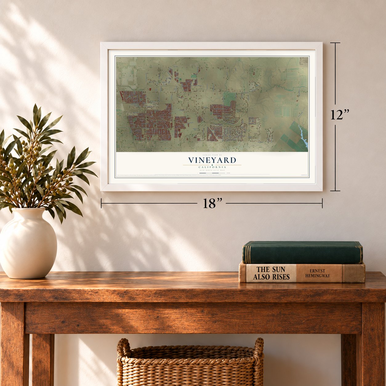
12" x 18" Archival Matte Print
A Map of Home. A Work of Art.
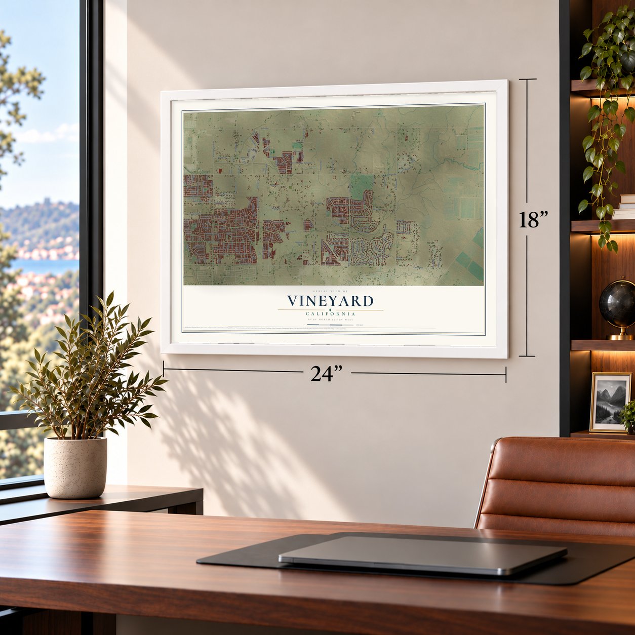
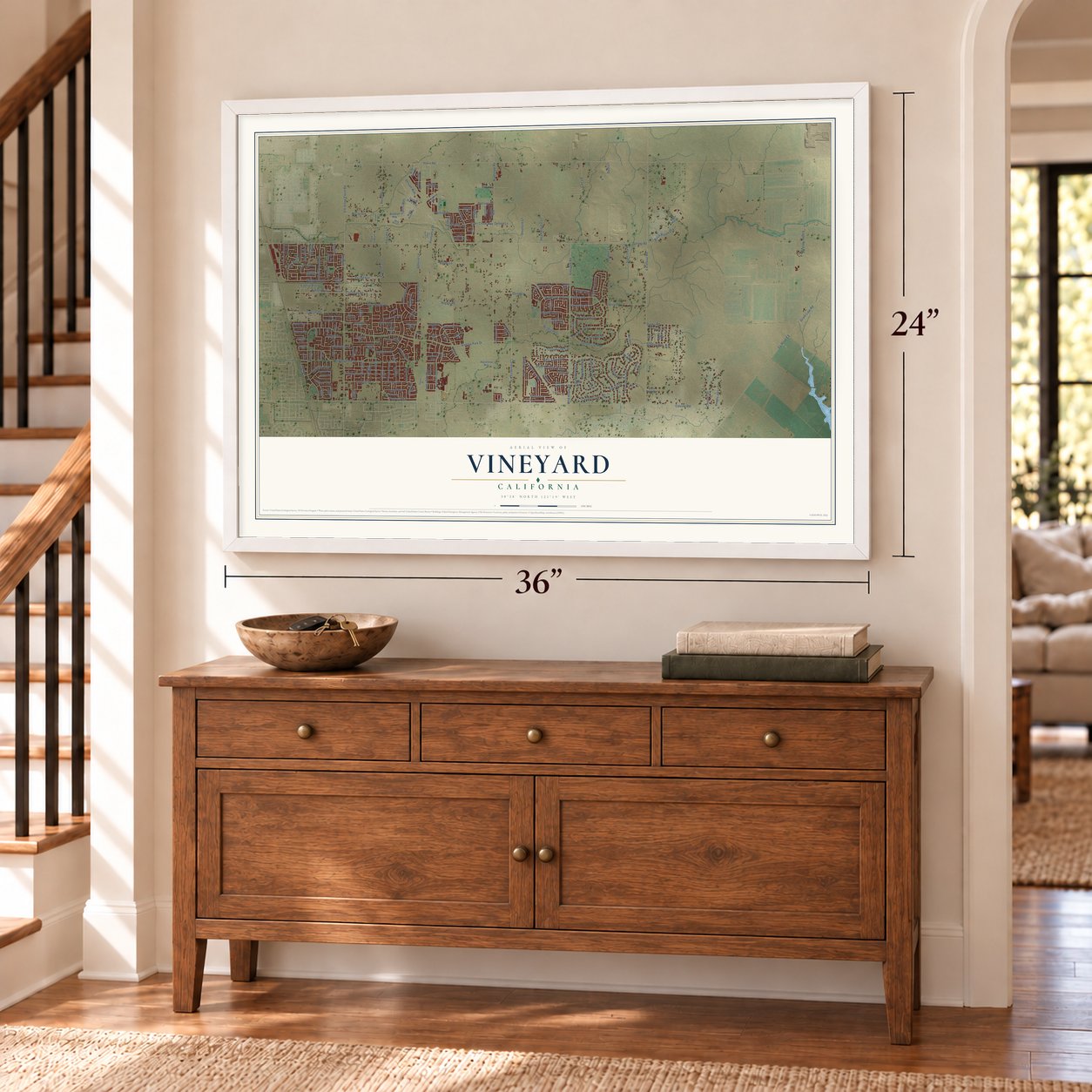
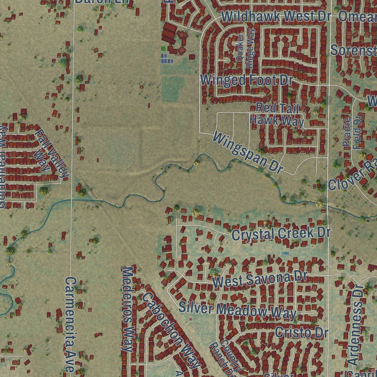
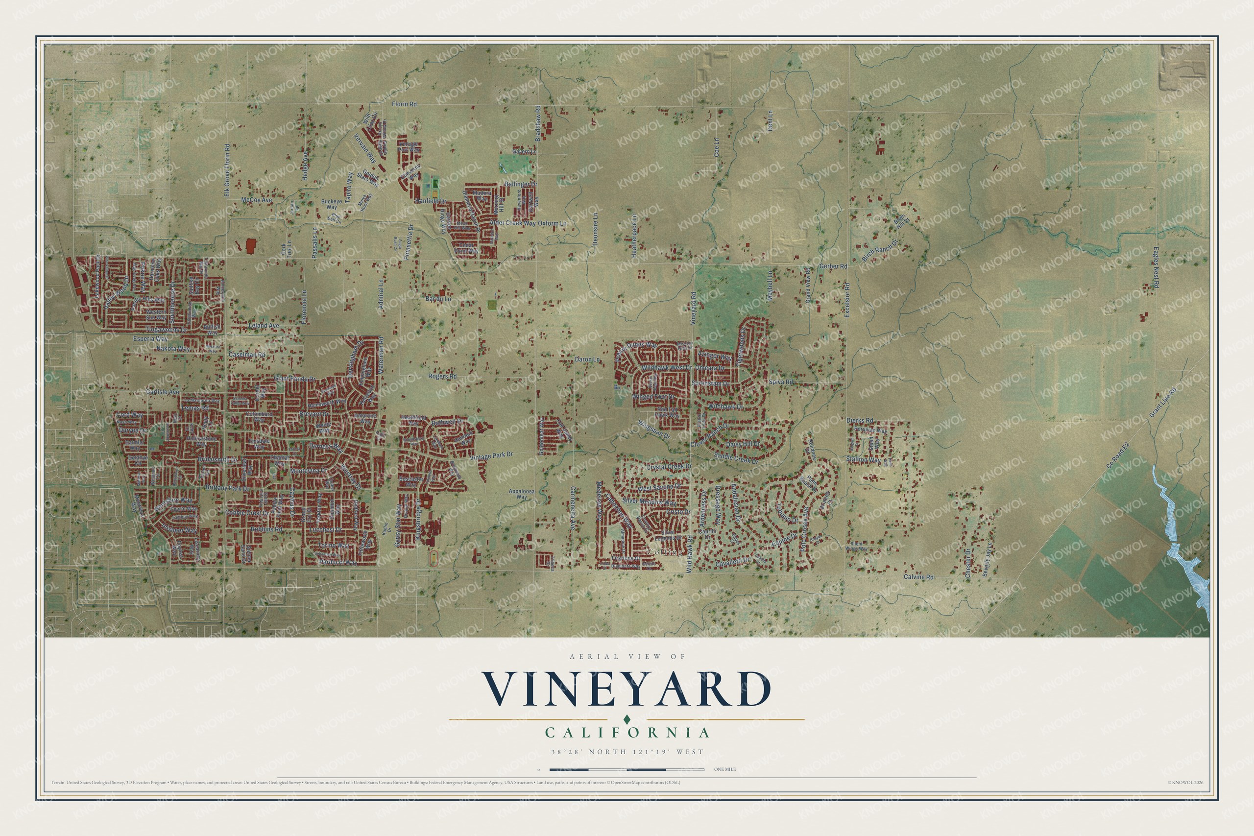
Explore Vineyard, California from a whole new perspective. Created using aerial imagery and detailed geographic data, this map captures Vineyard building by building, with labeled streets, familiar landmarks, and shaded topographical relief that highlights the natural contours of the landscape.
Combining modern data with the timeless character of a vintage atlas, this map is just as interesting up close as it is beautiful on the wall. Whether you grew up in Vineyard, spent memorable years there, or call it home today, this unique map is a great way to celebrate a place that means something to you. Zoom in on the preview to look for your street, and then order a print to put your memories on the wall.
Three ways to hang it
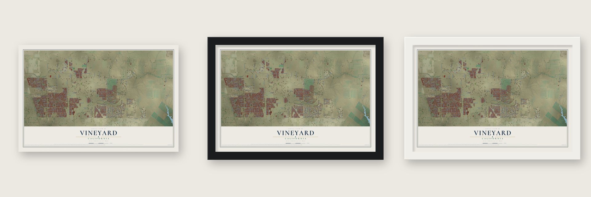
Unframed archival matte, a black wood frame or a white wood frame.
Up close
Geography Worth Displaying
This map was created using accurate cartographic data and authoritative geographic sources, including the U.S. Geological Survey and the Census Bureau. The map brings together terrain, waterways, roads, and building detail. The majority of the streets are labeled, houses are accurately depicted, and the topography is derived from government sources. Combining local data with carefully composed color and shading leads to this beautifully detailed Vineyard artwork for your wall.
Rather than simply showing street outlines, we’ve included as many of the street names as we could reasonably fit on the map while keeping their names legible. Zoom in on the high resolution preview to see exactly what’s on the map. We truly set out to create a statement piece for anyone who loves Vineyard. So whether it’s for you, or a gift for someone you love, we hope this map of Vineyard brings back fond memories.
Read the story behind this map of Vineyard, California from 2026.

Find your street
Names on the Vineyard map
Every name below is printed on this map. Look for your street, your school, the park where you played, or the pond down the road.
Places and landmarks1
- Coffing
Streets and roads210
- Silver Meadow Way
- Wildhawk West Drive
- West Savona Drive
- Azinger Way
- Nakota Way
- Parducci Way
- Calvine Road
- Florin Road
- Gerber Road
- Vintage Park Drive
- Bradshaw Road
- Elk Grove Florin Road
- Excelsior Road
- Waterman Road
- Vineyard Road
- Wild Hawk Road
- Polo Crosse Avenue
- County Road E2
- Grant Line Road
- Carmencita Avenue
- Rogers Road
- Caselman Road
- Tiogawoods Drive
- Dierks Road
- Carlisle Avenue
- Bar du Lane
- Eagles Nest Road
- Brittany Park Drive
- Caymus Drive
- Bothwell Drive
Show all 210 streets
- Saddle Creek Drive
- Montevina Drive
- Birch Ranch Drive
- Giant Panda Drive
- Sorenstam Drive
- Kingsbridge Drive
- Ardenness Drive
- Chester Drive
- Dressage Way
- Dersingham Drive
- Wildhawk Drive
- Cord Way
- Lemas Road
- Cavalletti Drive
- Daisy Hill Drive
- Poinsettia Drive
- Medeiros Way
- Valley Wood Drive
- Tigerwoods Drive
- Coe Lane
- Cabochon Way
- Bridalsmith Drive
- Brevard Drive
- McCoy Avenue
- Stallion Way
- Hedge Avenue
- Spiva Road
- Leland Avenue
- Prairie Dunes Way
- Clover Ranch Drive
- Robbins Road
- Ballinger Drive
- Southbreeze Drive
- Lucchesi Drive
- Crystal Creek Drive
- Durness Way
- Andalusian Drive
- Heatherpace Lane
- Hanfield Drive
- Wingspan Drive
- Florencia Lane
- Vervain Way
- Inisheer Way
- Gypsy Star Way
- Omeara Drive
- Torino Way
- Winged Foot Drive
- Oxform Lane
- Alder Creek Way
- Admiral Lane
- Kentshire Way
- Tobiano Drive
- Cristo Drive
- Passalis Lane
- Esperia Way
- Cobble Crest Drive
- Deonsire Lane
- Westray Drive
- Equine Drive
- Tapiro Way
- Dent Lane
- Maybell Lane
- Pekoe Way
- Duryea Drive
- Daron Lane
- Silver Legends Drive
- Colombard Way
- Firsrtone Drive
- Sailfish Bay Circle
- Heinlein Way
- Diamond Ranch Drive
- Fall Valley Way
- Kelvedon Way
- Hollowstone Way
- Grand Cru Drive
- Liscarney Way
- Silverleaf Way
- Chantal Way
- Yorkton Way
- Pacific Hills Way
- Appaloosa Way
- Pebble Field Way
- Heathfield Way
- Daimler Way
- Wild Lilac Circle
- Redford Way
- Lakewood Park Drive
- Garden Ridge Way
- Tevrin Way
- Boscastle Way
- Glendon Way
- Peruvian Way
- Delahye Circle
- Billfish Way
- Red Tail Hawk Way
- Sienna Sand Drive
- Buckeye Way
- Hemsworth Way
- Dartwell Way
- Montreux Way
- Wente Way
- Cheverny Way
- Grand View Road
- Golden Stars Way
- Morning Hill Street
- Goldenleaf Way
- Western Sun Way
- Empingham Way
- Emsdale Way
- Beverly Jay Lane
- Fittleworth Way
- Vintage Port Way
- Foynes Way
- Cork Tree Lane
- Harmony Oaks Way
- Amarone Way
- Steed Way
- Madora Way
- Caprilli Drive
- Brianna Court
- Gavern Lane
- Cedar Point Way
- Palm Beach Drive
- Reliance Court
- Birch Hill Court
- Korbel Way
- Healy Court
- Amberjack Way
- Tamarindo Bay Drive
- Country Ranch Drive
- Darien Circle
- Kadlin Drive
- Tea Berry Way
- La Margarita Way
- Westport Circle
- Blue Bell Circle
- Dolphinfish Way
- Cashel Way
- Havenford Way
- Almadine Drive
- Arroyo Willow Drive
- Prairie Field Drive
- Tribeca Drive
- Moss Hill Way
- Diamonte Way
- Lambay Way
- Stone Cliff Way
- Rivallo Way
- Silent Wings Way
- Nash Way
- Bramfield Way
- Malva Rosa Way
- Purple Sage Court
- Mission Hills Drive
- Jordan Lane
- Geode Court
- Babes Court
- Kelty Court
- Benz Court
- Brownsberg Way
- Langham Way
- Finmere Way
- Quaker Ridge Way
- Helmsdale Drive
- Derbyshire Circle
- Pine Valley Drive
- Hazelton Way
- Sugar Bush Circle
- Sonoma Valley Way
- Messara Way
- Bramwell Way
- Marmon Way
- Sebastian Way
- Brogan Court
- Caballo Court
- Elnora Court
- Belgian Court
- Izilda Court
- Audra Court
- Paint Way
Names are listed as they appear on the printed map. Zoom into the product photos to find them.
About Vineyard, California
During the Gold Rush, miners traveled Jackson Road through this area on their way from Sacramento to the gold country. Once the road was built, growing grapes here began to pay. In 1875 George McMullen bought a 240 acre farm called Lizzie's Vineyard. He set 85 acres in vines and grew strawberries as well.
Keep exploring California
Vineyard is one of 1,990 California towns we've mapped. Every dot on the map is a print of its own.
The search covers every state, California first.
Near Vineyard
Order 2 or more town maps and save 10%. Shown in the size and finish you picked above, so they hang as a set.
- Florin 12" x 18" / Archival Matte Print $39.99
- Elk Grove 12" x 18" / Archival Matte Print $39.99
- Rosemont 12" x 18" / Archival Matte Print $39.99


More maps nearby: Mather, La Riviera, Parkway, Wilton and Lemon Hill.
The art of mapping a place
How This Map Was Made
Real places. Remarkable detail. Discover the layers that turn geographic data into a map of home.

The view from above
Aerial imagery reveals the character of the land: woodland, open fields, and the patterns of a place.

The shape of the land
Elevation data brings hills, valleys, and subtle changes in the landscape into view.

The details of home
Roads, waterways, and building footprints come together to make the map feel unmistakably local.

Geography becomes art
Considered color, shading, and typography bring the layers together in a map made for your wall.


Process illustrated with Mendon, Massachusetts. Aerial imagery: USDA NAIP. Terrain: USGS 3D Elevation Program. Map details and finished artwork: KNOWOL.
The Details
About This Print
Choose an archival matte print, or a black or white Ayous wood frame. The archival matte print is unframed.
Select your size and finish above to see the matching product image and price.
Materials & Craftsmanship
A contemporary map with the character of a classic atlas, printed on archival matte paper. Optional frames are made from Ayous wood.
Your printed map does not include the watermark shown in the full-map preview.
Shipping & Delivery
Free shipping within the United States. Every print is made to order in the USA.
Buying a gift? Add a note in your cart and we'll include it. We never put prices in the package.
Prints ship within 2 to 3 business days. Allow 7 to 10 days total from ordering for delivery. Timing may vary during holidays or periods of high order volume.
Read our shipping policy.
Returns and damaged prints
Each print is made to order. Change-of-mind refunds are not available after production.
If your print arrives damaged, misprinted or incorrect, contact support@knowol.com within 30 days of receiving it. Include your order number, photos and a description of the issue.
Read our full refund and replacement policy. For questions about your order, email support@knowol.com.