
Search for another town



Free U.S. delivery 7 to 10 days after you order
Elk Grove, California Map Art
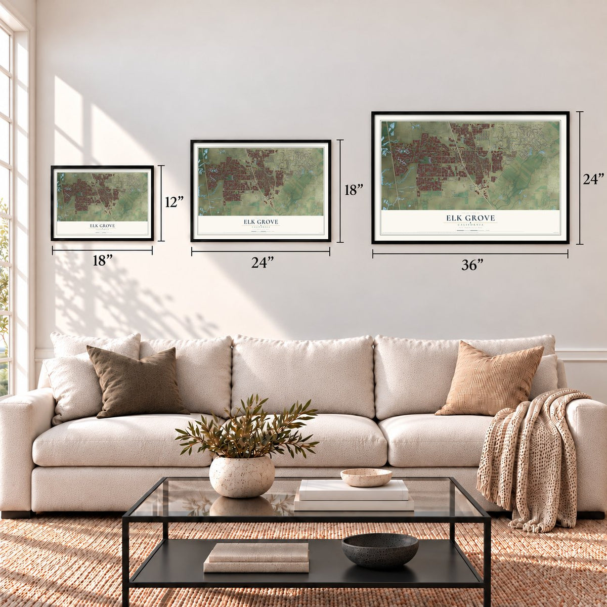
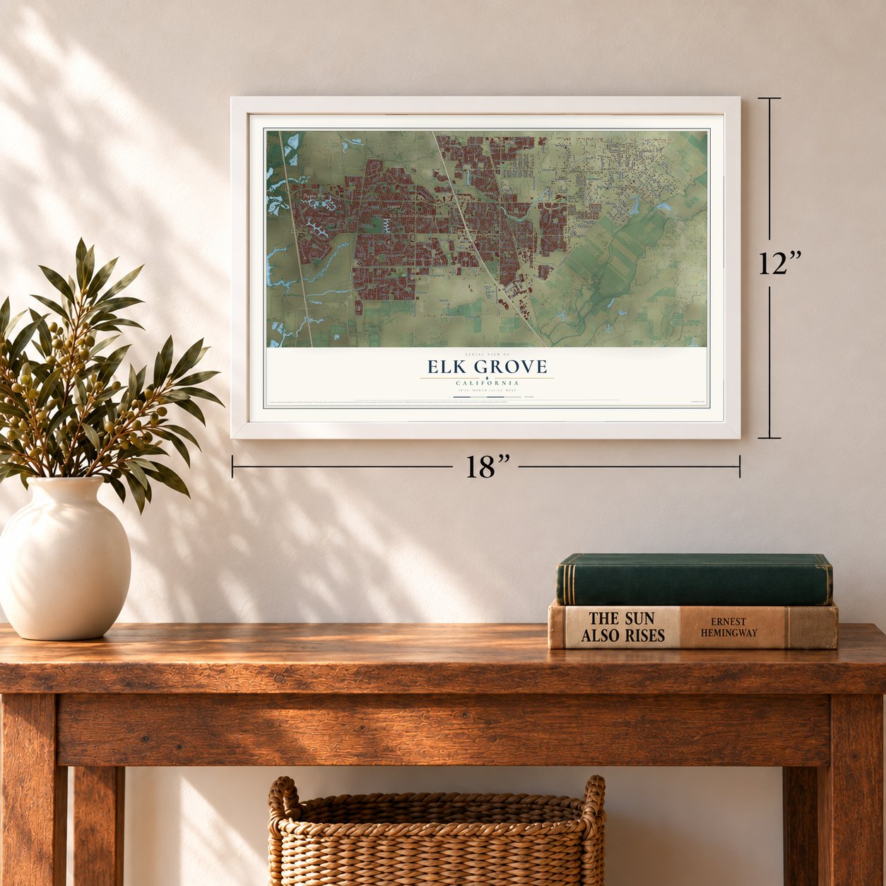
A new map of Elk Grove, California, made in 2026 and printed to order on thick archival matte paper.
12" x 18" Archival Matte Print
A Map of Home. A Work of Art.
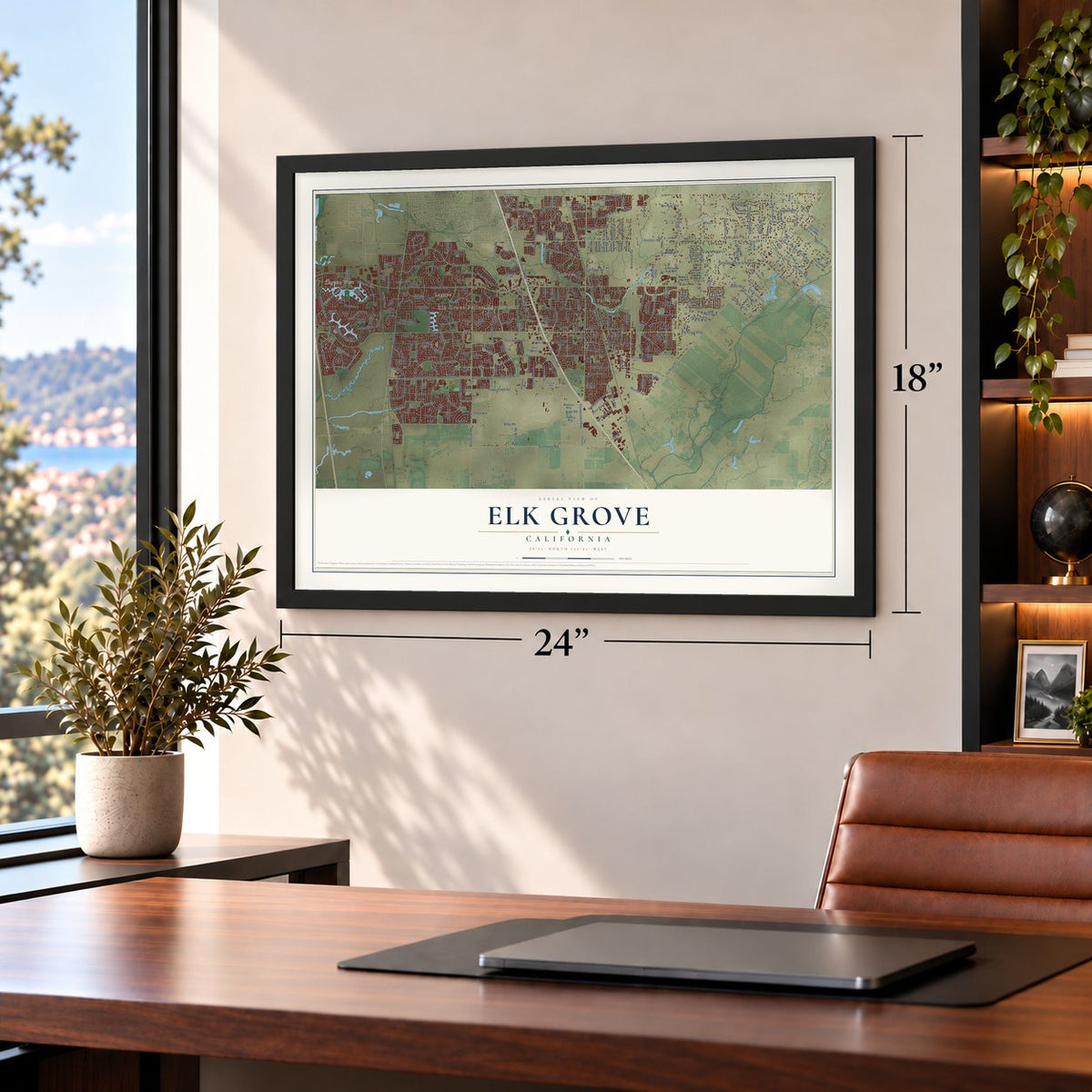
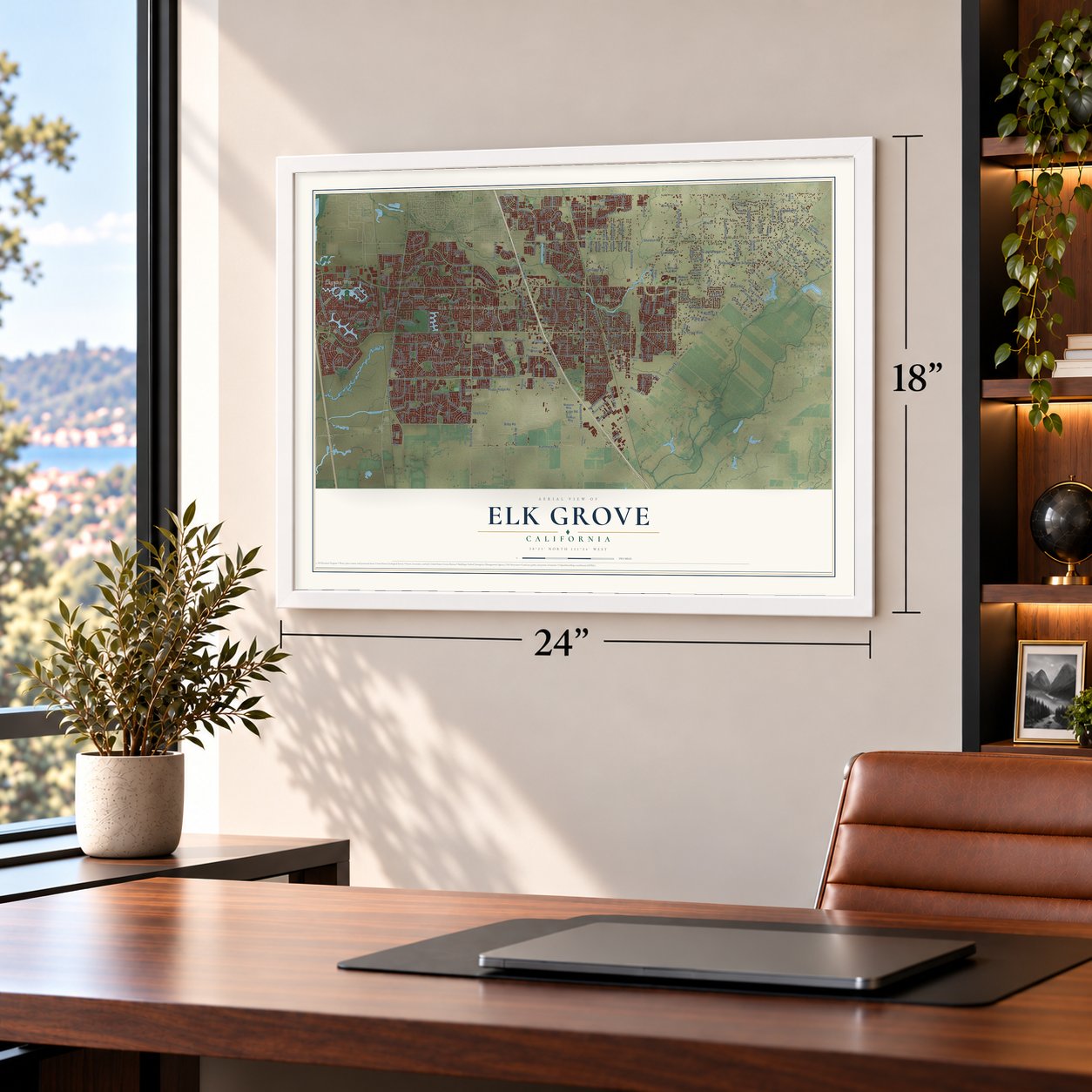
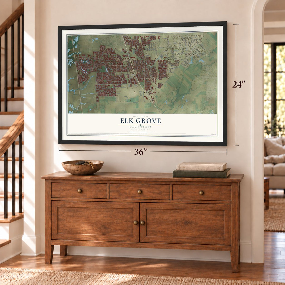
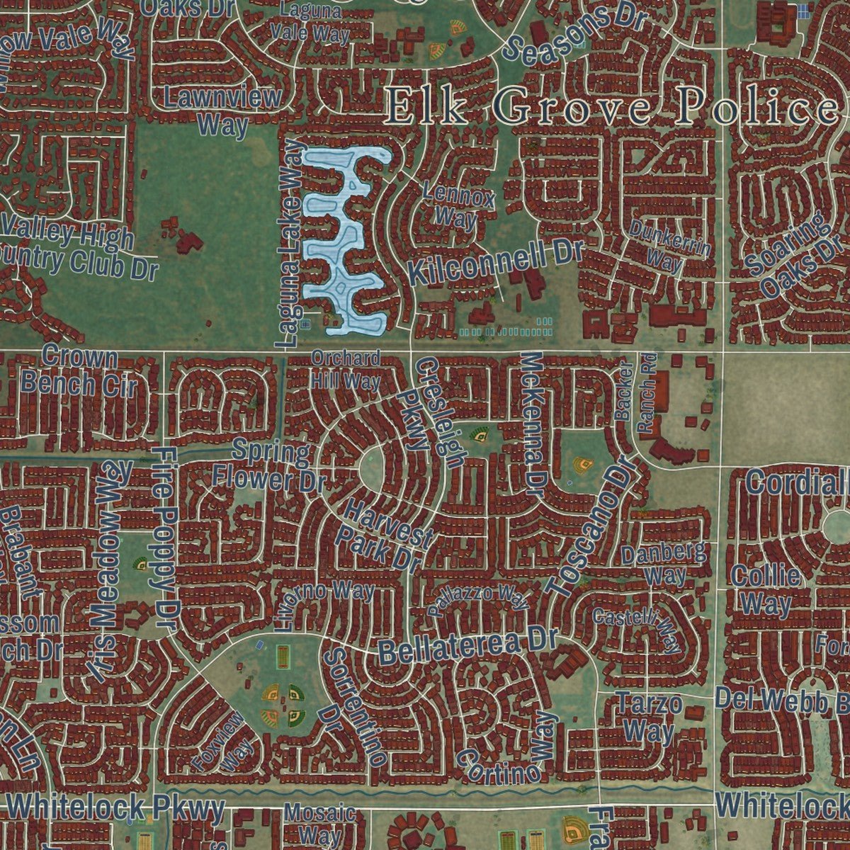
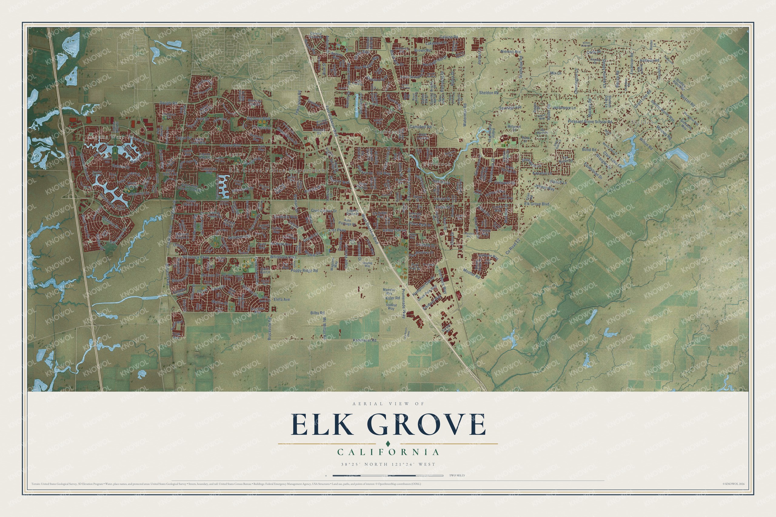
Explore Elk Grove, California from a whole new perspective. Created using aerial imagery and detailed geographic data, this map captures Elk Grove building by building, with labeled streets, familiar landmarks, and shaded topographical relief that highlights the natural contours of the landscape.
Combining modern data with the timeless character of a vintage atlas, this map is just as interesting up close as it is beautiful on the wall. Whether you grew up in Elk Grove, spent memorable years there, or call it home today, this unique map is a great way to celebrate a place that means something to you. Zoom in on the preview to look for your street, and then order a print to put your memories on the wall.
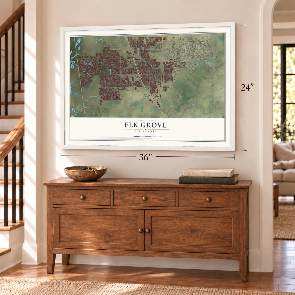
Three ways to hang it
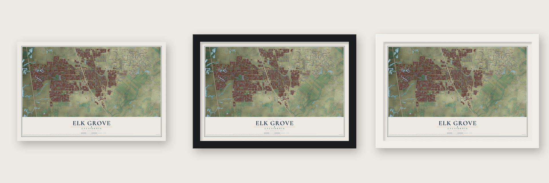
Unframed archival matte, a black wood frame or a white wood frame.
Up close
Geography Worth Displaying
This map was created using accurate cartographic data and authoritative geographic sources, including the U.S. Geological Survey and the Census Bureau. The map brings together terrain, waterways, roads, and building detail. The majority of the streets are labeled, houses are accurately depicted, and the topography is derived from government sources. Combining local data with carefully composed color and shading leads to this beautifully detailed Elk Grove artwork for your wall.
Rather than simply showing street outlines, we’ve included as many of the street names as we could reasonably fit on the map while keeping their names legible. Zoom in on the high resolution preview to see exactly what’s on the map. We truly set out to create a statement piece for anyone who loves Elk Grove. So whether it’s for you, or a gift for someone you love, we hope this map of Elk Grove brings back fond memories.
Read the story behind this map of Elk Grove, California from 2026.

About Elk Grove, California
Elk Grove is a city of 176,124 people in Sacramento County, just south of the state capital. In 1850 James Hall opened the Elk Grove Hotel and Stage Stop for travelers going between Sacramento and the San Francisco Bay Area, and the town took its name from his hotel. Hall picked the name because he had found elk antlers in the nearby groves of trees, and because he had once lived in a Missouri town called Elk Grove.
A mile or so east of the stage stop, the Central Pacific Railroad's Western Division laid its tracks in 1868, and a second Elk Grove Hotel was built next to the line. Local ranchers and farmers could now ship their goods by rail, so churches and stores soon filled a new downtown. A fire in 1892 destroyed buildings and slowed the town's growth, but the town rebuilt, and in the decades after the fire it gained a bank and a post office.
“Canopies of oaks and cottonwoods, many festooned with grapevines, overhung both sides of the blue current. Birds chattered in the trees and big fish darted through the pellucid depths. The air was like champagne, and (the Spaniards) drank deep of it, drank in the beauty around them.”
- Wine grapes by the 1880sGold Rush crowds created demand for food, so families set up ranches here that raised cattle and sheep and grew wheat, barley, fruit and nuts. In the 1880s at least 35 growers were raising wine grapes. Winemaking kept growing even through the Great Depression, but after World War II many of the town's wine businesses closed.
- Reagan led the 1966 paradeThe Elk Grove Western Festival started in 1957 to celebrate the town's western roots with parades and carnival games. Ronald Reagan, who would become governor of California and then president, served as its Grand Marshal in 1966. Since 1994 the Giant Pumpkin Festival has drawn growers every autumn to show off pumpkins weighing thousands of pounds.
- A city since 2000Elk Grove stayed a small farm town long after the war. Highway 99 was expanded in 1957, building picked up, and the first shopping center opened in the early 1960s. The 1980 census counted 10,959 people, and suburbs for Sacramento and Bay Area commuters soon spread. Elk Grove incorporated on July 1, 2000, and in 2004 and 2005 it was the fastest growing city in the country.
- A casino where a mall stalledWork began on a large shopping mall in 2007, but the 2008 recession stopped it with buildings left half finished. By 2019 the shell had been torn down and the land went to the Wilton Rancheria, a federally recognized Miwok tribe. Its Sky River Casino opened in 2022 and had 1,600 employees as of 2025.
Find your street
Names on the Elk Grove map
Every name below is printed on this map. Look for your street, your school, the park where you played, or the pond down the road.
Places and landmarks6
- Elk Grove Police Department
- Sheldon
- Laguna West
- Laguna
- Camden
- Fallbrook
Streets and roads344
- Whitelock Parkway
- Franklin Boulevard
- Poppy Ridge Road
- Auberry Drive
- Seasons Drive
- Elk Grove Boulevard
- Grant Line Road
- Sheldon Road
- East Stockton Boulevard
- Calvine Road
- County Road E2
- Waterman Road
- Laguna Boulevard
- Bond Road
- Big Horn Boulevard
- Elk Grove Florin Road
- Bruceville Road
- West Stockton Boulevard
- Bradshaw Road
- Kammerer Road
- Bilby Road
- Laguna Park Drive
- Bader Road
- Whitelock Plwy
- Franklin High Road
- Babson Drive
- Maritime Drive
- Willard Parkway
- Bellaterea Drive
- Power Inn Road
Show all 344 streets
- Harbour Point Drive
- Shasta Lily Drive
- Lotz Parkway
- Pleasant Grove School Road
- Lakepoint Drive
- Civic Center Drive
- Promenade Parkway
- Blossom Ridge Drive
- Mainline Drive
- County Road J8
- Kapalua Lane
- Cordially Way
- Fire Poppy Drive
- Renwick Avenue
- Dwight Road
- Heritage Hill Drive
- Wilton Road
- Stathos Drive
- Excelsior Road
- Brown Road
- Matina Drive
- West Taron Drive
- Mackey Road
- Red Elk Drive
- Stonebrook Drive
- Beitzel Road
- Riparian Drive
- Winkle Circle
- Wymark Drive
- Mooney Road
- Denali Circle
- Kent Street
- Corfu Drive
- Four Seasons Drive
- Hampton Oak Drive
- Elk Way
- East Taron Drive
- Sleepy Hollow Lane
- Equestrian Drive
- Tegan Road
- Ocean Lane
- Rancho Drive
- Di Lusso Drive
- Kyler Road
- Coop Drive
- Shortline Lane
- Benedix Way
- Justamere Lane
- Mecca Road
- Kilconnell Drive
- Lakemont Drive
- Plaza Park Drive
- Gilliam Drive
- Blue Maiden Way
- Red Fox Way
- Clark Lake Lane
- Iris Meadow Way
- Lewis Stein Road
- Cape Verde Drive
- Rubia Drive
- Valley Oak Lane
- Halfway Road
- Lake Terrace Drive
- Black Kite Drive
- Iron Rock Way
- Generations Drive
- Polhemus Drive
- Elefa Avenue
- Lousada Drive
- McLean Drive
- Bovill Drive
- Grove Street
- Hite Circle
- Bobbell Drive
- Sandage Avenue
- Lismore Drive
- Silvergate Lane
- Wrangler Drive
- Crisswell Drive
- Dino Drive
- Zinnia Way
- Elkmont Way
- Cherrington Lane
- Jordan Lane
- Nieman Avenue
- Bamarcia Drive
- Terra Linda Drive
- Campbell Road
- Mc Millan Road
- Edisto Way
- Toscano Drive
- Jetmar Way
- Mosher Road
- Bow Street
- Feickert Drive
- Locust Street
- Egret Drive
- Garrity Drive
- Pavich Lane
- Emily Street
- Mix Lane
- Laguna Star Drive
- Boreal Way
- Emerald Vista Drive
- Dunisch Road
- Cresleigh Parkway
- Santorini Drive
- Laguna Springs Drive
- Laguna Lake Way
- Crowell Drive
- Sheldon Woods Way
- Soaring Oaks Drive
- Frye Creek Drive
- Willow Vale Way
- Crown Bench Circle
- Stone Springs Drive
- Sierra River Drive
- Old Creek Drive
- Grenache Way
- Frank Greg Way
- Emerald Park Drive
- Blossom Ranch Drive
- Four Winds Drive
- Harvest Park Drive
- Black Swan Drive
- Kelsey Drive
- Quail Cove Drive
- Canadeo Way
- Vizela Way
- Carico Way
- Elk Ridge Way
- Modena Way
- Union Park Way
- Amber Creek Drive
- Cortino Way
- East Lake Drive
- Upbeat Way
- Romanzo Way
- Monterey Oaks Drive
- Lawnview Way
- Park Meadows Drive
- McGray Way
- Boa Nova Drive
- Nick Way
- Poplar Hollow Way
- Laguna Oaks Drive
- Fossil Way
- McKenna Drive
- Van Ruiten Lane
- Geneva Pointe Drive
- Bradley Ranch Road
- Conda Way
- Sheldon Creek Drive
- Collie Way
- Graciosa Way
- Valley High Country Club Drive
- Spring Flower Drive
- West Lake Drive
- Tarzo Way
- Atkins Drive
- Del Webb Boulevard
- Rhone River Drive
- Oscar Circle
- Cellana Drive
- Railroad Avenue
- Banff Vista Drive
- Mandalay Way
- Philta Way
- Sauterne Way
- Wagoner Way
- Rossport Way
- Kinder Lane
- Tusk Way
- Sheldon North Drive
- Graybill Lane
- Webb Street
- Brabant Way
- School Street
- Salmon Creek Drive
- Jef Jen Way
- Sorrentino Drive
- Marsh Point Drive
- Waterfield Drive
- Laguna Crest Way
- Survey Road
- Festival Drive
- Elliott Ranch Road
- Freitag Way
- Trout Way
- Auto Passage Drive
- Gresham Lane
- Dorcey Drive
- Millpond Court
- Rainbow Falls Way
- Elk Crest Drive
- Felicia Way
- Sheldon Oaks Lane
- Laguna Main Street
- Laguna Grove Drive
- Emerald Crest Drive
- Quail Run Lane
- Maestro Way
- Country Hill Court
- Titan Road
- Sabrina Lane
- Sierra Street
- Pascal Way
- Park Trail Drive
- Scenic Elk Court
- Fey Way
- Colton Avenue
- Briskin Drive
- Tiant Way
- Binger Drive
- Buna Court
- Adur Road
- Monte Cresta Way
- Careyback Avenue
- Village Tree Drive
- Granite Park Lane
- Chambeau Way
- Bastona Drive
- Waterfowl Drive
- Camden Lake Way
- Brahma Way
- Peak Forest Way
- Mosaic Way
- Menlo Oaks Court
- Livorno Way
- Tralee Way
- Allister Way
- Albacore Way
- Chambray Road
- Atlantis Drive
- Malheur Way
- Koto Drive
- Elvora Way
- Selva Way
- East Park Drive
- Moonlight Way
- Blue Thistle Way
- Windrift Lane
- Lennox Way
- Jilson Way
- Hirsch Circle
- Silverberry Avenue
- Danberg Way
- Wooded Brook Drive
- Shire Oaks Lane
- Yarnell Way
- Alissa Way
- Alameda Park Drive
- Vista Brook Drive
- Greylag Way
- Atrio Circle
- Melrose Avenue
- Stockton Boulevard
- Sharkey Avenue
- Tegea Way
- Cll Susana
- Melfort Way
- Oak Ranch Place
- Vytina Drive
- Edeva Way
- Saint Jude Court
- Armaria Court
- Annie Street
- Royal View Court
- Upton Court
- Surritt Way
- Ukiah Lane
- Saul Way
- Foxview Way
- Meadowspring Drive
- Harvest Hill Way
- Sea Cliff Way
- Porto Rosa Drive
- Dunkerrin Way
- Hawley Way
- Trenholm Drive
- Castleview Drive
- Emerald Oak Drive
- Shelter Cove Lane
- Bungalow Way
- Allen Ranch Way
- Castelli Way
- Backer Ranch Road
- Laguna Vale Way
- Pallazzo Way
- Poppyseed Lane
- Christo Way
- Cote Dor Drive
- Windy Cove Lane
- Ashtone Way
- Beckington Drive
- Freesia Drive
- Superb Circle
- Mission Falls Circle
- Vicino Drive
- Pembridge Drive
- Lent Ranch Parkway
- Charolais Way
- Izzy Way
- Orchard Hill Way
- Knotts Drive
- Cornelius Way
- Saint Anthony Court
- Wollaston Way
- Willow Hollow Lane
- Avalon Hills Way
- Earl Fife Drive
- Chianti Way
- Gage Street
- Ely Court
Names are listed as they appear on the printed map. Zoom into the product photos to find them.
The art of mapping a place
How This Map Was Made
Real places. Remarkable detail. Discover the layers that turn geographic data into a map of home.

The view from above
Aerial imagery reveals the character of the land: woodland, open fields, and the patterns of a place.

The shape of the land
Elevation data brings hills, valleys, and subtle changes in the landscape into view.

The details of home
Roads, waterways, and building footprints come together to make the map feel unmistakably local.

Geography becomes art
Considered color, shading, and typography bring the layers together in a map made for your wall.


Process illustrated with Mendon, Massachusetts. Aerial imagery: USDA NAIP. Terrain: USGS 3D Elevation Program. Map details and finished artwork: KNOWOL.
The Details
About This Print
Choose an archival matte print, or a black or white Ayous wood frame. The archival matte print is unframed.
Select your size and finish above to see the matching product image and price.
Materials & Craftsmanship
A contemporary map with the character of a classic atlas, printed on archival matte paper. Optional frames are made from Ayous wood.
Your printed map does not include the watermark shown in the full-map preview.
Shipping & Delivery
Free shipping within the United States. Every print is made to order in the USA.
Buying a gift? Add a note in your cart and we'll include it. We never put prices in the package.
Prints ship within 2 to 3 business days. Allow 7 to 10 days total from ordering for delivery. Timing may vary during holidays or periods of high order volume.
Read our shipping policy.
Returns and damaged prints
Each print is made to order. Change-of-mind refunds are not available after production.
If your print arrives damaged, misprinted or incorrect, contact support@knowol.com within 30 days of receiving it. Include your order number, photos and a description of the issue.
Read our full refund and replacement policy. For questions about your order, email support@knowol.com.
Find your town
Looking for another city?
Find a map of home in our California collection, or any town in the country.
Nearby
Maps of towns near Elk Grove
Know someone from one of these towns? Their map makes a great gift.
 Florin
, California
From $39.99See the map
 Vineyard
, California
From $39.99See the map
 Parkway
, California
From $39.99See the map
More maps nearby: Freeport, Hood, Lemon Hill, Clarksburg and Fruitridge Pocket.