
Search for another town





Free U.S. delivery 7 to 10 days after you order
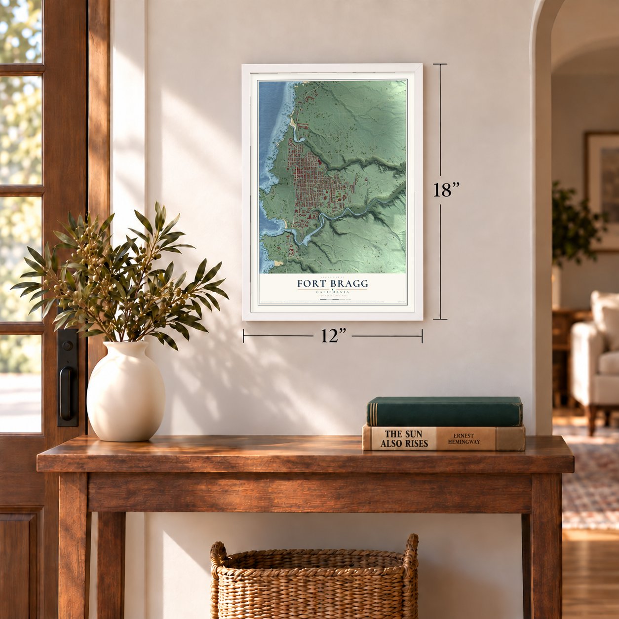
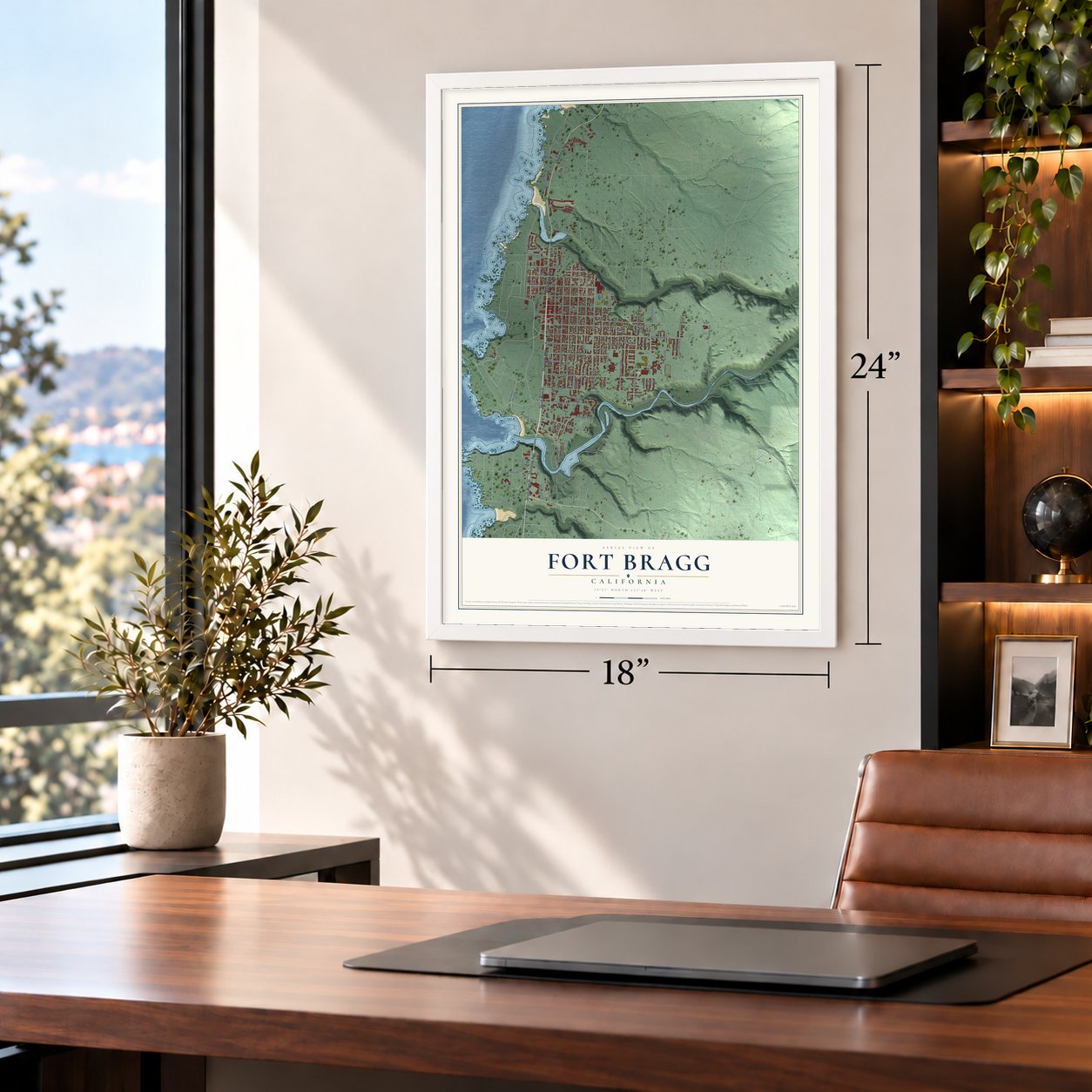
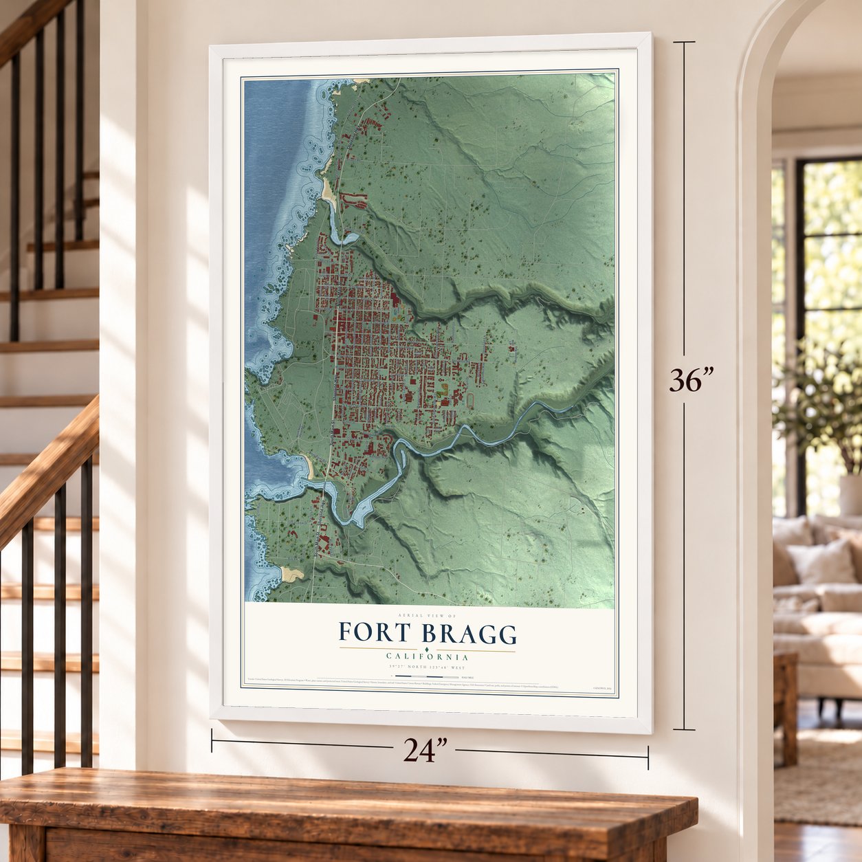
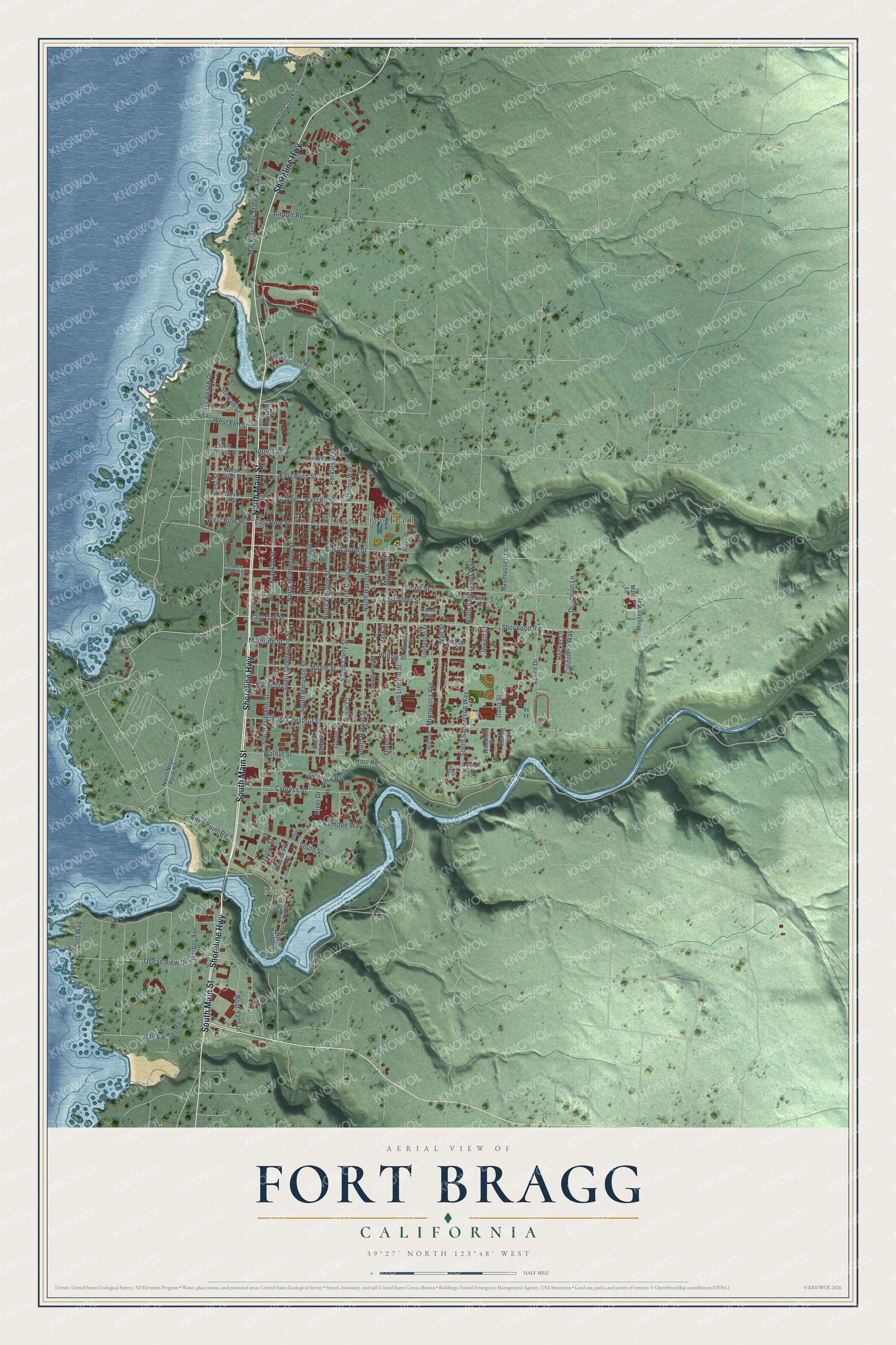
Fort Bragg, California Map Art
Building by building, with labeled streets and shaded relief.
12" x 18" Archival Matte Print
A Map of Home. A Work of Art.
Explore Fort Bragg, California from a whole new perspective. Created using aerial imagery and detailed geographic data, this map captures Fort Bragg building by building, with labeled streets, familiar landmarks, and shaded topographical relief that highlights the natural contours of the landscape.
Combining modern data with the timeless character of a vintage atlas, this map is just as interesting up close as it is beautiful on the wall. Whether you grew up in Fort Bragg, spent memorable years there, or call it home today, this unique map is a great way to celebrate a place that means something to you. Zoom in on the preview to look for your street, and then order a print to put your memories on the wall.
Three ways to hang it
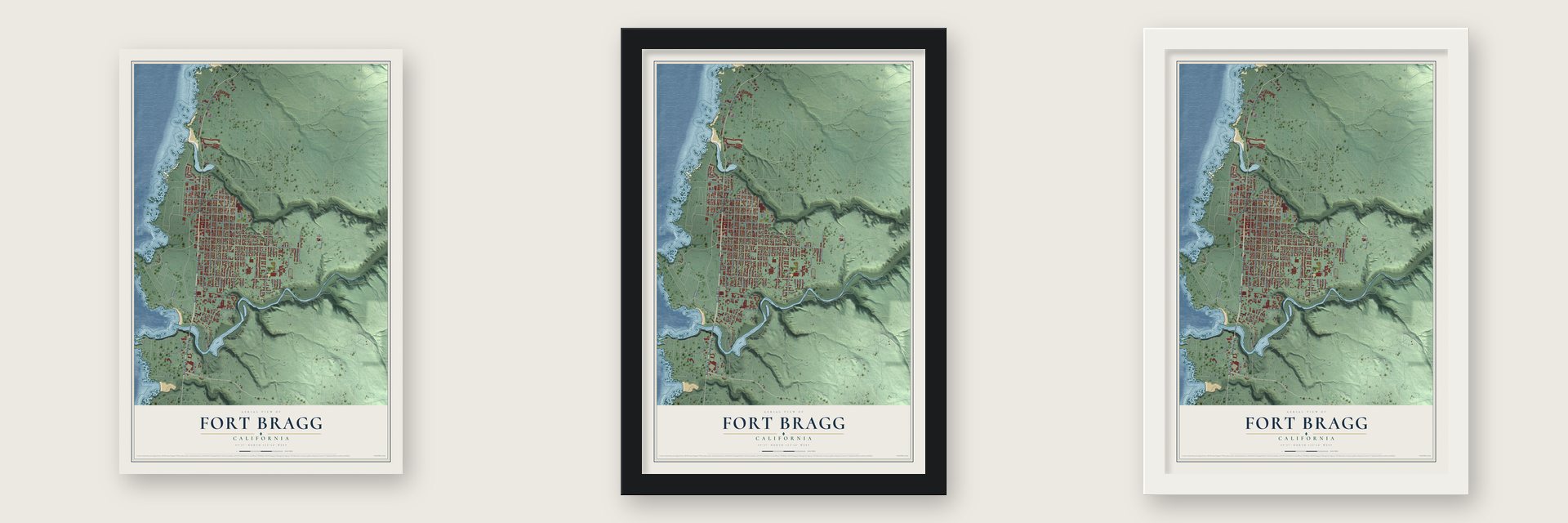
Unframed archival matte, a black wood frame or a white wood frame.
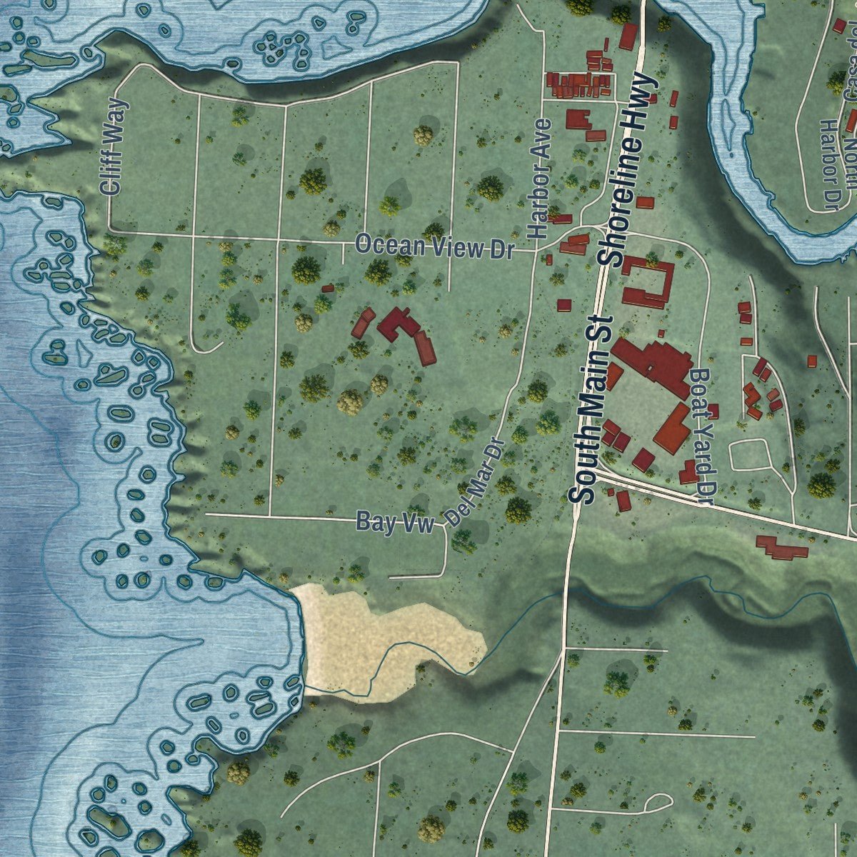
Up close
Geography Worth Displaying
This map was created using accurate cartographic data and authoritative geographic sources, including the U.S. Geological Survey and the Census Bureau. The map brings together terrain, waterways, roads, and building detail. The majority of the streets are labeled, houses are accurately depicted, and the topography is derived from government sources. Combining local data with carefully composed color and shading leads to this beautifully detailed Fort Bragg artwork for your wall.
Rather than simply showing street outlines, we’ve included as many of the street names as we could reasonably fit on the map while keeping their names legible. Zoom in on the high resolution preview to see exactly what’s on the map. We truly set out to create a statement piece for anyone who loves Fort Bragg. So whether it’s for you, or a gift for someone you love, we hope this map of Fort Bragg brings back fond memories.
Read the story behind this map of Fort Bragg, California from 2026.

Find your street
Names on the Fort Bragg map
Every name below is printed on this map. Look for your street, your school, the park where you played, or the pond down the road.
Places and landmarks2
- Fort Bragg City Hall
- Noyo
Streets and roads98
- South Main Street
- Shoreline Highway
- North Main Street
- Noyo Point Road
- East Oak Street
- Cypress Street
- Hocker Lane
- Dennison Lane
- Minnesota Avenue
- Mackerricher State Park Road
- Harbor Avenue
- Glass Beach Drive
- Ocean View Drive
- West Elm Street
- Cliff Way
- North Whipple Street
- South Corry Street
- West Pine Street
- East Chestnut Street
- South Franklin Street
- North Franklin Street
- Cedar Street
- East Alder Street
- Georgia-Pacific ---Haul Road
- North Harrison Street
- Stewart Street
- Fir Avenue
- East Laurel Street
- Maple Street
- North Harold Street
Show all 98 streets
- South Sanderson Way
- North McPherson Street
- South Harrison Street
- South Harold Street
- South Lincoln Street
- South Street
- Dana Street
- North Corry Street
- Boat Yard Drive
- Madrone Street
- East Pine Street
- East Fir Street
- Willow Street
- Wall Street
- Walnut Street
- South McPherson Street
- East Bush Street
- Sherwood Road
- West Street
- Park Street
- Kemppe Way
- North Sanderson Way
- Morrow Street
- Virgin Creek Lane
- Hazel Street
- River Drive
- Acorn Drive
- Perkins Way
- Rasmussen Lane
- Spruce Street
- Airport Road
- California Way
- Grove Street
- Olson Lane
- Myrtle Street
- Jewett Street
- Susie Court
- Bay Vw
- North Noyo Point Road
- North Harbor Drive
- Woodward Street
- Del Mar Drive
- South Whipple Street
- Pudding Creek Road
- West Fir Street
- West Bush Street
- Casa del Noyo
- Winifred Street
- West Spruce Street
- Brandon Way
- Monsen Way
- Howland Court
- Livingston Street
- South Harold
- Florence Street
- Alger Street
- Ebbing Way
- Woodland Drive
- Lonne Way
- Eddy Street
- Mall Lane
- Minisota
- Noyo Heights
- Halsey Way
- Holms Lane
- West Redwood Avenue
- Sequoia Circle
- Ness Avenue
Names are listed as they appear on the printed map. Zoom into the product photos to find them.
About Fort Bragg, California
Fort Bragg is a city of 6,983 people in Mendocino County, on California's North Coast, and Pomo people lived along this shore long before settlers came. In the spring of 1856 the government set up the Mendocino Indian Reservation at Noyo. The next summer 1st Lt. Horatio G. Gibson built an army post on the reservation, about a mile and a half above the Noyo River, and he gave it the name of his old commander, Capt. Braxton Bragg.
The last soldiers sailed away on the steamer Panama in October 1864, and the reservation closed in March 1866. In 1869 the land went on sale to settlers for $1.25 an acre. In 1885 C. R. Johnson and his partners Calvin Stewart and James Hunter hauled their sawmill machinery from Mill Creek on the Ten Mile River to Fort Bragg so they could ship lumber from its harbor. The town incorporated in 1889, with Johnson as its first mayor and Stewart drawing its plat maps.
“You can smell 'em before you can see 'em.”
- A lumber town from 1885Johnson's mill began as the Fort Bragg Redwood Company and became the Union Lumber Company in 1891 after it merged with the Noyo River Lumber Company. To reach timber in the Noyo River watershed, Johnson hired Chinese tunnel builders from San Francisco, and after the tunnel was done most of them settled in Fort Bragg and Mendocino. The mill, later run by Georgia Pacific, closed in 2002.
- Rebuilt after 1906The 1906 earthquake damaged every brick building in town, and a fire burned the whole block bounded by Franklin, Redwood and McPherson Streets. Most of downtown was rebuilt within 12 months. The mills shipped lumber south to rebuild San Francisco, and the ships came home weighted with bricks for Fort Bragg. With that new money the rail line to Willits was finished, and in 1912 the first tourists arrived.
- The Skunk TrainThe California Western Railroad started as a log route in 1885, began steam passenger service in 1904 and reached Willits, 40 miles inland through the redwoods, in 1911. In 1925 it added yellow rail cars with their own gas engines, and people named them Skunks for the smell. Today the line carries visitors on scenic trips through the forest.
- Glass BeachIn the early 20th century residents threw their household trash, including glass, appliances and even cars, over the bluffs onto a beach locals called "The Dumps." City leaders closed it in 1967, and over the following decades the waves wore the broken glass into the smooth sea glass that now draws tourists to the end of Elm Street.
- The Weller House, 1886Horace Weller had the Weller House built in 1886, and no older house still stands in Fort Bragg. It joined the National Register in 1976 and has been a hotel since 1999.
Keep exploring California
Fort Bragg is one of 1,990 California towns we've mapped. Every dot on the map is a print of its own.
The search covers every state, California first.
Near Fort Bragg
Order 2 or more town maps and save 10%. Shown in the size and finish you picked above, so they hang as a set.
- Cleone 12" x 18" / Archival Matte Print $39.99
- Caspar 12" x 18" / Archival Matte Print $39.99
- Mendocino 12" x 18" / Archival Matte Print $39.99


More maps nearby: Little River, Albion, Comptche, Brooktrails and Laytonville.
The art of mapping a place
How This Map Was Made
Real places. Remarkable detail. Discover the layers that turn geographic data into a map of home.

The view from above
Aerial imagery reveals the character of the land: woodland, open fields, and the patterns of a place.

The shape of the land
Elevation data brings hills, valleys, and subtle changes in the landscape into view.

The details of home
Roads, waterways, and building footprints come together to make the map feel unmistakably local.

Geography becomes art
Considered color, shading, and typography bring the layers together in a map made for your wall.


Process illustrated with Mendon, Massachusetts. Aerial imagery: USDA NAIP. Terrain: USGS 3D Elevation Program. Map details and finished artwork: KNOWOL.
The Details
About This Print
Choose an archival matte print, or a black or white Ayous wood frame. The archival matte print is unframed.
Select your size and finish above to see the matching product image and price.
Materials & Craftsmanship
A contemporary map with the character of a classic atlas, printed on archival matte paper. Optional frames are made from Ayous wood.
Your printed map does not include the watermark shown in the full-map preview.
Shipping & Delivery
Free shipping within the United States. Every print is made to order in the USA.
Buying a gift? Add a note in your cart and we'll include it. We never put prices in the package.
Prints ship within 2 to 3 business days. Allow 7 to 10 days total from ordering for delivery. Timing may vary during holidays or periods of high order volume.
Read our shipping policy.
Returns and damaged prints
Each print is made to order. Change-of-mind refunds are not available after production.
If your print arrives damaged, misprinted or incorrect, contact support@knowol.com within 30 days of receiving it. Include your order number, photos and a description of the issue.
Read our full refund and replacement policy. For questions about your order, email support@knowol.com.