


Search for another town


Free U.S. delivery 7 to 10 days after you order
Fort Knox, Kentucky Map Art
Building by building, with labeled streets and shaded relief.
12" x 18" Archival Matte Print
A Map of Home. A Work of Art.
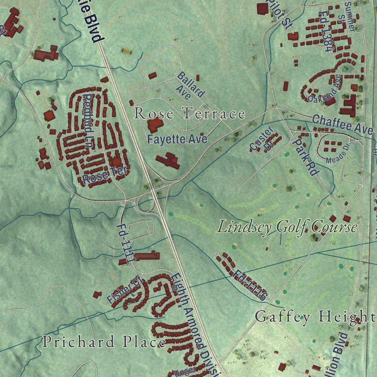
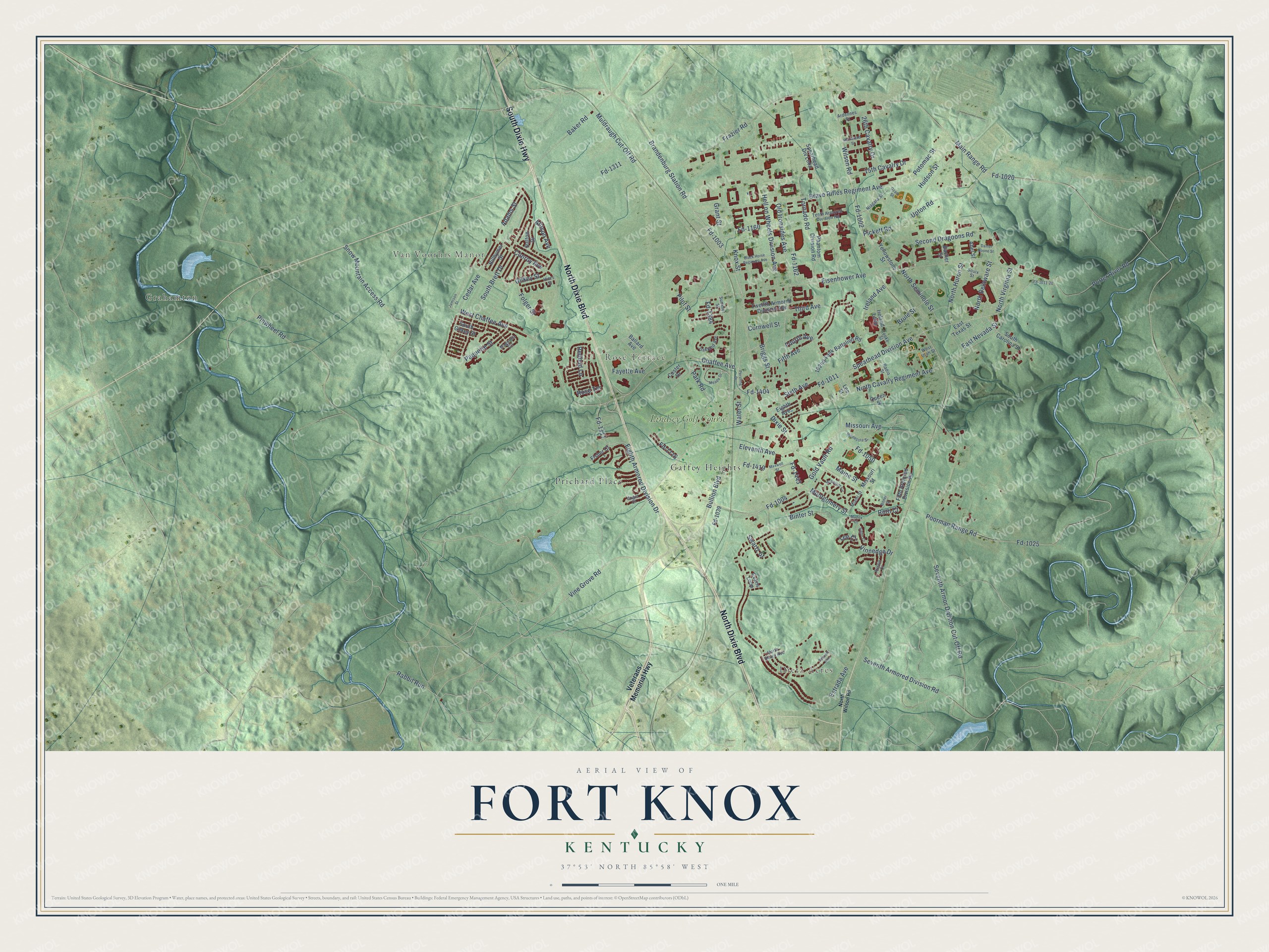
Explore Fort Knox, Kentucky from a whole new perspective. Created using aerial imagery and detailed geographic data, this map captures Fort Knox building by building, with labeled streets, familiar landmarks, and shaded topographical relief that highlights the natural contours of the landscape.
Combining modern data with the timeless character of a vintage atlas, this map is just as interesting up close as it is beautiful on the wall. Whether you grew up in Fort Knox, spent memorable years there, or call it home today, this unique map is a great way to celebrate a place that means something to you. Zoom in on the preview to look for your street, and then order a print to put your memories on the wall.
Three ways to hang it
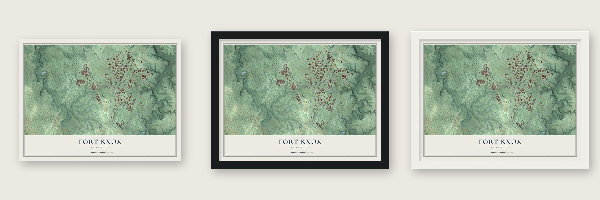
Unframed archival matte, a black wood frame or a white wood frame.
Up close
Geography Worth Displaying
This map was created using accurate cartographic data and authoritative geographic sources, including the U.S. Geological Survey and the Census Bureau. The map brings together terrain, waterways, roads, and building detail. The majority of the streets are labeled, houses are accurately depicted, and the topography is derived from government sources. Combining local data with carefully composed color and shading leads to this beautifully detailed Fort Knox artwork for your wall.
Rather than simply showing street outlines, we’ve included as many of the street names as we could reasonably fit on the map while keeping their names legible. Zoom in on the high resolution preview to see exactly what’s on the map. We truly set out to create a statement piece for anyone who loves Fort Knox. So whether it’s for you, or a gift for someone you love, we hope this map of Fort Knox brings back fond memories.
Read the story behind this map of Fort Knox, Kentucky from 2026.

Find your street
Names on the Fort Knox map
Every name below is printed on this map. Look for your street, your school, the park where you played, or the pond down the road.
Places and landmarks7
- Dietz Acres
- Van Voorhis Manor
- Rose Terrace
- Gaffey Heights
- Grahamton
- Prichard Place
- Lindsey Golf Course
Streets and roads145
- South Dixie Highway
- North Dixie Boulevard
- Vine Grove Road
- Chaffee Avenue
- Rabbit Run
- Fayette Avenue
- Knox Street
- Seventh Armored Division Road
- Dixie Street
- Old Ironsides Avenue
- Fd-1002
- Wilson Road
- Pinwheel Road
- Main Range Road
- Fd-1020
- Bullion Boulevard
- Eisenhower Avenue
- Seventh Armor Division Cut-Off Road
- Brandenburg Station Road
- Fd-1011
- Spearhead Division Avenue
- Estrada Avenue
- Ninth Cavalry Regiment Avenue
- Fd-1003
- Fd-1025
- Poorman Range Road
- Park Road
- Gold Vault Road
- Brave Rifles Regiment Avenue
- Eighth Armored Division Drive
Show all 145 streets
- Fd-1111
- Fd-1004
- Eleventh Avenue
- South Brett Drive
- Frazier Road
- West Chaffee Avenue
- Fifth Avenue
- Snow Mountain Access Road
- North Delaware Street
- Pickett Road
- Conroy Avenue
- Porter River Road
- Second Dragoons Road
- Baker Road
- Hell on Wheels Division Avenue
- Gilkey Street
- Cedar Avenue
- Binter Street
- Muldraugh Cut-Off Road
- Grant Street
- Upton Road
- Third Avenue
- Adams Street
- Ireland Avenue
- Fd-1311
- North Seminole Street
- Brule Street
- Fd-1162
- Vinnedge Drive
- Folger Street
- Fd-1404
- Pilot Street
- 15th Cavalry Drive
- 26th Cavalry Drive
- Potomac Street
- North Huron Street
- Sixth Avenue
- Paquette Street
- Fd-1419
- Missouri Avenue
- Fd-1050
- Briggs Street
- Montgomery Street
- Hudson Street
- Maine Street
- Fd-1160
- East Nevada Street
- North Virginia Street
- Tornado Road
- Fd-1116
- Allison Avenue
- Water Street
- Cornwell Street
- Swartz Street
- Redbud Lane
- Fourth Avenue
- Fd-1384
- Fd-1443
- Roth Court
- Lee Court
- Veterans Memorial Highway
- Twelfth Armored Division Avenue
- Spearhead Div Loop
- 192nd Tank Battalion Road
- Phantom Division Road
- Ballard Avenue
- South Carolina Street
- Custer Drive
- Yellowstone Street
- Fifth Armored Division Road
- South Gilkey Street
- Ireland Loop
- Queen Street
- Billhymer Street
- Dalton Drive
- Missouri Street
- Fd-1039
- Abel Street
- Fisher Court
- Bacher Street
- Eighth Avenue
- East Texas Street
- Evans Loop
- Lee Street
- Tenth Armored Division Road
- Oakland Avenue
- Souix Street
- Magnolia Circle
- Niagara Street
- Radio Street
- Hiers Street
- Miami Street
- West Utah Street
- Ardennes Street
- Unger Court
- Austin Court
- North Beard Avenue
- Cooke Street
- Summer Street
- North Wilson Road
- Meade Drive
- Pershing Drive
- Bennett Avenue
- Black Horse Regiment Avenue
- McDevett Circle
- Maxwell Street
- Jamison Street
- Minnesota Street
- Rhineland Street
- Daniel Boone Street
- Madox Court
- Fd-1011-20
- Siglin Court
- Bitner Street
- Ozark Street
Names are listed as they appear on the printed map. Zoom into the product photos to find them.
About Fort Knox, Kentucky
Fort Knox is an Army post in Hardin County, and the census counted 7,742 people living on it in 2020. In April 1918, artillery units from Camp Zachary Taylor came to West Point, Kentucky, to train, and the government leased 20,000 acres near the village of Stithton for a permanent camp. It bought 40,000 more acres that June, and building began in July. The camp was named for Henry Knox, chief of artillery in the Continental Army and the nation's first secretary of war.
The war ended soon after, and Army cuts in 1921 shrank the camp to a part-time training ground for reserve officers, the National Guard and citizen summer camps. Its fortunes turned in 1931, when a small force of mechanized cavalry arrived to train. In January 1932 the camp became a permanent garrison called Fort Knox, and the 1st Cavalry Regiment came that same month to work with machines instead of horses. When the Army created its Armored Force in July 1940, the headquarters went here, and by 1943 the post had 3,820 buildings on 106,861 acres.
- Gold vault since 1936The Treasury built the United States Bullion Depository in 1936 on land taken from the post, and combat cars of the 1st Cavalry Regiment guarded the early gold shipments on their way in. It holds more than half of the nation's gold reserves. When the Japanese struck Pearl Harbor in 1941, the government sent the Declaration of Independence, the Constitution and the Gettysburg Address here to be locked away, and they stayed inside until their release in 1944.
- Fort Duffield in 1861During the Civil War, Fort Duffield went up on Muldraugh Hill, a high point that looked down on the Louisville and Nashville Turnpike and on the spot where the Salt River flows into the Ohio. Union and Confederate forces both fought for this ground, and guerrilla bands raided it often. John Hunt Morgan and his 2nd Kentucky Cavalry raided the area before setting off on his famous ride across Indiana and Ohio.
- Home of armor for 60 yearsThe Armored Force School opened here in October 1940, and for 60 years the post trained Army and Marine Corps crews on the tanks of each era, ending with the M1 Abrams. The Armor School left for Fort Benning, Georgia, in 2011. The General George Patton Museum on the post tells the story of the cavalry, the armored forces and Patton's own career.
- Cadets every summerThe Army Human Resources Command began moving here in 2009, and its center, the largest office building in Kentucky, opened in May 2010 with nearly 4,300 soldiers and civilians. U.S. Army Cadet Command arrived in 2014, and every ROTC cadet's summer training now happens at Fort Knox. V Corps was brought back to life on the post on 16 October 2020.
Keep exploring Kentucky
Fort Knox is one of 659 Kentucky towns we've mapped. Every dot on the map is a print of its own.
The search covers every state, Kentucky first.
Near Fort Knox
Order 2 or more town maps and save 10%. Shown in the size and finish you picked above, so they hang as a set.
- Muldraugh 12" x 18" / Archival Matte Print $39.99
- Radcliff 12" x 18" / Archival Matte Print $39.99
- Vine Grove 12" x 18" / Archival Matte Print $39.99

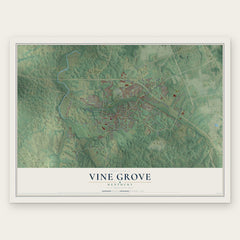
More maps nearby: West Point, Flaherty, Doe Valley, Rineyville and Ekron.
The art of mapping a place
How This Map Was Made
Real places. Remarkable detail. Discover the layers that turn geographic data into a map of home.

The view from above
Aerial imagery reveals the character of the land: woodland, open fields, and the patterns of a place.

The shape of the land
Elevation data brings hills, valleys, and subtle changes in the landscape into view.

The details of home
Roads, waterways, and building footprints come together to make the map feel unmistakably local.

Geography becomes art
Considered color, shading, and typography bring the layers together in a map made for your wall.


Process illustrated with Mendon, Massachusetts. Aerial imagery: USDA NAIP. Terrain: USGS 3D Elevation Program. Map details and finished artwork: KNOWOL.
The Details
About This Print
Choose an archival matte print, or a black or white Ayous wood frame. The archival matte print is unframed.
Select your size and finish above to see the matching product image and price.
Materials & Craftsmanship
A contemporary map with the character of a classic atlas, printed on archival matte paper. Optional frames are made from Ayous wood.
Your printed map does not include the watermark shown in the full-map preview.
Shipping & Delivery
Free shipping within the United States. Every print is made to order in the USA.
Buying a gift? Add a note in your cart and we'll include it. We never put prices in the package.
Prints ship within 2 to 3 business days. Allow 7 to 10 days total from ordering for delivery. Timing may vary during holidays or periods of high order volume.
Read our shipping policy.
Returns and damaged prints
Each print is made to order. Change-of-mind refunds are not available after production.
If your print arrives damaged, misprinted or incorrect, contact support@knowol.com within 30 days of receiving it. Include your order number, photos and a description of the issue.
Read our full refund and replacement policy. For questions about your order, email support@knowol.com.