
Search for another town





Free U.S. delivery 7 to 10 days after you order
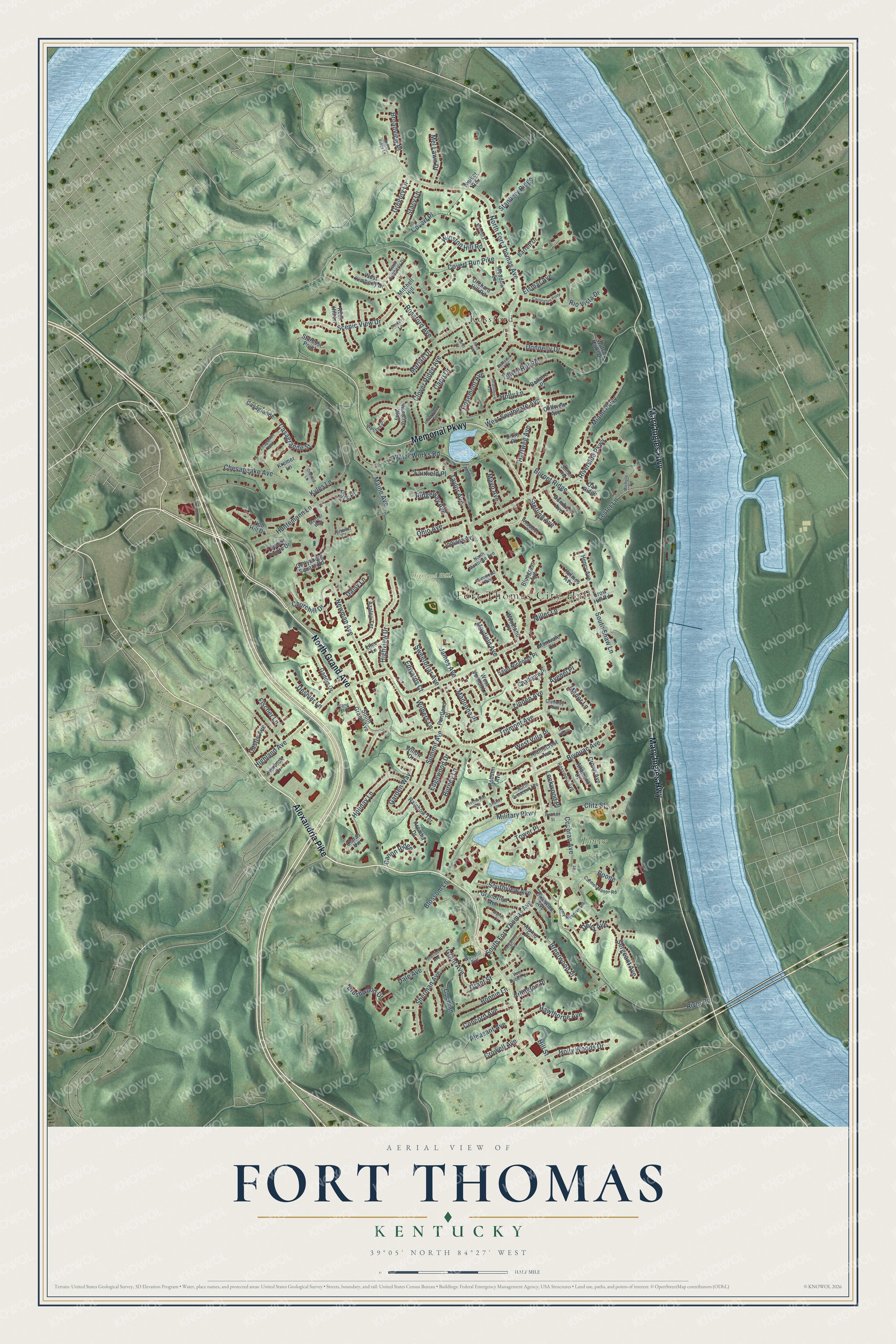
Fort Thomas, Kentucky Map Art
Building by building, with labeled streets and shaded relief.
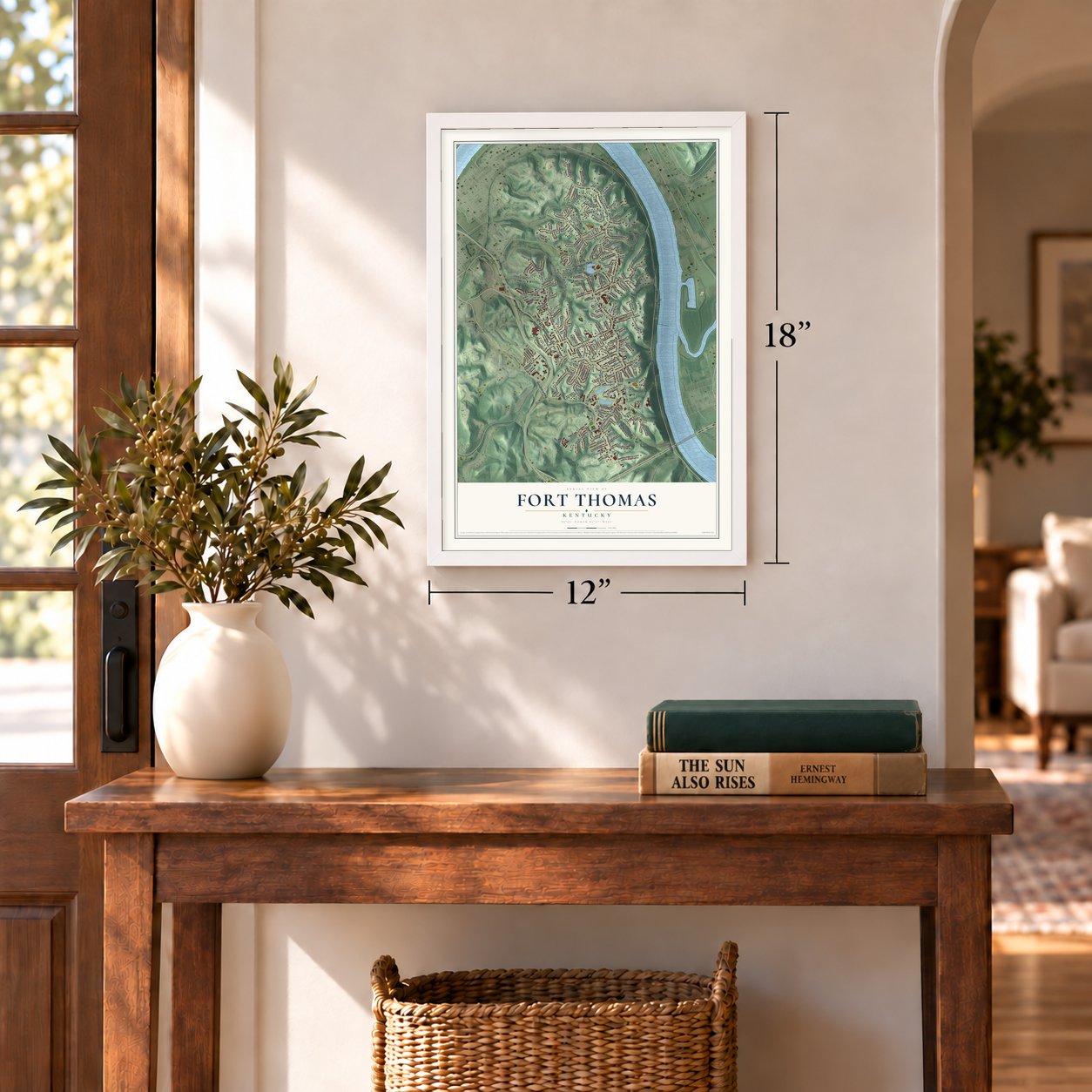
12" x 18" Archival Matte Print
A Map of Home. A Work of Art.
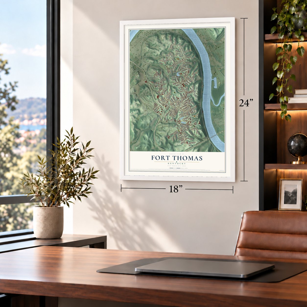
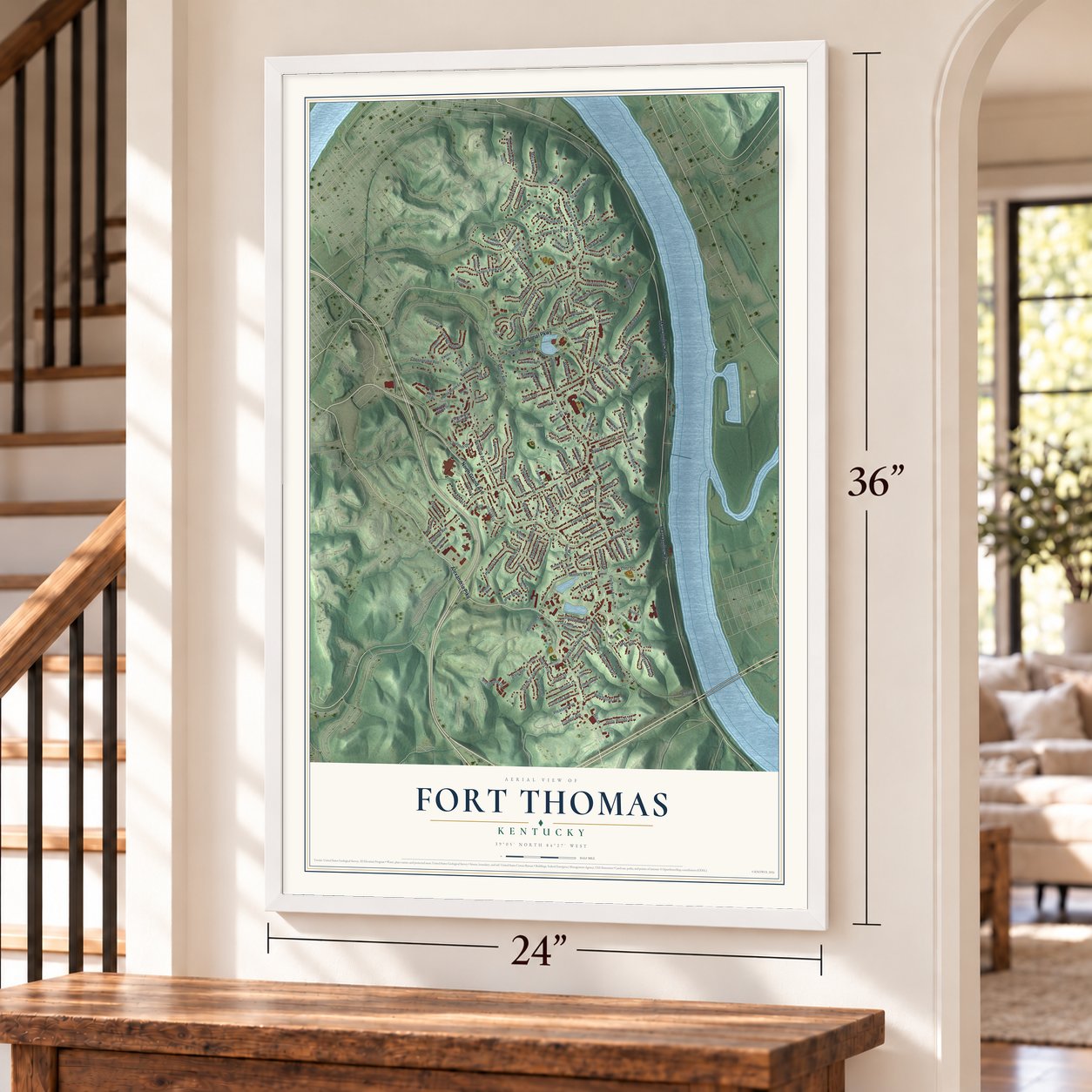
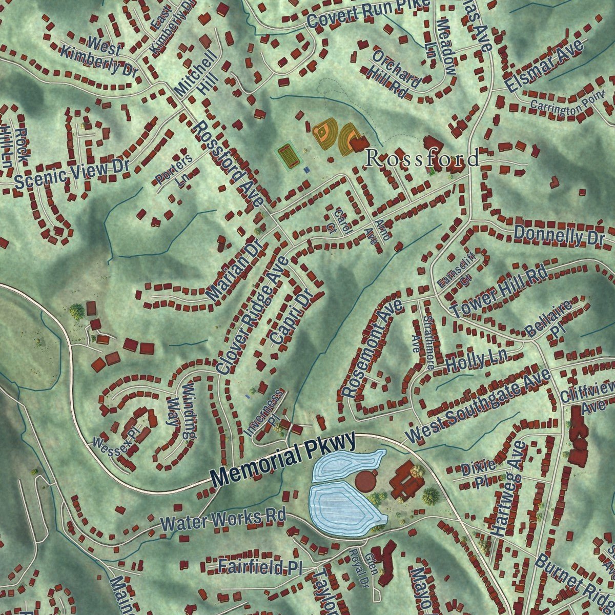
Explore Fort Thomas, Kentucky from a whole new perspective. Created using aerial imagery and detailed geographic data, this map captures Fort Thomas building by building, with labeled streets, familiar landmarks, and shaded topographical relief that highlights the natural contours of the landscape.
Combining modern data with the timeless character of a vintage atlas, this map is just as interesting up close as it is beautiful on the wall. Whether you grew up in Fort Thomas, spent memorable years there, or call it home today, this unique map is a great way to celebrate a place that means something to you. Zoom in on the preview to look for your street, and then order a print to put your memories on the wall.
Three ways to hang it
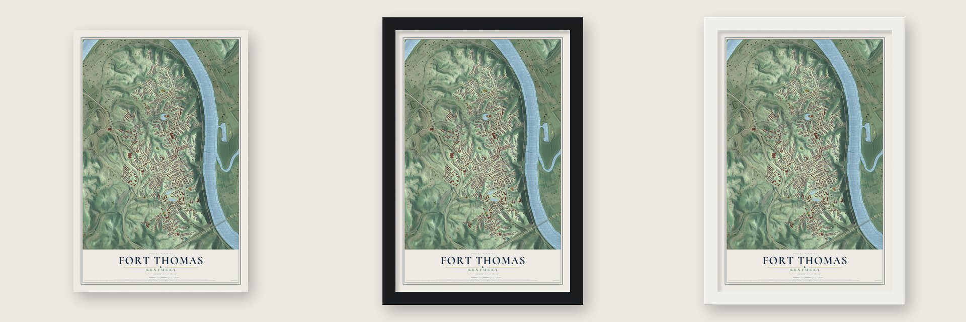
Unframed archival matte, a black wood frame or a white wood frame.
Up close
Geography Worth Displaying
This map was created using accurate cartographic data and authoritative geographic sources, including the U.S. Geological Survey and the Census Bureau. The map brings together terrain, waterways, roads, and building detail. The majority of the streets are labeled, houses are accurately depicted, and the topography is derived from government sources. Combining local data with carefully composed color and shading leads to this beautifully detailed Fort Thomas artwork for your wall.
Rather than simply showing street outlines, we’ve included as many of the street names as we could reasonably fit on the map while keeping their names legible. Zoom in on the high resolution preview to see exactly what’s on the map. We truly set out to create a statement piece for anyone who loves Fort Thomas. So whether it’s for you, or a gift for someone you love, we hope this map of Fort Thomas brings back fond memories.
Read the story behind this map of Fort Thomas, Kentucky from 2026.

Find your street
Names on the Fort Thomas map
Every name below is printed on this map. Look for your street, your school, the park where you played, or the pond down the road.
Places and landmarks4
- Fort Thomas City Hall
- Highland Hills Park
- Tower Park
- Rossford
Streets and roads181
- Alexandria Pike
- North Grand Avenue
- Mary Ingles Highway
- Memorial Parkway
- North Fort Thomas Avenue
- Highland Avenue
- Cochran Avenue
- South Fort Thomas Avenue
- River Road
- Rossford Avenue
- Covert Run Pike
- Newman Avenue
- Water Works Road
- Tower Hill Road
- Burnet Ridge
- Clover Ridge Avenue
- Mayfield Avenue
- Military Parkway
- Riverside Parkway
- Scenic View Drive
- Highview Drive
- Lester Lane
- Summit Avenue
- Chesapeake Avenue
- Burney Lane
- Rosemont Avenue
- Fischer Lane
- Miami Parkway
- Holiday Lane
- Sergeant Avenue
Show all 181 streets
- Covert Place
- Ohio Avenue
- Brentwood Place
- Sherman Avenue
- Tremont Avenue
- Taylor Avenue
- Ridgeway Avenue
- Holly Woods Drive
- Huntemann Lane
- Tower Place
- Hawthorne Avenue
- Donnelly Drive
- Maine Avenue
- Miller Lane
- Boone
- Casagrande Street
- Garden Way
- Rio Vista Drive
- West Southgate Avenue
- Churchill Drive
- Delta Avenue
- South Shaw Lane
- Marian Drive
- Edgewood Drive
- Southview Avenue
- Broadview Place
- Bonnie Lane
- Capri Drive
- Cochran
- Stanbery Ridge
- Concord Avenue
- Gregory Lane
- Madonna Place
- Winston Hill Road
- Hartweg Avenue
- Manor Lane
- West Villa Place
- Mel Lawn Drive
- Pleasant Avenue
- Bivouac Avenue
- Sweetbriar Avenue
- Grant Avenue
- Kyles Lane
- Brushwood Drive
- Clitz Street
- Canon Ridge
- Deshler Lane
- Blossom Lane
- Linden Avenue
- Stacy Lane
- Wilbers Lane
- James Avenue
- Elsmar Avenue
- Fairfield Place
- Lockwood Place
- Holly Lane
- Sterling Avenue
- Grant Street
- Mayo Avenue
- Crowell Avenue
- Arlington Place
- Custis Avenue
- Daisy Lane
- Edwards Court
- Park Place
- Dale Avenue
- Avenel Place
- Hill Street
- South Grand Avenue
- Nob Hill Drive
- Grandview Avenue
- Robson Avenue
- Gaddis Drive
- Orchard Hill Road
- Azalea Terrace
- Shawnee Avenue
- Winding Way
- Pentland Place
- Barrett Drive
- Thomas Pointe Drive
- Saint Nicholas Place
- Kremer Lane
- Walker Road
- Gettysburg Square Road
- Bluegrass Avenue
- West Kimberly Drive
- Casagrande
- Stardust Point
- Oak Ridge
- Dixie Place
- Crown Avenue
- Dumfries Avenue
- Arcadia Drive
- Rainbow Terrace
- Klainecrest Avenue
- Altamont Court
- Mitchell Hill
- Watch Point Drive
- Meadow Lane
- Willow Drive
- Chalfonte Place
- Alpine Drive
- Woodland Place
- Indiana Avenue
- West Vernon Lane
- Montvale Court
- Henry Avenue
- Overlook Drive
- Holmes Avenue
- Lilac Lane
- Rock Hill Lane
- Bellaire Place
- Cliffview Avenue
- Crow Hill Road
- Claras Vw
- Inverness Place
- Carmel Manor Road
- Army Reserve Road
- Memory Lane
- North Crescent Avenue
- North Montrose Avenue
- Rossmore Avenue
- East Kimberly Drive
- Woodfill Avenue
- Porters Lane
- Von Zuben Court
- Woodside Place
- Wessex Place
- Jennifer Court
- Elmwood Avenue
- Mercer Way
- Sunset Avenue
- Glenway Avenue
- Sheridan Avenue
- Villagrande Boulevard
- Strathmore Avenue
- Carrington Point
- Grand Lake Drive
- Orchard Lane
- Glen Royal Drive
- Margarete Lane
- Warren Court
- Pearson Street
- Michelle Lane
- Beechwood Avenue
- Earnscliff Court
- North Ridge Lane
- East Villa Place
- Sharon Place
- Carol Court
- Arno Avenue
Names are listed as they appear on the printed map. Zoom into the product photos to find them.
About Fort Thomas, Kentucky
Fort Thomas is a city of 17,438 people in Campbell County, on the southern bank of the Ohio River. Long before the city existed, around 1749, a band of Cherokee fought Miami and Shawnee warriors here and lost. Archeologists have since uncovered as many as 600 graves of the men who died.
The Army had kept a post at Newport Barracks, where the Licking River meets the Ohio, from 1808 until 1887. That low ground flooded again and again in the early 1880s, so the Army looked for a higher site. General Philip Sheridan chose this ground himself, called it the Highlands and said it would one day be the "West Point of the West." Named for General George Henry Thomas, the post opened in 1890, and the city carries its name.
- A 102-foot stone water towerThe Stone Water Tower, the 16th structure built on the military reservation, stands at the entrance to Tower Park. It wraps a standpipe that holds 100,000 gallons, pumped from reservoirs across South Fort Thomas Avenue, because in 1890 the area had no other water tower. In front of it rest cannons the Americans took in Havana Harbor in the Spanish-American War, cast in Barcelona and dated 1768 and 1769.
- Soldiers off to war in 1898The 6th Infantry Regiment was based at Fort Thomas until it was called to the Spanish-American War in June 1898. Soldiers of the 8th Volunteer Infantry, nicknamed the "8th Immunes," were stationed here too. The Army raised the Immune regiments believing, wrongly, that some soldiers resisted tropical disease, and General Orders No. 55, issued May 26, made five of them regiments of Black soldiers led by Black officers.
- The fort closed in 1964Over its years of service the fort worked as a depot, an induction center and a military hospital. Most of the garrison passed to the Veterans Administration in 1946, and the Army left for good when the fort closed in 1964. The U.S. Army Fort Thomas Mess Hall joined the National Register in 1980.
Keep exploring Kentucky
Fort Thomas is one of 659 Kentucky towns we've mapped. Every dot on the map is a print of its own.
The search covers every state, Kentucky first.
Near Fort Thomas
Order 2 or more town maps and save 10%. Shown in the size and finish you picked above, so they hang as a set.
- Woodlawn 12" x 18" / Archival Matte Print $39.99
- Southgate 12" x 18" / Archival Matte Print $39.99
- Newport 12" x 18" / Archival Matte Print $39.99

More maps nearby: Bellevue, Dayton, Wilder, Highland Heights and Kenton Vale.
The art of mapping a place
How This Map Was Made
Real places. Remarkable detail. Discover the layers that turn geographic data into a map of home.

The view from above
Aerial imagery reveals the character of the land: woodland, open fields, and the patterns of a place.

The shape of the land
Elevation data brings hills, valleys, and subtle changes in the landscape into view.

The details of home
Roads, waterways, and building footprints come together to make the map feel unmistakably local.

Geography becomes art
Considered color, shading, and typography bring the layers together in a map made for your wall.


Process illustrated with Mendon, Massachusetts. Aerial imagery: USDA NAIP. Terrain: USGS 3D Elevation Program. Map details and finished artwork: KNOWOL.
The Details
About This Print
Choose an archival matte print, or a black or white Ayous wood frame. The archival matte print is unframed.
Select your size and finish above to see the matching product image and price.
Materials & Craftsmanship
A contemporary map with the character of a classic atlas, printed on archival matte paper. Optional frames are made from Ayous wood.
Your printed map does not include the watermark shown in the full-map preview.
Shipping & Delivery
Free shipping within the United States. Every print is made to order in the USA.
Buying a gift? Add a note in your cart and we'll include it. We never put prices in the package.
Prints ship within 2 to 3 business days. Allow 7 to 10 days total from ordering for delivery. Timing may vary during holidays or periods of high order volume.
Read our shipping policy.
Returns and damaged prints
Each print is made to order. Change-of-mind refunds are not available after production.
If your print arrives damaged, misprinted or incorrect, contact support@knowol.com within 30 days of receiving it. Include your order number, photos and a description of the issue.
Read our full refund and replacement policy. For questions about your order, email support@knowol.com.