
Search for another town


Free U.S. delivery 7 to 10 days after you order
Franklin Farm, Virginia Map Art
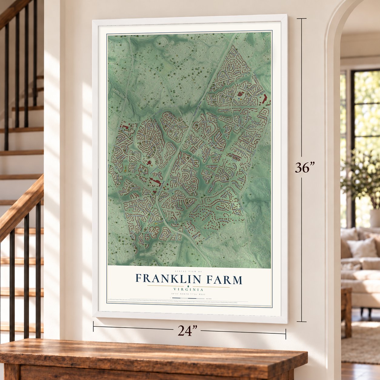
A new map of Franklin Farm, Virginia, made in 2026 and printed to order on thick archival matte paper.
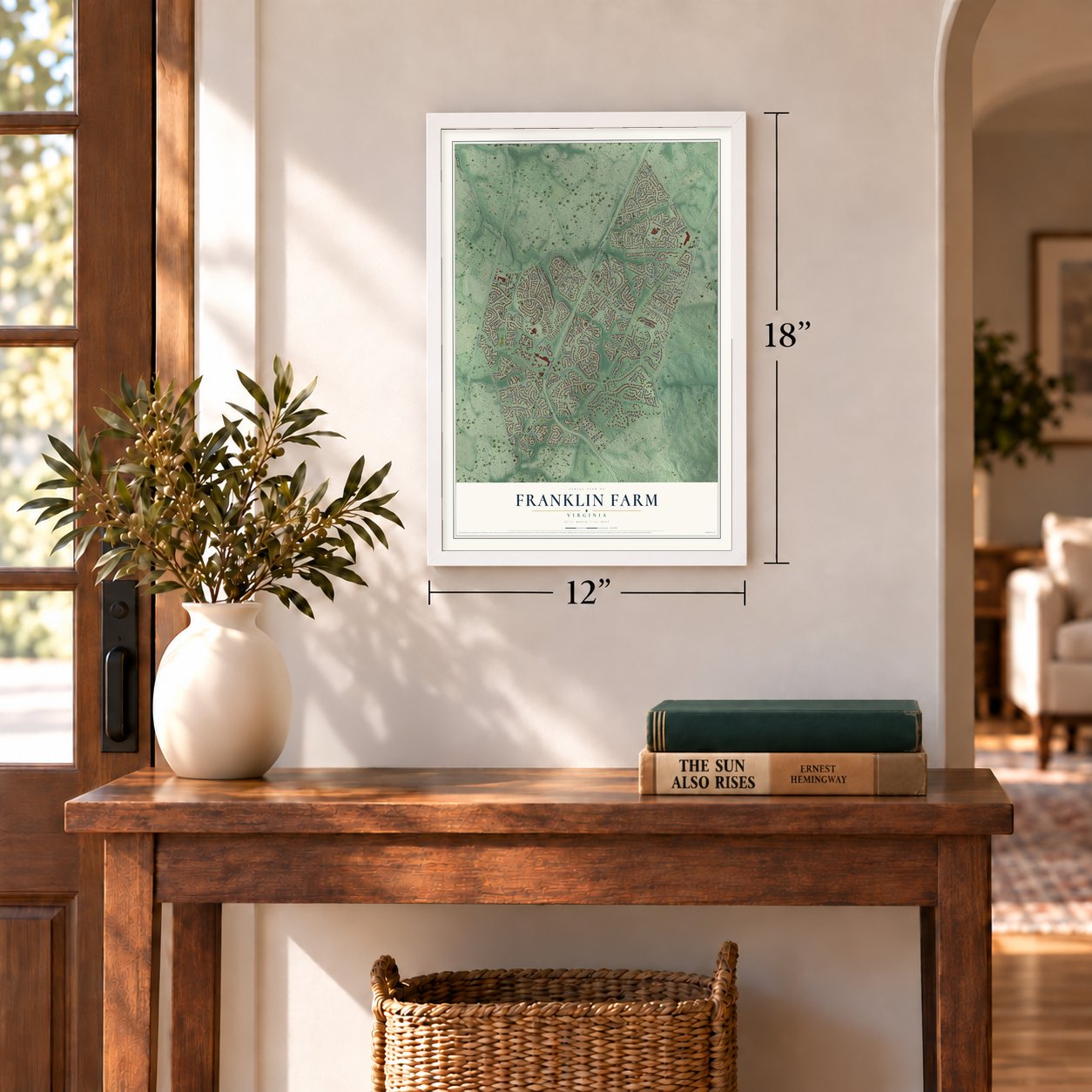
12" x 18" Archival Matte Print
A Map of Home. A Work of Art.
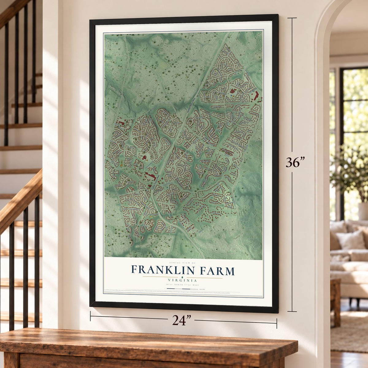
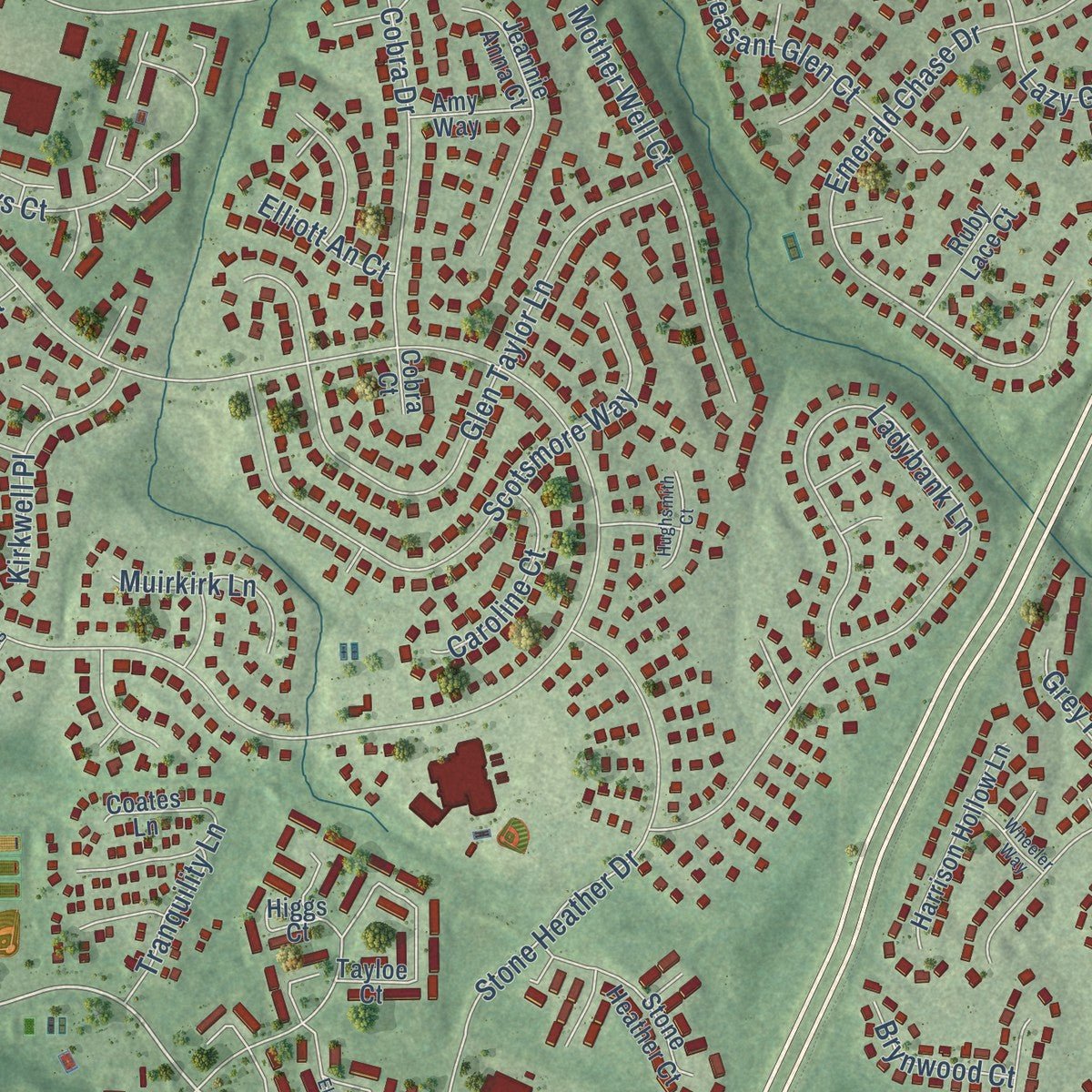
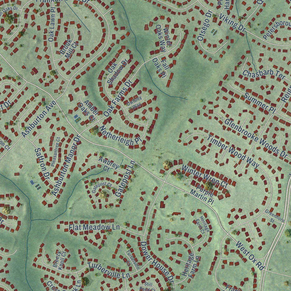
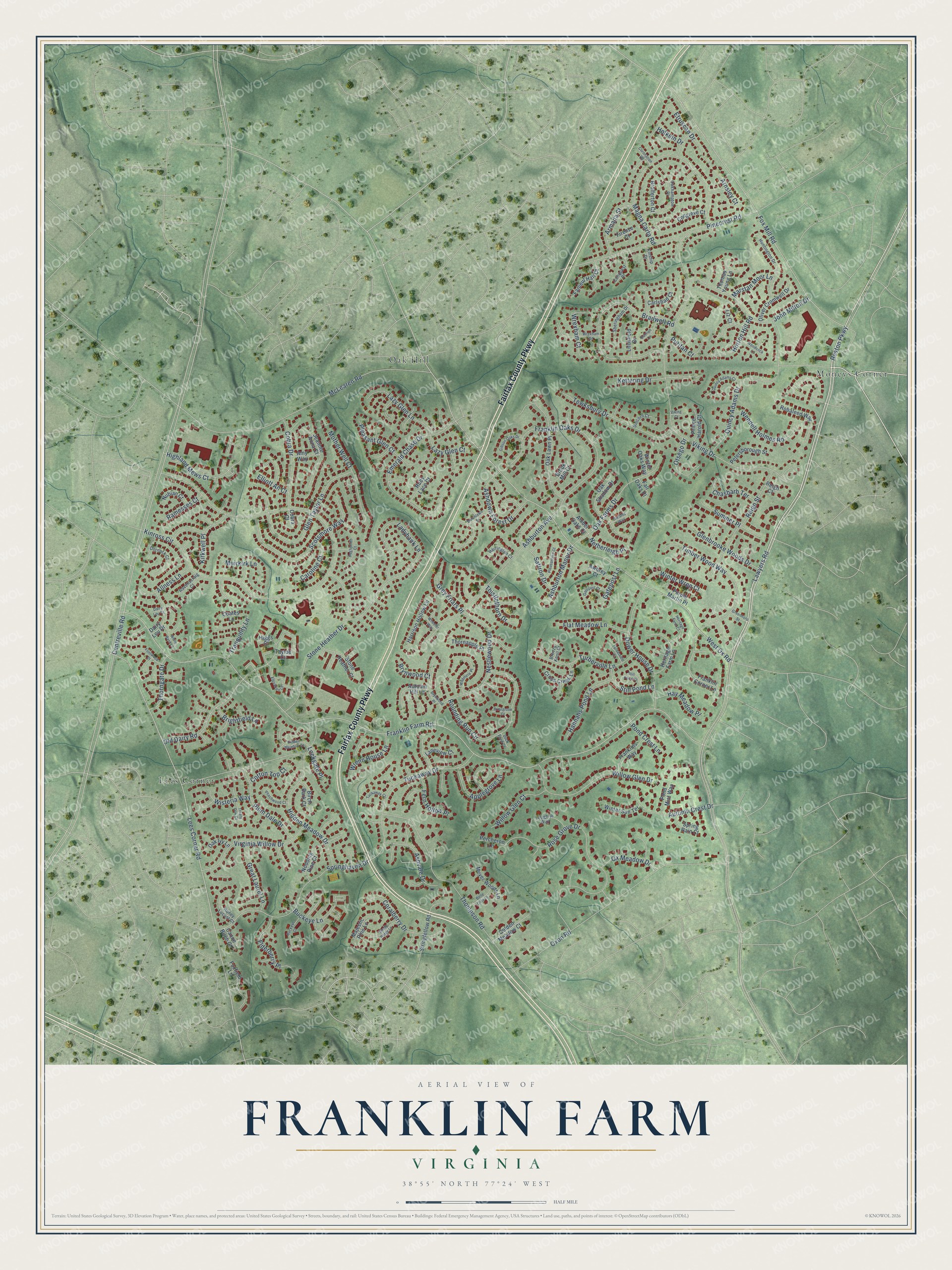
Explore Franklin Farm, Virginia from a whole new perspective. Created using aerial imagery and detailed geographic data, this map captures Franklin Farm building by building, with labeled streets, familiar landmarks, and shaded topographical relief that highlights the natural contours of the landscape.
Combining modern data with the timeless character of a vintage atlas, this map is just as interesting up close as it is beautiful on the wall. Whether you grew up in Franklin Farm, spent memorable years there, or call it home today, this unique map is a great way to celebrate a place that means something to you. Zoom in on the preview to look for your street, and then order a print to put your memories on the wall.
Three ways to hang it
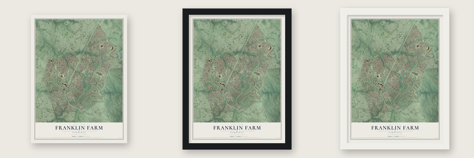
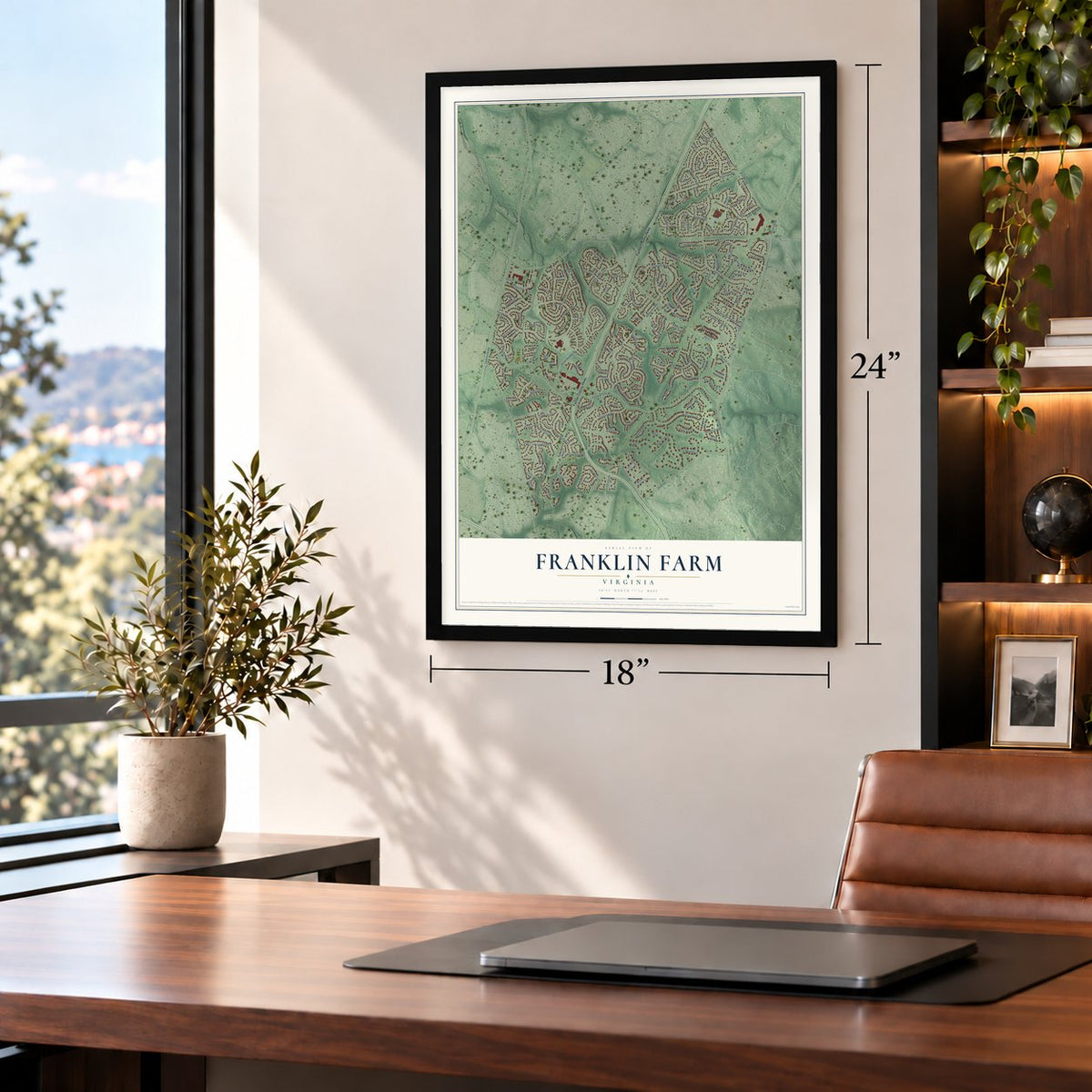
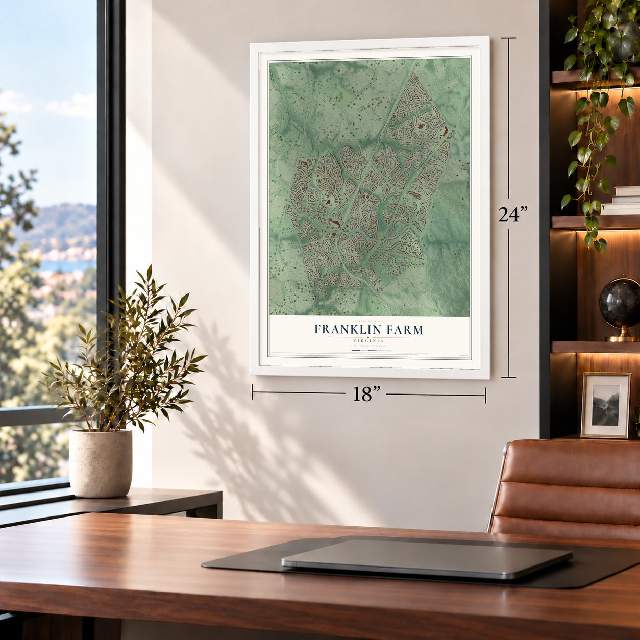
Unframed archival matte, a black wood frame or a white wood frame.
Up close
Geography Worth Displaying
This map was created using accurate cartographic data and authoritative geographic sources, including the U.S. Geological Survey and the Census Bureau. The map brings together terrain, waterways, roads, and building detail. The majority of the streets are labeled, houses are accurately depicted, and the topography is derived from government sources. Combining local data with carefully composed color and shading leads to this beautifully detailed Franklin Farm artwork for your wall.
Rather than simply showing street outlines, we’ve included as many of the street names as we could reasonably fit on the map while keeping their names legible. Zoom in on the high resolution preview to see exactly what’s on the map. We truly set out to create a statement piece for anyone who loves Franklin Farm. So whether it’s for you, or a gift for someone you love, we hope this map of Franklin Farm brings back fond memories.
Read the story behind this map of Franklin Farm, Virginia from 2026.

About Franklin Farm, Virginia
Franklin Farm is a community of 19,189 people in the Oak Hill section of Fairfax County, about 20 miles west of the White House. It takes its name from a farm that James Franklin, an airline pilot, bought with $10,000 he won in a sweepstakes. He and his wife Jean changed the place, then called Oak Hill Farm, from a general farm into a dairy.
After 1979 the Franklin land was sold for development, and the planned community of Franklin Farm was established in 1980. It grew to 1,777 homes in 27 neighborhoods. The Fairfax County Parkway now runs straight through the middle of it.
- From 100 to 827 acresThe farm started at 100 acres. Franklin kept buying land, and by 1979 he had 827 acres, which put his dairy among the biggest in Fairfax County. Wikipedia dates his first purchase to 1936, while Franklin Middle School gives 1937.
- Planned on 850 acresThe planned community covers 1.32 square miles, slightly less than 30 percent of the larger census area that shares its name. The Franklin Farm Foundation, its homeowner association, sets its boundaries.
- 13 miles of trailsResidents share 13 miles of trails and 180 acres of open space. Along the way are two swimming pools, six tennis courts, three multipurpose courts, a sand volleyball court, 14 tot lots and six ponds stocked for fishing.
Find your street
Names on the Franklin Farm map
Every name below is printed on this map. Look for your street, your school, the park where you played, or the pond down the road.
Places and landmarks3
- Lees Corner
- Moneys Corner
- Oak Hill
Streets and roads194
- Fairfax County Parkway
- Lawyers Road
- Reston Parkway
- Franklin Farm Road
- West Ox Road
- Kinross Circle
- Lees Corner Road
- Thompson Road
- Viking Drive
- McLearen Road
- Fox Mill Road
- Centreville Road
- Oxon Road
- Ladybank Lane
- Franklin Oaks Drive
- Rose Grove Drive
- Magna Carta Road
- Pinecrest Road
- Ashburton Avenue
- Bradwell Road
- Springhaven Drive
- Emerald Chase Drive
- Quincy Adams Drive
- Tuckaway Drive
- Hidden Meadow Drive
- Stone Heather Drive
- Glen Taylor Lane
- Old Dairy Road
- Rounding Run Circle
- Nestlewood Drive
Show all 194 streets
- Timber Wood Way
- Scotsmore Way
- Wendell Holmes Road
- Willow Glen Drive
- John Milton Drive
- Dower House Drive
- Tewksbury Drive
- Oak Farms Drive
- Highland Mews Court
- Virginia Willow Drive
- Reign Street
- Turberville Lane
- Mother Well Court
- Ashdown Forest Drive
- Cobra Drive
- Plum Dale Drive
- Autumn Crest Drive
- Glenbrooke Woods Drive
- Coralberry Drive
- Lazy Glen Lane
- Applegrove Lane
- Kettering Drive
- Pleasant Glen Court
- Etruscan Drive
- Elderberry Place
- Ashvale Drive
- Hannahs Pond Lane
- Buckeye Lane
- Great Laurel Lane
- Flat Meadow Lane
- Summer Place
- Willow Glen Court
- Winter Wren Court
- Armada Street
- Horton Hill Road
- Netherleigh Place
- Ashburton Manor Drive
- Ox Meadow Drive
- Thorngate Drive
- Otsego Drive
- Kirkwell Place
- Wrenn House Lane
- Chasbarb Terrace
- Still Pond Lane
- Tranquility Lane
- Fern Hollow Place
- Allness Lane
- Hay Meadow Place
- Wrexham Court
- Saffron Drive
- Arnsley Court
- Caroline Court
- Muirkirk Lane
- Thistlethorn Drive
- Pond Crest Lane
- Ramesses Court
- Marstan Moor Lane
- Wisteria Way
- Brightfield Lane
- Puritan Court
- Lazy Glen Court
- Grey Friars Place
- Cotton Top Court
- Brynwood Court
- Holkein Drive
- Lockgate Place
- Gatepost Lane
- Elliott An Court
- Oak Lawn Place
- Oak Shadow Drive
- Franklin Corner Lane
- Heritage Farm Lane
- Jeannie Anna Court
- Robaleed Way
- Foxfield Lane
- Tayloe Court
- Oliver Cromwell Drive
- Harrison Hollow Lane
- Stone Heather Court
- Dairy Lou Drive
- Fanieul Hall Court
- Franklins Way
- Golden Meadow Court
- Petersborough Street
- Cross Creek Lane
- Stringfellow Road
- Carlsbad Court
- Autumn Hill Lane
- Meyer Woods Lane
- Nodding Pine Court
- Winter Sun Terrace
- Higgs Court
- Thornapple Place
- Purple Martin Place
- Prince Harold Court
- Majestic Pine Lane
- Brook Mill Court
- Canoe Birch Court
- Nubian Court
- Birch Bark Court
- Brofferton Court
- Pond Mist Way
- Thomas Young Lane
- Laneview Court
- Ruby Lace Court
- Spring Rain Court
- Congreve Court
- Awbrey Court
- Firenze Court
- Litchfield Drive
- Amy Way
- Percheron Lane
- Oak Ivy Lane
- Amber Oaks Court
- Winter Oaks Way
- Fall Oaks Place
- Reign Court
- Coates Lane
- Liz Court
- Cobra Court
- Huntington Drive
- Oakhampton Place
- Dornock Court
- Honey Locust Court
- Sheringham Drive
- Conquest Place
- Loughrie Way
- Harrington Court
- Ravenscraig Court
- Unicorn Court
- Kinship Drive
- Breezy Knoll Court
- Elevation Lane
- Buckeye Court
- Wildmere Place
- Wrexham Road
- Brynwood Place
- Hidden Meadow Court
- Shady Ridge Lane
- Quincy Adams Court
- Gatepost Court
- Burchlawn Street
- Pleasantree Court
- Heritage Farm Court
- Flintwood Place
- Belle Cote Lane
- Gibson Oaks Drive
- Bastian Lane
- Peachwood Court
- Woodcock Lane
- White Barn Lane
- Still Pond Court
- Hughsmith Court
- Tuckaway Court
- Wheeler Way
- Briargrove Court
- Treaty Oak Court
- Turberville Court
- Owlsley Way
- Coronation Road
- Greenhorn Street
- Duck Pond Court
- Viking Court
- Dairy Lou Court
Names are listed as they appear on the printed map. Zoom into the product photos to find them.
The art of mapping a place
How This Map Was Made
Real places. Remarkable detail. Discover the layers that turn geographic data into a map of home.

The view from above
Aerial imagery reveals the character of the land: woodland, open fields, and the patterns of a place.

The shape of the land
Elevation data brings hills, valleys, and subtle changes in the landscape into view.

The details of home
Roads, waterways, and building footprints come together to make the map feel unmistakably local.

Geography becomes art
Considered color, shading, and typography bring the layers together in a map made for your wall.


Process illustrated with Mendon, Massachusetts. Aerial imagery: USDA NAIP. Terrain: USGS 3D Elevation Program. Map details and finished artwork: KNOWOL.
The Details
About This Print
Choose an archival matte print, or a black or white Ayous wood frame. The archival matte print is unframed.
Select your size and finish above to see the matching product image and price.
Materials & Craftsmanship
A contemporary map with the character of a classic atlas, printed on archival matte paper. Optional frames are made from Ayous wood.
Your printed map does not include the watermark shown in the full-map preview.
Shipping & Delivery
Free shipping within the United States. Every print is made to order in the USA.
Buying a gift? Add a note in your cart and we'll include it. We never put prices in the package.
Prints ship within 2 to 3 business days. Allow 7 to 10 days total from ordering for delivery. Timing may vary during holidays or periods of high order volume.
Read our shipping policy.
Returns and damaged prints
Each print is made to order. Change-of-mind refunds are not available after production.
If your print arrives damaged, misprinted or incorrect, contact support@knowol.com within 30 days of receiving it. Include your order number, photos and a description of the issue.
Read our full refund and replacement policy. For questions about your order, email support@knowol.com.
Find your town
Looking for another city?
Find a map of home in our Virginia collection, or any town in the country.
Nearby
Maps of towns near Franklin Farm
Know someone from one of these towns? Their map makes a great gift.
 Floris
, Virginia
From $39.99See the map
 Sully Square
, Virginia
From $39.99See the map
 Navy
Navy, Virginia
From $39.99See the map
More maps nearby: McNair, Difficult Run, Greenbriar, Chantilly and Hutchison.