
Search for another town





Free U.S. delivery 7 to 10 days after you order
Chantilly, Virginia Map Art
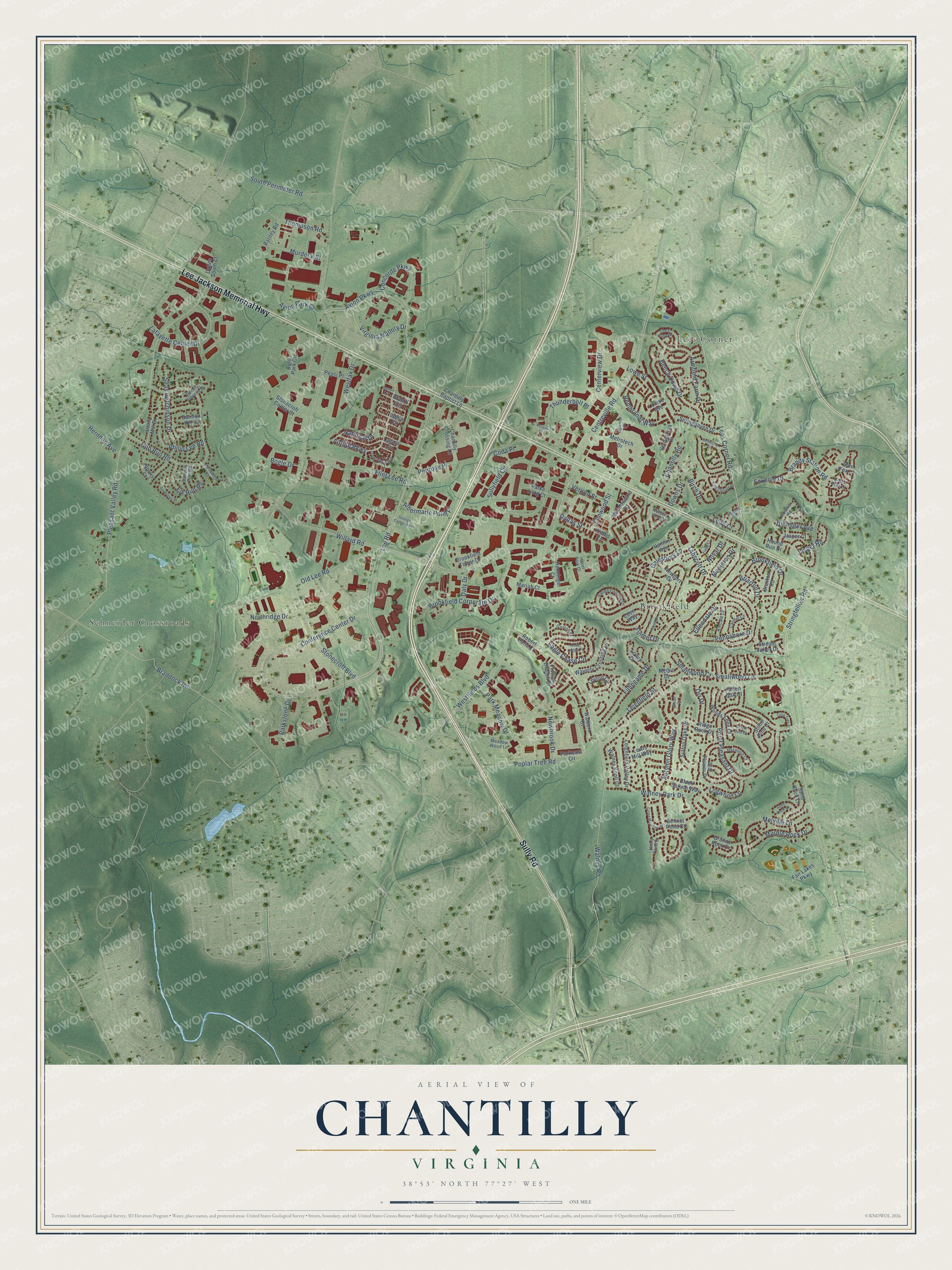
A new map of Chantilly, Virginia, made in 2026 and printed to order on thick archival matte paper.
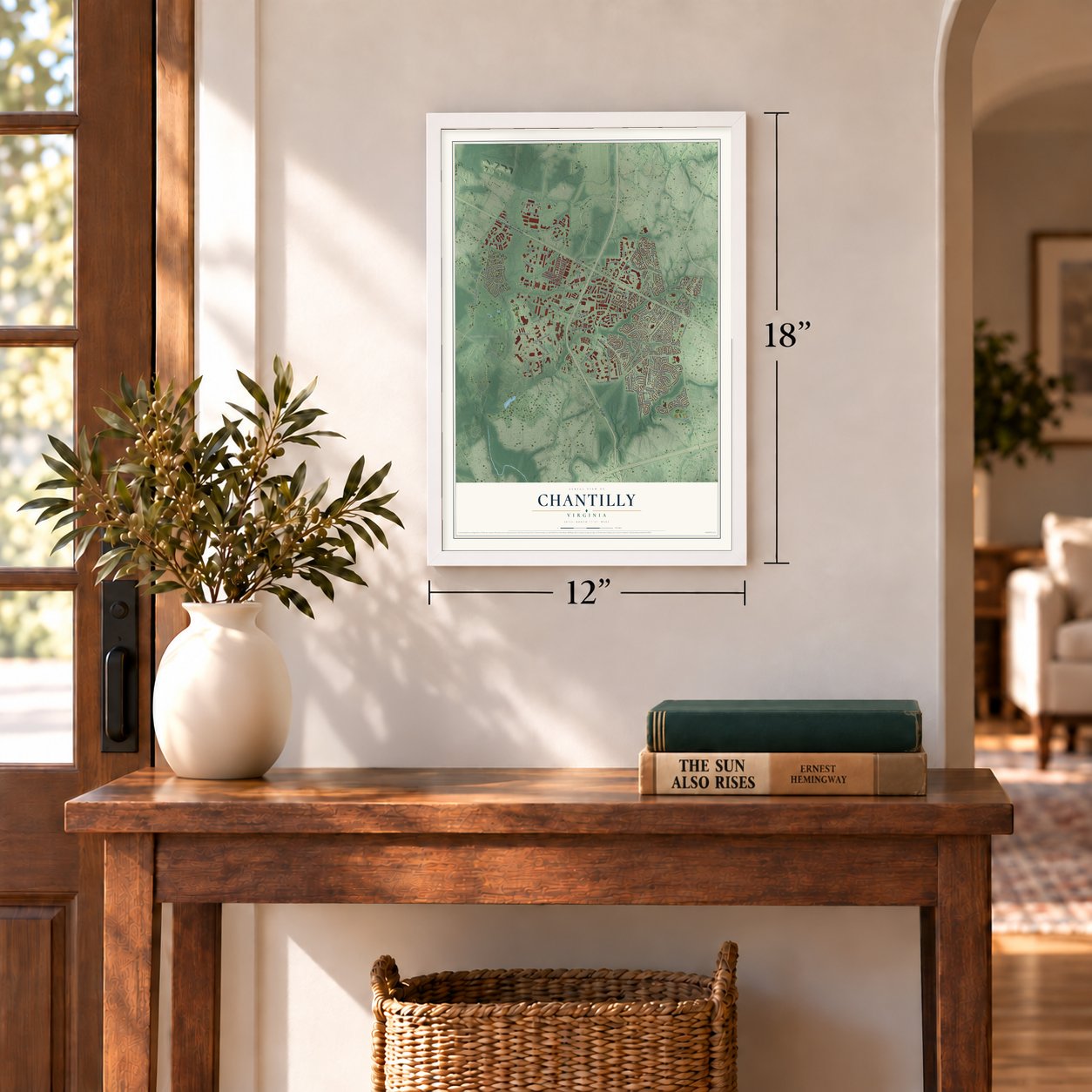
12" x 18" Archival Matte Print
A Map of Home. A Work of Art.
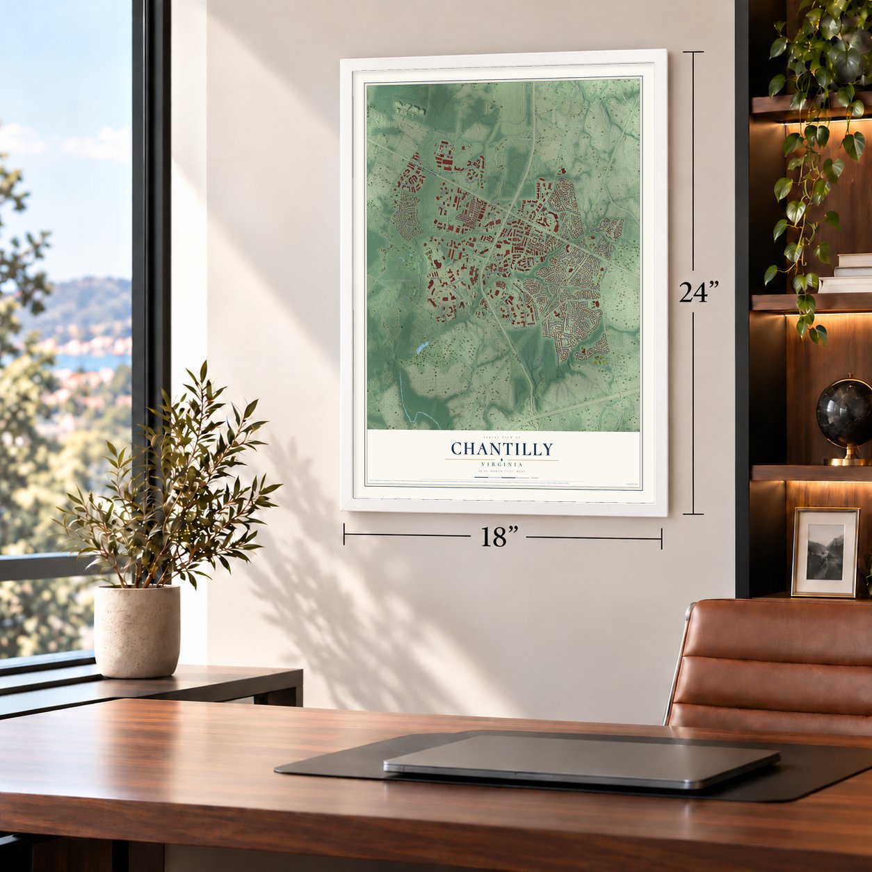
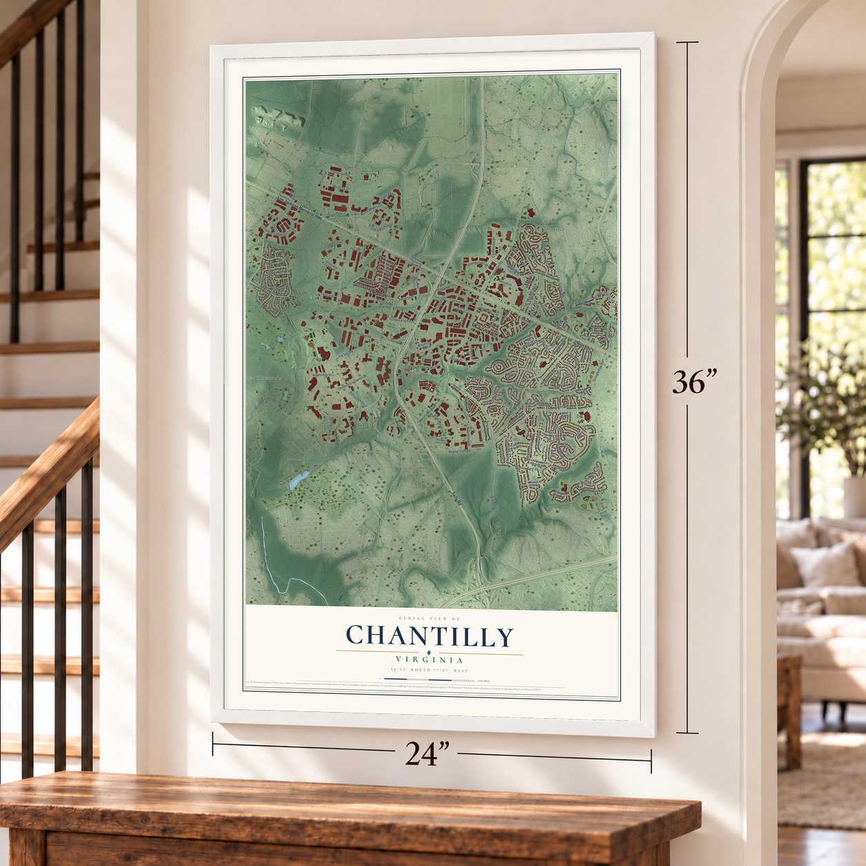
Explore Chantilly, Virginia from a whole new perspective. Created using aerial imagery and detailed geographic data, this map captures Chantilly building by building, with labeled streets, familiar landmarks, and shaded topographical relief that highlights the natural contours of the landscape.
Combining modern data with the timeless character of a vintage atlas, this map is just as interesting up close as it is beautiful on the wall. Whether you grew up in Chantilly, spent memorable years there, or call it home today, this unique map is a great way to celebrate a place that means something to you. Zoom in on the preview to look for your street, and then order a print to put your memories on the wall.
Three ways to hang it
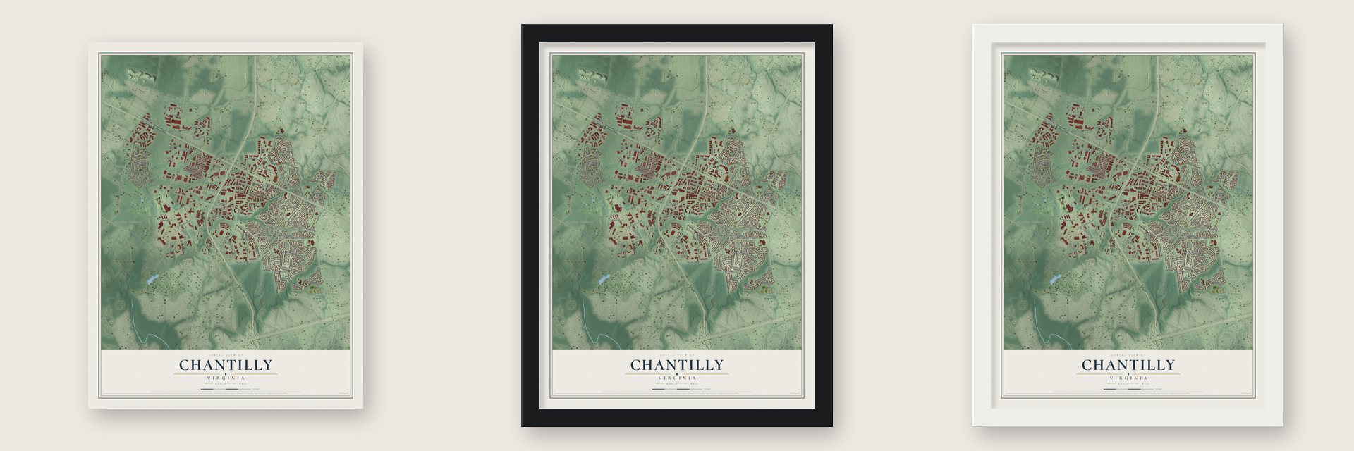
Unframed archival matte, a black wood frame or a white wood frame.
Up close
Geography Worth Displaying
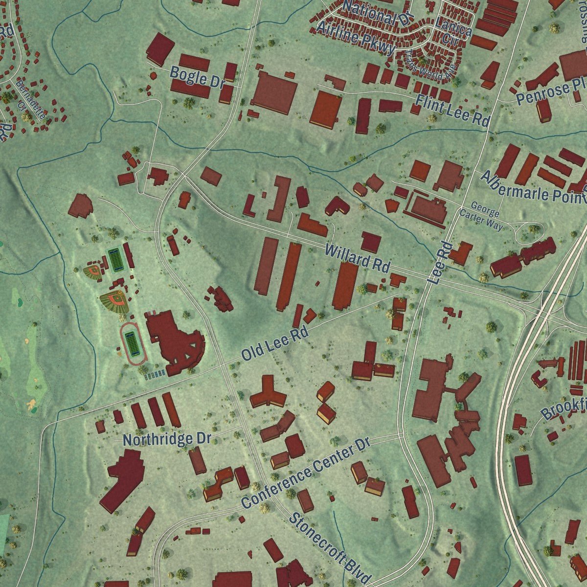
This map was created using accurate cartographic data and authoritative geographic sources, including the U.S. Geological Survey and the Census Bureau. The map brings together terrain, waterways, roads, and building detail. The majority of the streets are labeled, houses are accurately depicted, and the topography is derived from government sources. Combining local data with carefully composed color and shading leads to this beautifully detailed Chantilly artwork for your wall.
Rather than simply showing street outlines, we’ve included as many of the street names as we could reasonably fit on the map while keeping their names legible. Zoom in on the high resolution preview to see exactly what’s on the map. We truly set out to create a statement piece for anyone who loves Chantilly. So whether it’s for you, or a gift for someone you love, we hope this map of Chantilly brings back fond memories.
Read the story behind this map of Chantilly, Virginia from 2026.

About Chantilly, Virginia
Chantilly is a community of 24,301 people in western Fairfax County, about 25 miles west of Washington, D.C. Its name goes back to 1763, when Richard Henry Lee, later a signer of the Declaration of Independence, named his Westmoreland County estate for the Château de Chantilly in France. His granddaughter Cornelia Lee Turberville Stuart received a share of her father's Leeton estate. Around 1817 she and her husband, Charles Calvert Stuart, built a mansion here from red sandstone cut on the property, and they gave it the old family name.
Union troops burned the Chantilly manor house during the Civil War. Afterward Cornelia Stuart, by then deep in debt, sold the 1,064-acre estate, but the name stayed with the country around it. The village had already grown along the Little River Turnpike to Winchester. After 1980, developers turned the farmland south of Dulles Airport into subdivisions and shopping areas, and Chantilly became an outer suburb of the capital.
- A battle in the storm, 1862After winning at Second Manassas, Robert E. Lee sent Stonewall Jackson around John Pope's Union army at Centreville. Jackson marched east toward Fairfax Court House on the Little River Turnpike, today's U.S. Route 50. Near Ox Hill on September 1, 1862, Union troops met him in a pouring storm; the battle killed two Union generals, Isaac Stevens and Philip Kearny. Fighting ended at dusk, and Pope kept retreating to Washington.
- Sully and Leeton GroveRichard Bland Lee I built Sully Plantation in the 1700s, and it is now the Sully Historic Site. George Richard Lee Turberville's Leeton Grove once covered more than 5,000 acres, and its main house still stands on Walney Road.
- The last plantation buildingOne stone house from the Chantilly Plantation still stands, facing the Greenbriar Shopping Center from the other side of Route 50. It was most likely an overseer's quarters before the war and a tavern or boarding house after it. When Cornelia Stuart put the estate up for sale, her advertisement listed it among several "tenements."
- Air and Space MuseumThe Steven F. Udvar-Hazy Center of the National Air and Space Museum is in Chantilly. So is the headquarters of the National Reconnaissance Office, the agency that designs, builds and operates the country's spy satellites.
Find your street
Names on the Chantilly map
Every name below is printed on this map. Look for your street, your school, the park where you played, or the pond down the road.
Places and landmarks3
- Brookfield
- Lees Corner
- Schneider Crossroads
Streets and roads166
- Lee Jackson Memorial Highway
- Sully Road
- Lees Corner Road
- Avion Parkway
- Autumn Glory Way
- Airline Parkway
- National Drive
- Conference Center Drive
- Avion Park Court
- Lee Road
- Stringfellow Road
- Centerview Drive
- Stonecroft Boulevard
- Willard Road
- Walney Road
- Pleasant Valley Road
- Centreville Road
- Poplar Tree Road
- Braddock Road
- Westfields Boulevard
- Old Lee Road
- Point Pleasant Drive
- Cub Run Road
- Sullyfield Circle
- Newbrook Drive
- Beech Down Drive
- Lafayette Center Drive
- Brookfield Corporate Drive
- Tabscott Drive
- Galesbury Lane
Show all 166 streets
- Eagle Chase Circle
- Chantilly Road
- Pennsboro Drive
- Silas Hutchinson Drive
- Park Meadow Drive
- Armfield Farm Drive
- Melville Lane
- Brandy Station Road
- Rembrandt Way
- Ellendale Drive
- Fillingame Drive
- Walney Park Drive
- Westfax Drive
- Concorde Parkway
- South Perimeter Road
- Thunderbolt Place
- Hollinger Avenue
- Flint Lee Road
- Brookfield Drive
- Virginia Mallory Drive
- Marble Rock Drive
- Lowe Street
- Smallwood Lane
- Thompson Road
- Elk Run Road
- Murdock Street
- Albermarle Point Place
- Birch Drive
- Briarton Drive
- Penrose Place
- Herndon Avenue
- Philip Lee Road
- Orr Drive
- Novar Drive
- Northridge Drive
- Leighfield Street
- Elmwood Street
- Logwood Lane
- Smallwood Court
- Jasper Road
- Bogle Drive
- Vernon Street
- Mapleton Drive
- Parkstone Drive
- Coda Place
- Downs Drive
- Dallas Street
- Foxhole Drive
- Daly Drive
- Leith Court
- Fulmer Drive
- Lanica Circle
- Parkeast Circle
- Metrotech Drive
- Auto Park Circle
- Louis Mill Drive
- Star Flower Drive
- Leighfield Valley Drive
- Chantilly Crossing Lane
- Newport Drive
- Barney Road
- Leeton Circle
- Sutton Oaks Drive
- Woods Edge Court
- Waverly Crossing Lane
- Sand Rock Lane
- Springhaven Drive
- Vernacchia Drive
- Chantilly Baptist Lane
- Lewis Mill Way
- Robert Paris Court
- Stonecroft Center Court
- Granite Rock Drive
- Iberia Circle
- Walney Knoll Court
- Braniff Circle
- Hound Run Drive
- Ridge Rock Drive
- Fair Lakes Parkway
- Black Spruce Way
- Brookfield Tower Drive
- Meadowland Court
- Pepsi Place
- Jasper Court
- Stone Pine Court
- Stream Valley Drive
- Henninger Court
- Lowry Drive
- Braxton Road
- Flatlick Branch Drive
- Bennet Pond Court
- McGill Drive
- Dulles South Court
- Walbern Court
- Louise Avenue
- Norris Court
- Fallen Oak Court
- Parke Long Court
- Mariah Court
- Hamlin Avenue
- Eden Way
- Khalid Lane
- Bannon Hill Court
- Blue Fox Lane
- Valley Country Drive
- Meadow Wood Lane
- Kincaid Court
- Samuels Pine Road
- Hazelnut Court
- General Stevens Court
- Henry Pond Court
- Carmel Lane
- Scibilia Road
- Gaston Street
- Bokel Drive
- Cross Keys Court
- Autumn Vale Court
- Hazel Park Court
- George Carter Way
- De Haven Drive
- Trans World Avenue
- Lightfoot Street
- Clary Sage Drive
- Sovereign Place
- Cross Meadow Place
- Flagg Court
- King Charles Drive
- Boac Circle
- Bellerose Drive
- Tulip Tree Court
- Sand Rock Court
- Bernadette Court
- Black Gum Court
- Corsair Court
- Rose Lodge Place
- Gilead Court
Names are listed as they appear on the printed map. Zoom into the product photos to find them.
The art of mapping a place
How This Map Was Made
Real places. Remarkable detail. Discover the layers that turn geographic data into a map of home.

The view from above
Aerial imagery reveals the character of the land: woodland, open fields, and the patterns of a place.

The shape of the land
Elevation data brings hills, valleys, and subtle changes in the landscape into view.

The details of home
Roads, waterways, and building footprints come together to make the map feel unmistakably local.

Geography becomes art
Considered color, shading, and typography bring the layers together in a map made for your wall.


Process illustrated with Mendon, Massachusetts. Aerial imagery: USDA NAIP. Terrain: USGS 3D Elevation Program. Map details and finished artwork: KNOWOL.
The Details
About This Print
Choose an archival matte print, or a black or white Ayous wood frame. The archival matte print is unframed.
Select your size and finish above to see the matching product image and price.
Materials & Craftsmanship
A contemporary map with the character of a classic atlas, printed on archival matte paper. Optional frames are made from Ayous wood.
Your printed map does not include the watermark shown in the full-map preview.
Shipping & Delivery
Free shipping within the United States. Every print is made to order in the USA.
Buying a gift? Add a note in your cart and we'll include it. We never put prices in the package.
Prints ship within 2 to 3 business days. Allow 7 to 10 days total from ordering for delivery. Timing may vary during holidays or periods of high order volume.
Read our shipping policy.
Returns and damaged prints
Each print is made to order. Change-of-mind refunds are not available after production.
If your print arrives damaged, misprinted or incorrect, contact support@knowol.com within 30 days of receiving it. Include your order number, photos and a description of the issue.
Read our full refund and replacement policy. For questions about your order, email support@knowol.com.
Find your town
Looking for another city?
Find a map of home in our Virginia collection, or any town in the country.
Nearby
Maps of towns near Chantilly
Know someone from one of these towns? Their map makes a great gift.
 Sully Square
, Virginia
From $39.99See the map
 Greenbriar
, Virginia
From $39.99See the map
 Navy
Navy, Virginia
From $39.99See the map
More maps nearby: Centreville, Franklin Farm, South Riding, Bull Run and Fair Lakes.