
Search for another town





Free U.S. delivery 7 to 10 days after you order
Frayser, Tennessee Map Art
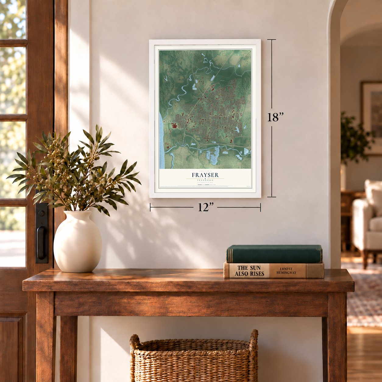
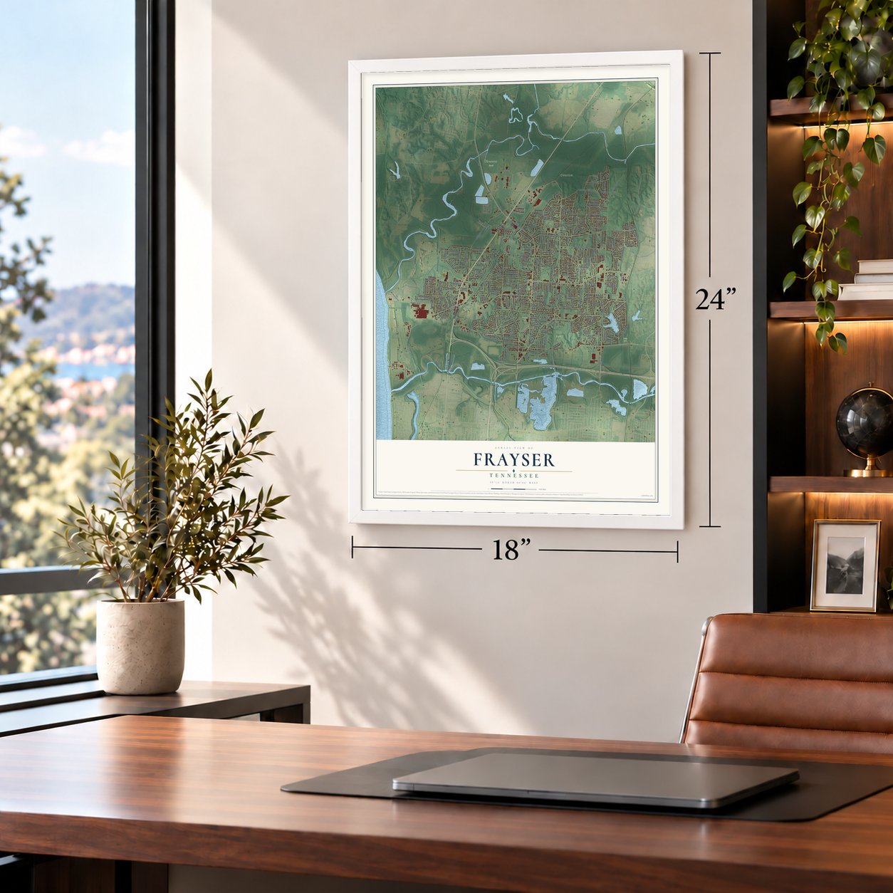
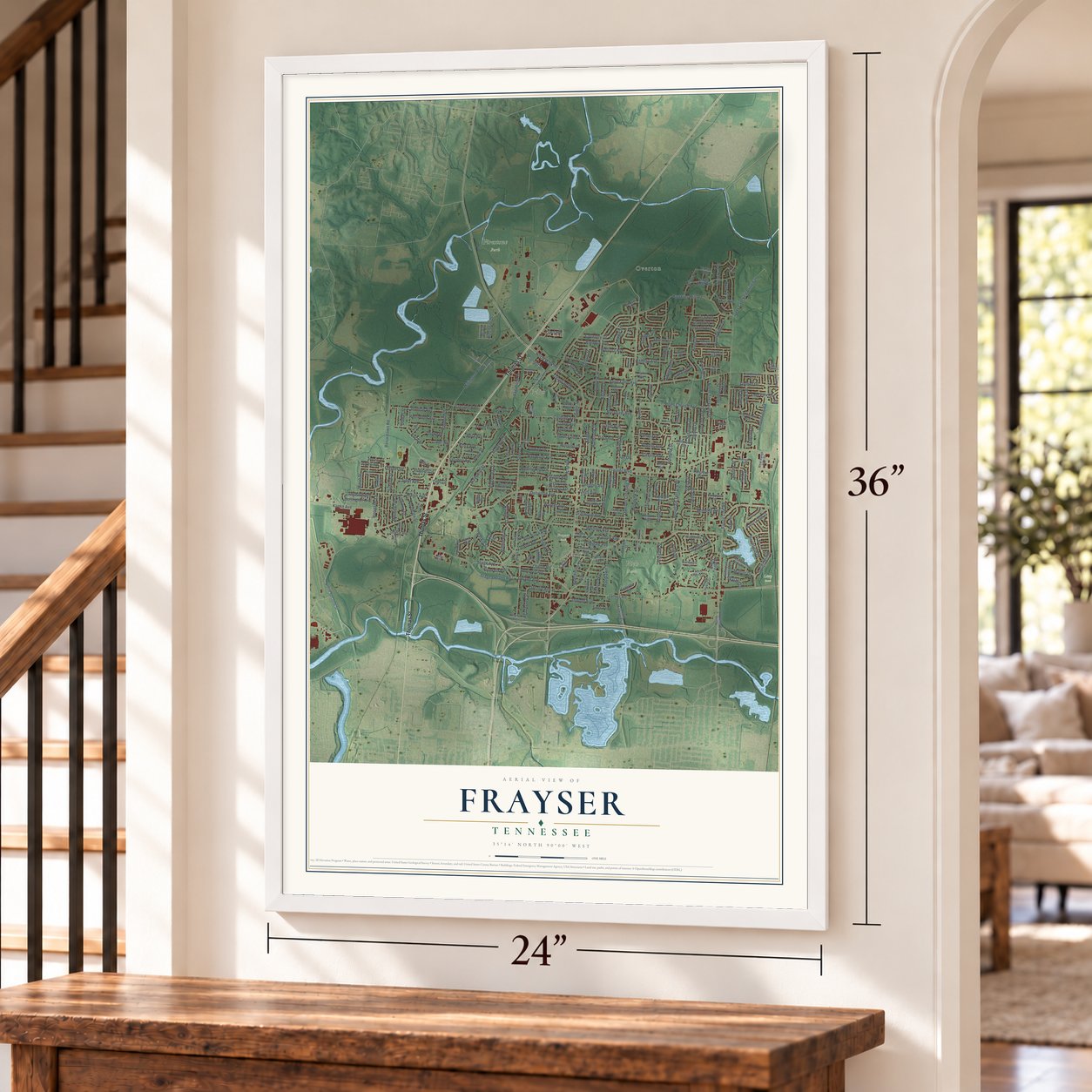
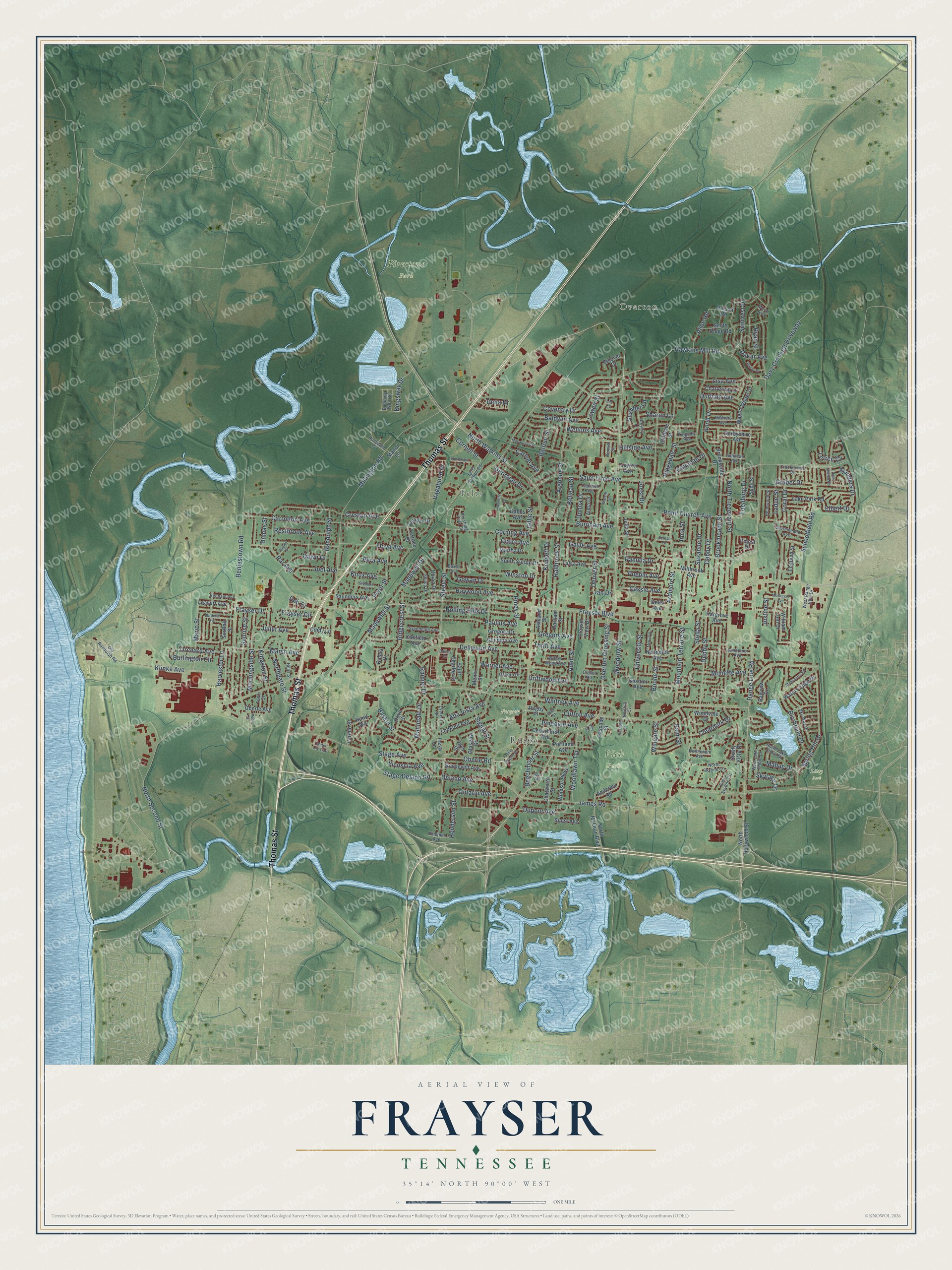
A new map of Frayser, Tennessee, made in 2026 and printed to order on thick archival matte paper.
12" x 18" Archival Matte Print
A Map of Home. A Work of Art.
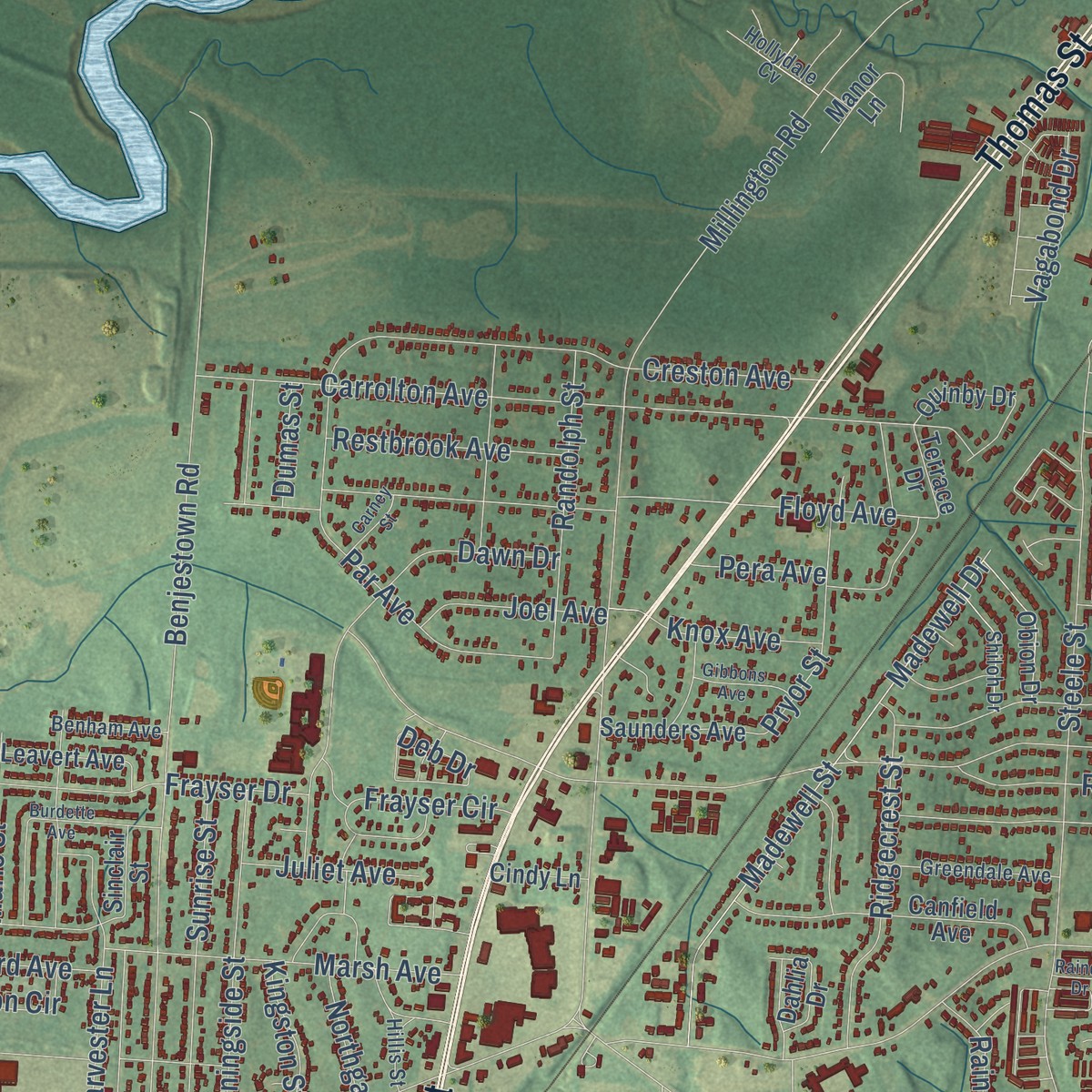
Explore Frayser, Tennessee from a whole new perspective. Created using aerial imagery and detailed geographic data, this map captures Frayser building by building, with labeled streets, familiar landmarks, and shaded topographical relief that highlights the natural contours of the landscape.
Combining modern data with the timeless character of a vintage atlas, this map is just as interesting up close as it is beautiful on the wall. Whether you grew up in Frayser, spent memorable years there, or call it home today, this unique map is a great way to celebrate a place that means something to you. Zoom in on the preview to look for your street, and then order a print to put your memories on the wall.
Three ways to hang it
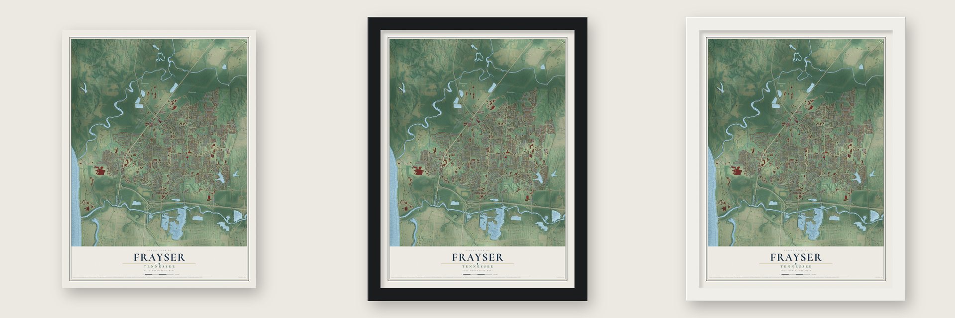
Unframed archival matte, a black wood frame or a white wood frame.
Up close
Geography Worth Displaying
This map was created using accurate cartographic data and authoritative geographic sources, including the U.S. Geological Survey and the Census Bureau. The map brings together terrain, waterways, roads, and building detail. The majority of the streets are labeled, houses are accurately depicted, and the topography is derived from government sources. Combining local data with carefully composed color and shading leads to this beautifully detailed Frayser artwork for your wall.
Rather than simply showing street outlines, we’ve included as many of the street names as we could reasonably fit on the map while keeping their names legible. Zoom in on the high resolution preview to see exactly what’s on the map. We truly set out to create a statement piece for anyone who loves Frayser. So whether it’s for you, or a gift for someone you love, we hope this map of Frayser brings back fond memories.
Read the story behind this map: Detailed Map of Frayser, Tennessee.

Find your street
Names on the Frayser map
Every name below is printed on this map. Look for your street, your school, the park where you played, or the pond down the road.
Places and landmarks7
- Overton
- Rugby
- Felts
- Firestone Park
- Frayser Park
- Litty Park
- Vieh Park
Streets and roads263
- Thomas Street
- Overton Crossing Street
- Millington Road
- Oberle Road
- Frayser Boulevard
- Range Line Road
- Delano Avenue
- Brookmeade Street
- Henderson Street
- North Watkins Street
- Whitney Avenue
- Mountain Terrace Street
- Steele Street
- Saint Elmo Avenue
- University Street
- James Road
- North Trezevant Street
- Corning Avenue
- Benjestown Road
- Denver Street
- Dellwood Avenue
- Alta Vista Avenue
- Wellons Avenue
- Argonne Street
- Carrolton Avenue
- Birchfield Drive
- Hawkins Mill Road
- Stage Avenue
- North Second Street
- Durham Avenue
Show all 263 streets
- Baskin Street
- Ardmore Street
- Floyd Avenue
- Ladue Street
- Madewell Street
- Madewell Drive
- Dupont Avenue
- Gowan Drive
- Clifton Avenue
- Sunrise Street
- Klinke Avenue
- Point Church Avenue
- Creston Avenue
- Harvester Lane
- Schoolfield Road
- Beechmont Street
- Paullus Avenue
- Dawn Drive
- Haywood Avenue
- Signal Street
- Coventry Drive
- Spring Hill Drive
- Debby Street
- Rolling Hills Drive
- Woodlawn Terrace
- Winston Drive
- Par Avenue
- Davy Crockett Driveway
- Driftwood Avenue
- Rainier Drive
- Lisa Avenue
- Woodrow Street
- Morningside Street
- Warner Avenue
- Ridgecrest Street
- Marsh Avenue
- Pueblo Avenue
- Clearpark Drive
- Pamela Drive
- Burnham Avenue
- Suzanne Drive
- Gruber Drive
- Hallbrook Street
- Coral Drive
- Ontario Avenue
- Edenburg Drive
- Frayser Drive
- Suncrest Drive
- Gregory Avenue
- Aden Street
- Randolph Street
- Hillside Avenue
- Stage-Delano Road
- Balfour Street
- Gayle Avenue
- Pera Avenue
- Boone Street
- Northgate Street
- Mario Street
- Pryor Street
- Kensett Drive
- Kingston Street
- Baldwin Avenue
- Belleau Street
- Debby Drive
- Knob Drive
- Sharon Lane
- Cassie Avenue
- Restbrook Avenue
- Burlington Circle
- Ajanders Drive
- Riney Street
- Donna Drive
- Ridgedale Street
- Pinedale Avenue
- Leweir Street
- Manndale Drive
- Knox Avenue
- Kingsway Drive
- Georgian Drive
- Monette Avenue
- Orchard Avenue
- Gillie Street
- Aline Road
- Joel Avenue
- Slumber Lane
- Vicoscia Avenue
- Vagabond Drive
- Callahan Drive
- Dena Drive
- Cornell Street
- Jan Drive
- Skylake Drive
- Thrift Avenue
- Juliet Avenue
- Mahue Drive
- Carlyle Avenue
- Claire Avenue
- Joest Drive
- Frayser Circle
- Dakar Avenue
- Wingate Street
- Ryan Street
- Letrec Cv
- Stella Street
- Dumas Street
- Justine Street
- Elbert Drive
- Palm Street
- Deb Drive
- Irma Street
- North Hollywood Street
- Portland Avenue
- Nunnelee Avenue
- Chattering Lane
- Lake Park Road
- Canfield Avenue
- Smith Ridge Road
- Sinclair Street
- Parham Street
- Lookout Avenue
- North McLean Boulevard
- Cliffdale Street
- Roosevelt Avenue
- Slocum Avenue
- South Sutton Drive
- Julia Street
- Wagon Wheel Drive
- Windsor Parkway
- Saint Charles Drive
- Mensi Street
- Waters Edge Drive
- Dabbs Avenue
- Cedarhurst Avenue
- Dove Street
- Bayview Drive
- Saunders Avenue
- Tulsa Avenue
- Glasgow Street
- Oberle Avenue
- Obion Drive
- Derbyshire Avenue
- Alma Drive
- Chatworth Street
- Millbrook Avenue
- Adderley Road
- Woodvale Drive
- William Tell Drive
- Sybil Street
- Childers Avenue
- Hargrove Avenue
- Leavert Avenue
- England Street
- Gregory Drive
- Shady Vista Drive
- Leyton Avenue
- Frayser View Drive
- Brooksville Drive
- Quinby Drive
- Laredo Street
- Manor Lane
- Belover Drive
- Ashland Street
- Martha Drive
- Sipes Avenue
- Haisch Road
- Treva Lane
- Cindy Lane
- Vayu Drive
- Cascade Street
- Terrace Drive
- Rugby Place
- Dahlia Drive
- Rand Avenue
- Pojest Drive
- Dells Avenue
- West Lake Shore Drive
- North Lake Shore Drive
- Willow Wood Avenue
- Pershing Park Drive
- Felts Station Road
- Sky Way Drive
- Hillis Street
- Kingsley Avenue
- Bethlehem Avenue
- Redvers Avenue
- Greendale Avenue
- Sandpiper Avenue
- Southmeade Avenue
- Helmwood Street
- Shiloh Drive
- Old Randolph Road
- East Skyline Circle
- West Range Hills Drive
- Drowsy Lane
- Benham Avenue
- Cracklerose Drive
- Everest Street
- Hollydale Cv
- North Skyline Circle
- Hindman Avenue
- Achaean Avenue
- Bubbling Well Road
- Osborn Drive
- Collier Road
- Lauretta Avenue
- Baxter Avenue
- Tudor Street
- Renwal Street
- Northill Cv
- Mirror Avenue
- Macaulay Avenue
- Point Church Road
- Celeste Drive
- Chandler Street
- Burdette Avenue
- Northside Drive
- Stonehurst Avenue
- Water Lily Trail
- McKell Drive
- McGregor Avenue
- Marvin Street
- Rainey Drive
- Annette Lane
- Gibbons Avenue
- Glen Avenue
- Davey Drive
- Falling Stream Drive
- Eden Street
- Carney Street
- Vine Avenue
- Pool Street
- Lee Cv
Names are listed as they appear on the printed map. Zoom into the product photos to find them.
The art of mapping a place
How This Map Was Made
Real places. Remarkable detail. Discover the layers that turn geographic data into a map of home.

The view from above
Aerial imagery reveals the character of the land: woodland, open fields, and the patterns of a place.

The shape of the land
Elevation data brings hills, valleys, and subtle changes in the landscape into view.

The details of home
Roads, waterways, and building footprints come together to make the map feel unmistakably local.

Geography becomes art
Considered color, shading, and typography bring the layers together in a map made for your wall.


Process illustrated with Mendon, Massachusetts. Aerial imagery: USDA NAIP. Terrain: USGS 3D Elevation Program. Map details and finished artwork: KNOWOL.
The Details
About This Print
Choose an archival matte print, or a black or white Ayous wood frame. The archival matte print is unframed.
Select your size and finish above to see the matching product image and price.
Materials & Craftsmanship
A contemporary map with the character of a classic atlas, printed on archival matte paper. Optional frames are made from Ayous wood.
Your printed map does not include the watermark shown in the full-map preview.
Shipping & Delivery
Free shipping within the United States. Every print is made to order in the USA.
Buying a gift? Add a note in your cart and we'll include it. We never put prices in the package.
Prints ship within 2 to 3 business days. Allow 7 to 10 days total from ordering for delivery. Timing may vary during holidays or periods of high order volume.
Read our shipping policy.
Returns and damaged prints
Each print is made to order. Change-of-mind refunds are not available after production.
If your print arrives damaged, misprinted or incorrect, contact support@knowol.com within 30 days of receiving it. Include your order number, photos and a description of the issue.
Read our full refund and replacement policy. For questions about your order, email support@knowol.com.
Find your town
Looking for another city?
Find a map of home in our Tennessee collection, or any town in the country.
Nearby
Maps of towns near Frayser
Know someone from one of these towns? Their map makes a great gift.
 North Memphis
, Tennessee
From $39.99See the map
 Northaven
, Tennessee
From $39.99See the map
 Woodstock
, Tennessee
From $39.99See the map
More maps nearby: Raleigh, Downtown Memphis, Midtown, Cooper-Young and Memphis.