
Search for another town





Free U.S. delivery 7 to 10 days after you order
Raleigh, Tennessee Map Art
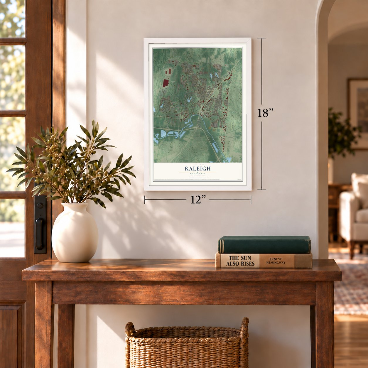
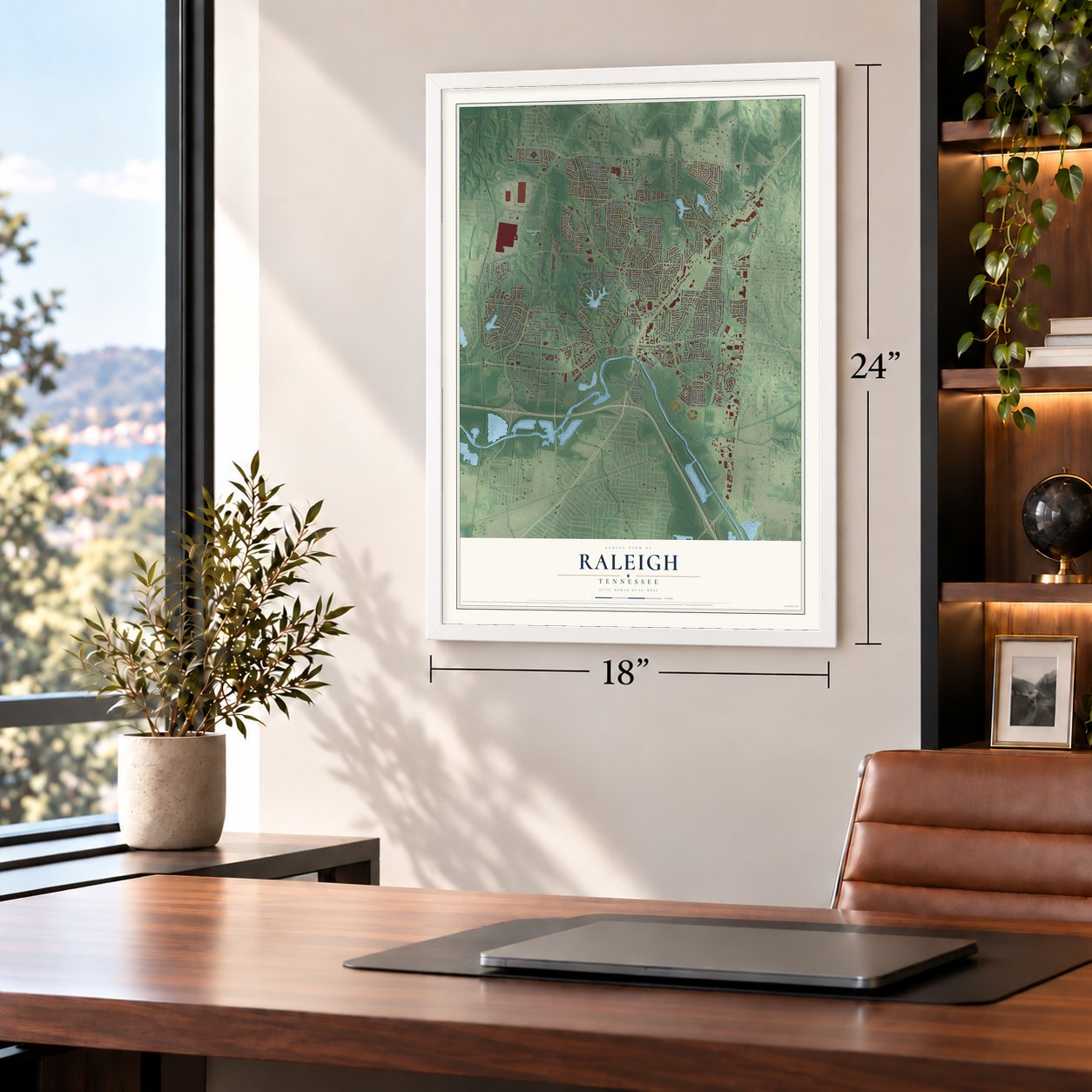
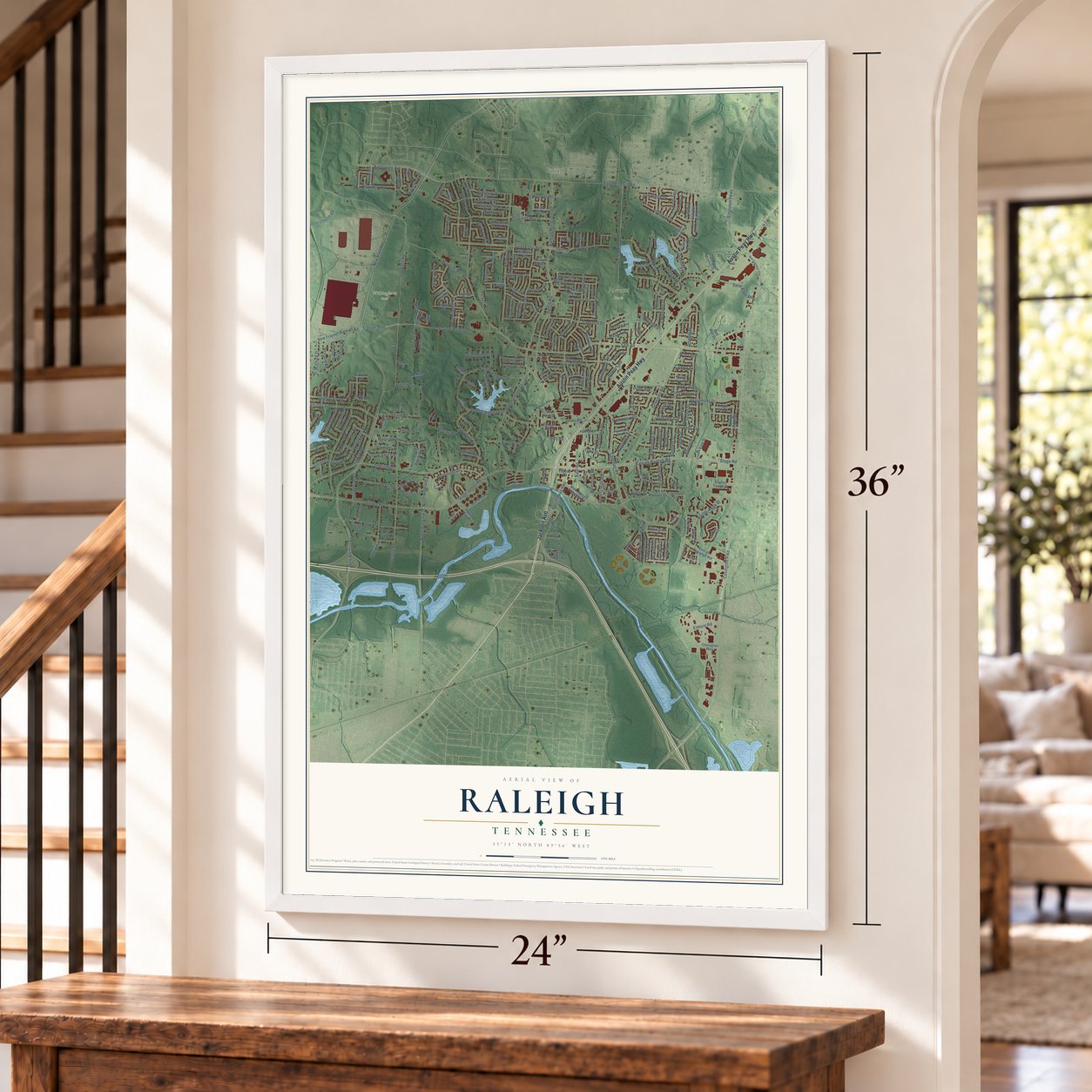
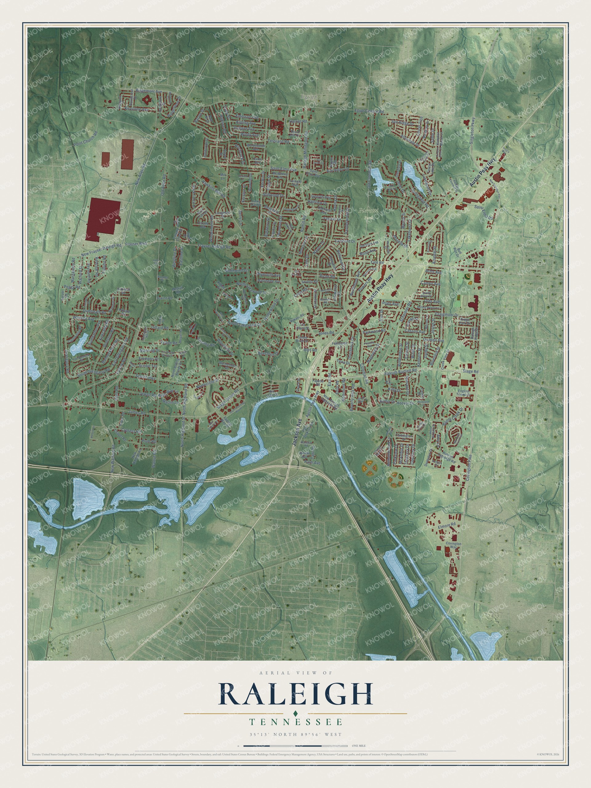
A new map of Raleigh, Tennessee, made in 2026 and printed to order on thick archival matte paper.
12" x 18" Archival Matte Print
A Map of Home. A Work of Art.
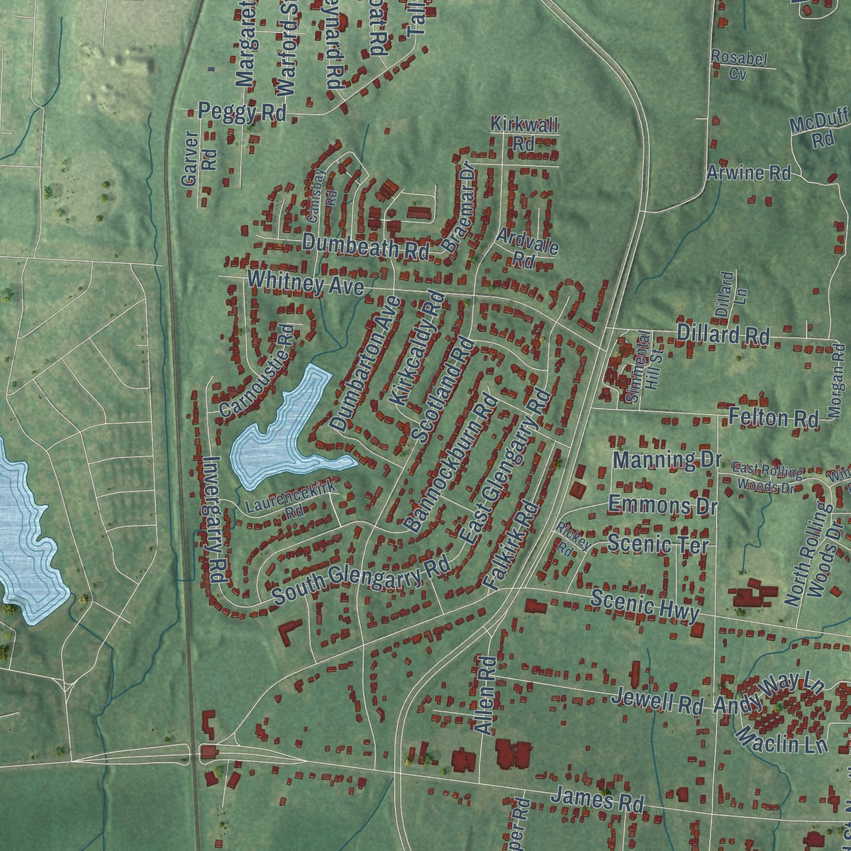
Explore Raleigh, Tennessee from a whole new perspective. Created using aerial imagery and detailed geographic data, this map captures Raleigh building by building, with labeled streets, familiar landmarks, and shaded topographical relief that highlights the natural contours of the landscape.
Combining modern data with the timeless character of a vintage atlas, this map is just as interesting up close as it is beautiful on the wall. Whether you grew up in Raleigh, spent memorable years there, or call it home today, this unique map is a great way to celebrate a place that means something to you. Zoom in on the preview to look for your street, and then order a print to put your memories on the wall.
Three ways to hang it
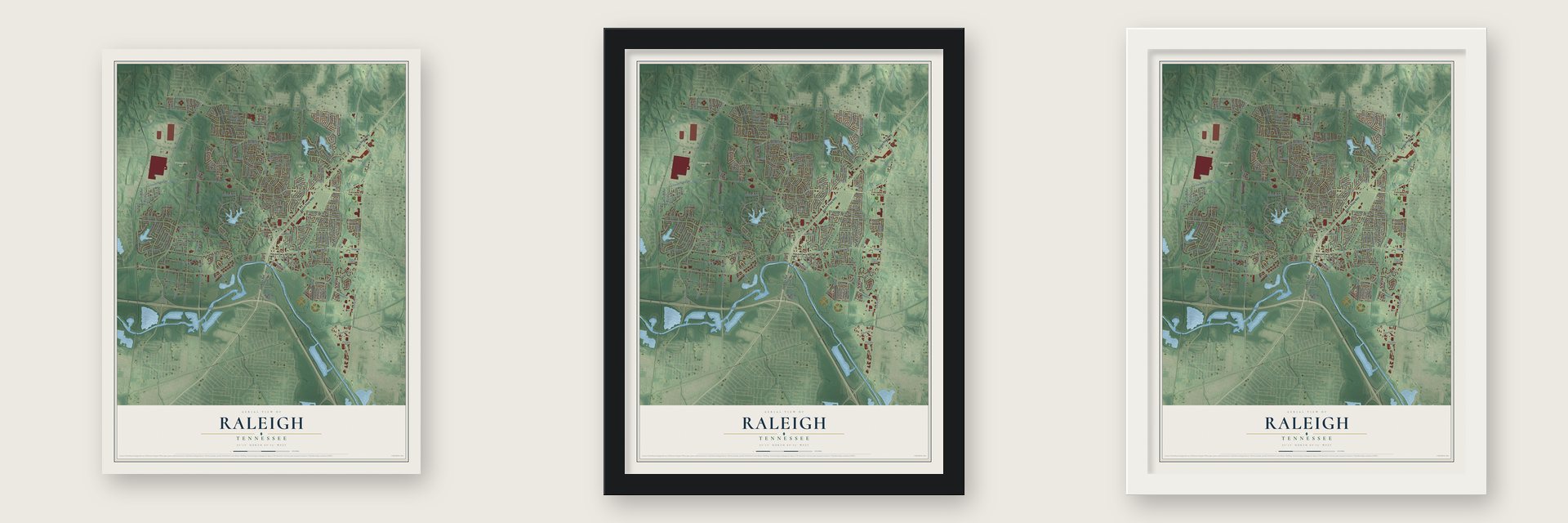
Unframed archival matte, a black wood frame or a white wood frame.
Up close
Geography Worth Displaying
This map was created using accurate cartographic data and authoritative geographic sources, including the U.S. Geological Survey and the Census Bureau. The map brings together terrain, waterways, roads, and building detail. The majority of the streets are labeled, houses are accurately depicted, and the topography is derived from government sources. Combining local data with carefully composed color and shading leads to this beautifully detailed Raleigh artwork for your wall.
Rather than simply showing street outlines, we’ve included as many of the street names as we could reasonably fit on the map while keeping their names legible. Zoom in on the high resolution preview to see exactly what’s on the map. We truly set out to create a statement piece for anyone who loves Raleigh. So whether it’s for you, or a gift for someone you love, we hope this map of Raleigh brings back fond memories.
Read the story behind this map: Detailed Map of Raleigh, Tennessee.
Find your street
Names on the Raleigh map
Every name below is printed on this map. Look for your street, your school, the park where you played, or the pond down the road.
Places and landmarks4
- Egypt
- Pierotti Park
- Willingham Park
- Kennedy Park
Streets and roads274
- Jackson Avenue
- Austin Peay Highway
- Yale Road
- Covington Pike
- Hawkins Mill Road
- New Allen Road
- Stage Road
- James Road
- Coleman Road
- Egypt Central Road
- Raleigh Millington Road
- Frayser Raleigh Road
- Old Allen Road
- Scheibler Road
- Windermere Road
- Saint Elmo Avenue
- Ridgemont Avenue
- Raleigh Bartlett Road
- Hanna Drive
- Powers Road
- Scenic Highway
- Old Coleman Road
- Walnut Road
- Scotland Road
- Kerwin Drive
- Singleton Parkway
- New Warford Road
- Craigmont Drive
- Tessland Road
- Homewood Drive
Show all 274 streets
- Joslyn Street
- Kenneth Street
- North Highland Street
- Hobson Road
- Bannockburn Road
- New Frayser Raleigh Road
- Lansford Drive
- Hoover Drive
- Voltaire Avenue
- Ramill Road
- Lakehurst Drive
- Cypress Road
- Magevney Street
- Whitney Avenue
- Stage James Road
- Battle Creek Drive
- Twinmont Street
- Northmoor Avenue
- Trudy Street
- Merritt Street
- Woodhills Drive
- Bluefield Street
- Kipling Avenue
- South Lakewood Drive
- Naylor Drive
- Dumbarton Avenue
- Riche Road
- North Lakewood Drive
- Northcliffe Drive
- East Road
- Otter Drive
- Hallview Drive
- Vanderwood Drive
- Frayser Boulevard
- Lehi Drive
- Invergarry Road
- Lakemont Drive
- Peggy Road
- Springfield Road
- Quintell Avenue
- East Glengarry Road
- Margaretta Road
- Keystone Avenue
- Allen Road
- Felton Road
- Stillwood Drive
- Point Church Road
- Allendale Drive
- Dillard Road
- Fortner Drive
- Jewell Road
- Kitty Drive
- Overbrook Drive
- Palm Avenue
- Emerson Avenue
- Ann Arbor Lane
- South Glengarry Road
- Beechrun Drive
- Arsenal Street
- Pippin Street
- Saint Elmo Road
- Genyth Avenue
- Barberry Street
- Parkview Drive
- Elmore Road
- Tena Drive
- Beverly Hills Road
- Eastline Drive
- Robbiedon Street
- Dumbeath Road
- Warford Street
- North Highland Road
- Courtney Drive
- Scenic Terrace
- Bellwood Drive
- Sun Ridge Drive
- Falkirk Road
- Suesand Drive
- Andy Way Lane
- Maclin Lane
- Redcoat Road
- Casann Avenue
- Hitchcock Drive
- Reynard Road
- Harriet Road
- Laurel Trce
- Kirkcaldy Road
- Olds Avenue
- Emmons Drive
- Manning Drive
- Windy Avenue
- Sable Drive
- Ridgestone Drive
- Cela Road
- Westline Drive
- Parkwood Road
- Jones Road
- Plymouth Avenue
- Northwind Drive
- Kerston Drive
- Hammond Road
- Crain Road
- Wade Street
- Earnett Street
- Earl Drive
- Mozelle Street
- McArthur Drive
- Thackery Drive
- Mayo Avenue
- Lansing Road
- Tant Road
- Cameo Avenue
- Darby Street
- Bacon Street
- Alps Road
- Tallyho Road
- Plato Avenue
- Berry Lane
- Buffer Drive
- Arms Avenue
- Plum Road
- Amy Lane
- Calvary Creek Drive
- Wordsworth Avenue
- Palm Jackson Road
- Raleigh Ridge Drive
- Jireh Drive
- Raleigh Lagrange Road
- Epping Way Drive
- New Raleigh Road
- Arwine Road
- Chapel Road
- Battlefield Drive
- Dagmar Street
- New Raleigh Lagrange Road
- Monterey Drive
- Dante Avenue
- Monessen Drive
- Fayette Road
- Glenshaw Drive
- Northumberland Lane
- Dorado Avenue
- Fairbanks Street
- North Rolling Woods Drive
- Hampton Manor Lane
- Black Forest Drive
- Tarkington Drive
- Forest Lake Drive
- Martindale Avenue
- Winwood Drive
- Carnoustie Road
- Velmagi Street
- Fairhaven Lane
- Gladstone Street
- Creek View Drive
- Oakcrest Avenue
- Garrison Avenue
- English Towne Drive
- Wychemere Drive
- Wolf Trail Drive
- Davidcrest Drive
- Longmont Drive
- Haliburton Street
- Devereux Drive
- Leschallas Drive
- Yellow Birch Drive
- McWeeny Avenue
- Glendale Drive
- Ridge Park Drive
- Roper Road
- Lucky Trail Drive
- Coach Drive
- Braemar Drive
- Covington Way
- Garver Road
- Druid Hill Drive
- Nam Ni Drive
- Sevella Road
- Wendt Avenue
- Stowe Street
- Cavern Drive
- Kiwani Road
- Rio Lobo Drive
- Naylor Road
- Bull Run Drive
- Twilight Avenue
- McDuff Road
- The Place Street
- Kirkwall Road
- Ardvale Road
- Kildee Cv
- Mill Lane
- West Barbara Circle
- Priscilla Avenue
- Twin Lakes Drive
- Fargo Road
- Socorro Drive
- Rolling Meadows Drive
- Laurencekirk Road
- Prince Rupert Lane
- Woodhaven Road
- Bowman Avenue
- Longhollow Drive
- Raleigh Common Drive
- South Milnor Drive
- Stone Way Lane
- Bontura Drive
- Westelle Street
- Renners Road
- Simmental Hill Street
- Mikewood Drive
- Merryville Street
- Merlcrest Cv
- Morgan Road
- Natalie Drive
- Watteker Road
- Rosabel Cv
- Dillard Lane
- Aux Arms Drive
- New Covington Pike
- South Advantage Way Drive
- West Lakewood Drive
- Ann Arbor Circle
- Canisbay Road
- Garden Grove Circle
- Northfield Circle
- Haughton Lane
- Bay Pointe Circle East
- Winderwood Circle
- Old Warford Road
- East Rolling Woods Drive
- Lake Vista Drive
- North Lake Forest Drive
- West Chantrey Street
- Archwood Drive
- Beechcliff Lane
- Westwood Cv
- High Meadow Drive
- Hampton Manor Cv
- Kerfield Drive
- Integra Way
- Winder Drive
- Rickey Road
- Doby Road
Names are listed as they appear on the printed map. Zoom into the product photos to find them.
The art of mapping a place
How This Map Was Made
Real places. Remarkable detail. Discover the layers that turn geographic data into a map of home.

The view from above
Aerial imagery reveals the character of the land: woodland, open fields, and the patterns of a place.

The shape of the land
Elevation data brings hills, valleys, and subtle changes in the landscape into view.

The details of home
Roads, waterways, and building footprints come together to make the map feel unmistakably local.

Geography becomes art
Considered color, shading, and typography bring the layers together in a map made for your wall.


Process illustrated with Mendon, Massachusetts. Aerial imagery: USDA NAIP. Terrain: USGS 3D Elevation Program. Map details and finished artwork: KNOWOL.
The Details
About This Print
Choose an archival matte print, or a black or white Ayous wood frame. The archival matte print is unframed.
Select your size and finish above to see the matching product image and price.
Materials & Craftsmanship
A contemporary map with the character of a classic atlas, printed on archival matte paper. Optional frames are made from Ayous wood.
Your printed map does not include the watermark shown in the full-map preview.
Shipping & Delivery
Free shipping within the United States. Every print is made to order in the USA.
Buying a gift? Add a note in your cart and we'll include it. We never put prices in the package.
Prints ship within 2 to 3 business days. Allow 7 to 10 days total from ordering for delivery. Timing may vary during holidays or periods of high order volume.
Read our shipping policy.
Returns and damaged prints
Each print is made to order. Change-of-mind refunds are not available after production.
If your print arrives damaged, misprinted or incorrect, contact support@knowol.com within 30 days of receiving it. Include your order number, photos and a description of the issue.
Read our full refund and replacement policy. For questions about your order, email support@knowol.com.
Find your town
Looking for another city?
Find a map of home in our Tennessee collection, or any town in the country.
Nearby
Maps of towns near Raleigh
Know someone from one of these towns? Their map makes a great gift.
 Frayser
, Tennessee
From $39.99See the map
 North Memphis
, Tennessee
From $39.99See the map
 Woodstock
, Tennessee
From $39.99See the map
More maps nearby: Midtown, Bartlett, East Memphis, Cooper-Young and Memphis.