


Search for another town





Free U.S. delivery 7 to 10 days after you order
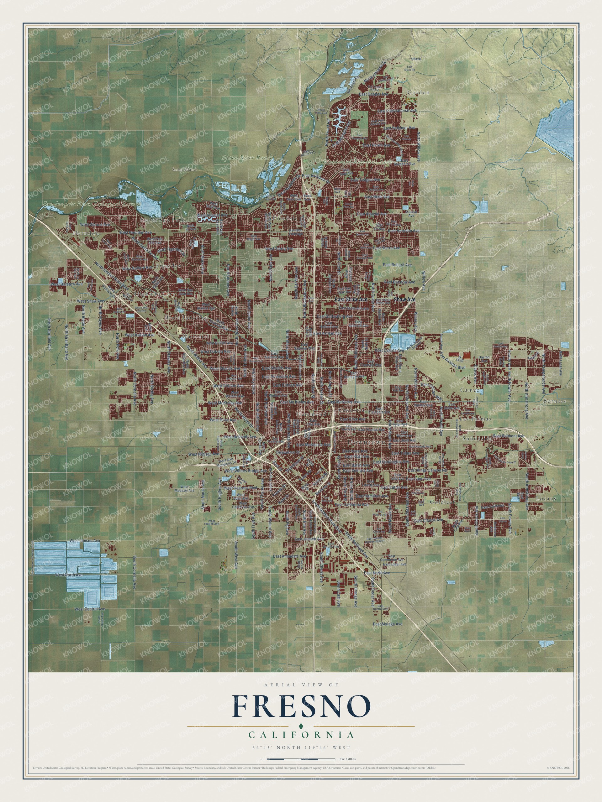
Fresno, California Map Art
Building by building, with labeled streets and shaded relief.
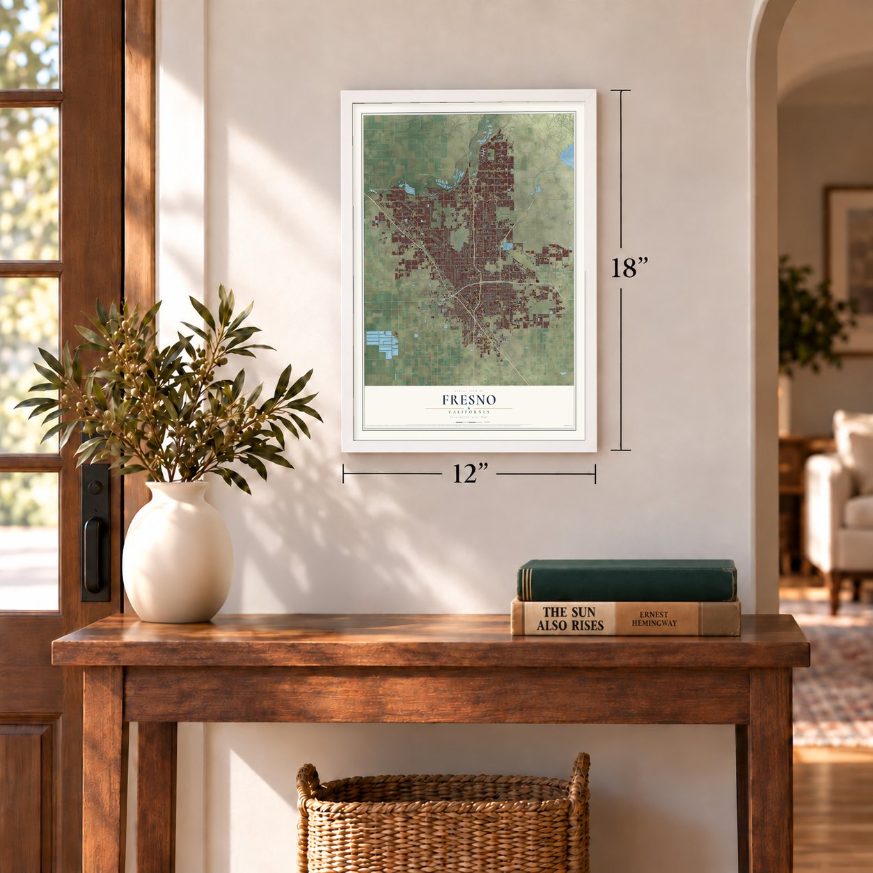
12" x 18" Archival Matte Print
A Map of Home. A Work of Art.
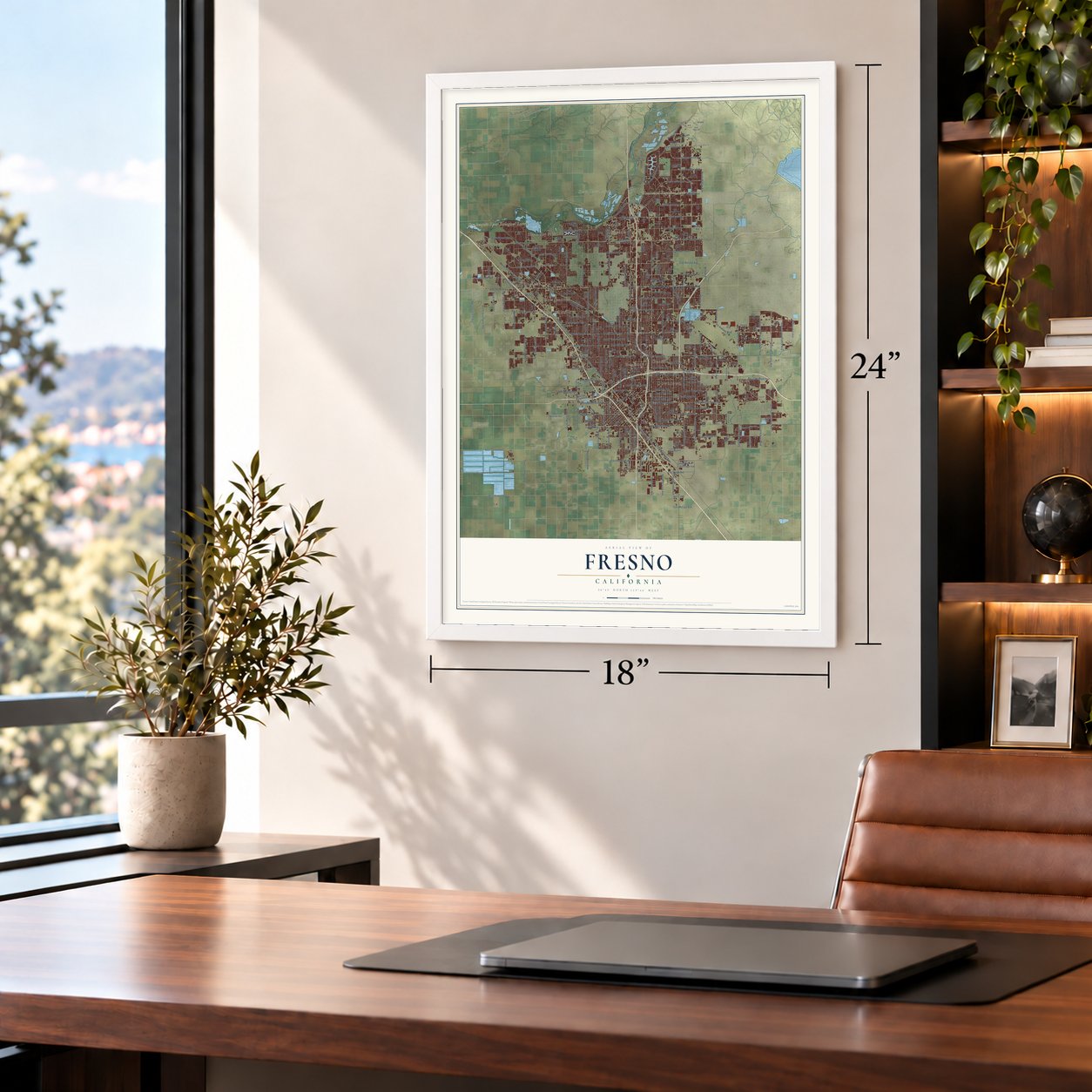
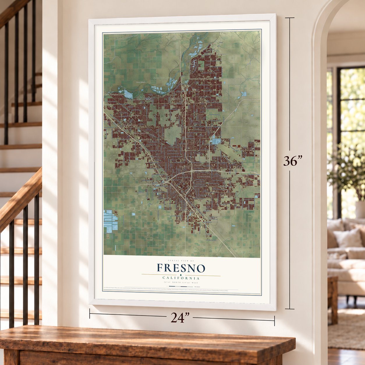
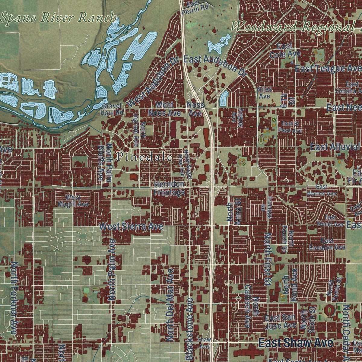
Explore Fresno, California from a whole new perspective. Created using aerial imagery and detailed geographic data, this map captures Fresno building by building, with labeled streets, familiar landmarks, and shaded topographical relief that highlights the natural contours of the landscape.
Combining modern data with the timeless character of a vintage atlas, this map is just as interesting up close as it is beautiful on the wall. Whether you grew up in Fresno, spent memorable years there, or call it home today, this unique map is a great way to celebrate a place that means something to you. Zoom in on the preview to look for your street, and then order a print to put your memories on the wall.
Three ways to hang it
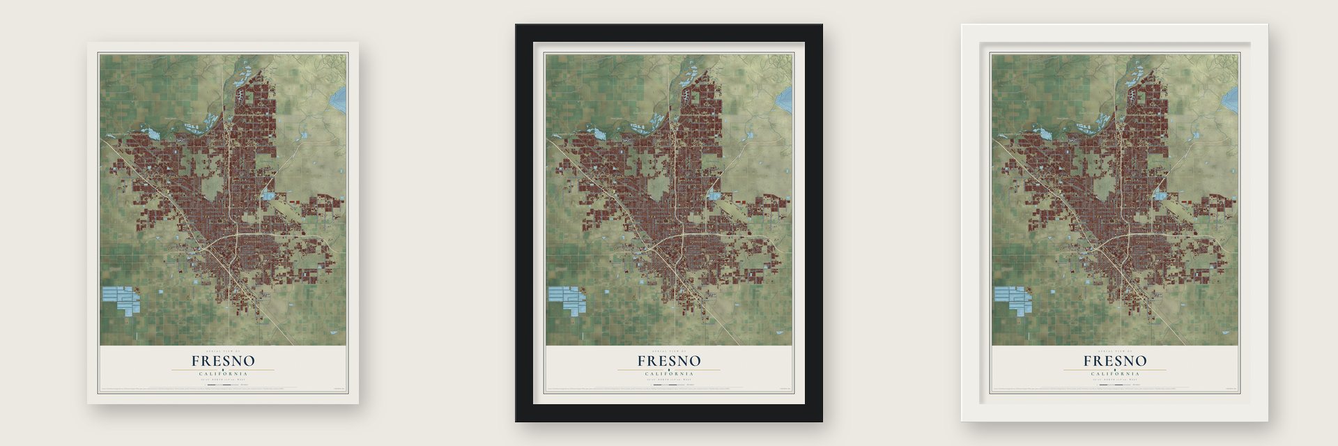
Unframed archival matte, a black wood frame or a white wood frame.
Up close
Geography Worth Displaying
This map was created using accurate cartographic data and authoritative geographic sources, including the U.S. Geological Survey and the Census Bureau. The map brings together terrain, waterways, roads, and building detail. The majority of the streets are labeled, houses are accurately depicted, and the topography is derived from government sources. Combining local data with carefully composed color and shading leads to this beautifully detailed Fresno artwork for your wall.
Rather than simply showing street outlines, we’ve included as many of the street names as we could reasonably fit on the map while keeping their names legible. Zoom in on the high resolution preview to see exactly what’s on the map. We truly set out to create a statement piece for anyone who loves Fresno. So whether it’s for you, or a gift for someone you love, we hope this map of Fresno brings back fond memories.
Read the story behind this map of Fresno, California from 2026.

Find your street
Names on the Fresno map
Every name below is printed on this map. Look for your street, your school, the park where you played, or the pond down the road.
Places and landmarks21
- Downtown
- Herndon
- Highway City
- Scout Island
- Spano River Ranch
- San Joaquin River Ecological Reserve
- Woodward Regional Park
- Biola Junction
- Burness
- Cameo
- Cincotta
- Figarden
Show all 21 places
- Goldleaf
- Gordon
- Hammond
- Las Palmas
- Locans
- Muscatel
- Pinedale
- Sierra Sky Park
- Sunnyside
Streets and roads306
- East Shaw Avenue
- Shaw Avenue
- North Chestnut Avenue
- North First Street
- North Fresno Street
- North Blackstone Avenue
- East Clinton Avenue
- West Alluvial Avenue
- North Brawley Avenue
- North Friant Road
- West Sierra Avenue
- East Butler Avenue
- North Winery Avenue
- North Harrison Avenue
- West Clinton Avenue
- East Hamilton Avenue
- East Sierra Avenue
- East Nees Avenue
- East Herndon Avenue
- North Arthur Avenue
- North Grantland Avenue
- Fresno Street
- North Temperance Avenue
- East Audubon Drive
- East Clinton Way
- South First Street
- North Millbrook Avenue
- North Cedar Avenue
- West Herndon Avenue
- North Maple Avenue
Show all 306 streets
- North Marks Avenue
- East Belmont Avenue
- East Olive Avenue
- East Shields Avenue
- West Shaw Avenue
- East Church Avenue
- North Weber Avenue
- East Jensen Avenue
- East Dakota Avenue
- North Golden State Boulevard
- North Willow Avenue
- East Mc Kinley Avenue
- East McKinley Avenue
- West Ashlan Avenue
- North Palm Avenue
- North West Avenue
- West Bullard Avenue
- North Fruit Avenue
- North Polk Avenue
- North Angus Street
- West Spruce Avenue
- East McKenzie Avenue
- West Barstow Avenue
- North Maroa Avenue
- East Tulare Avenue
- West North Avenue
- West Dakota Avenue
- South Cedar Avenue
- East Kings Canyon Road
- North Cornelia Avenue
- East Princeton Avenue
- East Ashlan Avenue
- North Teilman Avenue
- North Clark Street
- North Del Mar Avenue
- West Jensen Avenue
- North Santa Fe Avenue
- North Blythe Avenue
- South Maple Avenue
- West Shields Avenue
- South Orange Avenue
- East Alluvial Avenue
- North Armstrong Avenue
- East Barstow Avenue
- North Motel Drive
- East Gettysburg Avenue
- East Bullard Avenue
- East California Avenue
- South East Avenue
- West McKinley Avenue
- East Iowa Avenue
- North Delno Avenue
- North Bryan Avenue
- Fowler Avenue
- North Fowler Avenue
- South Chestnut Avenue
- South West Avenue
- East Annadale Avenue
- East Huntington Avenue
- South Cherry Avenue
- West Nielsen Avenue
- East Balch Avenue
- Clovis Avenue
- West Whites Bridge Avenue
- South Golden State Boulevard
- East Perrin Avenue
- East North Avenue
- East Teague Avenue
- North Hayes Avenue
- South Railroad Avenue
- Tulare Street
- East Lane Avenue
- West Figarden Drive
- West Olive Avenue
- South Hughes Avenue
- South Elm Avenue
- East Copper Avenue
- South Clovis Avenue
- South Thorne Avenue
- North Forkner Avenue
- East Platt Avenue
- North Peach Avenue
- South Fruit Avenue
- East Street
- West Kearney Boulevard
- Divisadero Street
- South Armstrong Avenue
- North Van Ness Avenue
- North Garfield Avenue
- South Walnut Avenue
- South Marks Avenue
- West Central Avenue
- South Fowler Avenue
- Ventura Street
- Stanislaus Street
- North Alicante Drive
- South Fifth Street
- South Third Street
- Kern Street
- East Behymer Avenue
- West Belmont Avenue
- South Cornelia Avenue
- East International Avenue
- East Ventura Avenue
- East Airways Boulevard
- South Fig Avenue
- Ft Washington Road
- West Audubon Drive
- Winery Avenue
- East Malaga Avenue
- Willow Avenue
- North Valentine Avenue
- West Palo Alto Avenue
- North Emerson Avenue
- East Santa Ana Avenue
- East Carmen Avenue
- North Locan Avenue
- West Nees Avenue
- Herndon Frontage
- East Floradora Avenue
- North Sierra Vista Avenue
- North Ninth Street
- East Garland Avenue
- North Glenn Avenue
- East Grant Avenue
- North Thorne Avenue
- North Parkway Drive
- North Barton Avenue
- East Home Avenue
- North Effie Street
- North Sixth Street
- East Michigan Avenue
- East Fountain Way
- North Bond Avenue
- West San Jose Avenue
- East Saginaw Way
- East Thomas Avenue
- North Van Ness Boulevard
- North San Pablo Avenue
- West Fir Avenue
- East Holland Avenue
- East Weldon Avenue
- East Shepherd Avenue
- East Clay Avenue
- East Cole Avenue
- East Tyler Avenue
- West Bluff Avenue
- North Wilson Avenue
- East White Avenue
- West Weldon Avenue
- West Griffith Way
- North Abby Street
- West Alamos Avenue
- East Liberty Avenue
- East Alta Avenue
- East Ashcroft Avenue
- North Callisch Avenue
- North Echo Avenue
- West California Avenue
- East Fir Avenue
- West Dan Ronquillo Drive
- East Edgar Avenue
- North Anna Street
- North Gates Avenue
- North Street
- Mono Street
- South Lotus Avenue
- East California
- East Commerce Avenue
- North Ila Avenue
- East San Jose Avenue
- West Madison Avenue
- South Trinity Street
- West Eden Avenue
- South Lind Avenue
- Old Friant Road
- Monterey Street
- North Palm Bluffs Avenue
- Sundance Avenue
- Peach Avenue
- Alluvial Avenue
- Dayton Avenue
- Redland
- Mitre Avenue
- East Burl
- Gap Drive
- Silaxo
- Ness Avenue
- 6 Th Street
- North Fourth Street
- North Marty Avenue
- West Magill Avenue
- East Omaha Avenue
- North Sommerville Drive
- North La Paz Avenue
- North Orchard Street
- East Nevada Avenue
- North Hughes Avenue
- East Yale Avenue
- East Central Avenue
- South Peach Avenue
- West Escalon Avenue
- East Harvey Avenue
- South Willow Avenue
- North Hazel Avenue
- North Tenth Street
- East Escalon Avenue
- East Spruce Avenue
- Inyo Street
- South Ivy Avenue
- East Dorothy Avenue
- North Ingram Avenue
- South Chateau Fresno Avenue
- West Church Avenue
- East Sierra Madre Avenue
- North Chestnut Diagonal
- North Argyle Avenue
- East Franklin Avenue
- East Jensen Avenue Bypass
- North Ezie Avenue
- South Hayes Avenue
- Gravel Haul Road
- North Lanes Road
- East Saint Andrew Avenue
- South Eunice Avenue
- South Argyle Avenue
- East Perrin Road
- Angus Avenue
- Niles Avenue
- Ash Prvt
- 23rd Avenue
- East Palo Alto Avenue
- East Grove Avenue
- West Dayton Avenue
- North Dante Avenue
- West Princeton Avenue
- North Warren Avenue
- East El Paso Avenue
- North Clovis Avenue
- East Lamona Avenue
- East Pontiac Way
- East Florence Avenue
- West Santa Ana Avenue
- North Second Street
- East Heaton Avenue
- East Braly Avenue
- West Corona Avenue
- West Acacia Avenue
- East Warner Avenue
- East Menlo Avenue
- South Minnewawa Avenue
- North Helm Avenue
- South Teilman Avenue
- East Fancher Creek Drive
- Frontage Road
- East Plymouth Way
- East Copper River Drive
- North Bendel Avenue
- North Howard Avenue
- North Minnewawa Avenue
- East Clubhouse Drive
- South Kirk Avenue
- East Church
- North Sugar Pine Avenue
- East Granada
- West Mission Street
- North Cresta Avenue
- North Cypress
- North Thiele Avenue
- East Silaxo Road
- Chandler Avenue
- East Byrd
- Maple Avenue
- Foothill Prvt
- South Bailey
- Paula Avenue
Names are listed as they appear on the printed map. Zoom into the product photos to find them.
About Fresno, California
Fresno is a city of 542,107 people and the seat of Fresno County, in the San Joaquin Valley. In 1867 Anthony Easterby bought land in what is now the Sunnyside district, but he couldn't raise wheat without water. In 1870 he hired Moses Church, a sheep man, to bring it in. Church dug new canals, bought up older ditches and formed the Fresno Canal and Irrigation Company, and the Easterby place became a huge wheat producer.
On December 24, 1867, the San Joaquin River flooded Millerton, then the county seat. In 1872 the Central Pacific Railroad set a station near the Easterby farm on its new Southern Pacific line, and a store beside it grew into Fresno Station. Many Millerton families, afraid of more floods and drawn by the trains, moved to the new town. Two years after the station opened, county voters made it the county seat, and Fresno became an incorporated city in 1885. Friant Dam was finished in 1944, and Millerton Lake rose over the old Millerton site.
“The railroad builders staked out a town, which they called Fresno (Sp., ash tree) Station, for the name of the county. The ash trees were in the foothills, and not near the embryo town.”
- The depot of 1889The Central Pacific opened a small wooden depot here in 1872. The Southern Pacific, which had taken over the Central Pacific, replaced it in 1889 with a brick Queen Anne depot on the same ground, now one of the oldest buildings still standing in Fresno. Trains served it for 99 years on that site, until falling business ended its rail operations in 1971. The Southern Pacific Passenger Depot is on the National Register.
- College at the high schoolFresno sat hundreds of miles from the big universities around San Francisco and Los Angeles. So in 1910 Fresno High School became the first high school in California to use the Upward Extension Act of 1907, teaching college courses to graduates who didn't want to leave home. That Collegiate Department later became Fresno City College. No other community college in California is older, and only one in the country is.
- The first modern landfillThe Fresno Municipal Sanitary Landfill opened in 1937 as the first modern landfill in the United States. Its crews dug trenches, packed the trash down and buried each day's load under dirt, methods that changed how the nation handled garbage. It closed in 1987 and is now both a National Historic Landmark and a Superfund site.
- Birthplace of VisaBank of America tested a new card called BankAmericard in Fresno in September 1958, picking the city partly because it was remote, so a failure wouldn't hurt the bank's name. Its creator resigned during a rocky start, but the card became the first credit card to succeed anywhere in the world. It was spun off as its own company in 1970, and in 1976 that company became Visa Inc.
Keep exploring California
Fresno is one of 1,990 California towns we've mapped. Every dot on the map is a print of its own.
The search covers every state, California first.
Near Fresno
Order 2 or more town maps and save 10%. Shown in the size and finish you picked above, so they hang as a set.
- Old Fig Garden 12" x 18" / Archival Matte Print $39.99
- Mayfair 12" x 18" / Archival Matte Print $39.99
- Calwa 12" x 18" / Archival Matte Print $39.99

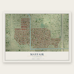
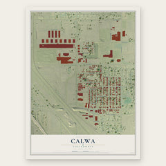
More maps nearby: Tarpey Village, West Park, Sunnyside, Fort Washington and Clovis.
The art of mapping a place
How This Map Was Made
Real places. Remarkable detail. Discover the layers that turn geographic data into a map of home.

The view from above
Aerial imagery reveals the character of the land: woodland, open fields, and the patterns of a place.

The shape of the land
Elevation data brings hills, valleys, and subtle changes in the landscape into view.

The details of home
Roads, waterways, and building footprints come together to make the map feel unmistakably local.

Geography becomes art
Considered color, shading, and typography bring the layers together in a map made for your wall.


Process illustrated with Mendon, Massachusetts. Aerial imagery: USDA NAIP. Terrain: USGS 3D Elevation Program. Map details and finished artwork: KNOWOL.
The Details
About This Print
Choose an archival matte print, or a black or white Ayous wood frame. The archival matte print is unframed.
Select your size and finish above to see the matching product image and price.
Materials & Craftsmanship
A contemporary map with the character of a classic atlas, printed on archival matte paper. Optional frames are made from Ayous wood.
Your printed map does not include the watermark shown in the full-map preview.
Shipping & Delivery
Free shipping within the United States. Every print is made to order in the USA.
Buying a gift? Add a note in your cart and we'll include it. We never put prices in the package.
Prints ship within 2 to 3 business days. Allow 7 to 10 days total from ordering for delivery. Timing may vary during holidays or periods of high order volume.
Read our shipping policy.
Returns and damaged prints
Each print is made to order. Change-of-mind refunds are not available after production.
If your print arrives damaged, misprinted or incorrect, contact support@knowol.com within 30 days of receiving it. Include your order number, photos and a description of the issue.
Read our full refund and replacement policy. For questions about your order, email support@knowol.com.