
Search for another town




Free U.S. delivery 7 to 10 days after you order
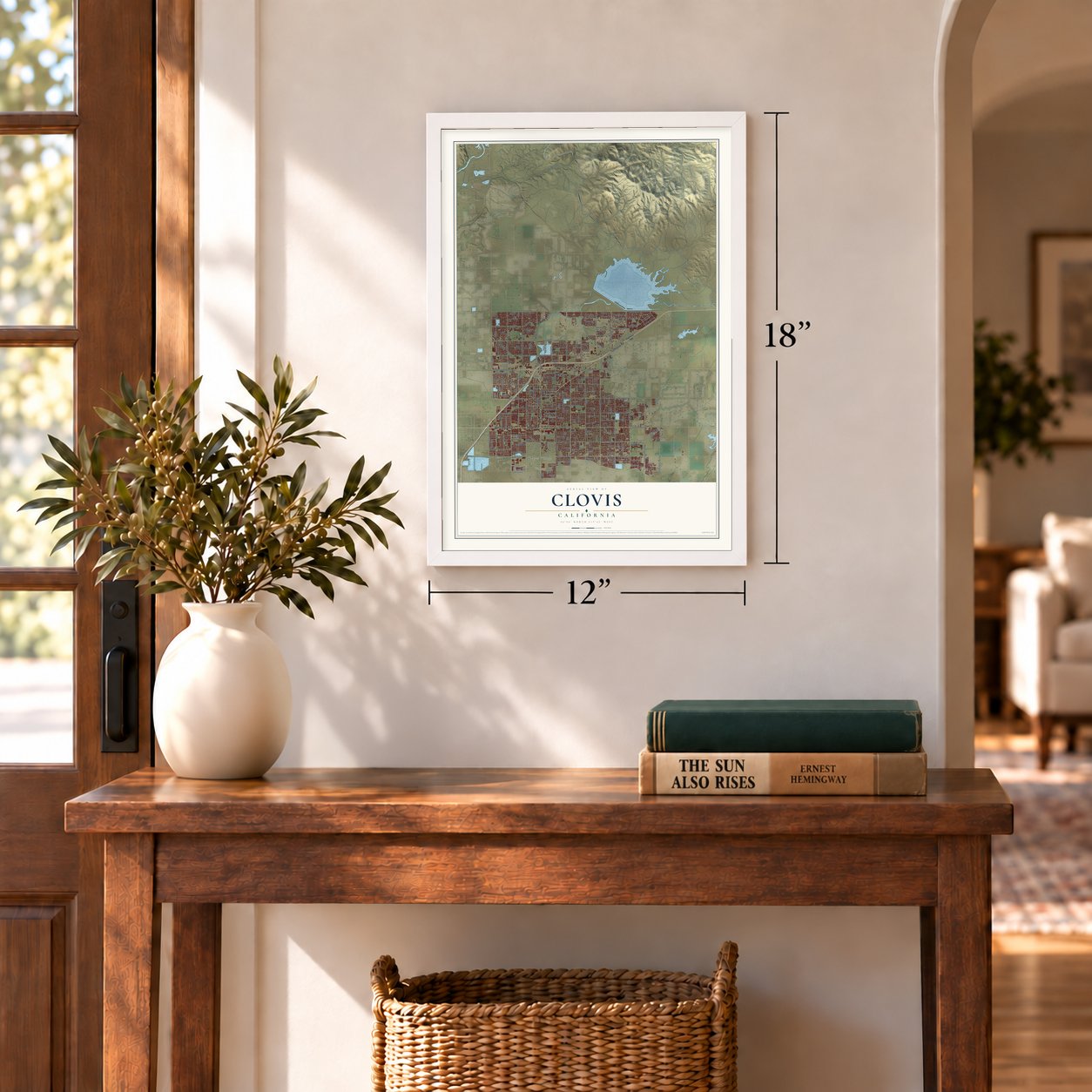
Clovis, California Map Art
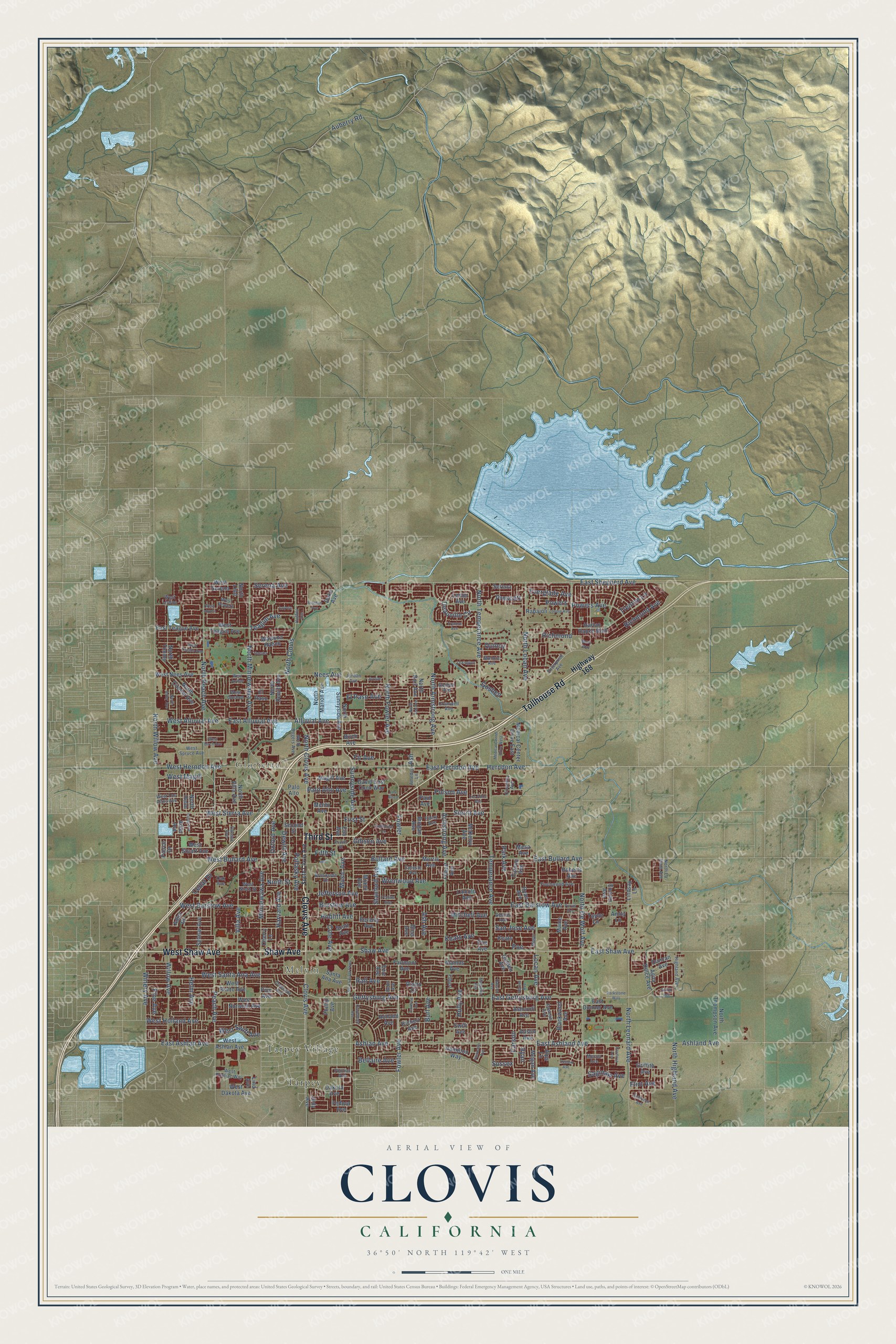
A new map of Clovis, California, made in 2026 and printed to order on thick archival matte paper.
12" x 18" Archival Matte Print
A Map of Home. A Work of Art.
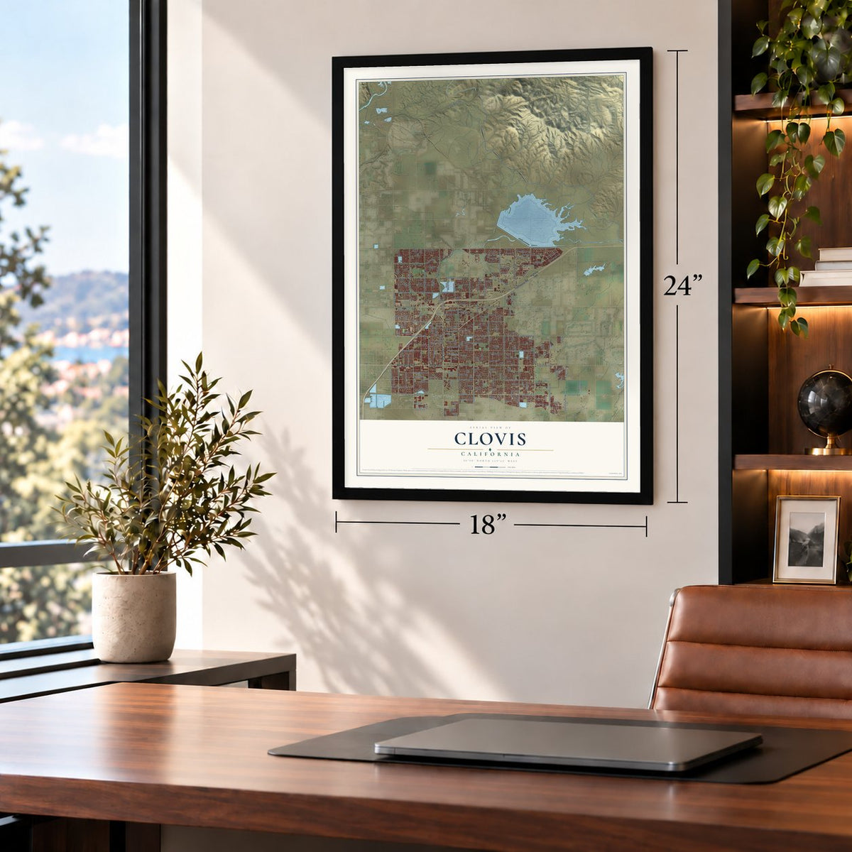
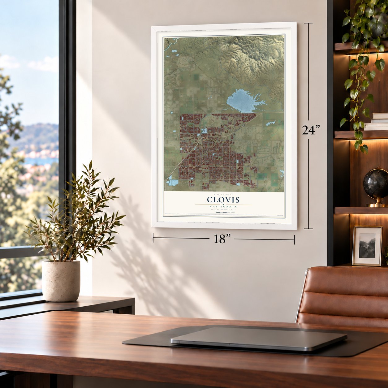
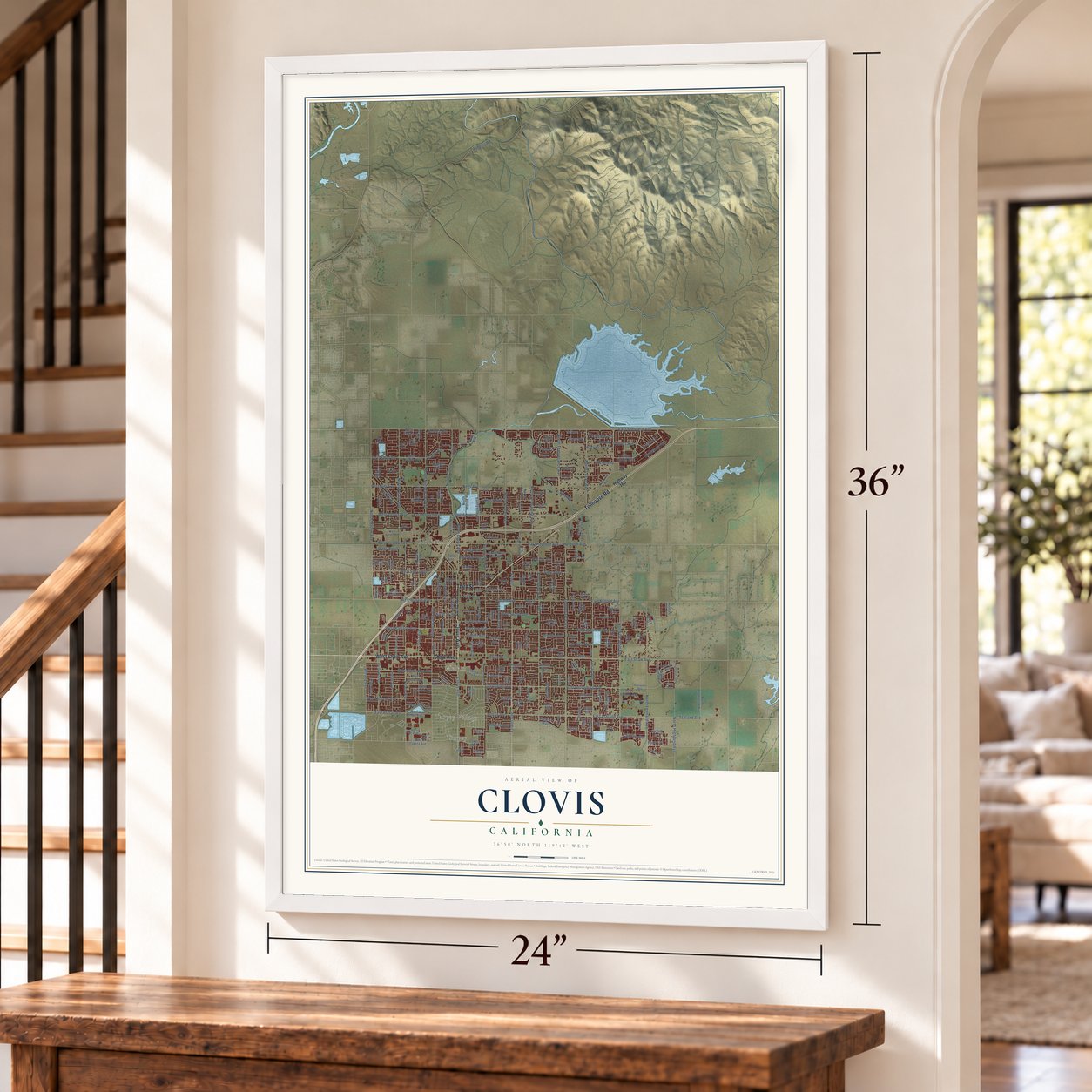
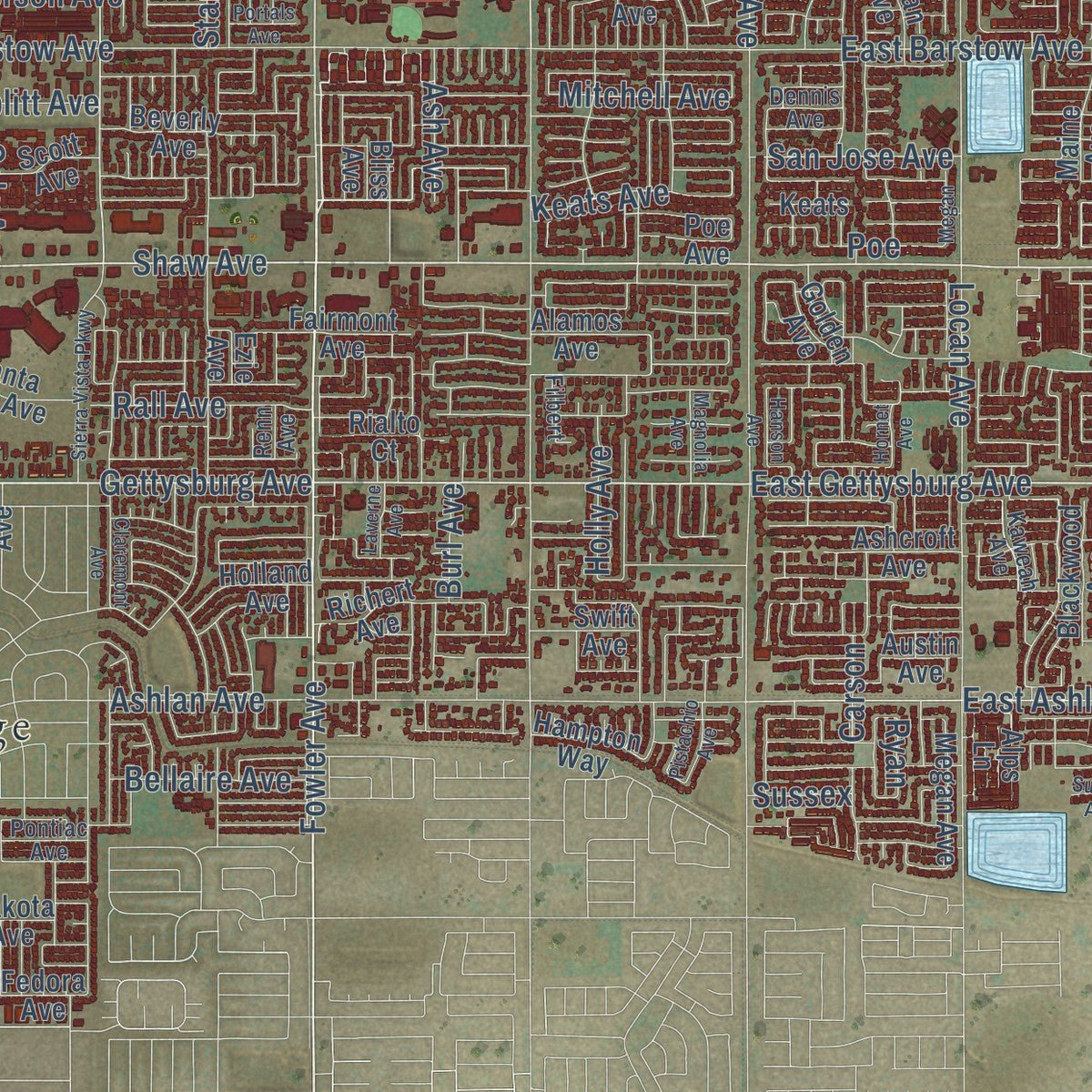
Explore Clovis, California from a whole new perspective. Created using aerial imagery and detailed geographic data, this map captures Clovis building by building, with labeled streets, familiar landmarks, and shaded topographical relief that highlights the natural contours of the landscape.
Combining modern data with the timeless character of a vintage atlas, this map is just as interesting up close as it is beautiful on the wall. Whether you grew up in Clovis, spent memorable years there, or call it home today, this unique map is a great way to celebrate a place that means something to you. Zoom in on the preview to look for your street, and then order a print to put your memories on the wall.
Three ways to hang it
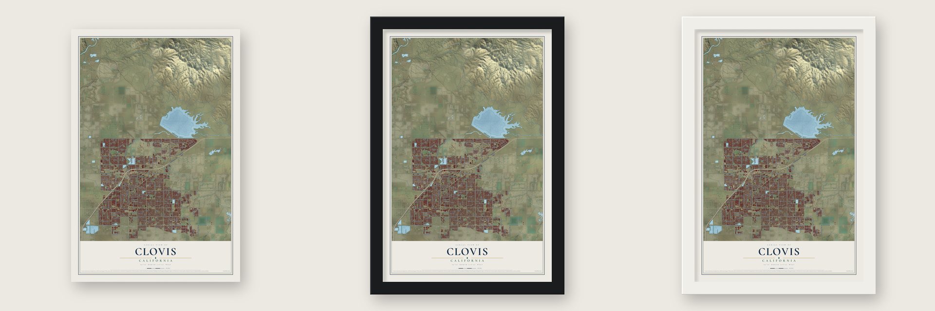
Unframed archival matte, a black wood frame or a white wood frame.
Up close
Geography Worth Displaying
This map was created using accurate cartographic data and authoritative geographic sources, including the U.S. Geological Survey and the Census Bureau. The map brings together terrain, waterways, roads, and building detail. The majority of the streets are labeled, houses are accurately depicted, and the topography is derived from government sources. Combining local data with carefully composed color and shading leads to this beautifully detailed Clovis artwork for your wall.
Rather than simply showing street outlines, we’ve included as many of the street names as we could reasonably fit on the map while keeping their names legible. Zoom in on the high resolution preview to see exactly what’s on the map. We truly set out to create a statement piece for anyone who loves Clovis. So whether it’s for you, or a gift for someone you love, we hope this map of Clovis brings back fond memories.
Read the story behind this map of Clovis, California from 2026.

About Clovis, California
Clovis is a city of 120,124 people in Fresno County, 6.5 miles northeast of downtown Fresno. It began as a freight stop on the San Joaquin Valley Railroad, which six Fresno businessmen and the Michigan promoter Marcus Pollasky organized on January 15, 1890. By October 1891 the tracks had reached the farms of Clovis M. Cole and George Owen. The railroad bought half its right of way from each man and ran the line along their shared boundary. The station stood on Owen's side, but it took Cole's first name.
Ingvart Tielman, a Fresno engineer, mapped a townsite for Pollasky on December 29, 1891, and its streets were named for the railroad's officers and investors. Real growth came in 1894, when a 42-mile flume began floating rough-cut lumber down from the Sierra Nevada to a planing mill east of the station. Mill workers built homes near the yard, so stores, churches and schools followed. A post office opened in 1895, and by 1896 a newspaper put the population near 500. Clovis became a city in February 1912.
“Later Mr. Swift erected a box factory at what is now Clovis, in fact his was the first industry to be built in what is now a thriving little town.”
- A rodeo since 1914The lumber mill burned in 1914, and no one rebuilt it. Its old grounds now hold Clark Intermediate School and the Clovis Rodeo Grounds. The Clovis Rodeo has run every year since 1914 on April's final weekend. A parade opens it on Saturday morning, and the riding goes on that afternoon and all of Sunday.
- Track's end in 1891The railroad stopped at Hamptonville, now Friant, on the San Joaquin River, only 26 miles from Fresno. The place was called Pollasky then, and about 3,000 people from Fresno came there the Wednesday before Thanksgiving of 1891 to celebrate. Trains began regular runs in January 1892, but hard times hit the nation, and in 1893 the Southern Pacific bought the line.
- The depot came home in 1999Of all the buildings the railroad put up, only one depot still stands. Photos taken around 1910 show it beside the Tarpey winery, just south of where Ashlan and Clovis Avenues cross. Movers brought it to the town center in 1999 and set it on a corner of Clovis Avenue and Fourth Street. There the Clovis Big Dry Creek Historical Society restored it with money, labor and materials donated by local businesses.
- From Fulton Street to Clovis AvenueThe main street through the old town center was first named Fulton Street, for railroad investor Fulton Berry. It later became Front Street, then Main Street, and today it is Clovis Avenue. Its restored storefronts are now known as Old Town Clovis.
- Champions from ClovisGolfer Bryson DeChambeau, who won the U.S. Open in 2020 and 2024, is from Clovis. So is Alysa Liu, the figure skating champion of the 2026 Winter Olympics, and so is Chris Colfer, who played Kurt Hummel on Glee and wrote the Land of Stories books.
Find your street
Names on the Clovis map
Every name below is printed on this map. Look for your street, your school, the park where you played, or the pond down the road.
Places and landmarks4
- Melvin
- Glorietta
- Tarpey
- Tarpey Village
Streets and roads258
- Clovis Avenue
- Third Street
- Shaw Avenue
- Tollhouse Road
- West Shaw Avenue
- North Fowler Avenue
- Fowler Avenue
- North Clovis Avenue
- Serena Avenue
- East Gettysburg Avenue
- Gettysburg Avenue
- Everglade Avenue
- East Shaw Avenue
- Keats Avenue
- North Clovis
- Teague Avenue
- East Herndon Avenue
- Herndon Avenue
- San Jose Avenue
- Burl Avenue
- El Paso Avenue
- Sunnyside Avenue
- Powers Avenue
- West Sierra Avenue
- West Herndon Avenue
- First Street
- East Shepherd Avenue
- North Peach Avenue
- North Locan Avenue
- North De Wolf Avenue
Show all 258 streets
- North Leonard Avenue
- North Willow Avenue
- Alluvial Avenue
- East Alluvial Avenue
- Minnewawa Avenue
- Temperance Avenue
- North Armstrong Avenue
- Villa Avenue
- Armstrong Avenue
- Stanford Avenue
- Barstow Avenue
- Wrenwood Avenue
- Ashland Avenue
- East Ashland Avenue
- Peach Avenue
- North Minnewawa Avenue
- North Temperance Avenue
- Rall Avenue
- East Bullard Avenue
- Willow Avenue
- Nees Avenue
- Ashlan Avenue
- Sierra Avenue
- Dewitt Avenue
- Bullard Avenue
- Mitchell Avenue
- Harvard Avenue
- East Barstow Avenue
- Helm Avenue
- Polson Avenue
- Pollasky Avenue
- Fifth Street
- North Highland Avenue
- Gibson Avenue
- East Ashlan Avenue
- West Santa Ana Avenue
- West Holland Avenue
- Bellaire Avenue
- Richmond Avenue
- Park Avenue
- Deauville Circle
- Oxford Avenue
- Auberry Road
- West Barstow Avenue
- West Bullard Avenue
- Holly Avenue
- Palo Alto Avenue
- Locan Avenue
- Winery Avenue
- Saginaw Avenue
- Cole Avenue
- West Swift Avenue
- Quincy
- Trenton Lane
- West Alluvial Avenue
- Richmond
- Flint Avenue
- Jefferson Avenue
- Fowler
- West Magill
- Hoblitt Avenue
- Fine Avenue
- Carson
- Goshen
- Ninth Street
- Ash Avenue
- Music Avenue
- Powers
- Prescott
- Fir Avenue
- Ryan
- Cedar Drive
- Poe
- Sussex
- Ash
- Highway 168
- Maine Avenue
- Burgan Avenue
- Holland Avenue
- Birch Avenue
- Duke Avenue
- Griffith Avenue
- West Teague Avenue
- Richert Avenue
- Pico Avenue
- Paul Avenue
- Poe Avenue
- Santa Ana Avenue
- Alamos Avenue
- Fairmont Avenue
- Ashcroft Avenue
- Lincoln Avenue
- Beverly Avenue
- McKelvy Avenue
- North Sunnyside Avenue
- Carson Avenue
- Swift Avenue
- Roberts Avenue
- Scott Avenue
- Sylmar Avenue
- Morris Avenue
- Blackwood Avenue
- West Ashlan Avenue
- Lester Avenue
- Cherry Lane
- East Teague Avenue
- Hampton Way
- West Nees Avenue
- Harlan Ranch Boulevard
- Ezie Avenue
- North Marion Avenue
- West Rialto Avenue
- Menlo Avenue
- Lind Avenue
- Adler Avenue
- Miami Avenue
- Megan Avenue
- North Thompson Avenue
- Austin Avenue
- Magill Avenue
- North Villa Avenue
- Phillip Avenue
- Pierce Drive
- David East Cook Way
- North Dewitt Avenue
- Bliss Avenue
- Mesa Avenue
- Duncan Avenue
- Medical Center Drive East
- North Timmy
- North Burl Avenue
- Second Street
- Agua Dulce Avenue
- Serena
- North Lind
- West Norwich Avenue
- El Paso
- East Donner Avenue
- Dakota Avenue
- North Citadel Avenue
- Keats
- Filbert Avenue
- Ryan Avenue
- Wawona Ranch
- West Stuart Avenue
- Adler Drive
- West Serena
- North Helm
- West Dakota Avenue
- Elm Avenue
- Fedora Avenue
- Palo Alto
- Rabaioli
- Lindsay Lane
- Golden Avenue
- Judy Avenue
- Rialto Court
- Taylor Lane
- Encino Avenue
- Amity Lane
- Alps Lane
- Kaweah Avenue
- Celeste Avenue
- Mecca Avenue
- Coventry Avenue
- Finchwood Avenue
- Dennis Avenue
- Cromwell Avenue
- Goshen Avenue
- Enterprise Avenue
- North Rogers Avenue
- Renn Avenue
- West Spruce Avenue
- Oak Avenue
- Pontiac Avenue
- Jordan Avenue
- Ellery Avenue
- Caesar Avenue
- West Powers
- West Pontiac Way
- West Los Altos Avenue
- Highland Avenue
- Crescent Avenue
- West Ninth Street
- Brookside Drive
- North La Vona Avenue
- Muncie Avenue
- West Goshen
- Amedeo Lane
- West Lisbon
- Filbert
- South Clovis Avenue
- Riordan Avenue
- Hanson Avenue
- Jordan
- Magnolia Avenue
- Purvis Avenue
- Fourth Street
- Laverne Avenue
- Los Altos Avenue
- Portals Avenue
- Sussex Avenue
- Rialto Avenue
- Pistachio Avenue
- West Birch Avenue
- Hornet Avenue
- North Adler Avenue
- Loyola Avenue
- Claremont Avenue
- Tollhouse Lane
- Sierra Vista Parkway
- Medical Center Drive West
- Robinson Avenue
- Trenton Avenue
- Cindy Avenue
- Hughes Avenue
- West Loyola
- Omaha
- North Ash Avenue
- West Omaha Avenue
- Lexington
- Loyola
- Cordova Avenue
- Parkstone Way
- West Jordan
- Los Altos
- Megan
- Muse Way
Names are listed as they appear on the printed map. Zoom into the product photos to find them.
The art of mapping a place
How This Map Was Made
Real places. Remarkable detail. Discover the layers that turn geographic data into a map of home.

The view from above
Aerial imagery reveals the character of the land: woodland, open fields, and the patterns of a place.

The shape of the land
Elevation data brings hills, valleys, and subtle changes in the landscape into view.

The details of home
Roads, waterways, and building footprints come together to make the map feel unmistakably local.

Geography becomes art
Considered color, shading, and typography bring the layers together in a map made for your wall.


Process illustrated with Mendon, Massachusetts. Aerial imagery: USDA NAIP. Terrain: USGS 3D Elevation Program. Map details and finished artwork: KNOWOL.
The Details
About This Print
Choose an archival matte print, or a black or white Ayous wood frame. The archival matte print is unframed.
Select your size and finish above to see the matching product image and price.
Materials & Craftsmanship
A contemporary map with the character of a classic atlas, printed on archival matte paper. Optional frames are made from Ayous wood.
Your printed map does not include the watermark shown in the full-map preview.
Shipping & Delivery
Free shipping within the United States. Every print is made to order in the USA.
Buying a gift? Add a note in your cart and we'll include it. We never put prices in the package.
Prints ship within 2 to 3 business days. Allow 7 to 10 days total from ordering for delivery. Timing may vary during holidays or periods of high order volume.
Read our shipping policy.
Returns and damaged prints
Each print is made to order. Change-of-mind refunds are not available after production.
If your print arrives damaged, misprinted or incorrect, contact support@knowol.com within 30 days of receiving it. Include your order number, photos and a description of the issue.
Read our full refund and replacement policy. For questions about your order, email support@knowol.com.
Find your town
Looking for another city?
Find a map of home in our California collection, or any town in the country.
Nearby
Maps of towns near Clovis
Know someone from one of these towns? Their map makes a great gift.
 Tarpey Village
, California
From $39.99See the map
 Fort Washington
, California
From $39.99See the map
 Mayfair
, California
From $39.99See the map
More maps nearby: Sunnyside, Fresno, Old Fig Garden, Calwa and Millerton.